Litchfield National Park Plan of Management December 2016
←
→
Page content transcription
If your browser does not render page correctly, please read the page content below
PARKS AND WILDLIFE COMMISSION
  OF THE NORTHERN TERRITORY

      Litchfield National Park
      Plan of Management
      December 2016

www.dtc.nt.gov.au
Litchfield National Park Plan of Management

Intent of this Plan

This is the second Plan of Management prepared for Litchfield National Park. It has been prepared in
accordance with section 18 of the Territory Parks and Wildlife Conservation Act.

The first plan came into operation in 1992. The 1992 plan will be replaced by this plan when it comes into
operation. This plan will remain in force until it is revoked by another plan prepared under the Territory
Parks and Wildlife Conservation Act. Any development in the park, or any other “act” for the purposes of
the Native Title Act, done in the park, will comply with the requirements of the Native Title Act.

Management actions stated in this plan have been given a priority rating of Low, Medium or High.
Implementation of these actions is subject to change.

This plan complies with Northern Territory and Commonwealth legislation and Parks and Wildlife
Commission policies. Supplementary information is provided on Commission policies and related
documents under www.dtc.nt.gov.au. This plan focuses specifically on the values of this park.

Published by the Parks and Wildlife Commission of the Northern Territory.

ISBN 978-1-921937-35-4

Acknowledgements:

This plan was made possible through the efforts and interests of many individuals and organisations
including the Litchfield National Park Stakeholder Reference Group. Consultation with interested groups
within the wider community also occurred and valuable contributions were given by various key
stakeholder groups including members from the tourism industry, neighbours to the park and recreational
groups.

Front cover photo Tjanera Falls (Sandy Creek): Courtesy of Tourism NT

                                                                                                            Page i
Litchfield National Park Plan of Management

Executive Summary

The Park and its Values
Litchfield National Park is renowned for spectacular waterfalls, safe swimming and opportunities to
experience the rugged landscapes of the Top End. The park is located 120 km south of Darwin, covers
about 145 600 ha and received about 350 000 visitors in 2016. It is one of the most highly visited parks
in the Northern Territory and a key driver of tourism in the Top End and Batchelor area.

It is a popular destination for Darwin residents, interstate and international visitors. Its close proximity to
Darwin and the range of activities (swimming, walking, camping, four-wheel driving, extended
bushwalking, fishing, nature appreciation) and different standards of facilities (highly developed to
natural) provide significant recreation and tourism opportunities for visitors.

Visitor experiences were enhanced through the implementation of the Litchfield National Park Visitor
Experience Development Plan which was released with funding in early 2015. These works included a
redesign of the Buley Rockhole site, enhanced facilities at Tolmer Falls, enhanced facilities and increased
camping at Florence Falls, a redesign of the Tjaynera Falls campground and new boardwalks and
amenities at the Termite Mounds site.

In April 2015, the Northern Territory Government announced it would complete the sealing of the
Litchfield Park Road and construct an all-weather bridge over the Lower Finniss River. These works are
due for completion in 2018 and are likely to have a significant impact on key sites and the flow of visitors
through the park.

                      Visitors enjoy swimming in Wangi Falls and Buley Rockhole (Photos: M. Barritt)

The park is recognised as a premier conservation reserve for its high biodiversity and large number of
species of conservation value. It protects biodiversity of regional and national significance, in a region that
is developing rapidly. This high species diversity is due to the variety of habitats including sandstone
plateaus, monsoon rainforests and swamps, Melaleuca woodlands and lowlands and alluvial plains. Water
movement is an important factor in the shaping and maintaining of these ecosystems. The park contains
water-dependent ecosystems, which are of regional significance as important wildlife habitats, including
monsoon forests, riparian and floodplain habitats.

The core values of Litchfield National Park include its biodiversity, cultural and visitor values. These
attributes are under threat from the impacts of Gamba grass (Andropogon gaynus). This aggressive weed
has infested about 17% of the park leading to destructive, uncontrollable wildfires which impact on visitor
safety and biodiversity values. Management of Gamba grass is essential to ensure the long term safety of
visitors and the integrity of (natural values of) the park.

                                                                                                                Page ii
Litchfield National Park Plan of Management

Litchfield National Park has significant cultural value. The area is significant to the local Aboriginal people,
who have an important connection to the land. Sites of cultural significance of ritual, mythological and
spiritual importance to the Aboriginal people and that underpin their connection to country and cultural
obligations include several registered sacred sites and a variety of art sites dating back several thousands
of years.

The park contains historical values of regional significance that illustrate the development of the Top End
pastoral and mining industries which had a profound effect on the culture and lifestyles of local Aboriginal
people. Two sites within the park are registered on the NT Heritage Register. The sites are Blyth
Homestead which was part of an operating pastoral station and Bamboo Creek tin mine which operated
sporadically between 1906 and 1955. The park also contains the wreckage of a number of World War II
Spitfires.

The park is used for many purposes by a wide range of stakeholders including the Aboriginal
stakeholders, tourism industry and local community. It is important for the Parks and Wildlife Commission
to work closely with these stakeholders and to support the varied uses of the park.

Key Management Directions
This is the second Plan of Management prepared for the park. It sets management objectives and
proposes measures to guide management and development over the life of the plan.

The park will continue to be developed as a major national park
offering recreational experiences for the spirited and adventurous
visitor as well as for families. The major attraction of the park will
continue to be the opportunity to swim and relax in spectacular,
natural plunge pools and waterholes in close proximity to Darwin.
New recreation sites and activities will be opened and promoted,
providing visitors with new and exciting experiences, assisting in
dispersing visitors and protecting the natural values. The park will
continue to offer a range of visitor sites with different standards of
access and facilities.

The plan proposes to manage the key issues of poor circulation and
over-crowding through improvements to existing sites and new
developments. Some issues have been addressed through the
implementation of the Visitor Experience Development Plan in 2015-
16. This Visitor Experience Development Plan considered the
immediate recreational needs of visitors, including measures
necessary to cater to increasing visitor numbers while continuing to
                                                                              Fun in Florence Falls plunge pool
deliver a high quality visitor experience.
                                                                                    (Photo: Tourism NT)
A new Visitor Experience Development Plan will be prepared by
2020 guided by development proposals outlined in this plan. New developments and experiences
proposed include:

   •   New four-wheel drive tracks;

   •   New half day and overnight walks;

   •   One or two new mountain bike / cycle tracks;

                                                                                                              Page iii
Litchfield National Park Plan of Management

   •   Potential new visitor sites at Horse Paddock Creek, the Eastern Escarpment and the East
       Reynolds;

   •   Indigenous tours;

   •   Adventure activities, such as ziplining; and

   •   Nature based luxury accommodation.

Specific visitor sites in the park will be monitored to assess potential impacts from the sealing of the
Litchfield Park Road and bridge over the Lower Finniss River. These findings will be considered in the
preparation of the new Visitor Experience Development Plan. The Parks and Wildlife Commission will
also investigate the carrying capacity of key sites and the park as a whole and options to best deal with
over-crowding into the future.

The Parks and Wildlife Commission will focus on threats to the park’s landscapes and biodiversity by
implementing the Litchfield National Park Integrated Conservation Strategy. The Integrated Conservation
Strategy defines key values and sets out key management interventions to protect these values and
manage threats to them.

The greatest threat to the park’s biodiversity is
frequent, high intensity, late Dry season
wildfires which are exacerbated by Gamba
grass infestations and arson. Inappropriate fire
regimes negatively impact on biodiversity,
visitor safety and visitor infrastructure. These
threats need to be managed if the park is to
maintain its significant natural values which
ultimately are the major draw card for visitors.

Management of Gamba grass will be critical to
the future of the park. The Parks and Wildlife
Commission will investigate all avenues to
source funding and innovative methods to
                                                             Gamba grass leads to destructive, uncontrollable wildfires.
manage this weed.                                                      (Photo: Charles Darwin University)

The Parks and Wildlife Commission will continue to work closely with key stakeholders, local Aboriginal
people, neighbours, the community and the tourism industry to maintain good working relationships.

                             The park attracts both day visitors and campers.

                                                                                                                           Page iv
Litchfield National Park Plan of Management

Table of Contents
Executive Summary .................................................................................................................................................................... ii

The Park and its Values ...............................................................................................................................................ii
Key Management Directions .....................................................................................................................................ii
Table of Contents ........................................................................................................................................................................ v

1. Introduction ..............................................................................................................................................................................1

          1.1 History of the Park ...................................................................................................................................................1
          1.2 A Vision for the future of Litchfield National Park ...............................................................................................3
          1.3 The Relative Importance of the Park ..................................................................................................... 3
2. Managing for Visitors............................................................................................................................................................4

          2.1 Visitor trends, use and activities ........................................................................................................................4
          2.2 Economic Value of Tourism .................................................................................................................................5
          2.3 Existing Visitor Activities and Facilities ...........................................................................................................6
                 Visitor Experience Development Plan..............................................................................................................6
                 Potential Commercial Opportunities ................................................................................................................7
          2.4 Future Considerations ............................................................................................................................................7
          2.5 Proposed New Park Developments ............................................................................................................... 30
          2.6 Visitor Safety .......................................................................................................................................................... 32
          2.7 Visitor Access ......................................................................................................................................................... 33
          2.8 Visitor Information, Interpretation and Monitoring ................................................................................. 34
          2.9 Waste Management............................................................................................................................................. 35
3. Managing Natural Values ................................................................................................................................................. 36

          3.1 Water Resources ................................................................................................................................................... 37
          3.2 Flora ........................................................................................................................................................................... 37
          3.3 Fauna ......................................................................................................................................................................... 38
          3.4 Managing Threatening Processes ................................................................................................................... 40
          4. Managing Cultural Values..................................................................................................................................... 45

5. Park Administration ............................................................................................................................................................ 47

          5.1 General Administration ....................................................................................................................................... 47
          5.2 Community and Stakeholder Engagement .................................................................................................. 48
          5.3 Development Proposals and Commercial Operations ............................................................................ 49
6. References ............................................................................................................................................................................. 50

                                                                                                                                                                                            Page v
Litchfield National Park Plan of Management

1.0 Introduction
Litchfield National Park is 120 km south of Darwin and covers about 145 600 ha. The park encompasses
Tabletop and Tableland Ranges and parts of the Reynolds, Finniss and Adelaide Rivers drainage basins. It
is an ancient landscape, shaped by water features and numerous waterfalls which cascade from the
sandstone plateau of the Tabletop Range.

Since being established, the park has become a popular destination for Darwin residents, interstate and
international visitors. In 1990, the park received about 130 000 visitors. Since this time, it has become
one of the Territory’s iconic attractions receiving about 350 000 visitors in 2016, making it the Territory’s
most visited national park. It is renowned for spectacular waterfalls, swimming and opportunities to
experience the rugged landscapes of the Top End.

Litchfield National Park is a landscape rich in biodiversity and contains a large number of species of
conservation value. It plays an important role in protecting a broad representation of Top End flora and
fauna. The park contains a variety of habitats including sandstone plateaus, monsoon rainforests, swamps,
Melaleuca woodlands, lowlands and alluvial plains. The park’s natural values are important from a
conservation and recreation perspective, as it is the opportunity to experience the true Top End outback
that entices many visitors to the park. The park also contains sites of cultural and historic significance.

The park is surrounded by several different land tenures including pastoral leases (Welltree, Litchfield and
Tipperary Stations), Aboriginal freehold, private freehold and Crown Lease Perpetual (see Map 1).

History of the Park

Litchfield National Park was named after the explorer Fredrick Henry Litchfield, who was a member of
the original Finniss Expedition to the Northern Territory in 1864. Litchfield led the expedition south-west
from the Finniss River to the Reynolds River and then south to the Daly River. With the discovery of
copper and tin in 1870, several small-scale subsistence mining operations were established which
continued through to the 1950s. Pastoral occupation began in the 1870s and continued until the original
declaration of the park in 1991.

The park was originally part of Stapleton, Tipperary and Camp Creek pastoral leases. In 1986, the lessees
of Stapleton Station surrendered the pastoral lease over NT Portion 2783 and it was taken up by the
Conservation Land Corporation as Crown Lease in Perpetuity 616 and declared under the Crown Lands
Act. The park was extended with the addition of a portion of Tipperary Station, NT portion 3424, Camp
Creek Sections 94 and 95, Hundred of Waterhouse and Sections 2922, Hundred of Goyder. The park was
declared under section 12 (1)(a) of the Territory Parks and Wildlife Conservation Act in July 1991. The park
was re-declared under the Territory Parks and Wildlife
Conservation Act in 2002.

                                                                  Visitors love swimming at Florence Falls
                                                                             (Photo: Tourism NT)

                                                                                                             Page 1
Litchfield National Park Plan of Management
Map 1: Litchfield National Park Locality Map
C re e k
Park ad
Ro
Road
d
f ie l
or
el
ch
ch
B at
Batchelor
Lit
Walker Creek
Bamboo Creek Tin Mine
Ranger Station
Walker Creek
Florence Falls
Magnetic Termite
Stuart
Buley Rockhole Mounds
R iv e r
Cascades
Tjenya Falls ch
ss
i
F inn
an
Highway
Bine-Jeruk Falls
Br
Finniss River
th
Aboriginal Land
ve r S o u
Trust
Wangi Falls
Ri
s
is
Tjaetaba Falls
nn
Ro ad
Fi
on
Greenant Creek Milt
Tolmer Falls
Lost City
Blyth Homestead
Welltree
Station
Tjaynera Falls
(Sandy Creek Falls)anch
Br
s Ri ve
st
ld
no
Ea
r
y
Re
LITCHFIELD
Trac k
Re y
n
NATIONAL
R
old
h
ey
nc
s
a
PARK Br
nol
st
We
le ton
R iv
s
d
A dela
er
Rive r 4wd Tra
Sk
Sta p
r
ve
Ri
ew
id e
es
Ad ela i de
Ro
ck
ad
Surprise Creek Falls Ri
ve
r
Litchfield
Station
eek
ek
r e
Cr
Sandy C
la n d
Tableland Creek
le
Tab
Ta ble
la n
Daly River Road
d
Cr
ee ra ck
k T
Legend
Litchfield National Park
Sealed
Unsealed
Track (4wd)
LOCALITY MAP Tabletop Tack
River
Creek
Tipperary
Station Park Feature
DARWIN
(
! Tenure
( Jabiru
!
Freehold
Crown Lease Term
Pine !
( Pastoral Lease
Creek 0 5 10
´
KATHERINE Crown Lease Perpetual
(
!
Kilometres
Crown Land
(
!
Mataranka
Horizontal Datum: Geocentric Datum of Australia (GDA) 1994
Map Projection: Universal Transverse Mercator, MGA Zone 52 Government Use
Page 2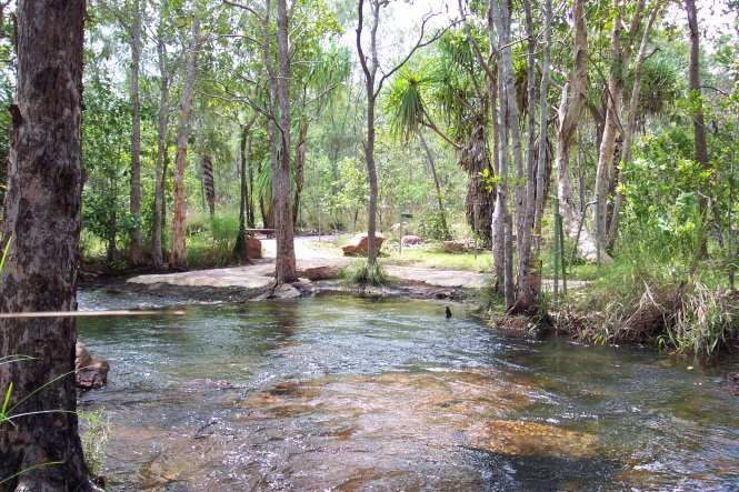
Litchfield National Park Plan of Management

1.1 Vision for the future of Litchfield National Park

      Litchfield National Park is the Top End’s leading national park. It protects and conserves outstanding
          natural values. It is loved by the community and visitors for its great nature and culture-based
         recreational experiences and as a source of inspiration and human well-being. Likewise, the park
           contributes enormously to the Territory’s economy. It is also valued for its cultural heritage.

1.2 The Relative Importance of the Park
The Parks and Wildlife Commission has a policy framework which informs priority setting and resource
allocation across the NT parks and reserves system. Part of the framework establishes the relative
importance of each park in the context of the park system, by assessing each park’s contribution to
biodiversity conservation, recreation and tourism. The framework groups parks of similar importance and
specifies general management standards to each group.

Under the Commission’s classification of parks, Litchfield National Park is a Biodiversity Class 1 park and
a Visitor Class 1 park. The park’s contribution to both conservation and to recreation and tourism is the
highest within both groups. Biodiversity Class 1 parks should aim to maintain and improve landscape
condition and as a very high priority manage threats at both landscape scale and specific conservation
values. Visitor Class 1 parks should provide high quality and scale of facilities of superior design at key
visitor sites for key experiences.

Class 1 parks will be subject to biennial performance review that looks at each aspect of the business
cycle. Every fifth year the condition of the park’s biodiversity will be directly assessed by biological
surveys incorporating the park’s long-term fire-plot monitoring program.

                   The park offers a wide range of recreation activities for visitors. The new viewing deck at
                          Tolmer Falls provides the opportunity for functions to be held in the park.

                                                                                                                   Page 3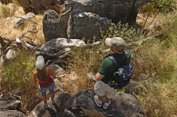
Litchfield National Park Plan of Management

2. Managing for Visitors

2.1 Visitor trends, use and activities
Tourism is a major contributor to the Northern Territory economy. The Tourism Vision 2020: Northern
Territory’s Strategy for Growth was developed to grow the visitor economy on the Northern Territory. The
strategy recognises that NT parks and reserves are a central driver of the Territory’s tourism industry.

The Northern Territory has a higher reliance on tourism than any other state or territory apart from
Tasmania (Tourism NT, 2015). Tourism Vision 2020 recognises the important role of national parks and
the important part visitors can play in national parks. The strategy states, ‘Increased visitation and use of
national parks delivers regional economic benefits, as well as increased visitor awareness and an
understanding of park values, ultimately contributing to long term conservation efforts’.

Visitor numbers to Litchfield National Park have been steadily increasing. The park is renowned for
picturesque waterfalls, scenic Top End landscapes and swimming, all in close proximity to Darwin. The
park provides a wide variety of visitor experiences ranging from swimming and walking to remote, four-
wheel driving. The park has the highest satisfaction of any Territory experience and it is one of the
Territory’s most popular parks. On average, 70% of visitors are from interstate, 18% are international
visitors and 12% are from the Northern Territory.

Tourism Vision 2020 explains that 61% of inbound visitors to Australia selected nature-based activities as
the primary purpose for their visit. National research shows that visitors to the NT are more likely to
participate in nature-based tourism activities than visitors to other states in Australia. The three main
reasons people visit the park is to swim, view waterfalls / waterholes and sightseeing. The range of
activities available in the park and undertaken by visitors is provided in Table 1. The top three activities
undertaken by local, interstate and international visitors are swimming, short walks and photography.

                      Photography is a popular activity in the park (Photo: courtesy of Tourism NT)

                                                                                                                 Page 4
Litchfield National Park Plan of Management
Table 1: Activities provided in the park and percentage of visitors undertaking the activities.
Activity Local (%) Interstate (%) International (%) Total (%)
Swimming 89 78 84 82
Short walk (< 2 hours) 51 76 73 71
Photography 42 66 68 62
Picnicking / Barbecuing 42 37 47 41
Driving / touring 27 48 38 41
Wildlife viewing 25 40 51 41
Camping 34 36 43 38
Bird watching 18 32 22 26
Medium walks (2-4 hours) 12 20 15 17
Four-wheel driving 17 20 10 16
Guided commercial tour 4 9 12 9
Long walks (>4 hours) 4 3 3 3
Overnight hike 3 1 2 2
Mountain biking 2 1 1 1
(Source: 2009 Visitor Survey Report, Litchfield National Park.)
2.2 Economic Value of Tourism
In 2015, total visitors (holiday, visiting friends and business) to the Greater Darwin tourism region, which
encompasses Darwin, Palmerston, Batchelor, Mary River National Park and Litchfield National Park, was
766 000 (Tourism NT, 2016). Key attractions for visitors are natural and cultural values and the proximity
of the park to Darwin. It is probable that visitor numbers to the park will continue to grow over the life of
the plan. The plan needs to consider developing the park to cater for this potential increase while
ensuring a positive experience for visitors.
The park is significant to the Top End tourism industry and is a key driver of tourism activities in the
Batchelor area. The tourism industry in the area provides commercial tours, accommodation, meals and
general provisions. Commercial accommodation available near the park and in Batchelor includes a motel,
caravan parks, cabins and camping. During the peak season, 27.5% of visitors stay overnight while during
the shoulder season 24.5% of visitors stay overnight in the park (Visitor Surveys July 2013).
The Territory’s park visitors are from all stages of life and include youth, families and older couples. They
come from overseas, interstate and from the local area. While they have different holiday and
recreational preferences, by and large today’s park visitors want rich experiences in nature and seek
connections on a personal level. Visitors are not content just to “look”, they want to DO. The challenge is
making sure what they can DO in the Territory is unique from experiences anywhere else.
The Territory’s competitive strength as a holiday destination is in providing visitor experiences that
deliver a unique blend of nature and culture. The majority of domestic and international leisure visitors
come to the Territory for these core experiences.
The Tourism Vision 2020 (Tourism NT, 2013) identifies that in order to increase market growth, there
needs to be a focus on developing new visitor experiences; either repackaging existing products or
Page 5Litchfield National Park Plan of Management
introducing new experiences. New recreation sites and activities identified in the park need to enhance
the visitor experience, be sustainable and alleviate pressure on the existing key visitor sites.
2.3 Existing Visitor Activities and Facilities
The key sites in the park, including Wangi Falls, Florence Falls and Buley Rockhole, will continue to be key
attractions for visitors. These sites are often at capacity or over-crowded during the peak season. It is
important that the park offers alternative sites to encourage visitors to disperse, to maintain visitor
experiences and reduce over-crowding. The plan proposes four ways to address this:
1. upgrade existing visitor sites to cater for increased visitor numbers;
2. improve awareness and promotion of alternative sites in the park;
3. improve flow of visitors through the park, and
4. investigate options for new recreation sites to cater for current and future demands.
Visitor Experience Development Plan
The Commission recognises the need to maintain the quality of existing experiences and attract
government and private investment for new nature-based opportunities at our most popular parks. As a
result, the Parks and Wildlife Commission will prepare Visitor Experience Development Plans for the
highest priority parks.
Visitor Experience Development Plans were released for Litchfield National Park and Casuarina Coastal
Reserve in early 2015. The Visitor Experience Development Plan for Litchfield National Park considered
the immediate needs of visitors, including measures to ensure that the park can cater to increasing visitor
numbers while continuing to achieve and deliver a high quality visitor experience. The Northern Territory
Government funded the implementation of this plan, with works commencing in 2015-16. The key works
included:
• expanding the Florence Falls 2WD and 4WD campground, a new ablution block, new toilet block,
sealing the road between the two campgrounds, a new coach parking area, a new path from the
4WD campground to the plunge pool and stairs into the plunge pool;
• the redesign of the Buley Rockholes site included removing the car park and creating a new day-use
area with picnic facilities, removing the campground and replacing with a sealed car park;
• redesigning the Tjaynera Falls campground to provide additional campsites and a new toilet block;
• upgrading the Termite Mounds site with a new boardwalk around a cathedral termite mound,
upgrading the existing boardwalk and a new toilet block to replace the existing one; and
• enhancing the Tolmer Falls site with a new picnic / functions area with landscape views, a new toilet
block, new half day walk and a new privately operated campground site.
Table 2 provides a summary of visitor sites and proposed new sites categorised by their level of use.
There are a number of sites in all three categories from low to moderate to high levels of use. This range
of sites provides opportunities for different types of visitors to experience and enjoy the park. Tables 3 to
21 summarise the existing visitor sites in the park and identifies the purpose of the site, existing facilities,
issues, opportunities and proposed future directions.
A new Visitor Experience Development Plan will be prepared for the park in the next five years. In
developing the new plan, consideration will be given to the level of use of existing facilities and new
opportunities to ensure a positive visitor experience. The ‘Future Directions’ section of Tables 3 to 21 and
the Proposed New Park Developments in section 2.5 will be used to inform the new Visitor Experience
Page 6Litchfield National Park Plan of Management
Development Plan. Other recreation experiences that will be considered include more swimming and
bush camping opportunities and new half or full day walks.
Potential Commercial Opportunities
In 2014, the Parks and Wildlife Commission made an open call for expressions of interest, Growing
Investment Opportunities in Parks. The purpose was to increase tourism investment in Northern Territory
parks and reserves, to encourage new and exciting visitor experiences and to attract greater visitor
numbers across the estate. Interest was expressed for several tourism opportunities in the park. If these
ventures are realised they will enhance the experiences offered to visitors.
Private operators can offer experiences for visitors which are not offered by the Parks and Wildlife
Commission (see also section 5.3). The Parks and Wildlife Commission aims to promote new and existing
tourism opportunities in parks and reserves across the Northern Territory. Operators can approach the
Parks and Wildlife Commission to develop new commercial opportunities.
Opportunities exist for private operators to manage new and existing campgrounds within the park.
Private management of these campgrounds can enhance the visitor experience and reduce anti-social
behaviour through a more regular presence in problem areas. It can also enable the Parks and Wildlife
Commission to better focus effort on key conservation and visitor outcomes.
Management Actions
• Develop a new Visitor Experience Development Plan by 2020. (High)
• Promote and facilitate commercial management of key campgrounds. (High)
• Promote the lesser known and used sites in the park to assist in dispersing visitors including
working with the tourism industry. (High)
2.4 Future Considerations
As visitor numbers to the park continues to increase, many of the key visitor sites will reach their carrying
capacity. Sites will become over-crowded to the point where the visitor experience and the natural
environment will be negatively impacted. In the years leading to this point, the Parks and Wildlife
Commission will investigate options to best deal with this situation. Options considered may include
opening new recreation sites within the park, limiting entry numbers to sites and running shuttle buses to
specific sites.
Management Actions
• Determine the carrying capacity of key sites and the park as a whole and investigate options to
best deal with this situation. (High)
Page 7Litchfield National Park Plan of Management
Table 2: Existing and proposed visitor sites classed by level of use.
Sites Access Swimming Picnicking Camping Toilet / Walking Tracks
Ablution
Facilities (S, M, TT)
High Use
Wangi Falls 2WD S, M, TT
Florence Falls 2WD / 4WD S, M, TT
Buley Rockhole 2WD S, M
Tolmer Falls 2WD S, M
(proposed) (proposed)
(proposed
concession)
Magnetic Termite 2WD S
Mounds
Moderate Use
Cascades 2WD S, M
Walker Creek 2WD M, TT
Environmental 2WD S, M
Education
Campground
Blyth Homestead 4WD S
Ruins
Tjaynera Falls 4WD S, M
(Sandy Creek)
Horse Paddock 4WD S, M
Creek Falls #
(proposed) (proposed)
Low Use
Tabletop Swamp 2WD S
Lost City 4WD S, M
(proposed) (proposed)
Greenant Creek 2WD S, M, TT
(Tjaetaba Falls)
Bamboo Creek Tin 2WD S
Mine
Surprise Creek Falls 4WD S, M
Tableland Creek 4WD S, M
Commercial Safari 4WD
Camp
East Reynolds # 4WD S, M
(proposed) (proposed) (proposed) (proposed)
# - Proposed new recreation site.
S, M, TT – short, medium, long and links to Tabletop Track
Page 8Litchfield National Park Plan of Management
Map 2: Existing Recreation Facilities and Activities
a d
Park Ro
Road or
ld
el
h fi e
h
Florence Falls tc
Ba
c
Batchelor
Li t
Walker Creek Ranger
Station Bamboo Creek
Tin Mine
Buley Rockhole
Walker Creek Education Campground
Stuart
Cascades
R iv e r
Magnetic Termite
Mounds
Highway
Wangi Falls
Tjenya Falls ss
ch
i
F inn
an
Br
th
ve r S o u
Ri
Tolmer Falls
Tjaetaba is
s
nn
Fi
Lost City
Greenant Creek
Blyth Homestead
Tjaynera Falls (Sandy Creek)
ch
an
Br
Commercial Safari
st
ld s
no
Ea
Camp y Riv er Legend
Re
Litchfield National
LITCHFIELD Park
NATIONAL
R
ey
Road
Track
PARK
nol
s 4WD Track
d
Ri er 4wd Tr a
to n
Re y n
TabletopTrack
v
pl e
Drainage
o ld
a
St
s
Cadastre
R i ve r
Tabletop Tack
Surprise Creek Falls
Visitor Facilities
ck
Information
Ranger Station
Sk
ew
Toilets
es
Ro
k
ee
ek
ad
e Tableland Creek Picnic Facilities
Sandy C r
Cr
nd
Camping
l e la
Tab
Ta ble
Caravan
la n
Daly River Road
d
Cr
ee Trac k Wood BBQ
k
Gas BBQ
Lookout
Walking Track
4wd
Historical
Art sales
Emergency Call
Device
Telephone
Swimming is only permitted within Kiosk
0 5 10
Kilometres
Horizontal Datum: Geocentric Datum of Australia (GDA) 1994
Map Projection: Universal Transverse Mercator, MGA Zone 52
´ designated swimming areas due
to the presence of Saltwater
Crocodiles.
Swimming
Disabled Access
Page 9Litchfield National Park Plan of Management
Table 3 - Wangi Falls
Purpose/ Wangi Falls is one of the most popular sites in the park. It encompasses a spectacular twin waterfall
Level of Service with large plunge pool providing the opportunity for safe swimming, nature appreciation, picnicking and
walks. It is a major site providing high standards of access, facilities and information for large numbers of
visitors.
Visitor Typical Visit: Visitors are provided with comfort and convenience in a popular /iconic site. Intensity of Use:
Experience High. Received over 210 000 visitors in 2015. Many stay in the main visitor area for less than two hours.
Provided Levels of Service: Very high level of service.
Access Vehicle Access: High standard sealed road. Disabled Access: Barrier free access to key features and
Standards facilities of the main visitor node. Tracks and Paths: Highly accessible and high standard tracks. The Wangi
Falls Walk from the viewing platform up across the escarpment is of moderate standard with some narrow
and rocky sections. Car Parking: Sealed car and bus parking catering for 52 car parks and 25 spaces for
coaches, caravans and long vehicles.
Standard of Orientation: Directional signs on arterial roads. Detailed site information supported on the website.
Information Comprehensive site orientation and information. Interpretation and Information: A comprehensive
interpretation geared to large numbers of visitors, with diverse needs and usage patterns.
Activities Activities encouraged include: swimming, sightseeing, picnicking, short walks, photography, camping,
nature and culture appreciation and relaxation. The presence of many other visitors is an expected part of
the park experience. The Wangi Falls Centre includes a café.
Visitor Facilities Seats, Tables and Shelter: Seating, tables and BBQs and Fireplaces: Gas BBQs are provided in the day-
Standards shelters provided. use area and the campground. A communal fireplace is
provided in the campground. Firewood is collected by
Toilets: Two toilet blocks with flushing toilets visitors along the Litchfield Park Road for the communal
and wash basin facilities are provided. One fireplace. Food Services: The Wangi Falls Centre includes a
toilet block is located in the day-use area and café. Camping: Provision for 34 camping sites and three of
the other is located in the campground. these sites are tent only. No powered sites are provided.
Camping fees apply for all forms of camping. Consideration
will be given to the Wangi Falls Centre managing the
booking of camp sites. The use of generators is not
permitted in the park.
Ranger Visitor Safety and Risk Mitigation: Open Space Management: Mowing of day-use and
Presence Significant hazards and hidden threats camping areas for aesthetic appeal. Slashing of sides of
communicated on site and in pre-visit access road for visitor safety (fire).
information. Standard swimming safety
equipment and signs installed on site. Risk Management Facilities: No management facilities are
mitigation and on-site compliance to located at this site.
minimise exposure to hazards. A public
telephone is provided. Glass containers are
not permitted within 10 m of designated
swimming areas.
Issues and • Swimming in the plunge pool is closed over the Wet season when water levels become too high leading to
Opportunities hazardous conditions and the potential for saltwater crocodiles to enter the pool. The pool is not opened
again until the water levels have dropped and the pool has been thoroughly surveyed for crocodiles. A
crocodile fence was installed in 2014 to reduce the likelihood of crocodiles entering the plunge pool.
• Issues arise from visitors climbing and jumping from rock faces surrounding the falls and can result in
serious injuries and negative experiences for other visitors.
• The main car park area was expanded in 2009 to accommodate an additional 12 long vehicles and 26 cars.
This expansion was to cater for the large numbers of visitors in the peak visitor season.
• The Wangi Falls Centre opened in June 2013. Consideration will be given to the booking of campsites
through the Centre. The Wangi Falls Centre may assist in spreading the visitors across the site however it
is recognised that the Centre is likely to attract more visitors to the site and potentially increase the length
of stay of visitors at the site.
• Opportunity to improve the use and the flow of the Tabletop Track through visitors registering at the
Wangi Falls Centre. A secure car parking compound could be constructed at this site to enable a place for
visitors who are walking the Tabletop Track or cycling the overnight mountain bike loop (see section 2.3)
to safely leave their vehicles.
• Interpretive and orientation information located in the interpretive shelter is adequate.
• The campground was extended in 2009 and is already at capacity during the peak visitor season. There is
Page 10Litchfield National Park Plan of Management
potential to re-design the campground to accommodate more campsites. A re-design should also provide
a number of spaces for over-sized vehicles. The campground could also be improved through the sealing
of the road through the site.
• There is an opportunity to work with tour companies to stagger the arrival of tour groups to Wangi Falls,
Florence Falls and Buley Rockhole.
• Free WiFi has been installed at Wangi Falls and is only available for set hours.
• Scenic helicopter flights run by a private operator will begin operation from the Wangi Falls area in early
2017.
Future • Proposed Development – Re-design the campground to accommodate more spaces and identify a few
Directions camp sites which will accommodate larger caravans, campervans and mobile homes. Seal the road through
the campground and install a new ablution block. (High)
• Proposed Direction – Realise the potential for commercial management of the Wangi Falls campground
including bookings, campground management and cleaning. (High)
• Movement of Visitors – Work with the tourism industry and tour companies to develop a system of
staggering the arrival of visitors to the key visitor sites, particularly in relation to cruise ship visitors. Work
with the tourism industry to more widely promote the lesser used sites in the park. (High)
• Visitor Safety – Continue to implement the Crocodile Management Plan and the Emergency Response
Procedure Manual. (High)
• Visitor Safety – Review the swimming and water safety guidelines for the plunge pool to ensure it is
opened at the appropriate water levels. (High)
• Proposed Development – Investigate the potential for a secure car parking compound for visitors using
the Tabletop Track. (Medium)
• Proposed Development – Through the Wangi Falls Centre encourage the site as the starting point for
visitors wishing to walk the whole of the Tabletop Track. (Medium)
The spectacular Wangi Falls (Photo: Tourism NT)
Page 11Litchfield National Park Plan of Management
Table 4 - Florence Falls
Purpose/ Level Florence Falls is a spectacular twin waterfall surrounded by attractive monsoon rainforest. The site is
of Service managed as a major site providing high standards of access, facilities and information for a relatively
large number of visitors.
Visitor Typical Visit: Park visitors are provided with passive and active recreation opportunities. Visitors who are
Experience prepared to walk are provided with the opportunity to swim in a natural bush setting. Intensity of Use:
Provided High. Over 244 000 visitors in 2015. Many stay in the main visitor area for less than two hours. Levels of
Service: Moderate level of service.
Access Vehicle Access: High standard sealed road. Disabled Access: Disabled access to the viewing platform. No
Standards disabled access to the plunge pool. Tracks and Paths: Disabled access to viewing platform. From the
viewing platform the walk leads to a steep staircase to the plunge pool at the base of the falls. Shady Creek
Walk from main pool to car park is an easy walk. A formalised walking track extends from Florence Falls to
Buley Rockhole. Car Parking: Sealed car and bus parking.
Standard of Orientation: Directional signs on arterial roads. Detailed site information supported on the website.
Information Comprehensive site orientation and information. Interpretation and Information: A range of interpretation
signs are provided to cater to large numbers of visitors.
Activities Activities encouraged include swimming, sightseeing, picnicking, short walks, photography, camping,
nature appreciation and relaxation. The presence of other users is an expected part of the park experience.
Visitor Facilities Seats, Tables and Shelter: Picnic BBQs and Fireplaces: BBQs provided at day-use area. At the two-
Standards platforms provided at the Florence wheel drive and four-wheel drive camping areas there are wood
picnic area. No seating provided at BBQs. Visitors are asked to collect firewood along the Litchfield
plunge pool. Seating provided at Park Road within the park. Food Services: Mobile food and drinks
viewing platform. van. Camping: Works associated with the Visitor Experience
Development Plan, will see an increase in camping sites from 14 to
Toilets: Flushing toilets are located 25 in the two-wheel drive campground and an increase from 5 to
in the car park and at the two-wheel 25 sites in the four-wheel drive campground. No powered sites are
drive and four-wheel drive provided. Camping fees apply. There is currently no booking system
campgrounds. for the campgrounds however there is potential for a booking
system to be implemented over the life of the Plan.
Ranger Presence Visitor Safety and Risk Mitigation: Open Space Management: Slashing for infrastructure, safety (fire),
Hazards communicated on site and visitor access, open space and aesthetic appeal.
in pre-visit information. Risk
mitigation and on-site compliance Management Facilities: No management facilities are located at this
to minimise exposure to hazards. visitor site.
Glass containers are not permitted
within 10 m of designated
swimming areas.
Issues and • This site was upgraded as part of the Visitor Experience Development Plan. Upgrades included re-
Opportunities designing the day-use car parking area, expanding the two-wheel drive and four-wheel drive
campgrounds (including a new ablution block and toilet block) and a staircase into the plunge pool. The
path from the four-wheel drive campground to the plunge pool is also being upgraded as part of these
works.
• In peak visitor season the rocks located beside the main plunge pool can become over-crowded. Entry
into the plunge pool at these times can be difficult.
• Issue with visitors jumping from the escarpment and / or the top of the waterfall. This presents a serious
danger to visitors.
• A concrete walking track was constructed in 2012 from Florence Falls along the creek to Buley Rockhole.
This track ensures a safer and easier walk and reduces the impact on the environment.
• A helipad will be constructed in 2017 to enable Careflight to make emergency evacuations.
Future • Proposed Direction – Encourage commercial management of the campgrounds including bookings,
Directions campground management and cleaning. (High)
• Promotion – Promote the walk from Buley Rockhole to Florence Falls to assist in dispersing visitors from
the key visitor sites. (High)
Page 12Litchfield National Park Plan of Management
Table 5 - Buley Rockhole
Purpose/ Level Buley Rockhole is a very popular site with locals and visitors. The site provides the opportunity to enjoy
of Service swimming in a series of rockholes. Buley Rockhole is a major site providing a high standard of access,
facilities and information for a relatively large number of visitors. The site is at capacity.
Visitor Typical Visit: Park visitors seeking to swim with minimal walking required to the site. Intensity of Use: High.
Experience About 244 400 visitors in 2015. Many spread along the creek and rockholes. Tourists tend to stay for a
Provided short time while regular park visitors may stay for several hours. Levels of Service: High level of service.
Access Vehicle Access: High standard sealed road. Disabled Access: No disabled access is provided. Tracks and
Standards Paths: Highly accessible with a moderate standard of tracks. The track that runs parallel to the creek is
rocky and basic. Car Parking: Sealed car park and unsealed tour operator parking.
Standard of Orientation: Directional signs on arterial roads. Detailed site information supported on the website.
Information Comprehensive site orientation. Sign located in the car park advises visitors that if the car park is full then
so are the rockholes. Interpretation and Information: Interpretation is provided at the start of the walk.
Activities Activities encouraged include swimming, informal picnicking, short walks, sightseeing, photography, nature
appreciation and relaxation.
Visitor Facilities Seats, Tables and Shelter: None currently as BBQs and Fireplaces: BBQs are provided in the day-
Standards visitors picnic directly on the rocks surrounding the use area.
creek. Through with the Visitor Experience Food Services: None.
Development Plan a new day-use area was created Camping: None.
in the existing car park. Tables, chairs and shade
shelters provided. Toilets: A new toilet block was
installed in 2014.
Ranger Presence Visitor Safety and Risk Mitigation: Hazards and Open Space Management: Slashing for infrastructure,
hidden threats communicated on-site and in pre- safety (fire), visitor access, open space and aesthetic
visit information. Risk mitigation and on-site appeal. Management Facilities: None.
compliance to minimise exposure to hazards. Glass
containers are not permitted within 10 m of the of
designated swimming areas.
Issues and • This site was upgraded as part of the Visitor Experience Development Plan. The upgrades included
Opportunities removing the existing car park and creating a new day-use area with picnic facilities in its place. The
campground was removed and turned into a sealed car park.
• Visitor over-crowding of Buley Rockhole is a major problem during the peak visitor season.
• Interpretative and orientation information located at the start of the walk is quite dated. There is scope to
upgrade this area.
• Anti-social behaviour was previously an issue at this site however the removal of the campground has
been anti-social behaviour decrease.
• Some visitors jump from inappropriate locations presenting a danger to themselves and those swimming
in the pools below.
Future • Movement of visitors - Work with the tourism industry and tour companies to develop a system of
Directions staggering the arrival of visitors to the key visitor sites. Work with the tourism industry to more widely
promote the lesser used sites in the park. (High)
• Direction – Continue to work with NT Police in managing the anti-social behaviour that can occur at this
site. (Ongoing)
Page 13Litchfield National Park Plan of Management
Table 6 - Tolmer Falls
Purpose/ Level Tolmer Falls is a spectacular waterfall which includes a cave at the base of the falls, sheltering a colony of
of Service the near threatened Orange Leaf-nosed Bat. This site provides a high standard of access, facilities and
information for a large number of visitors. Visitors are able to view the spectacular falls from a distance
without impacting the fauna living near the falls.
Visitor Typical Visit: Tourists and park visitors seeking a view of the waterfall and a short easy walk. Intensity of
Experience Use: High. About 100 000 visitors in 2015. Most visitors stay for a short amount of time. Levels of Service:
Provided Very high level of service.
Access Vehicle Access: High standard sealed road. Disabled Access: Disabled access is provided from the car park
Standards to the Tolmer Falls lookout, picnic area, functions deck and toilet block. Tracks and Paths: High standard of
access to the viewing platform. Alternative track back to car park is of moderate standard with some rocky
sections. Path to functions deck. Car Parking: Sealed car and bus parking.
Standard of Orientation: Directional signs on arterial roads. This walk is described on the Park ‘Short Walks’ Fact Sheet.
Information Interpretation and Information: A range of interpretation panels are provided at the lookout and in the
interpretation shelter near the car park. Geared to large numbers of people.
Activities Activities encouraged include sightseeing, short walks, photography and nature appreciation. The presence
of many other users is an expected part of the Park experience.
Visitor Facilities Seats, Tables and Shelter: Seating is provided at the BBQs and Fireplaces: None.
Standards interpretation shelter and along both walks to viewing Food Services: None.
platform. No seats are provided at the viewing platform. Camping: There is currently no camping at this
A picnic area with seating and shelters and a functions site. A low-key camping area, to be managed by
deck was constructed as part of the works associated a private operator, will be developed as part of
with the Visitor Experience Development Plan. Toilets: the Visitor Experience Development Plan.
A new toilet block was constructed as part of the Visitor
Experience Development Plan works.
Ranger Presence Visitor Safety and Risk Mitigation: Hazards and hidden Open Space Management: Slashing for
threats communicated on-site and in pre-visit infrastructure, safety (fire), visitor access, open
information. Risk mitigation and on-site compliance to space and aesthetic appeal when required.
minimise exposure to hazards. Glass containers are not Management Facilities: None.
permitted within 10 m of designated swimming areas.
Issues and • The site was upgraded as part of the Visitor Experience Development Plan and included a new picnic
Opportunities area, functions deck with landscape views, a new toilet block, upgrades to the existing viewing platform
and development of a low-key camping area that could potentially be managed by a private operator. The
works may also include a half day walk to the Lost City.
• The site could accommodate higher visitor numbers without impacting on the experiences. The site has
the potential to be developed as a visitor hub and alleviate pressure on some of the other sites.
• The site has the potential to develop a ‘wow’ feature such as a glass walkway out over the edge of the
existing viewing platform or a swing bridge. This ‘wow’ feature would attract visitors to the site and help
alleviate pressure on the primary visitor sites. This ‘wow’ feature could be developed by a private
operator.
• A tour operator has in the past held a permit to take a limited number of visitors swimming in a rockhole
above Tolmer Falls. This site is difficult to access and only physically fit visitors with a competent tour
guide should enter. This is a unique adventure experience only available to a limited number of visitors.
Future • Future Proposed Development - The site is to be developed as a visitor hub including development of a
Directions ‘wow’ feature such as a swing bridge or glass walkway out over the edge of the escarpment. This ‘wow’
feature could be developed and run by a private operator. (High)
• Commercial Operator - Promote the continued use of swimming in the rockhole above the Falls for tour
groups to increase the diversity of experiences available in the park. (High)
Page 14Litchfield National Park Plan of Management
Table 7 - Magnetic Termite Mounds
Purpose/ Level The Magnetic Termite Mounds site provides visitors with the opportunity to learn about and appreciate
of Service these unusual insects and their homes. The site provides a high standard of access, facilities and information
for a large number of visitors. Visitors are able to view the magnetic termite mounds from a boardwalk
constructed on the black soil plains. This is the first visitor site as visitors enter the park from Batchelor.
Visitor Typical Visit: Visitors are provided with a short stop to view termite mounds. Intensity of Use: High. About
Experience 150 000 visitors in 2015. Most stay at the site for less than an hour. Levels of Service: Very high level of
Provided service.
Access Vehicle Access: High standard sealed road. Disabled Access: Barrier-free access to key features and
Standards facilities of the main visitor site. Tracks and Paths: Highly accessible and high standard of tracks. Viewing of
the termite mounds is along a boardwalk. Car Parking: Sealed car and bus parking.
Standard of Orientation: Directional signs on arterial roads. Interpretation and Information: A comprehensive range of
Information interpretation geared to large numbers of visitors.
Activities Activities encouraged include sightseeing, short walk, photography and nature appreciation. The presence
of many other users is an expected part of this site experience.
Visitor Facilities Seats, Tables and Shelter: Seating provided BBQs and Fireplaces: None.
Standards under interpretation shelter. Toilets: Flushing Food Services: None.
toilets replaced the old toilets as part of the Camping: There is no camping provided at this site.
Visitor Experience Development Plan works.
Ranger Presence Visitor Safety and Risk Mitigation: No Open Space Management: Slashing for infrastructure,
significant hazards. Risk mitigation and on-site safety (fire), visitor access, open space and aesthetic
compliance to minimise exposure to hazards. appeal (if necessary). Management Facilities: None.
Issues and • This site was upgraded as part of the Visitor Experience Development Plan including upgrades to the
Opportunities existing boardwalk, a new boardwalk around the cathedral termite mound and a new toilet block.
• The biggest threat to the site is Gamba grass leading to large wildfires.
Future • Management – Maintain a fuel buffer around the termite mounds to protect the site from Gamba grass
Directions and wildfires. (High)
The boardwalk provides visitors with an excellent view of the Magnetic Termite Mounds
(Photos: Tourism NT)
Page 15You can also read