Integrating Indigenous knowledge and survey techniques to develop a baseline for dugong (Dugong dugon) management in the Kimberley
←
→
Page content transcription
If your browser does not render page correctly, please read the page content below
Integrating Indigenous knowledge and survey techniques to
      develop a baseline for dugong (Dugong dugon)
               management in the Kimberley
          KIMBERLEY MARINE RESEARCH PROGRAM NODE
           P R O J E C T 1 . 2 . 5 – D R P E T E R B AY L I S S - C S I R O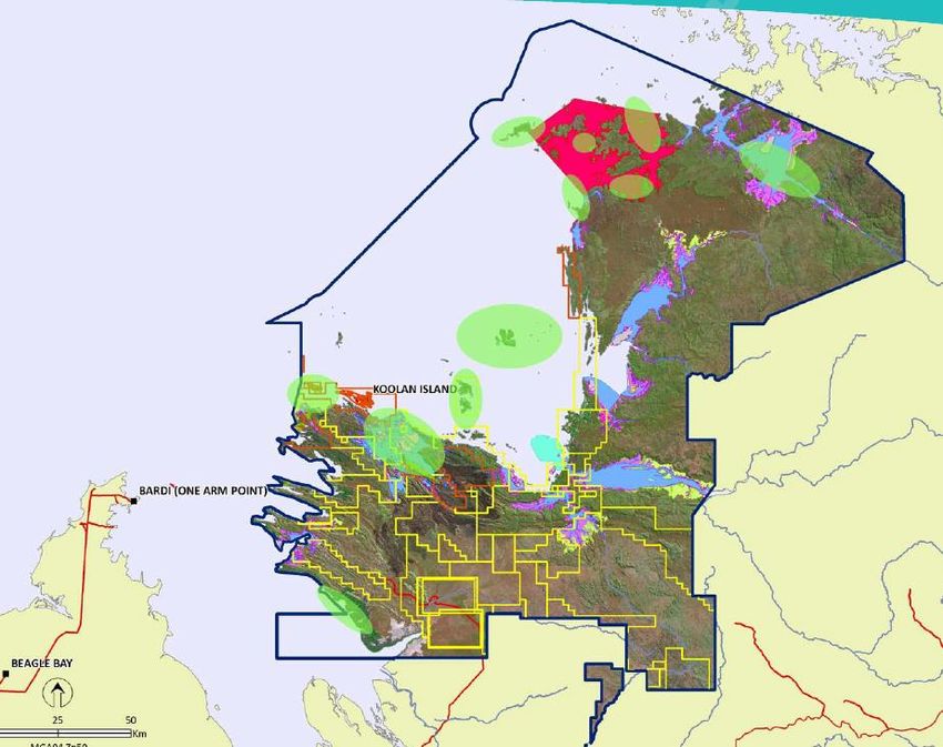
Background

•   Dugongs are currently listed as vulnerable to extinction globally and Northern
    Australia is home to the largest remaining populations.

•   Whilst they occur from Shark Bay through to the NT border there is limited
    information on their distribution and abundance in the Kimberley, representing a
    substantial knowledge gap.

•   Dugongs are culturally significant to Indigenous coastal communities and provide a
    high value food source.

•   There is deep cultural knowledge of dugongs in the Kimberley (& elsewhere across
    northern Australia) including an understanding of seasonal changes in abundance.

•   Currently there are limited human-induced threats to dugongs in the Kimberley
    making the region an important global and national stronghold for the species.
Background cont.

•   Current and future risks to dugong populations, including the potential for
    unstainable harvests, will need to be placed into perspective using monitoring and
    assessment frameworks that are underpinned by both scientific knowledge and
    Traditional Ecological Knowledge.

•   Management of marine parks and Indigenous Protected Areas (IPAs) in the
    Kimberley will therefore need to address potential cumulative impacts from
    increasing development pressures in catchments, coasts and seas, any associated
    habitat loss or modification, and concomitant increases in local human populations.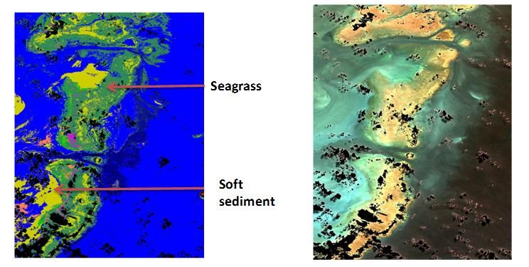
Cultural context – north Kimberley
•   Dugongs (& marine turtles) belong to sea country & are an important
    cultural resource for saltwater people throughout the Kimberley
    (& northern Australia).
•   They provide rich sources of high protein food in all seasons.
•   Saltwater people have a long history of hunting dugong (& sea turtle)
    & so have a deep Traditional ecological understanding of them.

•   Whilst they have been sustainably harvested for thousands of years there are emerging
    cumulative pressures and threats, particularly habitat loss through coastal development ,
    that need to be managed together.
•   Dugongs (& turtles) are identified target species for monitoring in Healthy Country Plans
    (HCP) by Indigenous coastal communities in the Kimberley.
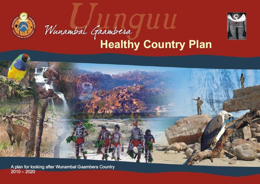
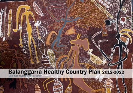
e.g. Uunguu Healthy Country Plan (Wunambal Gaambera)
Target 10: Mangguru (marine turtle) and Balguja (dugong)
“We need to know more about where they travel, their habitats in our country and how
to look after them. Working together...using our traditional knowledge, doing
surveys...will help us keep these animals healthy in our country as well as keeping our
saltwater traditions strong.”

•   Kimberly ranger groups want to partner
    with research organisations to manage
    dugongs using both scientific knowledge
    & Traditional Ecological Knowledge (the
    2 tools box approach).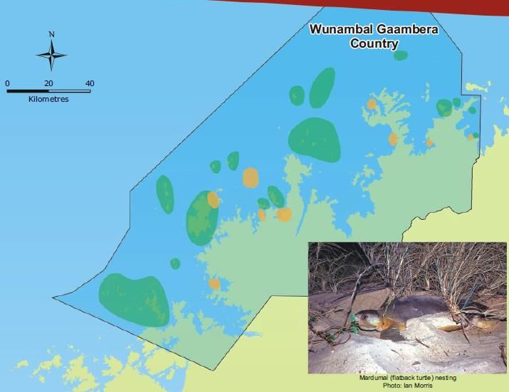
North Kimberley
•   Balanggarra
•   Uunguu (Wunambal Gaambera)
•   Dambimangari
South Kimberley
•   Mayala (include S Kimberley)
•   Nyul Nyul
•   Bardi Jawi
Broome to Port Hedland
•   Karajarri & Yawuru TOs.
WAMSi dugong project
Is working in partnership with North Kimberley rangers groups

    Balanggarra         Dambimangari           Uunguu

                                                          Dredging Science Node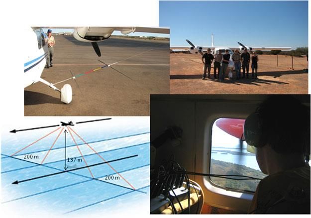
Project aims
•   Develop long-term research partnerships with the Balanggarra, Wunambal Gaambera
    and Dambimangari Aboriginal Corporations and their associated ranger groups.

•   Integrate Indigenous knowledge with existing and new data to better understand
    dugongs in the Kimberley to determine how best to monitor and manage them in future.

•   Determine the distribution and abundance of dugongs in the North Kimberley using
    standardised aerial survey methods & in partnership with Indigenous rangers.

•   Extend the project area to the Southern Kimberley and through to Port Hedland
    depending on available resources.

•   Use satellite tags to describe dugong seasonal movement patterns in relation to sea
    grass habitat in proposed marine reserves & areas relevant to Indigenous Sea Country
    Plans.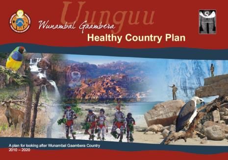
Project design
2 phases
Phase 1 objectives (2014-15)

•   Document the knowledge and aspirations of Indigenous coastal communities in
    relation to understanding and managing dugong populations of the Kimberley
•   Incorporate the views and knowledge of Indigenous communities and western
    science into a single plan for delivering Phase 2 of the project.

•   On track to be delivered by end May/early June, although documenting Indigenous
    knowledge & aspirations is ongoing.
Project design
2 phases (cont.)
Phase 2 objectives (2015-2017)

•   Describe the spatial distribution and critical habitats of dugongs in selected areas
    of the North Kimberley ascertained from Phase 1.
•   Estimate the number of dugongs present in selected areas, including quantifying
    the uncertainty in these estimates.
•   Describe the patterns of dugong movement in the Kimberley in relation to existing
    & proposed marine parks, and relevant Sea Country Plans.
•   Develop cost effective monitoring protocols for dugong populations that are
    relevant to joint managers of the Kimberley marine park system.
Progress to date & new timelines
• Change of roles in CSIRO team – Peter Bayliss & Chris Wilcox have swapped roles - PB is now
project lead, CW is now analytical support.
• Finalising research partnerships with Balanggarra, Uunguu (Wunambal Gaambera ) and
Dambimangari North Kimberley ranger groups (aiming for end FY or sooner).
• Cultural maps of dugong hunting areas currently being collated for the 3 ranger groups and will be
used in the survey design. Completion by end April. Consultations on dugong management ongoing.
• Design of the baseline aerial survey and research plan for Phase 2 to be completed end May.
• The survey team will comprise two Indigenous rangers from each group, CSIRO staff & initially an
experienced observer from JCU (Helene Marsh team). Some surveys will involve DPAW staff.
• A 3-day aerial survey training package for Indigenous rangers is being developed with WGAC. A
training camp on Uunguu country will be run in late Sept. just before regional surveys Oct. to Nov.
• 10 satellite tags have been purchased and are ready to be deployed depending on available resources
(most likely next year).Dugong & turtle cultural sites – from Healthy Country Plans
Turtle & dugong sightings
Dambimangari country Wunambal Gaambera/Uunguu country
Dredging Science NodeDugongs, seagrass & Indigenous hunting
knowledge
Dredging Science NodeBroad correlation between the seasonal distribution
& abundance of dugongs & sea grass in the NT GoC
DRY WET
Bayliss & Freeland (1989)
Seagrass map produced from small boat
surveys (I. Poiner pers. comm.)Mapping sea grass distribution in the Kimberley using
remotely sensed satellite data
• A high correlation exists between water clarity and seagrass distribution.
• Janet Anstee (CSIRO remote sensor) has commenced work to map benthic
vegetation and light availability in Kimberley’s coastal zone using remotely sensed
satellite data. Developed method in Torres Strait where 15 yrs of boat-based
seagrass survey data exists for calibration & validation.
• Maps of diffuse vertical attenuation will be analysed together with seagrass maps to
produce areas where the probability of seagrass extent is high.
• Maps of bathymetry, light penetration, seagrass & benthic vegetation extent will be
provided by end June 2015.Mapping seagrass in Torres Strait using Landsat 7 & 8 with
bathymetric dataSURVEY DESIGN
Location of dugong aerial survey transects in NT
In the Kimberley we’ll adopt a similar sampling intensity (10km transect spacing) but modified based
on Indigenous knowledge & satellite maps of seagrass extent (pre- & post-stratification)Acknowledgments
• The State Government of Western Australia and WAMSI partners for funding
this research.
• Other researchers: Tom Vigilante (WGAC); Jarrad Holmes (Dambi); Scott
Whiting & Tony Tucker (DPAW); Rachel Groom (NT DLRM).
• Linked research in and out of the Node: Mat Vanderklift (Key Ecological
Processes, seagrass herbivory ); WGAC dugong & turtle research & monitoring
project; others.
• Traditional owners from Balanggarra; Uunguu (Wunambal Gaamera); and
Dambimangari. In future hopefully Mayala, Bardi Jawi, Nyul Nyul, Yawru &
Karajarri .
Dredging Science NodeYou can also read