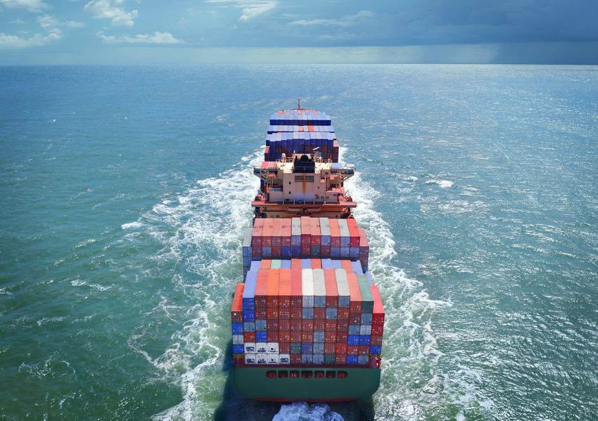
Achieve safer, cheaper shipping with optimized weather routing
←
→
Page content transcription
If your browser does not render page correctly, please read the page content below
Achieve safer, cheaper shipping
with optimized weather routing

Remko Vermeer, one of the former seafarers employed in the continuous shift service at DTN, is more than
familiar with weather information and routing from experience.

Before he joined the company, Vermeer was a first mate for Spliethoff. He turned down a master’s position
due to the administrative workload and the responsibility it entails.

DTN has undoubtedly benefited from adding experienced seafarers, like Vermeer, in its weather room.
Before, for example, maps did not always have enough detail. Masters would say things like, “Your advice
guides me past an island, but there’s a big sandbank in front of it. What do I do?” It was ample reason to
improve the maps and buy an electronic chart display and information system (ECDIS).
“One master might be almost too compliant while
     another won’t have anything to do with us and works it
     out all by himself.”
                                                                           Remko Vermeer

A global view                                      An average five-day forecast in normal
                                                   circumstances can be reasonably accurate.
Vermeer is in the weather room. In front of        But Vermeer sticks to 48 to 72 hours when
him, three screens display views of global         dealing with hurricanes. “You can’t always
weather conditions. They show air pressures,       predict what such systems will do the next
wind forces and trajectories, currents, and        day, so we send the masters extra updates
details about waves and swells. To see out         every six to 12 hours,” he said.
12, 24, 48, or 72 hours — and if necessary, as
many as nine days ahead — he only needs to
press a few keys.
                                                   What is the best option?
                                                   “Many shipping companies use SPOS,
On the screen is a new stratum, predicted          but not all ships buy our route advice,”
to develop wind speeds of 55 knots over            Vermeer continued. “However, the most
the next few days. It displays the expected        recent data might not always be available
trajectory (80 to 180 degrees) and speed           to them due to the limitations of their
(7 to 11 knots). It will probably not reach        onboard satellite communications. Our
the 63 knots or 117 km/h required for a            product RouteGuard always uses the
hurricane, but others have developed from          most up-to-date datasets.”
similar systems over warm water. “Breeding
grounds for hurricanes include the ocean           Vermeer is fully aware it’s challenging to
between Africa and the Caribbean, the area         prove the advantages of routing, including
of ocean west of Panama, and the region of         lower fuel consumption. “Try and prove
sea between Japan and Papua New Guinea.            that a certain loxodrome or a different
We can recognize those systems because             passage is better or worse. There are so
they don’t have fronts as normal strata            many variables, which makes it hard to
do. They are drains, sucking in everything,”       compare two journeys, and the choice of
Vermeer explained.                                 route can make a huge difference on an
                                                   ocean crossing,” he said. “If the ship arrives
                                                   at a point earlier or later on a route, how
A safe distance of 300 miles                       will the wind and swell be then?”
Routing around tropical systems assumes
a safe distance of 300 miles to the eye of         Masters passing Skagerrak on their way
the storm. “We need to consider the type of        to the U.S. East Coast sometimes ask for
ship when recommending a route because             advice on the next part of the route. “They
our advice depends on the mutual velocities        can pass just above the British Isles or sail
and the ship’s destination. We might advise        through the English Channel,” Vermeer
sailing dead slow for half a day, stop sailing
                                                   said. “In theory, a master can knock 35
entirely, or the exact opposite — shift from
                                                   hours off their journey if they don’t go
eco speed to greater velocity. The first or
                                                   through the English Channel — but the
second case may delay a ship for days. In
                                                   weather can be worse on the alternative
the last, it will reach its port sooner but will
use more fuel. The client’s response depends       route, so we expect a slower speed,
on the sort of ship. For some, stopping for        cutting the time saved down to 16 hours.”
a short while might be an option, but it’s a
different story for vessels with a tight ETA.”
Work it out yourself
or get skilled advice At current SPOS
The standard shipping solution at DTN is subscription prices, a
SPOS, which masters can use to collect
container ship using 15 to
weather information themselves. The
shipowners decide which functions are 25 tons a day will typically
available onboard. SPOS has more than cover the costs by saving
5,000 daily users. “Worldwide, there are
several sources for weather information, 10 tons of heavy oil.
and DTN combines them in our model,”
Vermeer reported. “We give a certain
weight to areas in which separate models
perform better after verification. It involves entirely dependent on the DTN seafarers
a few percentage points of difference.” for routing advice. At times like that, they
wonder why the charterer doesn’t ask the
Other DTN products are RouteGuard, shipping company for SPOS so the master
onshore weather routing, and FleetGuard, can do their own routing. At current SPOS
with the ships reporting to the shipping subscription prices, a container ship using
companies’ and charterers’ headquarters 15 to 25 tons a day will typically cover the
via a website. “All of the data is recorded costs by saving 10 tons of heavy oil.
and used in their own performance systems,
if they have them, to optimize each ship’s The calculation is based on a seven-day
operation costs,” explained Vermeer. “It helps voyage for container ships that sail at
them decide when a hull needs cleaning, more than 20 knots for 14 to 15 days at a
or a propeller needs a polish, for instance. cruising speed of 10 to 11 knots on an ocean
To do that, a ship’s performance must be crossing from Rotterdam to New York. The
gauged in calm weather. Nonetheless, theory vessel type will impact the savings timeline.
and reality don’t often match because the Ocean-going tugs only do 5 knots at most
weather is always a major variable.” and make huge detours for the sake of the
tow’s safety. A strong tailwind might be
Penny wise and pound foolish? favorable for a freighter, but a tug captain
can’t allow their tow to overtake them.
The main driver behind weather routing is
reducing costs, such as ETA, laycan, and
DTN checks its weather forecasts
fuel consumption. Shipowners understand
retrospectively. In the weather room, there
the importance of safety, but everything
is a screen the reveals the accuracy of
is becoming more and more competitive.
onshore-weather reports. This information
Shipowners typically know how far they can
is added to historical data to improve the
push their ship. Charterers are more inclined
weather models further. Globally, there are
to rely on routing advice.
plenty of data buoys that pass on details.
Satellites monitor the oceans, and offshore
However, competition still affects
construction and ships are often equipped
routing choices, particularly in the bulk
carrier market. Sometimes, there is only
a facsimile on board, and the master iswith automatic weather stations. Masters There are scarcely any clients who ask
also still send weather information to the for forecasts for the polar regions. “Very
Royal Netherlands Meteorological Institute occasionally, someone will ask for a route, but
(KNMI). But even so, there are still large in reality, the Russian pilots and government
parts of the oceans that are not covered. decide on the routes — and they are more or
less fixed,” he said. “We can supply weather
Measuring and reporting data to latitudes of 85 degrees north and
south in SPOS, but the market does not
at two heights usually want anything farther north than
Masters often asked, “Why are we the north of Norway, or sometimes Hudson
measuring stronger winds here than the Bay or the Bering Sea. The behavior of ice is
forces you mentioned?” In response, DTN very hard to incorporate into models. Local
has started presenting wind forecasts in authorities, such as port authorities and
a new way. “We only used to report wind pilot agencies, have much better information
at 10 meters up at the average for 10 about the current situation and the condition
minutes — but often on board, the wind of the passages.”
sensors are installed much higher — so now
we make forecasts for 50 meters up too,”
Vermeer explained. “Wind to a height of up
to 10 meters has the most impact on the
Learn more about SPOS 9
Click here to discover how you can reduce
condition of the sea, but 50 meters is more
voyage costs and ensuring safety with
recognizable for SPOS users and provides
real-time, on-board route optimization.
a more detailed picture. Moreover, we can
also forecast gusts at 10 and 50 meters up
To learn how your company can utilize
and produce risk predictions.”
the expertise of our master mariners,
please click here.
The forecasts are even more specific if the
orographic effects are taken into account.
“At the Strait of Gibraltar, the Strait of
Dover, and in the Norwegian fjords, winds
accelerate due to geographic narrows,” said
Vermeer. “The effect is not as obvious in
model data, so if it predicts a force seven or
eight for Gibraltar, we add; bear in mind, it
could be eight or nine.”
www.dtn.com
©2021 DTN, LLC, all rights reserved. “DTN” and the degree symbol
logo are trademarks of DTN, LLC.You can also read