Avon River Aboiteau and Causeway Upgrading Design CLC Meeting 19th Sept 2018 - Note added on Sept 24: some annotations were made on the last slide ...
←
→
Page content transcription
If your browser does not render page correctly, please read the page content below
Avon River Aboiteau and
Causeway Upgrading Design
               th
CLC Meeting 19 Sept 2018
Note added on Sept 24: some annotations were
made on the last slide based on comments heard
during and after the CLC meeting.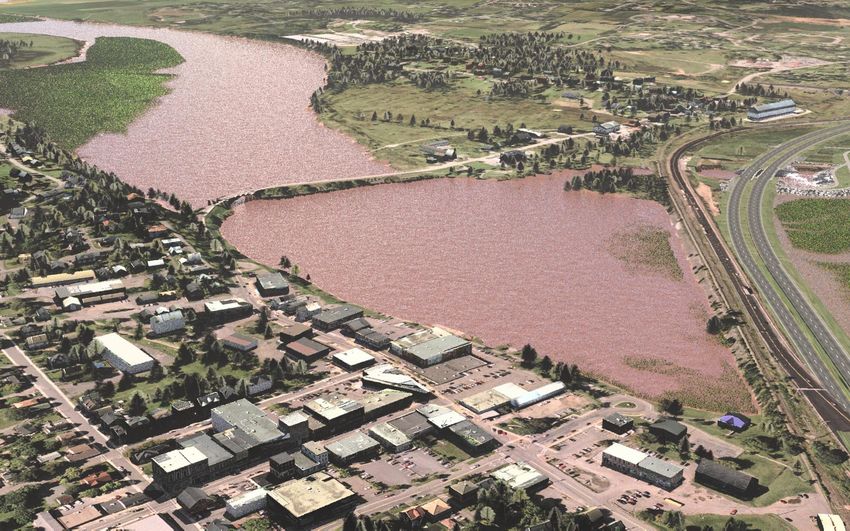
Project Key Objectives:
PUBLIC SAFETY
• Maintain corridor over Avon River for Highway 101 Twinning
  and continuity of rail, trail and utility services
• Continued protection of communities and agricultural land
  from the effects of flooding and future effects from sea level
  rise and climate change
REGULATORY REQUIREMENTS
• Improve Fish Passage (Fisheries Act-Sect.20 and EA Condition)
• Minimize Environmental Impacts (i.e. Impact to Salt Marsh)
MINIMIZE SOCIO-ECONOMIC IMPACTS
• On business groups, farming, ski, canoeing as well as
  recreational communities

2
Exit 7

                 Exit 6

             1

3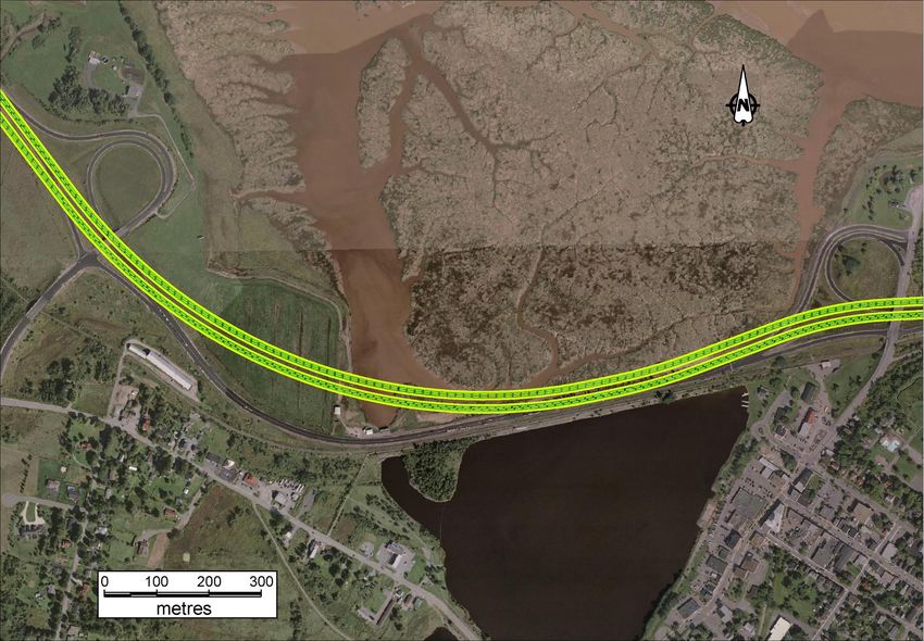
Exit 7

                 Exit 6

             1

4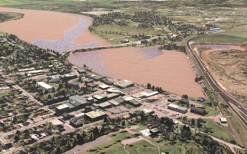
Options Considered
• Maintaining “Status Quo”, or the “do nothing” approach

• Scenario “A”: Maintain freshwater reservoir, with the
  upstream water level target being a priority over fish passage

• Scenario “B”: Maintain freshwater reservoir, with the fish
  passage being a priority over maintaining the water level

• Scenario “C”: Fish Passage is the design priority, provided
  with controlled tidal exchange

5
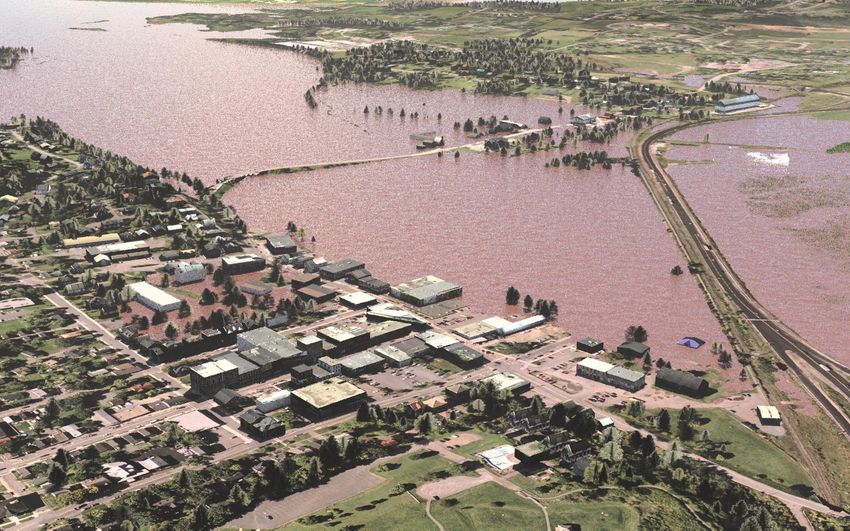
Do Nothing
“Do Nothing” Approach                                      Approach

Is it an option to maintain the Status Quo ?

Factors to Consider:
• The current structure is at the end of its life: the bearings,
  seals and rollers cannot be accessed safely to be replaced, i.e.
  the gate could get stuck at any moment.
• The costs involved mean that federal funding is required. The
  current opportunity for funding may not present itself again
  for many years.
• Consequences of the gate being stuck in place would be
  disastrous and lead to first an emptying of the reservoir, and
  then flooding of Windsor and Falmouth.

6
If the gate fails in the open position – low tide view   Do Nothing
                                                          Approach

   7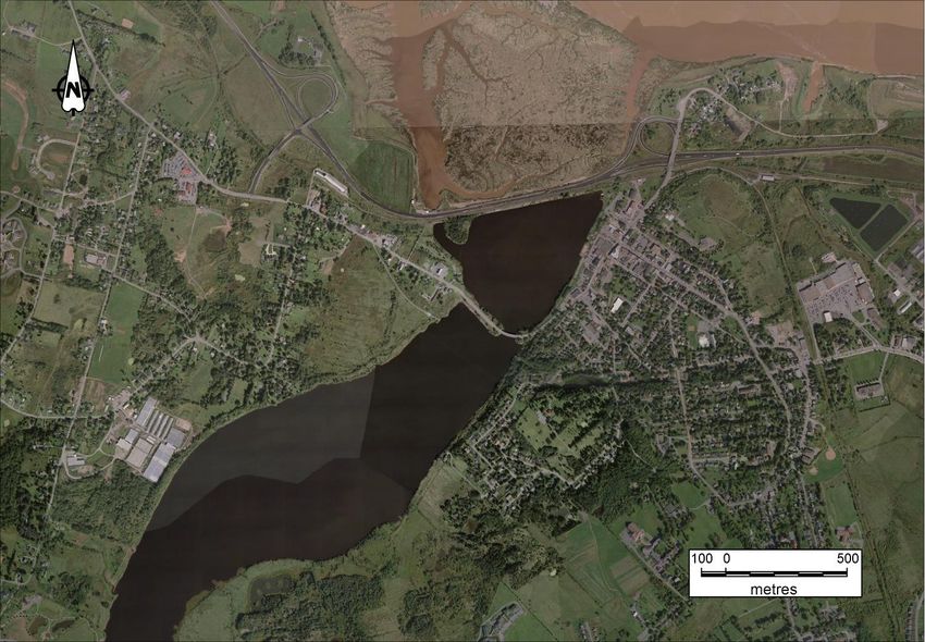
If the gate fails in the open / closed position – high tide view   Do Nothing
                                                                    Approach

   8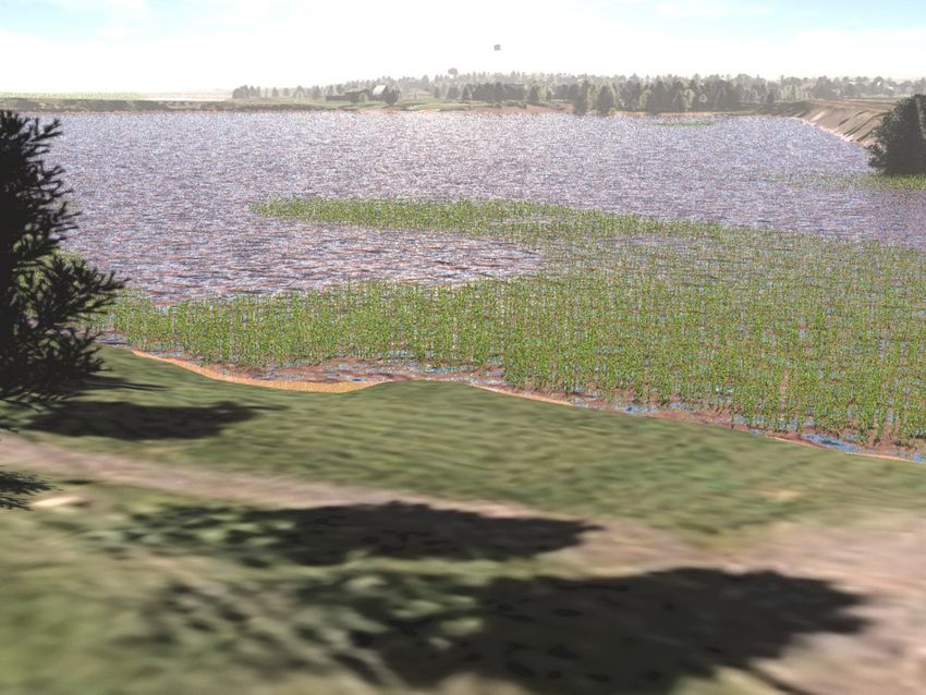
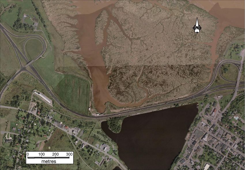
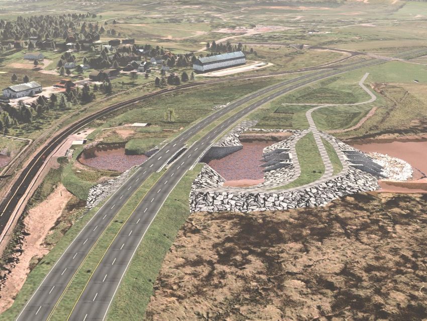
Scenarios A, B
                                                              and C

Design
• Before looking at water management scenarios, a location has
  to be identified for design, that allows the safe construction of
  the structure with minimized impacts on the surrounding
  area.

9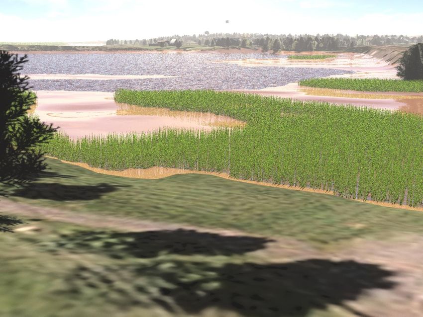
Scenarios A, B
                       Location Options       and C

     Exit 7

                                                 Exit 6
              2a         1

              2

                   1

10
Scenarios A, B
and C
Location Option 1
11Scenarios A, B
and C
Initial Design Goals
• Prevent flooding risks upstream of the causeway (not increasing
water levels beyond their current peaks);
• Improve fish passage (it is currently estimated to be of very low
quality and limited duration), accommodate the 25 species
identified;
• Protect the downstream salt marsh of international significance
(protected under Ramsar Convention);
• Prevent saltwater intrusion upstream of the causeway;
• Prevent silt from moving upstream of the causeway, as well as
blocking the tide gates and fishways, and
• Allow water levels to remain at current target in the summer
(roughly +2.4m CGVD28 when flow management allows it).
12Scenarios A, B Freshwater Fishway Design (fish ladder) 13
Scenario A

Scenario “A”: Freshwater Reservoir
(Water level is priority over fishway)
 The fishway would have very little improvement over
 the current situation:
     • Fishways would need to be closed during the summer
       months to avoid lowering the upstream water levels
     • Fishways would only flow when excess water is available
       in the lake. This is likely to be seldom, since dry weather
       flows either evaporate or infiltrate in the ground and
       through the causeway
     • Highly prone to plugging with sediment
     • Therefore, the fishway will not be very effective

14
Scenario A Scenario “A”: Freshwater Reservoir (Water level is priority over fishway) Other Considerations: • The fishway low effectiveness not likely to meet the Fisheries Act, Section 20 • Concerns from First Nations, CRA fisheries groups, other advocacy groups • More complex gate needed, with flood warning and forecasting systems • Continued upstream sedimentation, water quality degradation 15
Scenario B

Scenario “B”: Freshwater Reservoir
(Fishway is priority over water level)
 Goal 1 – Prevent blockage with sediment (needs high velocities)
 Goal 2 – Fish passage for as many local species as possible
 (needs low velocities, sufficient water depth and width), and be
 adaptive in response to sea level rise
     Difficult to meet contradictory goals

 We identified a design to balance both goals, but it does not
 meet either goal very well, and results in a fairly small fishway
 (400 mm width x 300 mm height)

16
Scenario B Scenario “B”: Freshwater Reservoir Impacts on upstream water levels • Since we know that the gate can remain closed for several months in the summertime, this demonstrates that the summer river flows evaporate or infiltrate (into the ground or through the causeway) and cannot contribute to fishway flows • The only source of water for the fishway is the lake, which will be drawn down by the fishway • Modelling has shown that to maintain the flushing velocities in the fishway, water levels would be lower than the current target 330 days per year and the level would be completely drawn down (no water left) 36 days per year on average. • Climate change is expected to further decrease water available 17
Scenario B

 Scenario “B”: Freshwater Reservoir
 Impacts on quality of fish passage
 • A small fast-flowing fishway would prevent juveniles, small
   fish, as well as large fish from swimming up the fishway
 • The fishway has to be closed half the time to prevent tides
   from flowing upstream.
 • 36 days with no flow per year (during the late summer fish
   migration) would negatively impact the goal of providing
   significantly improved fish passage
 • 36 days with no flow would lead to complete blockage of the
   fishway with sediment (very challenging to maintain for
   access and safety reasons)

18
Scenario B

        Scenario “B”: Freshwater Reservoir
For a fishway width of 400mm   Probability that the given water level is NOT AVAILABLE during that month

Water Depth Flow       January February March    April      May      June     July      August SeptemberOctober NovemberDecember
         0.3     0.308 #N/A      #N/A    #N/A      #N/A      #N/A       15.2%     18.7%    43.9%  42.6%    28.4%    3.9% #N/A
         0.4      0.44 #N/A      #N/A    #N/A      #N/A         5.5%    29.4%     37.4%    47.1%  48.4%    43.5%    5.2%    0.6%
         0.5     0.578     3.5% #N/A     #N/A          1.0%   15.5%     30.0%     43.9%    59.7%  60.6%    56.1%    7.7%    1.0%
         0.6     0.716     8.4% #N/A     #N/A          2.6%   22.9%     34.2%     51.3%    68.4%  64.8%    61.0%   15.8%    3.5%
         0.7     0.856    11.0%    7.0% #N/A           4.8%   28.1%     46.5%     61.3%    76.5%  74.2%    63.5%   24.2%    7.7%
         0.8     0.998    12.6%    7.0% #N/A           6.1%   29.4%     51.0%     68.4%    79.4%  77.1%    66.5%   31.0%   10.6%
         0.9    1.1398    15.2%    7.7%     1.7%       7.4%   32.3%     55.8%     80.0%    82.6%  81.0%    71.6%   34.2%   13.5%
           1     1.282    16.5%    9.3%     5.0%       8.1%   35.2%     61.3%     84.8%    84.8%  83.5%    78.7%   38.4%   17.4%
         1.1     1.424    19.4%   14.7%     8.7%       8.1%   36.8%     64.8%     88.4%    85.8%  87.7%    80.0%   39.0%   19.4%

                       Resulting Upstream Levels (Simulation over 50 Years)

                                                                                                                    target

      19
Scenario B
Scenario “B”: Freshwater Reservoir
Comparison with current water levels
target
Scenario B Upstream Levels (Simulation over 50 Years)
target
20Scenario B
Scenario “B”: Freshwater Reservoir
• Significant impacts on water levels
• Not expected to meet the Section 20 of the Fisheries Act.
Even if construction proceeds, post-construction monitoring is
typically required to demonstrate that adequate fish passage has
been achieved. If this can not be demonstrated, the structure
may need to be modified until sufficient fish passage is achieved
(e.g., LaPlanche River Aboiteau – removal of a gate, which allows
saltwater inflow upstream of the aboiteau, or partial tidal
exchange).
21Scenarios A, B Other considerations: Water Quality - Would continue to deteriorate, with more chances of weeds/algae, odours, public safety concerns/ contact restrictions, and poor fish habitat / mortality. Continued sedimentation of the Growth in Lake Pesaquid (2015, Google Earth) lake. Current accommodations for fish passage in April have led to public concerns over dust clouds 22
Scenarios A, B

 Other considerations:
 Operation & Maintenance
 • Higher potential for flood risk (more complex gate)
 • Regular maintenance required to clean sediment blockages
 • Continuous modifications may be needed to meet fish
    passage requirements
 • Impossible to fully prevent seepage through causeway
    (saltwater seepage will limit freshwater biota and fish habitat
    to current level)

23
Scenario C Revised Design: Partial Tidal Exchange: Scenario “C” • Provides controlled partial exchange of tidal water • Year-round fish passage for all species • Adaptive design for anticipated climate change and sea-level rise 24
Scenario C

 Ft)

25
Scenario C

 Flexible Design:
 • The intention is that such a configuration can be adjusted as
   needed. It is able to function safely and effectively with
   minimal operation, but can be adjusted to meet various
   needs, such as allowing water levels to rise in the lake for
   specific events.
 • Currently, the water level in the reservoir is only at the target
   elevation (2.7m/ 9ft) for a few weeks in the year, given that
   flood protection needs require that the water level be
   lowered when large rainfall events are forecast.
                                                                   target

26
Scenario C Changes Anticipated with Partial Tidal Exchange: Fish Passage – Significantly greater fish passage and habitat potential Water level - The water level would be approx. 0.6m to 2.1m (2-7 ft.) below the existing target water level. This is intentional, to protect the farming ditches from saltwater intrusion. Currents - Currents would change but still remain safe for canoeing / boating. Salinity (salt) - Would not impact current farming operations. Salt would not reach Martock water intake except during a combination of extreme low runoff and high tides in late summer. Temperature - Tidal exchange would cool water, restore natural flushing and improve water quality (important for algae control and fish habitat/health). Sediments - Minor sediment deposition would occur in shallow areas; no sedimentation is expected in the main channels. 27
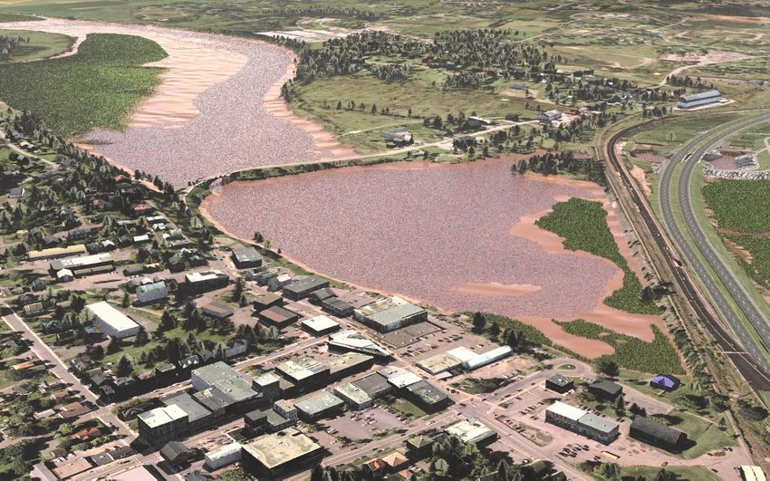
Scenario C
 Expected Water Depths

28
Scenario C
                                  Expected Salinity Patterns
                                                                 High Tide                        Low Tide
                                                   A   Water Level: 2.50 m          B   Water Level: 1.35 m
                            Large Amplitude Tide

                                                            Martock water intake             Martock water intake
                   High Runoff

                                                   C   Water Level: 2.05 m          D   Water Level: 0.75 m
Small Amplitude Tide

                                                             Martock water intake             Martock water intake

                        29
Scenario C
Expected Salinity Patterns
Water Level: 2.15 m
Large Amplitude Tide
Water may reach as far
upstream as this point
High tide
Martock water intake Martock water intake
Low Runoff
G Water Level: 1.70 m H Water Level: 0.22 m
Small Amplitude Tide
Water may reach as far
upstream as this point
Martock water intake Martock water intake
30Avon River - High Tide (2.1m / 7 ft) Scenario C 31
Avon River - Low Tide (0.6m / 2 ft)   Scenario C

32
Pisiquid Canoe Club - High Tide (2.1m / 7 ft)   Scenario C

  33
Pisiquid Canoe Club - Low Tide (0.6m / 2 ft)   Scenario C

  34
Exit 7   Exit 6

     1

35
1 Exit 7
Exit 6
361 Exit 7
Exit 6
371963 38
Avon River Causeway Shortly
Before October 1970 Opening

 39
Scenario C
 Results: Partial Tidal Exchange
• Improved flood protection (simpler, passive, standard system).
• System would be reverted back to a more natural functioning river and
  healthier habitat.
• Fish passage would be of very high quality for all fish species 24 hours a
  day, 365 days a year. Little chance of sedimentation of the fishway.
• Restored passage would generate significant recreational fishing
  opportunities (e.g., striped bass, shad)
• Water quality would be improved (reduced algae blooms, if any).
• Competitive Canoeing would be impacted.
• Salt marsh establishment upstream of the causeway would bring
  significant ecosystem benefits (including invaluable bird habitat), as well
  as recreational / tourism opportunities such as walking, birding, fishing,
  kayaking, etc.

40
Summary
 Freshwater Scenarios “A” and “B”
 • In both cases, fishways have very limited effectiveness, prone to
    sedimentation - not meeting requirements of Fisheries Act
 • In Scenario “B”, upstream water levels would vary significantly,
    emptying every year (in late summer instead of currently in April), to
    supply fishway with water
 • Lake Pesaquid currently is poor habitat for fish, has potential for long-
    term water quality issues, and would continue to gradually infill from
    upstream sediment.
 Partial Tidal Exchange Scenario “C”
 • Would allow for restoration to a more natural and healthier river
    system with significantly improved fish passage (meets Fisheries Act)
 • Can be operated to provide target water levels for events
 • Improved water quality, salt marsh with ecosystem benefits

41
Thank you
Note:
We heard the strong community
interest in keeping the lake high in the
summer, and we are now in the process
of exploring a new option “D” to
maintain the lake as well as fish
passage.
Photo from van Proosdij (2018)
42You can also read