Caesar Kleberg Tracks - WILDLIFE RESEARCH INSTITUTE - Texas A&M University Kingsville
←
→
Page content transcription
If your browser does not render page correctly, please read the page content below
Caesar Kleberg                                  Tracks
   A Publication of the Caesar Kleberg Wildlife Research Institute

                  CAESAR KLEBERG

          WILDLIFE
               RESEARCH INSTITUTE
          TEXAS A&M UNIVERSITY - KINGSVILLE
                                                                     1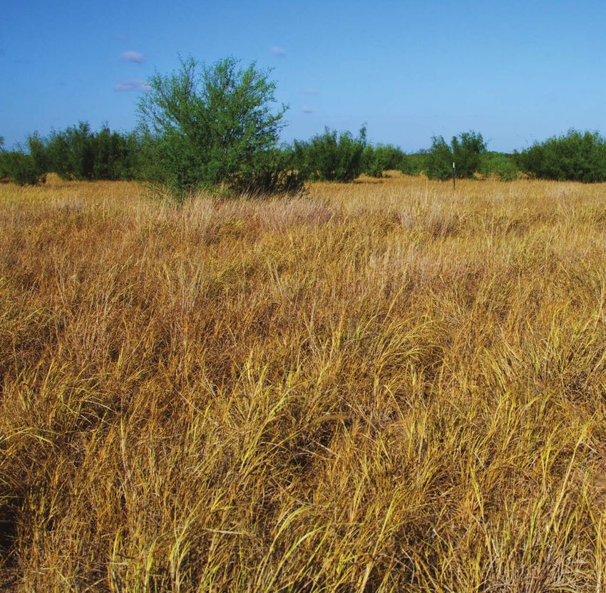
Caesar Kleberg
     Volume 4 | Issue 2 | Fall 2019
                                                                Tracks
In This Issue
3      From the Director

4      Behavior and Movements
       of Nilgai Antelope:

                                          8
       Implications for Management
       of Cattle Fever Ticks

8      Habitat Use of Montezuma
       Quail in the Edwards Plateau
       and Trans-Pecos Ecoregions
       of Texas
                                              Learn More About CKWRI
12     The Yturria Family                     The Caesar Kleberg Wildlife Research Institute at
       and Ocelot Conservation:               Texas A&M University-Kingsville is a Master’s and
       A 35-Year Story of Success             Ph.D. Program and is the leading wildlife research
                                              organization in Texas and one of the finest in the nation.
                                              Established in 1981 by a grant from the Caesar
16     Restoring Quail Habitat:
                                              Kleberg Foundation for Wildlife Conservation, its
       Long-term Research on the
                                              mission is to provide science-based information for
       Hixon Ranch
                                              enhancing the conservation and management of
                                              wildlife in South Texas and related environments.
20     Drone Heat Sensing Capabilities
       for Wildlife Ecology
                                              Visit our Website

                                      4
                                              www.ckwri.tamuk.edu

                                              Follow us on Facebook
                                              www.facebook.com/Caesar-Kleberg-Wildlife-Research-Institute

                                              Caesar Kleberg Wildlife Research Institute
                                              Texas A&M University-Kingsville
                                              700 University Blvd., MSC 218
                                              Kingsville, Texas 78363
                                              (361) 593-3922

                                                                             Cover Photo by Larry Ditto
2                                                           Magazine Design and Layout by Gina Cavazos
From the Director

                                         O
                                                   ne of the lures of the outdoors is spending time alone with only
                                                   the sounds of wind and wildlife. Many people in today’s hectic,
                                                   hyper-connected world treasure such peaceful moments. In fact,
                                          wildlife biologists often chose their profession because they relished time
                                          alone in the out-of-doors. In addition, scientists are often seen as lone
                                          wolves, quietly stalking the truth in their lab or in front of their computer.
                                          So, as wildlife scientists, CKWRI researchers may be expected to be
                                          especially introverted.

                                          Given these stereotypes of wildlife biologists and scientists, why are the by-
                                          lines in this issue of Tracks magazine so long? There are articles with 2, 6,
                                          7, and even 13 authors. One article has a single author but it describes 35
                                          years of personal connections between the author and Mr. Frank Yturria, a
                                          South Texas rancher with a special place in his heart for ocelot conservation.

                                          There are three reasons why these articles have so many authors. First,
                                          authorship is earned by being essential to the study. Modern wildlife re-
                                          search often requires several types of expertise to address the complex
                                          ecological and conservation issues, resulting in a large number of authors.

                                          The second reason for multi-author by-lines is that most CKWRI research
is conducted by graduate students. Graduate education is a critical part of the CKWRI mission and the reason why
our alumni are so successful. These students’ proving ground is not a written test in the classroom but the challenges,
frustrations, and rewards of conducting a full-blown scientific study and communicating the results. Because many
CKWRI studies are long-term and multidimensional, there are often a large number of graduate students involved by
the time the study is complete and a corresponding large number of co-authors on articles.

The third reason articles by CKWRI scientists have multiple co-authors and describe close personal relations with
members of the conservation community is that our scientists and students genuinely enjoy working together,
sharing ideas, working collaboratively to address research and conservation challenges, and engaging the wildlife
managers and landowners who can use the information we produce. Science is competitive and broad collabo-
rations are not common. However, scientists at the CKWRI understand the power of balancing competition and
collaboration. The results are highlighted in this edition of Tracks and our other publications.

You as a consumer of CKWRI research are an essential part of the team necessary to manage and conserve our
natural resources. Use what you learn to increase your appreciation of our natural world and to do what you can
to make sure Texas wildlife continues to thrive.

All the Best,
                                                                                      LEARN MORE

                                                                                      Read about a new plant
Dr. David Hewitt                                                                      identification book available
Leroy G. Denman, Jr. Endowed Director of Wildlife Research                            from TAMU Press, on page 23.

                                                                                                                           3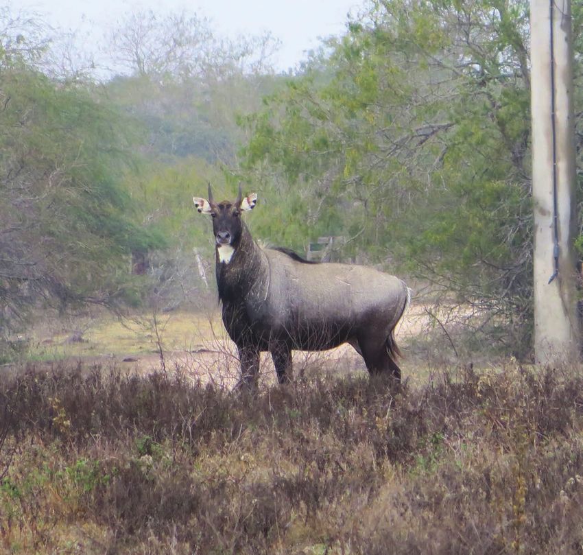
Behavior and Movements of Nilgai Antelope:
    Implications for Management
    of Cattle Fever Ticks
    By Lisa D. Zoromski, Randy W. DeYoung, J. Alfonso “Poncho” Ortega-Santos,
    Aaron M. Foley, David G. Hewitt, and John A. Goolsby

    N
           ilgai antelope are native to India, Nepal, and Pakistan. Nilgai were in-
           troduced to Texas during the 1920-40’s and have since expanded into
           much of coastal South Texas and parts of northern Mexico; current
    populations number over 30,000 free-ranging nilgai. Nilgai are challenging
    quarry and can be hunted year-round, and thus provide a significant econom-
    ic and recreational benefit to ranching operations. Although nilgai are near-
    ing the 100-year anniversary of their introduction, there is surprisingly little
    known about behavior and movements of nilgai in Texas or their native range.

                                                                            Photo by Lisa Zoromski
4   Caesar Kleberg   Tracks FALL 2019
Recent outbreaks of cattle fever ticks in the Lower        Trail cameras catch various Nilgai at fence crossing sites.
Rio Grande Valley have brought nilgai behavior
into the spotlight, as managers scramble to cope
with a very unique human-wildlife conflict. Few
outside of South Texas have heard of the cattle fever
tick, yet this tiny arachnid presents a multi-billion
dollar threat to the U.S. cattle industry via their
ability to spread bovine babesiosis. Cattle fever
ticks arrived in the Americas with the Spanish in
the 1600’s, but it wasn’t until much later that the
role of the tick in babesiosis, or “Texas cattle fever”
was recognized. Cattle fever ticks were eliminat-
ed from the U.S. by the 1950’s, and the USDA has
maintained a permanent quarantine zone along
the southern border to prevent re-infestation from
tick-endemic areas in Mexico.

The cattle fever tick spends its entire life on a single
host; as the name implies, the tick prefers cattle.
However, the ticks can survive on white-tailed
deer, and seem to like nilgai antelope as well. Tick
infestations in cattle can be managed with a com-
bination of husbandry and acaricides, but wildlife
greatly complicate tick eradication efforts. Deer can
be treated via medicated bait or corn. Unfortunate-
ly, nilgai do not respond to bait and there is cur-
rently no reliable means to treat free-ranging nilgai
for ticks. This is a major challenge for the manage-
ment of cattle fever ticks because nilgai appear to be
an important reservoir for re-infestation of South
Texas ranches.

The USDA-ARS is testing remotely activated spray-
ers as a treatment measure for wildlife. However,
the sprayers must be positioned in locations that
nilgai use frequently. Nilgai make latrines, or large
dung piles, that are noticeable along unpaved ranch
roads wherever nilgai are present. Nilgai also pre-
fer to cross underneath fences rather than jump,
and use established crossing sites, areas where the

                                                                                                                         5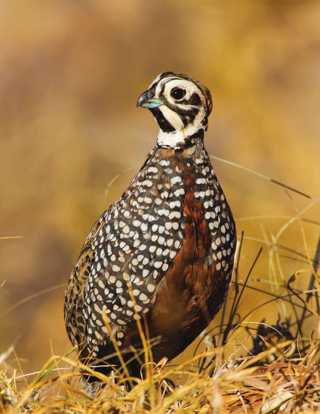
bottom fence wire is pushed up or missing, with animal runways beneath. Therefore, latrines and fence
    crossings are potential sites to target for treatment of ticks on nilgai.

    We studied nilgai behavior and use of latrines and fence crossings on 3 South Texas ranches using trail
    cameras during 2017–2019. We recorded 10,101 animal visits at latrines. Surprisingly, only 15% were
    nilgai visits, as other species of wildlife either investigated the latrine or passed near or over latrines on
                                                                   roads or trails. We found latrines to be abun-
                                                                    dant on the ranches studied, with about one
                                                                    latrine for every 3–7 acres. Although latrines
                                                                    on ranch roads were more visible, surveys of
                                                                    rangelands revealed nilgai latrines also were
                                                                    abundant off-road. Latrines were used main-
                                                                    ly by individual adult bulls, and only occa-
                                                                    sionally by cow-calf groups. Over the course
                                                                    of 1 year, we never recorded defecations by
                                                                    sub-adult bulls. Adult bulls visited latrines ev-
                                                                    ery 2–3 days on average, and defecated on the
                                                                    latrine about once per week. Most nilgai visits
                                                                    to latrines occurred at night. Trail cameras
                                                                    revealed some interesting insights into nilgai
                                                                    behavior, as we documented a fight between
                                                                    two adult bulls at a latrine site, as well as three
                                                                    mating events. Latrines appear to be import-
                                                                    ant for social communication, serving to mark
                                                                    the territory of adult bulls, and provide a
                                                                    venue for cows to advertise their reproductive
                                                                    status.

                                                                    We documented 10,889 attempted fence
                                                                    crossing events, 58% of which were success-
                                                                    ful. Overall, 14 species of wildlife used fence
                                                                    crossings. White-tailed deer and nilgai com-
                                                                    prised about 50% and 10% of crossing events,
                                                                 respectively. In terms of nilgai, fence cross-
    Lisa Zoromski checking a nilgai latrine site.
                                                                 ings were used equally by bulls and cows, and
    a given crossing was visited on average about once every 2–3 days. The number of crossing events was
    proportional to the size of the crossing, where larger crossings received greater use. Attempts to patch
    the holes in fencing created by animal crossings were usually short-lived, as feral pigs or nilgai often
    created another hole in the fence nearby within a few months. Visits to both latrines and fence crossings
    peaked during December–March, corresponding with a peak in nilgai breeding season.

6   Caesar Kleberg      Tracks FALL 2019
Overall, the number and visitation rates of
latrines suggests that dung piles will be an
inefficient means for the sprayer treatment.
Fence crossings were used by both sexes and
all age classes of nilgai and may be a better
target site for the sprayer treatment than
latrines. However, there must be suitable
fencing and fence crossings present for this
technique to work. With additional funding
from the USDA-ARS, we are investigating a        Interactive
large-scale deployment of remote sprayers
at fence crossings in the Lower Rio Grande
                                                 Seed Mix Map
Valley. We will determine how many individ-
ual nilgai are treated at fence crossing sites
                                                 Now Available
with the aid of individually tagged nilgai. We   The map is a new addition to the CKWRI
                                                 website where you can now locate a custom
are also investigating nilgai movements and
                                                 seed mix that is made specific to your area.
home ranges using satellite GPS radio-collars.   Visit the Texas Native Seeds Program page
We will determine the efficacy of the sprayer    at www.ckwri.tamuk.edu to check it out!
treatments by re-capturing tagged nilgai and
comparing tick loads to un-treated nilgai.
The results of this research will have import-
ant implications for the management of cattle
fever ticks in the South Texas region.

This study was funded by the Las Huellas
Organization of South Texas, with additional
support provided by the USDA Agricultural
Research Service, and the East Foundation.

                                                                                                7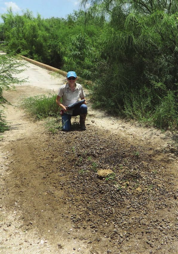
Habitat Use of Montezuma Quail
    in the Edwards Plateau and Trans-Pecos
    Ecoregions of Texas
    By Kristyn Stewart, Fidel Hernández, Eric Grahmann,
    Humberto L. Perotto-Baldivieso, Leonard Brennan,
    Robert Perez, and Zachary Pearson

    Male Montezuma quail during the breeding season.
    Photo by Geron Gowdy

8   Caesar Kleberg   Tracks FALL 2019
O
           ne of the most unique species of New
           World quails inhabiting North America can
           be found in Texas. With vibrant coloration
to contrast its cryptic nature, and strong elongated
feet, the Montezuma quail possesses a unique life
history compared to other quails (Figure 1). Across
their geographic distribution, Montezuma quail are
found at varying elevations in pine-oak woodlands and
savannahs, typically involving mountainous terrain.
In Texas, two populations are located in the Trans-Pe-
cos Mountains and Basins (Figure 2A) and Edwards
Plateau (Figure 2B) ecoregions, with the latter contain-
ing possibly the smallest and least studied population.
Their cryptic nature and association with rugged ter-
rain contribute to the lack of knowledge on the species.

                                                A

Figure 2
                                                B
Examples of Montezuma-quail habitat in the A) Trans-Pecos
and B) Edwards Plateau ecoregions of Texas.

                                                            9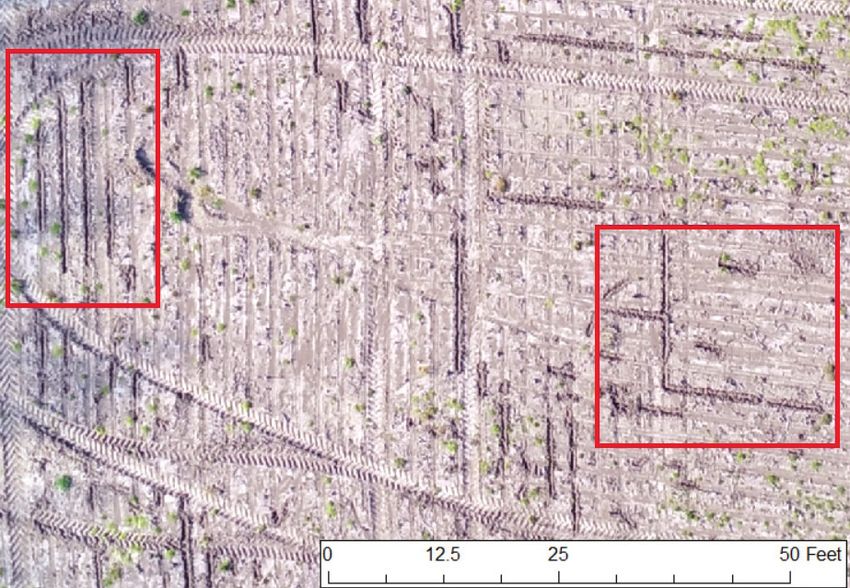
The Edwards Plateau, or Texas Hill Country as it          use of pen-reared Montezuma quail and a trap).
     is often called, is an ecoregion with shallow soils,      To determine habitat use of Montezuma quail,
     rocky hills, and elevations ~1,600 ft. above sea level.   we collected vegetation data at used and random
     A key woody species found in this ecoregion is Ashe       locations. This allowed us to make comparisons
     Juniper, an evergreen conifer, which has been en-         between what was available to Montezuma quail
     croaching for the past century. This encroachment         and what they were using. We collected data on
     is due to several factors including fire suppression      Ashe Juniper density, canopy cover, and height, as
     and overgrazing. Ashe Juniper forms dense colonies        well as metrics on forbs and grasses.
     across the landscape, eliminating key grasses and
     forbs crucial to the survival of Montezuma quail. In      During the first year of study (2018), we had no
     the southwestern portion of the Edwards Plateau           successful captures of Montezuma quail in the Ed-
     where Montezuma quail are found, landowners               wards Plateau, but we did have multiple sightings
     have started clearing Ashe Juniper in recent decades,     and responses that resulted in the collection of 13
     which has led to increased sightings of Montezuma         used locations. Due to this small number of ob-
     quail and, in turn, increased interest in the species     servations, we expanded our efforts in our second
     by the public. Consequently, we initiated two studies     year (2019) to include the Trans-Pecos ecoregion
     in collaboration with the Texas Parks and Wildlife        in order to compare habitat use of Montezuma
     Department during the 2000s that were focused             quail between the relatively small, isolated popu-
     on the development of a survey method for Mon-            lation in the Edwards Plateau to the larger, more
     tezuma quail and the factors that could influence         established populations in the Trans-Pecos. We
     its detection and presence. Once we knew how to           selected the Davis Mountains Preserve to serve as
     survey the landscape for the species, we then began       our West Texas study site because Alligator Juniper
     a study specifically to address how Ashe Juniper          is prevalent in this region, and we were interest-
     influenced habitat use of Montezuma quail in the          ed in determining if habitat use differed between
     Edwards Plateau.                                          areas that contained juniper but differed in the
                                                               species present. We collected the same vegetation
     This study began in spring of 2018 on two private         metrics in the Trans-Pecos that were collected in
     ranches and Kickapoo Cavern State Park in Ed-             the Edwards Plateau.
     wards and Kinney counties. One objective of our
     study was to capture Montezuma quail and place            Based on the vegetation data collected to date, we
     backpack transmitters on them to track surviv-            have documented that Montezuma quail are using
     al and their use of the landscape. We attempted           juniper differently in the two ecoregions. Prelim-
     captures during April–August of 2018 and again            inary analyses suggest that Montezuma quail in
     during March–August of 2019. Call-back surveys            the Edwards Plateau avoid sites when Ashe Juni-
     were used to detect individuals by playing a male         per is greater than 20% canopy cover (Figure 3A)
     buzz call and a female descending call, in attempts       and greater than 6 ft. in height (Figure 4A). In the
     of eliciting a response from a wild bird. Once            Trans-Pecos, however, Montezuma quail select
     a response was received, we attempted capture             sites where Alligator Juniper is greater than 12%
     through several methods (small-animal hand net            canopy cover (Figure 3B) and between ≈6–23 ft in
     gun, pointing bird dogs and hand nets, or the             height (Figure 4B).

10   Caesar Kleberg     Tracks FALL 2019
A
Figure 3
B
Habitat suitability bounds of Montezuma quail for A) Ashe Juniper cover in the Edwards Plateau, and B) Alligator Juniper
cover in the Trans-Pecos. Montezuma quail selection is indicated when values occur above the red line, and avoidance when
values occur below the red line.
A
Figure 4
B
Habitat suitability bounds of Montezuma quail for A) Ashe Juniper height in the Edwards Plateau, and B) Alligator Juniper
height in the Trans-Pecos.
We were surprised to learn that habitat selec- However, these results are preliminary, and data are
tion by Montezuma quail differed between the still being collected. Through this research, we hope
two populations, depending on which species of to quantify the bounds of suitability of Montezuma
juniper was present. That is, we documented that quail for Ashe Juniper and, in the process, provide
Montezuma quail tended to avoid Ashe Juniper in landowners and managers with concrete prescrip-
the Edwards Plateau, but tended to select Alligator tions for creating and managing Montezuma-quail
Juniper in the Trans-Pecos. For the Edwards Pla- habitat in the Edwards Plateau.
teau, these findings suggest that removal of Ashe
Juniper to levels below 20% cover at a given point
is necessary to create Montezuma-quail habitat.
1112 Caesar Kleberg Tracks FALL 2019
The Yturria Family and Ocelot Conservation:
A 35-Year Story of Success
By Michael Tewes
P
erhaps the most meaningful success story Once the railroad was laid in 1904, and the Port of
for ocelot conservation that I have been Brownsville constructed in the 1930's, agricultural
connected to followed my initial visit with crops could be exported to distant markets. Thus,
Mr. Frank Yturria in 1983. He graciously spent the El Jardin or brush garden was rapidly convert-
the afternoon showing his beautiful ranch to a ed to extensive farmland leaving less than 1% of
young 26-year-old graduate student from the the area still covered with ocelot brush.
Caesar Kleberg Wildlife Research Institute. I had
captured the first ocelot for research in the When I described the importance of these relict
preceding year on a nearby ranch. patches of thornshrub for ocelot conservation,
Mr. Yturria responded, as quoted in his biography
{ }
Before the visit, I had examined aerial photo- (Yturria 2018, pg. 474), “So I said, ‘Well, then,
graphs and identified I’ll stop clearing brush.”
two key tracts of dense
This moment in 1983
thornshrub suspecting
I HAVE DONE MY PART also began an incredibly
they may harbor ocelots.
I was excited when we
TO HELP THE OCELOT. successful story of the
achievements made by a
drove to the spot where
a thin brush corridor NOW, I WANT YOU TO single landowner commit-
DO YOUR PART. ted to ocelot conservation.
crossed a ranch road, and
Mr. Yturria mentioned
observing ocelots cross -Mr. Frank Yturria The family generously
allowed my team to moni-
at that location. This site
was exactly where I would expect to see an ocelot. tor ocelots with radio telemetry and cameras over
three and a half decades. As many as 15 ocelots
I could also see the ponderous bulldozer slowly within one year were found on the ranch. We have
clearing the two remaining brush fragments cov- documented several young ocelots born on the
ering the last 500 acres of the historically recog- Yturria Ranch. We tracked male ocelots as they
nized “El Jardin.” The English translation of “The dispersed to establish territories in surrounding
Garden” was a local term referring to the tangle of areas, and young female ocelots which tended to
extremely dense thorny brush that covered much stay in or near the territory where they were born.
of the Rio Grande Delta prior to the agricultural This dispersal pattern is typical for ocelots, and
period. The fertile alluvial soils deposited over many of the other 30 species of small wild cats
eons by the Rio Grande provided the nutrients to found around the world. Based on our research,
grow this dense cover used as prime habitat by we also believe this “source population” serves as
ocelots. the “heart beat” to keep nearby populations
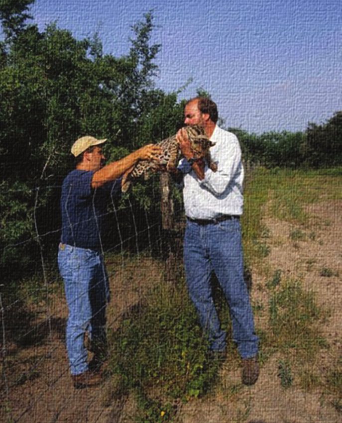
Former graduate student, David Shindle, is handing a sedated ocelot over the Yturria fence to Michael Tewes for
examination. (Shindle has subsequently been working on the endangered Florida panther for the past 20 years).
13Red and yellow striped lines indicate Yturria Ranch Habitat Restoration Areas in Willacy and Kenedy Counties, Texas.
replenished with young ocelots. For example, we have documented several ocelots, using camera trapping
or genetic identification, that initially occurred on the Yturria Ranch and later were found on the East
Ranch a few miles away. Understanding the movement ecology of ocelots on the Yturria Ranch is critical
for our team to develop effective management strategies.
In 1989, Mr. Yturria established a conservation easement of 510 acres to maintain the rare dense brush on
these two small tracts. The original easements were connected and expanded by the Nature Conservancy
with two larger easements of 698 acres in 2007 and 1,300 acres in 2009. Although these two recent ease-
ments were open rangelands, typically not the best cover for ocelots, their location confers great potential
for habitat restoration. They lie at the heart of this ranch ocelot population which I believe supports over
80% of the ocelot population in the U.S. In 2014, Mr. Yturria dedicated much of the remaining portion of
his ranch to a conservation easement, totaling about 10,000 acres.
Fewer than 80 ocelots live in extreme southern Texas. Typically only about 7-14 ocelots occur in the “refuge
population” at Laguna Atascosa National Wildlife Refuge, a population that has been disconnected from the
ocelots in Mexico for many generations. And the rapidly expanding urban areas and increasing road traffic
in Cameron County will further isolate this small population.
14 Caesar Kleberg Tracks FALL 2019A sedated ocelot being held by
Michael Tewes at Yturria Ranch.
In stark contrast, there are more than 35 ocelots
using the “ranch population” in Willacy and Kenedy
counties. These felines have access to more connect-
ed habitat surrounded by healthy rangelands. The
land ethic and dedication to promote ocelot recovery
continues today. We are all fortunate that the Yturria
Family continues their legacy of helping this natural
treasure of the animal kingdom.
Thiry-five years after my first visit with Mr. Yturria, I
accompanied him in July 2018 to Washington, D.C.
At age 95, Mr. Yturria passionately argued at different
federal offices for habitat restoration to help recover
the ocelot population. I will always remember Mr.
Yturria assertively telling the head of the U.S. Fish
and Wildlife Service that “I have done my part to
help the ocelot. Now, I want you to do your part.”
Mr. Yturria passed away only four months later.
Indeed, he has done his part.
ONLINE
Get the latest research
news from CKWRI
delivered directly to your
inbox. Visit our website at
www . ckwri . tamuk . edu
to sign up today!
15Restoring Quail Habitat:
Long-term Research on the Hixon Ranch
By Timothy E. Fulbright, Ellart J. Vreugdenhil, Brandon J. Palmer, Geron G. Gowdy,
Javier O. Huerta, Benjamin R. L. Olsen, Eric D. Grahmann, Fidel Hernández, David B. Wester,
Michael W. Hehman, Forrest S. Smith, Anthony D. Falk, and Scott E. Henke
16 Caesar Kleberg Tracks FALL 2019B uffelgrass and Old World bluestem are non-native grasses that did not originate in North America and
were brought here for erosion control and to provide livestock forage. Unfortunately, these grasses also
degrade habitat for northern bobwhites and scaled quail. Quail have a hard time walking through them
because they form thick stands. They also reduce food supplies because they suppress forbs (weeds) that
produce seeds and harbor insects that quail like to eat.
Buffelgrass and Old World bluestems have been planted across South Texas. They have spread from areas
where they were planted, replacing native grasses and forbs in the process. They are highly competitive, and
are often just about the only grass visible on land-
scapes they take over. Reducing abundance of
non-native grasses is difficult.
We initiated a research project in 2008 to try to re-
place non-natives with native plants. Our objective
was to restore quail habitat on a site overrun by
buffelgrass and Old World bluestem. In Septem-
ber 2008, we brainstormed with researchers from
agencies and ranch managers with experience in
invasive grass management to develop innovative
treatments to reduce non-native grasses.
We initiated a series of pilot studies on small plots
on the Hixon Ranch following the 2008 meeting.
We tested treatments including combinations of
mowing followed by herbicide application, mold-
board plowing, prescribed fire, and planting of
seeds from local varieties of native plants. Tradi-
tional treatments including application of herbi-
cides such as Fusilade, seedbed preparation and
sowing native plant seeds, and prescribed fire did
not reduce these grasses when we applied them as
individual treatments. Repeated discing followed
by planting of native plants adapted to the local
area appeared to have promise. We found that this
strategy eventually depleted the non-native grass
seeds in the soil.
We expanded our small-plot studies in 2013 to
test how our strategy of seed depletion followed by
planting native plant seeds worked on a 300-acre
‘restoration’ site dominated by non-native grasses.
Buffelgrass on the restoration site
in 2013 before treatments.
17We also designated a similar area that was covered compared to more than 40% on the control. We
with non-native grasses as an experimental ‘control.’ periodically spot-spray and hand-pull buffelgrass
We gathered pre-treatment data during 2013 and Old World bluestem plants that emerge on the
to document soil seed bank characteristics and restoration site to help keep it free of non-natives.
vegetation on both study sites. One important lesson we have learned is that re-
storing native vegetation where non-natives were
In February 2014, we burned the restoration site to once abundant is an on-going process. Although
remove the thick growth of non-native grasses and we greatly reduced the non-native seeds in the
then we disced in April 2014. We repeated discing soil, some remain. In addition, animals, vehicles,
after rains in January, May, June, and July 2015. and other carriers disperse new seeds onto the
Discing three times reduced buffelgrass seeds in site. Converting non-native grass stands to natives,
the soil by 91% but did not reduce seeds of Old therefore, requires a long-term commitment to
World bluestem. We applied glyphosate plus 2, maintenance.
4-D in March, June, August, and September 2016.
We applied herbicides instead of discing to kill Native grass cover was 23% on the restoration area
non-native grass seedlings so that the soil would by March 2019, compared to 0% on the control.
firm before we drill seeded. Canopy cover of native grasses on the restoration
area was similar to that in areas of native vegeta-
We drill-seeded native grasses, forbs, and sub- tion on the ranch. Canopy cover of native forbs in
shrubs on the restoration site in September 2016. March 2019 was 70% compared to only 10% on the
We put together three seeding mixes, each adapted control.
to one of the three major soil series in the resto-
ration area. We put 64 to 70 plant species in the We mechanically removed single woody plants and
seed mixes depending on the soil series. We used clusters of woody plants that had non-native grasses
seed mixtures with a large number of species to im- underneath their canopies. We left some mesquite
prove chances of plants taking hold under a variety clusters on the restoration area to provide cover for
of soil and moisture conditions and to enhance quail. We planted seedlings of native shrubs and
competition with non-native grasses. cacti in a pattern so that any quail in the study area
would have woody cover within its flight distance.
Canopy cover of non-native grasses on the resto- Woody cover on the restoration area was about 15%
ration area has remained near 0% since planting in March 2019.
Drill seeding native grass seeds on the restoration site in 2016.
18 Caesar Kleberg Tracks FALL 2019We kept track of use of the restoration and
control areas by bobwhites from 2013 until
September 2018. Bobwhite used the restoration
area less in 2018 than they did before we began
the restoration. In 2013, 6 out of 8 bobwhites
we collared with transmitters concentrated their
home ranges within the restoration site. After
the treatments were installed, only 1 out of 10
bobwhite home ranges were centered in the
site. Reasons bobwhites did not use the resto-
ration area as much after treatments include the
following: grasses and forbs were still coming
up and likely provided insufficient vegetation; A horned lizard on the restoration site.
tracking of bobwhites occurred in the summer
when temperatures are high and potentially
fatal, particularly to chicks; and lastly, since Our research resulted in several recommendations
woody plant seedlings require several years to for restoring native vegetation in areas dominated by
grow, thermal cover and hiding cover for quail buffelgrass and Old World bluestems:
were lacking, resulting in lower use than antici-
pated. • The initial step is to moldboard plow unless the
field is too rough, otherwise use deep discing,
We are determining effects of restoration on other and then disc or apply glyphosate every time
wildlife species as well. Breeding bird diversity on seedlings come up until few or no seedlings are
the restoration area increased from seven spe- detected to exhaust the seeds in the soil.
cies in 2015 to 31 in 2018. Likewise, butterflies
• Once the soil seed bank lacks non-native seeds,
increased from 6 species in 2015 to 15 species
plant a diverse mixture of locally-adapted seeds
in 2018. Texas horned lizards are abundant
of native plants.
on both the restoration and control sites. The
estimated population density is one lizard per • Autumn (September – October) is preferable for
2.5 acres. However, population structure differs planting based on our experience.
between the two sites. The restoration site has
• Restoration is restricted to sites that can be
more hatchling and juvenile lizards. Harvest- cultivated, such as old fields or areas that have
er ants, the main prey of Texas horned lizards, been root plowed and root raked.
also are more abundant on the restoration site
compared to the non-native control site. It is • Continuous maintenance for the life of the
possible that female horned lizards selected the restoration is essential. In the absence of
restoration site as nursery habitat to lay their spot-spraying and hand-pulling, non-natives
eggs in. will eventually re-establish.
• Restoring native vegetation results in greater
Over the six-year period from initial burning and wildlife diversity within two years following
discing in 2014 until 2019 the cost of conducting treatment.
the restoration was about $611/acre. The total
• Native vegetation restoration is expensive, but it
costs of discing and aerial herbicide applications
is cheaper than buying new habitat.
were $33,670 and $11,510 respectively. Restoration
is expensive; however, compared to buying wildlife
habitat the cost is reasonable.
19Drone Heat Sensing Capabilities
for Wildlife Ecology
By Aaron Foley and Jesse Exum
Figure 1
Two white-tailed deer detected during nighttime
drone surveys with thermal imagery.
D
rones, or Unmanned Aerial Vehicles video or still-image modes, and scientists can
(UAVs), have become extremely use both optical and thermal cameras on the
popular during recent years. Drones same drone. In this article, we will discuss the
are frequently used by construction companies, different ways that scientists have used thermal
search and rescue operations, and for recre- cameras on drones to collect data and how CKWRI
ational purposes. Wildlife researchers have scientists are incorporating these technologies into
recently begun using drones as a research tool their wildlife research programs.
to survey terrain that is difficult to access on
foot. Further, drones are quiet, which minimiz- One popular application of drone-based ther-
es disturbance of wildlife. Additionally, drones mal cameras is locating wildlife. In Colorado,
are safer for humans than small aircraft and drones with infrared sensors were successful-
helicopters that are typically used for aerial sur- ly able to determine whether leks (breeding
veys. The data collected by drones are used for grounds) were occupied by sage grouse. In
various reasons such as estimating population Germany, roe deer fawns are susceptible to
sizes, quantifying habitat characteristics, and mortality by farm implements during the mow-
wildlife and habitat monitoring. ing season. Because fawns are well camouflaged,
the use of optical cameras would prove difficult
Another neat thing about drones is the ability to to detect fawns. Thus, scientists used thermal
attach different types of sensors; optical, ther- cameras to locate fawns prior to mowing, which
mal, and infrared cameras are available in either in turn reduced mortality rates. The number of
20 Caesar Kleberg Tracks FALL 2019benefits of locating animals via thermal imagery is being used to detect animals while the optical
is limitless. camera is being used to identify species (Figure
1). Repeated daytime and nighttime drone esti-
Locating wildlife via drones can also be used to mates will be conducted to determine if counts
generate population estimations. For example, are consistent. Further, population estimates
scientists were curious about whether drone will be compared with trail camera surveys and
counts or ground counts would be a better helicopter surveys to determine if drone popu-
way to estimate the population size of sandhill lation estimates are comparable. If drones gen-
cranes on a wildlife refuge in Colorado. Using erate viable population estimates, then drones
drones near birds may be dangerous due to could be useful to survey white-tailed deer in
potential mid-air collisions so researchers used areas where the use of aircraft is limited (subur-
thermal cameras during nighttime drone sur- ban areas and smaller ranches).
veys when cranes were at their roost sites. In-
terestingly, drone counts were only 5% different There are some limitations of conducting
than ground counts. This autumn, scientists at wildlife surveys with drones such as battery
CKWRI will be using drones fitted with thermal life or the inability to fly during moderate
cameras to determine if roosting bobwhite cov- inclement weather (wind, fog, rain). However,
eys can be detected and whether this informa- many scientists consider these limitations to
tion can be used to create population estimates. be outweighed by the advantages. Footage or
If drones are capable of generating population images can be reviewed repeatedly, which re-
estimates then the need to use helicopters for duces the eye fatigue associated with real-time
quail surveys may be reduced which has safety surveys. Computers can be used to automatically
and financial implications. review the footage. For instance, research-
ers in Australia compared ground-based and
Another case study of using drones to estimate drone-based counts of radio-collared koalas.
population sizes occurred in Canada. Scientists The thermal imagery acquired by drones were
compared population estimates of woodland processed by an automated detection software
caribou conducted via drones with infrared sen- (artificial intelligence) and relative to ground-
sors, ground counts, and DNA analysis of fecal based counts, the probability of detection of
pellets. Population estimates were comparable koalas was higher (68-100%).
between the 3 methods, but precision was high-
er for drone counts and DNA analyses. Current- Counting or observing wildlife is not the only
ly, scientists at CKWRI are using a combination useful drone application. The data collected from
of thermal and optical cameras on 5 ranches thermal imagery can be used to determine the
in South Texas to determine whether drones proportion of landscape that may be thermally
can be used to generate population estimates of limiting to certain wildlife species. For instance,
white-tailed deer. The combination of thermal bobwhites can tolerate temperatures up to 102°F.
and optical cameras is being used because it is Researchers at CKWRI used thermal imagery
very difficult to detect animals in the brush via collected from drones to quantify temperature
optical footage alone; thus, the thermal camera of the landscape and found that during October,
21only 13-24% of a study site near Hebbronville
during 2-4 pm was below the tolerance limit
of bobwhites. The high proportion of the study
site not thermally suitable for bobwhites has
implications for population dynamics of this
popular game bird. Quantifying the thermal
environment can also be extended to include
numerous wildlife species.
Drones also have applications for agricultural
Figure 2 - Overhead shot of a cornfield.
areas. Quantifying damage of row crops (e.g., Note the sections that were damaged by feral pigs.
corn) often requires one to walk through the field Photo by Bethany Friesenhahn.
to locate damaged sites – a big task if the field is
hundreds of acres! Drones can be used to obtain With the rising popularity of drone-based wild-
overhead photographs and post-processing can life ecology, we at CKWRI are excited about the
be used to measure the amount of crop damage. increased access to a wealth of data. As with all
Scientists at CKWRI are currently using this new technology that has arisen during the last
technique in eastern Texas (Figure 2) with the 1-2 decades that benefit wildlife research (GPS
goal of quantifying the economic loss of crop radio-collars, trail cameras, etc.), there are a
depredation and comparing that cost with the number of experiments we need to conduct to de-
cost of feral pig control. One interesting thing is termine the pros/cons of drones relative to other
that drone imagery was able to locate areas where traditional data collection methods.
pigs rooted up recently sowed corn seeds (Figure 3).
Figure 3 -
Row crops just after
planting. Note the ar-
eas (dark lines within
red boxes) where
feral pigs recently
rooted for seeds.
Photo by Bethany
Friesenhahn.
22 Caesar Kleberg Tracks FALL 2019 Photo by Timothy FulbrightNow Available from TAMU Press
A Photographic Guide to the Vegetation
of the South Texas Sand Sheet
Organized with the non-botanist or beginning-level botanist in mind, A Photographic Guide to the Vegetation of
the South Texas Sand Sheet includes 200 of the most common grasses, flowering plants, vines, cacti, and woody
plants of the South Texas Sand Sheet, 56 of which are species endemic to Texas and 15 of which can only be
found in this region. Species are grouped by physical appearance, allowing budding naturalists, landowners, and
students to find a specific plant without needing
to first understand how families and species are
grouped scientifically. Each plant entry includes a
representative sampling of photos for that species,
showing how it might look from a distance, up
close, and at different stages of its life cycle.
This handy snapshot of plant life in the South
Texas Sand Sheet will enable anyone to easily
identify Sand Sheet plants, learn more about their
uses, and understand their value to the region.
ABOUT THE AUTHORS
Dexter Peacock is a retired lawyer, photographer,
cattle rancher, and Sand Sheet landowner.
Forrest S. Smith is the Dan L Duncan Endowed
Director of South Texas Natives and Texas Native
Seeds Projects at the Caesar Kleberg Wildlife Research
Institute at Texas A&M University-Kingsville.
ONLINE
A Photographic Guide to the Vegetation of the
South Texas Sand Sheet is available for purchase
from TAMU Press and Amazon.
23Caesar Kleberg Wildlife Research Institute 700 University Blvd. MSC 218 Kingsville, Texas 78363 DONATE TODAY & MAKE A LASTING IMPACT ON WILDLIFE Your gift to the Caesar Kleberg Wildlife Research Institute makes an impact on the wildlife that rely on the habitat of South Texas. Thanks to contributions from donors, our researchers can continue to stay on the cutting edge of applied wildlife research and train the next generation of wildlife biologists to continue Caesar’s legacy of conservation. To give online visit: www.ckwri.tamuk.edu/giving. 24 Photo by Zachary Pearson
You can also read