Participatory Mapping in a Developing Country Context: Lessons from South Africa
←
→
Page content transcription
If your browser does not render page correctly, please read the page content below
land
Article
Participatory Mapping in a Developing Country
Context: Lessons from South Africa
Dylan Weyer *, Joana Carlos Bezerra and Alta De Vos
 Department of Environmental Science, Rhodes University, P.O. Box 94, Grahamstown 6140, South Africa
 * Correspondence: projects@hgagri.co.za; Tel.: +27-63-53-8155

 Received: 31 May 2019; Accepted: 23 August 2019; Published: 3 September 2019

 Abstract: Digital participatory mapping improves accessibility to spatial information and the way in
 which knowledge is co-constructed and landscapes co-managed with impoverished communities.
 However, many unintended consequences for social and epistemic justice may be exacerbated
 in developing country contexts. Two South African case studies incorporating Direct-to-Digital
 participatory mapping in marginalized communities to inform land-use decision-making, and the
 ethical challenges of adopting this method are discussed. Understanding the past and present context
 of the site and the power dynamics at play is critical to develop trust and manage expectations among
 research participants. When employing unfamiliar technology, disparate literacy levels and language
 barriers create challenges for ensuring participants understand the risks of their involvement and
 recognize their rights. The logistics of using this approach in remote areas with poor infrastructure
 and deciding how best to leave the participants with the maps they have co-produced in an accessible
 format present further challenges. Overcoming these can however offer opportunity for redressing
 past injustices and empowering marginalized communities with a voice in decisions that affect
 their livelihoods.

 Keywords: D2D mapping; PGIS/PPGIS methods; epistemic justice; social justice; local knowledge;
 landscape management; ethics

1. Introduction
     Increasingly, researchers and policy makers are recognizing the importance of taking a multiple
evidence approach to co-produce knowledge that can enhance our understanding of the governance of
natural resources for human well-being [1–3]. Scientific, local, indigenous and practitioner knowledge
represent different, complimentary understanding of the real world [1,2,4]. Integrating across these
knowledge streams offers opportunities for shifting towards research and management processes that
are more transparent, just, legitimate, and sustainable [1–3]. One tool that has been extensively used to
integrate local and indigenous knowledge with scientific and practitioner knowledge in the context of
spatial planning, health sciences and public policy, is participatory mapping [5–8].
     Participatory mapping, in its many guises, offers many opportunities to co-construct knowledge
with communities. By engaging holders of local and indigenous knowledge in a participatory mapping
process, the researcher is able to translate certain kinds of scientific knowledge in a discursive manner [9].
Maps allow translation of scientific information onto a canvas that may project local and indigenous
knowledge [10]. In the process, community members and researchers are able to observe ecosystem
change over time or, at varying scales, the location of key services such as clinics or schools, relative to
the population size and distribution, and understand the implications of these changes for human
well-being, using this to lobby for improved provision of services [9]. The mapping process and
the created maps can also aid in the transfer of local ecological knowledge from one generation to
another [11]. As ecosystem services change, ecological degradation and the resilience of traditional and

Land 2019, 8, 134; doi:10.3390/land8090134                                          www.mdpi.com/journal/land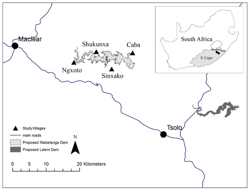
Land 2019, 8, 134                                                                                      2 of 16

local institutions are closely related [12–14], the process of inter-generational knowledge sharing plays
a crucial role in sustaining traditional knowledge systems and promoting ecosystem resilience [15–17].
In terms of environmental management, the participation of multiple stakeholders, each offering
different knowledge types, helps to inform multiple evidence approaches [1], that improve the legitimacy
and accuracy of decision-making [18,19]. The mapping process can also facilitate negotiation among
community members regarding resource area priorities and value, a process that can build community
cohesion [11,20].
      Whilst participatory mapping has been widely praised for its role in just and sustainable natural
resource management, investigators have nevertheless cautioned against its irresponsible application,
recognising that maps are inseparable from the political and cultural contexts in which they are
created and used [5,21,22]. Although participatory mapping processes can empower the voiceless,
they can also perpetuate existing inequalities by favouring the voices, perceptions, realities, and spatial
languages of those that are already privileged [22–24]. Additionally, by sharing spatial information,
communities or individuals can put themselves at risk by revealing spatially sensitive information
(at times unintentionally), or may risk exploitation of their intellectual property for research and
management [22].

1.1. From Participatory Mapping to Digital Participatory Mapping
      Participatory mapping encompasses a broad diversity of techniques and approaches [25].
 Participatory Geographic Information Systems (PGIS) refer to participatory planning processes in
 rural areas of developing countries, using a combination of participatory learning and action methods
 and GIS [26], where community empowerment and the building of social capital is often the aim [27].
 In contrast, public participation GIS (PPGIS), and its close relative volunteer geographic information
(VGI), generally pertains to participatory mapping conducted in developed country contexts and often
 takes the form of online mapping surveys [26] and places more emphasis on obtaining spatial data
 accuracy [27].
      Technological advances, particularly around the accessibility of spatial information and aerial and
 other remotely sensed imagery [22], has allowed the evolution of participatory mapping to shift to
 more digital platforms, e.g., [28–31]. These shifts to digital platforms have been accompanied by new
participatory mapping methodology. The ‘Direct-to-Digital’ (D2D) mapping technique uses Google
 Earth to directly map information from community workshops or interviews onto a digital platform,
 negating the need to digitise and transcribe data collected in the field [7]. This method (and slight
variations of it) has been used effectively, and extensively to represent indigenous knowledge and
 rights in traditional land-use studies in Canada [7], the United States [6], Russia [32], and Australia [33].
      There are many reasons for shifting to more digital platforms for understanding local and
 indigenous people’s relationship with natural resources, and their management of it. Aside from
 reducing the amount of technical work needed to post-process data [7], digital platforms may offer
 increased access to spatial data and diversify the forms of spatial knowledge used in environmental
 management [19]. Although all digital participatory mapping processes are community-integrated,
 D2D stands out as it allows for variability and diversity in representation of spaces when the mapping
 is done directly onto the map, thus capturing subtle particularities of a space and presenting a real
‘depth of place’ [7,34]. In some cases, the output maps from digital participatory mapping methods can
 be richer in content, more accurate, and easier to update than those produced on hard-copy maps [32].
      Whilst these techniques offer new opportunities for better and more just natural resource
 management, digital platforms also present a new set of logistical, technical, as well as ethical and legal
 considerations [6,7,35,36]. For one, it requires training of facilitators in the use of new tools, as well as
 familiarising community members with a different representation of the world [31]. In participatory
processes, the critical role of the facilitator [37,38] can determine who takes part in a participatory
process and its outcomes, as well as influence power dynamics [22,37]. With digital participatory
 mapping, the capacity to engage with digital media (or not) is a particular capacity that can yield power,
Land 2019, 8, 134 3 of 16
and facilitators need to be able to remove barriers to this, in addition to the usual considerations of
managing power related to venue, group, and participation [22,39–41]. They also need to acknowledge
and account for potential uncertainty, credibility and bias that may result from the realism embedded
in virtual globes [42].
Digital platforms offer the potential of much broader dissemination of spatial information [31],
and, importantly for cases where maps are used for legal and planning purposes, can also improve the
spatial accuracy of information collected [7]. Whilst this may offer elements of empowerment, it also
carries an increased risk for communities and individuals, [32,36,43]. Whilst intellectual property rights
should always be considered in participatory mapping projects, the legal aspects around who owns
what parts of the map in digital mapping approaches is undoubtedly more complex [7]. Since many
digital platforms belong to larger corporate companies, much concern has also been raised around
privacy [44], and serving the needs of large corporate companies [45]. Many digital participatory
mapping protocols, such as D2D, only work on digital platforms that can be used and cached offline [7].
Whilst digital methods in participatory mapping (and other co-production platforms) have been
more commonly used and studied in developed countries [46,47], they offer exciting opportunities
for more representative and just natural resource mapping (among other applications) in developing
countries, where they have been increasingly applied [31,47,48]. However, many of the ethical risks
associated with participating with digital platforms are exacerbated in these countries, or may be
unique to their contexts. Hereto, there has been little discussion of said exacerbated or specific
ethical implications of moving participative mapping onto digital platforms in developing country
contexts. The history, social environment and the political-economic reality in which these countries
are embedded have serious implications for the ethics of engagement, and the rights of community
members involved [5,22,49]. For example, in many rural areas in developing countries, communities
may be much more naïve (compared to indigenous communities in developed countries, for example)
to the ethical concerns around privacy on digital platforms, and the legal implications of sharing
knowledge here. Furthermore, the cultural differences in the understanding and consequently the
representation of the space, demand a critical perspective on how the mapping process will be
conducted [36]. For digital participatory mapping to achieve its potential as a tool for enhancing
inclusivity and engagement in places where it is most needed, it is critical to understand the ethical
dimensions of participatory mapping processes, particularly as it pertains to social and epistemic
justice [50,51].
1.2. Justice and Participatory Mapping
Justice is multi-faceted [52], but two dimensions are particularly relevant in the context of this
paper: social justice and epistemic justice. Social justice has its roots in philosophy and it is widely
used in social sciences [53], legal debates [54] and in everyday discussions. In broad terms, social
justice refers to both a process and a goal [55], in which the benefits and burdens of society are divided
between its citizens, not at random, but according to a set of principles defined by society. The rights
of individuals and groups are respected by all decision-making apparatus; and individuals are treated
with dignity and respect by all [56]. Thus, social justice has distributive, procedural and interactional
justice elements at its core and institutions play a role in enabling or hampering this. Rawls argued
that “justice is the first virtue of social institutions” ([57], p. 3), illustrating the role of institutions in the
pursuit of social justice.
At the core of participatory mapping is knowledge co-production and the drive for a more inclusive
and collaborative process to address the injustice embedded in more extractive and unrepresentative
data collection methods [8,29]. This kind of injustice is specifically related to epistemic injustice,
the injustices embedded in knowledge production and dissemination. Epistemic injustice occurs when
a person or group of people are wronged in their capacity as knowledge bearers or when there is a
gap in the interpretative framework of a person or a person’s ability to understand someone else [50].
In these cases, people who are experiencing epistemic injustice are labelled as unable to bear knowledgeLand 2019, 8, 134 4 of 16
and are not given any credibility in knowledge exchanges, being assigned a passive role in this process
and therefore having their voices suppressed [58]. People may also experience epistemic injustice
when their questions and issues are discredited through practices and institutions that prevent them
from pursuing their enquiries [59]. For example, an illiterate person trying to find information about
his/her plot of land, is unable to do so because it requires that they complete a written form in English.
The involvement of communities in natural resource management addresses both epistemic
and social injustice. By bringing communities to the table in the discussions about natural resource
management in their areas, their voices and claims gain legitimacy through the process, triggering
credibility on the part of the hearers of those claims. PGIS (in both its analogue and digital forms)
emerged to address the lack of resources and tools available to certain groups, which speaks directly
to epistemic injustice [50]. In this case, the gap in interpretative resources is the lack of access to the
technology necessary and ‘language’ refers to the technological jargon that typically accompanies
the use of these tools. Scientists and society therefore acknowledge community members as credible
knowledge-bearers. This also speaks to the distribution of knowledge and knowledge holders,
which refers to social justice.
Epistemic and social justice lie at the centre of any participatory mapping approach.
These approaches, however, carry assumptions that affect their implementation and ultimately
challenge their goal of inclusivity and knowledge democratization. Thus, what are the ethical
challenges that researchers face in a developing country context and what are the assumptions
embedded in such technological approaches that challenge their implementation in this context? In this
paper, we use a social and epistemic justice lens to analyse the technical, logistical and ethical challenges
of conducting participatory mapping in a developing country context, analysing these dimensions
by using a critical reading of two case studies. A case study approach supports the exploration of
complex themes with a recognised role in community-based research [60]. Both cases focus on D2D
methodology in a PGIS context, as this represents the most common digital participatory mapping
approach in developing countries. In both cases, Google Earth was chosen as the mapping platform
for four reasons: it presents the option of adding additional layers (e.g., rivers, protected areas and
old farms); the visual information is easier to grasp than other digital mapping platforms (i.e., Open
Street Map); it offers the possibility of adding photos to the map; and it can be used without requiring
access to the internet through cached imagery. Following our case analysis, we discuss how ethical
considerations, especially regarding power dynamics, could inform future D2D participatory mapping
in developing country contexts.
2. Case Studies
This article discusses the technological, logistical and ethical challenges of using D2D mapping in
two case studies in the Eastern Cape province of South Africa. Each case study presents a historical
introduction to the area in which the mapping took place; the context of the mapping project itself
and the methods employed; and the main challenges faced by the authors. The ethical concerns of
these studies were approved by the Department of Environmental Science in line with the Rhodes
University Ethical Research Guidelines.
2.1. Case Study Selection
Our selected case studies illustrate both the risks and rewards of using the D2D method in a
developing country context and the ethical implications of using this approach. Given that D2D is
most often used to understand and decide upon land use [7], South Africa is a particularly apt country
in which to investigate the ethics of using this approach. Both colonisation and Apartheid led to racial
and land ownership inequalities [61], and as such, the contestation of land has been an integral part
of South Africa’s recent history, and is closely linked to social identity [62]. The past English and
Afrikaans governments aimed to ensure the valuable land in the country would stay in the hands
of the white minority [52]. The 1913 Natives’ Land Act limited the territory where Africans couldLand 2019, 8, 134 5 of 16
live, stripping cash tenants and crop sharing labourers from their land, converting their ownership to
labour tenancy. Africans, who corresponded to 80% of the population, were restricted to only 7% of
the total territory of South Africa (later extended to 13.6%), through the formation of the homelands.
The demarcation of homelands, such as the Ciskei and Transkei in the Eastern Cape, were part of a
strategy to divide and control [61]. The White Paper on Land Reform from 1997 centres redress as one
of its goals, therefore recognising the injustices of the past and the need to address them in order to
move forward [63].
The injustices regarding land ownership in South Africa are intimately linked to how land is
represented. Mapping thus becomes a political exercise as it has, in the past, only reflected one way
of understanding the land [64]. The case studies below are both located in the former independent
homelands of the Eastern Cape Province, an area within which the dominant race is the amaXhosa
people. This is one of the poorest provinces in the country and an area characterised by female-headed
households, a high unemployment rate and illiteracy, high HIV prevalence, and dependency on state
issued social grants. At the time of the last census, the province had the lowest proportion of people
(20%) who had completed grade 12 schooling, with figures from the district municipalities within which
these sites fall being closer to 15% [65]. School attendance rates have however grown since democracy
and around 80% of the population between the ages of five and 24, attend schools in these regions.
This has important implications for the degree to which D2D participatory mapping is accessible for
what are two distinct generations. One which has borne the brunt of Apartheid-induced inequality
and been blocked from receiving an education and the other, the focus of the current governments’
transformation policies which seek to provide opportunities to previously disadvantaged members of
South African society.
2.1.1. Case Study 1: The Likhayalethu Community and the Great Fish Nature Reserve
The Great Fish Nature Reserve is situated in the former Ciskei homeland between the towns of
Grahamstown and Alice. Three reserves were amalgamated to form the nature reserve: Andries Vosloo
Kudu Reserve, Double Drift Nature Reserve, and Sam Knott Nature Reserve (Figure 1). The nature
reserve has been in operation since 1994 and covers 45,000 hectares [66].
Figure 1. Location of case study one: the Great Fish Nature Reserve and the Likhayalethu community [67].Land 2019, 8, 134 6 of 16
Members of the Likhayalethu community lived in the Double Drift part of the nature reserve and
were evicted from 1979 to 1992 from this area and relocated to 11 nearby villages. The new villages
had different environmental conditions to what the community was used to. In the new villages,
water availability was an issue and the different soil composition meant that their farming knowledge
was inefficient at their new homes. Following democracy in 1994, which brought with it opportunities
for land restitution, the Likhayalethu community submitted their land claim in 1998 for part of the
Double Drift section of the Great Fish Nature Reserve. In 2012 they signed the settlement agreement,
which gives the community legal ownership of the land. However, since the land is now a protected
area, the community is legally obliged to co-manage the land with the conservation agency in charge,
the Eastern Cape Parks and Tourism Agency.
With the aim to explore the dynamics in a land claim case, 31 life history interviews were conducted
in 2015 with members of the Likhayalethu community. Community members which contributed to
lodging the original land claim in 1998, and with a good recollection of this, were selected with the
help of the secretary of the Communal Property Association, the recognised community leadership
body. During the interviews, it became clear that participants’ attachment to Double Drift, decades
after eviction, was still strong. Knowing that the place was of special importance to them, we decided
to map these special places in 2016 by going back to the same households we interviewed in 2015 and
asking them to be involved in the process. In March 2016, permission to conduct the research was
granted by the Communal Property Association. D2D mapping was conducted from April to June 2016
and a map with the heritage sites was given back to each household in 2017. By the time the mapping
was conducted, both the researcher and the interpreter had been working with the Likhayalethu
community for one year and over this period, gained the trust of the community. From the beginning
of their relationship in 2015, the researcher was careful to be transparent about what the aim of her
research was and what the community would gain from it.
The heritage mapping of the Likhayalethu community was done with Google Earth Pro.
D2D mapping was conducted in each of the 11 villages and all the households that participated
in the life history interviews were invited to participate in the mapping session. A projector was used
on a wall in one of the houses in each village so all those present could see Google Earth Pro. To help
members of the Likhayalethu community orientate themselves we started the session showing on the
map the nearest towns of Alice and Fort Beaufort (see Figure 1). We would then ask the community
members to direct us to their village, leading us to where we were at the time of the mapping. Once they
could see their village, we would then ask them to direct us to Double Drift. We would follow their
instructions as to how to arrive at those places. This would help them understand how the map works.
Once in the reserve, we would ask each family to show us where they had previously lived and if there
were any places that were special to them such as the graves of loved ones or places they used to go to
when they were younger. Some of the members of the Likhayalethu community have not been back to
the reserve since their evictions. To jog their memory, pictures of the reserve were taken prior to the
D2D session and embedded on the map to aid the visualisation of key points in the reserve, which was
extremely helpful.
In contrast to the life history interviews, where the younger generation did not seem interested in
participating, the D2D mapping drew their attention. The mapping session was open to all the members
of the households interviewed in 2015 and the younger generation happily participated in the process.
Their presence was crucial in explaining to the older generation how the map worked. The older the
participant, the more difficult they found grasping the concept of Google Earth. Both groups, however,
did not have concerns about sharing their knowledge. Although the researcher did explain the purpose
of the project and obtained consent from participants, it was notable that no additional questions
were asked about who would have access to the map and what the map would be used for. This is a
clear example of how easily one can exploit a community for their knowledge, even unintentionally.
The lack of questions speaks to the history of South Africa when outsiders were never questionedLand 2019, 8, 134 7 of 16
during Apartheid rule, so community members, especially the older generations, might be reluctant to
interrogate the research and the researcher even today.
Looking at the history of the territory, the injustices are clearly evident. The social inequalities
inherent in the Apartheid governments’ policies are reflected in social injustices in terms of land access.
Speaking to epistemic injustice, the voices of the evicted communities about their wrongful evictions
were not heard. Moreover, epistemic injustice is embodied in the fact that despite the history of these
communities predating the arrival of the white settlers, the current heritage mapping of the Great Fish
Nature Reserve reflects only the history of the white farmers. Engaging the communities in this project
has helped deal with this by guiding them through the process of mapping their own heritage and
leaving them with the product thereof for the benefit of their future generations.
2.1.2. Case Study 2: The Mzimvubu Water Project and the Tsitsa Project
The area between Maclear and Tsolo in the north-eastern part of the Eastern Cape Province
(Figure 2) has been earmarked for a large-scale hydro-electric power scheme. The Mzimvubu Water
Project (MWP) will involve the building of two dams, namely the Ntabelanga Dam and the Laleni
Dam, on the Tsitsa River, a major tributary of the Mzimvubu River which drains one of the largest
catchments in the country.
Figure 2. Location of case study two: the Mzimvubu Water Project and the Tsitsa Project.
The study area encompasses both private and communal land, the latter being part of the former
Transkei homeland. This area is socio-politically complex and is inhabited by members of different
amaXhoxa tribal groups that share a history of conflict with one another [68,69]. The abject poverty that
typifies this area has meant a history of substantial reliance on the natural environment for livelihood
activities. With time and the transition to a democratic government, this has changed to some extent:
where crop cultivation, animal husbandry and the harvesting of natural resources were historically
dominant livelihood strategies, there is now a greater reliance on a cash-based economy mediated
largely through access to social grants provided by the government [68]. Nonetheless, the landscapeLand 2019, 8, 134 8 of 16
still provides critical ecosystem services to those inhabiting it, particularly in the form of cultural
services which, despite modernisation, still form a major component of the amaXhosa lifestyle.
The Tsitsa project is a restoration project that came about as a strategy to improve the likelihood
of successfully implementing the proposed MWP [69]. Due to the highly degraded landscape and
erosive soils [70], sedimentation of the Tsitsa River would likely render the proposed dams prematurely
inoperable if not dealt with. Thus, sustainable and co-produced restoration interventions were
required [69]. As local communities still rely heavily on the natural environment for both their
livelihoods and general well-being, identifying hotspots of overlapping ecosystem service provision
was deemed important to inform restoration interventions which could lead to the exclusion of people
and livelihood activities from certain areas. Additionally, it was important to understand how the
dams, once built, were going to affect people’s livelihoods and well-being.
As part of this larger restoration project, a study was initiated to build understanding around
the locals’ interaction with their environment, how this has changed over time, and how this might
impact the future of the area, and the proposed large-scale projects. An important component of this
process involved identifying key resource areas of value to the locals and gaining an understanding
of the degree to which communities were reliant on the natural environment for their livelihoods at
the time. The D2D method was identified as a useful tool for this process and served to engage local
communities in discussion about their use of the landscape.
A series of workshops were held in each of four selected villages. These workshops included
the leaders and elders of the community, livestock owners, crop cultivators, traditional healers and
other natural resource collectors, as well as young-adults. Involving the locals in decision-making
processes is one way of rectifying past social injustices [71] but the methods one employs can serve to
further alienate already alienated communities. This applied to the use of the D2D technique which
presented certain challenges. Given the history of totalitarian leadership and top-down imposition
of discriminatory laws, it was important to consider the racial makeup of the workshop facilitators
in impacting participants’ ability to engage and use their voice. The less forthright participants
may feel obliged to share information they aren’t necessarily comfortable sharing, while those in
positions of authority or power may choose to withhold information because of past experiences
and for fear of being taken advantage of by authorities. For example, the communities residing in
the vicinity of Tsolo recall clearly, from as early as the 1910s, the impact of government restrictions
placed on their use of locally available natural resources for their livelihoods [72]. For some, the late
1950s hold particularly traumatic memories as around 400 households were forcibly displaced for
the purposes of afforestation [72]. Some of the community members that took part in this research
were themselves victims of forced removals, as the Apartheid government zoned land for human
settlement, livestock grazing, and crop cultivation and imposed restrictions under the policy of so
called “Betterment” [73].
The success of both the restoration project and the proposed dam developments was therefore,
to a large extent, hinged on the success of these initial engagements with the community and the
degree to which trust could be established through clear communication and transparency between
all parties involved and exercising patience and sensitivity when working with people from different
cultural backgrounds.
A further challenge was that this marginalised and underprivileged population has had, until recent
times, little exposure to modern digital technology. As a result, the use of D2D required great sensitivity
to avoid excluding people, exacerbating existing epistemic injustices on account of their unfamiliarity
with the technology.
The gulf between the generations in terms of literacy also required careful navigation but the use
of digital participatory mapping did also offer an opportunity for bridging this divide, allowing the
youth who are typically more comfortable with technology, to assist the elderly with the sharing of
their knowledge. In doing so, D2D provided an opportunity to share and preserve traditional local
knowledge. After carefully introducing and explaining Google Earth, local participants responded veryLand 2019, 8, 134 9 of 16
positively to the technology and being presented with the opportunity to visualise their landscape in a
way they had previously never experienced. Communities will eventually receive these co-produced
maps, which could be used to lobby for or against future developments that may be proposed
for their region. The maps will also be used in discussions around the implications of the two
large-scale developments on their livelihoods and well-being, thus representing a potential instrument
of community voice. However, careful consideration is once again required when deciding who this
information is ultimately left with and in what format, to ensure that it is accessible to all community
members, regardless of their literacy levels, but also to avoid a situation where local elites use it to
further their own agendas at the expense of the marginalised in the community. Table 1 presents
a summary of the two case studies, highlighting the aim of each D2D mapping exercise, the main
challenges experienced and the lessons learnt from these.
Table 1. Case study summaries.
Case Study Aim of the Mapping Main Challenges Main Lessons Learnt
Taking time to familiarise
participants with the technology
Older generation unfamiliar
makes the process easier.
with the technology.
Heritage mapping of a Ethical considerations need to be
Lack of participant questions
Likhayalethu successful land claim thought through and discussed with
indicate a lack of
community. participants.
understanding of the ethical
Digital participatory mapping
implications.
allows knowledge sharing across
generations.
Participatory mapping can be a tool
Socio-politically complex to bridge inter- and intra-cultural
region with history of divides if the correct environment is
Understanding locals’
discrimination and conflict created for knowledge sharing and
interaction with their
Tsitsa Project requiring sensitivity when trust building.
environment to inform
forming the research team and Importance of understanding local
restoration interventions.
using this technology among power dynamics and managing
marginalised groups. expectations between parties
involved.
3. Discussion
The two case studies provided valuable insights on the ethics of D2D mapping in the South African
political landscape. Direct to digital mapping poses risks wherever it is used, however in developing
countries these risks are either exacerbated due to the historical context and social inequalities, or result
in unexpected risks. The power dynamics in the mapping process as well as the ethical considerations
are the two themes that stand out from both cases. These are discussed below.
Within this branch of participatory approaches, the method employed influences who takes part,
the power relationships between those involved, and the ultimate outcomes of the endeavour [5].
The influence of power dynamics can, for example, manifest in local elites or outsiders utilising
information that is shared for their personal gain such as through locating locally important resources
that they may wish to exploit [11]. This risk is of course not confined to digital participatory mapping
and can present itself in any form of participatory research, however, because of South Africa’s history
of exploitative leadership, participants are particularly vulnerable and unlikely to be aware of the risks.
The choice of facilitator can have profound impacts for the exercising of social and epistemic
justice in digital mapping exercises. In the participatory mapping literature it is generally recognized
that the facilitator can exacerbate power dynamics through the exclusion of marginalised, less
literate members of a community by, purposefully or unintentionally, involving local experts or those
better educated rather than the less forthright members of a community who may actually have
different, complementary perspectives to offer [22,41,74]. In the cases described in this article, the
framing of the projects meant that traditional and local knowledge were valued as critical knowledge
streams, requiring the involvement of largely illiterate participants with knowledge of the historyLand 2019, 8, 134 10 of 16
of their respective homes. This presented the ethical challenge of exposing the older generation
to technology they were very unfamiliar with, and stirring up upsetting memories from the past.
However, the mapping process did improve social and epistemic justice outcomes in that residents had
the opportunity to voice their feelings about past injustices, and were able to influence natural resource
management decisions regardless of their social standing or demography. Moreover, the development
of a map solely based on the knowledge of these communities legitimises their knowledge of the spaces
mapped, further addressing epistemic justice. Having said that, the racial profile of the facilitators
in both cases (which were more similar to the historical oppressors than the historically oppressed,
namely a coloured foreign woman and a white man) may have undermined epistemic justice in
that participants may not have felt comfortable or able to voice criticism or questions regarding the
mapping process.
Subtle details, such as the location of the venue used for the workshops, can also play a significant
role in exacerbating or diminishing a perceived power imbalance. To conduct digital mapping activities
requires access to a venue where a projected map is visible, and electricity to power computers and
projectors is available [7,32]. Although such pragmatic considerations are crucial in choosing a venue,
so are the considerations of power [39]. The location of the venue not only changes how people interact
with the researcher, but also how people interact with one another, thus making its location part of the
data analysis [39,40]. In both case studies challenges were encountered involving local elites hosting
the workshop but then being inclined to dominate proceedings and participants feeling less freedom
to participate, intensifying epistemic injustice. Tribal tensions in rural areas of developing countries
can be complex and tense and manifest in intra-village politics and conflict. This can also mean one
does not obtain a representative sample of participants unless the venue is located in a neutral space
located outside of the villages in conflict. Thus, knowledge about the local context is key in achieving a
more inclusive and therefore representative map.
These social and epistemic justice considerations have profound implications for the ethics of D2D
mapping in developing country contexts. As in many developed country contexts [7], maps developed
by communities can be of great value to them, as they represent a first attempt at a geographical
representation of natural resources, and therefore a document that can be used to negotiate legal rights
to land and resources [7,32]. However, it also represents a document that lists valuable resources,
and access to such a document may leave a community vulnerable to exploitation [32]. Communities
thus need to be clear on what the information they are supplying will be used for and the possible risks
associated with these uses, which may be potentially graver in a developing country context. In the case
of the Tsitsa Project for example, the information shared by local communities regarding the location
of important resource areas, may lead to their temporary exclusion from these sites for the purposes of
rehabilitation interventions. This could bear striking resemblance to the Betterment planning process
some underwent if the purpose of the intervention and research informing it is not clearly explained.
Thus, epistemic injustices relating to participants ability or willingness to raise concerns or protect
their data (indeed, to insist on rights to their data) may translate to further social injustices.
To exercise their mapping power, local communities need to have access to the maps that they have
produced, and should be able to share their knowledge for the benefit of improving their communal
well-being. In a rural developing country context, where access to digital technology on a day-to-day
basis may be limited on account of digital literacy and infrastructure, this may be a particularly hard
ethical challenge for D2D projects to overcome. Without access to their digital knowledge, and the
literacy to use these tools to engage in debates, negotiations and discussion (which relates to epistemic
injustice), social justice for communities are at best not improved, and at worst undermined.
Prior to the knowledge creation process, the rights of participants must be thoroughly explained.
The voluntary nature of participation and the participants’ right to leave a mapping process should they
wish, should be made explicitly clear in any mapping initiative. However, certain historical contexts
require more attention be given to the explanation of one’s rights. In a former dictatorial state locals
may tend to maintain submission to those who even unintentionally may be deemed elite purely byLand 2019, 8, 134 11 of 16
virtue of them being outsiders who arrived by vehicle and came bearing modern technology. It needs
to be made clear to participants that they are not at all obligated to be involved in the discussion or to
volunteer information.
Understanding the historical background in each context is critical for a sound and respectful
mapping process. This can shed light on the power dynamics within and between villages, but also
topics and themes that might be sensitive to these communities. This is the case with the Great Fish
Nature Reserve evictees, the history of conflict among the communities involved in the Tsitsa Project
and, in both cases, the delineation of tribal boundaries which had the risk of resurrecting old feuds.
Moreover, although some events took place decades before the mapping initiative, the implications of
such events might still be felt today, and therefore still pose a risk of triggering strong emotions.
In summation, what is going to be mapped, who is going to be involved, how the final product
will be utilised, what the expected impact of the tools to be utilized will be, the expected accuracy of
the final product, and the resources available, are all important considerations when choosing to adopt
this method [5,75].
4. Conclusions and Practical Recommendations
Digital participatory mapping presents ethical risks and can undermine social and epistemic
injustice, but also offers opportunities of social and epistemic redress by enhancing participation of
the previously marginalised in decision making processes, enhancing social capital, and improving
inter-generational knowledge transfer and connections. Drawing on our analysis and discussion,
we make the following recommendations for conducting ethical, and socially and epistemically just
digital D2D mapping in similar developing country contexts. Figure 3 below details the suggested
decision-making process that one should follow in this context.
In developing country contexts, ensuring participation from illiterate remote communities in
digital processes requires the availability of electricity and internet. Even in places where there is reliable
electricity, researchers must consider providing money to pay for what is used, and should preferably
still take portable generators and the necessary extensions and equipment. Researchers should also be
prepared to conduct digital mapping ‘offline’, requiring the use of cached imagery. The accessibility of
your venue is also a logistical consideration as road access in remote rural communities of developing
countries often presents a significant challenge.
It is common research practice, in the social and environmental sciences, to explain ethical
principles and informed consent to research participants. Informed consent deserves additional
attention in D2D exercises, as ethics boards approving informed consent forms may not be sensitive to
specific risks related to digital and participatory mapping [22]. Additionally, in part because of past
social and epistemic injustices, participants may be less likely to question their rights, or understand
what to question. Thus, facilitators need to take extreme care to explain all risks and processes,
from participation to dissemination, in a way that participants can engage with. This includes (but is
not limited to) using language that is most comfortable for the participants, thoroughly briefing
interpreters about the ethics of mapping, the mapping process itself and the rights of the participants,
and avoiding the use of jargon.
A second key principle relates to building trust. Based on (recent) past relationships between
oppressors and the oppressed, the presence of outsiders alone might prompt communities to say
‘yes’ to everything, even when risks are understood. Taking time to build trust and dismantling
misperceptions is key for a just and ethical mapping process. Part of building trust is managing
expectations, which is also linked to transparency. In many developing countries, communities rely on
outsiders for developmental opportunities, services and jobs. There is thus the risk that participants
may believe that appeasing visiting researchers may be linked to a better life, a misconception that
should be explicitly dispelled in favour of an honest knowledge generating partnership.Land 2019, 8, 134 12 of 16
Figure 3. Flow diagram for suggested decision-making process when conducting digital participatory mapping in a developing country context.Land 2019, 8, 134 13 of 16
Thirdly, we’ve discussed how power dynamics within communities, between different
communities (if the mapping requires different communities to take part), and between the researcher
and community members may undermine social justice. Thus, facilitators need to explicitly
acknowledge inequalities in the group, be they tied to gender or literacy or past injustices/historic
conflicts. The researcher also needs to be sensitive to cultural protocols for interaction, and the
implications that these may have for running a process that is epistemically just. The selection of the
mapping venue is also closely related to the power dynamics of a community. If the mapping is done
in the house of the village chief, for example, other members might not feel comfortable to add to the
discussion, as was observed in the case of the Tsitsa project.
A fourth, closely related recommendation links to obtaining adequate representation.
Understanding how to conduct D2D workshops in a way that captures all voices and represents all
relevant knowledge holders requires a thorough understanding of the local context, and building
relationships within a community. A D2D process that is epistemically just will often require multiple
workshops with multiple groups to achieve this.
Lastly, to ensure that the positive benefits of digital mapping exercises with local communities are
realised over the long term, the final product should be left with the communities that helped produce
them and in a format that is accessible to all including the less literate or the illiterate. If the maps are to
be resources for the communities that develop them, facilitators and the communities themselves will
be pushed to conceptualise maps that are understood and useful to all community members. This may
mean translating the existing maps into hardcopy, laminated versions, but may also mean improving
digital literacy, and access to digital infrastructure and technology.
Author Contributions: Conceptualization, D.W., J.C.B. and A.D.V.; Methodology, D.W., J.C.B. and A.D.V.; formal
analysis, D.W., J.C.B. and A.D.V.; investigation, D.W., J.C.B. and A.D.V.; resource, D.W., J.C.B. and A.D.V.; data
curation, D.W., J.C.B. and A.D.V.; writing—original draft preparation, D.W., J.C.B. and A.D.V.; writing—review and
editing, D.W., J.C.B. and A.D.V.; visualization, D.W., J.C.B. and A.D.V.; supervision, A.D.V.; project administration,
D.W., J.C.B. and A.D.V.; funding acquisition, J.C.B. and A.D.V.
Funding: This research was funded by the Department of Environmental Affairs: Natural Resource Management
Program, the Rhodes University Discretionary Grant (Sd07/2016) and the Rhodes University Research Council
Grant (Rg) 2016.
Acknowledgments: The authors wish to acknowledge and thank all the community members that participated in
the research as well as Georgina Cundill and Mike Powell for assistance with funding acquisition and supervision.
Conflicts of Interest: The authors declare no conflict of interest.
References
1. Tengö, M.; Brondizio, E.S.; Elmqvist, T.; Malmer, P.; Spierenburg, M. Connecting Diverse Knowledge Systems
for Enhanced Ecosystem Governance: The Multiple Evidence Base Approach. Ambio 2014, 5, 579–591.
[CrossRef] [PubMed]
2. Tengö, M.; Hill, R.; Malmer, P.; Raymond, C.M.; Spierenburg, M.; Danielsen, F.; Elmqvist, T.; Folke, C.
Weaving Knowledge Systems in IPBES, CBD and Beyond—Lessons Learned for Sustainability. Curr. Opin.
Environ. Sustain. 2017, 26, 17–25. [CrossRef]
3. Díaz, S.; Demissew, S.; Carabias, J.; Joly, C.; Lonsdale, M.; Ash, N.; Larigauderie, A.; Adhikari, J.R.; Arico, S.;
Báldi, A.; et al. The IPBES Conceptual Framework—Connecting Nature and People. Curr. Opin. Environ.
Sustain. 2015, 14, 1–16. [CrossRef]
4. Chalmers, N.; Fabricius, C. Expert and Generalist Local Knowledge about Land-Cover Change on South
Africa’s Wild Coast: Can Local Ecological Knowledge Add Value to Science? Ecol. Soc. 2007, 12. Available
online: https://www.ecologyandsociety.org/vol12/iss1/art10/ (accessed on 26 August 2019).
5. Chambers, R. Participatory Mapping and Geographic Information Systems: Whose Map? Who Is Empowered
and Who Disempowered? Who Gains and Who Loses? Electron. J. Inf. Syst. Dev. Ctries. 2006, 25, 1–11.
[CrossRef]
6. Chapin, M.; Lamb, Z.; Threlkeld, B. Mapping Indigenous Lands. Annu. Rev. Anthropol. 2005, 34, 619–638.
[CrossRef]Land 2019, 8, 134 14 of 16
7. Olson, R.; Hackett, J.; DeRoy, S. Mapping the Digital Terrain: Towards Indigenous Geographic Information
and Spatial Data Quality Indicators for Indigenous Knowledge and Traditional Land-Use Data Collection.
Cartogr. J. 2016, 53, 348–355. [CrossRef]
8. Robinson, C.J.; Maclean, K.; Hill, R.; Bock, E.; Rist, P. Participatory Mapping to Negotiate Indigenous
Knowledge Used to Assess Environmental Risk. Sustain. Sci. 2016, 11, 115–126. [CrossRef]
9. McCall, M.K.; Minang, P.A. Assessing Participatory GIS for Community-Based Natural Resource Management:
Claiming Community Forests in Cameroon. Geogr. J. 2005, 171, 340–356. [CrossRef]
10. Berkes, F. Evolution of Co-Management: Role of Knowledge Generation, Bridging Organizations and Social
Learning. J. Environ. Manag. 2009, 90, 1692–1702. [CrossRef]
11. Ramirez-gomez, S.O.I.; Torres-vitolas, C.A.; Schreckenberg, K.; Honzák, M.; Cruz-garcia, G.S.; Willcock, S.;
Palacios, E.; Pérez-miñana, E.; Verweij, P.A.; Poppy, G.M. Analysis of Ecosystem Services Provision in the
Colombian Amazon Using Participatory Research and Mapping Techniques. Ecosyst. Serv. 2015, 13, 93–107.
[CrossRef]
12. Adger, W.N. Social and Ecological Resilience: Are They Related? Prog. Hum. Geogr. 2000, 24, 347–364.
[CrossRef]
13. Butzer, K.W. Environmental History in the Mediterranean World: Cross-Disciplinary Investigation of
Cause-and-Effect for Degradation and Soil Erosion. J. Archaeol. Sci. 2005, 32, 1773–1800. [CrossRef]
14. Berkes, F.; Folke, C.; Gadgil, M. Traditional ecological knowledge, biodiversity, resilience and sustainability.
In Biodiversity Conservation; Perrings, C.A., Maler, K.G., Folke, C., Holling, C.S., Jansson, B.O., Eds.; Springer:
Dordrecht, The Netherlands, 1994; Volume 4, pp. 269–287.
15. Aswani, S.; Lemahieu, A.; Sauer, W.H.H. Global Trends of Local Ecological Knowledge and Future
Implications. PLoS ONE 2018, 13, e0195440. [CrossRef] [PubMed]
16. Boafo, Y.A.; Saito, O.; Kato, S.; Kamiyama, C.; Takeuchi, K.; Nakahara, M. The Role of Traditional Ecological
Knowledge in Ecosystem Services Management: The Case of Four Rural Communities in Northern Ghana.
Int. J. Biodivers. Sci. Ecosyst. Serv. Manag. 2016, 12, 24–38. [CrossRef]
17. Millennium Ecosystem Assessment. Ecosystems and Human Well-Being: Synthesis; Island Press: Washington,
DC, USA, 2005; pp. 1–137.
18. Bohensky, E.; Reyers, B.; van Jaarsveld, A.S.; Fabricius, C. Ecosystem Services in the Gariep Basin: A Basin-Scale
Component of the Southern African Millennium Assessment; Sun Press: Stellenbosch, South Africa, 2004;
pp. 1–152.
19. Elwood, S. Critical Issues in Participatory GIS: Deconstructions, Reconstructions, and New Research
Directions. Trans. GIS 2006, 10, 693–708. [CrossRef]
20. Cox, C.; Morse, W.; Anderson, C.; Marzen, L. Using Public Participation Geographic Information Systems to
Identify Places of Watershed Service Provisioning. J. Am. Water Resour. Assoc. 2015, 51, 704–718. [CrossRef]
21. Kathirvel, S.; Jeyashree, K.; Patro, B.K. Social Mapping: A Potential Teaching Tool in Public Health. Med.
Teach. 2012, 34, e529–e531. [CrossRef]
22. Rambaldi, G.; Kyem, P.A.K.; McCall, M.; Weiner, D. Participatory Spatial Information Management and
Communication in Developing Countries. Electron. J. Inf. Syst. Dev. Ctries. 2006, 25, 1–9. [CrossRef]
23. Ramirez-Gomez, S.O.I.; Brown, G.; Fat, A.T.S. Participatory Mapping with Indigenous Communities for
Conservation: Challenges and Lessons from Suriname. Electron. J. Inf. Syst. Dev. Ctries. 2013, 58, 1–22.
[CrossRef]
24. Wynne-Jones, S.; North, P.; Routledge, P. Practising Participatory Geographies: Potentials, Problems and
Politics. Area 2015, 47, 218–221. [CrossRef]
25. Levine, A.S.; Feinholz, C.L. Participatory GIS to Inform Coral Reef Ecosystem Management: Mapping
Human Coastal and Ocean Uses in Hawaii. Appl. Geogr. 2015, 59, 60–69. [CrossRef]
26. Brown, G.; Weber, D. Measuring Change in Place Values Using Public Participation GIS (PPGIS). Appl. Geogr.
2012, 34, 316–324. [CrossRef]
27. Brown, G.; Kyttä, M. Key Issues and Research Priorities for Public Participation GIS (PPGIS): A Synthesis
Based on Empirical Research. Appl. Geogr. 2014, 46, 122–136. [CrossRef]
28. Arts, K.; van der Wal, R.; Adams, W.M. Digital Technology and the Conservation of Nature. Ambio
2015, 44, 661–673. [CrossRef] [PubMed]Land 2019, 8, 134 15 of 16
29. Tulloch, D.L. Many, many Maps: Empowerment and Online Participatory Mapping. First Monday 2007, 12.
Available online: https://journals.uic.edu/ojs/index.php/fm/article/view/1620/1535 (accessed on 29 May 2019).
[CrossRef]
30. Peters-Guarin, G.; McCall, M.K. Participatory mapping and monitoring of forest carbon services using
freeware: Cybertracker and Google Earth. In Community Forest Monitoring for the Carbon Market: Opportunities
under REDD, 1st ed.; Skutsch, M., Ed.; Routledge: London, UK, 2011; pp. 94–104.
31. Falco, E.; Kleinhans, R. Digital Participatory Platforms for Co-Production in Urban Development. Int. J.
E-Plan. Res. 2018, 7, 52–79. [CrossRef]
32. Thom, B.; Colombi, B.J.; Degai, T. Bringing Indigenous Kamchatka to Google Earth: Collaborative Digital
Mapping with the Itelmen Peoples. Sibirica 2016, 15, 1–30. [CrossRef]
33. Stocker, L.; Burke, G.; Kennedy, D.; Wood, D. Sustainability and Climate Adaptation: Using Google Earth to
Engage Stakeholders. Ecol. Econ. 2012, 80, 15–24. [CrossRef]
34. Wickens Pearce, M.; Pualani Louis, R. Mapping Indigenous Depth of Place. Am. Indian Cult. Res. J.
2008, 32, 107–126. [CrossRef]
35. Caquard, S.; Pyne, S.; Igloliorte, H.; Mierins, K.; Hayes, A.; Taylor, D.R.F. A “Living” Atlas for Geospatial
Storytelling: The Cybercartographic Atlas of Indigenous Perspectives and Knowledge of the Great Lakes
Region. Cartogr. Int. J. Geogr. Inf. Geovisualization 2009, 44, 83–100. [CrossRef]
36. Scassa, T.; Engler, N.J.; Taylor, D.R.F. Legal Issues in Mapping Traditional Knowledge: Digital Cartography
in the Canadian North. Cartogr. J. 2015, 52, 41–50. [CrossRef]
37. Cranley, L.A.; Cummings, G.G.; Profetto-McGrath, J.; Toth, F.; Estabrooks, C.A. Facilitation Roles and
Characteristics Associated with Research Use by Healthcare Professionals: A Scoping Review. BMJ Open
2017, 7, e014384. [CrossRef]
38. Rixon, A.; Smith, T.F.; McKenzie, B.; Sample, R.; Scott, P.; Burn, S. Perspectives on the Art of Facilitation: A
Delphi Study of Natural Resource Management Facilitators. Australas. J. Environ. Manag. 2007, 14, 179–191.
[CrossRef]
39. Elwood, S.; Martin, D. “Placing” Interviews: Location and Scales of Power in Qualitative Research. Prof. Geogr.
2000, 52, 649–657. [CrossRef]
40. Herzog, H. On Home Turf: Interview Location and Its Social Meaning. Qual. Sociol. 2005, 28, 25–47.
[CrossRef]
41. Herlihy, P.H.; Knapp, G. Maps of, By, and for the Peoples of Latin America. Hum. Organ. 2003, 62, 303–314.
[CrossRef]
42. Sheppard, S.R.J.; Cizek, P. The Ethics of Google Earth: Crossing Thresholds from Spatial Data to Landscape
Visualisation. J. Environ. Manag. 2009, 90, 2102–2117. [CrossRef]
43. Crawford, K.; Finn, M. The Limits of Crisis Data: Analytical and Ethical Challenges of Using Social and
Mobile Data to Understand Disasters. GeoJournal 2015, 80, 491–502. [CrossRef]
44. Tanweer, A.; Bolten, N.; Drouhard, M.; Hamilton, J.; Caspi, A.; Fiore-Gartland, B.; Tan, K. Mapping for
Accessibility: A Case Study of Ethics in Data Science for Social Good. In Proceedings of the Bloomberg Data
for Good Exchange Conference, New York, NY, USA, 24 September 2017.
45. Plantin, J.C. Google Maps as Cartographic Infrastructure: From Participatory Mapmaking to Database
Maintenance. Int. J. Commun. 2018, 12, 489–506.
46. Brown, G.; Fagerholm, N. Empirical PPGIS/PGIS Mapping of Ecosystem Services: A Review and Evaluation.
Ecosyst. Serv. 2015, 13, 119–133. [CrossRef]
47. Brown, G. A Review of Sampling Effects and Response Bias in Internet Participatory Mapping
(PPGIS/PGIS/VGI). Trans. GIS 2017, 21, 39–56. [CrossRef]
48. Ansumana, R.; Malanoski, A.P.; Bockarie, A.S.; Sundufu, A.J.; Jimmy, D.H.; Bangura, U.; Jacobsen, K.H.;
Lin, B.; Stenger, D.A. Enabling Methods for Community Health Mapping in Developing Countries. Int. J.
Health Geogr. 2010, 9, 56. [CrossRef] [PubMed]
49. Harris, T.; Weiner, D. Empowerment, Marginalization, and “Community-integrated” GIS. Cartogr. Geogr. Inf.
Syst. 2007, 25, 67–76. [CrossRef]
50. Fricker, M. Epistemic Injustice: Power and the Ethics of Knowing; Oxford Scholarship Online: Oxford, UK, 2007.
51. Radil, S.M.; Anderson, M.B. Rethinking PGIS: Participatory or (Post) Political GIS? Prog. Hum. Geogr.
2019, 43, 195–213. [CrossRef]You can also read