RED ROCKS PARK Working towards a community-based management plan - Prepared by Sophie Mazowita UVM Field Naturalist Program for the City of South ...
←
→
Page content transcription
If your browser does not render page correctly, please read the page content below
RED ROCKS PARK
Working towards a community-based
         management plan

        Prepared by Sophie Mazowita
        UVM Field Naturalist Program
       for the City of South Burlington
                  April 2013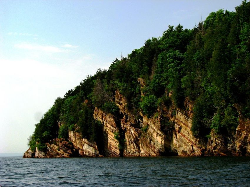
Dedicated to Fred Sargent and the members of the city’s original Natural
Resources Committee, who had the vision and drive to secure Red Rocks as a
                park for the residents of South Burlington.

  With thanks to the current members of the Red Rocks Committee, Tom
   Hubbard of South Burlington Recreation & Parks, the UVM advisory
   committee (Matt Kolan, Jeff Hughes & Walt Poleman), and the Field
                 Naturalist/Ecological Planning Team AC.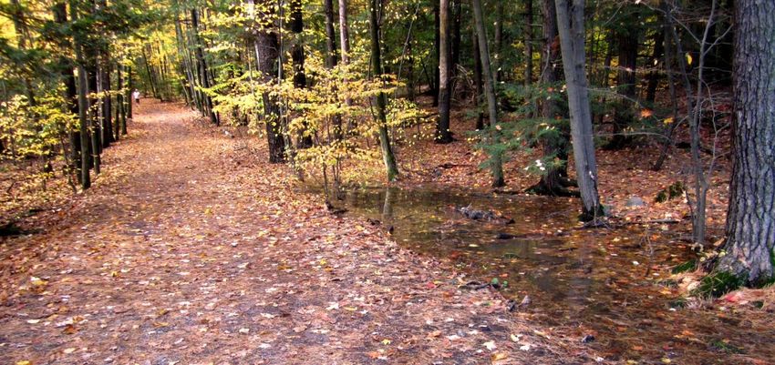
TABLE OF CONTENTS

SECTION 1: INTRODUCING RED ROCKS…………..………………………............        1
     Key management issues and objectives..…………….……………………..        1
     Purpose of this document……..…………………………………………………..             1
     Locator map……………………………………………………………………………….                    2

SECTION 2: PARK HISTORY……………………………………………………………….                   3
     The first owners………………………………………………………………………….                 3
     The Hatch Estate………………………………………………………………………..                 4
     Tracing the ongoing history through air photos………………………....   5
     Acquisition by South Burlington………………………………………………….           8

SECTION 3: NATURAL RESOURCES……………………………………………………                   10
     Geology………………………………………………………………………………………                      10
     Soils……………………………………………………………………………………………                      13
     Hydrology…………………………………………………………………………………..                    15
     Natural communities…….……………………………………………………………                 16
     Wildlife……………………………………………………………………………………….                    21

SECTION 4: MANAGEMENT CONCERNS…………………………………………….                   22
     Invasive plants……………………………………………………………………………                  23
     Trails…………………………………………………………………………………………..                    27
     Off-leash dog impacts…………………………………………………………………                32
     Forest health and management....………………………………………………            33
     Beach management……………………………………………………………………                    35
     CWD easement…………………………………………………………………………..                    36
     Parking area……………………………………………………………………………….                   38
     Funding………………………………………………………………………………………                      39
     Signage……………………………………………………………………………………….                     39
     Long-term conservation……………………………………………………………..               40

SECTION 5: RECREATION & EDUCATION…………………………………………… 41

SECTION 6: A DECISION-MAKER’S GUIDELINE………….……………………….             43
     Values and goal-setting………………………………………………………………               43
     Management limitations…………………………………………………………….                44
     Opportunities and key stakeholders……………………………………………           45
     Managing people and encouraging compliance..……………………….        46
     Ongoing process……………………………..………………..………………………..               47

SECTION 7: SUMMARY OF MANAGEMENT ACTIONS..……………………… 48
REFERENCES……………………………………………………………………………………. 51

FURTHER READING………………………………………………………………………….. 52

APPENDICES……………………………………………………………………………………..                   53
    (1) Red Rocks from the air………………………………………………………….          53
    (2) Current Park Trail Map………………………………………………………….          54
    (3) Timeline: History of Red Rocks……………….....………………………….   55
    (4) Plant Species List……………………………………………………………………           56
    (5) Animal Species List………………………………………………………………..          58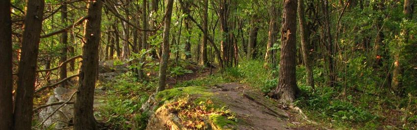
SECTION 1: INTRODUCING RED ROCKS

Red Rocks Park is a 100-acre community park and natural area in the city of South Burlington, Vermont.
It was purchased by the City in 1970, having formerly served as the Hatch Family Estate since the late
1800s. The roads and lookouts created by the Hatch family now provide walking trails through maple-
ash-hickory-oak forest and cedars perched atop red Monkton Quartzite cliffs. A city beach at the
southeastern edge of the park provides 200 yards of waterfront access (the only public lake access in the
city), and the Champlain Water District operates a pumping station with an adjacent 40-ft access
easement at the western limit of the beach.

Red Rocks is one of four large natural areas in the South Burlington Parks network (the others are
Wheeler Nature Park on Dorset Sreet, the Scott Property on Autumn Hill Road, and a recently acquired
property south of Nowland Farm Road). Red Rocks occupies the westernmost corner of South
Burlington (see Map 1). It is bordered by Lake Champlain to the south and west, Burlington to the
north, and the Queen City Park neighborhood to the east. The park is accessed from Central Avenue.

The park is currently operated by the South Burlington Recreation & Parks Department and maintained
by the Department of Public Works. Guidance and recommendations are provided by a seven-member
committee of appointed city residents, many of whom reside in the Queen City Park neighborhood.

Key management issues and objectives
Red Rocks faces challenges posed by heavy recreational use by the public. Aquatic and terrestrial
invasive species, off-leash dog impacts, unofficial trail use, forest health, and park signage are among
the concerns of the park’s management. The City seeks to provide a variety of recreational opportunities
in Red Rocks Park while maintaining ecological integrity, minimizing usage impacts, and addressing
threats and hazards.

Purpose of this document
Despite ongoing management questions and concerns, this is the first synthesized natural resource
assessment and management study for Red Rocks. Landscape architects made only an initial site
assessment and recommendations in 1971.

This document is intended to serve as both a guide to the human and natural history of Red Rocks and
as a guiding framework for making informed management decisions. It is written for park managers,
park users, and the present and future stewards of Red Rocks Park.

                                                   1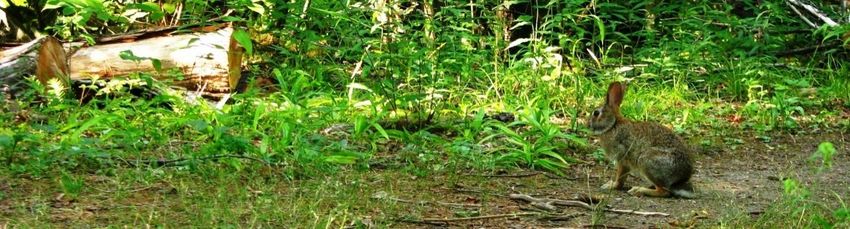
Map 1

        2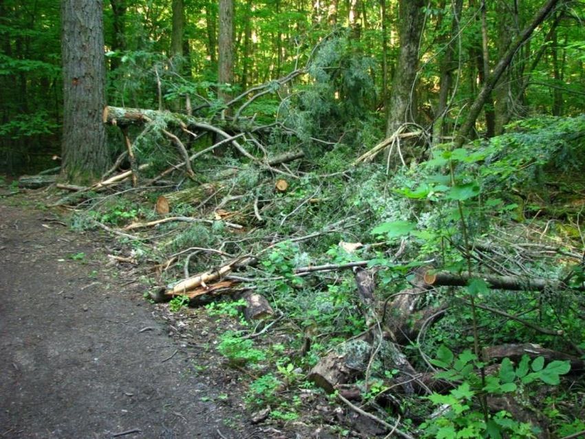
SECTION 2: PARK HISTORY
SUMMARY:
Edward Hatch purchased Red Rocks and maintained it as a private estate starting in 1866
Parts of the park were formely used as pasture and woodlot
The City of South Burlington purchased Red Rocks from the Hatch family in 1970
The first owners
When Red Rocks—the Hatch Estate—was purchased by the City of South Burlington, it came as a single
large tract of land. Through the 19th century, however, it was divided up in various parcels between
different landowners. In retracing the history of the land, it helps to divide the park into two large
sections:
(1) The eastern, “developed” section, from the Central Ave entrance to the north-south boundary
where the hiking trails begin (this section includes the parking lots, picnic area, beach, CWD
easement, and the northeastern loop walking trail).
(2) The western, “natural” section, stretching from the north-south parking road/hiking trail
boundary out to the far western tip of the park.
Eastern Section
Western Section
Map 2. Aerial view of Red Rocks showing the division between East and West sections of the park.
3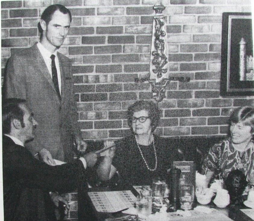
The western, now fully-wooded section of Red Rocks is first described in the Old Town of Burlington
records as lot no. 163. The lot was drawn by Thomas Udell at a meeting of town proprietors in June
1798, when the first settlers of Burlington were dividing up their shares of the land in the form of 103-
acre lots. The original lot was described based on its trees: “beginning at a pine standing on the lake
shore,” thence 3 chains (a chain is 66 feet) east to an ash, then 25 chains north to a beech, and from
there 46 chains west “to a cedar on the lake shore, thence southerly along the lake shore to the first
bound.”

Between 1798 and the early 1800s, the ownership and land use history of the property is unknown.
This was a time when much of Vermont was cleared for agriculture and timber, and Red Rocks was
probably no exception. An 1836 article in the Burlington Free Press describes a 60-acre parcel called
Red Rocks as “the Wood Lot of Ozias Buell.” Soon after this it was purchased by Joseph Harrington, who
conveyed it to his son, Hiram Harrington, in 1844.

Edward Hatch bought this western section (or at least part of it) from Harrington in 1866; one portion
was sold to his brother-in-law, Lucius Chittenden, that same year. Chittenden rose to fame as Register
of the Treasury during the Lincoln administration. He owned a piece of Red Rocks for 25 years, but by
1891 the entirety of the western 70-acre parcel was in Edward Hatch’s possession.

The Hatch Estate
This acquisition coincided with a flurry of activity on the property. In August 1891, the Free Press
announced that Hatch was finally making “improvements” to Red Rocks. Hatch enlisted Charles A.
Murray to oversee the construction of a quarter-mile drive “forming a continuation of the road to
Queen City Park.” Another road that “runs up a ledge” (most likely the eastern loop road towards the
highest spot in the park) was also started at this time. These carriage roads were largely constructed
from a bed of broken stone on the point, and they exist to this day as two and a half miles of hiking
trails.

The carriage roads led to a Lookout House at the far western point of Red Rocks. This gazebo-like
structure of white and red cedar, with a hemlock bark roof, was built in part by Hatch himself. He
considered building a residential cottage, but this never came about. Pre-existing buildings on the
property reportedly burned down and were never rebuilt.

                                                     4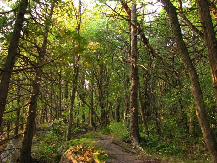
The Life of Edward Hatch (1832-1909)

    Edward Hatch was born in Norwich, Vermont on July 11, 1832 . He moved to Burlington when he was 5
 years old. After amassing a fortune at the helm of the Wilcox & Gibbs sewing machine company, he took on
 management of the Lord & Taylor Department Store in New York.
    Hatch spent his summers in Burlington, and he acquired Red Rocks between 1866 and 1907. He never
 lived on the property, instead taking up residence in the Hotel Vermont adjacent to City Hall Park. In the
 early 1890s he installed the Red Rocks carriage road system that persists to this day as a hiking trail network.
 He died in Burlington on September 9, 1909.

Hatch acquired the eastern section of Red Rocks just two years before his death. This parcel underwent
many changes of ownership in the mid- to late 1800s: from Levi Underwood to John Kelly in 1860, to C.
Cushman in 1864, to John Dickson in 1866, and then to Frank Converse in 1880. Frank and Abbie
Converse leased summer cottages along the beach before they sold the land to Hatch in 1907. This
different ownership history explains the difference in character between these two pieces of land—a
difference that can still be felt and that likely influenced the layout of today’s park. To the west lies the
land set aside as Hatch’s private woodland and carriage road system since 1866; to the east is a smaller
parcel with a patchy ownership history and more recent evidence of forest clearing and agricultural use.

Tracing the ongoing history through air photos
Local lore tells that Edward Hatch used Red Rocks as a summer resort from 1888 until his death in 1909.
What happened after that?

The park stayed in the Hatch family, but it was relatively untended from 1910 until it became a public
park in 1971. Untended did not mean unvisited—during this time, the park still served as a backyard for
the residents of Queen City Park (a thriving summer spiritualist camp until 1930, before becoming a
residential neighborhood). There is also evidence of both logging and farming during this time period.

Part of this evidence comes from historical air photos of the park, beginning in 1942:

                                                         5
         1942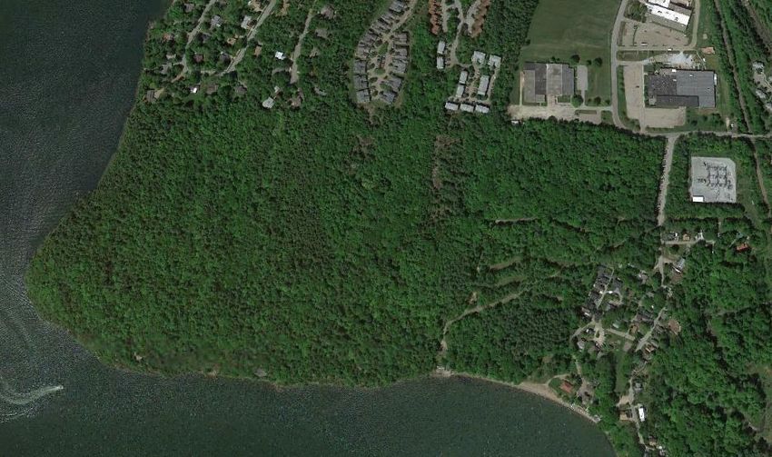
The eastern section of the park is almost totally cleared—perhaps as pasture—in 1942, though trees are
growing in to the north following agricultural abandonment. The opening in the forest to the west also
stands out. It is being maintained as a clearing, the exact use unknown. This land sits adjacent to the
western loop of the carriage road network, in an area of very fine-grained clay soils that retain a lot of
moisture. Today it is filled in with dense growth of young trees suited to the area’s wetter soils.
Also very noticeable in the 1942 image are several
large trees growing in the open near the park
entry. One of these is the “wolf pine” that many
visitors notice to the right of the road as they
head into Red Rocks today. This old white pine is
Wolf Pine now surrounded by other growth, but its wide-
spreading branches stand as evidence that the
Park Entry
tree grew in open, sunny conditions. The term
“wolf tree” could refer to the fact that the tree
once stood like a lone wolf on the landscape.
The convoluted branches of the wolf tree provide another clue to this pine’s past. The multiple trunks
and upturned branches are evidence of infestation by a tiny beetle called the white pine weevil. This
insect lays its eggs only in the tips of white pine trees growing in full sun. Normally the top shoot of the
tree would grow straight skyward, producing a single whorl of branches each year. When the weevil
eggs hatch, however, the larvae kill this top shoot, and the side branches end up curving upwards to
take over the role as the growing tip of the tree.
The next image from 1962 (see next page) shows several important changes:
New trees have already grown up all around the wolf pine; the park entry area and the western
clearing are closing in.
Rows of pine trees have been planted in what was the southernmost bit of the clearing in the
eastern side of the park. Today these trees tower over the grassy picnic area between the
parking lots and beach.
6 There is the first hint of residential development at the top left corner of the image, just across
the park boundary: South Cove Road is under construction.
The open fields at the top right of the 1942 image have been filled in with industrial
development, along the newly build Industrial Parkway.
1962
By the time of the next image, from 1974, the City had purchased the park and constructed parking lots
in the eastern side. The cottages once present along the beach are razed, the bathhouse is under
construction, and further housing development abuts the northwest edge of the park.
1974
7Rock outcrops
Deciduous trees
(maple, birch, aspen)
1988
This last image is from 1988 (see Appendix 1 for a 2012 color air photo of Red Rocks). Parts of the park
may look denuded of trees here, but that is mainly because many of the trees are missing their leaves;
this photo was taken in April, before leaf-out. This reveals the pattern of deciduous vs. evergreen trees
across the park. The northeastern corner where the wolf tree stands, for example, is now full of red
maples (Acer rubrum) and other hardwoods; these show a paler gray color compared to the evergreen
cedar and hemlock trees, for example, on the western shore of the park. Note the difference between
the pale gray of the deciduous growth compared to the even paler areas of rock outcrop and bare soil.
The construction trend continues in 1988, with more houses showing up just across the northern limit of
the park, which also happens to be the dividing line between Burlington and South Burlington. Could
the development have continued southward into present-day Red Rocks, had it not been for this
municipal boundary? Or for the Hatch Family keeping their estate intact?
Acquisition by South Burlington
The aerial photos above show a quick
transition from field to forest to the
parking pods of Red Rocks Park, but the
transfer of ownership was not a quick
process.
The industrial development first apparent
in the 1962 image is an important part of
the story; there was an interest in
Red Rocks was once a more manicured landscape, as depicted on
extending this development southwards, this 1908 postcard. This same carriage road now passes through full
into the northeastern corner of Red forest cover, the lawn replaced by fallen leaves.
8Rocks, in the mid-1960s. The Hatch family petitioned the City to rezone the land as light industry (which
would have raised the property value above its standing $450,000 estimate).
Some City officials and local conservationists, on the other hand, were keen to keep Red Rocks as a park.
In 1967, a technical team under the direction of UVM Professor Fred Sargent inventoried 16 South
Burlington sites with natural resource potential. Red Rocks made the top of the list: “it is felt that no
nature center in the county if not in the state can compare with Red Rocks.” The report recommended
the land for a nature center and picnic area and suggested that The Nature Conservancy could be
interested, should the City not choose to acquire it as a public park.
Fred Sargent led the effort to purchase Red Rocks from the Hatch Family, with support from South
Burlington residents who formed the city’s original Natural Resources Committee. In May 1970 the
property became available to the town at a cost of $450,000. Thanks to a $200,000 grant from the
federal Land and Water Conservation Fund and $152,000 from the state, the purchase was expected to
cost the town only $100,000 (or $1000/acre). In June 1970, residents voted 1094 to 98 in favor of a
bond to purchase the park at this price. They ended up paying even less because the Hatch family made
a gift of $50,000.
South Burlington officially took ownership of Red Rocks on October 5, 1970.
Robert Hatch (standing) turning over the deed to Red Rocks to (from left to right)
Selectman C. Harry Behney, town treasurer Helen Paquin, and Natural Resources
Committee chairperson Barbara Bull (Burlington Free Press 10/6/1970).
9SECTION 3: NATURAL RESOURCES
SUMMARY:
Red Rocks gets its name from the iron-rich Monkton quartzite rocks that underlie the park.
These rocks are formed of sand that formed the shoreline of a shallow sea 500 million years ago,
then was transformed by heat and pressure during the formation of the Green Mountains.
The soils of Red Rocks are mostly loams (a mix of particle sizes) with a shallow depth to
bedrock (under 2 ft in most locations, with many bedrock exposures).
The park has several wetland areas, where either very fine soils or the shallow bedrock cause
water to stay perched at or near the ground surface. These wetland areas are the site of vernal
pools that are important to breeding frogs and salamanders in the spring.
The Red Rocks forest houses a diversity of plant communities, including a state-significant
limestone bluff cedar-pine forest at the southwestern cliff edge.
The Red Rocks forest is a mix of northern hardwood tree species including maples and beech,
along with oaks and hickories that favor more warm and dry conditions.
The park hosts a diversity of wildlife, most notably 135 species of birds. Special habitat features
include mature forest, fallen woody debris, standing snags, mast-producing acorn and hickory
trees, and cliff ledges.
The Lake Champlain shoreline is a key feature of Red Rocks and an important corridor for
wildlife in South Burlington.
Geology
Bedrock geology
You need to reach much further back in time—long before Thomas Udell drew ownership rights to Red
Rocks in 1798—to uncover the geological story that gives Red Rocks Park its name.
The park’s namesake rocks are part of the Monkton Quartzite formation, which stretches in a band from
Colchester down to Addison County. Many buildings around Burlington are made from this rock, and
some of the most notable are on UVM’s redstone campus. Their material came from the redstone
quarry just east of Shelburne Road.
10These rocks formed from sediments laid
down 500 million years ago, in the early
Cambrian period, on the floor of a warm,
shallow tropical sea called the Iapetus
Ocean. Due to the movement of tectonic
plates, Vermont was situated near the
equator at the time, and South Burlington
was near the sandy beach and shallows at
the edge of the continent. Over many
millions of years, the sandy sediments
deposited in the water there solidified into
sandstone.
450 million years ago, more tectonic plate The pattern of rock, as seen from Lake Champlain, reveals
movements brought an island arc on a layers of sediments that fell near the shore of an ocean 500
million years ago.
(very slow) collision course with Vermont.
The resulting thrusting and folding of land
produced the Green Mountains, but more importantly here, it also made the Monkton quartzite: the
heat and pressure of the mountain-building event (an orogeny) turned the sandstone into quartzite.
This included reorienting of the quartz crystals and migration of some minerals into bands now seen as
distinct layers in the rock. The red bands (and red rocks) have a higher amount of iron oxide.
And then came the glaciers
Red Rocks continues to be shaped by the erosive forces of water and ice. The most dramatic of these
forces were the glaciers that covered the park in a mile-high sheet of ice as recently as 13,000 years ago.
This occurred when the climate was cooler and snow accumulated faster than it could melt.
When temperatures warmed and the glaciers receded, the area was covered by glacial Lake Vermont
and then the Champlain Sea; Red Rocks sat below as much as 500 ft of water. Sediments deposited in
these waters are the source of the delta sand and lake-bottom muds and clays that overlay the bedrock
through much of Red Rocks (see Map 3, next page). In other parts of the park, erosive forces have
exposed the underlying bedrock and glacial till (soils of mixed sediment sizes deposited by the retreating
glaciers).
11Map 3
12Map 4
13Soils
The soils of Red Rocks are the product of its bedrock, surficial
deposits, the forces of weathering, and modifications by plants
and animals—humans included. The park generally has nutrient-
rich soils derived from the limestone in its rocks. The high calcium
content and shallow depth of the soil have a strong influence on
the park’s vegetation.
The soils are generally characterized by a high windthrow
potential, particularly wherever there is a shallow depth to
bedrock or shallow depth to saturation. Soils are only slightly
susceptible to erosion as a whole, but the areas of 20% or more
slope are severely erodible. Devegetation greatly increases
erosion risk.
The main soils in Red Rocks are pictured on Map 4 (previous page)
and described below, in order of prevalence:
The canopy gap created by the fall of a
Farmington extremely rocky loam: Loamy soils (a mix of single oak tree. Red Rocks’ trees are highly
sand, silt and clay) of only 10 to 20” depth. Somewhat susceptible to windthrow due to the very
excessively drained, low available water capacity, slight shallow soils and high water table.
erosion hazard increases to severe where steeply sloped
(FaE) or where vegetation is cleared. The shallow and
steep soils pose many limitations to use besides forest.
High windthrow potential due to low depth to bedrock.
Covington clay: Poorly drained (hydric), highly fertile,
fine-textured soils. High water table keeps the soils wet
from fall through spring; water table is less than 12”
below surface during wettest part of the year.
Enosburg and Whately soils: Similar to Covington soil
but with coarser, loamy texture. Poorly drained (hydric),
water table within 12” of surface or ponded on surface.
Rockland: 50 to 90% bare bedrock or less than 10” of soil
over bedrock.
Georgia stony loam: Deep, stony, moderately well
drained soils. Perched water table 1.5 to 3 ft below
surface from fall to spring.
Adams and Windsor loamy sand: Deep, loose, The high water table of the Covington
clay soil is demonstrated by the ponded
excessively drained, sandy. water where heavy machinery was
Belgrade and Eldridge soils: Deep to bedrock, backed onto the soil. Such equipment
moderately well drained. Water table 1.5 to 3.5 ft below should be kept off these areas.
surface from late fall to spring.
14 Scantic silt loam: Deep, poorly drained with hydric areas, level to gently sloping. Low depth to
water table; remain wet for significant periods after rains. In Red Rocks, modified by
construction of parking area.
Hinesburg fine sandy loam: Well drained, deep soils. The areas with this soil type at Red Rocks
include high slopes (25 to 60%) and are thus highly susceptible to water erosion.
Munson and Raynham silt loam: Deep to bedrock, somewhat poorly drained. Perched water
table 0.5 to 2 ft below surface.
Hydrology
Red Rocks is situated on the shore of Lake
Champlain, and the land drains into the lake by
means of direct runoff and some channelling into
first-order streams. There are no permanent
surface waters within the park itself, but there
are vernal pools and wetland areas at the
locations on the map below. Boundaries should
be confirmed by a full wetland delineation, which
was beyond the scope of this report.
There is also a seep area alongside one section of
trail, where the rock impedes the downward movement of water and it discharges at the ground
surface. It crosses the path at this location and continues on the other side as a small stream which
drains into a manmade fountain.
Map 5. Water features of Red Rocks Park. Note the shoreline of Lake Champlain that marks the southern and
western boundaries of the park, wetlands indicated in pale blue, a seep shown in dark blue, and ephemeral streams.
15Map 6
16Natural Communities
A natural community is “an interacting assemblage of organisms, their physical environment, and the
natural processes that affect them.” These communities are usually identified by their dominant
vegetation, as groups of plants tend to grow in recognizable associations and patterns across the
landscape. These groupings can vary, but they generally reflect the similar environmental needs of the
plants of each community. There are 80 different natural community types recognized in Vermont.
In Vermont, natural communities are also specifically defined as those having minimal human alteration,
able to develop under natural processes. When an area is significantly altered or only just beginning to
regrow, the natural community identity of that location does not match what is visible on the ground,
but rather indicates what that area could be. This takes an understanding of the underlying soils and
how climate interacts with the the physical environment to create specific conditions for plant growth.
One must ask, what could or would have been here?
The present-day vegetation (or lack thereof) can be classified under a different scheme: land cover type
or forest cover type. The natural communities map for Red Rocks (Map 6, previous page) actually shows
a combination of natural communities and present-day land cover, especially where substantial
alterations have taken the land far from its “natural state” (the developed area around the parking lots
is an example).
Natural community types and variants represented in Red Rocks:
Mesic maple-ash-hickory-oak forest: This is the
most common plant community represented in
Red Rocks. The forest canopy is a mixture of
northern hardwood species including maples and
beech alongside oaks and hickories that are more
typical of the central hardwood forests south of
Vermont. It is found here in Red Rocks because of
the warm climate and somewhat dry conditions on
this rocky piece of the Champlain Valley.
Transition hardwood limestone forest: This is a
variant of the mesic maple-ash-hickory-oak forest,
and it occurs nearer to the cliff edges of Red Rocks
where bedrock is closer to the soil surface. The
nutrient-laden rocks provide for a rich community
of spring wildflowers here: large-flowered trillium,
Dutchman’s breeches, blunt-lobed hepatica, and
white baneberry are examples.
17Limestone bluff cedar-pine forest: This community
occupies a band along the top of the rocky bluffs at
the south and west edges of Red Rocks, facing the
lake. It is dominated by cedar trees that cling to
the rocks. These trees may be centuries old, slowly
growing on little to no soil. White pine, shagbark
hickory, and hophornbeam are other common tree
species here. This part of Red Rocks is also host to
several state-listed rare plants (see Appendix 2).
This is the typical plant community found on
calcium-rich rocks on the headlands of Lake
Champlain, but many of these areas in Vermont
have been lost to clearing and development. There are now only 21 quality examples of this natural
community remaining in Vermont, totalling only 360 acres (Sorenson & Popp 2006). This low overall
extent gives the community an S2 ranking, making the limestone bluffs of Red Rocks a state-significant
natural community and a priority area for conservation. Unfortunately, the limestone bluff community
in Red Rocks is one of the areas in the park that receives the most concentrated use and foot traffic, in
large part from cliff jumpers looking to access the rocky bluffs. The result is a large concentration of ad
hoc trails, vegetation trampling, littering, and colonization by invasive species in areas of disturbed soil.
Temperate calcareous cliff: This is not shown on the
map, but this community occurs on the cliffs
adjacent to the limestone bluffs and transition
hardwood forest, wherever slopes exceed 60
degrees. These areas are sparsely vegetated, but
small trees may grow on ledges or from cracks in
the rock and the cliffs may support a rich diversity
of herbs. Transition hardwood talus woodland
may be present at the base of the cliffs, where
pieces of rock have moved or fallen downslope from
the cliffs above.
Dry oak-hickory-hophornbeam forest: Open, park-
like forest with sparse shrubs. The ground layer is
dominated by sedges. In Red Rocks, this natural
community occurs upslope of the cliffside limestone
bluffs and transition hardwood forest. It is limited
in extent.
18Temperate calcareous outcrop: Sparsely vegetated openings dominated by grasses, sedges, and moss. Occur towards the northern edge of Red Rocks, where bedrock is exposed. The rocky openings are ringed by pine and eastern redcedar trees. Hemlock forest: Hemlocks are long-lived, shade- tolerant evergreen trees. This species is scattered throughout some of the other Red Rocks forest types, but it dominates the vegetation in two areas of the park that feature shallow soils and a steep cliff. In one of these areas, the hemlock forest grades into white pine-northern hardwood forest that is dominated by maple and pine trees. The hemlocks are very efficient at capturing light, making for very dark forest with few flowering plants at ground level. Red maple-black ash swamp: This plant community occupies the northeastern corner of Red Rocks, where seasonal inundation favors red maple trees, which can tolerate saturated soil conditions. This land was cleared for agriculture through the 1940’s and is now occupied by a young forest that includes early successional aspen and birch trees and white pine that regrew in the old fields. It is also highly impacted by non-native buckthorn and honeysuckle. The understory is rich in moisture-loving fern species including sensitive fern, cinnamon fern, and royal fern. 19
Vernal pools: The red maple swamp area is also
     the site of one or more vernal pools. Vernal pools
     form in forest depressions that fill with water
     during spring and fall, given sufficient rainfall and
     snowmelt. The temporary pools provide
     important breeding habitat for frogs and
     salamanders. The area mapped as wet clayplain
     forest on the natural communities map is another
     wetland area that likely holds vernal pools, though
     these require further mapping during a wet
     season. Prior to clearing and agricultural use, this
     area was likely the site of a clayplain forest of pine
     and oak trees on fine clay soils.

 Seeps: There is one known seep area in Red Rocks,
 where bedrock impedes downward water
 movement and instead causes horizontal flow at
 the ground surface. Park visitors may recognize
 this area from the frequently flooded adjacent trail.
 The seep is dominated by spotted touch-me-not
 plants and clear of trees and shrubs in the
 immediate area. This seep forms the headwaters
 of a stream that drains to the lakeshore.

 Lake sand beach and lake cobble beach: This is the
 shoreline community along the southern edge of
 the park. The public beach area features a sand
 beach that has been maintained by a supply of
 sediment from the mouth of nearby Potash Brook
 (south of Red Rocks on Shelburne Bay) and also
 human additions of sand. The sand beach grades
 into a cobble beach of larger rock fragments to the
 west, and this beach continues intermittently at
 the base fo the cliffs to the far western point of the
 park.

20
Wildlife
The bird, mammal, reptile and amphibian species of
Red Rocks are listed in Appendix 5. These lists
include confirmed sightings as well as suspected
presence in the case of some mammals, reptiles,
and amphibians. Suspected presence is based on
there being suitable habitat but no confirmed
sightings to date.
Red Rocks includes the following notable wildlife
habitat features:
Rocky and sandy shoreline A Common Raven nesting on the rocky cliffs at Red
Intact mature forest Rocks.
Shrubby undergrowth
Forest clearings
Hemlock stands
Rock crevices and ledges
Vernal pools
Woody debris (fallen trees and branches) on
the forest floor
Standing snags with nesting cavities and
loose bark
Large mast-producing trees (oaks and
hickories)
Cliffs
Deer scat found within the eastern loop trail of Red
Rocks. Deer are scarce in Red Rocks compared to
The intact forest of Red Rocks is particularly suited other local open spaces, likely due to the prolific
to a variety of birds; it serves as both a nesting presence of both people and dogs.
location for summer residents and an important
staging area for migrating species. The 135 species in the current Red Rocks bird list include 11 of the
Vermont “Birder’s Dozen,” a set of species identified by Audubon Vermont as being high priorities for
protection in northeastern US forests.
While the physical and biological habitat is suitable for a variety of species in Red Rocks, the fauna—
particularly ground-nesting species—are strongly impacted by the presence of both people and dogs in
the park. While off-leash dogs traveling off-trail may compound the problem, the mere presence of pets
and people is enough to deter many species of mammals and birds.
See the separate document, “Wildlife of Red Rocks Park,” for more information about the inhabitants of
the park and their habitat requirements.
21SECTION 4: MANAGEMENT CONCERNS
Management in the face of uncertainty
Red Rocks Park faces a host of management questions
and concerns that do not have simple answers or
solutions. Our knowledge of the natural world and
how a natural area like Red Rocks functions will
always be incomplete. The best that we can do as
park managers and stewards is to implement
solutions based on our current understanding of best
practices, shaped by our goals for the park. It is
important to monitor the results of these
management actions, evaluate their success, and
continually adjust as our scientific understanding and
The Adaptive Management approach to problem-
our own experience at Red rocks indicates. This is an
solving and land management.
“adaptive management” approach.
Some principles to keep in mind in managing an area like Red Rocks:
Think of management actions in terms of “small experiments” to test or evaluate possible
management strategies.
Monitor these experiments to assess how they meet goals.
Consider new information as it emerges and adjust strategies (and goals) accordingly.
This section outlines some of the key management issues and questions at Red Rocks, some possible
solutions, and recommended steps.
Section 6 provides additional management guidelines for decision-makers, and Section 7 summarizes
recommendations into a list of management actions.
22INVASIVE PLANTS
Overview
Much of Red Rocks is occupied by non-
native invasive plant species (see Table 1,
below), and their management should be a
priority for park directors. Many
conservation professionals sense a strong
threat from invasive species and
recommend complete removal as a best
practice; however, a growing body of
research is pointing to possible negative
impacts from such heavy-handed invasive
species control. Sound invasive species
management should weigh the potential
risks and benefits of such management
actions on a case-by-case (or species-by- The wolf tree area. Notice the yellow-green understory composed
entirely of invasive buckthorn, which holds onto its leaves after all
species) basis. First priority should be on
the native trees have dropped theirs.
preventing establishment of new invasive
plants and containing their spread.
Impacts of Invasives
Non-native species can quickly replace native vegetation in disturbed areas, leading to
dominance of a few species throughout the ecosystem.
This can lead to loss of a food source for local insects; many moths and butterflies, for example,
rely exclusively on a particular species of native plant on which they lay their eggs and their
caterpillars feed. Studies show that non-native species support a lower diversity of insects. This
impact can be felt up the food chain, as these insects are a main food source for many birds.
Other studies show more direct impacts to birds because some fruits of invasive plants have a
lower nutritional value compared to native ones, but more research is required to confirm this.
Some invasive plants cause changes in soil chemistry that can inhibit the growth of other plant
species, with long-lasting effects. Garlic mustard is an example of this allelopathic behavior.
Present condition
Table 1. Invasive species inventory
Species Location and Abundance
Common and Glossy Buckthorn Dominant understory shrub in parts of the limestone
Rhamnus cathartica and Frangula alnus bluff cedar-pine community (particularly the cliff
jumping area), the parking areas, the northeast corner
of the park, and recently disturbed areas (e.g. windthrow
gaps). Scattered patches and trees throughout the rest
of the forest; absent only from heavily shaded areas, e.g.
dense hemlock and cedar growth.
23Shrub Honeysuckles Small to large patches of variable density found
Lonicera sp. throughout park, often alongside buckthorns (though
less common). Particularly concentrated toward the
east side of the park and along the southern lakeside
trail to the main overlook points.
Japanese Barberry Individual plants and small patches found at low density
Berberis thunbergii throughout park.
Burning Bush or Winged Euonymus – Isolated plants along the entrance road and lakeside
PRIORITY SPECIES trail, with several plants concentrated along the far
Eunoymus alatus western (“turnabout”) overlook trail.
Norway Maple Scattered trees near the park entrance, along both sides
Acer platanoides of entry road, and near the high point of the E loop trail.
Other scattered undetected infestations likely.
Periwinkle Isolated dense patches at the top end of the western
Vinca minor loop trail, encroaching in from nearby houses. Growing
in thick mats.
Asiatic or Oriental Bittersweet – PRIORITY Isolated patches and individual plants throughout park,
SPECIES at low density.
Celastrus orbiculatus
Garlic Mustard – PRIORITY SPECIES Growing in isolated patches, at the southeast corner of
Alliaria petiolata the parking loop road (near backyards of houses) and
near the park entrance, to the north of the road just
beyond the entry kiosk.
Purple Loosestrife – PRIORITY SPECIES Several isolated plants and patches along the shoreline,
Lythrum salicaria including the beach area by CWD and shallows to the
west, plus around the point and north of the western
loop trails.
Multiflora Rose – PRIORITY SPECIES Isolated occurrences near western loop trail and around
Rosa multiflora parking area.
Goutweed – PRIORITY SPECIES Isolated occurrence along northern boundary of park.
Aegopodium podagraria
Japanese Knotweed – PRIORITY SPECIES One isolated occurrence just beyond the park boundary,
Fallopia japonica near a condo development and adjacent network of side
trails leading into the park.
An identification guide and removal guidelines for Vermont’s invasive plants are available from
The Nature Conservancy at www.vtinvasives.org
Invasive management history
The Nature Conservancy and student volunteers from UVM partnered for an invasive plant mapping day
on October 15, 2012. This ias followed by a removal day with students from Champlain College’s
‘Foundations of Ecology’ class on October 31, 2012. These students targeted buckthornproceeding with invasives management, as misguided removal efforts can easily lead to further spread.
Complete removal often requires an intensive effort, including either repeated physical pulling or
chemical treatment. The chemical herbicides are typically applied directly to cut stumps and reportedly
break down quickly in the environment, but there are still risks of toxicity inherent in the use of any
herbicide. Special care should be taken given Red Rocks’ waterfront location and proximity to drinking
water sources.
It is also important to keep in mind that
invasive plants are a symptom of habitat
disturbance rather than the root cause in
and of themselves. These plants dominate
in openings and areas of bare soil, such as
along trails. They were originally
introduced and are continually transported
by people. The most dense growth of
invasive buckthorn in Red Rocks, for
example, occurs atop the cliffs where
people have created side trails to access
lookouts and cliff-jumping locations.
Removal of these plants could simply open
up the bare soil for regrowth of buckthorn
Most of the green in this picture belongs to the leaves of non-
from the seedbank that persists in the soil. native buckthorn trees which have invaded the cedar forest at
Full removal would require a continued the top of the Red Rocks cliffs. What would be the consequence
effort that could be both expensive and of removing these plants from this sensitive environment?
time-intensive.
Even though invasive species have a lower food value for native wildlife, they do still provide some cover
and habitat value. Removing all non-native plants would mean removing much of the shrubby growth in
Red Rocks, taking away cover from small and medium-sized birds and mammals. Removal efforts should
consider what will replace the invasive plants. Such efforts may best be coupled with restoration
plantings of native species.
Desired Condition
Given all the uncertainty and risks outlined above, is it wise to pursue any invasive removal in Red
Rocks? The City does have the opportunity to limit the spread of certain invasive species that are only
present in a small extent at one or two locations right now. This could be done at low risk and low cost
and would prevent further loss of native biodiversity.
Management for more widespread and dominant invasives such as buckthorn and honeysuckle would
require a much more time- and cost-intensive operation. The pros and cons of this approach should be
considered further in consultation with park management and city residents. How important is it to
25maintain native forest in Red Rocks, in the face of continued introductions of non-native species and
disturbance from human use? This is not an easily answered question.
Park management should, at a minimum, aim to maintain the present level of ecosystem function by:
(1) curbing the spread of invasive plant species by containing current populations and
(2) preventing further infestations through an early detection-rapid response system
Management Options
Early detection of invasive species
Fall and spring survey by park staff or volunteers.
Control of small, isolated populations
Early detection and rapid response to isolated populations. Initial targets include garlic
mustard, purple loosestrife, burning bush, Japanese knotweed, and goutweed.
Protection of high-quality areas with few invasive species
No area of Red Rocks is completely untouched, but the interior of the loop trails (the
areas furthest from side trails and human disturbance) could be prioritized for
maintaining intact, native forest.
Restoration of rare natural habitat types heavily impacted by invasive species
The limestone bluff cedar-pine forest is a state-significant rare natural community that
could benefit from restoration, but it will require an intensive effort with uncertain
results.
Management of high-use areas that may be a source of further infestations.
Monitor the eastern, developed section and the park boundary for signs of new invasive
species.
Park managers should monitor the effectiveness of any treatment methods pursued and adjust as
appropriate.
Resources
Partnership and support from The Nature Conservancy, UVM, Champlain College
Department of Public Works certified herbicide applicators and chainsaw operators
o Note: no herbicide spraying within 150 feet of Queen City Park water source
Seasonal park gate staff could assist in management efforts and public outreach
Grants may be available to support removal efforts
Public outreach and education
Public outreach and education will be central to any invasive species management effort.
Articles, signs, letters to the editor and Front Porch Forum could notify the public of any invasive
removal strategies and the reasoning behind such efforts- especially around sensitive issues
such as herbicide use.
A park pamphlet or signs could educate visitors about invasive plant issues and Identification.
26TRAILS
Overview
The Red Rocks trail network includes 3.3 miles of official trails and access roads, based on the original
carriage trail network constructed in 1891. These trails have been generally well maintained over the
years. Areas in need of maintenance are outlined in Map 7, below. Some volunteers have been
assisting in maintaining drainage ditches along the areas prone to flooding. Park staff should monitor
trail condition and provide support where needed.
Map 7. Trail locations with issues of erosion or periodic flooding, requiring management attention.
Unofficial trails account for a further 4.3 miles of pathways through Red Rocks. There is a particularly
dense network along the cliffs, especially west of the main southern lookout point and concentrated
along the cliff-jumping area (cliff-jumping is not condoned by the City, and the jumping cliffs are
considered an attractive nuisance). The creation and use of these ad hoc trails threatens the ecological
integrity of Red Rocks.
Map 8 shows the distance from any point in the park to the nearest trail (official or unofficial). It
illustrates that the farthest point in Red Rocks from any trail is just over 90 meters (approximately 300
feet), which has a strong implication for park wildlife. Every species has a “flushing distance” at which it
will flee when approached by people (or other threats), causing stress and a disruption from regular
activities of feeding, breeding, etc. For species like white-tailed deer, this flushing distance may exceed
300 feet, meaning there is no place in Red Rocks where that animal can feel safe from the presence of
people.
27The Issue
More trails mean more wildlife disturbance, human-assisted spread of invasive species,
vegetation trampling, and erosion.
For soils, a little use causes most of the impact (trail compaction occurs rapidly with light use).
Soil erosion is the most permanent and therefore most serious effect of trail expansion. Soil
compaction recovery may take 6-18 years; erosion recovery may take centuries due to the long
time it takes for new soil to form.
Trail erosion risk exists wherever slopes exceed 9 degrees; especially severe above 18 degrees.
For vegetation, it may take only 20 tramples to lose 50% of the vegetation on a given piece of
land.
Wildlife disturbance is related to the frequency of people passing by, and side trails may bring
people closer to critical wildlife areas more often. Negative impacts on some breeding birds
occur with forest trails as narrow as 1 to 3 meters; some birds stop nesting near trails and others
avoid the trail areas altogether (Jordan 2000).
Trail Best Management Practices (BMPs)
Conduct a seasonal walk-through to identify trail hazards and assess extent of off-trail use
Respond to downed trees as needed
Post signs to notify park users of trail closures for rehabilitation purposes
Consider establishing select informal trails as “official” in order to concentrate impact and
avoid excessive proliferation.
Emphasize the contrast contrast between trail and offtrail zones to avoid expansion of the
impact zone (e.g. line the sides of the trail with stones, keep the trail very smooth-surfaced
relative to the adjacent land).
Install barriers to control movement of people—thorny shrubs can be particularly effective.
Shrubs and trees are the best options for near houses.
Plant grass-like plants (grasses and sedges) to revegetate areas where continued trampling
is likely, as they are most resistant.
Examples of Red Rocks ad hoc trails
28Map 8
29Trail Closures and Openings
Table 2. Recommendations for opening and closing recreational trails
Which trails are recommended for opening? Which trails are recommended for closure?
Heavily trafficked trails that connect to the Trails going down steep slopes (erosion
local community and serve as an alternate issues)
park entry Dense sidetrail networks (close the
Heavily trafficked trails that lead to network with the possibility of centralizing
particular destinations (e.g., the wolf tree, traffic on one path)
the 76er lookout) Trails going through sensitive habitat
Trails that are already as wide, well-used Trails that are minimally used or impacted,
and maintained as the “official” ones but with good potential for revegetation and
have not been marked on the map as such masking of the walked path
Key shortcut trails between loops
Why? Why?
Concentrate use on these official trails to Steep slopes are subject to erosion (soil
draw use away from other ad hoc trails loss, siltation and pollution of water)
The heavily used spur trails are already Seldom-used trails stand a good chance of
impacted successful closure and restoration
Trail closure not a viable option due to
heavy use
How to open trails How to close trails/discourage use
Mark edges of trail Place logs and other debris across trail
Reroute or reorient the trail as needed to Use tools to scuff up the trail, break up
give it a low grade and decrease erosion earth to make it look unused
risk Place notices of “area closed for
Add trail signage restoration” (shown to deter 90% of
Indicate the trail on official park maps visitors)
Notes on the selected trails:
The cliff-jumping area would be a prime area for closure given the intense disturbance and the
presence of the sensitive limestone bluff cedar-pine forest there, but this would be very difficult
to enforce given the high traffic.
o Managers could consider closing off certain sections with signage indicating a
restoration area (“Please help the plants- restoration area-stay on designated trails”).
o They might also consider designating an official trail along the length of the cliff, from
the main south-facing lookout towards the turnabout loop at the far western lookout
point. The goal here would be to concentrate use along the official trail and prevent
further spreading of this trail network. This could pose liability issues, however.
There is also a well-travelled network leading from the eastern loop, up towards the Austin Dr
neighborhood; this area is also densely populated with invasive species, e.g. the only Japanese
knotweed occurrence in the area is right here on the park doorstep. This trail is recommended
for official opening so as to concentrate use and acknowledge this alternative entryway into the
park.
30You can also read