Standards for Soil Erosion and
Sediment Control in New Jersey
2018 Summary and Overview of
         Revisions
←
→
Page content transcription
If your browser does not render page correctly, please read the page content below

Standards for Soil Erosion and
Sediment Control in New Jersey
2018 Summary and Overview of
Revisions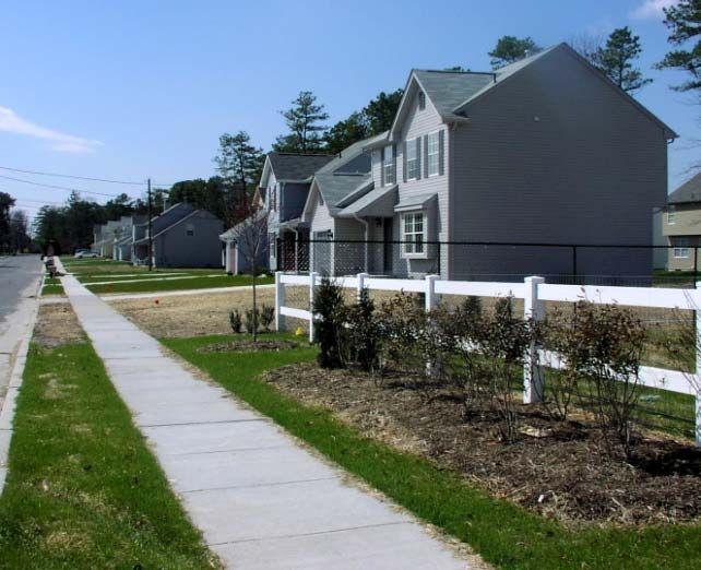
Staff and Presenters

David Reilly, District Manager             Michael Kent, Assistant Manager

Glenn Ward, Site Inspector III            Marie Rogowski, Administrative
                                                            Assistant II
Celia Rodrigues, Agriculture Conservation Specialist

  Frank Minch , NJ Department of Agriculture
                Executive Secretary, State Soil Conservation Committee

  John Showler, P.E., NJ Department of Agriculture
                      State Erosion Control Engineer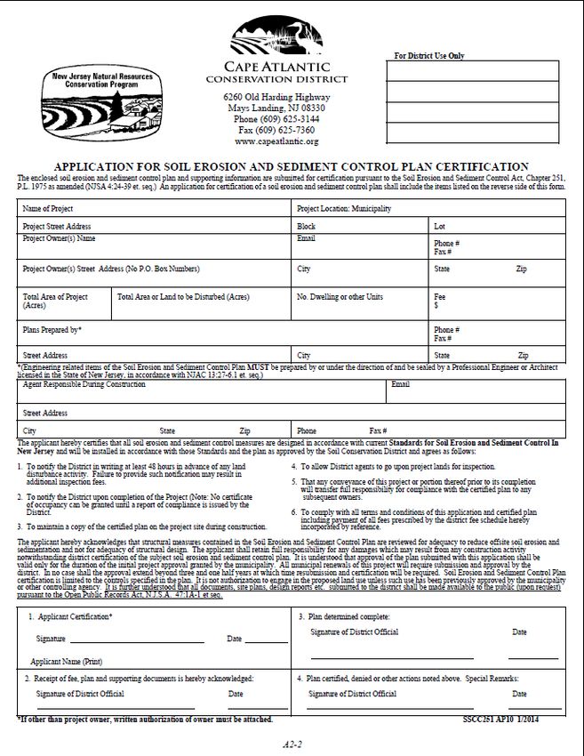
Frank Minch
        New Jersey Department of Agriculture
Executive Secretary, State Soil Conservation Committee
State of New Jersey Soil Erosion and Sediment Control Act, P.L.
1975, Chapter 251 , N.J.S.A. 4:24‐39 et seq.
On January 31, 1976, the State of New
Jersey approved the “Soil Erosion and
Sediment Control Act, P.L. Chapter 251”.
This is a Statewide program to reduce the
danger from stormwater runoff, to retard
nonpoint source pollution, and to conserve
and protect the environmental resources
of the State.
Developers disturbing more than 5,000
square feet of land are required to obtain a
soil erosion and sediment control plan
certification and to implement measures
at construction sites to address erosion and
sedimentation problems.State Soil
Conservation Committee
Responsibilities
Promulgate Program Rules
Establish Policy/Procedures
Adopt Technical Standards
Provide Technical Training
Approve District Fee Schedules
Conduct Appeals and Render Decisions
Establish Agreements with any Public AgencyWhat is a Soil Conservation District Districts are special purpose subdivisions of the New Jersey Department of Agriculture Semi‐autonomous political bodies which are locally governed Serve a regulatory role by implementing the State’s erosion control laws on construction and development sites Districts conduct inspections of construction sites and have a variety of regulatory and enforcement powers to ensure that construction sites are maintained in compliance with the certified erosion control plan
New Jersey Soil Restoration Act
P.L. 2010, Chapter 113
2010 – NJ Legislature amended Chapter 251 to require the
addition of ‘soil restoration’ practices to the Standards for
Soil Erosion and Sediment Control in New Jersey.
"Plan" means a scheme which indicates land treatment
measures, including a schedule of the timing for their
installation, to minimize soil erosion and sedimentation,
and which specifies the soil restoration
measures, consistent with the standards established
by the committee pursuant to section 2 of P.L.2010, c.113
(C.4:24‐42.1).Michael Kent
Assistant Manager
Cape Atlantic Conservation DistrictApplication Process 1) Completed Application Form 2) Ownership Disclosure Affidavit (if Applicable) 3) One set of Sealed Plans 4) Hydrologic and Hydrology Report (if Applicable) 5) Completed Database Summary Form (if Applicable) 6) Appropriate Fee 7) 5G3 Permit for all Projects 1 Acre and Over 8) Digital Copy of Plan
Updated Forms Application
Updated Forms (cont.) Ownership Disclosure Affidavit
Updated Forms (cont) Minimum Requirements Form
John Showler, P.E.
NJ Department of Agriculture
State Erosion Control EngineerThe Standards for Soil Erosion and Sediment
Control in New Jersey
The Standards are a blend
of agronomic science,
(vegetative standards), and
state of the art engineering,
(engineering standards),
embodied in 32 individual
design chapters and
detailed appendicesRevised Soil Erosion Standards
The Standards for Soil Erosion and
Sediment Control in New Jersey
7th Edition, January 2014,
Revised July 2017Topsoiling and Land Grading
Standards
Revisions to the Standard for
Topsoiling (Chapter 8) and
the Standard for Land
Grading (Chapter 19)
went into effect on
December 7th, 2017 with the
re‐adoption of the Soil
Erosion and Sediment
Control Act And RulesSoil Restoration –
Topsoiling Chapter 8
5” depth required (was 5” recommended)
Must be ‘firmed in place’
Imported topsoil must have 2.75% organic matter
content (no change)
17Standard for Topsoiling Chapter 8
Soil Restoration –
Land Grading Chapter 19
More extensive changes
Areas of exclusion added
Added table of maximum (not optimum) bulk density
Added options to test soil for density
Added requirement to depict areas on plans
Added requirement to de‐compact in lieu of testing or
as a result of test failure.
19Revised Standard for Land Grading Section 19 (cont)
Changes to Land Grading…
List of “exclusion areas” –
– 20’ from basements, 12’ from crawl spaces
– Under pavement
– Regulated by other design requirements
• Septic systems
• Golf courses, soccer fields, airports etc.
• Site Remediation
• Brownfields
– Not required if restoration area is
500 sq feet or less.
21Example of a “Soil Restoration Plan” for a Subdivision
Outer limits of
potential
restoration area
defined by
normal limits
of disturbance.
Inner limits defined by buffers
22
around structuresL.O.D.
Around
buildings 20’
basements, 12’
crawl spaces.
23Test locations @ 2
tests per acre , evenly
distributed in ‘open
space’
24Typical Detail Provided on plan 2 tests per acre. Note. For areas that are less than (illustrative purposes; please do not copy. 1 acre, the test location density This is someone else’s work used is a minimum of 2 tests. with permission) 25
Image Courtesy of HDG2, Engineering, Land Surveying, Environmental Consulting
Typical Single Family Site Plan‐ Large Lot
1.65
Acres of
open
spaceCommercial Site Plan
www.capeatlantic.org www.nj.gov/agriculture/divisions/anr/nrc/njerosion.html
Michael Kent
        Assistant Manager
Cape Atlantic Conservation DistrictTypical Notes and General Details
to be Included on the Plan
Subgrade Soils
Areas Subject to Compaction
Graphically Denoted
Compaction Testing Locations
Compaction Testing Methods
Mitigation Before Topsoil Placement
Restoration of Compacted Soils
Sequence of Construction
31Testing Options
Options to perform soil compaction test
• Simple wire probe test using 15.5 ga steel wire
(survey flag)
• Penetrometer
• Tube Bulk Density test
• Nuclear Densitometer
• Can start with a simple test, and if unsatisfactory, can
move up to more complex and reliable tests.
Tests performed by the applicant or their agent.
A minimum of two tests per acre are required.
321. Wire probe test
Firm wire (15‐1/2 gauge steel wire ‐ e.g. survey
marker flag, etc.)
18 to 21 inches in length
6” inches from one end visibly marked on the wire.
Holding the wire flag near the flag end
Push it vertically into the soil to the lesser of a
6 inch depth or the depth at which it bends due to
resistance in the soil.
Record the depth at which it bends/deforms due to
resistance in the soil
331. Wire probe test (Cont)
• Pass = Penetrate without bending or deforming at
least 6” into the ground by hand
• If penetration fails and an obstruction is suspected
(rocks, root, debris, etc.) the test can be repeated in
the same general area.
• Fail = Wire is difficult to insert (wire bends or
deforms prior to reaching 6 inches in depth) the soil
may be excessively compacted and compaction
mitigation or further testing via handheld soil
penetrometer, tube bulk density, or nuclear density
method may be performed, the choice of which is at
the contractor/owner’s discretion.
341. Wire probe test (cont)
352. Penetrometer test
Penetrometers are devices used to
measure the resistance of a soil to
penetration
Pass = A result of less than or equal
to 300 psi at 6 inches
Fail = A result greater than 300 psi
the soil may be excessively
compacted and compaction
mitigation or further testing via
tube bulk density or nuclear
density method may be performed,
the choice of which is at the
contractor/owner’s discretion. Photo : Steve Yergeau, Rutgers
Cooperative Extension of Ocean &
36
Atlantic Counties
362. Penetrometer test (cont)
37
373. Tube Bulk Density Test
This test shall be certified by a New Jersey
Licensed Professional Engineer
Utilizing only undisturbed samples
(reconstitution of the sample not permitted)
Procedure for Soil Bulk Density Tests as
described in the USDA NRCS Soil Quality Test
Kit Guide, Section I, Chapter 4, pp. 9 – 13
Pass = A result at or below maximum dry bulk
density in preceding table
Fail = A result greater than the maximum dry
bulk density permitted in preceding table and
compaction mitigation is required
384. Nuclear density test
This test shall be certified by a New Jersey Licensed
Professional Engineer and conducted by a nuclear
gauge certified inspector pursuant to ASTM D6938
Pass = A result at or below maximum dry bulk
density in preceding table
Fail = A result greater than the maximum dry bulk
density permitted in preceding table and
compaction mitigation is required
Portable device which uses radiation to measure
soil bulk density and soil moisture.
39Soil Test Method Options
Procedures for
Soil
Compaction
Mitigation
&
Installation
RequirementsJohn Showler, P.E.
NJ Department of Agriculture
State Erosion Control EngineerOffsite Stability (Chapter 21‐1)
Reorganized text to ‘flow’ more logically
Added criteria for infiltration:
Ok to use for reductions (redundancy)
Not ok for point discharge stability (different criteria)
Not intended to assess discharging to Ag fields; don’t use it for this condition
Added option to use multiple outlets (for point discharge stability peak flow)
Removed velocity from Table 21‐1 since the primary criteria are slope, soils and veg
Point of Discharge Stability Analysis
When infiltration practices are proposed, an alternate analysis (failure analysis) must be provided which ignores
infiltration (no dead storage volume available, no static or dynamic infiltration loss rates in the routing calculations,
etc) and demonstrates that no erosion will occur at the point of discharge if infiltration fails to function. Flow rates
based solely upon basin inlet and outlet hydraulics must be used in comparison to table 21-1 (below) to document a
stable outlet.
Downstream (off-site) Stability Analysis.
Infiltration may be used to meet peak flow reduction requirements (outlined below) for the purposes of documenting
stability of the downstream receiving channel, provided that the complete loss of infiltration function does not result
in an increase in peak flow values above the predevelopment levels..Offsite Stability Flow Chart
Offsite Stability (Table 21‐1)
Table 21‐1 Non‐Erosive Conditions for Point Discharges
Maximum Stable Slope for Point Discharges
for Various Soils
Soil Type Perennial, Natural Vegetation
Velocity removed since
Maximum Slope (%)
Slope, soil and vegetation
Sands 1.8 are the primary criteria.
Sandy loam 2.0
Silt loam, loam 2.5
Sandy clay loam 3.5
Clay loam 5.0
Graded loam to gravel 8.0
Stability Criteria (in conjunction with table 21‐1)
i. The maximum discharge rate shall be 10 cfs or less for the twenty‐five (25) year storm.
ii. Multiple outlets may be utilized to reduce individual outlet flow rates to levels below the
thresholds noted above. Outlets should be spaced no closer than 50 ft horizontally to avoid
re‐mixing of flows
iii. Flow over the outlet area shall be less than 0.5 cfs/ft. Designers shall not design excessive widths
which will cause flows to concentrate.
iv. Conduit outlet protection shall be provided in accordance with that Standard and may include: flat
aprons, preformed scour holes, impact basins, stilling wells, plunge pools, etc. Level spreaders are
not an acceptable designMichael Kent
Assistant Manager
Cape Atlantic Conservation DistrictReports of Compliance
4 types of compliance can be issued:
1. Report of Compliance with Conditions (CRC)
if the project is not yet in full compliance
2. Winter Report of Compliance with Conditions
if the project is not yet in full compliance
3. Report of Compliance (ROC) for projects or
portions of a project that is in full compliance
4. Final Report of Compliance (FROC) for
projects that are in full and complete complianceSoil Compaction Mitigation Verification Form Must be filled out completely and submitted to the Soil Conservation District prior to the District performing a Report of Compliance inspection
John Showler, P.E.
    NJ Department of Agriculture
State Erosion Control EngineerNew Jersey Department of Agriculture Hydrologic Modeling Data Summary Form
Where
             does all
              that
              data
               go?

https://hydro.Rutgers.edu
Filtering for Infiltration Basins from the entire basin layer (close up of the Freehold area)
All Infiltration basins selected that are within 1000 feet of
the Surface Water Quality Standards Stream Network
Zoom to area of interest – basin is an
      infiltration, class IV dam

    Other basins near stream but
    are not infiltration based
Statewide Basin layer showing basins with infiltration component Possible Analyses: -basin type -Basin age (surrogate for retrofit) -Land use (TMDL) -SWQS -Flooding potential -groundwater impacts -H&H research (CN’s, PRF’s Tc) -identification of possible dams -basin maintenance records
All Basin Data are publicly downloadable in CSV format and includes
                       spatial coordinate data
David Reilly
District Manager
Cape Atlantic Conservation DistrictHow the District and Municipalities
Can Work Together
Cape Atlantic Conservation District
serves the 39 municipalities throughout
Atlantic and Cape May Counties
Permitting process
Preconstruction meetings
Report of compliance/certificate of occupancy
process
Work cooperatively with construction officials
and municipal engineers to meet the objectives of
the Acts
Communication is importantWeb Site Information
Web Site Information
Questions and Inquiries

David Reilly, District Manager        Frank Minch                    John Showler, P.E.
609‐625‐3144, ext. 11                 Executive Secretary, SSCC      State Erosion Control Engineer
davidreilly@capeatlantic.org          NJ Department of Agriculture   NJ Department of Agriculture
                                      PO Box 330                     PO Box 330
Michael Kent, Asst. Manager           Trenton, NJ 08625              Trenton, NJ 08625
609‐625‐3144, ext. 14                 frank.minch@ag.nj.gov          john.showler@ag.nj.gov
michaelkent@capeatlantic.org           609‐292‐5532                  609‐292‐5540
Glenn Ward, Site Inspector III
609‐625‐3144 ext. 13
glennward@capeatlantic.org                 Standards and forms may be downloaded from:
Marie Rogowski ,                                       www.capeatlantic.org
Administrative Assistant II                                     and
609‐625‐3144 ext. 10                   www.nj.gov/agriculture/divisions/anr/nrc/njerosion.html
marierogowski@capeatlantic.org
Celia Rodrigues,
Agriculture Conservation Specialist
856‐285‐7672
You can also read