Sustainable Management of the Ganga with Innovative Remote Sensing Methods - Patrice Carbonneau Rajiv Sinha S.K. Tandon Dave Milledge
←
→
Page content transcription
If your browser does not render page correctly, please read the page content below
Sustainable Management of
the Ganga with Innovative
Remote Sensing Methods

      Patrice Carbonneau
          Rajiv Sinha
          S.K. Tandon
        Dave Milledge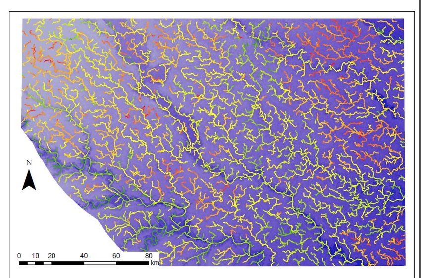
Major Objectives of the project
• Use remote sensing to
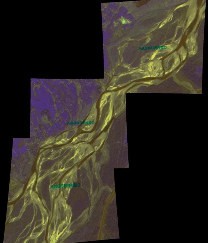
Reach of the Ganga
examine and monitor river near Narora
connectivity in the Ganga
Basin
• Use reduced complexity
modelling to get easy
predictions of pollution
levels in the Ganga
• Development of a GIS
Platform: Spaceborne
Channel
Observation and Analysis Networks
of Rivers (S.O.A.R)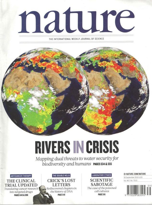
Basic Premises
• Humans have had a strong impact
  on the river building dams,
  removing water and also polluting
  the water.
• These changes in the network of
  the river and in the quality of its
  waters have had a dramatic
  impact on the ecosystem of the
  Ganga.
• Efforts to restore the Ganga are
  once again a high priority for
  central and state governments
• We need both new science and
  new management if the Ganga is
  to be restored to a sustainable       Nature, September 30, 2010
  status
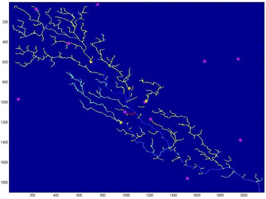
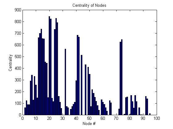
Network Metrics

With the Network created,
we can calculate a few
simple network measures:

• Full list of possible paths
• Reachability: list if 2
  nodes are connected via
  a path.
• Centrality: which nodes
  participate in the most
  local connections (i.e.
  flow nexus)
• Modularity: are parts of
  the network isolated
  from the rest?
Adding more physical meaning: weights and
         the connectivity matrix
            1
                                      n. 1      n. 2    n.3
 dry link                  n. 1       0         0.5     1
                Wet link
                           n. 2       0         0       0
                           n.3        0         0       0
 2                 3
By adding weights to an
adjacency matrix, we make         Weights relevant to rivers:
it non-binary and call it the
‘Connectivity Matrix’.            •       Spatial distance to node
These weights can account         •       Channel Width at node
for more physical                 •       Channel depth at node
processes:                        •       Channel elevation at node
                                  •       Etc…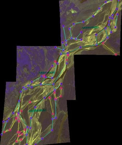
Basic Example

• A simple
  network with 2
  types of nodes:
  wet and dry.

• Two connectivity
  matrixes
  calculated:

• First was weights
  of 0.5 for dry and
  1 for wet
  channels

• Second has
  spatial distance
  to next node as
  weights.
Sample Results
                 Nodes with a high
                 centrality participate in
                 a large number of
                 connections and are
                 crucial to the system.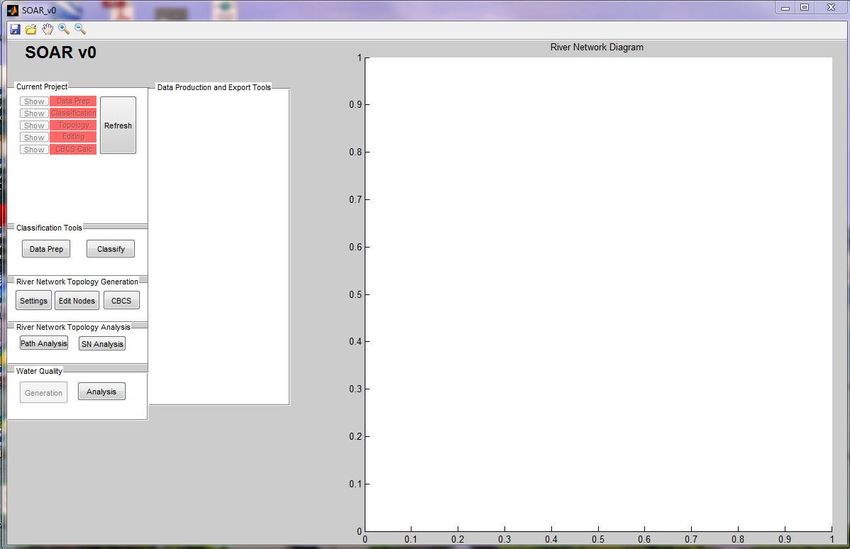
Flow Paths

• Now we take the
  top 2 wet nodes as
  entry points and
  consider flow
  paths from these
  sources.

• There are 2609
  paths with lengths
  up to 29 nodes.

• First we can
  convert these
  lengths into real
  river lengths
  (euclidean
  between nodes)

Sample Results

These distances are important in
ecological terms where it is
recognised that animal
displacement is a crucial energy
expenditure. Many species of river
fish show an inverse correlation
between mouvement distance and
survival.
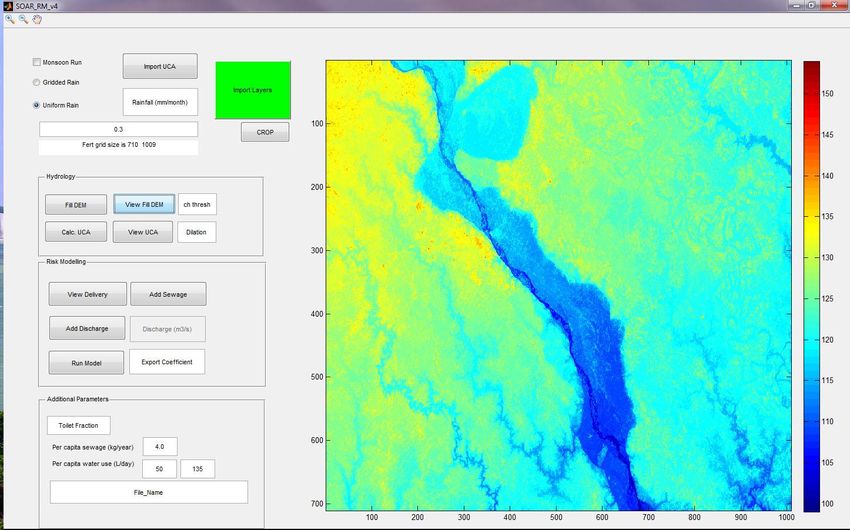
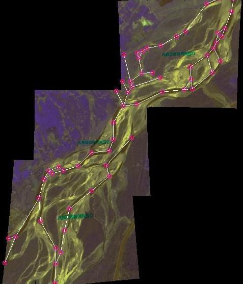
Spaceborne Observation and Analysis of Rivers (SOAR)

   The SOAR prototype is functional and complete. In the coming months, large
   catchment areas of the Ganga will be studied.
Sample Results

The modes at 0.94, 0.96 and 0.98
show that hundreds of paths have
only a few dry nodes. Reactivation
of a small number of dry nodes can
have a large effect on the
connectivity of the system.
Pollution Modelling

Preliminary run of SCIMAP on the Ganga plains in the area of Kanpur
Pollution Modelling with SCIMAP

Needed work:

• SCIMAP was
  developped for the
  UK
• Need to add
  population density
• Need to consider
  Indian hydrology
New model

Key elements:
- Can do monsoon and non-monsoon climates
- Includes population density and urban centres
- Includes channel flow, precipitation and human water usage
Sample results
                                    Gives us a tool to:

                                    1- explore the relationship
                                    between agriculture and water
                                    quality

                                    2- Build scenarios to target
                                    management intervention

* Simulated water injection point
* Urban centre
Future developments and
capacity building thanks to
UKIERI
• Complete SOAR and examine the structure of the
Ganga
• Keep up with current events and extend the study
site to Uttarakhand (using declassified satellite
images of 60s)
• Initiate more detailed work on water quality.
Specifically, explore the potential of remote
sensing for rapid and low-cost monitoring of
water quality (e.g. airborne survey)
• UKIERI has enabled us to join a consortia of
universities – developing for a very large project
on the health of North-Indian rivers.Project Outreach
No. of exchanges under the India to UK: 06
project (including academic UK to India: 03+04
staff and students)
No. of joint publications / Conference/workshop: 02
research papers
Media mention / Press NIL
release
Workshops organised Durham: 1 (July, 2013):
(please include details like Craig Hutton, Southampton
no of participants/key University
people/Key speakers and Sanmit Ahuja, ETI Dynamics
Vinod Tare: IIT Kanpur
way forward from the
workshop) IIT Kanpur : 1 (proposed in
October)Post-UKIERI
• River Health project by a much larger Indo-UK consortium (workshop in
October, 2013)
• ESPA project (NERC)
– Assessing Health, livelihoods, ecosystem services and poverty alleviation in
populous Deltas
– Project partners:
• Southampton, Oxford (UK)
• Yadavpur, IIT Kanpur (India)
• BUET, Bangladesh
• CARIAA Project (IDRC)
– Migration as adaptation in degrading deltaic environments: assessing the
vulnerability and resilience of the poor under a changing climate
– Three major deltas in the world: Nile (Egypt), Ganga-Brahmaputra,
Mahanadi (India), Volta (Ghana)
– Project partners
• Southampton, Oxford (UK)
• Yadavpur, IIT Kanpur (India)
• IWFM and BUET Dhaka (Bangladesh)
• NARSS, Cairo (Egypt)
• GhanaYou can also read