Article 6 (3) Appropriate Assessment Screening Report - Interim repair works at Bandon fish pass, Co Cork
←
→
Page content transcription
If your browser does not render page correctly, please read the page content below
Article 6 (3)
Appropriate
Assessment Screening
Report

Interim repair works
at Bandon fish pass,
Co Cork
Interim repair works at Bandon fish pass, Co Cork
                                                AASR F02 - 2021.04.20- 210359

DOCUMENT DETAILS

Client:           Office of Public Works

Project title:    Interim repair works at Bandon fish
                  pass, Co Cork

Project Number:   210359

Document Title:   Article 6 (3) Appropriate
                  Assessment Screening Report
Document File
Name:             AASR F03 – 2021.04.23 - 210359

Prepared By:      MKO
                  Tuam Road
                  Galway
                  Ireland
                  H91 VW84

Rev   Status      Date          Author(s)               Approved By

01    Draft       15/04/2021    IR                      PR

01    Final       16/04/2021    IR                      PR

02    Final       20/04/2021    IR                      PR

03    Final       23/04/2021    IR                      PR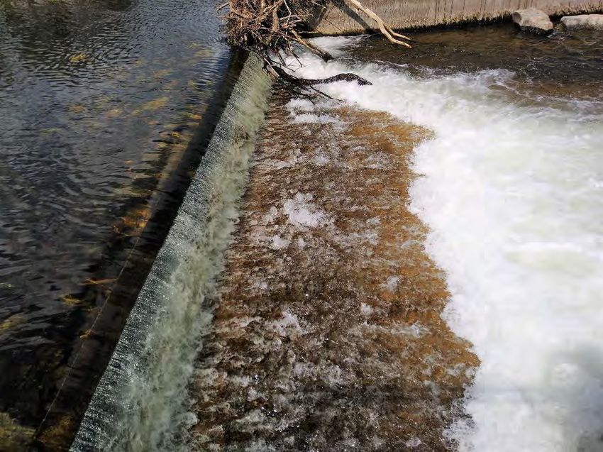
Interim repair works at Bandon fish pass, Co Cork
                                                                         AASR F02 - 2021.04.20- 210359

Table of Contents
1. INTRODUCTION .................................................... 1
1.1   Background .................................................. 1
1.2   Appropriate Assessment ...................................... 1
  1.2.1   Screening for Appropriate Assessment ............................ 1
  1.2.2   Statement of Authority .......................................... 2
2. DESCRIPTION OF THE PROPOSED WORKS ............................... 3
2.1   Site Location ............................................... 3
2.2   Characteristics of the Proposed Works ....................... 3
  2.2.1   Description of the project ...................................... 3
      2.2.1.1     Access from Riverview Shopping Centre access road................. 4
      2.2.1.2     Access from the northern riverbank................................ 4
  2.2.2   Description of the Baseline Ecological Environment .............. 6
3. IDENTIFICATION OF RELEVANT EUROPEAN SITES ....................... 9
3.1   Identification of the European Sites within the Likely Zone of
      Impact ...................................................... 9
3.2   Likely Cumulative Impact of the Proposed Works on European
      Sites, in-combination with other plans and projects ........ 14
4. ARTICLE 6(3) APPROPRIATE ASSESSMENT SCREENING STATEMENT AND
CONCLUSIONS ....................................................... 15
4.1   Data Collected to Carry Out Assessment ..................... 15
4.2   Concluding Statement ....................................... 15
BIBLIOGRAPHY ...................................................... 16

TABLE OF PLATES
Plate 2.1 Exposed concrete sill at the upstream exit of the fish pass.
       Area of very shallow water in front of sill followed by an area
       of high turbulence evident .................................. 3
Plate 2.2 Possible access points for the work. The most likely route
       of the excavator to access the fish pass from the northern
       bank is shown in orange ..................................... 4
Plate 2.3 View of the southern riverbank, the upstream exit of the
       fish pass is visible in the centre of the picture ........... 7
Plate 2.4 View of the northern riverbank from the upstream exit of
       the fish pass ............................................... 7
Plate 2.5 View of sloping agricultural grassland field to be crossed
       if access from the Riverview Shopping Centre access road is
       not possible ................................................ 8
Plate 2.6 View of wet grassland area in proximity of the river .... 8

TABLE OF TABLES
Table 3.1 Identification of European Sites within the Likely Zone of
       Impact ..................................................... 11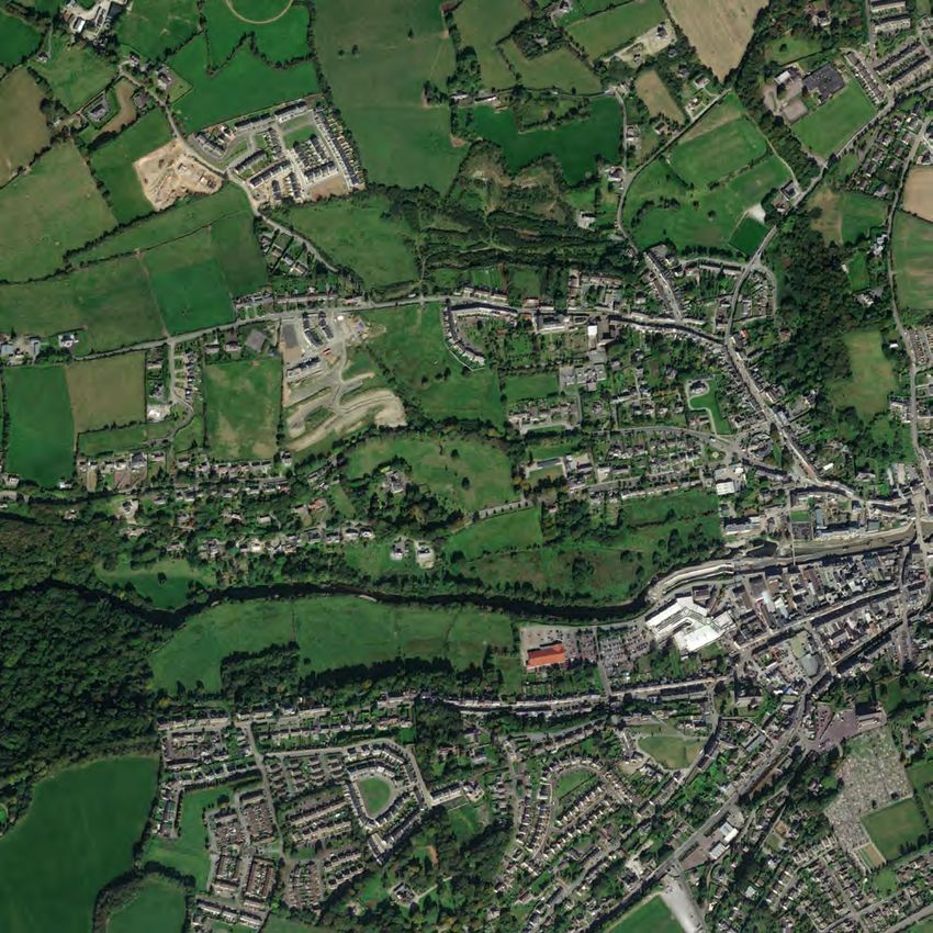
Interim repair works at Bandon fish pass, Co Cork
                                                                                                  AASR F02 - 2021.04.20- 210359

1.      INTRODUCTION
1.1     Background
        MKO has been appointed to provide the information necessary to allow the competent authority to
        conduct an Article 6(3) Screening for Appropriate Assessment of interim repair works at Bandon fish
        pass in Bandon, Co Cork.

        Screening for Appropriate Assessment is required under Council Directive 92/43/EEC on the
        conservation of natural habitats and of wild fauna and flora (the Habitats Directive). Where it cannot be
        excluded that a project or plan, either alone or in combination with other projects or plans, would have a
        significant effect on a European Site then same shall be subject to an appropriate assessment of its
        implications for the site in view of the site's conservation objectives. The current project is not directly
        connected with, or necessary for, the management of any European Site consequently the project has
        been subject to the Appropriate Assessment Screening process.

        The assessment in this report is based on a desk study and field survey undertaken in April 2021. It
        specifically assesses the potential for the proposed works to result in significant effects on European sites
        in the absence of any best practice, mitigation or preventative measures.

        This Appropriate Assessment Screening Report has been prepared in accordance with the European
        Commission’s Assessment of Plans and Projects Significantly affecting Natura 2000 Sites: Methodological
        Guidance on the provisions of Article 6(3) and 6(4) of the Habitats Directive 92/43/EEC (EC, 2001) and
        Managing Natura 2000 Sites: the provisions of Article 6 of the ‘Habitats’ Directive 92/43/EEC (EC, 2018)
        as well as the Department of the Environment’s Appropriate Assessment of Plans and Projects in Ireland
        - Guidance for Planning Authorities (DoEHLG, 2010).

        In addition to the guidelines referenced above, the following relevant documents were also considered in
        the preparation of this report:

                    1.   Council of the European Commission (1992) Council Directive 92/43/EEC of 21 May
                         1992 on the conservation of natural habitats and of wild fauna and flora. Official Journal
                         of the European Communities. Series L 20, pp. 7-49.
                    2.   EC (2000) Managing Natura 2000 Sites: the provisions of Article 6 of the ‘Habitats’
                         Directive 92/43/EEC, Office for Official Publications of the European Communities,
                         Luxembourg.
                    3.   EC (2007) Guidance document on Article 6(4) of the 'Habitats Directive' 92/43/EEC –
                         Clarification of the concepts of: alternative solutions, imperative reasons of overriding
                         public interest, compensatory measures, overall coherence. Opinion of the commission.
                    4.   EC (2013) Interpretation Manual of European Union Habitats. Version EUR 28.
                         European Commission.

1.2     Appropriate Assessment
1.2.1   Screening for Appropriate Assessment
        The Habitats Directive (Council Directive 92/43/EEC on the conservation of natural habitats and of wild
        fauna and flora) aims to maintain or restore the favourable conservation status of habitats and species of
        community interest across Europe. The requirements of this Directive are transposed into Irish law
        through the European Communities (Birds and Natural Habitats) Regulations) 2011 (S.I. No. 477 of
        2011).

        Under the Directive a network of sites of nature conservation importance have been identified by each
        Member State as containing specified habitats or species requiring to be maintained or returned to
        favourable conservation status. In Ireland the network consists of Special Areas of Conservation (SACs)
        and Special Protection Areas (SPAs), and also candidate sites, which form the Natura 2000 network.

                                                                                                                                1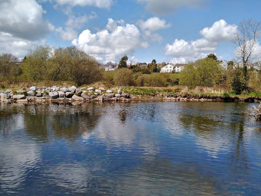
Interim repair works at Bandon fish pass, Co Cork
                                                                                                 AASR F02 - 2021.04.20- 210359

        Article 6(3) of the Habitats Directive requires that, in relation to European designated sites (i.e. SACs and
        SPAs that form the Natura 2000 network), "any plan or project not directly connected with or necessary
        to the management of the site but likely to have a significant effect thereon, either individually or in
        combination with other plans or projects, shall be subject to appropriate assessment of its implications for
        the site in view of the site's conservation objectives".

        A competent authority (e.g. the OPW or Local Authority) can only agree to a plan or project after having
        determined that it will not adversely affect the integrity of the site concerned. Under article 6(4) of the
        Directive, if adverse impacts are likely, and in the absence of alternative options, a plan or project must
        nevertheless proceed for imperative reasons of overriding public interest (IROPI), including social or
        economic reasons, a Member State is required to take all compensatory measures necessary to ensure the
        overall integrity of the Natura 2000 site. The European Commission have to be informed of any
        compensatory measures adopted, unless a priority habitat type or species is present and in which case an
        opinion from the European Commission is required beforehand (unless for human health or public
        safety reasons, or of benefit to the environment).

1.2.2   Statement of Authority
                                                                th
        A baseline ecological survey was undertaken on the 14 of April 2021 by Inga Reich Honours degree
        (Biology), Ph.D. (Applied Ecology) who also wrote the report. This report has been reviewed by Pat
        Roberts B.Sc. (Env.) MCIEEM. Pat has over 15 years post graduate experience in ecological consultancy
        and impact assessment.

                                                                                                                               2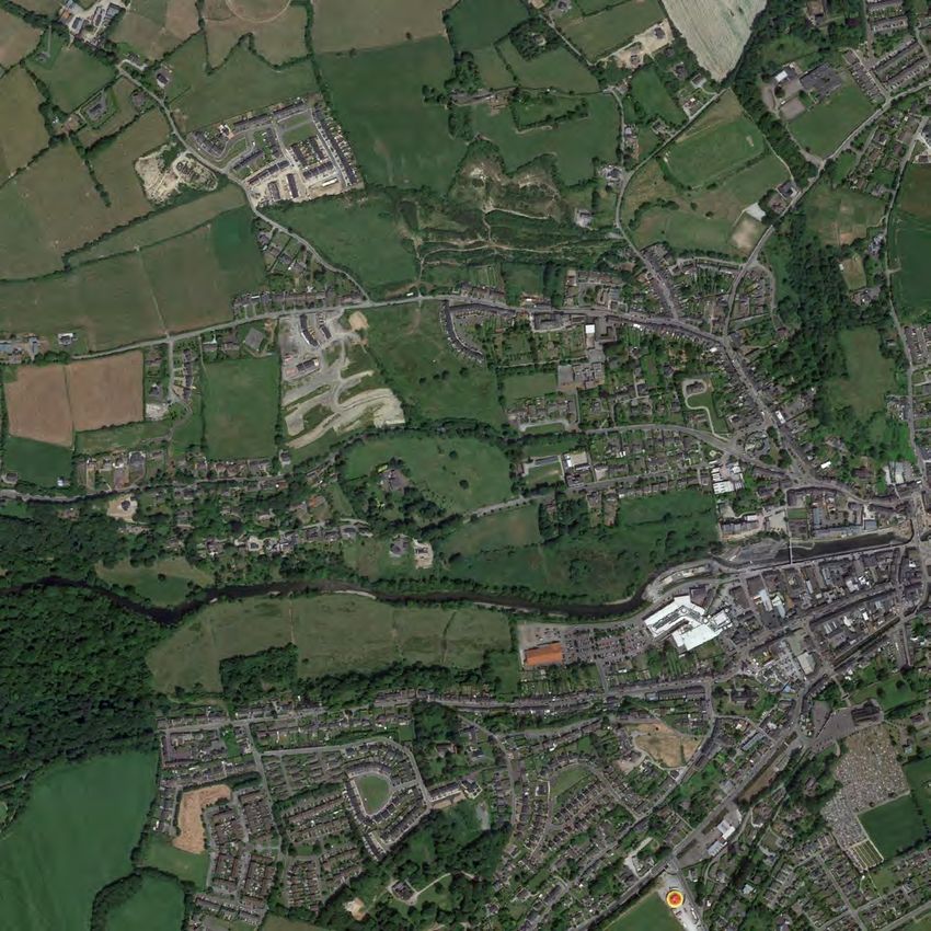
Interim repair works at Bandon fish pass, Co Cork
                                                                                                                   AASR F02 - 2021.04.20- 210359

2.      DESCRIPTION OF THE PROPOSED WORKS
2.1     Site Location
        The fish pass is situated on the River Bandon and bypasses the weir in Bandon, Co Cork. It is located
        just north of Macswiney Quay and Weir Street, which is the access road for the Riverview Shopping
        Centre (grid ref: E 148859 N 055022). The site is surrounded by urban infrastructure to the south, east
        west and a wet grassland field to the north. It is situated about 23km downstream of the Bandon River
        SAC which is designated, amongst others, for brook lamprey but also supports populations of Atlantic
        salmon. The site location is shown in Figure 2.1.

2.2     Characteristics of the Proposed Works
2.2.1   Description of the project
        The gravel and rock bed in the Bandon fish pass was seriously damaged by recent flood events which
        exposed a concrete sill at the upstream end of the fish pass that now impedes the migration of several fish
        species, including eel, salmon, trout and lamprey (Plate 2.1). The proposed interim works are necessary
        for the efficient functioning of the fish pass, and a number of different options are considered which will
        result in raised water levels and reduced velocity of the water across all or part of the sill.

        Plate 2.1 Exposed concrete sill at the upstream exit of the fish pass. Area of very shallow water in front of sill followed by an area of
        high turbulence evident.

        Depending on whether sufficient large boulders can be sourced from the local area, one of two options will
        be selected:

        Option 1: Two rows of large boulders (weight of approx. 5 tons) will be placed across the width of the pass
        (12.6m), one at 3m and one at approx. 9m downstream of the exposed sill.

                                                                                                                                                 3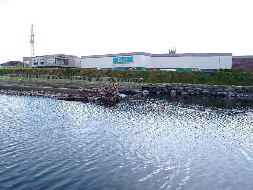
Interim repair works at Bandon fish pass, Co Cork
                                                                                                                AASR F02 - 2021.04.20- 210359

      Option 2: Two rows of precast concrete traffic separator barriers (approx. 2 x 1 x 0.5m) will be placed
      across the width of the pass (12.6m), one at 3m and one at approx. 9m downstream of the exposed sill.
      Gaps will be left between the concrete blocks to enable fish passage.

      While it will be avoided if at all possible, it may be necessary that a person will have to enter the upstream
      area of the pass to unsling the boulders/concrete barriers from the crane. In this case, to create a safe
      working environment for the person, a row of 1 ton bags filled with clean washed gravel will be placed in
      the river immediately upstream of the pass, to reduce or prevent water flow into the pass during the works.
      These will be removed once works are finished.

      In addition, as it is not yet clear which access route will be used to access the works area, two access routes
      are assessed:

2.2.1.1 Access           from Riverview Shopping Centre access road
      The boulders or concrete blocks will be placed carefully by crane situated on the Riverview Shopping
      Centre access road. These works will be carried out in the evening and overnight with artificial lighting to
      avoid obstructing access to the adjacent Riverview Shopping Centre during opening hours.

2.2.1.2 Access           from the northern riverbank
      If it is not possible to carry out the works from the Riverview Shopping Centre access road, a large
      excavator will be tracked over areas of grassland located on the northern bank of the River Bandon
      opposite the fish pass (Plate 2.2). The rock armour on the riverbank will be flattened to allow the creation
      of a slope from which the excavator can track into the river. If the water depth at time of work is too deep
      for the machine to cross, the scour hole in the middle of the river will need to be filled in with gravels
      sourced from the riverbed. The excavator will be placed at the upstream end of the fish pass and existing
      boulders will be dragged up towards the sill or sufficiently large boulders that are currently part of the
      rock armour at the northern riverbank will be used alternatively. While it is unlikely and will be avoided if
      at all possible, there may be a need of a tractor with dumper trailer to deliver boulders to the bank.

      Plate 2.2 Possible access points for the work. The most likely route of the excavator to access the fish pass from the northern bank is
      shown in orange.

                                                                                                                                              4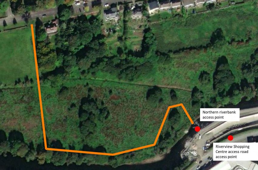
Map Legend
                     Location of fish pass

                                                                                                                                     Ordnance Survey Ireland Licence No. AR 0021820© Ordnance Survey Ireland/Government of Ireland
                                               Microsoft product screen shots reprinted with permission from Microsoft Corporation
Drawing Title

                     Site Location
Project Title

  Interim repair works at Bandon fish
             pass, Co. Cork
Drawn By                       Checked By

                IR                       PR
Project No.                    Drawing No.

        210359                   Figure 2.1
Scale                          Date

                                15.04.2021

                                MKO
                                Planning and
                                Environmental
                                Consultants
                                Tuam Road, Galway
                                Ireland, H91 VW84
                                +353 (0) 91 735611
                                email:info@mkoireland.ie
                                Website: ww.mkoireland.ie
Interim repair works at Bandon fish pass, Co Cork
AASR F02 - 2021.04.20- 210359
2.2.2 Description of the Baseline Ecological
Environment
Assessing the impacts of any project and associated activities requires an understanding of the ecological
baseline conditions prior to and at the time of the project proceeding. Ecological Baseline conditions are
those existing in the absence of proposed activities (CIEEM, 2018).
th
A multidisciplinary walkover survey was conducted on the 14 of April 2021 in line with NRA (2009)
guidelines. The habitat classifications and codes correspond to those described in ‘ A Guide to Habitats in
Ireland’ (Fossitt, 2000). All habitats within and adjacent to the works area were readily identifiable during
the site visit. Following on from the multidisciplinary survey there was no requirement for additional
dedicated floral or faunal surveys to be undertaken due to the built-up/disturbed surroundings and the
nature and scale of the proposed works. During the survey, the site was also searched for species listed on
the Third Schedule of the European Communities (Birds and Natural Habitats) Regulations (S.I. 477 of
2011).
The Bandon fish pass is an eroding/upland river (FW1) while the River Bandon upstream and
downstream of the pass is a depositing/lowland river (FW2). The southern riverbank where the fish pass
is located is dominated by buildings and artificial surfaces (BL3) with banks consisting of amenity
grassland (improved) (GA2) (Plate 2.3). The northern riverbank is characterized by earth banks covered
with wet grassland (GS4) vegetation, boulders and treelines (WL2) consisting of willow (Salix spp.), alder
(Alnus glutinosa) and ash (Fraxinus excelsior) as well as areas of bramble (Rubus fruticosus) scrub (WS1)
(Plate 2.4).
If works from the Riverview Shopping Centre access road are not possible, the excavator would track
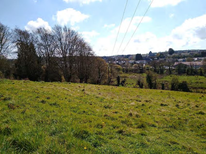
through an area of sloping agricultural grassland (GA1) with a large percentage of herbs, in particular
ribwort plantain (Plantago lanceolata), silverweed (Potentilla anserina) and dandelion (Taraxacum
vulgaria) (Plate 2.5). Towards the eastern field margin, which consist of a treeline (WL2), the ground
cover incorporates emerging bramble, dock (Rumex spp.) and winter heliotrope (Petasites pyrenaicus). A
small patch of hybrid bluebells (Hyacinthoides x masartiana), a Third Schedule invasive, was identified in
the north-eastern corner of the field in vicinity of the neighbouring garden. A small, largely overgrown
stream (FW2) will be crossed over an existing concrete structure covered with soil and established
vegetation and the excavator will track through a wet grassland (GS4) field before reaching the river. This
area is characterized by soft rush (Juncus effusus) and Yorkshire fog (Holcus lanatus), creeping buttercup
(Ranunculus repens), meadowsweet (Filipendula ulmaria) and pockets of horsetails (Equisetum spp.),
yellow iris (Iris pseudacoris) and marsh cinquefoil (Potentilla palustris). Clusters of willow of varying
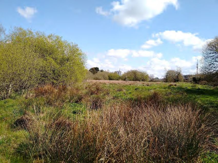
maturity can be found throughout this area (Plate 2.6).
6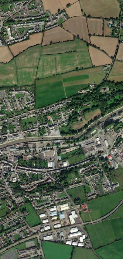
Interim repair works at Bandon fish pass, Co Cork
                                                                                                             AASR F02 - 2021.04.20- 210359

Plate 2.3 View of the southern riverbank, the upstream exit of the fish pass is visible in the centre of the picture.

Plate 2.4 View of the northern riverbank from the upstream exit of the fish pass.

                                                                                                                                           7
Interim repair works at Bandon fish pass, Co Cork
AASR F02 - 2021.04.20- 210359
Plate 2.5 View of sloping agricultural grassland field to be crossed if access from the Riverview Shopping Centre access road is not
possible.
Plate 2.6 View of wet grassland area in proximity of the river.
8Interim repair works at Bandon fish pass, Co Cork
AASR F02 - 2021.04.20- 210359
3. IDENTIFICATION OF RELEVANT EUROPEAN SITES
3.1 Identification of the European Sites within the Likely
Zone of Impact
The following methodology was used to establish which European Sites are within the Likely Zone of
Impact of the proposed works:
Initially the most up to date GIS spatial datasets for European Designated Sites and water
catchments were downloaded from the NPWS website (www.npws.ie) and the EPA website
(www.epa.ie) on the 07.04.2021. The datasets were utilized to identify European Sites which could
feasibly be affected by the proposed works.
All European Sites within a distance of 15km surrounding the site were identified and are shown
on Figure 3.1. In addition, the potential for connectivity with European Sites at distances of greater
than 15km from the proposed works was also considered in this initial assessment. In this case,
Bandon River SAC, which is located about 23km upstream of the works will be assessed due to
the connection between one of its QIs and the functioning of the fish pass. No potential for impact
on any other sites located further than 15km from the proposed works was identified due to lack
of pathways and size and scale of the proposed works.
The catchment mapping was used to establish or discount potential hydrological connectivity
between the site of the proposed works and any European Sites. The hydrological catchments are
also shown in Figure 3.1.
In relation to Special Protection Areas, in the absence of any specific European or Irish guidance
in relation to such sites, the Scottish Natural Heritage (SNH) Guidance , ‘Assessing Connectivity
with Special Protection Areas (SPA)’ (2016) was consulted. This document provides guidance in
relation to the identification of connectivity between proposed works and Special Protection
Areas. The guidance takes into consideration the distances species may travel beyond the
boundary of their SPAs and provides information on dispersal and foraging ranges of bird species
which are frequently encountered when considering plans and projects.
Table 3.1 provides details of all relevant European Sites as identified in the preceding steps and
assesses which are within the likely Zone of Impact. The assessment considers any likely direct or
indirect impacts of the proposed works, both alone and in combination with other plans and
projects, on European Sites by virtue of the following criteria: size and scale, land-take, distance
from the European Site or key features of the site, resource requirements, emissions, excavation
requirements, transportation requirements and duration of construction, operation and
decommissioning were considered in this screening assessment
The site synopses and conservation objectives of these sites, as per the NPWS website
(www.npws.ie), were consulted and reviewed at the time of preparing this report 07.04.2021.
Figure 3.1 shows the location of the proposed works in relation to all European sites within 15km
of the proposed works.
Where potential pathways for Significant Effect are identified, the site is included within the Likely
Zone of Impact and considered in the Screening Assessment.
9Map Legend
Location of fish pass
15km Buffer
Special Area of
Conservation
Special Protection
Area
WFD Hydrological
Subcatchments
Ordnance Survey Ireland Licence No. AR 0021820© Ordnance Survey Ireland/Government of Ireland
Microsoft product screen shots reprinted with permission from Microsoft Corporation
Drawing Title
EU Designated Sites within
15km
Project Title
Interim repair works at Bandon fish
pass, Co. Cork
Drawn By Checked By
IR PR
Project No. Drawing No.
210359 Figure 3.1
Scale Date
15.04.2021
MKO
Planning and
Environmental
Consultants
Tuam Road, Galway
Ireland, H91 VW84
+353 (0) 91 735611
email:info@mkoireland.ie
Website: ww.mkoireland.ieInterim repair works at Bandon fish pass, Co Cork
AASR F02 - 2021.04.20- 210359
Table 3.1 Identification of European Sites within the Likely Zone of Impact
European Sites and Qualify Interests/Special Conservation Conservation Likely Zone of Impact Determination
distance from proposed Interests for which the European site has Objectives
works been designated (Sourced from NPWS
online Conservation Objectives,
www.npws.ie on the 07/04/2021
Special Areas of Conservation (SAC)
Courtmacsherry Estuary [1130] Estuaries Detailed conservation There will be no direct impact on the SAC as it is located outside of the
SAC [001230] [1140] Mudflats and sandflats not covered objectives for this site (Version footprint of the proposed works.
by seawater at low tide 1, July 2014) were reviewed as
[1210] Annual vegetation of drift lines part of the assessment and are No potential pathway for effect was identified for any of the following QI
Distance to site: 9.4km
[1220] Perennial vegetation of stony available at www.npws.ie habitats due to their terrestrial nature:
banks
[1310] Salicornia and other annuals [2110] Embryonic shifting dunes
colonising mud and sand [2120] Shifting dunes along the shoreline with Ammophila
[1330] Atlantic salt meadows (Glauco- arenaria (white dunes)
Puccinellietalia maritimae) [2130] Fixed coastal dunes with herbaceous vegetation (grey
[1410] Mediterranean salt meadows dunes)
(Juncetalia maritimi)
[2110] Embryonic shifting dunes This SAC is separated from the works area by the open sea and the
[2120] Shifting dunes along the shoreline River Bandon discharges to an entirely separate catchment. Hence, no
with Ammophila arenaria (white dunes) potential pathway for significant effect arising from deterioration of water
[2130] Fixed coastal dunes with quality was identified for the remaining QI habitats:
herbaceous vegetation (grey dunes)
[1130] Estuaries
[1140] Mudflats and sandflats not covered by seawater at low tide
[1210] Annual vegetation of drift lines
[1220] Perennial vegetation of stony banks
[1310] Salicornia and other annuals colonising mud and sand
[1330] Atlantic salt meadows (Glauco-Puccinellietalia maritimae)
[1410] Mediterranean salt meadows (Juncetalia maritimi)
As such, there is no potential for indirect effects to occur.
This SAC is not in the Likely Zone of Impact, no further assessment is
required.
11Interim repair works at Bandon fish pass, Co Cork
AASR F02 - 2021.04.20- 210359
European Sites and Qualify Interests/Special Conservation Conservation Likely Zone of Impact Determination
distance from proposed Interests for which the European site has Objectives
works been designated (Sourced from NPWS
online Conservation Objectives,
www.npws.ie on the 07/04/2021
Bandon River SAC [3260] Water courses of plain to montane No conservation objectives are There will be no direct impact on the SAC as it is located outside of the
[002171] levels with the Ranunculion fluitantis and available for this site yet. footprint of the proposed works.
Callitricho-Batrachion vegetation [3260]
[91E0] Alluvial forests with Alnus The SAC is upstream from the works area. Hence, no potential pathway
Distance to site: 22.9km
glutinosa and Fraxinus excelsior (Alno- for significant effect arising from deterioration of water quality was
Padion, Alnion incanae, Salicion albae) identified for any of the QIs.
[1029] Freshwater pearl mussel
(Margaritifera margaritifera) Disturbance to QI species within the European Site can be ruled out
[1096] Brook lamprey (Lampetra planeri) due to the distance between Bandon fish pass and this SAC. While
brook lamprey occurs the proposed works area, the works are small
scale and very short-term (less than 1 day) and will not cause any
significant disturbance for ex situ fish.
In addition, a functioning fish pass will have a positive effect on the QI
species [1096] brook lamprey as it will enable upstream migration and
will also benefit the other QI species [102] freshwater pearl mussel as
their larvae are dependent on salmonids hosts which will also use the
fish pass for migration.
There is no potential for significant negative effect, no further
assessment is required.
Special Protection Areas (SPA)
Courtmacsherry Bay SPA [A003] Great northern diver (Gavia Detailed conservation There will be no direct impact on the SPA as it is located outside of the
[004219] immer) objectives for this site (Version footprint of the proposed works.
[A048] Shelduck (Tadorna tadorna) 1, October 2014) were
[A050] Wigeon (Anas penelope) reviewed as part of the This SPA is separated from the works area by the open sea and the
Distance to site: 9.4km
[A069] Red-breasted merganser (Mergus assessment and are available at River Bandon discharges to an entirely separate catchment. Hence, no
serrator) www.npws.ie potential pathway for significant effect arising from deterioration of water
[A140] Golden plover (Pluvialis apricaria)
12Interim repair works at Bandon fish pass, Co Cork
AASR F02 - 2021.04.20- 210359
European Sites and Qualify Interests/Special Conservation Conservation Likely Zone of Impact Determination
distance from proposed Interests for which the European site has Objectives
works been designated (Sourced from NPWS
online Conservation Objectives,
www.npws.ie on the 07/04/2021
[A142] Lapwing (Vanellus vanellus) quality was identified for supporting habitats associated with the SPA and
[A149] Dunlin (Calidris alpina) in particular the following SCI:
[A156] Black-tailed godwit (Limosa
limosa) [A999] Wetland and waterbirds
[A157] Bar-tailed godwit (Limosa
lapponica) Disturbance to SCI species within the European Site can be ruled out due
[A160] Curlew (Numenius arquata) to the distance between Bandon fish pass and this SPA. While some of
[A179] Black-headed gull the SCI species may occur in the proposed works area, the works are small
(Chroicocephalus ridibundus) scale and very short-term (less than 1 day) and will not cause any significant
[A182] Common gull (Larus canus) disturbance for ex situ birds.
[A999] Wetland and waterbirds
As such, there is no potential for indirect effects to occur.
This SPA is not in the Likely Zone of Impact, no further assessment is
required.
13Interim repair works at Bandon fish pass, Co Cork
AASR F02 - 2021.04.20- 210359
3.2 Likely Cumulative Impact of the Proposed Works on
European Sites, in-combination with other plans and
projects
The works are associated with the much larger Bandon flood relief scheme and involve a small adaption
to that permitted scheme. However, they are designed specifically for the purpose of facilitating upstream
fish passage and have no potential to impact negatively on any European Site individually – they therefore
cannot contribute to any negative effect when considered cumulatively.
14Interim repair works at Bandon fish pass, Co Cork
AASR F02 - 2021.04.20- 210359
4. ARTICLE 6(3) APPROPRIATE ASSESSMENT
SCREENING STATEMENT AND CONCLUSIONS
The findings of this Screening Assessment are presented following the European Commission’s
Assessment of Plans and Projects Significantly affecting Natura 2000 Sites: Methodological Guidance on
the provisions of Article 6(3) and 6(4) of the Habitats Directive 92/43/EEC (EC, 2001) and Managing
Natura 2000 Sites: the provisions of Article 6 of the ‘Habitats’ Directive 92/43/EEC (EC, 2018) as well as
the Department of the Environment’s Appropriate Assessment of Plans and Projects in Ireland - Guidance
for Planning Authorities (DoEHLG, 2010).
4.1 Data Collected to Carry Out Assessment
In preparation of the report, the following sources were used to gather information:
Review of NPWS Site Synopses, Conservation Objectives for the European Sites
Review of 2019, 2013 and 2007 EU Habitats Directive (Article 17) Reports.
Review of OS maps and aerial photographs of the site of the proposed project.
Review of online web-mappers: National Parks and Wildlife Service (NPWS),
Environmental Protection Agency (EPA) and Water Framework Directive (WFD).
Information provided by email from OPW
th
Meeting with Damien Cannon and Owen Lynch from Byrne Looby on 14 of April
2021.
th
Site visit conducted by Inga Reich on the 14 of April 2021.
4.2 Concluding Statement
It is concluded beyond reasonable scientific doubt, in view of best scientific knowledge, on the basis of
objective information and in light of the conservation objectives of the relevant European Sites, that the
proposed works, individually or in combination with other plans and projects, will not have a significant
effect on any European Site.
15Interim repair works at Bandon fish pass, Co Cork
AASR F02 - 2021.04.20- 210359
BIBLIOGRAPHY
Birds Directive (2009/47/EC) http://ec.europa.eu/environment/naturelegislation/birdsdirective/index
_en.htm
CIEEM (2018) Guidelines for Ecological Impact Assessment in the UK and Ireland: Terrestrial,
Freshwater, Coastal and Marine version 1.1. Chartered Institute of Ecology and Environmental
Management, Winchester. Version 1.1..
Council Directive 92/43/EEC of 21 May 1992 on the conservation of natural habitats and of wild fauna and
flora (Habitats Directive) and Directive 2009/147/EC (codified version of Directive 79/409/EEC as
amended) (Birds Directive) – transposed into Irish law as European Communities (Birds and Natural
Habitats) Regulations 2011 (SI 477/2011).
DEHLG (2009) Appropriate Assessment of Plans and Projects in Ireland: Guidance for Planning
Authorities. DEHLG, Dublin.
DoEHLG (2010). Appropriate Assessment of Plans and Projects in Ireland. Guidance for Planning
Authorities. Revision, February, 2010. Department of the Environment, Heritage and Local Government.
EC (2018) Managing Natura 2000 Sites: the provisions of Article 6 of the ‘Habitats’ Directive 92/43/EEC,
Office for Official Publications of the European Communities, Luxembourg. European Commission.
EC (2001) Assessment of plans and projects significantly affecting Natura 2000 sites: Methodological
guidance on the provisions of Articles 6(3) and (4) of the Habitats Directive 92/43/EEC.
EC (2002) Assessment of Plans and Projects Significantly Affecting Natura 2000 Sites: Methodological
guidance on the provisions of Article 6(3) and (4) of the Habitats Directive 92/43/EEC, Office for Official
Publications of the European Communities, Luxembourg. European Commission.
EC (2007a) Guidance document on Article 6(4) of the 'Habitats Directive' 92/43/EEC – Clarification of the
concepts of: alternative solutions, imperative reasons of overriding public interest, compensatory measures,
overall coherence, opinion of the commission. Office for Official Publications of the European
Communities, Luxembourg. European Commission.
EC (2013) Interpretation Manual of European Union Habitats. Version EUR 28. European Commission,
DG Environment.
EPA website: http://www.epa.ie.
European Communities (Natural Habitats) Regulations, SI 94/1997, SI 233/1998 & SI 378/2005 –
http://www.irishstatutebook.ie.
Habitats Directive (92/43/EEC).
NPWS (2013) The Status of EU Protected Habitats and Species in Ireland. Conservation Status in Ireland
of Habitats and Species listed in the European Council Directive on the Conservation of Habitats, Flora
and Fauna 92/43/EEC.
NPWS of the DEHLG (2013) The Report on Status of Habitats and Species in Ireland: Technical Reports
and Forms.
NPWS (2014) Conservation Objectives: Courtmacsherry Estuary SAC 001230. Version 1. National Parks
and Wildlife Service, Department of Arts, Heritage and the Gaeltacht. Online, Available at:
https://www.npws.ie/sites/default/files/protected-sites/conservation_objectives/CO001230.pdf Accessed:
07/04/2021.
NPWS (2014) Conservation Objectives: Courtmacsherry Bay SPA 004219. Version 1. National Parks and
Wildlife Service, Department of Arts, Heritage and the Gaeltacht. Online, Available at:
16Interim repair works at Bandon fish pass, Co Cork
AASR F02 - 2021.04.20- 210359
https://www.npws.ie/sites/default/files/protected-sites/conservation_objectives/CO004219.pdf, Accessed:
07/04/2021.
NRA (2009) Guidelines for the Assessment of Ecological Impacts of National Road Schemes.
NRA 2008, Ecological Surveying Techniques for Protected Flora and Fauna during the Planning of
National Road Scheme.
Scottish Natural Heritage (SNH) (July 2013) Assessing Connectivity with Special Protection Areas (SPA).
17You can also read