BIGS Policy Paper - BIGS ...
←
→
Page content transcription
If your browser does not render page correctly, please read the page content below
BIGS Policy Paper
                                Brandenburg Institute for Society and Security

                                                                     BRANDENBURGISCHES INSTITUT
                                                                     für GESELLSCHAFT und SICHERHEIT

                                Unmanned Aircraft
                                        Systems for
                                  Civilian Missions

 md4-1000/ © microdrones GmbH

 Therese Skrzypietz                            BIGS Policy Paper No. 1 / February 2012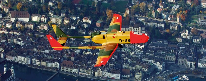
2 BIGS Policy Paper No. 1 / February 2012
BIGS Policy Paper
Therese Skrzypietz . Brandenburg Institute for Society and Security

    Unmanned Aircraft Systems for
         Civilian Missions

                                    BRANDENBURGISCHES INSTITUT
                                    für GESELLSCHAFT und SICHERHEIT

           Brandenburgisches Institut für Gesellschaft und Sicherheit gGmbH
                Brandenburg Institute for Society and Security gGmbH

                                 Executive Director
                                 Dr. Tim H. Stuchtey

                              Rudolf-Breitscheid-Str. 178
                                   14482 Potsdam

                            Telephone: +49-331-704406-0
                               Fax: +49-331-704406-19

                            E-Mail: info@bigs-potsdam.org
                               www.bigs-potsdam.org

                                                                       Skrzypietz – Civil Use of UAS   3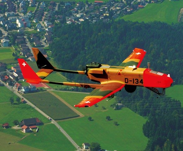
I Table of Contents

    I Table of Contents                                                 4
    II List of Figures                                                  4
    III List of Tables                                                  4
    1   Introduction                                                    5
    2   Functions and Properties of UAS                                 6
    3   Comparison of UAS to Alternatives                               8
           3.1 Disadvantages of UAS                                     8
           3.2 Advantages of UAS                                        10
    4   Potential Applications in Civilian Fields                       12
           4.1 Use in Scientific Research                               13
           4.2 Disaster Prevention and Management                       14
           4.3 Protection of Critical Infrastructure                    16
           4.4 Use in Homeland Security                                 18
    5   Potential of the Civilian UAS Market                            20
    6   Need for Further Study                                          21
    7   Sources and References                                          22
           7.1 Interviews Conducted                                     22
           7.2 List of Abbreviations                                    23
           7.3 List of Works Cited                                      24
           7.4 List of Footnotes                                        27

    II List of Figures

    Figure 1: The Development of UAS 2005–2011                          5

    Figure 2: Categories of UAS                                         7

    Figure 3: Civilian Application Fields for UAS                       12

    Figure 4: Civilian Market for UAS in Europe by Category 2008–2017   20

    III List of Tables

    Table 1: Possible Classification of UAS                             6

4   BIGS Policy Paper No. 1 / February 2012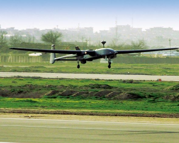
1 Introduction

In the last few years, Unmanned Aircraft Systems                                        This project eventually resulted in the Helios,
(UAS) have become more and more important.                                              Pathfinder and Altus unmanned systems, among
The number of unmanned aircraft designs regis-                                          others, which are now used in environmental re-
tered with UVS International, a non-profit society                                      search and for conducting atmospheric measure-
which promotes unmanned systems, more than                                              ments.2 This early research into the civilian use of
doubled between 2005 and 2011. During the same                                          unmanned aircraft by American scientists is one of
time period, the number of producers and devel-                                         many important reasons which have led to the Uni-
opers has also more than doubled. This has been                                         ted States’ leading role in the quickly-growing UAS
accompanied by a growing interest in the research,                                      market. To make an international comparison, the
development and production of UAS, with a sharp                                         United States develops and produces 30.33% of
increase in the number of UAS-producing countries                                       the world’s UAS, making them the world leader in
over the last six years. Yet, while most air-based                                      2011. The second-largest market share is held by
reconnaissance systems are currently used for mi-                                       France, with 6.42%, followed closely by the Uni-
litary purposes, it is the civilian and commercial                                      ted Kingdom, Israel and the Russian Federation.
use of UAS which has shown the strongest growth                                         Germany holds sixth place in the international ran-
during this period.1 Considering the fact that civili-                                  kings, with a market share of 3.85%.3
an research on UAS only began in the early 1990s,
                                                                                        The civilian use of UAS is gaining more and more
these growth figures point to a strong interest in
                                                                                        attention, both at the international and national le-
the use of UAS for civilian purposes.
                                                                                        vels. The goal of this study is therefore to identify
The American Environmental Research Aircraft and                                        and critically investigate the various potential civi-
Sensor Technology (ERAST) project was a very im-                                        lian applications of UAS. The study is structured as
portant research project which promoted and ena-                                        follows. First, the advantages as well as the limita-
bled the use of UAS in the civilian sphere early                                        tions of unmanned aircraft will be explored. Next,
on. This nine-year National Aeronautics and Space                                       the special characteristics of UAS will be compared
Administration (NASA) project sought to develop                                         with existing alternatives which are already em-
unmanned aircraft that could be employed for ex-                                        ployed for civilian observation and reconnaissance
tended scientific missions while operating from an                                      missions and their potential application will be eva-
altitude of up to 30,000 meters (98,000 feet).                                          luated. Finally, the market potential of unmanned
                                                                                        aircraft in the civilian sphere will be estimated.

Figure 1: The Development of UAS 2005–2011
1600                                                                                                                             Number of registered UAS
                                                                                                                                 Number of Producers/ Developers

1400                                                                                               1424

1200                                                                             1244
                                                              1190

1000
                                            974

800
                               789

600
                   603
       544                                                                                                  511
                                                                                         500

400                                                                   422
                                                    369
                                     312
                         252
200
             207
                                                                                                                        Source:
                                                                                                                        Diagram by Therese Skrzypietz
  0                                                                                                                     based on Blyenburgh & Co. 2011, 153.
         2005        2006        2007          2008               2009               2010              2011

                                           Source: Diagram by Therese Skrzypietz based on Blyenburgh & Co. 2011, 153.
                                                                                                                                          Skrzypietz – Civil Use of UAS   5
2 Functions and Properties of UAS Depending on their size and available functions,
certain UAS can be employed for specific civilian
A scientific examination of UAS must always con- missions.
sider it as a system which is composed of three
The extent to which certain unmanned systems
different components: An important part of the
are suited to specific civilian applications will be
system is the Ground Control Station (GCS), via
evaluated in the fourth chapter. To gain a better
which the aircraft can be controlled and its opera-
understanding of the wide variety of characte-
tion observed. Another component is the commu-
ristics and functions of UAS and to demonstrate
nications infrastructure needed for the connection
UAS’ diversity, this chapter shall provide a short
between the transmitter and the receiver. The
overview of UAS and group them into broad cate-
third component is the aerial platform, i.e. the
gories. Four characteristics can be used to cate-
vehicle itself, formally termed the Unmanned Ae-
gorize unmanned aerial vehicles:
rial Vehicle (UAV). In German the term “drone” is
also widespread. The terms UAS and UAV are so-
• Range
metimes used as synonyms; however, in correct
usage, UAV only describes the aerial platform, not • Flight altitude
the system as a whole. The scientific literature
therefore primarily uses the term UAS, as this • Endurance and
implicitly includes all three components, thereby
• Maximum Take-Off Weight (MTOW).
covering the entire system.
UAS may be characterized by very different fea-
tures and characteristics, with the market made The following table groups UAS into several cate-
up of a large number of diverse systems. For ex- gories. The ranges of values given for each cha-
ample, UVS International lists 1,424 different sys- racteristic are examples which need not necessa-
tems which are in development worldwide. These rily be strictly applied to all systems in a defined
include prototypes as well as systems which are category. Based upon the values listed for each of
completely market-ready and in operation, as the four characteristics, it is clear that a strict se-
well as those which are obsolete and no longer paration between different categories or classes
in use.4 The platforms themselves can be divided is not possible, as certain characteristics overlap
into different categories based upon size. one another or are identical.
Possible Classifica
on of UAS
Table 1: Possible Classification of UAS
Category Range Flying Endurance MTOW Example
(km) Altitude (h) (kg)
(m)
Micro & Mini UAV (MUAV) < 10 300 500 15,000 24 – 48
Endurance (MALE) 7,000 Predator
High Altitude Long 4,500 –
> 2,000 20,000 24 – 48 Global Hawk
Endurance (HALE) 15,000
Vertical Take-off and 0.019 – Nano Hummingbird,
x – 204 x – 6,100 0.18 – 8
Landing UAV (VTOL UAV) 1,400 MQ-8 Fire Scout
Source: Diagram by Therese Skrzypietz based on Blyenburgh & Co. 2010, 120.
Source: Diagram by Therese Skrzypietz based on Blyenburgh & Co. 2010, 120.
6 BIGS Policy Paper No. 1 / February 2012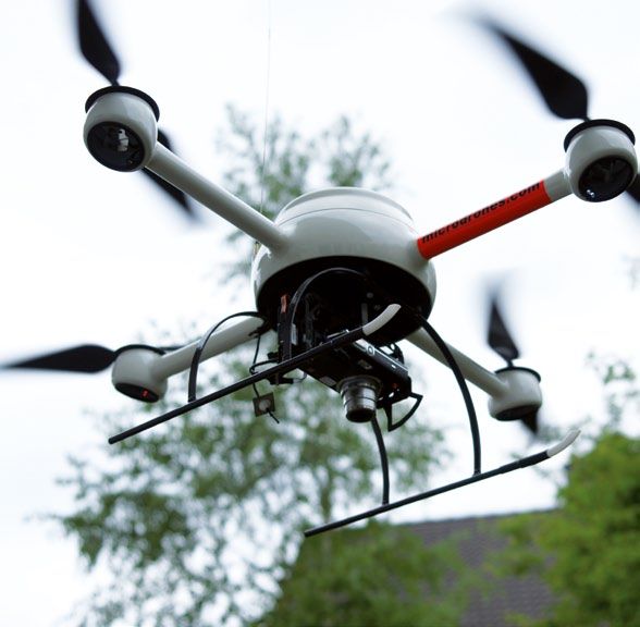
For example, there are very small platforms, the Vertical Take-Off and Landing (VTOL) provides
so-called micro and mini-UAVs, which in the ta- another opportunity to further classify unmanned
ble both fall under the category Mini Unmanned aerial vehicles by dividing UAS into “fixed wing”
Aerial Vehicle (MUAV). Because they only differ and “rotary wing” groupings.5 An examination of
slightly from each other in respect to these cha- the characteristics in Table 1 makes it clear that
racteristics, here they are included in a single ca- great variation exists in the properties of VTOL-
tegory. MUAVs have only a relatively short ran- UAVs. Unmanned rotary-wing vehicles may be as
ge of a few kilometers and a minimal altitude of small as a hummingbird or as massive as a heli-
about 300 meters (990 feet). Their endurance of copter. For this reason, MUAVs, for example the
a maximum of two hours is very limited compared md4-200, are also often included in this category.
to the other categories and their MTOW, usually Additional examples of VTOL-UAVs are the RQ-16
less than 30 kg, is relatively low. MUAVs include, T-Hawk, from the American company Honeywell,
for example, the Aladin reconnaissance system, and the Camcopter S-100, produced by the Aust-
developed by the German company EMT. Aladin rian company Schiebel. VTOL-UAVs are also often
stands for Abbildende luftgestützte Aufklärungs- propelled by four downward-facing rotors, and
drohne im Nächstbereich, or close-range air- are in such cases termed quadrocopters. Figure 2
based imaging reconnaissance drone. The md4- provides a clear overview of these categories and
200, produced by Germany’s microdrones GmbH a way to differentiate between them based upon
is also a MUAV. An additional platform which can flying altitude and maximum take-off weight.
be included MUAV category is the Nano-UAS.
The following section will consider MUAVs, MALE
These unmanned reconnaissance systems have a
and HALE systems, as well as VTOL-UAS. These
wingspan of only a few centimeters, with a cor-
systems are marked by various characteristics
respondingly low weight of just a few grams. The
which are present to different degrees in each
Nano Hummingbird, developed by the American
category, making it possible to draw conclusions
company AeroVironment and presented to the
about their various potential applications.
public in February 2011, is an example of such a
Nano-UAS. As its name suggests, it is about the
size of a common hummingbird.
Larger and considerably more complex systems Figure 2: Categories of UAS
are represented by the Medium Altitude Long
Endurance (MALE) and High Altitude Long Endu-
Flying Altitude
rance (HALE) systems. Compared to MUAVs, the-
se have much a longer range of several thousand
kilometers, as well as better endurance, up to or
exceeding 24 hours. In regard to altitude, a MALE
system can reach up to 15,000 meters (49,000 HALE
feet) and a HALE system can reach up to 20,000
meters (65,500 feet). The maximum takeoff
MALE
weight for both vehicle types can measure up to
several tons and enables a correspondingly large
payload. Fundamentally, these unmanned plat-
VTOL
forms are comparable in size to manned aircraft.
One example of a HALE UAS is the Global Hawk,
MUAV
by America’s Northrop Grumman. The MALE cate-
gory includes, for example, the Predator, produ-
ced by the American company General Atomics;
the Heron, made by Israel Aerospace Industries
MTOW
(IAI) and used by the Bundeswehr (German Fe-
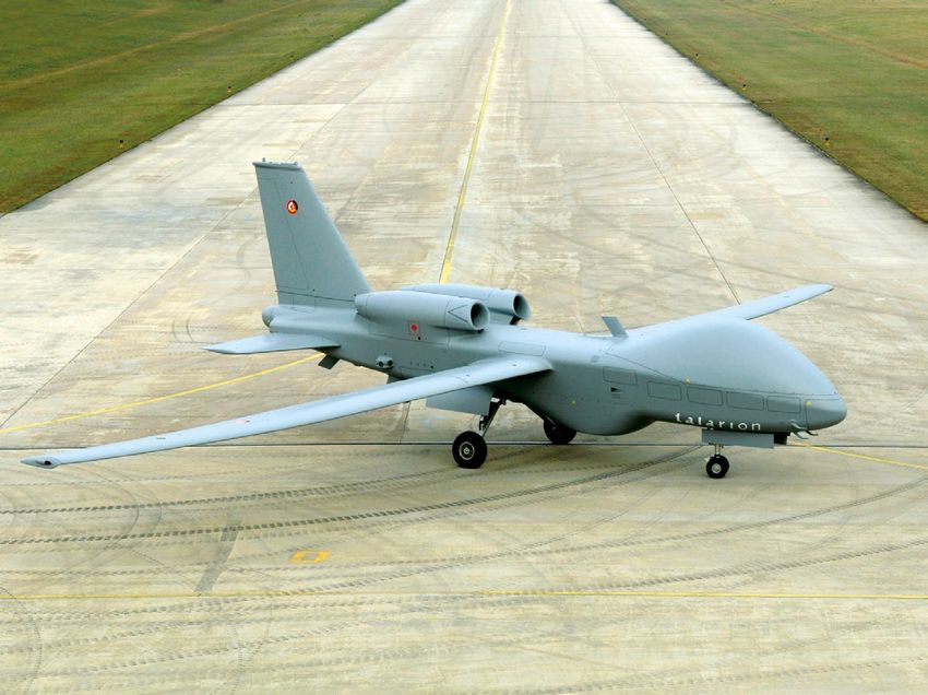
deral Armed Forces); as well as the Talarion, pro-
duced by Europe’s European Aeronautic Defence Source: Diagram by Therese Skrzypietz.
and Space Company (EADS).
Skrzypietz – Civil Use of UAS 7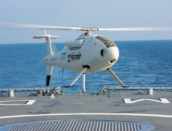
3   A Comparison of UAS to                             and their integration into controlled airspace. In
        Alternatives                                       the meantime, however, it has been possible to
                                                           successfully demonstrate techniques and proce-
                                                           dures for the successful control of unmanned air-
    To be able to evaluate the possible uses of un-        craft in German airspace, for example the project
    manned aerial vehicles in the civilian sphere, it      Weitreichende Abstandsfähige Signalerfassende
    is necessary to determine the advantages and           Luftgestütze Aufklärung – HALE (Long-Range and
    disadvantages of UAS compared to satellites and        Distance Air Supported Signals Reconnaissance
    manned aircraft. These existing alternatives are       – WASLA-HALE), funded by the Bundesamt für
    already used for various civilian observation and      Wehrtechnik und Beschaffung (Federal Office for
    reconnaissance missions, and are potential can-        Defense Technology and Procurement).9 Within
    didates for substitution by UAS.6 The advantages       the framework of the WASLA-HALE project, the Ad-
    and constraints of unmanned systems are parti-         vanced Technologies Testing Aircraft System (AT-
    ally dependent upon the characteristics discussed      TAS) was used as an experimental platform, with
    in Chapter 2. The different UAS categories also        a back-up pilot onboard, to carry out test flights
    result in respective differences in the advantages     at the German Bundeswehr’s airfield at Manching.
    and limitations of UAS in carrying out such missi-
                                                           The Validierung von UAS zur Integration in den
    ons; these will be summarized in Chapter 3.
                                                           Luftraum (Validation of Unmanned Aircraft Sys-
                                                           tems Integration into the Airspace – VUSIL) pro-
    3.1 Disadvantages of UAS                               ject, funded by the German Federal Police, also
                                                           aims to determine whether safe participation in air
                                                           traffic by unmanned systems is possible through
    The greatest limitation of UAS lies in the absence
                                                           various tests with a MUAV. The project is testing
    of legislation and regulation for operation in
                                                           emergency landing procedures, radio connec-
    non-segregated airspace. The problem posed by
                                                           tions, sensor function, separation of the airspace
    allowing unmanned aircraft to operate in the same
                                                           and vertical separation.10 Since September 2009,
    “civil” airspace as traditional aircraft has been a
                                                           the Mid Air Collision Avoidance System (MIDCAS)
    controversial subject among pilots, airlines and
                                                           project has worked to arrive at a common inter-
    aviation safety authorities for several years. To
                                                           national solution for the integration of unmanned
    address the unresolved issue of aviation security
                                                           vehicles in the airspace. This international project,
    and the operation of UAS, the legal basis for the
                                                           funded by the European Defense Agency (EDA), is
    operation of unmanned aircraft in Germany was
                                                           a joint effort by Sweden, France, Germany, Italy
    changed and clarified to a rudimentary degree by
                                                           and Spain. Supported by a consortium made up of
    the German federal government in early 2010.
                                                           13 companies from these five countries, it aims to
    According to §1 paragraph 3 of German air traffic
                                                           develop an acceptable collision avoidance system
    regulations, the LuftVO, the operation of unman-
                                                           and demonstrate it in the air within four years.11
    ned aerial vehicles is prohibited if the vehicle is
    flown out of the range of view of the operator or      A functional “Sense and Avoid” system approved
    if the total mass of the device exceeds 25 kilo-       by the aviation safety authorities would create
    grams.7 However, the LuftVO goes on to specify         the basis to allow UAS to operate in the same
    that this ban can be lifted through a waiver issu-     airspace as manned aircraft without restrictions.
    ed by the responsible air transportation authority.    The European countries are planning, in close co-
    Yet, at the national and international levels, the     operation with these authorities, to completely in-
    operation of UAS in general air traffic, alongside     tegrate UAS in general air traffic by 2015. In the
    manned aircraft, is fundamentally prohibited at        past, several waivers have already been issued to
    the current time.                                      certain unmanned aircraft to operate within con-
                                                           trolled airspace, lending credibility to the predic-
    Because future investments in and development of
                                                           tion that the “act of regulatory approval” as well
    unmanned aviation systems are dependent upon
                                                           existing technical hurdles will be resolved in the
    their integration into non-segregated airspace,
                                                           next five to eight years.
    this topic is currently a subject of intense inquiry
    by various research projects. Attempts are being       The political and societal acceptance of the
    made to develop “Sense and Avoid” systems8 and         use of UAS in the civilian sphere poses an addi-
    to work out guidelines for the certification of UAS    tional hurdle, as the use of unmanned aerial ve-

8   BIGS Policy Paper No. 1 / February 2012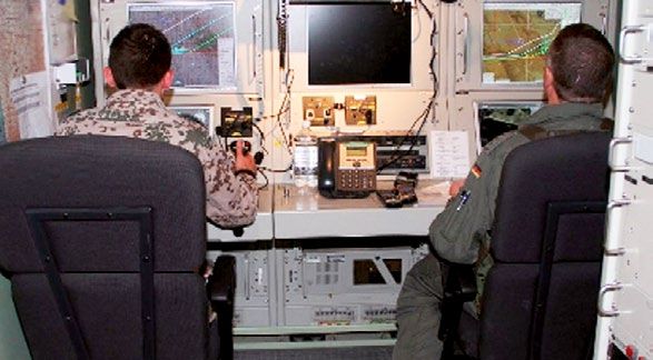
hicles inobservation missions is very controversi-     However, the public has yet to show such trust.
al. Opinions in this regard differ depending on the    A study by the American aircraft company Boeing
kind of mission and result mainly from two heated      revealed that, even if ticket prices were reduced by
lines of argument: On the one hand the problems        50% through the use of UAS, only 17% of people
of data protection and infringements on the right      would consider flying in an “unmanned” aircraft. It
to privacy are raised, on the other hand, the safe-    has been suggested that the cause of this skepti-
ty of the technology and its potential for accidents   cism and unease is that the general public has too
are viewed skeptically.                                little information about and experience with UAS
                                                       technology.16 This skepticism is therefore more an
The use of MUAVs by the police in Lower Saxo-
                                                       emotional reaction than something which based in
ny during the Castor nuclear waste transport in
                                                       logical reasoning process. Providing more and bet-
November 2010 and the procurement of a quad-
                                                       ter information about unmanned aircraft systems
rocopter by the Ministry of the Interior of Saxony
                                                       would lead to a better public understanding of this
have been especially criticized by data protection
                                                       technology, its reliability and its potential for civi-
officer. To clarify these privacy protection issues
                                                       lian use. This in turn would help society to form a
and to ensure the privacy and freedom of indivi-
                                                       more rational opinion about this subject and re-
dual citizens during the use of UAS, legal clarifi-
                                                       duce general misgivings about automated tech-
cation and further legislation regarding the use of
                                                       nology. This has been the case in the past, when
data collected in such operations is needed. Fur-
                                                       political and societal acceptance for new revoluti-
thermore, the advantages for civil defense which
                                                       onary technologies was established, once practical
are offered by unmanned aircraft must be better
                                                       examples demonstrated the value of these techno-
communicated to the public. For example, the use
                                                       logies to the public.
of smaller UAS during large public events in Ger-
many, such as demonstrations, is often criticized,
while their use during disasters has been over-
whelming welcomed by relief professionals. In a
poll of professional firemen, a total of 73% of tho-
se asked viewed the use of UAS technology posi-
tively and supported it. In respect to the concrete
use of unmanned systems in disaster manage-
ment, acceptance was even higher at over 82%.12
Despite these high rates of acceptance, the use of
UAS in disaster management in Germany has so
far been prevented by regulation.

Within the context of UAS flights, including actual
missions as well as test flights, reports of acci-       md4-1000/ © microdrones GmbH
dents and uncontrollable unmanned aircraft sur-
face regularly.13 Such reports, as well as a lack      High development and procurement costs
of acceptance of the technical abilities of UAS,       could also represent an additional barrier to the
have led to skepticism of UAS technology. How-         use of UAS. In the case of small unmanned aerial
ever, when considering the question of increased       vehicles, it is often possible to use inexpensive off-
risk of accidents with completely automated un-        the-shelf systems. However, for the larger MALE
manned aircraft, it is important to note at appro-     and HALE systems, considerable financial invest-
ximately two-thirds of all airplane accidents are      ments are necessary.17 Especially the development
due to human error.14 In regard to the technical       of new and larger aerial platforms and the impro-
requirements placed upon UAS, these should be          vement of their sensor arrays are large drivers of
the same as for manned aircraft.15 The risk of ac-     higher costs. The sensors, which are continually
cidents with UAS can therefore not be considered       being improved and redeveloped, are an important
higher, per se, than that of manned aircraft. In       contributor to increase costs. The development
this regard, the societal acceptance of UAS is es-     and procurement costs of complex UAS therefore
pecially dependent upon trust in the technology        do not always correspond to those of manned air-
of the automated control centers and in the in-        craft and may exceed them substantially. However,
formation which is made available about manned         UAS is still considerably much less expensive when
and unmanned flight.                                   compared to investments in new satellite systems.
                                                                                        Skrzypietz – Civil Use of UAS   9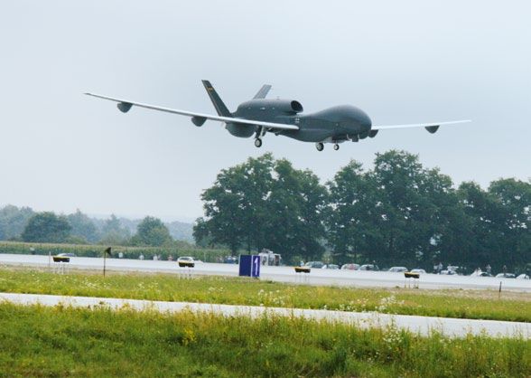
The costs of acquiring an unmanned system vary                 as those which could be developed. This impor-
     widely depending on the size of the vehicle in                 tant consideration will be pursued further and in
     question. An MUAV, for example the md4-200,                    more detail in Chapter 3.2.
     costs about €47,000, depending on the features
     it is equipped with. In comparison, the per-unit
     cost for a MALE-UAV, such as the Predator, is
                                                                    3.2 Advantages of UAS
     about $4.5 Million.18 The per-unit cost for alrea-
     dy developed and operational larger UAS can be
                                                                    The most important advantage of unmanned aeri-
     significantly less than those for manned aircraft
                                                                    al vehicles lies above all in their high endurance
     and helicopters. For example, according to report
                                                                    and the constant availability for operations which
     by the Congressional Research Service (CRS), the
                                                                    results from this. This advantage only applies to
     cost for manned aircraft systems which are used
                                                                    larger unmanned systems, however. As shown in
     in US border protection operations lies between
                                                                    Chapter 2 in the categorization of UAS systems,
     $8.6 million for the CBP Blackhawk helicopter and
                                                                    the maximum duration of a flight is up to 24 hours
     $36 million for the Lockheed P-3 Orion aircraft.
                                                                    for MALE systems and 48 hours for HALE systems.
     At the same time, the report also notes that the
                                                                    In contrast to manned aircraft, UAS can therefore
     operating costs for UAS are twice as high as those
                                                                    operate within a very long time horizon, as they
     for manned aircraft. This is due to the fact that
                                                                    are not dependent upon the physical endurance
     UAS requires a large amount of logistical support
                                                                    of a single pilot. Pilots, working from the ground
     and specially trained personnel, among other fac-
                                                                    control station, can work in shifts, allowing the
     tors.19 This illustrates the problem of separating
                                                                    unmanned platform to operate continuously. This
     the various costs related to UAS operation.
                                                                    is especially relevant for ongoing, repetitive ob-
                                                                    servation missions and represents an important
                                                                    advantage, as these kinds of missions are not
                                                                    only typically long in duration, but are also cha-
                                                                    racterized by monotonous flight operations.

                                                                    A further advantage of unmanned reconnaissance
                                                                    systems over manned aircraft is that of safety.
                                                                    Because the pilot is now located in the ground
                                                                    control station rather than in the aircraft itself, he
                                                                    is not in any danger during the flight. This is es-
                                                                    pecially relevant for dangerous civilian missions,
                                                                    such as observational flights over forest fires or
                                                                    research missions in the arctic. This advantage
                                                                    applies to all size categories of UAS.

                                                                    Increased flexibility is yet another advantage.
                                                                    Because of their size and aerodynamic characte-
                                                                    ristics, UAS are more maneuverable than manned
                                                                    aircraft.20 Thus, for example, smaller systems can
                                                                    also be used inside buildings which are in danger
                                                                    of collapse. Compared to satellites, they can also
                                                                    be used at any time to observe the area requi-
                                     md4-200 / © microdrones GmbH   red and can instantly provide dynamic imagery
                                                                    of a given subject. Satellite imagery, in contrast,
     To determine the costs associated with selecting               is usually available no sooner than 24 hours from
     a certain UAS system for a particular purpose, it              when it is requested, so that the information nee-
     is not sufficient to merely consider the develop-              ded about a specific situation can only be provi-
     ment and procurement costs of unmanned sys-                    ded with a significant delay - sometimes as much
     tems compared to the alternatives. Instead, it is              as 72 hours.21 This flexibility in respect to time
     necessary to also consider the cost advantages                 of operation is therefore especially important in
     offered by all UAS platforms in operation, as well             disaster management.
10   BIGS Policy Paper No. 1 / February 2012
UAS can also overcome the atmospheric distor- in an evaluation of operating costs, different argu-
tions which affect satellite imagery, as they ope- ments may be made to suggest that overall costs
rate from a much lower, more flexible altitude. may be lower when using a UAV. For example, the
Drawing upon the categorization in Chapter 2, it cost of operating a helicopter lies at about €3,000
can be seen that the different platform sizes also - €6,000 per hour. If the area or situation under
cover different operational altitudes, so that dif- observation is relatively compact, or if a situation
ferent flights at different altitudes are possible. only requires observation for a short time period
and manned vehicles are not required, the use of a
The use of highly developed sensors for recon-
MUAV would be an alternative to a helicopter.
naissance purposes is also an important advantage
of unmanned systems. A UAS vehicle may carry
and use different sensors, depending upon the size
of the aerial platform in question and its MTOW.
The variety of sensors available is very great.
Smaller UAS typically employ high quality video
and digital cameras. These can be accompanied by
infrared sensors which ensure observational capa-
bilities at night. However, other instruments may
also be used, for example gas sensors which pro-
vide current information during atomic, biological
or chemical (ABC) accidents. Larger UAS can also
be equipped with radar sensors, owing to their lar-
ger payload capabilities. To be able to provide data
independent of current weather conditions, sen-
sors with Synthetic Aperture Radar (SAR) can be
employed.22 In contrast to a satellite, the sensors
Camcopter S-100 / Shipboard Operation / © Schiebel Corporation
employed on a UAS can be changed throughout
its lifetime, ensuring that they are always state of The use of a smaller UAS could therefore reduce
the art, and UAS be retrofitted with newer, more the relatively mission cost. If a very large field of
innovative sensors. In the case of satellites, on observation over a longer time period is necessary,
the other hand, the technology onboard has to be a MALE-UAS would be a better option because of
“frozen” some years ahead to allow proper system their greater endurance, as fewer systems would
verification and validation.23 The sensors in a UAS be required to observe the area in question. A sin-
can be used for specialized civilian missions, or can gle system is able to collect a much larger volume
be used for more general tasks, as they can be of data. Therefore, in addition to overall operating
installed and exchanged as needed. This great be- costs, the cost per unit of information would also
nefit which is a result of the modularity of different seem to be an appropriate basis for making a cost-
sensor technologies reinforces UAS’ advantage of based decision.
flexibility, as it enables an unmanned vehicle to
In addition, the fact that the pilots are based in
accomplish a variety of civilian missions.
the ground control station leads to lower “main-
Therefore, the potentially high development and tenance costs”. The pilot himself no longer needs
procurement costs associated with UAS may be to learn to fly using the actual vehicle, but can
offset by lower operating costs and UAS’ longer gain the necessary practice in a simulator. The pi-
operational lifecycle. However, opinions differ wi- lot is also freed from the burden of regular health
dely on the question of cost advantages of UAS checks which are required at frequent intervals in
compared to manned vehicles and helicopters. the case of manned aircraft and which then often
While UAVNET at al. assume that UAS entails cost lead to absenteeism. Fuel costs are also reduced
advantages, a 2011 article about UAS in the Ger- by the lower operational weight of UAVs. Further-
man publication BehördenSpiegel is more skep- more, a UAV’s highly developed sensors offer opti-
tical and does not anticipate such advantages.24 mal support in analyzing data, as the “digital flood
Currently, the total per flight-hour costs of modern of information” can be reduced to the needed pa-
UAS exceed those of manned aircraft.25 However, rameters under observation.
Skrzypietz – Civil Use of UAS 11Therefore, the various advantages of UAS must critical infrastructure for scientific research.
be viewed as a holistic, comprehensive package The protection of maritime transportation against
when deciding whether UAS offers cost advan- piracy, which falls under the category of protec-
tages when it is employed in civilian observation tion of critical infrastructure, also overlaps with
missions. To date, almost no quantitative studies coastal surveillance under homeland security.
exist which examine or compare the difference in Coastal surveillance, in turn, is also useful in the
cost between manned and unmanned systems. field of environmental protection, as this can help
To be able to make a direct comparison between uncover illegal fishing practices. The observation
the two alternatives, a cost analysis is necessary of oil fields, an additional application in the en-
which takes potential applications in civilian fields vironmental protection category, could provide
into consideration. important information for disaster management.
These examples make it clear that these civilian
4 Potential Applications fields of application cannot be considered in com-
in Civilian Fields plete isolation from one another. Rather, the appli-
cation of UAS in the civilian sphere brings with it
The literature describes and discusses numerous economies of scale, as a reconnaissance missi-
areas in the civilian sector in which UAS could be on undertaken for one purpose can also be used
applied, often in case examples. To provide more to generate data for another purpose. Because of
structure and order to this rather eclectic collec- the aforementioned payload modularity, a plat-
tion of individual cases, the following section shall form can in principle be equipped with different
attempt to categorize them. Civilian application sensors, so that only one platform can be used to
fields can be subdivided into six categories which carry out several different civilian missions.
are presented in figure 3. Next, the application fields of scientific research,
The points listed under each of the six categories disaster management, protection of critical infra-
in figure 3 suggest interdependencies between the structure and homeland security will be examined
individual application fields. Thus, for example, in more detail. The benefit of UAS for selected ci-
it is possible to use data which are collected for vilian missions will be analyzed using the advan-
disaster management or in the protection of tages discussed in Chapter 3.
Figure 3:
Civilian Application Fields for UAS
Disaster Prevention and
Management
Scientific Research
• Forest fire monitoring and prevention
• Atmospheric research • Monitoring flooding
• Geological research • Earthquakes damage assessments
• Ecological research • Securing areas struck by hurricanes
• Studying hurricanes • Determination of ABC contamination in
• Vulcano observation disasters
• Transportation science • Searching for survivors after shipwrecks,
• Agriculture and forestry airplane accidents and in disaster areas
Environmental Protection Homeland Security
• Monitoring illegal fishing • Border protection
Civilian • Coastal surveillance
• Pollution emissions Applications for
• Observation of oil fields • Observing and securing
UAS
• Protecting water resources large public events
• Renaturalization
Protection of Critical Infrastructure
Communications Missions • Monitoring oil and gas pipelines
• UAV as a substitute for • Monitoring the power grid
satellites • Protecting maritime transportation from
• Telecommunications relays piracy Source:
• Observing traffic flows Diagram by
• Broadband communications Therese Skrzypietz.
12 BIGS Policy Paper No. 1 / February 20124.1 Use in Scientific Research over time.29 “It would be like parking a satellite
above the storm” 30 is how the director of NASA’s
Unmanned reconnaissance systems can be of UAS program in Boulder, Colorado, characterized
great importance for science. The variety of po- the use of large, unmanned systems for hurrica-
tential fields of application is very diverse and co- ne research. This statement also highlights UAS’s
vers a very wide array of scientific disciplines. In flexibility compared to satellites, which, owing to
particular, UAS is ideal for atmospheric research their great distance from the storm, cannot pro-
and the observation of volcanoes and hurricanes. vide as detailed data about the storm and cannot
Unmanned systems can also be very helpful in ag- shadow its movements.
riculture and forestry as well as in transportation
These examples clearly illustrate the wide varie-
science. As explained in the introduction, unman-
ty of civilian tasks for larger UAS in scientific re-
ned systems were developed in the United States
search. However, smaller UAS are also frequently
for scientific research in the early 1990s. The use
used for scientific research. For example, in the
of UAS for scientific purposes was tested at a very
ANDROMEDA (Application of Drone-Based Aerial
early stage and UAS is now used to an ever-incre-
Photographs - Mosaic Creation, Rectification and
asing degree. To examine and analyze the vari-
Data Analysis) research project, a smaller UAS
ous scientific applications of UAS more closely, it is
was developed which makes it possible to capture,
helpful to look at a few practical examples.
automatically process, and analyze aerial imagery,
From May to June 2002, a MALE-UAV was tested so as to collect geographic data from the air.31 In
above the North European Aerospace Test Range- 2010, with the help of this system, it was possi-
Area (NEAT) in the north of Sweden, including its ble to determine the extent of damage following
use for atmospheric research. The NEAT is com- a storm in the Thüringer forest region of Germa-
monly used for the aeronautical testing due to ny. The unmanned Carolo P 200 vehicle was flown
the low population density in the northern part over 3,100 hectares (7,657 acres) of forest, collec-
of Sweden. An Eagle UAV, developed by IAI and ting more than 3,000 images during its one-hour
operated by EADS, was used for the mission and flight.32 These images made it possible to create a
equipped with a condensation particle counter. very good, practical map of damaged trees, which
Using the instruments installed in the Eagle, it was was then quickly provided to the forestry workers,
possible to collect data at altitudes between 4,000 who were then able to use the information to pre-
and 7,500 meters (13,100 and 24,600 feet), ena- vent additional damage by bark beetles. Thus, in
bling an analysis of different levels of the atmos- the future, the use of smaller, unmanned systems
phere. From a scientific perspective, the flight was in forestry could represent an important civilian
Camcopter S-100
a complete success.26 application of UAS, if the regulatory framework is
In November 2005, a UAS demonstration project clarified. In Japan, smaller VTOL-UAVs have also
by the American National Oceanic and Atmosphe- played a supporting role in agriculture.
ric Administration (NOAA) successfully concluded The Institute for Geoinformatics at the University
following an almost 20-hour mission over the eas- of Münster is using MUAVs to investigate possible
tern Pacific. Carrying a 140 kg payload, the UAS
applications for smaller unmanned systems in the
Altair, a Predator variant, was able to collect at-
earth sciences.33 The project has developed and
mospheric data from the lower stratosphere (al-
uses its own ificopter, which can both collect ae-
titude 13,000 meters / 42,500 feet) for scientific
rial data from a bird’s eye perspective as well as
purposes.27 One year after the successful NOAA
process it.
mission, a civilian version of the predator was ac-
quired by NASA’s Dryden Flight Research Center MUAVs can also be put to excellent use in vulcano-
(DFRC) to support geoscientific research and to logy. Staff of the Institute of Aerospace Systems
help develop aerospace technology. This unman- at the Technische Universität Braunschweig have
ned system, named Ikhana, is also used as a plat- used a version of the Carolo UAS, similar to the
form to develop and test technologies and tech- one mentioned above, to successfully carry out
niques to improve the use of UAS.28 Furthermore, volcano observations in Ecuador.34 The unmanned
in 2010 the Global Hawk was used for hurricane system was able to fly into the crater of the active
observations and was able to collect very detailed volcanoes Cotopaxi and El Reventador and collect
data about how hurricanes develop and evolve images of lava flows.
Skrzypietz – Civil Use of UAS 13The possibility of undertaking risky missions, such Because of their high endurance, MALE and HALE
as volcano and hurricane observations, without UAS are of great interest to researchers in situa-
endangering the lives of aircraft crews underlines tions in which these systems can offer a view into
the safety advantages of UAVs compared to man- largely unresearched areas, enabling us to gain
ned aircraft. Thus, MUAVs can be used in regions, new insights in atmospheric science.
such as volcano craters, which are not reachable
by manned aircraft. Research missions over the
poles or across the open ocean, where an emer- 4.2 Disaster Prevention and
gency landing would entail considerable risk for a Management
pilot, are especially well-suited for a UAS.35 Addi-
tionally, the additional flexibility offered by UAS The use of UAS to prevent disasters and help
is very important, as unmanned vehicles can be address them once they have occurred is of par-
employed relatively independent of weather con- ticular value. For example, UAS can be used in
ditions. Furthermore, the examples cited above natural disasters such as forest fires, floods,
illustrate that, in the scientific area, it is necessary earthquakes and dangerous storms to observe
to collect data over a long, continuous period of and analyze the situation. At the same time, they
time. Here, MALE and HALE systems represent an support specific search and rescue operations, for
important option, due to their better endurance example searching for survivors of shipwrecks or
compared to manned vehicles. airplane crashes or for victims buried in avalan-
ches or other disasters. UAS can also be used to
gather information in other types of disasters, for
example ABC accidents or oil spills. In the past,
the use of UAS in disaster situations has proven to
be very helpful. As in the previous chapter, a num-
ber of practical examples will be cited which will
then be evaluated against existing alternatives.
In October 2007, the UAS Ikhana, mentioned pre-
viously, was used for reconnaissance operations
during the disastrous forest fires in California.37
Using specially installed thermal imaging sensors,
it was possible to pass the exact coordinates of
Ground Control Station of an UAS / © B. Berns, German Airforce
the flames on to the fire-fighting aircraft, making
In regard to their sensor capabilities, modular, it possible to better fight the fires. When compa-
unmanned reconnaissance systems also repre- red to satellites, the UAS’ capability to capture
sent a more advanced option for collecting data dynamic images at a higher resolution proved to
when compared to satellites, which can make im- be very beneficial for the firefighters. Their high
portant contributions to research. The collection endurance and the minimal risk to pilots are two
of atmospheric data in the air column itself using leading criteria which support the use of UAS in
instruments installed in UAVs also offers a broader forest fires. While the Ikhana was carrying out its
basis of data than collecting the information from successful mission in support of the firefighters,
above, via satellites. The automated processing of sensors it was carrying were also collecting a very
imagery also facilitates the analysis of the results. large amount of data about the fire itself. Later, it
was possible to use these data sets in research, an
All in all, UAS represents a very promising tool,
example of two different fields benefiting from a
especially for researchers in the earth and atmos-
single UAS mission.
pheric sciences. Regardless of the size of the plat-
form, its endurance, or its specific capabilities, UAS can not only be helpful during large forest
there will always be scientists who will use UAS fires, but can also support smaller, more limited
and who will demand new developments in this firefighting missions. For example, since 2007
field.36 Smaller systems are also well suited for Britain’s West Midlands Fire Service (WMFS) has
temporary use in research in small, predefined, employed the Incident Support Imaging System
spatially-limited areas. (ISiS), which uses a German md4-200 MUAV, to
14 BIGS Policy Paper No. 1 / February 2012observe the development of fires from the air. For and measure radiation levels. Thus, through the
example, during a fire event at a university in Oc- use of large and small unmanned reconnaissance
tober 2008, ISiS was used by the WMFS to provi- systems, it was possible to observe and better
de the firefighters at the fire with thermal imagery understand the dangers posed by the reactor, wi-
of the development of the fire on the roof of the thout endangering the lives of the response crews
building. With the help of these live images, it was by subjecting them to radiation.
immediately determined that the roof was in a
much weaker condition than expected and requi-
red special attention from the fire service.38 This
made it possible to direct the action against the
fire in a way that the risk to the firefighting per-
sonnel was minimized.
UAS can also support observations of flooding. Be-
cause of their high endurance, they make it pos-
sible to continuously collect information about the
situation as it evolves, both during the day and
at night. Flyover inspections of dikes can be con-
ducted at regular intervals and critical points can
be immediately identified. The ability to quickly
provide information about the scene and to ob-
serve the development of the flood is essential in
catastrophe management, so that the population EuroHawk landing in Manching / © EADS
can be warned early enough to escape to safety.
After the Indian Ocean Tsunami of 2004, the He-
Above all, it is UAS’ abilities to quickly produce ae-
ron MALE-UAS was used to locate missing persons
rial imagery of a disaster area and to measure the
and victims buried in rubble. A Swedish study has
levels of contaminants in the area which make it so
also shown that smaller UAS systems can be used
well-suited to disaster management. Two days af-
to effectively find people in a simulated disaster.41
ter the strong earthquake in Haiti in January 2010,
In this instance it is important to distinguish bet-
the Global Hawk was utilized for fourteen straight
ween the search for missing or buried people in a
hours to collect data on the extent of the catast-
disaster area and the specific search for a single
rophe. Using the high-resolution photographs ob-
missing person. Because a disaster usually ext-
tained during the mission, it was possible to locate
ends over a well-defined area which must be co-
usable takeoff and landing areas of helicopters and
vered in any search, UAS can be helpful in such
relief aircraft. This was one of the Global Hawk’s
instances. The value of UAS in the search for a
first disaster relief missions in the Caribbean.39
single missing person in a large area which can-
After the earthquake and subsequent tsunami in
not be well-defined is viewed more critically. While
Japan in March 2011, the Fukushima Daiichi nuc-
smaller unmanned systems with thermal imaging
lear power plant suffered heavy damage. Here too,
cameras can be used to support such operations
a HALE-UAS was flown over the disaster area and
from the air, teams on the ground with search dogs
the power plant to take pictures of the building
are more effective and thorough in such cases.42
and the flooded coastline. Using high-resolution
infrared sensors, it was possible to determine that For search and rescue missions in crisis zones, ae-
overheating was occurring within the power plant rial vehicles’ high endurance and ability to flexibly
buildings and to transmit these to the disaster res- observe a large area are decisive, especially for
ponse teams in real time. Through repeated flights maritime accidents on the open ocean. Thermal
by the unmanned system, the changes in the heat cameras make deployment possible at any time
source could be observed and the success of the of day or night and can especially helpful for al-
attempts to cool the reactor measured.40 Similarly, pine avalanches. However, to actually get aid to
in April 2011, the VTOL-UAV RQ-16 T-Hawk, men- the person in danger, a combination of UAS and
tioned above, was deployed directly at the reac- rescue personnel in helicopters or other vehicles
tor site to take pictures of the damaged facility is necessary.
Skrzypietz – Civil Use of UAS 15The use of UAS in disaster management and relief 4.3 Protection of Critical Infrastructure
is a very current topic which is currently being in-
vestigated and discussed in various research pro- An additional field of application for UAS is their use
jects. Since July 2008, the German Federal Minis- in protecting critical infrastructure. This includes
try of Education and Research (BMBF) has been the protection of oil and gas pipelines, electrical
funding the AirShield (Airborne Remote Sensing grid, the observation of rail and highway transpor-
for Hazard Inspection by Network-Enabled Light- tation, and of maritime routes, e.g. against piracy.
weight Drones) project, which intends to develop
a system which can collect data about a hazar-
dous situation from the air. In this project, smaller,
autonomous mobile aerial robots with lightweight
sensors are used that, for example, can be used in
an urban fire to determine and predict the threat
posed by the fire. The intent is to use these un-
manned systems to provide public authorities and
other organizations with information collected from
the air to support them in their decision-making,
so that they can better enable fulfill their security
responsibilities.43 In addition to Germany, the Uni-
ted States and the United Kingdom, many other
Camcopter S-100 / © Schiebel Corporation
countries, such as South Korea and France, are
also interested in the development of unmanned Europe’s natural gas pipeline system extends over
reconnaissance systems for disaster management. 300,000 km (186,400 miles). It is essential that
this large network, with its many branch lines, be
UAVs can also be a useful technical tool for relief
constantly monitored to prevent accidents and
organizations. For the Technische Hilfswerk (THW),
uncontrolled gas leaks, so that the energy supply
for example, smaller systems are of particular in-
can be secured and the safe operation of facilities
terest, as they can use thermal imaging to locate
can be guaranteed. Oil and gas pipelines in regions
buried victims and provide an overall picture of the
with extreme weather conditions, such as Russia,
situation in a disaster. Especially following a seve-
Alaska and Africa, must also be monitored and ins-
re earthquake, UAS would be more effective than
pected regularly to minimize supply risks. Pipeline
manned helicopters, because helicopters’ strong
systems are threatened by two different factors:
downdraft can lead to the collapse of buildings
natural hazards on the one hand, and man-made
which have been heavily damaged by the qua-
threats on the other. To minimize these risks, it
ke.44 Therefore, MUAVs can essentially be flown in
is necessary to get an understanding of the natu-
very close to an operations site and to damaged
ral and man-made hazards which exist along the
buildings in the disaster zone, without endange-
entire length of the pipeline and with 20 meters
ring rescue personnel. But it is not just smaller
(66 feet) of it. Furthermore, all transportation ac-
UAVs which are of interest for aid organizations.
tivities and other work undertaken with 200 me-
MALE systems would also be useful in principle, as
ters (660 feet) of the pipeline must be registered
they could be used as communications platforms
if these may affect or endanger the pipeline.45 The
in disaster zones, representing a more economi-
natural hazards include uncontrollable ground mo-
cal alternative to satellites and therefore reducing
vements as well as flooding. Man-made dangers
communications costs.
may arise through cable- or pipe-laying activities,
All-in-all, UAS represent an important additional drilling, and many other activities. Furthermore,
tool for disaster prevention and management. Even international oil and gas pipelines are increasingly
today, these examples make it clear that unman- threatened by war or terrorist attacks.46 Theft by
ned systems hold great potential for use in civilian the diversion of gas or oil from the pipeline also
disaster management and to reduce the informa- endangers the security and functionality of pipe-
tion gap in civil defense. UAS’ advantages in secu- lines. All of these dangers may lead to explosions
rity, flexibility, instant availability and endurance which can result in considerable property damage
support their use in disaster and crisis situations. or loss of life in densely populated areas.
16 BIGS Policy Paper No. 1 / February 2012The monitoring and inspection of energy infra- tional field of application which has been studied
structure currently takes place primarily with heli- in different research projects, and which is still
copters, smaller manned aircraft and foot patrols undergoing study. Test flights in these studies
and is very expensive in certain regions. The afo- are usually conducted with a MUAV. The spect-
rementioned threats have led to a sharp increase rum of applications for unmanned aerial systems
in the amount spent by governments and private in the transportation sector is very diverse. UAS
companies to secure oil and gas networks in re- can be used to observe the general situation
cent years. For pipeline operators, a reliable and and road conditions in normal road traffic, can
cost effective method of observing gas and oil li- offer support during accidents, or can be used
nes would be extremely important. Smaller, un- for scientific research on transportation. By con-
manned systems, as well as MALE-UAS, offer an tinuously observing traffic flows, UAS can collect
appropriate platform for such a continuous obser- data about the volume of road traffic and road
vation system.47 Once again, UAS’ high endurance congestion.51 This especially during peak times,
is the critical argument supporting the use of UAS such as for heavily-used highways during rush
for monitoring pipelines. hour. The information collected about traffic vo-
lumes can also be provided to drivers themsel-
The use of satellites as an alternative is proble-
ves, who can use them to avoid heavily-travelled
matic, as their availability to observe the territory
routes, relieving congestion. Such a pool of infor-
needed is currently very limited and very expen-
mation could not only be used for transportation
sive. Furthermore, their ability to collect data may
management, but would also be very useful for
be limited by clouds.48 In this respect, UAS offers
transportation research, reflecting the econo-
the advantage of flexibility, because it can opera-
mies of scale of UAS.
te at different altitudes and is always available to
observe the territory in question. For the protec- To date, video cameras and induction loops have
tion of critical infrastructure, then, the advantages primarily been used to monitor and collect infor-
of high endurance and flexibility are decisive, be- mation about traffic flows. However, helicopters
cause the monitoring of gas and oil pipelines can are also used by the police and other institutions
thus be carried out continuously and at any time to monitor traffic. Compared to fixed instrumen-
necessary. Despite these advantages, unmanned tation, unmanned systems have the advantage
systems are currently rarely used for monitoring of flexibility, because they can be flow into out of
pipelines owing to their lack of permission to ope- the way locations, where they can monitor traf-
rate in civilian airspace. Israel’s Aeronautics De- fic which results from drivers’ attempts to avoid
fense Systems had demonstrated that this appli- congestion. Compared to helicopters, UAS missi-
cation is possible and can be put into practice. The ons can be conducted without additional person-
company uses the UAS Aerostar to protect and nel expense and can be conducted almost inde-
monitor Chevron Texaco’s pipelines in Angola.49 pendently of duration limits, allowing them to be
flexibly deployed to monitor roadways. It is also
In all, fewer UAS systems than manned systems
conceivable that a UAS could be used to overfly a
are required to provide the necessary coverage
region in advance of a road construction project,
of oil and gas pipelines, meaning that, in prin-
to conduct information for land-use and cost be-
ciple, cost savings could be achieved through the
nefit analysis purposes. The use of a helicopter
use of such systems. The costs of a UAS mission
for such specialized purposes would not be cost
would have to be under $15 (US) per kilometer
effective. However, the use of smaller, unman-
of pipeline for them to be interesting for energy
ned systems is sometimes dependent on weather
infrastructure providers.50 So far, it has not been
conditions. Thus, for example, a UAS test for the
possible to calculate UAS’ actual costs per kilome-
Washington State Department of Transportati-
ter, because of a lack of legal frameworks. To the
on, carried out for traffic observation purposes,
extent that cost advantages over manned systems
had to be aborted due to high turbulence which
can be realized, UAS has great potential to sup-
affected the mini-UAV.52 If the platform is large
port pipeline monitoring.
enough, and therefore more weather resistant,
The use of UAS for the observation and protection UAS can provide information about current traffic
of the highway transportation system is an addi- situations without significant time delay.
Skrzypietz – Civil Use of UAS 17Unmanned aircraft are also well-suited to monito- on the other hand, larger MALE and HALE systems
ring roadways which are subject to avalanches or are likely to see the most use.
landslides. Because of the many positive results of
experiments using unmanned systems, and their
overall advantages, it is generally broadly recog- 4.4 Use in Homeland Security
nized that UAS can be very helpful and successful
in monitoring transportation.53 However, the inte- UAS can also be used in homeland security. This
gration of such platforms in the road transportati- civilian field of application overlaps somewhat with
on sector is only possible if the legal basis for this the protection of critical infrastructure and is the
is established. one which is most heatedly debated in society and
political circles. Civilian tasks related to homeland
The protection of critical infrastructure also inclu-
security include, in this case, border protection and
des the protection of maritime traffic against pi-
control, monitoring the coastline and providing se-
racy. In the last four years, the number of pirate
curity for large public events. The use of unman-
attacks on shipping has increased significantly.54
ned observation systems in homeland protection
The waters off the coast of Somalia have been
is especially relevant for state institutions and is
especially affected. Here too, UAS can be applied
already in heavy use in some countries. Using a
in the civilian sphere and are already being used
number of practical examples, the use of UAS in
for reconnaissance purposes after pirate attacks.
homeland security will be illustrated and critically
Because of their high endurance, MALE and HALE
evaluated in the following section.
systems make it possible to observe a very large
area of the affected region for a continuous period, For several years, the US Department of Homeland
so that quickly-approaching pirate vessels can be Security has been investing considerable sums in
seen as early as possible. the acquisition of UAS for border protection.
Kontrollstation
ADS-95 flying over Lucerne / © Swiss Airforce
In closing, it can be said that the protection of In fiscal year 2010 alone, $32 million were used
critical infrastructure is an important civilian task to purchase two additional unmanned aerial vehic-
which can be accomplished with the help of UAS. les for US Customs and Border Protection (CBP).55
Depending on the type of mission in question, dif- Currently, the CPB has six Predator UAS that are
ferent platform categories can be used as recon- used in support of border operations on the sou-
naissance tools. Smaller systems with low pay- thwestern and northern borders of the US. An un-
loads and relative low operating altitudes are best manned reconnaissance vehicle is used in Europe
suited for observing road traffic. Both larger and as well. Since 2006, the Swiss company RUAG has
smaller unmanned vehicles can be used to monitor used a Ranger UAV to monitor the Swiss border.
pipelines. For monitoring maritime transportation, The German federal police have been considering
18 BIGS Policy Paper No. 1 / February 2012You can also read