COASTAL SWAMP SCLEROPHYLL FOREST OF NEW SOUTH WALES AND SOUTH EAST QUEENSLAND
←
→
Page content transcription
If your browser does not render page correctly, please read the page content below
Conservation Advice for the
  COASTAL SWAMP SCLEROPHYLL FOREST OF NEW SOUTH WALES
              AND SOUTH EAST QUEENSLAND
In effect under the Environment Protection and Biodiversity Conservation Act 1999 from
8 December 2021.

This document combines the conservation advice and listing assessment for the threatened
ecological community. It provides a foundation for conservation action and further planning.

        Coastal Swamp Sclerophyll Forest of New South Wales and South East Queensland © Louise Armstrong

The Coastal Swamp Sclerophyll Forest of New South Wales and South East Queensland
ecological community occurs within country (the traditional lands) of several First Nations
peoples, including the Gureng, Quandamooka, Bajtala, Gubbi, Kabi, Yuggera, Bundjalung,
Gumbaynggirr, Dainggatti, Biripi, Birpai, Worimi, Wonnarua, Awabakal, Darkinjung, Kurin-gai,
Eora, Dharug, Tharawal/D’harawal and Yuin. We acknowledge their culture and continuing link
to the ecological community and the country it inhabits.

Conservation Status
The Coastal Swamp Sclerophyll Forest of New South Wales and South East Queensland
ecological community was listed in the Endangered category of the threatened ecological
communities list under the Environment Protection and Biodiversity Conservation Act 1999
(Cwlth) (EPBC Act) effective from 8 December 2021.

The ecological community was assessed by the Threatened Species Scientific Committee to be
eligible for listing as Endangered under criteria 2 and 4. The Committee’s assessment is at
Section 7. The main factors that make the threatened ecological community eligible for listing in
the Endangered category are the nature of its geographic distribution together with severe loss
of integrity due to ongoing threats from land clearing and fragmentation, changes in hydrology,
weeds and invasive fauna, disease, and inappropriate fire regimes.

Ecological communities can also be listed as threatened under state and territory legislation. At
the time of this advice, the ecological community corresponds closely with several Regional
Ecosystems (REs) in Queensland and with the Swamp Sclerophyll Forest on Coastal Floodplains
of the NSW North Coast, Sydney Basin and South East Corner bioregions ecological community
listed under NSW legislation. More information is at Section 2.2.7.

                         Department of Agriculture, Water and Environment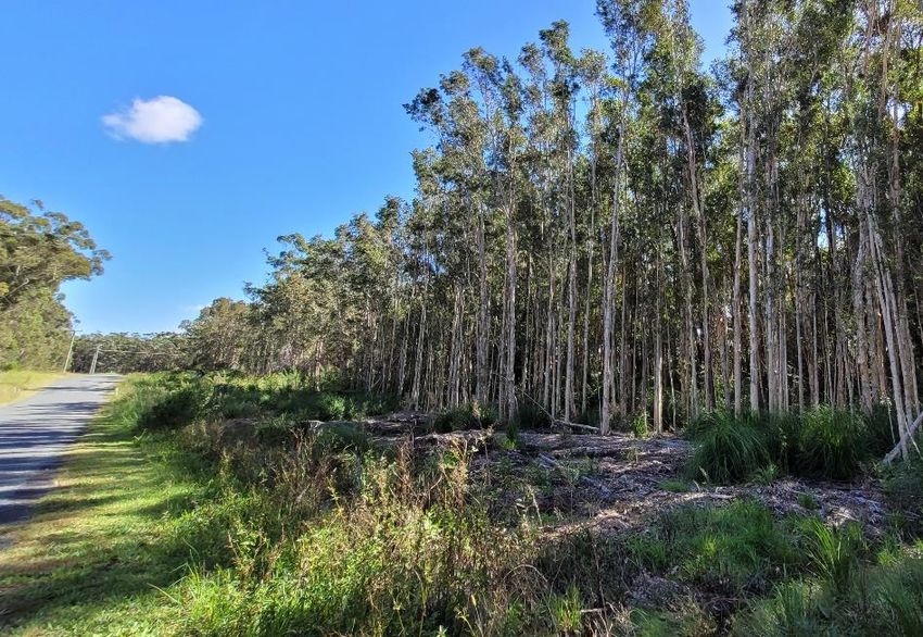
Recovery Plan Decision
The Minister decided, in line with the Committee’s recommendation, that a recovery plan is not
required at this time. The Committee’s recommendation is at Section 7.3.
Coastal Swamp Sclerophyll Forest of New South Wales and South East Queensland ecological community
                                                   Conservation Advice

CONTENTS

1    Ecological community name and description ..................................................................................................................4
  1.1     Name .........................................................................................................................................................................................4
  1.2     Description of the ecological community and the area it inhabits ................................................................4
2    Identifying areas of the ecological community ............................................................................................................. 10
  2.1     Key diagnostics.................................................................................................................................................................. 10
  2.2     Additional information to assist in identifying the ecological community ............................................ 11
  2.3     Condition classes, categories and thresholds ...................................................................................................... 15
  2.4     Areas/Habitat critical to the survival of the ecological community .......................................................... 17
  2.5     Areas of high value - surrounding environment and landscape context ................................................. 17
3    Cultural significance of the ecological community...................................................................................................... 19
4    Threats ............................................................................................................................................................................................ 20
  4.1     Threat table......................................................................................................................................................................... 20
5    Existing management plans .................................................................................................................................................. 27
  5.1     State management plans ............................................................................................................................................... 27
  5.2     Recovery, threat abatement and wildlife conservation plans ...................................................................... 28
  5.3     Plans relating to Cultural Heritage management and/or Indigenous Protected Areas (IPAs) ..... 29
  5.4     Existing protection under state laws ....................................................................................................................... 30
  5.5     Existing protection in reserves .................................................................................................................................. 30
6    Conservation of the ecological community .................................................................................................................... 31
  6.1     Conservation objective .................................................................................................................................................. 31
  6.2     Principles and standards for conservation ........................................................................................................... 31
  6.3     Priority conservation and research actions ......................................................................................................... 32
7    Listing assessment and recovery plan recommendation ......................................................................................... 43
  7.1     Eligibility for listing ......................................................................................................................................................... 43
  7.2     Public consultation .......................................................................................................................................................... 59
  7.3     Listing and Recovery Plan Recommendations .................................................................................................... 60
Appendix A - Species lists................................................................................................................................................................... 61
  A1 Flora ........................................................................................................................................................................................... 61
  A2 Fauna ......................................................................................................................................................................................... 68
Appendix B - Weeds .............................................................................................................................................................................. 72
Appendix C - Relationship to other vegetation classification and mapping systems .............................................. 73
  C1 Queensland vegetation classifications ........................................................................................................................ 73
  C2 NSW vegetation classifications ...................................................................................................................................... 74
Appendix D – Cultural heritage management and First Nations peoples ..................................................................... 77
  D1.     First Nations associated with Coastal Swamp Sclerophyll Forests (at the time of this advice).... 77
  D2.     Legislation and guidelines related to cultural heritage management ..................................................... 78
References................................................................................................................................................................................................. 79

                                                                     Threatened Species Scientific Committee
                                                                                  Page 3 of 94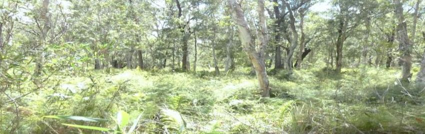
This Conservation Advice contains information relevant to the Primary conservation objective
(Section 6.1) by:
• describing the ecological community and where it can be found (Section 1);
• outlining information to guide its identification and conservation, including the key
diagnostic features, condition thresholds, categories and classes, and additional
information to identify the ecological community (Section 2);
• summarising the cultural significance of the ecological community (Section 3);
• identifying the key threats to the ecological community (Section 4);
• summarising the existing protections and plans relevant to the ecological community
(Section 5);
• outlining the priority conservation and research actions that could be undertaken to stop
its decline, support its recovery and recognise the importance of involving landholders
and Indigenous people in its conservation (Section 6); and
• presenting evidence as to why the ecological community is eligible for listing as
nationally threatened (Section 7).
1 Ecological community name and description
1.1 Name
The ecological community was originally nominated under the name “Melaleuca dominated
Temperate Swamp Sclerophyll Forests on Coastal Floodplains of Eastern Australia”.
The name of the ecological community is the “Coastal Swamp Sclerophyll Forest of New South
Wales and South East Queensland” (hereafter referred to as the “Coastal Swamp Sclerophyll
Forest” or the “ecological community”). The name refers to the geographic areas, typical wetland
type, vegetation structure and landscape position which characterise the ecological community.
1.2 Description of the ecological community and the area it inhabits
The ecological community includes the plants, animals and other organisms typically associated
with forested palustrine wetlands1, or swamp forests, found in the temperate to subtropical
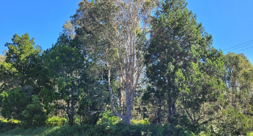
coastal valleys of Australia’s east coast (Keith et al. 2020). The Coastal Sclerophyll Swamp Forest
often has a layered canopy, dominated by melaleucas and/or Eucalyptus robusta (Bell & Driscoll
2016; DELWP 2016; DPI 2016; Miles 2006; Queensland Government 2019a; Sheringham et al.
2008). The ecological community occurs between the Great Dividing Range and the coastline
from near Gladstone in Queensland, through to the south coast of New South Wales.
This section describes the natural and largely undisturbed state of the ecological community. As
a result of past disturbance, most patches of the ecological community no longer exist in a
benchmark state. Section 2 provides information to identify which patches retain sufficient
conservation values to be considered a matter of national environmental significance.
1Palustrine wetlands are vegetated, non-riverine or non-channel systems, which include billabongs, swamps, bogs,
springs, soaks etc. and have more than 30% emergent vegetation.
wetlandinfo.des.qld.gov.au/wetlands/ecology/aquatic-ecosystems-natural/palustrine/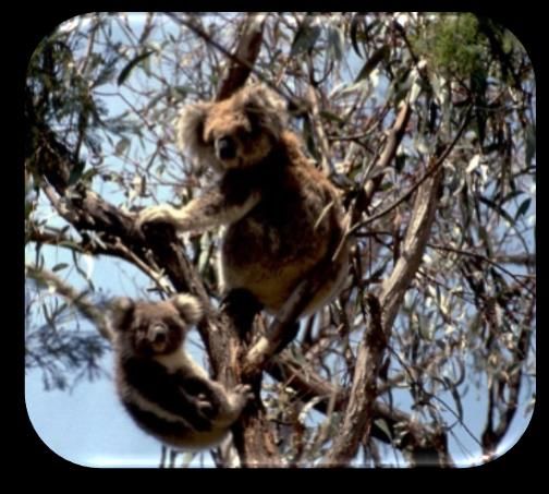
Coastal Swamp Sclerophyll Forest of New South Wales and South East Queensland ecological community
                                                Conservation Advice

1.2.1     Location and physical environment

The Coastal Swamp Sclerophyll Forest ecological community occurs on the mainland and islands
near to the coast (within 20 km) within the following IBRA2 Bioregions: South East Queensland
(SEQ); NSW North Coast (NNC); Sydney Basin (SYB); and the Bateman subregion of the South
East Corner (SEC2).

The ecological community typically occurs in low-lying coastal alluvial areas with minimal relief,
such as swamps, floodplain pockets, depressions, alluvial flats, back-barrier flats, fans, terraces,
and behind fore-dunes (DPI 2016; Queensland Government 2019a). The ecological community
most commonly occurs at elevations below 20m above sea-level (ASL) but may occur
occasionally up to 220m ASL on hill slopes, for example in association with perched swamps and
lakes, or a naturally high-water table.

The frequency and duration of water inundation, salinity and nutrient content of the soil, and
latitude influences the vegetation composition of the Coastal Swamp Sclerophyll Forest. The
ecological community is found on hydric3 soils, which are either waterlogged or intermittently
or episodically inundated for typically between one to three months per year, often seasonally
(NSW DPI 2016; NSW EPA 2016a, b; Queensland Government 2019a). The soils on which the
ecological community is found, are formed by unconsolidated sediments4 and include alluvial
deposits, as well as soils that are primarily marine or aeolian sand in origin, but where silts,
clays and organic matter have been incorporated, such as inter-barrier creek deposits, within or
along the margins of, coastal barrier systems (Tozer et al. in prep.). They are often stained black
or dark grey from humus (NSW Scientific Committee 2011). While the Coastal Swamp
Sclerophyll Forest occurs on the soil types as described above, the primary basis for determining
whether an area is the nationally listed ecological community is based on the biological
composition of an area. The features that distinguish an area containing the ecological
community from other ecological communities are identified in Section 2.

1.2.2     Vegetation structure

The structure of the Coastal Swamp Sclerophyll Forest ecological community varies from open
woodland to closed forest with a crown cover5 of at least 10% and typically no more than 70%
(Tozer et al. in prep.). In an intact forest, the canopy can be layered, with a sub-canopy of
melaleuca grading into a taller mixed melaleuca and/or eucalypt canopy. Canopy density, light
availability, water regime, salinity level and soil fertility influence the development and

2 IBRA refers to the Interim Biogeographical Regionalisation of Australia. IBRA regions are large geographically
distinct areas of similar climate, geology and landform with corresponding similarities in their vegetation and animal
communities. The version current at the time of this advice is IBRA v7 (DoE, 2013), which divides Australia into 89
bioregions and 419 subregions, including offshore islands.
3Soil that is wet long enough to produce anaerobic conditions (at least periodically), thereby influencing the growth of

plants: wetlandinfo.des.qld.gov.au/resources/static/pdf/ecology/soils/soils-report/01047-soil-indicators-qld-
wetlands-lowres.pdf
4Unconsolidated sediments include Quaternary deposits of coastal barrier, estuarine, fluvio-deltaic and alluvial origin

that have not become lithified. Coastal Quaternary mapping of the southern Hunter to northern Illawarra regions,
New South Wales. Quarterly Notes: NSW DPI.
www.resourcesandgeoscience.nsw.gov.au/__data/assets/pdf_file/0009/584037/QN-146.pdf
5 The crown cover is measured as the % covered by the total area within the vertical projection of the periphery of the

tree crowns, where the tree crowns are considered to be solid (National Committee on Soil and Terrain 2009).
                                          Threatened Species Scientific Committee
                                                       Page 5 of 94
composition of the understorey flora (Tozer et al. 2010; NSW Scientific Committee 2011;
Queensland Government 2019a; Tozer et al. in prep.).

1.2.3   Flora

1.2.3.1 CANOPY (AND SUB-CANOPY) SPECIES
The Coastal Swamp Sclerophyll Forest typically features a canopy and/or sub-canopy dominated
by Melaleuca spp. and/or Eucalyptus robusta. Other eucalypts, which are also tolerant of regular
inundation and are adapted to sandy soils, may emerge from the canopy with the mix of species
present varying depending on the location. Eucalypt trees other than E. robusta that occur
scattered through the canopy, often emergent, in some areas but do not dominate the canopy of
a patch, include Corymbia intermedia (Pink Bloodwood), E. tereticornis, (Forest Red
Gum/Queensland Blue Gum), E. longifolia (Woollybutt), E. botryoides (Southern
Mahogany/Bangalay) and E. ovata (Swamp Gum). Lophostemon suaveolens (Swamp Box/Swamp
Turpentine) can be an associate (typically minor) in the canopy north from the Hastings River
(Griffith & Wilson 2007a, b).

In the northern extent of the ecological community (northern SYB to the SEQ bioregion) the
canopy is typically dominated or co-dominated by Melaleuca quinquenervia (Broad-leaved
Paperbark) and/or Eucalyptus robusta (Swamp Mahogany). In some other areas (e.g., when
more saline) in the northern (e.g. Central Coast) and the southern SYB (near Jervis Bay) and SEC
bioregions, Swamp Mahogany and/or M. ericifolia (Swamp Paperbark) typically dominate or co-
dominate. Where Swamp Paperbark occurs, it can form a dense scrub-forest which can out-
compete other canopy species. Regional variants of the ecological community with canopies
dominated by other melaleuca and other species can occur. For example, M. biconvexa (Biconvex
Paperbark) in the southern extent and in northern extent, M. dealbata (Swamp Teatree/Blue-
leaved Paperbark), Glochidion ferdinandi (Cheese Tree) and G. sumatranum. In some other (e.g.
slightly saline) areas, Acmena smithii (Lilly Pilly) and M. linariifolia (Narrow-leaved
Paperbark/Flax-leaved Paperbark) may also be common. In many areas, Casuarina glauca
(Swamp Oak) occurs as a subdominant in patches of the ecological community but where it
dominates over a large area this is indicative of a separate ecological community that is
nationally listed, the Coastal Swamp Oak (Casuarina glauca) Forest of New South Wales and
South East Queensland. In some areas adjacent to lowland or littoral rainforest, rainforest
species such as Cupaniopsis anacardioides (Tuckeroo), Endiandra sieberi (Hard Corkwood),
Homalanthus populifolius (Bleeding Heart/Native Poplar) and Melicope elleryana (Pink-flowered
Doughwood) may become locally abundant (NSW Scientific Committee 2011; Queensland
Government 2019a).

In some areas, other melaleuca species such as M. linariifolia (Flax-leaved Paperbark),
M. styphelioides (Prickly Paperbark or Prickly-leaved Tea-tree); or other tea-tree species (i.e.
Leptospermum polygalifolium subsp. polygalifolium) are likely to be present and may be locally
common in stands, but they do not dominate across a patch (NSW Scientific Committee 2011).

Other canopy or sub-canopy species can also include the following shrubs and trees: Acacia
leiocalyx (Black wattle), A. melanoxylon (Blackwood), Alphitona excelsa (Red Ash, Soapbush, Soap
Tree), Callistemon salignus (White/Willow Bottlebrush), Cupaniopsis anacardioides (Tuckeroo),
Elaeocarpus reticulatus (Blueberry Ash), Glochidion ferdinandi (Cheese Tree) and G. sumatranum,
Melicope elleryana (Pink-flowered Doughwood), and Pittosporum undulatum (Sweet
Pittosporum). Other characteristic species in some areas include Livistona australis (Cabbage
Tree Palm) and Lophostemon suavolens (NSW Scientific Committee 2011; Tozer et al. in prep.).

Vines are frequently found on the trunks and climbing into the crown of melaleucas and
eucalypts within the ecological community, notably the woody vine Parsonsia straminea
(Common silk-pod), Gynochthodes jasminoides (Climbing Scrub-orange) and Stephania japonica
Coastal Swamp Sclerophyll Forest of New South Wales and South East Queensland ecological community
                                                Conservation Advice

var. discolour (Snake-vine) (NSW EPA 2016a, b; OEH 2016; Queensland Government 2019a;
Tozer et al. in prep.). Epiphytic plants, such as Cymbidium suave (Snake Orchid), can also be
found on the branches of larger trees (Keith et al. 2007).
1.2.3.2 GROUND-LAYER SPECIES
The understorey has a diverse range of hydrophytic plants including some species tolerant of
brackish water in proximity to estuarine areas. Ground layer composition is variable depending
mostly on latitude, canopy cover, inundation regime and disturbance. A mid-dense to dense
cover of freshwater sedges, ferns and grasses is common, with some brackish species evident in
sites closer to estuarine areas.

Typically occurring species include Blechnum spp. (syn. Telmatoblechnum spp.), Calochlaena
dubia (False Bracken), Gahnia spp., particularly Gahnia clarkei (Tall Saw-sedge), Hypolepsis spp.,
Imperata cylindrica (Blady Grass), Baumea spp. (syn. Machaerina spp.) (Twig-rushes) and
Pteridium esculentum (Bracken). Other grasses, sedges, reeds, and herbs that commonly occur,
depending on local conditions, include Baloskion spp. (plume rushes), Carex appressa (Tall
sedge), Centella asiatica (Indian Pennywort), Dianella caerulea (Blue Flax Lily), Entolasia
marginata (Bordered Panic), E. stricta (Wiry Panic Grass), Hemarthria uncinate (Mat Grass),
Isachne globose (Swamp Millet), Ischaemum austral (Large Bluegrass), Juncus spp., Lobelia ssp.,
Lomandra longifolia (Spiny-headed Mat-rush), Oplismenus spp., Persecaria spp. (Knotweeds),
and Viola hederacea (Ivy-leaved Violet) (Tozer et al. in prep.). Orchids, including the nationally
listed Phaius australis (Common Swamp-orchid) and scramblers such as Glycine clandestina
(Twining Glycine) and G. tabacina (Glycine Pea, Variable Glycine) also occur in some patches.

Halophytic species may occur more commonly in the ground layer at lower elevations closer to
estuarine sites or where groundwater is influenced by brackish inflows, for example, twig-
rushes. If the canopy cover is dense, limiting light penetration results in a ground layer that is
almost devoid of herbs and fosters cryptogams such as mosses (including sphagnum), lichens
and liverworts. Sphagnum moss may also be regularly present in waterlogged patches. At wetter
sites or during periods of inundation, the ecological community supports wetland specialist
plants, such as Cycnogeton procerum (Water Ribbons). During drier periods, there are a range of
grasses that are likely to be more dominant (Griffith & Wilson 2007a, 2008; NSW EPA 2016a, b;
OEH 2016; Queensland Government 2019a).

There is also often a dense leaf-litter and logs from fallen trees in the ground layer.

A more comprehensive list of characteristic flora species, including threatened species, is in
Appendix A.

1.2.4     Fauna

A wide array of animals is part of the Coastal Swamp Sclerophyll Forest ecological community,
supporting healthy ecosystem function through pollination, seed dispersal, soil turnover,
nutrient cycling, and predator/prey interactions. The vegetation provides key feeding, breeding
and roosting habitat for water-dependant, arboreal and ground-dwelling mammals, birds,
reptiles, frogs, and invertebrates, including several nationally listed animal species.

                                      Threatened Species Scientific Committee
                                                   Page 7 of 94
1.2.4.1 AQUATIC FAUNA Water-dependant animals strongly associated with the Coastal Swamp Sclerophyll Forest include the threatened Xeromys myoides (Water mouse) and frogs associated with paperbark swamps, such as the nationally listed Litoria olongburensis (Wallum Sedge frog) (Hines et al. 2002; Meyer et al. 2006). Other nationally listed frogs that may be present include Litoria aurea (Green and Golden Bell Frog) and Mixophyes iteratus (Giant Barred Frog) (TSSC 2017b). Other water-dependent species that occur as part of the ecological community include Chelodina longicollis (Eastern Long-necked Turtle) (OEH 2020d), Hydromys chrysogaster (Water Rat/Rakali), Intellagama lesueurii (Water Dragon) (Cogger 2014) and Australia's only true fishing bat, Myotis macropus (Large-footed or Southern Myotis) (OEH 2020e). Small fish, including galaxiids, and eels (DPI 2019) may be found in the ecological community, particularly when it is more connected to river systems during periods of inundation. The ecological community also includes aquatic invertebrates such as the NSW-listed Petalura gigantea (Giant Dragonfly) (OEH Species profile: Accessed 14 March 2021) and the QLD-listed Tenuibranchiurus glypticus (Swamp Yabby) (Dawkins et al. 2010; Queensland Museum 2020). The Coastal Swamp Sclerophyll Forest is also found in, or as part of, nationally6 and internationally7 important wetlands where waterbirds, such as Rostratula australis (Australian Painted Snipe) and some migratory waders, such as the Calidris tenuirostris (Great Knot) are known to be associated with the ecological community (Marchant & Higgins 1993; Higgins & Davies 1996; Boone et al. 2016). The melaleucas and reed beds that fringe the waterbodies provide roosting sites and breeding areas for colonially nesting Threskiornis spinicollis (Straw- necked Ibis), Platalea regia (Royal Spoonbill) and other waterbird species. 1.2.4.2 GROUND-DWELLING FAUNA Ground dwelling species that play a functionally important role in the ecological community include the nationally listed Isoodon obesulus (Southern Brown Bandicoot) (TSSC 2016b) and Potorous tridactylus (Long-nosed Potoroo). These species forage in the leaf litter and soil for invertebrates, fungi, plant root nodules and bulbs. Ground-dwelling birds such as Menura novahollandie (Superb Lyrebird) and Alectura lathami (Australian Brush-turkey or gweela), also move soil and distribute nutrients which benefit the plants (Eldridge & James 2009). The Superb Lyrebird flushes out insects, which are also retrieved by its companion species Pycnoptilus floccosus (Pilotbird) (Higgins et al. 2001). Dasyornis brachypterus (Eastern Bristlebird) is another nationally listed species found in the ground layer of the ecological community (OEH 2012a). Ground mammals depend on the vegetation for nesting materials. Where the understorey is denser it provides cover and shelter for smaller mammals such as the vulnerable Pseudomys novaehollandiae (New Holland Mouse) (Norton et al. 2010 cited in TSSC 2010b) and the state- listed Planigale maculate (Common Planigale) (TSSC 2016c; Queensland Museum; OEH Species Profile: Accessed 2 August 2019). Other mammals that are part of the Coastal Swamp Sclerophyll Forest include the nationally listed Dasyurus maculatus (Spot-tailed Quoll, SE mainland population) (TSSC 2004), as well as more common species such as Wallabia bicolor (Swamp Wallaby) and Tachyglossus aculeatus (Short-beaked Echidna). 6 The Directory of Important Wetlands in Australia (DIWA) identifies, describes, and provides important information on Australia’s Wetlands. www.environment.gov.au/water/wetlands/australian-wetlands-database/directory- important-wetlands 7 Ramsar wetlands: representative, rare or unique wetlands, or are important for conserving biological diversity. www.environment.gov.au/water/wetlands/australian-wetlands-database/australian-ramsar-wetlands
Coastal Swamp Sclerophyll Forest of New South Wales and South East Queensland ecological community
                                                 Conservation Advice

Reptiles include the state-listed Cyclodomorphus michaeli (Mainland She-oak Skink) (DEPI
2014), Lissolepis coventryi (Swamp/Eastern Mourning Skink), and snakes such as Hoplocephalus
bitorquatus (Pale-headed Snake) (OEH Species Profile; Queensland Museum Species Profile:
Accessed 25 September 2019).

The ground layer plants also provide food for important pollinators and their larvae, including
butterflies such as the nationally listed Argynnis hyperbius inconstans and the state-listed
Ocybadistes knightorum (Black Grass-dart), which depends upon restricted patches of the state-
listed Alexfloydia repens (Floyd’s Grass) (Andren and Cameron 2012; 2014; OEH 2020a). More
commonly occurring butterfly species such as Tisphone Abeona (Sword-grass Brown (Braby
2004) can often be seen flying around the sedges and lower canopy.

1.2.4.3 ARBOREAL SPECIES
Many animals that are part of this ecological community inhabit the canopy, dependent on the
large amounts of seasonal pollen, nectar, fruit, and seeds produced by the melaleucas, eucalypts
and other plants. These species, particularly birds, bats, possums and gliders, tree frogs and
insects, have an important role in the health and functioning of the ecological community
including pollination and as part of important predator prey-relationships. Many are nocturnal
and will shelter during the day in the canopy, hollows and crevices found in mature trees
(Gibbons and Lindenmayer 2002). The nationally listed Phascolarctos cinereus (Koala) is also
strongly associated with Coastal Swamp Sclerophyll Forest, particularly where favoured food
trees8 such as Swamp Mahogany and Broad-leaved Paperbark dominate and/or Forest Red Gum
is present (Queensland Parks and Wildlife Service 2002; OEH 2018; Queensland Government
2019b; Dr J. Aldenhoven, pers. comm. 10 May 2021). A connected forest floor provides a safe
way for Koalas to traverse the ground between trees to find mates and new food supplies
(McAlpine et al. 2015 cited in Neldner et al. 2017).

Other notable arboreal mammals associated with a healthy ecological community include
possums and gliders, such as the nationally listed Petauroides volans (Greater Glider) and flying
foxes. The nationally listed Grey-Headed Flying Fox (Pteropus poliocephalus), and other flying
foxes (Pteropus spp.) feed on the fruit, flowers, pollen, and nectar found within the Coastal
Swamp Sclerophyll Forest. While flying foxes are highly mobile and can move up to hundreds of
kilometres to follow the flowering and fruiting of food sources, they can set up “camps” within
the Coastal Swamp Sclerophyll Forest, as is the case with one of the largest colonies in the
Sydney region that currently live within the forest at Lachlan Swamp in Centennial Park. Smaller
bats, such as Syconycteris australis (Common Blossom-bat) (Booth and Low 2005; Eby and Law
2008; DECCW 2009) and Rhinolophus megaphyllus (Eastern Horseshoe-bat) (Churchill 2008) are
also found within the ecological community.

Nectar flows produced within the ecological community attract a large number of bird species
that also utilise nesting habitat found within the ecological community. Species recorded
foraging in flowering coastal Swamp Mahogany forests include the nationally listed honeyeaters,
Anthochaera phrygia (Regent Honeyeater) (TSSC 2015a; Commonwealth of Australia 2016; OEH
2020c) and Grantiella picta (Painted Honeyeater). These critically endangered nectivores also

8Koalahabitat and feed trees www.environment.nsw.gov.au/topics/animals-and-plants/native-animals/native-
     animal-facts/koala/koala habitat

                                       Threatened Species Scientific Committee
                                                    Page 9 of 94
utilise the flowers of canopy species such as the native mistletoe, Amyema cambagei. Many
lorikeets and parrots, including the critically endangered Lathamus discolor (Swift Parrot) (TSSC
2016a) occasionally feed in the canopy of the Coastal Swamp Sclerophyll Forest. The trees and
shrubs of the ecological community are also home to insectivorous birds, such as Pachycephala
rufiventris (Rufous Whistler), fairy-wrens and robins. The canopy also provides shelter for large,
predatory birds, such as forest owls, for example, Ninox strenua (Powerful Owl) (DEC 2006), and
the nationally listed Erythrotriorchis radiatus (Red Goshawk) (TSSC 2015).
Reptiles and amphibians that may inhabit the canopy include tree-frogs (Litoria spp.) and the
threatened, partly tree-dwelling Hoplocephalus stephensii (Stephens' Banded Snake) (OEH
2020b). Invertebrates that inhabit canopy trees within the ecological community include native
bees such as Amegilla chlorocyanea (Blue-banded Bee), sand wasps, butterflies, moths, and ants
(Braby 2004; Sands 2018), some of which help pollinate plant species or are prey for canopy
birds and mammals.
A more comprehensive list of fauna species of the ecological community is in Appendix A.
2 Identifying areas of the ecological community
Section 2 describes this ecological community and the area it inhabits. This section provides
additional information to assist with the identification of the ecological community and
important occurrences of it.
The Coastal Swamp Sclerophyll Forest intergrades with other vegetation types and ecological
communities (see Section 2.2.7). Key diagnostic characteristics are used to identify an area of
native vegetation as being the Coastal Swamp Sclerophyll Forest , and define the features that
distinguish it from other communities and habitat types, noting that additional information to
assist with identification is provided in the other sections of this document, particularly the
description (Section 11) and Appendix A - Species lists.
2.1 Key diagnostics
The key diagnostic characteristics are designed to allow identification of the ecological
community irrespective of the season.
Areas of vegetation that do not meet the key diagnostics do not support the nationally listed
ecological community.
The ecological community is defined as patches of native vegetation meeting the description in
Section 1 that meet the following key diagnostic characteristics:
• Occurs on the mainland and islands near to the coast (within 20 km) from South East
Queensland to south-eastern NSW specifically within these IBRA Bioregions: South
Eastern Queensland (SEQ); NSW North Coast (NNC); Sydney Basin (SYB) and the
Bateman sub-region of the South East Corner (SEC).
• Occurs in coastal catchments typically below 20m ASL, but occasionally up to 220m ASL.
• Occurs on hydric soils with inundation patterns ranging from intermittent to episodic.
• The vegetation structure varies from tall closed to open forest to woodland, to dense
(closed) shrubland or scrub forest. Minimum crown cover (see footnote 5, p. 4) is at least
10%, but it is more typically in the range 50% to 70%.Coastal Swamp Sclerophyll Forest of New South Wales and South East Queensland ecological community
Conservation Advice
• From South East Queensland to the Sydney Basin Bioregion, the canopy9 is typically
dominated or co-dominated by Melaleuca quinquenervia and/or Eucalyptus robusta. In
some areas, the canopy may be locally dominated by other melaleuca species including
M. dealbata (SEQ bioregion) (rarely); M. biconvexa (mid-NSW coast to south of Sydney);
M. decora (north of Shoalhaven), frequently with Parsonsia straminea climbing on the
trunks of canopy species. In the SEC bioregion, M. ericifolia may occur as a dominant
canopy or sub-canopy species.
• Other tree species may occur in the canopy (or sub-canopy) in some areas, but they are
not dominant across a patch, including Casuarina glauca, Banksia spp., Callistemon
salignus, Corymbia intermedia (Pink Bloodwood), E. tereticornis, (Forest Red
Gum/Queensland Blue Gum), E. longifolia (Woollybutt), E. botryoides (Southern
Mahogany/Bangalay), E. ovata (Swamp Gum), Livistona australis and/or Lophostemon
spp.
• The understorey typically includes a variable ground layer, depending on the canopy
cover and inundation rate/period. Tall sedges (typically Gahnia spp.) and/or ferns often
dominate the ground layer, mixed with graminoids and other herbs, especially Imperata
cylindrica (Blady Grass).
• While they can occur regularly in the ground layer, the ecological community is not
present if halophytic species, more typically associated with estuarine/saltmarsh areas,
dominate the ground layer of a patch, for example, Appium prostratum, Atriplex cineria,
Chenopodium glaucum, Rhagodia candolleaus and Samolus repens.
A list of characteristic or commonly occurring flora and fauna species is at Appendix A.
2.2 Additional information to assist in identifying the ecological community
The following information should also be taken into consideration when applying the key
diagnostic characteristics to assess if a site may include the ecological community. Land use and
disturbance history, particularly fire history, will influence the state in which a patch of the
ecological community is currently expressed.
2.2.1 Identifying a patch
A patch is a discrete and mostly continuous area of the ecological community10, as defined by the
key diagnostic characteristics, but can include small-scale (vegetation mapping), localised areas of the ecological community greater than 0.25 ha may be present within this larger area. 2.2.2 Breaks in a patch When it comes to defining a patch of the ecological community, allowances are made for “breaks” up to 30 m between areas that meet the key diagnostics. Such breaks may be the result of watercourses, tracks, paths, roads, gaps made by exposed areas of soil, leaf litter or cryptogams, and areas of localised variation in vegetation that do not meet the key diagnostics. Such breaks do not significantly alter the overall functionality of the ecological community and thus form a part of the patch. Small breaks (< 30m across) should be included in the calculation of the size of the patch but be taken into account when determining the overall condition of the patch by excluding them from the calculation of patch condition. Where there is a break in the ecological community of 30 m or more (e.g. due to permanent artificial structures, wide roads or other barriers, water bodies or other types of vegetation) then the gap indicates that separate patches are present. 2.2.3 Variation within a patch Patches of the ecological community may contain areas that vary in structural or biological characteristics. For example, one part of a patch may consist of mostly melaleuca species, whereas another part of the same patch may be dominated by eucalypts; or one part of a patch may have been more recently burnt and therefore at a different stage of regeneration. Variation in canopy cover, quality, or composition of vegetation across a patch should not be considered to be evidence of multiple patches, so long as the overall area meets the key diagnostics. 2.2.4 Revegetation and regrowth Revegetated or replanted sites, or areas of vegetation regeneration (regrowth), are included in the nationally listed ecological community if they meet the key diagnostic characteristics. The inclusion of patches of natural and managed regeneration reflects the ecological community’s ability to regenerate. 2.2.5 Survey requirements Patches of the ecological community can vary markedly in their shape, size, condition, and features. Thorough and representative on-ground surveys are essential to accurately assess the extent and condition of a patch. NSW Native Vegetation Type Standard (Sivertsen 2009) and the Australian Soil and Land Survey Field Handbook (National Committee on Soil and Terrain 2009), or the Methodology for surveying and mapping regional ecosystems and vegetation communities in Queensland (Neldner et al. 2020) may provide guidance. The size, number and spatial distribution of plots or transects must be adequate to represent variation across the patch. Sampling should address likely variation in species composition and significant variation in the vegetation (including areas of different condition), landscape qualities and management history (where known) across the patch. Plots of 0.04 ha (e.g. quadrats of 20 x 20 m) would be suitable (Tozer 2003; Tozer et al. 2010). Recording the search effort (identifying the number of person hours spent per plot/transect and across the entire patch; along with the surveyor’s level of expertise and limitations at the time of survey) is useful for future reference.
Coastal Swamp Sclerophyll Forest of New South Wales and South East Queensland ecological community
                                                Conservation Advice

Whilst identifying the ecological community and its condition is possible at most times of the
year, consideration must be given to the role that season, rainfall and disturbance history may
play in an assessment. For example, after a fire one or more vegetation layers, or groups of
species (e.g. obligate seeders), may not be evident for a time. Timing of surveys should allow for
a reasonable interval after a disturbance (natural or human-induced) to allow for regeneration
of species to become evident and be timed to enable diagnostic species to be identified. At a
minimum, it is important to note climate conditions and what kind of disturbance may have
happened within a patch, and when that disturbance occurred, as far as possible.

2.2.6     Mapping and vegetation classifications

Queensland and New South Wales use different mapping and vegetation classification schemes.
Although none directly map areas of the ecological community as described in this advice, they
provide useful information on the likely occurrence of the ecological community.

Coastal Swamp Sclerophyll Forest can intergrade with a range of other vegetation types, some of
which are also listed as threatened. It can form mosaics with other coastal floodplain vegetation
types that share similar environment factors. For example, on lower elevation coastal estuarine
plains, typically less than 10 m ASL, the ecological community intergrades with vegetation
dominated by Swamp Oak and halophytic forbs and graminoids. The ecological community also
intergrades with lowland rainforests, other coastal swamp, or wet sclerophyll forests, including
those dominated by a wider range of eucalypts. It may also grade, typically at higher elevations,
into drier sclerophyll forests and woodlands (such as on the Cumberland Plain and in the Hunter
Valley).

The key feature distinguishing the Coastal Swamp Sclerophyll Forest from other vegetation
types includes a canopy and/or sub-canopy dominated by melaleuca spp. and/or Eucalyptus
robusta. Other eucalypts, which are also tolerant of regular inundation and are adapted to sandy
soils, may be part of or emerge from the canopy, but they do not dominate.

2.2.7     Other listed ecological communities

There are several other nationally listed threatened ecological communities that occur adjacent
to or near to the Coastal Swamp Sclerophyll Forest. Table 1 outlines these ecological
communities and their status at the time of this document.

                                      Threatened Species Scientific Committee
                                                   Page 13 of 94
Table 1: Other nationally listed threatened ecological communities (TEC) that can
intergrade or overlap with Coastal Swamp Sclerophyll Forest
TEC Status
Other floodplain and/or coastal communities
Coastal Swamp Oak (Casuarina glauca) Forest of New South Wales and South East Endangered
Queensland
Cooks River/Castlereagh Ironbark Forest of the Sydney Basin Bioregion Critically Endangered
River-flat eucalypt forest on coastal floodplains of southern New South Wales and eastern Critically Endangered
Victoria
Littoral Rainforest and Coastal Vine thickets of Eastern Australia Critically Endangered
Lowland Rainforest of Subtropical Australia Critically Endangered
Subtropical and Temperate Coastal Saltmarsh Vulnerable
Other communities adjoining the floodplain
Castlereagh Scribbly Gum and Agnes Banks Woodlands of the Sydney Basin Bioregion Endangered
Central Hunter Valley eucalypt forest and woodland Critically Endangered
Cumberland Plain Shale Woodlands and Shale-Gravel Transition Forest Critically Endangered
Illawarra-Shoalhaven Subtropical Rainforest of the Sydney Basin Bioregion Critically Endangered
Illawarra and south coast lowland forest and woodland Critically Endangered
Lowland Grassy Woodland in the South East Corner Bioregion Critically Endangered
Warkworth Sands Woodland of the Hunter Valley Critically Endangered
Western Sydney Dry Rainforest and Moist Woodland on Shale Critically Endangered
Source: EPBC list of Threatened Ecological Communities.
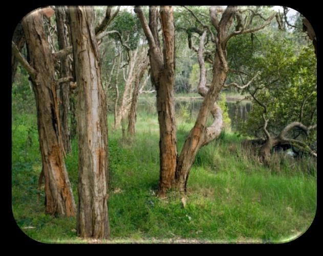
A patch of Coastal Swamp Sclerophyll Forest with ferny understorey, Ballina, northern NSW. ©
Louise Armstrong, Department of Agriculture, Water and Environment 2021.Coastal Swamp Sclerophyll Forest of New South Wales and South East Queensland ecological community
Conservation Advice
2.3 Condition classes, categories, and thresholds
National listing focuses legal protection on patches of the ecological community that are the
most functional, relatively natural and in comparatively good condition. These patches are
identified through minimum condition thresholds.
Condition classes and categories are also used to distinguish between patches of the ecological
community of different qualities, to aid environmental management decisions.
In order to be protected as a matter of national environmental significance areas of the
ecological community must meet both:
• the key diagnostic characteristics (Section 2.1) AND
• at least the minimum condition thresholds Table 2 (on page 16).
Table 2 outlines the different condition classes and categories that apply to the ecological
community. The minimum condition and size thresholds are designed to identify those patches
that retain sufficient conservation values to be considered a matter of national environmental
significance, to which the referral, assessment, approval, and compliance provisions of the
EPBC Act apply. These include all patches in Classes A and B (Categories B1 and B2) and C
(Categories C1 and C2).
Patches that do not meet the minimum condition and size thresholds are excluded from
protection under national environment law (the EPBC Act). In many cases, the loss and
degradation are irreversible because natural characteristics have been permanently removed.
However, although not protected under the EPBC Act, many of these patches may still retain
important natural values and may be protected through state and local laws or planning
schemes.
In addition, patches that can be restored should be encouraged and not excluded from recovery
and other management actions. Suitable recovery and management actions may improve a
patch’s condition, such that it subsequently can be included as part of the ecological community
fully protected under the EPBC Act. Management actions should be designed to restore patches
to high quality condition and larger size where practical.
When assessing condition of a patch of the ecological community it is important to also consider
the key diagnostics (Section 2.1) and patch definition information (Section 2.2).
There may be some patches of the ecological community likely to be in better condition,
particularly those which have been subject to no adverse impacts, or low impacts such as light
grazing, and those which retain hollow bearing trees. Patches of the ecological community that
have a low incidence of weeds, contain mature habitat trees (e.g. those with hollows) and a more
diverse understorey, and/or patches that are part of larger native vegetation remnants and/or
patches that are known to support arboreal mammals, are a high priority for protection and
management. Very small, isolated patches that are subject to high disturbance and with a less
diverse native understorey, contribute less to the conservation of the ecological community and
may not meet the condition thresholds for national protection.
Threatened Species Scientific Committee
Page 15 of 94The largest area that meets the key diagnostic characteristics of the ecological community
should be used in determining patch condition. Where it falls below the minimum thresholds,
the next largest area or areas that meet key diagnostic characteristics and minimum condition
thresholds should be specified and protected. This may result in multiple patches of the
ecological community being identified within the overall area first considered. Areas of high,
good, or moderate quality may then be identified within patches if that is useful to further
conservation decision making.
Table 2: Condition classes, categories, and thresholds
Patch size Large patch Medium patch Small contiguous patch Small patch
thresholds The patch is at least The patch is at least The patch is at least 0.25 The patch is at least
5 ha. 2 ha and less than ha and less than 2 ha 0.5 ha and less than 2 ha
It may or may not be 5 ha. and is part of a larger which is isolated or part
Biotic thresholds contiguous with other It may or may not be area of native vegetation of a small native
native vegetation. contiguous with other of at least 5 ha. vegetation remnant less
native vegetation. than 5 ha in total.
HIGH CONDITION CLASS A CLASS B1 CLASS B2 CLASS C1
Non-native species A large patch that meets A medium patch that A small patch that meets A small patch which
comprise < 20% of key diagnostics AND has meets key diagnostics key diagnostics AND has meets key diagnostics
total ground layer a predominantly native AND has a a predominantly native AND has a
vegetation cover* ground layer. predominantly native ground layer AND is predominantly native
ground layer. contiguous** with ground layer.
another large area of
native vegetation.
GOOD CONDITION CLASS B1 CLASS C1 CLASS C2 CLASS C2
Non-native species A large patch that meets A medium patch that A small patch that meets A small patch that meets
comprise 20% to 50% key diagnostics AND meets key diagnostics key diagnostics AND has key diagnostics AND has
of total ground layer the ground layer is AND the ground layer a mostly native ground a mostly native ground
vegetation cover* mostly native. is mostly native. layer AND is layer.
contiguous** with
another large area of
native vegetation.
MODERATE CLASS C1 CLASS C2 Not protected Not protected
CONDITION A large patch which A medium patch that
Non-native species meets key diagnostics meets key diagnostics
comprise 50% - 80% AND the ground layer AND the ground layer
of total ground layer has at least 20% native has at least 20%
vegetation cover* vegetation cover. native vegetation
cover.
LOW CONDITION CLASS C2 Not protected Not protected Not protected
Non-native species A large patch which
comprise more than meets key diagnostics,
80% of total ground but the ground layer has
layer vegetation cover* low native vegetation
cover.
*Refers to total perennial ground layer vegetation cover for the patch of the ecological community. Includes vascular plant species
with a lifecycle of more than two growing seasons. It includes herbs (graminoids and forbs), grasses, shrubs, and juvenile plants of
canopy species, but does not include annual plants, cryptogams, leaf litter or exposed soil.
**Contiguous means the patch is connected or within 30 m of another area of native vegetation.
See Appendix B for further information on non-native/invasive alien plants associated with the Coastal Swamp Sclerophyll Forest.Coastal Swamp Sclerophyll Forest of New South Wales and South East Queensland ecological community
Conservation Advice
2.4 Areas/Habitat critical to the survival of the ecological community
Since hydrology governs the vegetation in wetland systems, the areas (including habitat) most
critical to the survival of the ecological community are those where the hydrological regime
remains reasonably intact such that the vegetative diagnostic features are maintained. Changes
to natural hydrological regimes is a major factor contributing to the loss of wetland features,
biological diversity and ecological function in Coastal Swamp Sclerophyll Forests. Categories A,
B1, B2, and C1 (Table 2) represent those parts of the ecological community closest to its
benchmark state, with more intact hydrology, other ecological function, and other critical habitat
features, as demonstrated by the largest, most connected and/or most intact native vegetation
and species diversity of the ecological community. These areas provide the highest chance for
the ecological community to persist with integrity over the long term if significant impacts are
avoided. Additional areas, such as buffer zones around patches, whilst not part of the ecological
community that is protected under national environment law, should be taken into
consideration (e.g. to avoid adverse impacts on the patch, and as part of the broader
surrounding environment and landscape context) (see also 6.8.1.4 Apply buffer zones).
No Critical Habitat as defined under section 207A of the EPBC Act has been identified or
included in the Register of Critical Habitat at the time of this advice.
2.5 Areas of high value - surrounding environment and landscape context
Patches of the ecological community do not occur in isolation and are frequently part of a larger
mosaic of native vegetation near the eastern Australian coast. Sometimes, the ecological
community is part of a corridor of surrounding vegetation, treeless wetlands, and other valuable
natural landscape areas. For example, in some areas Koala food trees occur through a patch and
the ecological community forms a well-used corridor connected to other Koala habitat. This will
influence how important a patch is to the ecological community within a whole-of-landscape
context, especially considering a changing climate.
Patches that are larger and less disturbed are likely to provide greater biodiversity value and
will also influence how important a patch is to the ecological community within a whole-of-
landscape context. For natural resource management activities or actions that may have
‘significant impacts’, i.e. important, notable or of consequence to the condition of the existing
patch and require approval under national environment law (the EPBC Act), it is important to
consider the whole environment surrounding patches of the ecological community.
For example, in heavily cleared areas, some patches that meet the minimum condition
thresholds occur in isolation. Such patches require protection and could benefit from
revegetation activities to link them with other patches or the restoration of natural hydrology. In
other areas, patches that are interconnected to other native vegetation may not, in their current
state, meet the minimum condition thresholds, but have high conservation value. Such patches
could benefit from restoration works to improve their condition so that they do meet the
minimum condition thresholds. The ecological community often occurs in association with other
native vegetation types. Patches of the ecological community that remain connected with other
native vegetation often have higher biodiversity and have a better chance of future survival and
restoration success, because connected patches are buffered from disturbance by the
surrounding native vegetation. The following indicators of high value should be considered
Threatened Species Scientific Committee
Page 17 of 94when assessing the impacts of proposed actions under the EPBC Act, or when determining
priorities for protection, recovery, management, and funding.
• Patches that meet or are closest to high quality (Classes A, B and C1) for this ecological
community or are otherwise critical to the survival of the ecological community. These
may be based on recent on-site observations or known past management history.
• Patches that include mature trees with important habitat values, for example, hollows
and crevices, and/or are part of important wetland areas.
• Patches with a larger area to boundary ratio – such patches are more resilient to edge
effect disturbances such as weed invasion and human impacts.
• Patches within or near to a larger native vegetation remnant and that contribute to a
mosaic of vegetation types present at a site. Areas of mosaic native vegetation provide a
wider range of habitats that benefit flora and fauna diversity. Other patches are
important as linkages among remnants, acting as ‘stepping stones’ of native remnants in
the landscape or for fauna to travel to and from water sources. Connectivity may include
actual or potential connectivity to restoration works (e.g. native plantings).
• Patches that occur in areas where the ecological community has been most heavily
cleared and degraded, or that are at the natural edge of its range, particularly where
there is genetic distinction, or absence of some threats. These may include unique
variants of the ecological community, e.g. with a unique flora and/or fauna composition,
or a patch that contains flora or fauna that have largely declined across the broader
ecological community or region.
• Patches that show evidence of recruitment of key native plant species or the presence of
a range of age cohorts (including through successful assisted regeneration or
management of sites). For example, tree canopy species are present on a range of ages
and sizes, from saplings to large, potentially hollow-bearing trees.
• Patches with good faunal habitat as indicated by diversity of topography and other
landscape features, plant species, vegetation structure, and age class, presence of
movement corridors, mature trees (particularly those with hollows), logs, watercourses,
and wetlands, etc.
• Patches containing nationally or state-listed threatened species.
• Patches with high species richness, as shown by the variety of native understorey plant
species, or high number of native fauna species (vertebrates and/or invertebrates).
• Patches with low levels of weeds and feral animals.You can also read