Existing Conditions Analysis - Vaughan Mills Centre Public Realm Strategy and Streetscape Master Plan
←
→
Page content transcription
If your browser does not render page correctly, please read the page content below

Existing Conditions
Analysis
City of Vaughan
May 26, 2020

DTAH
TMIG
REM
AW Hooker

Vaughan Mills Centre Public Realm Strategy
and Streetscape Master Plan
2

                              Caldari Rd.
                                                            Jane St.
                                                                       Bass Pro Mills Dr.
             Rutherford Rd.

                                       Vaughan Mills Mall

                                                                       Edgeley
                                                                       Blvd.
                               Highw      Fis
                                     ay 40 hermans W
                                          0         ay
                                  Weston Rd
Study Area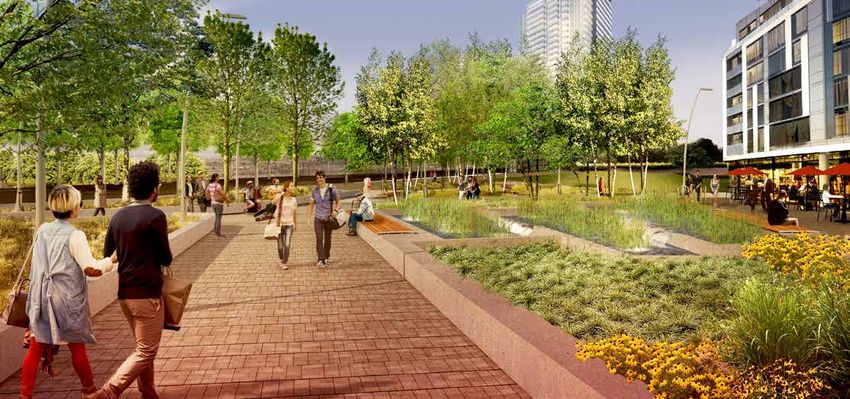
Study Process

                         1                              2                             3                             4
                         Background,                    Design Guidelines             Public Realm                  Implementation &
                         Review & Analysis                                            Framework and                 Phasing Strategy
                                                                                      Streetscape Plan              Report
                         Mar 2020 to June 2020          June 2020 to Jul 2020         Jul 2020 to Jan 2021          Jan 2021 to Mar 2021

                   Project Purpose and           Public Realm and               Public Realm                 Prepare Draft Report
                   Schedule                      Streetscape Vision             Framework and
                                                 Guiding Principles             Streetscape Master Plan

                   Background,                   Draft Design Guidelines        Public Realm Framework       Local Advisory
                   Review & Analysis                                            and Streetscape Plan         Committee &
                                                                                Report                       Public Meeting

                   Project Management            Stakeholder Meeting            Stakeholder Meeting
             Are
                                                                                                             Implementation and
           e
          W ere    Meeting + TAC Meeting         & Public Meeting               & Public Meeting             Phasing Strategy
            H                                                                                                Final Report

                                                 Design Review Panel +          Design Review Panel +        Council Working Session
                                                 TAC Meeting                    TAC Meeting                  TAC Meeting

                                                                                                                                           3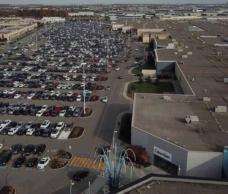
Master Plan Objectives and Goals

»» Build upon and complement the                  »» Improve connectivity to adjacent
   Vaughn Mills Centre Secondary Plan.               neighbourhood and destinations outside
                                                     of the study area.
»» Direct and guide future design,
   implementation and maintenance of a            »» Improve the comfort and experience of
   comfortable, convenient, safe and high-           those traveling by foot and by bike. Highlight
   quality public realm.                             the importance of a pedestrian and bicycle-
                                                     friendly Vaughan Mills Centre.
»» Establish a coherent design approach for
   all public realm projects within the Vaughan   »» Establish a restrained and timeless
   Mills Centre Secondary Plan area.                 palette of materials and street furniture,
                                                     that is robust, with low maintenance, easily
»» Provide a Public Realm Framework that             repaired/replaced, vandal resistant and
   enables the centre to be appreciated as           considers life-cycle cost.
   a totality while reinforcing the unique
   character of distinct neighbourhoods,
   streets and spaces.
                                                                                                      4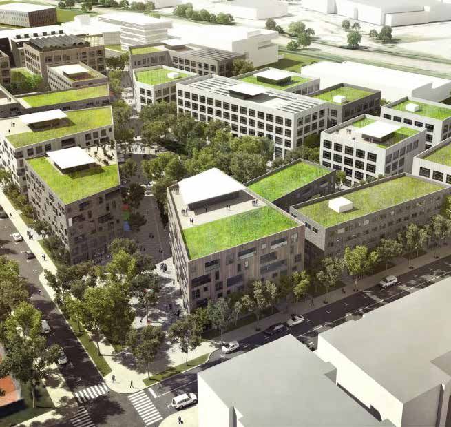
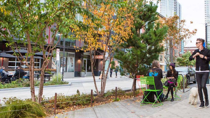
What is the Public Realm?

Spaces Between
the Buildings               +   Opportunities
                                for Interaction   =   Sense of
                                                      Place

                                                                 5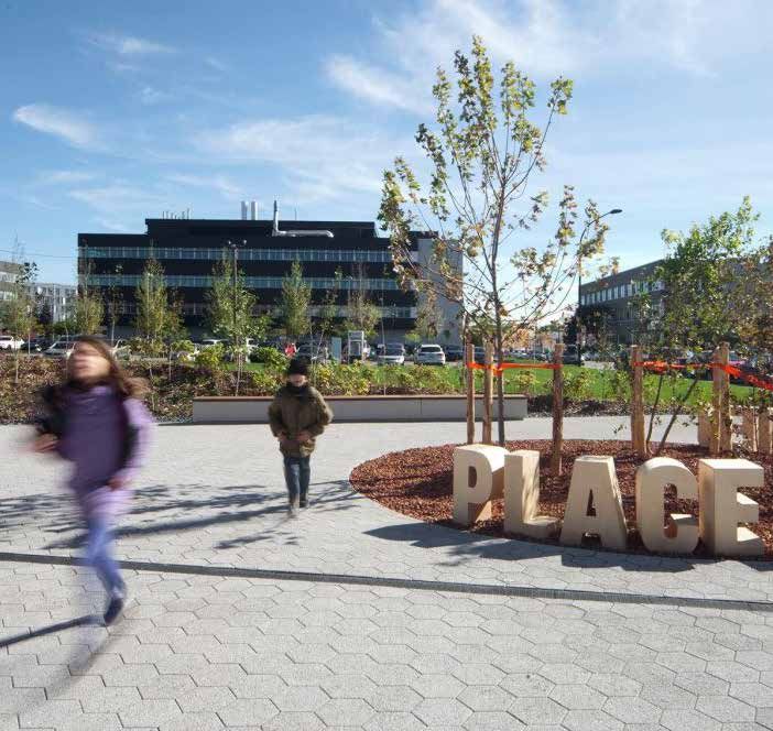
Policy Context
  High Level Broad Policy                                                                                                                          Increased Detail

                                                                                                 Vaughan                Streetscape                 City of
     Provincial                     Regional                         City of                    Mills Centre             and Public                Vaughan
      Policy                         Policy                         Vaughan                     Secondary                  Realm                Implementation
                                                                                                    Plan                Master Plan                  Tools

Broad policy directing      Broad policy directing         Vaughan’s Vision for           District-wide built form,   Refined public realm      Following from
growth within the           growth within the region       growth and change to the       landuse, public realm and   and streetscape           Public Realm and
province                                                   year 2031                      transportation vision       recommendations           Streetscape Study
                            Local Corridors (Jane Street                                                              and guidelines            recommendations
“Reduce automobile          and Rutherford Road)           One of five Primary Centres.   The Plan moves towards
dependency through          have the potential for                                        the goal of creating a      - Parks, open spaces      Possible
mixed-use,                  intensive and mixed-use        Vaughan Vision 2020; Green     healthy and unique            and trails              Implementations
transit-supportive, and     land development               Directions Vaughan; Official   complete community          - Streetscapes            Tools:
pedestrian friendly         supported by public transit    Plan (under review); TMP;      environment that provides   - Active transportation   - Site plan review
development.” (Growth       services.                      2019 Pedestrian and Bicycle    a mix of uses, promotes       facilities              - Street Standards
Plan)                                                      Master Plan Update and the     diversity, encourages       - Priority projects       - Other?
                            Context Sensitive Approach     Integrated Urban Water         walkability and             - Operations and
Provincial Policy           to Streets; Pedestrian and     Master Plan (IUWMP).           accessibility, and builds     maintenance costing
Statement and A Place to    Cycling Master Plan;                                          community identity.
Grow: Growth Plan for the   Transportation Master Plan     Bass Pro Mills Extension EA
Greater Golden              (TMP); Official Plan and the   is currently underway.         Functional Servicing
Horseshoe.                  10 Year Capital Plan.                                         Strategy Reports (FSSR)
                                                                                          required: opportunity to
                                                                                          integrate SWM with public
                                                                                          realm and streetscape.

                                                                                                                                                                      6
Natural Heritage Context
»» The Study Area is King Vaughan Road
centered between
n Road
Road
e
d
Pine Valley Driv
et
Highway 400
et
Jane Street
nue
Weston Roa
Highway 27
Keele Street
Dufferin Stre
Bathurst Stre
Albion Vaugha
Cold Creek
Kipling Ave
two significant Kirby Road Kirby Road
Natural Heritage
Road
Huntington
Areas and their
associated water Teston Road Teston Road
Nashville Road
tributaries: Black Core Features
Enhancement Areas
Creek and the Major Mackenzie Drive West
Major Mackenzie Drive West Built-Up Valley Lands
West Don River. Greenbelt Plan Area1
Oak Ridges Moraine Conservation Plan Area1
Isli
ng
ton
Rutherford Road
Rutherford Road
Minister’s Decision on ORMCP Designation Deferred
A ven
ue
Municipal Boundary
Langstaff Road
Langstaff Road
Highway 400
e
Highway 27
Jane Street
d
Pine Valley Driv
et
Weston Roa
et
nue
et
Bathurst Stre
Highway 50
Dufferin Stre
Yonge Stre
Kipling Ave
Highway 7 Highway 7 Centre Street
Highway 407
Highway 427
Steeles Avenue West Steeles Avenue West
7
Historic Evolution

Pre-Settlement &      Concessions    The Mall &           Recent
Connection to Water   and Farmland   Suburban Expansion   Development

                                                                        8
Development
                                                                                                Jane and Rutherford
                                                                                                       Conceptual Landscape Master Plan

                                                     6
                                                                                      5                               Vaughan, Ontario     5
                                                     5                                                                         June 2019

                                                     4

                                                 1
                                                 2
                                                 3
                                             7

                           8
                                                 Private

                                                 Capitol

                               Jane Street                         RLDC                       RLDC

                                                               3                          2                                                4
EVELOPMENT PROJECTS
                                                     Ba

          Fishermans Way
                                                     ss
                                                         Pr
                                                          oM
                                                           ills

       Vaughan Mills
       Neighbourhood Park
       (Kirkor MBTW)

                                                                   Charisma Phase 2           Solmar
                                                                                                                                               9
Secondary Plan Land Use Vision

                                                       Rutherford Rd.

                                                                                     Caldari Rd.
                                   Highw
              Weston Rd

                                 ay 40
                                      0

                                                                          Jane St.
                                           Blvd.
                                           Edgeley
                                                     Bass Pro Mills Dr.

                                                                                                   10
Parks and
Open Spaces
11Existing Conditions
»» Lack of formal public
places within the
Study Area.
»» Public realm scaled to
the automobile.
»» Lack of trail system.
»» Barriers to movement:
Highway 400, wide streets
and parking lots.
»» Little sense of connection
or awareness with the
West Don River Natural
Heritage Area and Black
Creek- ‘Back-lands.’
12Bluescape
Water Courses Impermeable vs Permeable Surfaces
WEST SIDE EAST SIDE
(+/-20%) (+/-80%)
(95%) (5%) Imperm.
Perm.
Perm. Imperm.
13Secondary Plan: Public Parks and Open Spaces
»» 7ha of new parkland in a Comdel
Park Komura
Road Park West
Do n
range of types of spaces
R
Julliard
iver
Park
(parks, squares, etc.)
Jane St.
»» Parkland acquisition:
5% gross land for Rutherford Rd.
residential areas and
Highwa
2% for commercial and Fishermens Way
y 400
employment areas.
»» The mall site is a gap.
»» Public Parks and Open
Spaces supplementated
with POP’s. 1
»» Planned projects: Vaughan Weston Rd
Bass Pro Mills Dr.
Mills Neighbourhood Park (1)
Caldari Rd
Edg
ley e
.
Blvd
Project Boundary
.
SW Pond Neighbourhood Park
Urban Square
Project Boundary Greenway Public Open Space
Neighbourhood Park Green Buffer Area
Urban Square Black Creek Greenway
Greenway Public Open Space Existing Open Space 14
Green Buffer Area Natural FeaturePrivately Owned Public Open Space (POPS)
»» Privately owned publicly- Atrium Pedestrian
accessible open space
Connection
(POPS) located and
designed to complement the
public park system.
Atrium at 101 Second Street, San Fransisco Woodward redevelopment, Vancouver
Park Landscape Setback
Vaughan Metropolitan Centre Urban Design Guidelines 18 Yorkville, a park on top of parking Gerling Ring, Cologne Germany (Image Credits: Fosters + Partners)
15Examples of POPS Planned for Vaughan Mills Centre
Solmar RLDC
POPS: Under Review / Approved
POPS: Future phase 16Public Art (Vaughan City-Wide Public Art Program)
»» Gateways West
Do n R
Jane St.
»» Existing and Proposed
iver
Parks + Open Spaces
Julliard Dr.
Sweetriver
»» Key Destinations (i.e.
Blvd.
Rutherford Rd.
Transit Hub, Shopping
Centre etc.)
Highwa
»» Premium Streetscapes
400 y
(Rutherford + Jane)
»» Important Intersections
(Jane + Rutherford) Fishe
rmen
s Wa
y
»» View Termini
Caldari Rd
»» Infrastructure (400 bridge
.
crossing/bus terminal) Weston Rd
Bass Pro Mills Dr.
Edgeley B
Rom
Creek
Black
ino Dr
lvd.
Public Art
Enhanced Streetscapes
17Food Landscapes
GROWING
PROCESSING
Niagara Falls Exchange Cultural Hub & Farmers’ Market (Niagara)
DISTRIBUTION
FOOD LOSS
& RECOVERY
EDUCATION &
CONNECTION
Lafayette Greens (Detroit) Eastdale Collegiate (Toronto) 18Streets
19Streets Existing Conditions
»» Large and irregular blocks, West
Do n
designed for auto-oriented
R
iver
office and commercial uses,
but not for pedestrians and
Julliard Dr.
Sweetriver
Jane St.
Blvd.
cyclists. Rutherford Rd.
»» Limited network of streets
Highw
and pedestrian/cycling
ay 400
connections.
»» Safety and comfort issues
associated with informal
Fishe
pedestrian and cycling rmen
s Wa
y
Caldari Rd
connections through parking.
»» Limited Highway 400
Bass Pro Mills Dr.
.
Weston Rd
Edgeley B
Rom
crossing points. Black
Cre ek
ino Dr
»» Bass Pro Mills Drive EA is
lvd.
Project Boundary
currently underway and Arterial Road
Rutherford Road widening Project Boundary
Collector Road
Mall Driveway
(Jane to Westburne) is Arterial Road Transit Hub
planned. Collector Road Existing Open Space
20
Mall Driveway Natural FeatureSecondary Plan: Streets
West
Do n R
iver
Min. 8.0m
15.0-17.0m 5 Right-of-
22.0m
23.0-26.0m Way Widths
Julliard Dr.
Jane St.
Sweetriver
28.0-30.0m Rutherford Rd.
Blvd.
Highwa
y 400
Public Lane
Mews
Local Street 5 Street
Minor Collector
Arterial / Major Collector
Types
Fishe
rmen
s Wa
y
Caldari Rd
21.0m pavement, 45.0m ROW
26.0m pavement, 43.0m ROW
.
cycle lane Bass Pro Mills Dr.
Project Boundary
Edgeley B
Weston Rd
Rom
14.0m pavement, 30.0m ROW
6 Standard Black
Cre ek Arterial Streets
ino Dr
15.0m pavement, 26.0m ROW
cycle lane Street Cross Major Collectors
lvd.
on-street parking Project Boundary Minor Collectors
12.0m pavement, 23.0m ROW Sections
Arterial Streets Potential Future Collector Streets
on-street parking
11.0m pavement, 22.0m ROW Major Collectors Local Streets
on-street parking Project Boundary Minor Collectors Potential Connections
Arterial Streets Potential Future Collector Streets Potential Future Ramp Configuratio
Major Collectors Local Streets
Minor Collectors Potential Connections
21
Potential Future Collector Streets Potential Future Ramp ConfigurationSecondary Plan: Cycling and Pedestrian Connections
»» Fine grain connected West
Do n
network of pedestrian and
R
iver
cycle connections (on/off
Vellorewoods
Blvd.
street).
Julliard Dr.
Sweetriver
Jane St.
Blvd.
»» A new accessible linkage Rutherford Rd.
across Highway 400 through
Highw
a series of connected parks
ay 400
and trails.
Fishe
rmen
s Wa
y
Caldari Rd
.
Weston Rd Bass Pro Mills Dr.
Edgeley B
Rom
Cre ek
Black
ino Dr
lvd.
Project Boundary
Dedicated On-Street Biking
Multi-Use Pathway
Landscaped Mid-Block Pedestrian Connections
22Secondary Plan: Transit
»» Rapid transit and transit West
Do n
priority planned along the
R
Jane St.
iver
Arterials with a network of
Vellorewoods
Blvd.
internal transit connections.
Julliard Dr.
Sweetriver
Blvd.
»» Opportunity for a public Rutherford Rd.
realm focal point associated
Highw
with the future transit
ay 400
hub/MTSA at Jane St and
Rutherford Road.
m
500
Fishe
rmen
s Wa
y
Caldari Rd
m
800
.
Weston Rd Bass Pro Mills Dr.
Edgeley B
Rom
Cre ek Project Boundary
Black
ino Dr
Potential Future Rapid Transit
lvd.
Project Boundary Potential Future YRT
Potential Future Rapid Transit Transit Priority (HOV Lanes)
Potential Future YRT Conceptual Subway Alignment
Project Boundary Transit Priority (HOV Lanes) Potential Future Subway Entrances & Platform
Potential Future Rapid Transit Conceptual Subway Alignment Potential Future Transit Stops
Potential Future YRT Potential Future Subway Entrances & Platforms
Potential Future Transit Hub Area
Transit Priority (HOV Lanes) Potential Future Transit Stops
23
Conceptual Subway Alignment Potential Future Transit Hub AreaSample Cross Sections (Secondary Plan)
Arterial: Jane Street (45m ROW) Local Street (22m ROW)
Regional / Widenings:
Jane Street 36 to 45m
Rutherford Road 36 to 43m
Weston Road 36 to 43m
* Cross sections to be reviewed in phase 2
24Urban Grain
Vaughan Mills Centre - Today Vaughan Mills Centre - Secondary Plan Vaughan Metropolitan Centre Yonge & Dundas, Toronto
Streets (10) Streets (45) Streets (56) Streets (112)
Intersections (17) Intersections (89) Intersections (68) Intersections (197)
Blocks
Connectivity
Quality
25Mid-block Pedestrian and Cycling Connections
26Three Dimensions of Street Design
Street for Street as Street as green
movement destinations infrastructure
Link Place Ecology
Design Objective: Design Objective: Design Objective:
Move people Spend time Improved ecosystem
27Green Infrastructure Opportunities
Enhanced Grass Swales Bioswales Passive Irrigation
R.O.W. Edge Drainage Increased Urban Tree Canopy Permeable Parking lots Open Pit Planters
28Changing Travel Patterns
Autonomous Urbanism Micro-Mobility for First-Mile/
Opportunities (NACTO) Last-Mile Solutions
29Character Areas
30Character Areas West
Do n R
iver
Jane St.
Rutherford Rd.
Highway
Landscape Rutherford Road Area Jane Street Corridor
Highwa
Fishermens Way
Business District
y 400
Vaughan Mills Mall
Bass Pro Mills
Weston Rd
Bass Pro Mills Dr.
Caldari Rd.
Creek
Black
Edg
el e y
Blvd
.
31Rutherford Road Area
Land Use + Character
Higher density mixed use
neighbourhood along
Rutherford Road with low-rise
residential uses along internal
ring road.
Urban Main street focus
along Rutherford Road.
Commercial gateway node at
Highway and Rutherford Road.
Fine grain pedestrian/cycle
friendly internal streets linking
with internal neighbourhood
parks.
32Jane Street Corridor
Land Use + Character
Higher density mixed-use
neighbourhood.
Urban Main Street focus along
Jane Street and Rutherford
Road.
Fine grain pedestrian/cycle
friendly internal streets linking
with neighbourhood parks.
Transit hub gateway focal point
in the public realm.
Strong green character and
connectivity with the West Don
Natural Heritage Area.
33Bass Pro Mills
Land Use + Character
Mid-rise neighbourhood
focused around a new school
or other community facility.
Area south of Bass Pro is
outside of the intensification
area and will reamin
employment.
Gateway urban square knitting
together a commercial node
along Highway, residential
mixed use are and
employment area.
Dedicated on-street cycle
infrastructure connecting with
Fishermans Way Crossing
(multi-use pathway over
Highway).
Bass Pro Mills Drive Green
Street (Secondary Plan).
34Highway
Highway Landscape
Landscape
Land Use + Character
Greening and increased
urban tree canopy to provide
to greenway edges, buffer
Highway 400 and a green
to HIghway
landscape stitch to the
Secondary Plan area.
New north/south active
transportation linkages within
greenways.
Northern Green Gateway at
Rutherford Road Crossing a
significant landscape feature
with public art.
Fishermans Way Crossing:
Opportunity for landmark
bridge.
35
41Business Park: Black Creek Revitalization
Land Use + Character
Unique mixed-use
employment district that is
vibrant, walkable, bikeable
and active.
Focused around the Black
Creek Common - revitalized
Black Creek as a central
storm water management +
public realm focal point.
Contains sub-character
areas based on location and
ground floor uses. I.e. blocks
facing Weston Road and
Rutherford Road vs. blocks
backing onto Highway 400 or
around Black Creek.
36Storm Water Management + Public Place (Edgeley Park and Pond Precedent)
37Urban Plazas at Corners + Apertures
38Vaughan Mills Mall
Land Use + Character
Super regional mall with short
and long term public realm
opportunities.
Short term: pedestrian
pathways, mews, and
sidewalks to ensure safe and
comfortable pedestrian and
cycle movement to/through the
Vaughan Mills Mall parking
area and cycling facilities and
accessible bike parking along
ring road.
Long term: incremental
transformation of the mall into a
walkable more compact urban
neighbourhood.
39Reimagining the Mall
»» Evolution of similar malls
into more compact,
connected and walkable
places with lively animated
public spaces.
Shops at Don Mills (Toronto) Square One, Mississauga
Shops at Don Mills (Toronto) Shoppers World (Brampton)
4011
You can also read


