Extremes in the Midlatitude Storm Track: Atmospheric Rivers - Christine A. Shields
←
→
Page content transcription
If your browser does not render page correctly, please read the page content below
Extremes in the
Midlatitude Storm Track:
  Atmospheric Rivers
                         Christine A. Shields
             National Center for Atmospheric Research

Contributors: Ashley Payne (U. Michigan), Jonathan Rutz (NOAA/NWS, Salt Lake
                        City), Nan Rosenbloom (NCAR)

                                                                               6/20/19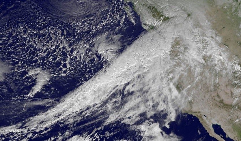
Outline
          • What are Atmospheric Rivers (ARs)?
          • Why are ARs considered “Extreme” Events?
          • Dynamics and Structure
          • Water and Energy Transports
          • AR Community Project
          • ARs in a Future, Warmer World
          • Research Directions for ARs

6/20/19                                                2
What are Atmospheric Rivers (ARs)?
                                      “Pineapple
                                      Express”
                                      variety hitting
                                      the Pacific
                                      Northwest
                                      coast, Dec 8th,
                                      2015.

                                     Image credit: NOAA,
                                     via BLM Oregon &
                                     Washington Twitter
                                     feed

6/20/19                                                 3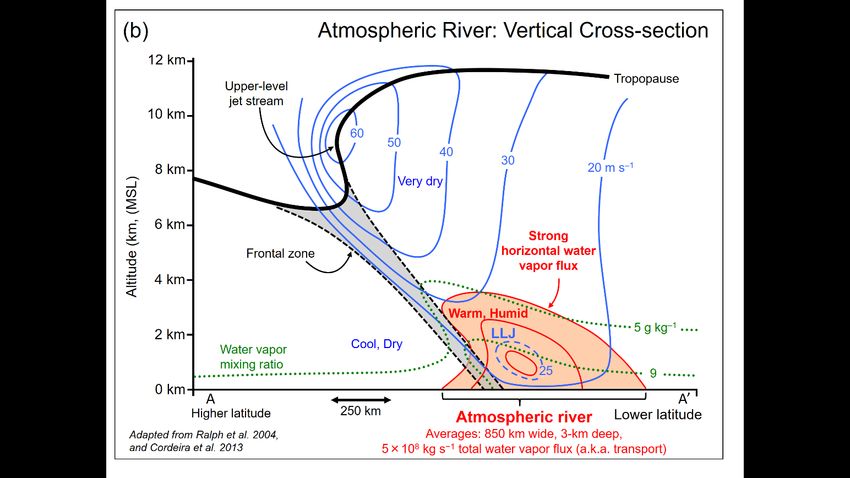
Why are ARs considered “Extreme”
Events?
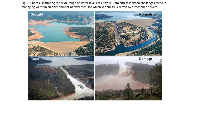
Potential for disastrous flooding….
Orville Dam Crisis Feb 2017, California Sierra Nevada
Foothills, photo credit M. Ralph.
6/20/19 4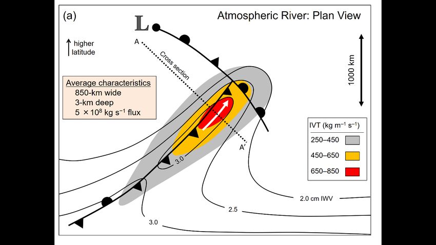
Why are ARs considered “Extreme”
                       Events?
      And/or, they can act as
      drought busters:

                                Dettinger, JHM, 2013, ”…Drought Busters…”

6/20/19                                                                     5
Dynamics and Structure
                           AMS Glossary of Meteorology

     ARs are a sub-set of the extratropical cyclone phenomena, where the lagging frontal boundary extends
     into the subtropical band and acts as a mechanism to transport moisture northward.

6/20/19                                                                                              6
Dynamics and Structure
AMS Glossary of Meteorology
Skew-T vertical
profile with
temperature in red,
dew point in blue
and wind vectors
plotted to the right.
Shows total
saturation through
~700mb.
Skew-T/Photo credit: Jon Rutz
6/20/19 7Water and Energy Transports
§ Movie of 1 year’s worth of AR events strung together
§ Precipitable water (red = wettest, blue = driest)
§ CESM1.3 NE120 (~0.25o) coupled to 0.10o ocean
6/20/19 8Water and Energy Transports
§ Meridional energy transports via ARs Internal Energy = ∫ "#$% &'/)
are accomplished primarily through
Latent Energy = ∫ *$+ &'/)
Internal (Temperature) or and Latent
(Specific Humidity) energy.
§ MERRA-2 reanalysis (0.5o resolution),
tracking ARs for the period of 1980-
2016.
§ CESM1.3 ( ne120, ~0.25o coupled to MERRA2
1o ocean) for the period of 1991-
2005 (shorter period due to data
availability).
§ Assess for ARs making landfall on the
western North American and UK
coasts.
CESM1.3
6/20/19 9Water and Energy Transports
MERRA2 vs CESM1.3 LE MERRA2 vs CESM1.3 IE
Western
North
America
landfalling
ARs
UK
landfalling
ARs
6/20/19 10AR Community Project
http://www.cgd.ucar.edu/projects/artmip/
The goal of ARTMIP is to understand and quantify uncertainties in atmospheric
river (AR) science based on choice of detection/tracking methodology.
6/20/19 11ARTMIP Results
MERRA-2 data
Colors indicate the
number of methods
that agree on the
month where the
highest number of ARs
occur.
This gives us a sense of
what the uncertainty is
per latitude. For
example, Dec at
latitude 37N, almost all
algorithms agree.
More ARTMIP results:
Shields et al, GMD 2018; Rutz et al., JGR-A (in review)
Algorithms available to the community on CDG.
6/20/19 12ARs in a Future, Warmer World
Landfalling ARs for
Western North America
AR frequency change:
RCP8.5 – 20thC
(CAM5 FV0.25 ensembles)
ARTMIP tracking algorithms
Landfalling ARs for
Western Europe
Brown = Restrictive algorithms
Green = Less restrictive algorithms
6/20/19 13ARs in a Future, Warmer World
Landfalling ARs for
Western North America
AR duration change:
RCP8.5 – 20thC
ARTMIP tracking algorithms
AR event min duration 12 hours
Brown = Restrictive algorithms
Green = Less restrictive algorithms
Landfalling ARs for
Western Europe
6/20/19 14ARs in a Future, Warmer World
20C RCP8.5
# of ARTMIP
methods
that agree
Western N.
America
coastlines
Western
Europe
coastlines
6/20/19 15AR Research Directions
§ ARs in the polar regions, their impacts land and sea ice, and how this
changes in the future.
§ AR influences (or vice versa) on/from the ocean surface and mixed layer.
§ Connecting to terrestrial systems via hydrology, i.e. snowpack, river
runoff, streamflow, etc.
§ Continued work on understanding the implications of different tracking
algorithms, for current and future climates.
§ Heat and energy transport via ARs.
§ AR predictability across timescales, i.e. weather, S2S, multi-decadal, and
long-term projections.
6/20/19 16You can also read