Facts in Fiction: Introducing Cartography and Surveying in Martin Suter's Novel "Die Zeit, die Zeit"
←
→
Page content transcription
If your browser does not render page correctly, please read the page content below
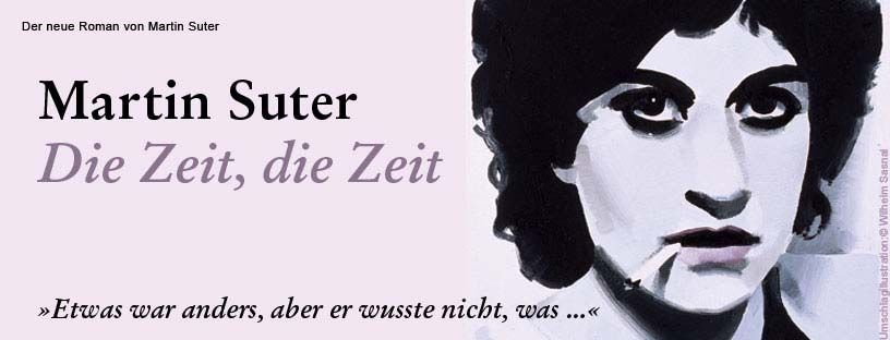
Facts in Fiction:
Introducing Cartography and Surveying in
Martin Suter’s Novel „Die Zeit, die Zeit“
Lorenz Hurni, Julia Burgermeister

ETH Zurich, Institute of Cartography and Geoinformation, Wolfgang-Pauli-
Strasse 15, 8093 Zurich, Switzerland

Abstract. Swiss best-selling author martin Suter published his latest novel
“Die Zeit, die Zeit” (“Time, time”) in 2012. It is set up around two main ac-
tors, who would like to turn back time to a specific moment by re-
establishing the spatial situation of a specific place. To achieve this, they
need to use methods to survey the neighborhood in its current and its his-
toric states. This paper describes which methods are used and how they are
described in the novel. Furthermore the final text of the novel is analyzed in
order to find out to what extent the imaginary landscape of the novel can be
(re-)mapped again.

Keywords: Literary cartography, surveying, mapping, map projections,
map transformations.

1.   Introduction
In September 2012, Swiss best-selling author Martin Suter („Smallworld“,
„Lila, Lila”, “Business Class”) published his latest novel “Die Zeit, die Zeit”
(“Time, time”; in German, currently no translation available (Suter, 2012)).
Figure 1 shows the announcement of the novel by the publisher.
Martin Suter (born 1948) is currently the best-selling Swiss author. Suter
was first working as Creative Director for several advertising agencies, but
soon started writing reportages and columns, e.g. his famous column Busi-
ness class, about archetypical behavior of business men. He wrote several
film scenarios. In 1997 he wrote his first novel “Smallworld” about an Alz-
heimer disease patient, which became immediately successful. “Die Zeit, die
Zeit” (“Time, time”), published in 2012, is Suter’s 10th novel.
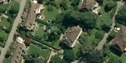
Figure 1. Announcement of the novel by the publisher (Diogenes Verlag, Zurich).

The story of “Die Zeit, die Zeit” is set up around two main actors, Taler and
Knupp, who are neighbors across the street in an average suburban town in
Switzerland. Both of them have lost their spouses some years before and
they are longing for them. Knupp develops a somewhat exotic theory that
instead of time only changes exist. Time could therefore be turned back to a
specific moment by “simply” re-establishing the spatial situation of a specif-
ic place. Taler and Knupp therefore start to re-create their houses, gardens
and the street in between in the exact same manner as they were twenty
years before.
Of course, this imposes a major challenge not only to the two main actors,
but also to the author. Martin Suter therefore contacted one of the authors
of this ICC paper in spring 2012 in order to evaluate possible surveying and
mapping methods to fulfill this demanding task. Suter set up several
boundary conditions, such as the presence of old analogous Leica photog-
raphy depicting the house and the garden of Knupp in its old state, or the
use of an old theodolite for surveying purposes. After intensive discussions
between author and consultant, it was decided to set up a threefold work-
flow (next chapter).Furthermore, the choice of classical surveying methods
was considered more tangible than virtual computer-based methods and
therefore better describable and interesting to the reader.

2.   Recreating the Historical Situation
2.1. Classical Surveying by Traverse and Detailed Surveying
During the first discussions with the author, it was decided that the main
actors should first carry out a classical survey of the gardens and buildings
in the neighborhood. Suter had a specific settlement type in mind which is
typical for many Swiss residential areas (Figure 2).

Figure 2. Settlement type in Suter’s novel (courtesy of the author).

First task was therefore to set up a number of bench mark points in order to
set up traverse measurements using a classical theodolite. In Switzerland,
such official surveying points are available in almost every street. However,
to do detailed surveying in the backyards, additional traverse points needed
to be set up by the main actors. In the novel, this activity is described as
follows (in German, © Martin Suter and Diogenes Verlag, Zurich):

Den Nachbarn des Gustav-Rautner-Wegs bot sich an diesem Sonntagmorgen ein seltsames
Bild: Der eigenbrötlerische alte Knupp hantierte zittrig und umständlich mit einem antiken
Theodoliten, unbeholfen assistiert von dem menschenscheuen jungen Witwer aus dem
Haus gegenüber. (…) [Knupp and Thaler act as land surveyors, using an old theodolite.]
Albert Knupp hatte sich für sein großes Projekt einen alten Theodoliten beschafft und sich
das nötige vermessungstechnische Grundwissen selbst angeeignet. Er stand über das Gerät
gebeugt, guckte durch das Zielfernrohr und dirigierte seinen Gehilfen mit gebieterischen
Gesten herum. Ein wenig weiter links, ein bisschen nach rechts, einen Schritt zurück.
[Working with the theodolite.]
Er hatte Taler Sinn und Ziel der Aufgabe erklärt, wie ein pädagogisch fortschrittlicher
Offizier seinen Soldaten eine Übung. Es ging darum, „an die bestehenden Polygonpunkte
anzuschliessen, um neue Fixpunkte im Garten zu bestimme“. [Measuring the traverse.]
Für Taler war das Unangenehme an dieser Arbeit, dass sich diese amtlichen Messpunkte
auf der Straße befanden, und er mit Knupp das Stativ samt Theodolit über diesen millime-
tergenau zentrieren und horizontieren musste. Allein diese Arbeit kostete den tatterigen
Geometer und seinen unerfahrenen Gehilfen über eine halbe Stunde. [Calibrating the theo-
dolite.]
Talers Hoffnung, nicht dabei beobachtet zu werden, wurde durch den Hauswart Gelphart
zunichte gemacht, den Mann seiner schwatzhaften Putzfrau. Er stand plötzlich hinter ihnen
und fragte: „Was vermessen Sie da?“ In einem Tonfall, als sei Vermessen ein schwerwie-
gender Verstoß gegen die Hausordnung. [The janitor arrives. „What are you doing here?“]
„Polygonzug“, brummte Knupp. [„Traverse measuring.“]
Gelphart gab sich keine Blöße und antwortete ebenso fachmännisch: „Dachte ich mir“.
[“That’s what I thought.”]

Suter on one hand describes the surveying method rather straight forward,
detailed and as explained to him by the consultant. On the other hand he
enriches the action by describing the mood of the surveyors, for instance
their sense of shame towards the neighbors when surveying the area on a
Sunday morning. The final product was a large scale plan of the garden and
the buildings drawn on a millimeter paper.

2.2. Projection of Old Photos Using a Camera Obscura
Knupp has a large number of Leica photos of his garden available which
were taken 20 years before. The author had the idea to extract the historical
situation out of these images. The 3D reconstruction of an area out of imag-
es is usually a rather complex process and requires photogrammetric meth-
ods and specific software. For the novel, complex techniques should be
avoided, as explained earlier. The author and the consultant therefore de-
veloped a method using a classical Camera obscura. Assuming that the
garden was a flat place one could project the image through a pinhole cam-
era onto the ground plan compiled in the garden by classical surveying. By
rotating and tilting the negative, the still existing objects on the ground
could be matched (projective transformation or collineation, Figure 3). The
old, disappeared objects could then be drawn from the picture onto the
plan. Again, Suter describes this method in a straight forward manner, en-
riching the action by the pain of perfectly matching the two images:

Taler stand in der Finsternis des Dunkelkammervorraums. Die einzige Helligkeit kam von
dem Licht, das durch das Negativ fiel. Es war zwischen zwei Gläser geklemmt und steckte
in einer vierundzwanzig mal sechsunddreißig Millimeter kleinen Öffnung in einem vier-
eckigen Kasten. [Description of dark room with holding device for film negative.]
Dieser war am Ende eines nach allen Seiten schwenkbaren Arms angeschweißt. Talers
Aufgabe war es, diesen so lange zu kippen, heben, senken, drehen und sonst zu bewegen,
bis die Projektion in der richtigen Position war, und die Fixpunkte auf dem Bild mit denen
auf dem Plan übereinstimmten. [Device can be tilted and rotated in all directions.]
In der Durchgangstür zur Dunkelkammer befand sich eine quadratische Öffnung, die mit
einem dünnen schwarzen Blech verdeckt war, in dessen Mitte sich ein kleines Loch befand.
Da mussten die Lichtstrahlen aus dem Negativ hindurch. Im nächsten Raum projizierten
sie ein Bild auf das Millimeterpapier mit dem Gartengrundriss. [Description of pinhole
camera with projection screen on millimeter paper.]
Dort drüben stand Knupp und rief Taler mit wachsender Gereiztheit seine Anweisungen
zu: „Links, links, links, halt! Nach vorne kippen. Zu viel, zu viel. Nein, mehr.“ (…) [Protago-
nists are adjusting negative.]
Das Negativ, das sie auf diese vorsintflutliche Art zu projizieren versuchten, stammte von
dem legendären elften Oktober neunzehneinundneunzig. Es war eine Ansicht des Gartens,
und weil eine Camera obscura Bilder an die Wand warf, die von keinem Objektiv verfälscht
waren, sollte es möglich sein, die Punkte auf dem Plan mit den Punkten auf dem Foto in
Übereinstimmung zu bringen. [Projection of garden pictures using Camera obscura.]
Sobald dies gelungen war, konnte man alle Objekte des Fotos exakt auf den Plan übertra-
gen, indem man ihre Konturen nachzog. Wenn man dann den gleichen Vorgang mit einer
heutigen Fotografie vom gleichen Standpunkt aus wiederholte, hatte man die Veränderun-
gen, die in den einundzwanzig Jahren geschehen waren. Erst danach konnte die Detailar-
beit beginnen. (…) [Retracing old objects from images onto plan.]
Bald hatten sie das Negativ in der gewünschten Stellung. (…)
Der Garten des elften Oktober neunzehnhunderteinundneunzig fügte sich exakt in den
Grundriss, den er so mühevoll gezeichnet hatte. (…)
Bis spät in die Nacht übertrug Peter Taler unter den euphorischen Anweisungen des alten
Mannes alle Pflanzen, Gartenmöbel und Gegenstände auf den Plan. [Results are perfect!]

2.3. Reconstruction of Trees
Taler’s intention was to reconstruct the garden and the surroundings in full
3D. Until now, the two surveyors could only reconstruct the ground plan. In
order to avoid complex 3D methods for the reconstruction of trees, a simple
try-and-error-based method was developed: The surveyors simply tried to
recreate the geometrical configuration of the historic images by placing a
digital camera in the garden and by comparing the old image with the cur-
rent display window. Once the correct place was found, they placed a sight
rod next to the tree and took a picture. This time a computer was used in
order to overlay the new image including the sight rod with the old rod. By
doing so, the dimensions of the old trees could be measured with a reason-
able precision. Suter again describes this method in a linear way, this time
with no further atmospheric elements.
Figure 3. Projective transformation or collineation (after Gruen, 1985).

Es ging darum, den Kamerastandort von damals herauszufinden. Sie hatten die Leica auf
das Stativ montiert und versuchten, das Bild im Sucher mit dem auf dem alten Foto in
Übereinstimmung zu bringen. [Setting up the camera in the garden, comparing with old
image.]
Der Vorgang war mindestens so kniffelig wie die Arbeit in der Camera obscura. Wenn die
Fixpunkte am linken Bildrand stimmten, waren sie am rechten nicht richtig; wenn es unten
aufging, war es oben verrutscht. [Matching the two images is tricky.]
Sie hatten auf der Höhe des Stammes auf beiden Seiten des Buschs einen Fluchtstab aufge-
stellt, um für die Rekonstruktion einen Maßstab zu erhalten, und schossen Dutzende von
Fotos. [Using the sight rod as a scale bar.]
Peter Taler lud die Ausbeute auf den Computer und sortierte die besten aus. Diese überla-
gerte er in Bernoullis Programm mit dem digitalisierten alten Bild, bis sie eines gefunden
hatten, das genau passte. Auf diese Weise gingen sie auch mit den Fotos aus den anderen
Himmelsrichtungen vor. [Overlay of old an new images in computer.]

3.    Reconstructing the Spatial Setting from Factual
      Information in Suter’s Novel
When reading a book, the reader usually tries to imagine the figures as well
as the spatial setting out of the text of the novel. It would now be interesting
to analyze the text in order to find out which locations and spatial topolo-
gies could be extracted without any ambiguities out of the novel. As a proof- of-concept, the findings could be symbolized and visualized cartographical- ly in 2D end even in 3D. Such models could serve for further analysis of the text by literary specialists or for a future film project. These questions stood at the beginning of a Bachelor’s theses project at ETH Zurich, carried out by J. Burgermeister in the spring semester 2013. Mapping literary settings is currently an evolving discipline in literary sci- ences which can be seen in the broader framework of digital humanities. Graphical depictions have been used for a long time, such as the map of Scotland with the settings of Walter Scott’s novels, published by Sharp (1904). Authors have even used maps or sketches for planning the settings of their novel: Friedrich Dürrenmatt has drawn a detailed sketch map of the village of Konolfingen for his oeuvre “Stoffe” (NB, 2013). Extracting spatial information out of fictional texts is also one of the major aims of the Swiss National Science Foundation funded project “A Literary Atlas of Europe”, carried out at ETH Zurich since 2006. Reuschel et al. (2012) give an overview of the detailed taxonomy used for the description of such places in novels and novellas. One main question is about the relation between the textual space and the so-called geospace (real world). The au- thors distinguish between imported settings in real places, transformed settings in modified real places, invented settings within familiar geograph- ic reality, and imagined setting with no relation to the real geospace. As as described earlier, Suter chose a typical residential area as a setting for his novel “Die Zeit, die Zeit”, most probably in a medium-sized Swiss town; it may therefore be considered an invented setting. After the first reading, it was possible to draw a first sketch of the neighbourhood around the build- ings where the two protagonists Taler and Knupp live (Figure 4). There are several other secondary settings in the novel, for instance the office of protagonist Taler, a police station, a restaurant etc. They are of secondary importance, and only in very rare cases, information about their topological and geometrical (distances) relation is given. Figure 5 shows a schematic representation of all settings. In a next step, the main setting in the neighbourhood could be detailed more by extracting all possible information with spatial reference and in various levels of detail. In this inventory, it is also indicated whether the information is factual (directly based on information from the novel), inter- preted (out of other facts) or plausible (by common sense). Table 1 shows an example of all geo-referenced information which can extracted from the novel. The colours represent the quality or type of information (factual, in- terpreted, plausible).
Figure 4. Main setting of the novel with houses where the protagonists live:
Knupp in No. 39 and Taler in No. 40.

Figure 4. Schematic representation of all settings.
House of Taler, Gustav‐Rautner‐Weg 40
Object            No. Position                Dimension                       Color
House             1     120 m from curve      3 floors
                        at left, 60 m from
                        curve at right
Parking lot       4     vor dem Haus, an      Size of car                     Asphalt
                        der Strasse
Parking lot panel 4     Next to parking lot   Size of licence plate           white
Side wall         2     side                  3 floors, depth: 1 flat         Washed‐out concrete
Front             2     In front, behind      3 floors, largeness of 1 flat   Beige plastering
Roof              1     On top                Size of groundplan of 1 flat    brown
Flower window 4         At road               Regular window size             Glass

Table 1. Example of geo-referenced information which can extracted from the
novel. The colours represent the quality of information (dark blue: factual, medium
blue: interpreted, light blue: plausible).

4.    Discussion, Outlook
The literary chain of perception comes close to a similar chain in Cartog-
raphy: Idea of author, mental landscape (imagination) of author, definition
of literary setting and detailed furnishing, textual implementation, reading
and perception process by reader, mental map/imagined landscape of read-
er. In this paper we have tried to extract information out of Suter’s novel as
precisely as possible. We showed that inventories with a rather high level of
detail can be set up. The last step of this proof-of-concept would be the
graphical visualization (2d/3D) of the setting in order to be able to compare
it with the original intention of the author and to use it for further purposes
like, for instance, a film project.

References
Gruen A (1985) Photogrammetry. Lecture notes. ETH Zurich, 1985
NB (2013) Friedrich Dürrenmatt: Sketches of the village of Konolfingen. Swiss Na-
 tional Library. http://ead.nb.admin.ch/html/fdabi_f.html#f . Accessed 15. April
 2013
Reuschel A, Piatti B, Hurni L (2012) Modelling Uncertain Geodata for the Literary
 Atlas of Europe. In: Kriz K, Cartwright W, Kinberger M: Understanding Different
 Geographies. Lecture Notes in Geoinformation and Cartography. Berlin: Spring-
 er, 135–157
Sharp W (1904) Literary Geography. London: Pall Mall Publications
Suter M (2012) Die Zeit, die Zeit. Zurich: Diogenes Verlag
You can also read