Further archaeological investigations at the Thayer Homestead: Excavations at the Hop House/Barn
←
→
Page content transcription
If your browser does not render page correctly, please read the page content below
Further archaeological investigations at the Thayer Homestead: Excavations
at the Hop House/Barn
David P. Staley1
ABSTRACT
Detailed mapping and limited excavations were conducted during 2006 at the
Thayer Homestead Site. The subtle outline of a barn foundation was cleared and
documented. The rubble alignments suggested the barn was composed of two rooms or
spaces on the ground floor. Excavations bisecting one of the alignments found a totally
dissolved wall with no apparent stacking or linear integrity. The foundation was casually
constructed of dry laid, undressed, irregularly sized and shaped, rounded, locally
available stone. Rather than a load-bearing component of the structure, the wall likely
functioned to fill spaces between fieldstone piers, sill members of the barn superstructure,
and the ground surface. Greater quantities of cut nails and other architectural artifacts
were found on the wall mound and the interior of the wall. Unlike areas tested in the
south end of the barn, no modern wire nails and roofing materials were recovered
indicating that only that end of the barn was remodeled. Oral history regarding the site
correlates with the archaeological findings and adds much detail to the record.
INTRODUCTION
The Thayer Homestead is one of several apparently well-preserved 19th century
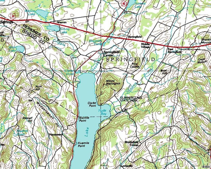
historic farmstead sites located on SUNY Oneonta Biological Field Station’s Rum Hill
property in the Town of Springfield, Otsego County, New York (Figure 1). This
investigation comprises part of a multi-year, multi-site, cooperative archaeological and
historical research effort that will provide basic interpretive data about the sites for the
Biological Field Station’s ongoing ecological educational program, contribute knowledge
regarding historical agricultural practices, human ecological adaptations, illustrate to
visitors the methods, techniques, and utility of archaeology and historical research, and
will also provide educational opportunities for local primary and secondary school
children.
1
Archaeologist, Project Manager. New York State Museum, Cultural Resource Survey Program, Albany,
New York.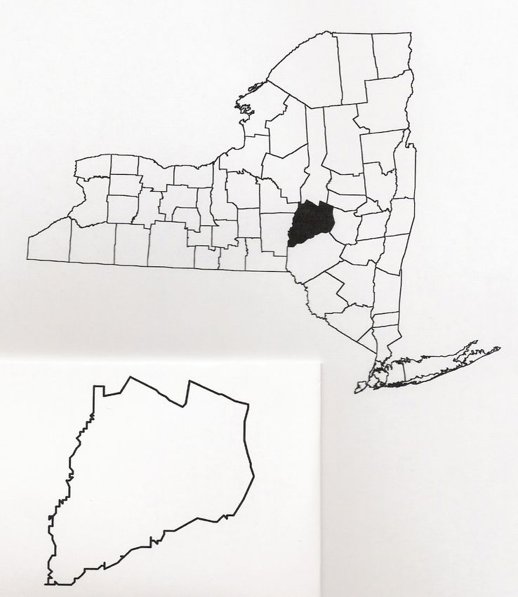
Figure 1. Approximate location of Thayer site.

        The overall history, context, and research goals for the Thayer Homestead project
have been outlined previously (Staley 2006). In brief, the Thayer Homestead site
consists of a house foundation, several barn foundations, chicken coop, and pigsty. A
variety of historic artifacts such as glass, ceramics, metals, and farm machinery parts can
be observed across the site. Based on historic maps, census materials, and oral history
the Thayer homestead property was purchased in 1807, the house built in 1814, and used
throughout the century by generations of the Thayer family (Reed 2006). Typical of
post-Revolutionary War settlers of New York, the Thayers had emigrated from
Massachusetts as an extended family to settle on the rocky, steep, upland locations
similar to the lands they had left behind (VanWagenen 1963; Ryan 1981; Parkerson
1995). The Thayers were also typical in their balance of agricultural production and the
sequence of agricultural adaptations and choices (McMurry 1995). Wood products
supported the farm’s establishment, however the Thayer’s broad balance of production
shifted through time with an emphasis on grain, sheep and wool, and then to hops, and
then dairying and the production of butter and cheese (U.S. Federal Census 1850, 1870;
Reed 2006). These transitions were typical of agriculture in this part of New York. At
some point in the early 20th century, the homestead and the upland lands were abandoned
and the family occupied lower portions of their land closer to the more developed
roadways and lake. Christiana (Dingman) Thayer, wife of Marcena Thayer and the last
occupant of the house, died in 1914. The various agricultural structures on the property
were used after this date. The house stood until the 1930s, the hop house/barn until at
least 1940 (Reed 2006).
RESEARCH GOALS
Some of the larger, broader research questions approachable from the perspective
of the Thayer site regard the evolution of farming in Otsego County and in New York.
What was the nature of the agricultural and cultural adaptations on these upland
properties? Can the relative involvement in the emerging marketplace be traced at both
sites? What are the archaeological differences between the Thayer and the neighboring
properties and do these provide clues as to the greater longevity, continuity, and success
of the Thayer property? Can the archaeological record at the Thayer site reveal anything
about the transition of agricultural practices and ultimately provide clues as to why this
portion of the property was abandoned?
The limited excavations of the past year have much more humble research goals.
Investigations hoped to refine the dimensions of a barn foundation, gather information
about construction style and techniques, the age of barn construction and modifications,
and perhaps recover information about function.
METHODOLOGY
The area of the barn foundation was cleared of tall grasses, branches, and woody
debris exposing the low mounds and aligned rocks and boulders. The on-site grid was
extended across the area of the barn foundation and the mounds and boulders were
mapped. Students from a Cherry Valley-Springfield (CVS) Archaeology elective class,
under the direction of social studies teacher William Nelson, excavated two test units.
The test units (TUs 1 and 2) were positioned on the grid and straddled one of the low
linear mounds suspected of being a barn foundation (Figure 2). These tests were 1 x 1m
in size, dug to sterile soil, and students recorded artifacts recovered in situ, positions of
rocks, and variations in soil strata. All sediments were screened with ¼ inch mesh.Artifact analysis, treatment, and preparations for curation followed standards set
forth by the New York Archaeological Council and the New York State Museum. The
CVS students from the 2007 class conducted basic cleaning, stabilization, attribute
analysis, and cataloguing.
Figure 2. Site map.
RESULTS
Subsequent to clearing, alignments of linear rubble mounds, isolated rubble
mounds, and massive individual boulders were revealed as a rectangular outline
measuring approximately 10 x 18 m (33 x 60 ft) (Figure 3). An interior wall, one of the
more vertically intact and stacked segments, indicated the structure was separated into
two rooms or areas. The smaller space or room on the south side of the barn measured
approximately 10 x 5 m (33 x 16 ft). A swale or an open-ended depression in the mound
might represent an entry centered eastern wall of the main barn space. It may alsorepresent a crawl space feature or an early manure removal feature. Although highly conjectural, the barn superstructure may have been sized and positioned as shown on Figure 4. The barn outline approximates a 9 x 17 m (30 x 56 ft) footprint. Figure 3. Barn foundation ruin.
Figure 4. Presumed superstructure location.

       Two test units (TUs 1 and 2) were excavated spanning a segment of barn
foundation. No evidence of an intact wall was observed. The rocks and boulders were of
multiple sizes, rounded to irregular in shape, were not dressed, and there was no evidence
of mortar. None of the stones were obviously stacked or sorted with only a slight
concentration of larger rocks and multiple layers in TU 2 (Figure 5).

        The tests found that the artifacts were confined to the compacted and rocky upper
levels and thinned with depth. As expected for a barn, artifacts were largely of an
architectural class. TU 1, in what might be assumed to be the exterior of the barn, soils
were noted as a black silty loam. The arbitrary upper level averaged 14 cm thick and
Figure 5. Plan View of Test Units 1 and 2.
contained eight cut nails, two cut nail fragments (with one of these appearing cinched),
one large wrought nail that had been cinched. Cinched nails were historically used on
batten doors and to fasten hardware. The upper level also contained an iron clasp or link
similar to horse tack and a trace of charcoal. The lower level, excavated to 30 cm below
the surface, contained four cut nails, and two cut nail fragments and a brick fragment.
TU 2, positioned more toward the interior of the barn, contained soils described as
a dark yellow brown clay loam matrix surrounding rocks and cobbles. These compacted
soils contained greater numbers and varieties of artifacts in both levels. Artifacts
recovered from the upper 15 cm included five medium sized brick fragments, one large
cut nail, two medium cut nails, a fine cut finish nail or brad (possible upholstery nail),
three cut nail fragments, a gimleted screw, a single fragment of aqua colored window
glass, and a possible piece of window glazing. The lower level revealed two more brick
fragments, seven cut nails, 11 cut nail fragments, and two small pieces of tarpaper.
DISCUSSION
Oral history provided by William Reed (Reed 2006), the grandson of William J.
Thayer or William III (b. 1858), describes some aspects of the barn layout, construction,
and function. Mr. Reed recollects the barn located and oriented in the manner of thisfoundation. The barn was originally a hop house of two floors and no cellar. It was
changed into a general barn by his grandfather when he stopped growing hops around
1920. The barn was used after that time to store hay in the loft and grain in bins in the
front and to house farm equipment. He specifically recalled a two wheeled racing sulky
and a horse drawn grain drill stored in the barn. The barn was built on timber sills
supported by a fieldstone foundation made of stones gathered from nearby agricultural
fields. A large door faced the road or away from the creek with a smaller door above
providing access to the hayloft. There were horse stalls near the front of the barn on one
side. At least one window was located on the side facing the house although there were
likely others. The interior of the barn was partitioned and separated from the rest of the
barn by an interior door. Mr. Reed recalled it being “full of stuff” as his “grandfather
would have been considered a pack rat in today’s parlance.” The barn, as well as other
buildings, had wooden shingle roofing until at least 1930. Any repairs or modifications
would have occurred afterward. Mr. Reed recalls the barn as the last standing structure
on the property around 1941.
The data gathered through archaeological investigations correlates with Mr.
Reed’s boyhood recollections. The predominance of cut nails and the use of clinched
wrought nails corroborate the construction of the barn in the early 19th century. It is
interesting to note that the more modern wire nails and roofing materials have been found
only in the southern portion of the barn from STP 3 (Staley 2006; Sardella 2005)
suggesting that perhaps only a portion of the barn roof was modernized. The window
glass and the glazing suggest a window along this section of wall. The brick fragments
remain a puzzle although might be related to any hearth used to provide heat in barn
when it functioned as a hop house. The iron clasp, buckle, or link probably functioned to
connect a strap, chain, or rope related to horse traction. Further work could precisely
identify this unique artifact. The dissolved remains of the fieldstone wall did not suggest
a great deal of construction effort or permanence. It seems likely this segment was not a
load-bearing component but functioned to fill spaces between fieldstone piers, sill
members of the barn superstructure, and the ground surface.
FUTURE WORK
At this stage in the program, we are unable to draw conclusions in regard to any
of our overall research questions. We have discovered some facts about the barn and oral
history has provided some rich details about the Thayer Homestead. However humble
our basic research questions and results, it is hoped that they will ultimately contribute to
the greater questions regarding agricultural adaptations. This season’s work will include
further mapping, testing, and excavations near the house, barns, and outbuildings
focusing on the correlation of oral history and the physical remains at the site. The
continued involvement of Mr. Reed is greatly anticipated. The field investigations and
continued analysis will involve SUNY Oneonta Anthropology students and high school
students from Cherry Valley – Springfield Central School.REFERENCES CITED
McMurry, S.1995. Transforming Rural Life: Dairying Families and Agricultural
Change, 1820-1885. John Hopkins University Press. Baltimore.
Parkerson, D.H.1995. The Agricultural Transition in New York State: Markets and
Migration in Mid-Nineteenth century America. Iowa State University Press.
Ames.
Reed, W. 2006. Personal communications with the author. September 24, October 6, and
October 20, 2006.
Ryan, M.P. 1981. Cradle of the Middle Class: the Family in Oneida County, New York,
1790-1865. Cambridge University Press. New York.
Sardella, J. 2005. Analysis of Thayer Farmstead in Cooperstown, New York. Class Paper
for Anthropology 343 and Dr. Renee Walker.
Staley, D. P.2006. Preliminary Archaeological Investigations at the Thayer Homestead.
In 2005 Annual Report of the Biological Field Station. State University of New
York-College at Oneonta, Biological Field Station, Cooperstown, N.Y.
U.S. Federal Census. 1850. Agricultural Schedules of the Seventh Census of the United
States. New York State, Otsego County, Town of Springfield. Microcopy 432,
Roll 562. 1963 National Archives and Record Service. General Services
Administration.
1870 Agricultural Schedules of the Ninth Census of the United States. New York
State, Otsego County, Town of Springfield. Microcopy 593, Roll 1059, Vol. 77.
1965 National Archives Microfilm Publication.
VanWagenen, J.1963. Golden Age of Homespun. Hill and Wang. New York.You can also read