Introducing our G.I.S. Champions - New Zealand Geographical ...
←
→
Page content transcription
If your browser does not render page correctly, please read the page content below
Geography Network of Expertise
                          Newsletter #3
                          He waka eke noa
                          We’re all in this together: Building capacity in the
                          geography teaching community

        Introducing our G.I.S. Champions
If developing subject specific ICT capability is a next-step focus of your
geography teaching, then the NEX G.I.S. Champions would welcome the
chance to contribute to your journey. The G.I.S. champs will offer support on a
regional basis, so starting from the north and working our way to the deep
south, we introduce you to:

                                Kira Clark (Auckland)
                                Hello Geographers, I have been a teacher in Auckland since 2006 and my
                                current role is HoF at Takapuna Grammar. I’ve always been interested in GIS
                                and it is now more accessible for teachers to create relevant and exciting
                                lessons for students.
                                I’m especially fascinated with the use of historical data and using historical
                                imagery to track changes over time. What better way to visualise data than
                                through spatial patterns on a map!
                                I’d like to help other teachers in the Auckland region implement the GIS
                                Achievement Standards through Levels 1, 2 and 3. I hope to give teachers the
                                confidence using GIS in the classroom and a clear understanding of how to
                                begin and what platform to use. k.clark@tgs.school.nz

Matt Harrison (Tāmaki Makaurau/Auckland)

I am a teacher of social studies and geography at Orewa College.
I’m in my fourth year of teaching and it has proven a new lease
on life for me after a background working in local government.
Through the years I have seen the advancements in GIS capability
and usability and am excited about the opportunities it offers in
the classroom.
I want to help to break down the barriers teachers may have to
using GIS in the classroom. Once this happens I see students
taking ownership of GIS as an intuitive tool that they can use
across and beyond the curriculum. m.harrison@orewacollege.nz

                                                                                                             1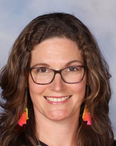
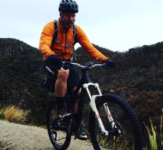
Christian Richardson (Waikato/BOP)
                                               I am originally from Yorkshire and emigrated here in 2005. I did
                                               my teacher training in 2006 through the University of Waikato and
                                               have been working at Mt Maunganui College since 2007. We
                                               implemented the GIS standards from the outset with Google Earth
                                               and jumped into the deep-end by acquiring ARCGIS for desktop
                                               the following year. More recently we have jumped onto the online
                                               platform. It has been a steep but worthwhile learning curve. Away
                                               from the rigours of GIS I enjoy rock climbing, mountain biking,
                                               swimming and taking the kids out geocaching!

My goal as a GIS champion is to try and demystify the topic - GIS is cool and can be used in many ways, not just
in the standards. It isn’t that scary or hard and it is really all about getting out there and trying things out. After
all, aren’t we meant to be role-modelling to our students and being life-long learners, showing resilience and
problem solving skills? GIS is the perfect way to do this! christianr@mmc.school.nz

Nicky Hodson (BOP/Waikato)
I am a passionate geographer and have been teaching Geography for 15
years. I began my teaching career in South Africa and have been in New
Zealand for the past 12 years. I was first introduced to GIS at University. I
immediately loved the capabilities it has to show data spatially and solve
geographic problems. I had little opportunity to use it over the next 10 years
but, with the introduction of the 1.8, 2.8 and 3.8 standards, GIS once again
came to the fore. We teach all 3 standards at our school and have done so
for the past few years. We are trying to integrate it into all classes, including
Social Studies. This has been a slow process but is an ongoing goal for us.

My goal is to give teachers the confidence and skills to use GIS in their
classrooms. There are so many applications of GIS to our subject away from
the standards that can help students and teachers to gain skills and build
capacity. If we can help teachers to do the assessments - even better!
nhodson@tgc.school.nz

                                        Gareth Haddon (Taranaki)
                                        Whether it be navigating my way around a foreign city or just finding new
                                        trails at the local MTB park, I love a good map almost as much as a good
                                        coffee. Combining this with my passion for learning has lead me to the
                                        Geography classroom where I also try to include an interest in digital
                                        technology to help the students explore the world around them. It is with
                                        great excitement that I take on board the challenge of GIS champion for
                                        Taranaki and look forward to working with the teachers of this fantastic
                                        part of the country.

                                       The main goal for the role is to build teacher confidence in using ArcGIS
                                       in the classroom, whether that be to complement existing programmes
or for standalone NCEA assessment. To begin with, this looks like taking some time in 2019 to create some
relevant resources for local teachers to use as well as meeting the teachers in the region and develop a
relationship so that I can best serve their needs. gareth.haddon@inglewoodhs.school.nz

                                                                                                                     2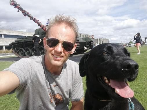
Paul Walker (Wellington)
                                     I’ve been at WGC as TIC Geography since arriving in NZ in 2004. Prior to
                                     that I taught for 10 years in a large comprehensive in the UK and had a year
                                     on a teacher exchange in Melbourne.
                                     My goal is to help you and myself gain confidence and expertise (let’s start
                                     at competence) in GIS and be willing to teach aspects of GIS and the
                                     internals. It’s such a vital area to our subject and propels us into a new
                                     paradigm of Geography teaching that makes the subject more relevant and
                                     appealing. Plus, with huge employment and application opportunities that
                                     are increasingly expanding, it acts as a significant drawcard to students. I
                                     want more Geo teachers to make the step and immerse themselves in GIS.
                                     Paul.walker@wgc.school.nz

Andy McMillan (Wellington)
I teach at Mana College and am passionate about growing GIS
use and its application in our teaching. I believe if we can
connect our student with real world applications of their
geographic knowledge and skills we will be empowering
them. For me GIS is about providing a relevance for
Geographers to address 21st century challenges. My area of
specialty is cultural geography and with the rise of ‘big data’ I
see an opportunity for our discipline that hasn’t existed in
quite the same way before.

As one of your Wellington champions, I don’t profess to be
the font of all GIS knowledge. I see an opportunity to work
collaboratively with teachers in our area to grow our
expertise and practice. I have taken part in the workshops offered by Eagle and have grown in my
understanding. This network of expertise aligns nicely with better user operability. By this I mean that offering
GIS inquiries and work via ArcGIS online takes away the need to install desktop applications. I’m looking
forward to developing new resources and improving the uptake of GIS standards at levels 1, 2 and hopefully 3.
Andrewm@mana.school.nz

                                                                                                                3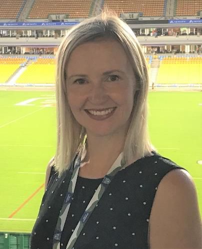
Sam Creed (Canterbury)
Through many years of camping and fishing as a kid I
developed a love for the natural environment of New
Zealand. This led me to studying Geography at UC,
focussing on river mouth/coastal environments towards
the end of my studies. I have been teaching Geography at
Kaiapoi High School since 2016 and absolutely love the
range of fun topics, ranging from Earthquakes and
Tsunami to Lime Scooters and tourism that we can study
in class. I am looking forward to the opportunity to
improve my knowledge of GIS tools that are available for
students to use and discover new and innovative ways to
use these in the classroom. Having an understanding of
GIS is a great skill for students to have and the more we
use it in the classroom the better! I am looking forward to
playing my part in helping GIS grow in Canterbury
schools. s.creed@kaiapoi.school.nz
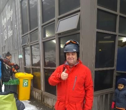
Brendon Robertson (Otago/Southland)
I am a Geography teacher at Mt Aspiring College in Wanaka, and
have the privilege to live and work in a beautiful and unique
environment. My family enjoys the lifestyle of being close to the
mountains, rivers, and lake that the region offers. I have had an
interest in GIS for many years now, developing my understanding
of spatial concepts through Google apps for Education and ESRI
Mooc, and integrating this into the programs we develop at Mt
Aspiring College.
My GIS Champion goals are to build capacity, understanding, and
integration of GIS into Geography and other Social Science
classrooms. robertsonbr@mtaspiring.school.nz
Mike Beeby (Otago/Southland)
I’m teaching Geography at South Otago High School in Balclutha. Prior
to this I was based at Waimea College near Nelson which is where I first
learnt about GIS. I’ve been using it in the classroom for 7 years at both
the Year 11 and 12 level as well as little lessons with my juniors. The
next step is to write an assessment for use in Year 13 as well.
GIS has been a real motivator for my students due to its real world and
career relevance. I want to help other teachers experience that same positive experience in their classrooms.
Part of this is through the sharing of resources but also helping with the nuts and bolts of how to use the
software in the wider school setting. That support to make it work is key for you to have an enjoyable and
sustainable experience with this technology. mbeeby@sohs.school.nz
4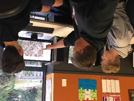
PLD Priorities Feedback
Geography teachers are encouraged to submit a response to the PLD National Priorities
before 10 May, 2019. The current national PLD priorities are:
Pāngarau and maths
Pūtaiao and science
Te reo matatini (pānui, tuhituhi, kōrero), reading and writing
Digital fluency.
The proposed national PLD priorities in (English medium) are:
Cultural capability
Local curriculum design
Using information to support learning
Such priorities will sit alongside a MAJOR system change with the NCEA and Tomorrow’s
Schools reviews. It seems that this period will be a time where subject specific (e.g.
Geography!) PLD would work to support the changes that are likely to come with these
reviews. Are generic cross-cutting PLD priorities such as those proposed likely to be of
greatest value to specialist secondary school teachers? Or should we be demanding a PLD
priority that is more closely focused on secondary specialisms?
It would be great for specialist secondary teachers to mobilise on this issue by completing the
survey at the link above.
Brief messages from the NCEA Review
The Achievement Standard Review has been deferred to 2020 so that it is after the NCEA
Review is complete.
The goal is to reduce workload for teachers and students. Larger, fewer standards will reduce
workload. Within the review there will be elements of cross curricular but it is essential to
work out what the critical body of knowledge is for each subject. A national conversation
among geography teachers is required for such a question to be answered.
Soon to be released details suggest a staggered implementation of the new NCEA
qualifications over the next five years.
NZQA PLD: Assessor Support Model
NZQA have delivered 93 workshops (10 of which were online). Some subject associations
are using these more than others.
5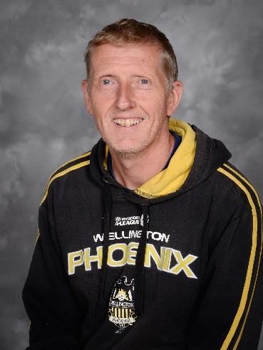
You used to need 18 people to have a workshop run. Now it’s 10 (because they’re using a
model where they don’t have to hire a venue etc.) Online equivalents are still available for
more remote areas.
With this model, regions can request assistance on what their teachers need.
Making assessor judgements workshops - generally where the moderators have
noticed that there is a national issue.
Speaker requests - targeted support for regional clusters or national subject
associations.
Transforming Assessment Praxis (TAP). A 9 week online programme. Aims to assist
teachers to change assessment resources to better meet needs of their students; and to
explore different ways of collecting evidence (includes case studies)
6
You can also read