NHS delivers efficient vaccination programme - www.esriuk.com - ISSUE 48 SUMMER 2021 - Resource Centre
←
→
Page content transcription
If your browser does not render page correctly, please read the page content below
NOTTINGHAM               AFFINITY
            4                      6                      11
                 ARCADIS               CITY COUNCIL             WATER
           Fast-tracking data     Inspiring city centre   Finding and fixing
           from field to client   regeneration            leaks quickly

                                                                 A SMARTER
                                                            3
                                                                 WORLD

                                                                NHS delivers
ISSUE 48                                                        efficient
SUMMER                                                          vaccination
2021
                                                                programme

                                                           www.esriuk.com
WELCOME
    THIS SMARTER WORLD
    Now, more than ever before, GIS professionals have a critical role to play in helping
    to build a better future, explains Stuart Bonthrone, Managing Director of Esri UK.

    Five years ago, Esri President Jack Dangermond appealed to        The biggest challenge that lies ahead is the need to reverse
    people in the GIS community to use their skills and resources     climate change. There is a clear and urgent need to repair the
    to address the most pressing and challenging issues on            damage that has been done to our environment as well as
    the planet. He urged them to use geospatial analysis and          begin to decarbonise the way we live, work and travel.
    digital mapping techniques to make smarter decisions about
    everything from protecting biodiversity to building new           Some positive steps are already being made towards creating
    infrastructure and delivering humanitarian relief. “GIS—your      this smarter world. In particular, customers are developing
    profession, your technology—provides the framework and the        new processes for enhancing, protecting and managing the
    process for creating... a smarter world,” he said.                environment. Costain, for example, is using ArcGIS to improve
                                                                      biodiversity on rail, road and utility schemes (page 10), while
    This smarter world is needed now more than ever before.           Affinity Water is using ArcGIS to find and fix leaks faster
                                                                      and conserve our planet’s water supply (page 11). Thames
    Certainly, the events of the last eighteen months have            Estuary Partnership is using ArcGIS to work with partners and
    demonstrated, beyond all doubt, just how important it is for      reopen fish migration routes (page 13), and Forestry and Land
    organisations to be able to understand complex situations         Scotland uses ArcGIS in the field to survey and manage ash
    and make fast, well-informed decisions. With the outbreak of      trees (page 5).
    COVID-19, public and private sector organisations alike had to
    address unprecedented challenges and develop new ways of          Whether we are challenged by COVID-19 or climate change,
    working. In this issue of ThinkGIS, you can read about the many   conflict or commerce, GIS delivers the tools we need to
    GIS heroes who lived up to Jack’s expectations, using GIS to      understand incredibly complex issues, find new ways of
    make smart decisions and support society through the crisis       working and living, and engage positively with others to
    (pages 8-9).                                                      achieve common goals. GIS professionals have the skills and
                                                                      technology to enable smarter decisions and help build a
    GIS played an essential role in informing some of the most        better future for us all.
    pivotal decisions of the pandemic. In our cover story, you can
    read how NHS South, Central and West used Esri’s GIS system,
    ArcGIS, to help it plan and implement the roll-out of the UK’s
    most ambitious vaccination programme ever (page 3).
    Furthermore, 42 Engineer Regiment used ArcGIS to help the         Stuart Bonthrone
    government share timely data about the ever-changing              Managing Director, Esri UK
    healthcare crisis and make rapid decisions about the siting of
    COVID-19 test sites and Nightingale hospitals (page 12).

    As the world comes to terms with the lasting impacts of the
    COVID-19 pandemic, almost all organisations will need to
    work smarter, whether they are redesigning high streets for
    an era dominated by online shopping, protecting the green
    spaces that were so important during lockdowns or enabling
    flexible working practices, now that we have all got used to
    working from home. Our customers are already illuminating
    the way ahead, using ArcGIS to create a sustainable, efficient
    and safer world. Nottingham City Council has used ArcGIS
    to inspire innovative schemes for city centre regeneration
    (page 6), while Arcadis has pioneered a more efficient survey
    and project management method (page 4). A UK research
    organisation, Conflict Armament Research, is using ArcGIS to
    trace the source of weapons and help create a better future for
    people whose lives are dominated by the threat of violence
    (page 7).

2
SMARTER WORLD

NHS DELIVERS
EFFICIENT
VACCINATION
PROGRAMME

NHS South, Central and West (SCW) used
geospatial analysis to help the NHS vaccinate
millions of people as quickly as possible.

When the NHS faced the enormous             people as possible, as quickly as         “Through our use of ArcGIS, we
challenge of vaccinating the entire UK      possible, while ensuring all available
population against COVID-19 within an       vaccines were used.
                                                                                      have supported the NHS to deliver
ambitious timescale, geospatial analysis                                              a massive, coordinated effort and
brought clarity to the planning process.    At the start of the national              vaccinate millions of people in the
The GIS team at SCW used ArcGIS to          COVID-19 vaccination programme,
help ensure that people receive the         SCW modelled the best locations           UK in a planned and efficient way.”
right vaccine at the right time from a      for large vaccination sites, based on     Trevor Foster
site convenient to them.                    a detailed understanding of where         Associate Director, Geographic Intelligence and
                                            people lived and drive times. SCW         Mapping Service, NHS South, Central and West
Critically, SCW helped in the planning      then adjusted the model iteratively to
and modelling of the optimal location       plan smaller vaccination centres at GP
of vaccination sites, taking into account   practices and pharmacies in response
the number of people in the catchment       to changes in the Government’s roll-out
area, in the target age range, for each     strategy. Now, SCW is using ArcGIS to
separate phase of the roll-out. The         keep NHS decision makers informed
organisation also worked with Primary       about the uptake of vaccinations and
Care Networks in Somerset to optimise       help them plan targeted interventions
the routing for vaccinating house-          that will encourage more people to
bound people, to allow district nurses      get vaccinated and prevent health
and GPs to reach as many vulnerable         inequalities.

                                                                                      SCW-produced map for optimising housebound vaccination
                                                                                      visit routes

                                                                                                                                               3
150%
                                                                                                  improvement in project
                                                                                                  management efficiencies

    SMARTER WORLD

    ARCADIS                                            Through the creation of a seamless digital workflow,
                                                       Arcadis can transfer asset and health & safety data
    FAST-TRACKS                                        rapidly from the field to its rail industry client.
    DATA FROM FIELD
    TO CLIENT                                          A leading global design and                Drawing on its extensive engineering,
                                                       consultancy firm, Arcadis was engaged      GIS and building information modelling
                                                       by a major rail industry client to         (BIM) expertise, Arcadis used ArcGIS to
                                                       survey around 50,000 electrical assets     build a fully integrated and automated
                                                       along 400 miles of railway lines in        digital workflow for managing the
                                                       the UK. Traditional survey and project     entire project, from the capture of
                                                       management methods were clearly not        survey data in a live rail environment
                                                       going to be up to the huge scale of this   to the creation of a BIM masterplan
                                                       task, so a new approach was needed.        for the electrified infrastructure. This
                                                                                                  new process has improved project
                                                                                                  management efficiencies by up to
                                                                                                  150% and reduced data capture time
                                                                                                  by 10%. The automated flow of data
                                                                                                  from ArcGIS to the BIM model has
                                                                                                  also halved the effort needed from
                                                                                                  the design team to produce the final
                                                                                                  deliverables for the client.

                                                                                                  In addition, the new digital workflow
                                                                                                  has improved collaboration between
                                                                                                  Arcadis, its client and its contractor, as
                                                                                                  all three organisations can view and
                                                                                                  share data via ArcGIS Dashboards and
                                                                                                  the ArcGIS Hub. Everyone has real-time
                                                                                                  access to the same information, and the
                                                                                                  client can monitor Arcadis’ performance
                                                                                                  against key performance indicators, at a
                                                                                                  glance, on demand. Critically, surveyors
                                                                                                  can use ArcGIS on site to notify the
                                                                                                  client immediately of any health &
                                                                                                  safety concerns observed. Rapid action
                                                                                                  can then be taken to remove potential
                                                                                                  hazards, reducing risks for all rail staff
                                                                                                  and contractors working along the
                                                                                                  railway lines – now and in
                                                                                                  the future.

                                                                                                  An ArcGIS dashboard used for monitoring the
                                                                                                  progress of the survey project

    “The new digital workflow that we have
    developed with ArcGIS enables us to
    deliver an efficient, collaborative and high
    quality service for our client.”
    Gideon Simons
    Principal GIS and Geospatial Consultant, Arcadis

4
FIELD MOBILITY

FORESTRY AND
LAND SCOTLAND
HELPS TO MAINTAIN
PUBLIC SAFETY

Concerned about the increased                  When ash trees become diseased,               scale of Ash Dieback impacts, Forestry
                                               branches can break away and tree              and Land Scotland can more accurately
risks to the general public, Forestry          trunks can crash to the ground, causing       forecast what resources it will need to
and Land Scotland is surveying                 serious injuries or even death for            tackle the safety and environmental
thousands of ash trees and                     anyone unlucky enough to be nearby.           impacts of Ash Dieback across 640,000
                                               Forestry and Land Scotland is taking          hectares of Scotland’s forests and land.
monitoring the growing threat                  action to limit this risk, by surveying ash
of Ash Dieback disease.                        trees on its land and monitoring their
                                               condition using Survey123 for ArcGIS.

                                               With near-instant visibility of data
                                               collected in the field, Forestry and Land
“ArcGIS provides the clear                     Scotland can easily see ‘hot spot’ areas
insight we need to make                        where there are particularly badly
informed decisions about how                   diseased trees or weakened branches
                                               in close proximity to high-risk areas
best to tackle Ash Dieback and                 such as public roads and paths. Then it
plan the level of investment that              can make rapid, informed decisions
                                               about where to prioritise its resources,
will be needed in the future to                to remove branches or fell trees to
manage diseased trees and                      reduce the risks to people and
maintain public safety”                        property.

Alan Gale                                      Forestry and Land Scotland is now
Climate Change Adaptation Programme Manager,
                                               using ready-made dashboards in
Forestry and Land Scotland
                                               ArcGIS Online to monitor changes in
                                               the condition of specific trees over
                                               time and measure the speed at which
                                               diseased trees deteriorate. With an

                     6,600
                                                                                             Employees capture data on smartphones using
                                               improved understanding of the true            Survey123 for ArcGIS

                      ash trees surveyed
                      in two months

                                                                                                                                           5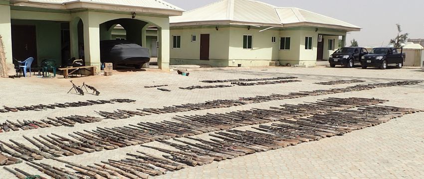
MAP CREATOR

    NOTTINGHAM
    CITY COUNCIL
    LEADS THE
    REGENERATION
    CONVERSATION

    In a public consultation called the
    ‘Big Conversation’, a Story Map inspired
    innovative schemes for regenerating a derelict
    shopping centre and creating a thriving city centre.

    When a major retail developer went           story map to view historic maps, see       “The Big Conversation story
    into administration at the start of the      3D models of other developments
    coronavirus pandemic, the historic           already underway nearby and learn          map really captured people’s
    city of Nottingham was left with a           about the history of the 20-acre Greater   imagination and helped to engage
    partly demolished shopping centre            Broadmarsh site. The vast amount
    and shattered redevelopment plans.           of local information in the story map
                                                                                            a wide audience in the process
    Recognising this as an opportunity           helped to stimulate public interest in     of designing a new vision for the
    rather than a catastrophe, Nottingham        the city’s future and contributed to       future of Nottingham’s city centre.”
    City Council used an ArcGIS Story Map        more than 3,000 responses.
    to engage local people and businesses                                                   Mick Dunn
                                                                                            GIS Service Manager, Nottingham City Council
    in the ‘Big Conversation’ about what         Significantly, using ArcGIS StoryMaps
    they would like the area to look like in a   enabled the council to be entirely
    future beyond COVID-19.                      transparent about not only the
                                                 opportunities, but also the challenges
    With its attractive and interactive          of the development site, such as
    format, the Big Conversation story map       large changes in elevation, planning
    succeeded in capturing the attention of      constraints and a network of
    a large number of people and gained          underground caves. With an accurate
    more than 12,000 views during the            understanding of these issues,
    10-week consultation period. Local           people could put forward innovative
    people, developers, architects and           suggestions for the future of this prime
    business owners were able to use the         city centre location.

                                                 12,000
                                                 Story Map views
                                                                                            Nottingham City Council shared a vast amount of local
                                                                                            information with the public via an interactive Story Map

6                                                in 10 weeks
877
                                                                                           weapons & rounds
                                                                                           of ammunition
                                                                                           investigated
MAP CREATOR

RESEARCHERS
TRACE THE WEAPONS
OF WAR

                                                                                           An ArcGIS Story Map shows the likely route of
                                                                                           Polish-manufactured weapons from Libya to
                                                                                           Nigeria

In one of the deadliest conflicts in           Fierce clashes between herder and           East. It visualised all the data collected
                                               farmer communities in Nigeria have          in an ArcGIS Dashboard, providing
Western Africa, Conflict Armament              led to the deaths of 3,600 people since     researchers and policy makers around
Research is tracing the source of              2014, and more than 300,000 people          the world with an easy way to examine
                                               have been displaced from their homes        the type, age and origin of the illicit
weapons and sharing this vital                 as a result of violence in the region. To   weapons and ammunition used in
intelligence via ArcGIS.                       improve understanding of how armed          herder-farmer violence in Nigeria.
                                               groups in countries like Nigeria are
                                               obtaining weapons, the independent          In addition, Conflict Armament
                                               research organisation Conflict              Research produced an interactive
                                               Armament Research systematically            ArcGIS Story Map, clearly explaining
“ArcGIS gives us a massively                   investigates the original source and        how these military weapons had
                                               supply of arms and armaments that           reached armed groups in Nigeria. The
expanded toolkit for sharing our               security forces have seized in conflict     Story Map embeds mapping content
investigative findings and raising             zones around the world.                     from Esri Living Atlas to make the
awareness of the importance of                                                             complex story of armament movements
                                               In one recent investigation, Conflict       very easy for people to understand
better controlling weapon supply               Armament Research mapped the                in a visual format. Government policy
routes, to reduce violence in                  movement of 148 weapons and 729             makers and non-governmental
Nigeria.”                                      rounds of ammunition found in Nigeria       organisations can now use this Story
                                               back to manufacturing plants in Europe,     Map to help them implement more
Rob Perkins                                    East Asia and the Middle                    effective measures to block weapons
Head of Research, Conflict Armament Research                                               from entering Nigeria and thereby
                                                                                           reduce the human cost of this conflict.

                                                                                                                                           7
Read articles about
all these inspirational
GIS heroes here
CONGRATULATIONS HELPING VULNERABLE PEOPLE
TO OUR GIS HEROES At the outset of the pandemic, millions of people
volunteered to help vulnerable people in their
communities. Lewis Westbury, founder of the
group Police Rewired, used ArcGIS Online to
produce a web-based dashboard for the police,
showing details of over 3,750 local voluntary
groups. Police officers were able to use this
dashboard to contact groups and provide
timely, relevant safety information to support the
nation’s new army of volunteers.
In Scotland, Scottish Water was concerned about
the potential impact that a water outage might
have on vulnerable people during lockdown, if
they couldn’t call upon friends and neighbours
to help them. Stuart Hill, Asset Inventory Lead
at Scottish Water, developed an analytical web
app using ArcGIS that displays the locations of
vulnerable households, care homes, hospitals
and other vulnerable groups. This solution gives
Scottish Water rapid visibility of the locations
of vulnerable people, making it more prepared
than ever to support its most vulnerable
customers if a water outage occurs.
When COVID-19 threatened and disrupted lives,
GIS heroes around the UK launched into action
and used ArcGIS to overcome unprecedented,
urgent and colossal challenges.
ENABLING HOME SCHOOLING
Following the closure of schools and the move
SUPPORTING KEY WORKERS RESPONDING TO EMERGENCIES COMMUNICATING to online learning, over 1.14 million pupils
across the UK found themselves disadvantaged
While most of the UK was told to ‘Stay at Home’,
INFORMATION RAPIDLY because they didn’t have access to a laptop or
Just because the country was in lockdown, it
key workers still needed to get safely to work. computer at home. Lindsey Parslow, founder
didn’t mean that emergency situations wouldn’t The ability to communicate information rapidly
Stuart Lester, Data Insights Manager at Transport of the charity Business2Schools, worked with
arise and first response organisations needed to proved critical for many organisations. At
for West Midlands (TfWM), conducted detailed Esri UK to develop an ArcGIS web app that
be ready for action. Matthew Wright, GIS lead Public Health Scotland, Andrew Gasiorowski,
analysis with ArcGIS and identified specific areas made it easy for individuals and businesses to
at the Royal National Lifeboat Institution (RNLI), Principal Information Development Manager
of the Midlands with clusters of key workers donate any unwanted laptops to nearby schools.
used ArcGIS to build an interactive dashboard, and GIS Lead, developed an Esri dashboard
who are dependent on public transport. Using Widely publicised by the BBC, the app led to the
showing how many lifeboat members had for displaying live information about the
this information, TfWM could then work with its donation of thousands of laptops and helped
COVID-19 symptoms or were self-isolating and numbers of cases and deaths in Scotland. This
partners to ensure vital transport services were many more children access online learning.
the readiness of crews at 238 lifeboat stations in visual solution allowed the organisation to
maintained in these priority areas. the UK and Ireland. Developed in just 72 hours, communicate a high-level overview of what was
this dashboard helped the RNLI to maintain its Meanwhile, the Rivers Trust worked on a scheme
happening in the country during the pandemic.
Sustrans, in the meantime, launched a scheme vital, life-saving services during the COVID-19 to help parents and teachers deliver interesting
to help key workers cycle to work. GIS Officer pandemic. online lessons during lockdown. Anneka France,
In London, City of London Police used ArcGIS GIS Analyst at The Rivers Trust, quickly launched
Flora Tiley used ArcGIS Online to create a web
to communicate information about the business a Schools Hub, using ArcGIS Hub, providing
map displaying more than 1,600 bike shops Global travel restrictions threatened to premises that were closed, the workers who free access to a wide range of materials from
and repair centres throughout the whole of the hamper the actions of the specialist organisation were still traveling into the City and estimated virtual field trips and interactive presentations
UK, including 474 cycling industry offers for Oil Spill Response Limited (OSRL). However, footfall throughout the area. Created by PC to science experiments for the kitchen. These
key workers. Liam Harrington-Missin, Technology and Daniel Baker, the operational dashboard helped resources made teaching easier for parents and
Innovation Lead at OSRL, created an ArcGIS the police to optimise the security of business teachers, while helping to educate young people
dashboard to provide easy access to logistical premises throughout the City of London, at a about the critical importance of rivers.
information, COVID-19 contingency plans and time when quieter streets created potential
all the other information needed to deliver opportunities for criminal activities.
a rapid response in the event of an oil spill
emergency, anywhere in the world.
8 9
ANALYTICAL INSIGHTS

     IMPROVING                                            Smart infrastructure solutions company Costain
                                                          is working with clients and partners to improve
     BIODIVERSITY                                         biodiversity on rail, road and utility schemes.
     ON LARGE
     INFRASTRUCTURE                                       It is notoriously difficult and time         They then model how and when the

     PROJECTS                                             consuming to collect and analyse all the
                                                          data, options and costs associated with
                                                                                                       environment will be impacted by the
                                                                                                       project and devise plans to reinstate
                                                          managing biodiversity for construction       and enrich habitats. By considering
                                                          sites. However, an organisation              biodiversity up-front, in the design
                                                          committed to protecting and enhancing        phase, Costain can plan and implement
                                                          natural capital on infrastructure projects   environmental schemes more cost
                                                          is now using ArcGIS to help minimise         effectively and achieve the best
                                                          the environmental consequences of            environmental outcomes.
                                                          construction work and create high-value
                                                          new habitats that support improved           In one recent road improvement
                                                          biodiversity.                                scheme, Costain and its partners
                                                                                                       planted twice as many plants and trees
                                                          Costain uses ArcGIS to capture, manage       compared to those removed, creating
     ”ArcGIS allows us to be smarter                      and analyse a vast amount of ecological      over 270 hectares of new habitat.
     in how we collect, analyse, and                      data about sites, including land-cover       Five new habitats were constructed
                                                          and conservation areas. In the field,        specifically for voles, the fastest
     visualise environmental data, making                 ecologists use ArcGIS solutions to           declining mammal species in the UK,
     the implementation of innovations                    record the distinctive qualities of          as well as ponds, log piles and planting
     that reduce environmental impacts                    different areas, assess the needs of         for newts, insects and other creatures.
                                                          specific species and calculate the value     As a result, this major project has had a
     more feasible on a larger scale.”                    of the site in biodiversity units.           highly positive impact on biodiversity in
     Katie Dawson                                                                                      the area.
     GIS Lead for Environment, Costain

     ArcGIS cloud-based mapping and dashboards help
     visualise and analyse data to improve biodiversity
     management and reporting for regulatory compliance

10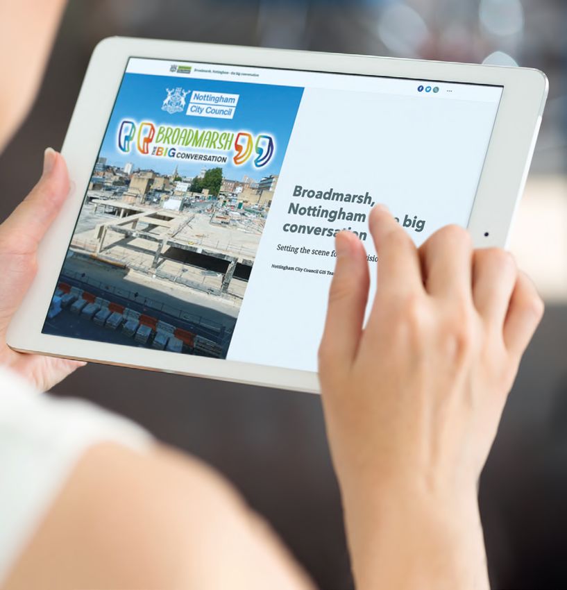
1day
to narrow
the search for a
ANALYTICAL INSIGHTS leak, instead of
two weeks
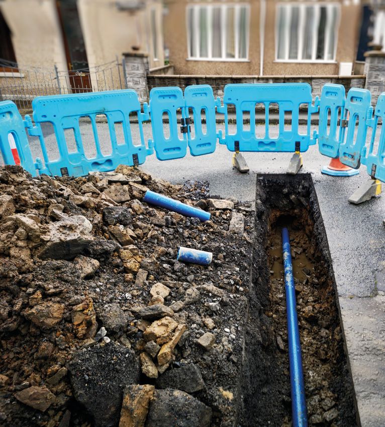
AFFINITY WATER
FINDS AND FIXES
LEAKS FASTER
After beating its challenging five-year leakage
reduction target in 2020, Affinity Water is now using
ArcGIS to help it find and fix leaks even faster.
Every single day, enough water leaks When leaks are identified and if water
from water pipes in England and Wales outages occur, Affinity Water can
to fill 1,182 Olympic swimming pools. also respond and instigate repairs
Water utilities are tasked with reducing more quickly, by using a Situational
this wastage, yet finding what can Awareness solution, developed using
be tiny holes amongst thousands of ArcGIS and open source technology.
kilometres of underground pipes, can This browser-based application gives
be an enormous and time-consuming employees instant visibility of all
challenge. incidents, on an interactive map, as
soon as they occur. From the office, the
Affinity Water estimates that it has field or at home, employees can easily
reduced the time required to narrow access all the information they need
down the search for a leak from around to plan the best response, all from one
two weeks to one day, by using ArcGIS screen, which enables the organisation
in conjunction with artificial intelligence to restore water services more quickly
and machine-based learning. Through and deliver a higher standard of
its new ArcGIS-based leak modelling customer service.
technique, the organisation can analyse
geospatial factors ranging from the
directional flow of water to the contour
of the ground and the soil type, to
‘learn’ with greater accuracy the most
probable locations of a leak.
Affinity Water’s Situational Awareness solution “We anticipate that our Situational
shows active incidents with indicators including
customer contacts, jobs and water pressure Awareness solution will help us
to reduce the average time that
properties are without water and
support us in achieving our Ofwat
performance target for 2020-25.”
Sue Fenlon
Head of Control Operations, Affinity Water
11COMMUNITY ENGAGEMENT
42 ENGINEER Throughout the COVID-19 pandemic, 42 Engineer
Regiment provided the trusted data and analysis
REGIMENT ENABLES needed to inform rapid decisions, protect the NHS
COLLABORATION IN and save lives.
A CRISIS
Over a thousand people were involved Military Assessment Teams, comprising
in planning the UK’s response to the engineers, medics and logistics
pandemic – from the Cabinet Office experts used an ArcGIS mobile data
and national government, healthcare collection app when visiting potential
agencies, local authorities, the police sites for Nightingale Hospitals to
and military. 42 Engineer Regiment gather information on everything from
(Geographic) used ArcGIS Online to potential bed capacity to the feasibility
provide all these organisations with of laying oxygen pipes. All the data
a single source of shared data that collected in the field was immediately
they could all rely upon to help them visible to all planners, across partner
collaborate during the rapidly evolving organisations, giving everyone instant
healthcare emergency. access to the latest information. This
speed supported faster decision
In addition, 42 Engineer Regiment making and enabled the construction
undertook a vast amount of multi- of hospitals to commence with utmost
criteria analysis to give policy makers haste, at a time when COVID-19 cases
the insight they urgently needed were rising at an exceptional rate.
to help them make decisions. For
example, a skilled team of military
geospatial analysts shortlisted and
“42 Engineer Regiment is proud to analysed potential sites for COVID-19
have played a key role in enabling testing centres, taking into account
local population figures, car parking,
the Government to make faster, transportation access, the size of the
well-informed decisions in the site and distance from residential areas.
They were able to accurately pinpoint
battle to protect the NHS and the most suitable locations that would
save lives.” serve the largest proportion of the
Captain Luke Parker population and help the Government
Strategic Command expand testing facilities rapidly.
Data about the health emergency, shared via
ArcGIS Online
12125
species of fish face
migratory obstacles in
the River Thames
COMMUNITY ENGAGEMENT
“With our ArcGIS Roadmap, we
THAMES ESTUARY can now engage and work with
PARTNERSHIP REOPENS stakeholders far more effectively
FISH MIGRATION ROUTES to remove and adapt river barriers
and help to sustain a diverse fish
population in the River Thames.”
Wanda Bodnar
Project Officer, Thames Estuary Partnership
A not-for-profit organisation in London is using ArcGIS to
engage successfully with stakeholders and create a more
sustainable future for fish in the River Thames.
Although the River Thames is one of Thames Estuary Partnership is
the world’s most famous rivers, few now using this roadmap to help it
people realise that it is home to more collaborate with a wide range of
than 125 species of fish. What’s more, stakeholders and instigate schemes
many of these species are threatened, to improve migratory routes. Local
as their migratory routes along the authorities, landowners and riverside
River Thames to high quality habitats developers working in the Thames
and spawning grounds are becoming region can easily see the specific
blocked by artificial barriers, such as barriers that restrict access to upstream
locks, sluice gates and weirs. areas where the habitats are good and
where fish species will thrive. They can
Thames Estuary Partnership is now then prioritise their investments and
raising awareness of this pressing make better decisions that will improve
environmental issue with the creation the quality of the River Thames as a
of a Greater Thames Estuary Fish habitat for all fish species, as well as
Migration Roadmap. Produced using the marine mammals and thousands of
ArcGIS, this interactive tool combines migratory birds that call it home.
data on fish species and their
migrations, habitat quality, artificial
river barriers, flood areas and riverside
developments to clearly show locations
where vital migratory routes are
impassable. People can, for example,
easily see the obstructions faced by the
European Eel, a critically endangered
species that travels across the Atlantic
Ocean to mature from a glass eel into a
The ArcGIS roadmap showing barriers to fish
silver eel in the Thames.
migration along the Thames and its tributaries
13LEARNING SERVICES
GIS PROFESSIONALS GIS professionals have continued to develop
their skills throughout the coronavirus pandemic
PRAISE QUALITY OF by attending Esri UK’s live virtual courses.
ONLINE COURSES
The challenges of COVID-19 have Esri UK hopes to be able to offer
not prevented GIS professionals from face-to-face training courses again
developing important new ArcGIS soon, but it will still continue to deliver
skills and learning about GIS best a varied programme of online training
practices. Since early 2020, Esri UK has opportunities.
been delivering all of its traditional
classroom-based and on-site training In addition to Esri UK’s instructor-led
courses, on topics such as moving from virtual training courses, Esri offers over
ArcMap to ArcGIS Pro, over the internet. 400 eLearning modules for self-paced
learning that are free for users with
GIS professionals who have attended an ArcGIS license in maintenance.
these live virtual courses have praised Esri also provides free Massive Open
Esri UK for providing the same Online courses (MOOCs) in topics
“Having been on in-person learning opportunities online as they ranging from spatial analysis to creating
would expect in face-to-face training geo-apps. By taking advantage of
Esri courses in the past, I was environments. There is no need for any of these learning services, GIS
dubious about how the virtual course participants to download professionals can invest in new skills
set up would work. I was very software, and they can communicate now that will help them succeed in
easily with the Esri-certified instructor the future.
impressed and felt like I got as via voice and text throughout the
much out of it as I would have sessions.
with an in-person course”
Fiona Livingston TAKE ADVANTAGE OF:
GIS Analyst, Crown Estate Scotland
A full programme of instructor-led virtual courses
400+ self-paced eLearning modules
Free 6-week massive online open courses (MOOCs)
Guided lessons based on real world problems with Learn ArcGIS
Being part of the Esri Community
14EDUCATION
NEW SCHOLARSHIP
PROGRAMME SUPPORTS
BLACK STUDENTS
Esri UK is working alongside the organisation
Black Geographers to encourage more diversity
in geography education and careers.
Black and ethnic minority groups are other black geography students
significantly under-represented in and is now actively championing
the GIS industry and in geography geography and geoscience as a
professions in general. Esri UK wants positive choice for black people.
to change this and has launched
a new scholarship programme to Each academic year, Esri UK will
encourage more young people with make two financial awards. The first,
African, Caribbean, black or mixed the Undergraduate Award, provides
black heritage to study geography and funding of £30,000 (£10,000 per
geoscience. year for three years) available for a
black student to study geography or
The scholarship programme has been geoscience. The second, the Master’s
introduced through collaboration Award, provides £20,000 for full-
with Black Geographers, a community time study on a one-year master’s
interest company founded by university programme within the same disciplines
student Francesca Rockey. After of geography or geoscience. The
discovering in 2020 that she was the first students to benefit from these
only black girl on her geography scholarships will be embarking on their
course, Francesca set up a network for new courses in September this year.
“Through the Esri UK Scholarship,
we hope that we can diversify
both the cohort of students on
undergraduate and postgraduate
geography courses and the
next generation of geography
professionals.”
Francesca Rockey
Founder of Black Geographers
15PROFESSIONAL SERVICES
SOLVE BUSINESS If you had ArcGIS experts on hand
to guide you, how much more
CHALLENGES quickly could you deliver the
FASTER! new business solutions that your
organisation urgently needs?
Esri UK’s Professional Services group offers
a range of consulting, project delivery and
packaged services to help organisations
accelerate the delivery of new GIS solutions and
services. With hands-on technical knowledge,
business experience and insight into best
practices, the team can
help you optimise your use of GIS and solve
business challenges faster.
NOT QUITE SURE HOW TO
GET STARTED?
The Professional Services team offers a range of
launchkits that have been specifically designed
to get customers up and running with ArcGIS
very quickly. Available at a fixed price, these
packaged services have a pre-defined scope
and are available for product installation and
configuration, system health checks, architecture
reviews and prototype development.
HAVE A SPECIFIC PROJECT
IN MIND?
Esri UK has an experienced team of GIS
consultants, developers and project managers
who will design and deliver a project to meet your
specific requirements. Using an ISO-accredited
quality management system and a range of
project delivery methodologies, we will manage
the scope, schedule and budget of each project
phase to reduce the risk of delays and ensure your
business outcomes are met.
PLANNING AHEAD FOR
THE FUTURE?
Our bespoke business and technical consulting
services can be engaged at any time, to help
resolve a specific technical issue or to support
your long-term strategic planning. Working closely
with you, we will help you maximise the value and
Find out more here: return on investment that your organisation
www.esriuk.com/services/professional-services gains from GIS.
Esri UK Ltd, Millennium House, 65 Walton Street, Aylesbury, Buckinghamshire, HP21 7QG | T 01296 745 500 | F 01296 745544 | E info@esriuk.com www.esriuk.com
Esri Ireland, Block B, 2nd Floor, Ashtown Gate, Navan Road, Dublin, 15 NP9Y | T +353 1 8693 900 | +353 1 8693 901 | E sales@esri-ireland.ie www.esri-ireland.ieYou can also read