Norwegian participation in space and satellite activities - AGF-216 - Pål Brekke Norwegian Space Agency
←
→
Page content transcription
If your browser does not render page correctly, please read the page content below
Norwegian participation in space and satellite activities
                      AGF-216

                       Pål Brekke
                    Norwegian Space Agency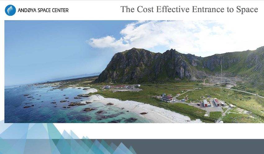
Satellite orbits
                          (ca. 20.000 km)

           Not to scale

Ikke i skala
                                            2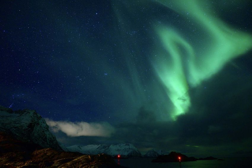

Satellites and Space Debris
• 8000 satellites launched
• 4850 still orbiting
• 2000 are operating
• 20.000 objects > 10 cm
• 700.000 small objects

                              US Space Surveillance Network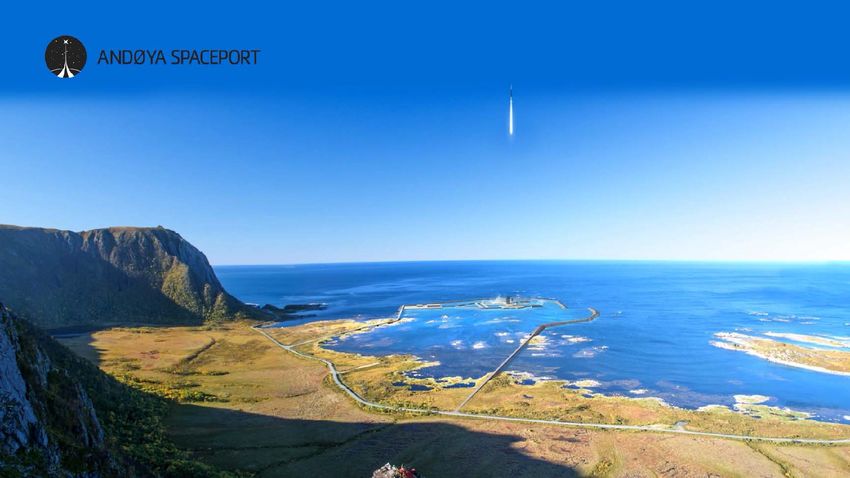
Geostationary satellites (GEO)
• Telecommunication
• TV-satellites
• Weather satellites (GOES, Meteosat)

                                  Wikipedia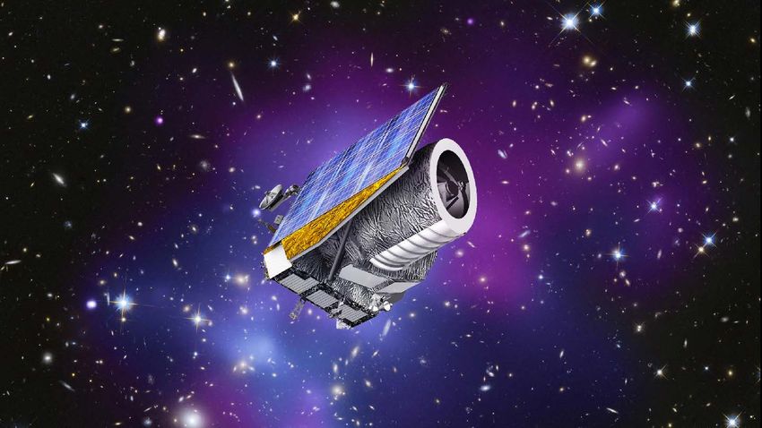
High inclination orbits (HEO)
• Will make it possible to provide communication and broadband internet over the polar regions
• Space Norway is leading the development of this project.

                                                                                       Google/NASA
                                Space Norway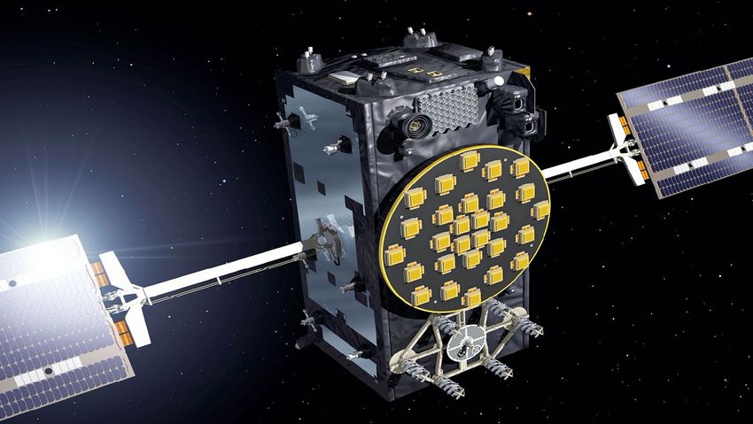
Medium Earth orbits (MEO)
• GPS (20.200 km)
• Galileo (23.200 km)
• Glonass (19.100 km)

                                                       EU

                                           Wikipedia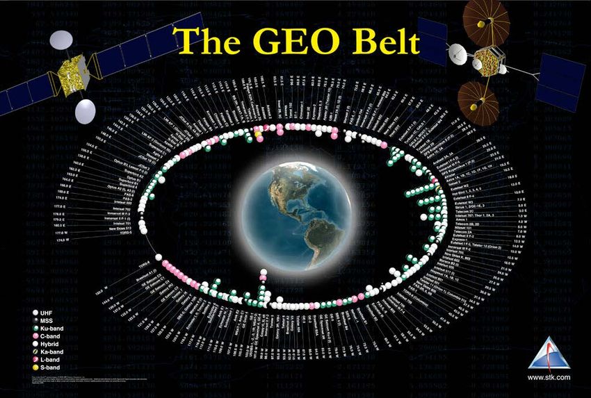
Low Earth Orbits (LEO) - polar
• Earth observation
• Astronomy/solar physics
• Spy satellites
• Some telecom (Iridium, Globalstar)

                                KSAT             Wikipedia

                                          NASA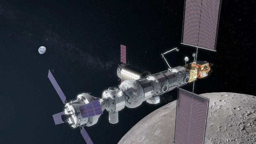
Norway - small space nation on top of the world

                     9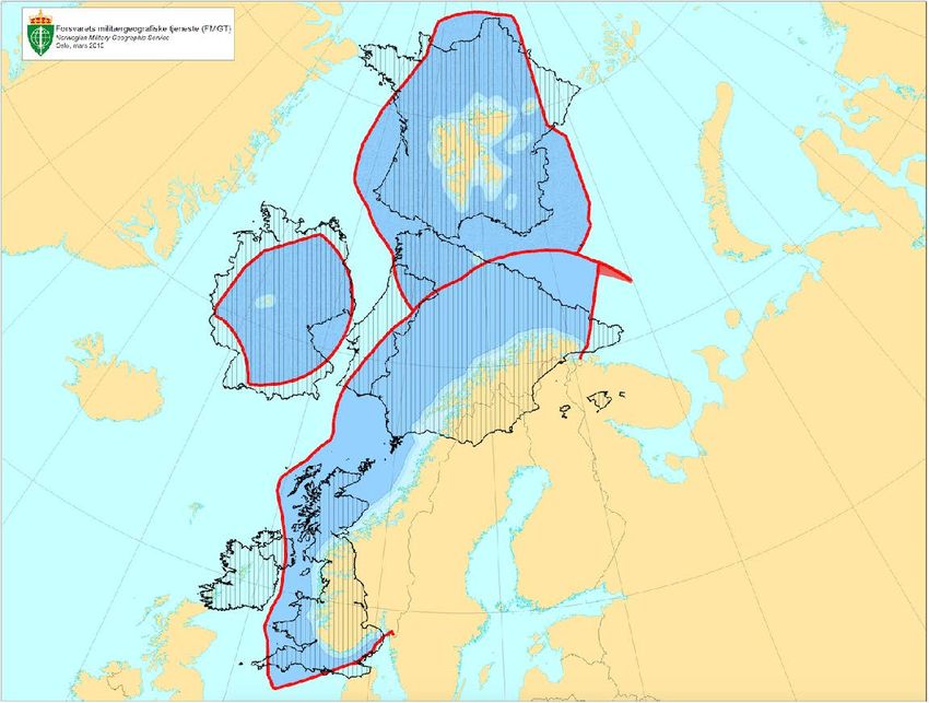
10
1 979 179 km²
   OCEAN
  to monitor

                11
Corresponds to half EU
12Why is the ArcXc important to Norway? • Norway has apart from Russia, Europe’s largest area to manage, mostly in the ArcXc or the High ArcXc • Norway and Russia manages one of the worlds largest well managed fish stocks in the Barents Sea • ExploitaXon of oil- and gas resources • More traffic through the Northern Sea Route increases traffic in Norwegian waters • Opening of new sailing routes across the ArcXc basin creates issues concerning safety and rescue
Norwegian Space Agency in brief

• The Norwegian Space Agency is a government
  agency under the Ministry of Trade and Fisheries
• Established in 1987 when Norway joined the
  European Space Agency
• Coordinates Norwegian space activities
  internationally, with focus on ESA and the EU
• Coordinates national space activities
• 40 employees at Skøyen, Oslo
• Budget 2021: NOK 1563 million (≈ € 156 million)

          www.romsenter.no
National priorities •Telecommunication •Navigation •Earth observation •Industrial development based on ESA and EU programmes •Ground infrastructure •Space research and space related basic research
Historic tradiXons

Long tradiXons within space research due to our locaXon far north :
  • ScienXfic observaXons of the aurora before 1900
  • Birkelands innovaXve experiment in 1896
  • NaXonal solar observatory in 1957
  • First rocket launch in 1962

                                                            16
Solar Physics in Norway
Institute of theoretical astrophysivs was
established by Professor Rosseland in 1934
and built with help from the Rockefeller
Foundation.
The National Solar Observatory was opened
in 1957. Provided satellite tracking for US
Airforce in the 50s and 60s.
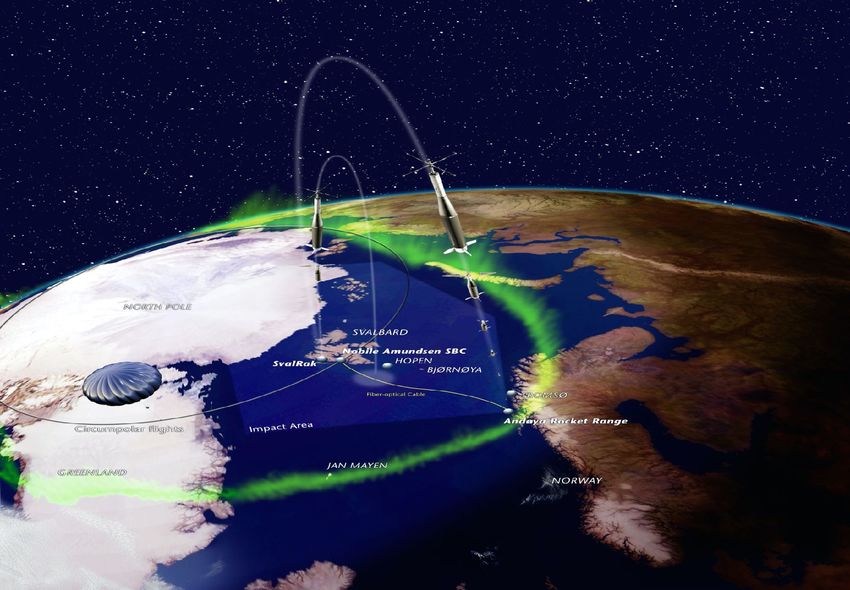
17The very start of space research.
Andøya Rocket Range
Ferdinand from Oksebåsen, Andøya 18 august 1962Launches
Launch of the NASA Charged Aerosol Release Experiment
(CARE II) from Andoya Space Center in Norway, Sept. 16, at
19:06 GMT. -
ICI-4 - space weather effectsALOMAR
Launch facility for small satellites
Spaceship Aurora
Space Geodetic Research Facility
 Space Geodetic Research Facility of the Norwegian Mapping Authority is part of an international network of stations measuring
small displacements in the Earths crest.

• Basis for Earth ObservaXons
• The Science of the Earths’s shape, moXon, gravitaXonal field and changes of these
• Fundamental for monitoring climate change, sea level an all mapping.
Planetary Exploration
• AMASE – Arctic Mars Analoge Svalbard Expedition is a Norwegian run cooperating project
  (ESA, NASA/JPL and Carnegie Institution of Washington) where future Mars rovers and
  instruments are being tested at Svalbard every summer.
Wisdom on ExoMars
• The radar, named WISDOM (Water Ice and Subsurface Deposit Observations on Mars), is
  able to detect geological structures under the surface, and is able to create high resolution
  pictures from down to 2-3 metres.
Instruments on Curiosity tested at Svalbard
• Two of the instruments on Curiosity was testes at Svalbard.
• Memscap in Horten provided pressure sensors to Curiosity
Norwegian Georadar on Mars
RIMFAX (Radar Imager for Mars Subsurface Exploration), was selected as one of the seven instruments on the MARS
Perseverence rover. RIMFAX will investigate the geology under ground and find areas where there as been water.
Norwegian Georadar on Mars
RIMFAX (Radar Imager for Mars Subsurface Exploration), was selected as one of the seven instruments on the MARS
2020 Rover. RIMFAX will investigate the geology under ground and find areas where there as been water.
Perseverence landing
Lunar Gateway
• Norway will participate in Lunar Gateway through ESA industry contracts. E.g. Nammo with
  rocket engines for the Heracles lander
Norwegian participation in Euclid
Euclid is an ESA mission to map the geometry of the dark Universe

                 CMR Prototech delivers to the NISP instrument:
                 - NI-SSS, a mechanical structure holding the detector electronics
                 - the feet holding the NISP instrument in place on the space telescope.

                 University of Oslo /ITA
                 - Science Ground Segment
Norway Central partner in HINODE Led by the Japan Aerospace ExploraXon Agency (JAXA), the Hinode mission is a collaboraXon between the space agencies of Japan, the United States, the United Kingdom and Europe. EIS So/ware, data downlink at Svalbard and the European Data Centre in Oslo (a 20 MEuro contract with ESA)
Birkeland Centre for Space Science
• ASIM on ISS
ASIM - front page in Nature
m-NLP - multi-needle Langmuir probe system
• UiO and Eidel: Plasma diagnostic around ISS - and space weather
Plants in space
• CIRiS - Centre for Interdisciplinary Research in Space has been selected as the operation center
  (N-USOC) for European Modular Cultivation System (EMCS) on the International Space Station.
• Plant cultivation chambers developed by Prototech in Bergen
Norway - early to utilise satellite communication
• Norway - first country in the world to use sat-com to localise emergency beacons
• Telenor - one of the biggest telecom-companies in the world

                                                        41
Norway - leading in satellite phone systems
• Satellite phones important for rescue workers, human aids personnel, journalists etc. in war zones
or disaster areas.
• First broad-band satellite phone developed in Norway 2 years ago
42Kongsberg Norspace Most communication satellites launched today includes 100 kg of electronics from a small company in south Norway (NORSPACE).
Kongsberg supports MEV-1/2 to extend lifetime of satellites
• Mission Extension Vehicle (MEV) designed to extend the functional lifetime of
  geostationary satellites.
• First time another satellites in geostationary orbit has been serviced.
• Kongsberg Space Electronics has delivered TTC (Telemetry, Tracking and command-
  system) Transmitters and Receivers that made it possible for MEV to safely approach
  the oter satellite. Thus, all commanding, control, telemetry and images goes
  through their electronic boxes

                          MEV-2 - also launched and on its way to Intelsat/Thor 1002 - partly owned by Telenor
Kongsberg supports MEV-1/2 to extend lifetime of satellites
Earth observing satellites

            46
Why Space in the ArcXc? Norway has best coverage over own areas
KSAT - The World Leader in Ground Station Networks

                        49
Kongsberg Satellite Services AS World leading commercial satellite services • Owned 50% by the Space Norway og 50% by Kongsberg Defence & Aerospace AS • Satellite stations in Tromsø, Grimstad, Svalbard (SvalSat) and in Antarctica (Troll station), Bangalore, Mauritius, Alaska ++ Total about 105 antennas Supports over 100 satellites - 35.000 passes per month
Svalbard Fiber Optical Cable

20 Gbit Fiberoptical cabel, 1,400 km lang,
Price: NOK 300 millioner.
FInaced by NASA og NOAA/IPO
Surface Displacement using inSAR observations
                        Hyefjorden i Sogn og Fjordane

• Launch: NORAIS was launched in
Monitoring Rockslide with SAR imagery
Fjellet fra "Bølgen": InSAR-kart av Åkneset basert på data fra
Radarsat-2. De røde stiplede linjene viser sprekker som forskerne
har tegnet inn, mens de oransje og røde flekkene viser hvor
utglidningen er størst.Surface Displacement using inSAR observations
Satellite images shows 50 avalanches on Svalbard
First operational oil spill detection from satellites
    Radar satellites can “see” oil spills day and night and through clouds

             Oil spill from a Norwegian platform in 2004
                                    57
KSAT detects oil-spills in the British Channel
EMSA CSN Detection Example
Oil spill detected by KSAT, alert through EMSA

          Oil spill detected by KSAT, alert through EMSA,
                                                            ESA2009/processed by KSAT
          Verified by Coastguard airplane. 14.02.2009
Service – but always not real pollution
Surveillance of ship traffic
Detecting ships with RADARSAT
Identification of ships using AIS signals
Coast guards AIS monitoring system
Coast guards monitoring system not enough!
The Rudolf-satellite (NCUBE)

Can AIS signals be received from space?
Can we track a reindeer?
Test version of AISsat (NORAIS) was installed at ISS
• Launch: NORAIS was launched in
  September 2008, antenna late 2009
• Start of experiment: Early 2010
• Main goal: AIS signal tests in crowded
  areas
World ship traffic from ISS
Norwegian AISsat-1
• Total cost ca. 30 million NOK.

• Launched summer 2010 from India

• Norwegian Space Centre and includes funding from NHD.

• Developed by Forsvarets Forskningsinstitutt (FFI), with contribution from Kongsberg Defence &
  Aerospace og Kongsberg Seatex
AisSat-2
    Today, the Norwegian Coastal AdministraXon and other governmental insXtuXons are using the data from
    AISat-1 and 2 for a variety of purposes, including monitoring fisheries, oil spills, and mariXme traffic, to
    support anX-piracy operaXons along the coast of Africa, and other areas of interest to Norway.
AisSat-1 supports Japan
Northern sea route (46 vessels in 2012)

                                          76
Norwegian small satellites AISSat-1 (2010) AISSat-2 (2014) (2014) AISSat-3 (Q4 2017) (2010) Norsat-1 (Jul. 2017) Norsat-2 (Jul. 2017) Norsat -3 (Q2 2019) - AIS - AIS - AIS - Space weather - VDES demonstrator (VHS - Navigation radar detector - Solar TSI Data Exchange System)
NORSAT-1
NORSAT-1 is a small Norwegian satellite designed to carry three
scienXfic payloads
• AIS-receiver - Ship detection - to test new algorithms
• CLARA - Solar Total Irradiance monitor (Sun-Climate)
• Mini-Langmuir probes (Space Weather)

                                                    78
Polar routes
• Polar routes : 11.214 flights in 2012 (3,365,000 passengers)
• No satellite communication north of 82 degree
2012
79Broadband - Telecom in polar regions Highly Elliptical Orbit (HEO)
Wy Space Activities in the Arctic
Space technology is perfect for use in the Arctic since
satellites can cover vast areas with relatively small
amount of infrastructure and without harming the
environment.

 - Earth observations
 - Navigation
 - Communictaion
 - Research
Arctic – an new Space Arena
                         Earth observing
                             satellites

    Surveillance
                                               Weather satellites
      satellites

                                               Communication
 Research satellites
                                                 satellites

                       Navigation satellites
Space is not the solution to all our challenges But few - or none - of our challenges in the Arctic can be solved without secure access to satellite systems
You can also read