Spa Ponds Nature Reserve
  Site Management Plan
       March 2021
←
→
Page content transcription
If your browser does not render page correctly, please read the page content below
Spa Ponds Nature Reserve
Site Management Plan
March 2021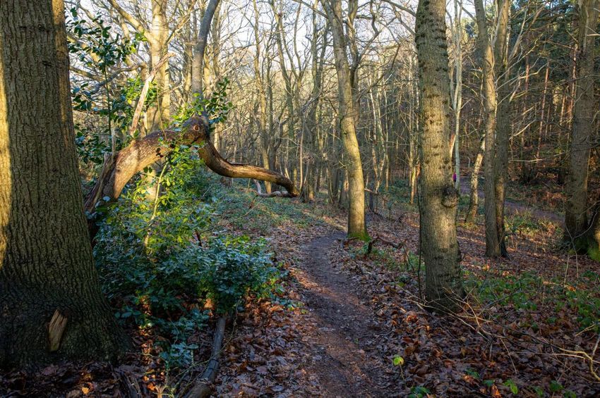
WELCOME TO SPA PONDS NATURE RESERVE
which is owned and lovingly managed by the
FOREST TOWN NATURE CONSERVATION GROUP
Free to access and always open to the public
The ponds are fed by springs, and the site has historic links
to Clipstone Park, Clipstone Peel, and King John's Palace
Thank you for keeping your dogs on leads near the ponds
Keep an eye out for birds, toads, fungi, dragonflies and
wildflowers and share your photos with us via Facebook
Looking for a friendly volunteering opportunity?
We are always happy for new people at our work days!
E-MAIL: SPA.PONDS@GMAIL.COM
WWW.FORESTTOWN.NET/NATURE
WWW.FACEBOOK.COM/SPAPONDS
WWW.FACEBOOK.COM/FTNCG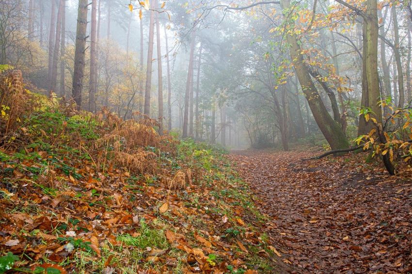
Contents
A. Overview .................................................................................................................. 1
   A.1 Forest Town Nature Conservation Group (FTNCG) ............................................. 1
   A.2 Land Holdings ...................................................................................................... 1
   A.3 Vision for Spa Ponds............................................................................................ 2
   A.4 Historic Biodiversity Context ............................................................................... 3
   A.5 Heritage Trees ..................................................................................................... 4
   A.6 Statements of Significance .................................................................................. 7
   A.7 Main Contacts ..................................................................................................... 7
B. Summary Information .............................................................................................. 8
   B.1 Site Information, Historic Context, and Geomorphology .................................... 8
   B.2 Significant Features and Their Importance ....................................................... 12
C. Habitat Management ............................................................................................. 13
   C.1 Semi-natural Broadleaved Woodland ............................................................... 13
   C.2 Hedgerow .......................................................................................................... 15
   C.3 Dead Wood ....................................................................................................... 17
   C.4 Ash Dieback Hymenoscyphus fraxineus ............................................................ 18
   C.5 Rides & Glades, Hedgerow and Ground Flora ................................................... 18
   C.6 Freshwater Ponds.............................................................................................. 19
   C.7 River .................................................................................................................. 24
   C.8 Path Management ............................................................................................. 26
   C.9 Non-Native Species ........................................................................................... 27
   C.10 Other Habitat Management Issues ................................................................. 28
D. Monthly Work Programme .................................................................................... 29

         Front cover photo by Tim King (Autumn Evening Sunset at Spa Ponds, November 2018)

                     Back cover photos by Dennis Platts (Spa Ponds, 2017 through 2021)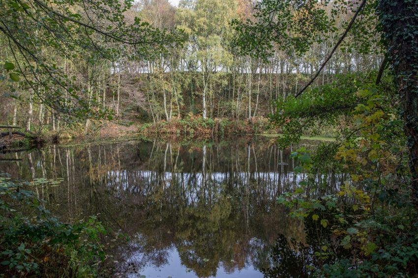
A. Overview

A.1 Forest Town Nature Conservation Group (FTNCG)
The Forest Town Nature Conservation Group (FTNCG) owns and manages Spa Ponds Nature Reserve
in Mansfield, Nottinghamshire. FTNCG is a registered Charity (number: 1157957), with the charitable
object of promoting the conservation, protection and improvement of the physical and natural
environment in and around Forest Town for the benefit of the local community. Local volunteers
manage and maintain the Spa Ponds site, which is home to the Nature Reserve.

A.2 Land Holdings
FTNCG owns the Spa Ponds site, which includes the Spa Ponds Nature Reserve, an area of 4.8
hectares of land highlighted in Figures 1a and 1b, below. Spa Ponds was purchased FTNCG by in May
2014, and in March 2015 the deeds (Title number NT502006) were registered in the name of the
Official Custodian for Charities.

                   Figures 1a and 1b. Spa Ponds Nature Reserve Map and Aerial View

Habitats at Spa Ponds include: semi-natural broadleaved woodland, freshwater ponds, and a section
of the River Maun. The northern half of the reserve, including the four ponds and the surrounding
woodland, glades and rides, is designated as a Local Wildlife Site, and the entire site (excluding Spa
Lane to the north, on the Mansfield Woodhouse side of the River Maun) has been designated a Local
Green Space in the Mansfield District Local Plan. The site is also formally registered with Mansfield
District Council as a Non-designated Heritage Asset.

                                                                                                    1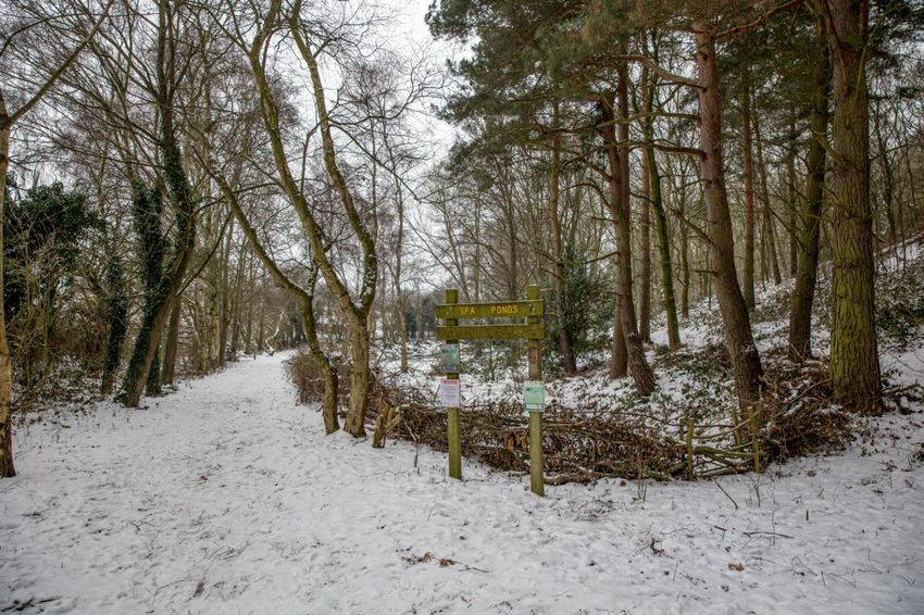
A.3 Vision for Spa Ponds
THE PEEL WATER RESTORATION VISION: JANUARY 2021 - DECEMBER 2050

Forest Town Nature Conservation Group will maintain and enhance the semi-natural broadleaf
woodland and increase its overall biodiversity value. We will create the structural diversity that
supports micro-habitats and ecotones. Space will be created to allow trees to mature, encouraging
the broadening of tree crowns. Heritage trees will be honoured and protected. Rotational thinning
of young trees, bramble, and nettle will allow mature trees to flourish and ground flora to develop.
Non-native species like Himalayan balsam will be eradicated.

The present Chestnut Wood will be managed to preserve and celebrate heritage trees while
maintaining about thirty per cent of the woodland as chestnut to provide timber for use on site
through sustainable coppicing. The remaining areas of woodland on the site will be maintained as
traditional Sherwood Landscape Oak/Birch woodland and indigenous understory trees and
associated ground flora. Areas of open glade will be established to provide pollinator corridors along
the length of Packman's Way. Pedestrian access will be developed to provide dog walkers and other
visitors with opportunities to explore and enjoy the Chestnut Wood from different elevations.

The 1,150 meters of hedgerow that creates the site's boundary will be improved, including through
the establishment of mature trees, shrub layers and base layers. Dense vegetation will be nurtured
to provide a mosaic of micro-habitats. Dead wood will continue to be an integral component of the
woodlands, providing wildlife habitat, maintaining ecosystem health and influencing geomorph-
ological processes. As the contribution of dead wood increases with stand age they will be a source
of energy, slowly released during decay, that will fuel and sustain complex food webs whilst
contributing to the enhancement of the site's woodland soils.

Ongoing improvement to the four spring-fed ponds will allow for more light and dappled shade and
less silt and leaf fall, these in turn will support a more diverse range of plants to create rich bio-
diverse areas of open water and intermediate wetland. Each pond will have its own niche features
and micro-habitats. The beauty and tranquillity around the ponds will be protected and enhanced.

At the point where the ponds empty into the River Maun the riverbanks will be protected and
improved using brash and timber, allowing for gravels to be revealed and brown trout to breed and
flourish.

Beyond Packman's Bridge, Spa Lane will be restored to healthy hedgerows and wildflowers providing
an experience of an idyllic country lane carrying visitors forward on their exploration of Sherwood
Forest. Travelling back up the site with the ponds on the right and Peel Wood and Pond Hill Wood to
the left, visitors will experience classic oak/birch woodland. The site, through the efforts of the local
community, will be made more resilient in the face of extreme weather, flood and drought. The site
will provide much-needed tranquillity and shade, alongside opportunities to enjoy birdsong and to
connect with the vibrancy of the natural world.

Spa Ponds Nature Reserve will be a haven for wildlife, from magnificent varieties of fungi to the
healthy population of toads, frogs, bats and dragonfly. Water voles will be numerous again, and an
exciting range of mammals and invertebrates will be part of the rich tapestry of wildlife supported
by the Nature Reserve.

                                                                                                       2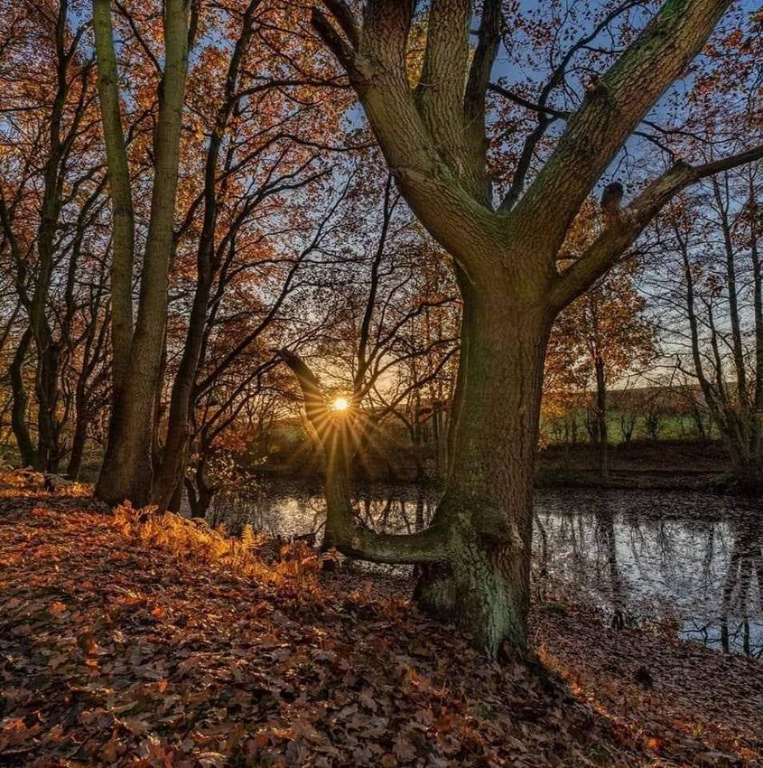
The site will continue to be a vital link in the mosaic of green corridors that sustain biodiversity up to
the Mansfield urban fringe. Connectivity along a range of footpaths will support access into the
heart of Sherwood Forest.

Spa Ponds will continue to provide exciting and nourishing experiences of the natural world for
children and young people, and this will be reflected in the oral histories of the future, carrying on
the tradition of our community affection and ownership of this hidden gem.

A.4 Historic Biodiversity Context
This vision outlined above has been inspired by the site’s rich heritage1, present day conservation
and climate change imperatives, and the enduring affection of our community for the Spa Ponds
Nature Reserve.

The name 'Peel Water' appears on the Sherwood Forest Map, also known as the 'Belvoir Map', of
circa 1334, as depicted below:

                                     Clipstone Park

                                                                          The Peel

                                                                            Approximate location of Spa Ponds
                            Peel Water

                        Figure 2. Detail from the 'Belvoir Map' showing 'Peel Water'
                   (Archives of the Duke of Rutland, held at Belvoir Castle, Leicestershire)

According to historian David Crook: "The [Sherwood] forest map indicates that it also included a
pond, probably formed by damming the river, called 'Peel Water’”.2 We know that what we call 'Spa
Ponds' was once part of and/or adjacent to the Royal Deer Park known as 'Clipstone Park'. Crook
wrote about how Clipstone Park was created under the orders of Henry II in 1178 as a deer park
south-west of King's Houses at King's Clipstone.

Over the course of five centuries the ownership of Clipstone Park passed through a succession of
Plantagenet Kings. In 1630 Clipstone Park was bought by William Cavendish, the 1st Duke of
Newcastle, who owned the site until he died in 1676. At the start of the English Civil War, in 1642,
William Cavendish sided with the Royalists, and was therefore branded a traitor by the
Parliamentarians. He fled to France in self-imposed exile until 1660.

1
 See: http://www.foresttown.net/index.php/heritageproject/
2
 Crook, D (1976). Clipstone Park and ‘Peel’. Transactions of the Thoroton Society of Nottinghamshire.
Footnote 78 on page 46.

                                                                                                        3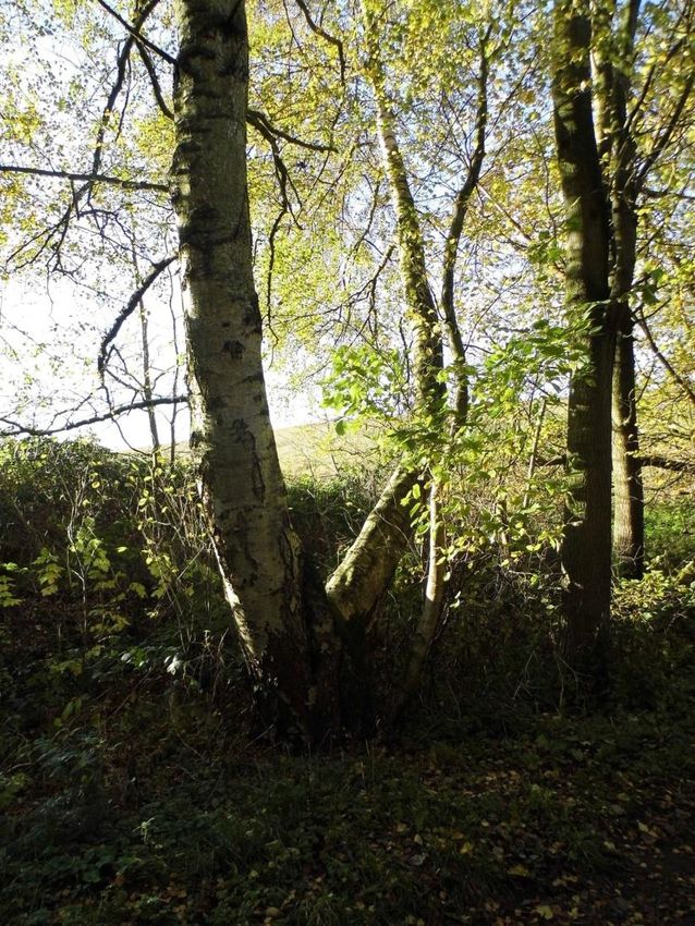
Describing the state of Clipstone Park upon their return William's wife Margaret Cavendish (c. 1617-
1673), also known as 'Mad Madge', wrote:

        "Of eight parks, which my Lord [William Cavendish] had before the [Civil] wars, there was
        but one left that was not quite destroyed...The rest of the parks were totally defaced and
        destroyed, both wood, pales, and deer; amongst which was also Clipston Park, of seven
        miles' compass, wherein my Lord had taken much delight formerly, it being rich of wood,
        and containing the greatest and tallest timber-trees of all the woods he had insomuch, that
        only the pale-row was valued at £2,000. It was watered by a pleasant river that runs through
        it, full of fish and otters; was well-stocked with deer, full of hares, and had great store of
        partridges...pheasants, &c., besides all sorts of water-fowl; so that this park afforded all
        manner of sports, for hunting, hawking, coursing, fishing, etc., for which my Lord esteemed
        it very much. And although his patience and wisdom is such that I never perceived him sad
        or discontented for his own losses and misfortunes, yet when he beheld the ruins of that
        park I observed him troubled, though he did little express it, only saying he had been in
        hopes it would not have been so much defaced as he found it, there being not one timber-
        tree in it left for shelter. However, he patiently bore what could not be helped, and gave
        present order for the cutting down of some wood that was left him in a place near adjoining,
        to repale it, and got from several friends deer to stock it".3

It is clear from this account that the area we know as Spa Ponds, which could also be described as
'Peel Water', enjoys a rich and bio-diverse history.

A.5 Heritage Trees
Spa Ponds is home to a number of trees believed to be older than 100 years (see Figures 3a and 3b,
overleaf), with some thought to be more than 300 years old. The oldest trees on the site include at
least 4 sweet chestnut, along with at least one very large oak tree stump, a hazel, a pair of
pedunculate oaks, and a sessile oak.

There is also a 'County Champion' downy birch (Betula pubescens). With a girth of 2.33 metres, this
downy birch (Ancient Tree Inventory reference 156390) is the widest downy birch in the whole of
Nottinghamshire (see Figure 3c).

The site also features a number of paper-bark birch trees, an ornamental North American tree
traditionally used by Native American Indians for making canoes. This type of tree was introduced
into the UK from around the 1750's, and the presence of such trees at Spa Ponds is significant as it
may have been imported from North America for use on the site by one of the Dukes of Portland for
its interesting bark. One of the paper-bark birch trees, which the group has named 'The Duke', won
the #IDigTrees competition that was run by TCV in 2016. Most of the trees identified at Spa Ponds
were recorded by Mark Fretwell in conjunction with the Woodland Trust's Ancient Tree Inventory.4

3
  'The Life of William Cavendish, Duke of Newcastle' by Margaret Cavendish in 1667. The quote is from the
1906 edition.
4
  https://ati.woodlandtrust.org.uk/tree-
search/?v=1821241&ml=map&z=15&nwLat=53.17183397480467&nwLng=-
1.1781690859697491&seLat=53.15734880940424&seLng=-1.104912593355003

                                                                                                            4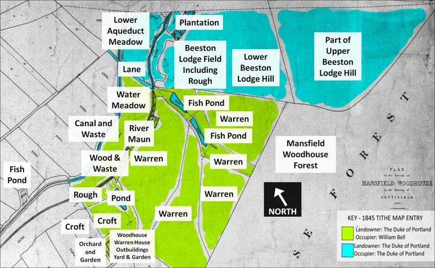
Figures 3a and 3b. Heritage Tree Map, taken from Appendix F of the Spa Ponds Heritage Management Plan (Arboreal History)

                                                                                                                           5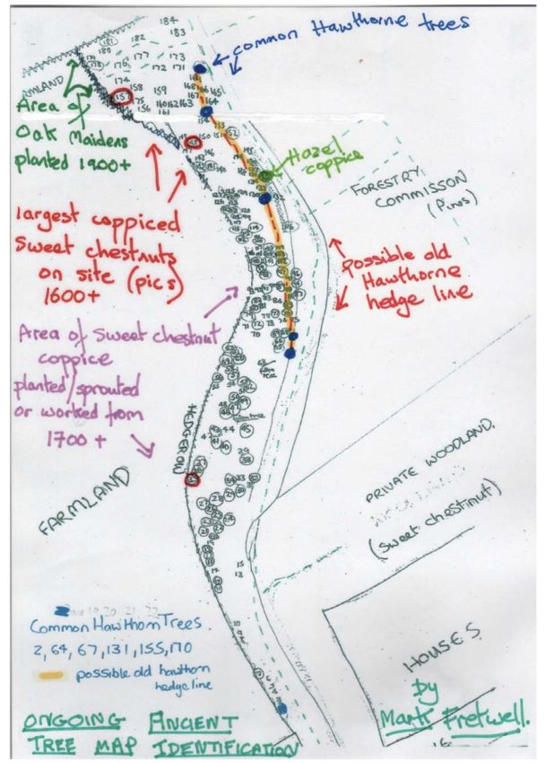
Pond 1

Figure 3c. Open Street Map and photograph of the County Champion Downy Birch at Spa Ponds

   Pond 4

Figure 3d. Open Street Map and photograph of 'The Duke', a paper-bark birch tree at Spa Ponds

                                                                                                6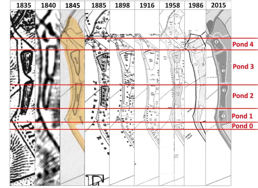
A.6 Statements of Significance
FTNCG management objectives include:

   •   Sustaining 4.05ha Semi-natural broadleaved woodland for biodiversity and heritage
   •   Restoring 1,150m of Boundary Hedgerow
   •   Sustaining 5,480m² of Ponds for biodiversity
   •   Enhancing 27m of river habitats, including in-channel revetment using natural materials and
       bankside tree rotational management in partnership with nearby land-owners, the
       Environment Agency, Nottinghamshire Wildlife Trust, Keep Britain Tidy (WatersideCare), and
       others involved with the Sherwood Water Catchment Partnership
   •   Maintaining approximately 3.12km of Public Right Of Way/Bridle Path and permissive
       footpaths in partnership with Forestry England and Nottinghamshire County Council
   •   Continued community-led riparian citizen science, including biological and chemical
       monitoring and recording of valuable environmental scientific data
   •   Monitoring and managing non-native invasive species
   •   Monitoring water quality of the four ponds and river
   •   Developing long-term sustainable conservation management regimes, working in
       partnership with Keep Britain Tidy (WatersideCare), Nottinghamshire Wildlife Trust, Forestry
       England, Environment Agency and Severn Trent Water
   •   Promoting sustainable habitat management and litter picking
   •   Promoting local history and heritage

A.7 Main Contacts

       Shlomo Dowen, Chairperson               c/o spa.ponds@gmail.com
       James Healy (Vice Chair)
       Josh Dowen (Treasurer and Secretary)

                                                                                                 7
B. Summary Information
Rural Payments Agency SBI Number 200510056
Grid Reference SK 570 633
Nearest Postcode NG19 0JH
County Nottinghamshire
District Mansfield
Size 4.8ha
Designations Local Wildlife Site, Local Green Space
Land owner Forest Town Nature Conservation Group
Access Details Public for most uses (not off-road biking)
Public Rights Of Way Packman’s Way, Footpaths
Principal Habitats Semi-natural broadleaved woodland
Hedgerow
Ponds
River
EA Waterbody ID Maun GB104028052960
B.1 Site Information, Historic Context, and Geomorphology
Spa Ponds is situated immediately off Clipstone Drive, Forest Town, Mansfield. See above Figures 1a
and 1b for Spa Ponds Nature Reserve map and aerial view.
A public bridleway, Packman’s Way, acts as the main footpath through the Reserve. Immediately
west of the site is arable farmland. The south-east of the site is bordered by a mixed woodland
known as Garibaldi Plantation, with much of the rest of the site's eastern boundary bordered by a
conifer plantation, known as Cavendish Wood, managed by Forestry England. The River Maun runs
along the northern border of the Reserve. South of the reserve is part of the village of Forest Town,
with the village of Clipstone located to the east of Spa Ponds. Beeston Lodge is a Historic England
Scheduled Monument located immediately to the north-east of Spa Ponds.
As set out in more detail in the Spa Ponds Heritage Management Plan5 it is understood that a
number of fish ponds at what is now known as Spa Ponds were constructed during the Medieval
period with links to the historic Clipstone (Deer) Park and to King John’s Palace in Kings Clipstone.
The reserve now comprises four ponds which are all gravity-fed, in sequence. At least some of the
water originates from underground springs, and this is especially evident in the southernmost pond
(known as Pond 1). The outflow from the lowest pond (known as Pond 4) flows into the River Maun
near Packman's Bridge (also known as Spa Lane Road Bridge).
Academic research records how, in 1316, Edward II ordered the creation of a Peel (area enclosed by
strong wooden fence and ditch) to the south-west of Clipstone Park, extending to vicinity of Spa
Ponds. It is believed that a number of spring-fed fish ponds were constructed as part of this initiative
in order to provide food for the King and others staying and working at the King's Houses in
Clipstone.
5
See: https://drive.google.com/open?id=0Bxx0kdC79NtxdGtsY1dvOWhiU28
8There is evidence to suggest that an order to create fish ponds was made during the Great Famine,
which began in 1315, and followed an embarrassing incident where the King ran out of food at the
King's Houses in Clipstone during the Christmas of 1315. It is possible that the Spa Ponds site is part
of what was referred to as 'Pele Water' or 'Peel Water' on the Belvoir map thought to be from the
late 1300s. 1317 is the likely year for the creation of the Medieval fish ponds, at what is now the Spa
Ponds Nature Reserve, although it should be noted that the ponds have been substantially altered
since the 14th century.
Figure 4. How the Spa Ponds have changed over 180 Years (1835-2015)
Note: Years shown are approximates based primarily on year of publishing.
The earliest map to clearly show Spa Ponds is Sanderson's Map of 1835, which showed two ponds
which are roughly in the same position as those which are now known as Ponds 2 and 3 (with Ponds
1 being the southern-most pond and Pond 4 being the northern-most pond, located nearest to the
River Maun). Ordnance Survey (OS) maps indicate that the pond system remained largely unchanged
until subsidence in 1983 resulted in the partial re-creation of the ponds, giving rise to the current 4-
pond system.
As shown overleaf, the 1845 Tithe Map of Mansfield Woodhouse (and accompanying tithe entries)
record that the area around Spa Ponds was all owned by the Duke of Portland, but that while he was
the occupier of the ponds the surrounding land was registered as being used as a rabbit warren by
William Bell. The area south of Spa Ponds is shown on the Plan as being part of Mansfield
Woodhouse Forest.
9Figure 5. Land Use, Ownership and Occupiers of Spa Ponds and Surrounding Areas
in the 1845 Tithe Map of Mansfield Woodhouse
Within the reserve there are remains of past irrigation systems, piping, culverts and stone sluices,
which have been excavated. It is possible that Spa Ponds served a role with respect to the Duke of
Portland's Flood Dykes and Water Meadows, and maps such as the 1885, 1898 and 1916 OS maps
indicate sluices at the northern-most pond (and in the 1916 map on both ponds).
Historically, the Maun Valley supported thousands of acres of heathland. Since the 18th century a
series of Dukes of Portland owned Spa Ponds. From May 1915 through to 1920 soldiers from the
nearby Clipstone Military Training Camp are believed to have used Spa Ponds for recreation and
bathing during the First World War. On 26th April 1943 the 6th Duke of Portland died, and when his
estate was auctioned off in 1945, the land including Spa Ponds was bought by the tenant farmer
Edmund (Edwin) Shaw Browne.
The ponds then became derelict and overgrown until the 1960's when the Forestry Commission set
up a coniferous plantation and osier was planted for willow basket production. Ownership passed to
Anthony (Tony) Shaw Browne in 1967, and then to Guy Shaw Browne in 2001.
The nature reserve was formally established in 1983 when the local farmer and landowner Anthony
Shaw Browne licensed 6.5ha to Nottinghamshire Wildlife Trust (who were then known as the
Nottinghamshire Trust for Nature Conservation).
Underlying solid geology is Triassic Nottingham Castle Sandstone Formation (see Figure 6, overleaf).
At Spa Ponds, the Bunter Pebble Bed series outcrops in places. The sandstone has produced light
sandy loam, which is acidic and free draining.
10Figure 6. Map showing underlying solid geology (Geotechnical and Geological Engineering, June 2019)
11B.2 Significant Features and Their Importance
FEATURE ATTRIBUTES IMPORTANCE
Local UK
BAP BAP
Habitats
Semi-natural Roosting potential for bats, oak-birchwoodland •
broadleaved woodland
Hedgerow BAP bird nesting habitat, bat foraging and • •
commuting routes and amphibian cover and
sheltering opportunities. provide ecological
corridor
Ponds Sherwood Sandstone spring, important LBAP • •
site for amphibian breeding, Daubenton's bat
foraging site, odanata foraging and ovipositing
River Good spawning sands and gravels • •
SPECIES*
Amphibians Common toad Bufo bufo • •
Mammals Brown long-eared bat Plecotus auritus • •
Daubenton's bat Myotis daubentoni •
Brandt's bat Myotis brandtii •
Noctule bat Nyctalus noctula • •
Pipistrelle bat Pipistrellus pipistrellus •
Roe deer Capreolus capreolus •
Soprano Pipistrelle Pipistrellus Pygmaeus • •
Fish Bullhead Cottus gobio •
Birds Common Starling Sturnus vulgaris • •
Dunnock Prunella modularis •
Grey wagtail Motacilla cinerea •
Lesser-spotted woodpecker Dryobates minor • •
Linnet Linaria cannabina • •
Skylark Alauda arvensis • •
Song Thrush Turdus philomelos • •
Yellowhammer Emberiza citrinella • •
Vascular Plants Bluebell Hyacinthoides non-scripta • •
Lesser stitchwort Stellaria graminea •
Meadow cranesbill Geranium pratense •
Nettle leaved bell flower Campanula trachelium •
Nipplewort Lapsana communis •
*Note: There is no LBAP information for the following groups: Ants, Molluscs, Algae, Bees,
Bryozoans, Fungi, Caddis flies, Stone flies, Lichens, Crustacea, True bugs, Liverworts, Flies, Wasps,
Mosses, Millipedes, Worms, Stoneworts. We are aware of a range of fungi, dragonflies and
damselflies regularly found at Spa Ponds.
12C. Habitat Management
Management aims are to enhance the biodiversity value of the site's various habitats, and to
develop the landscape and aesthetic appeal of the entire 4.8 ha site. FTNCG encourage responsible
access for the local community, educational activities, and other visitors. Minimalistic management
regimes are intended to stimulate self-sustaining biological processes within the woodland,
hedgerow, rides and glades, freshwater ponds and river habitats.
Fertilisers, manures and pesticides are not used on site, except potentially for herbicides to spot
treat trees or weed wiping to control invasive non-native species in exceptional circumstances and
based on professional advice. No livestock, ploughing and rolling activities are permitted on site.
The Spa Ponds Nature Reserve is located within a Higher Level Stewardship Target Area, a High
Groundwater Vulnerability Area, and a Nitrate Vulnerable Zone. A major management issue is soil
erosion from urban and agricultural run-off, which erodes sandstone paths and banks, transporting
sediments into the ponds.
C.1 Semi-natural Broadleaved Woodland
Spa Ponds Nature Reserve is part of the Woodland Priority Habitat Network and located within
Priority Habitat Inventory - Deciduous Woodland and the National Forest Inventory for Broadleaved
Woodland.
Woodland management prescriptions are to maintain and enhance 4.05ha of semi-natural
broadleaved woodland and increase biodiversity value. The woodland area is mainly semi-mature to
mature stands including areas of dense young growth. Prescribed woodland management will create
structural diversity and support micro-habitats and develop ecotones.
Young growth trees and shrubs require rotational thinning to encourage broadening of tree crowns.
Dense growth prevents light penetrating the ground layer and is currently increasing shade tolerant
plants such as bramble (Rubus fructicus) and common nettle (Urtica dioica). Therefore, it is
necessary to remove approximately 25% of the dense young trees to allow space for mature trees to
continue to thrive and ground flora to develop.
In areas closer to the hedgerow boundaries, ponds and river banks remove only around 10% of the
young growth trees and shrubs to maintain protection from strong winds, which can cause damage
and as a consequence exposure to further erosion issues.
13Figure 7. Spa Ponds Woodland Management Map
Woodland edges will be managed as boundary hedgerow and management prescriptions are
outlined in section C.2. Selective thinning should be carried out in 7-10 year rotations, working
annually within areas approximately 0.50ha as highlighted in Figure 7, above.
To improve habitat heterogeneity, remove Acer pseudoplatanus sycamore and Prunus sp. non-native
cherry species. Increase dead wood features throughout the woodland. Deadwood management
prescriptions are outlined in section C.3. Maintain mosaic of rides and small glades in open areas,
ensuring light penetrates the ground. Sympathetic woodland ride management will benefit wider
biodiversity. Rides and glades management prescriptions are outlined in section C.5.
Southern area of woodland along Packman’s Way, which has become dominated by Castanea sativa
sweet chestnut, is reminiscent of NVC W16, Oak-birch woodlands found on acid soils where Quercus
robur pedunculate oak and Betula pendula silver birch are the principal tree species. This area lacks
young regrowth of tree species and new native tree species need planting in this area at 1 x new tree
per 2m², including Q. robur common oak and silver birch B. pendula.
Objectives should be to create a more open canopy with oak and birch, a mixture of other native
species and a ground layer richer, more grass-dominated. Young sweet chestnut needs reducing to
30% frequency. Northern area of Packman’s Way, west of the ponds has a canopy dominated by B.
pendula silver birch with an understory of hawthorn Crataegus monogyna and the occasional
Sambucus nigra elder. The area east of the ponds is dominated by Quercus petraea sessile oak, Q.
robur pendunculate oak and B. pendula silver birch with occasional Alnus glutinosa common alder
and resembles a NVC 16 woodland community.
14Woodland Management Prescriptions:
• Reduce by approximately 25% the number of young trees growing in areas dominated by young
new growth (1 or 2 thick small dense clumps can be left as a habitat feature)
• Remove approximately 10% of the dominant dense young trees close to the hedgerow
boundaries, ponds and river banks
• Thinning management implemented in 7 year rotations, working annually within areasFigure 8b. Row spacing for planting hedgerow whips
Trim selected fruit bearing trees and shrubs in January or February to avoid the bird breeding season
and to allow for the berry crop to be utilised by wintering birds (September-December). Trimming
should be carried out on a 2 – 3 year rotation. Trimming of all hedgerows in the same year should be
avoided. Some invertebrate species will overwinter as pupa on hedgerows and wholesale trimming
of the hedgerows reduces the population. Rotational trimming will ensure a variety of hedgerow
structures across the site and allow over wintering species to re-colonise the trimmed hedgerow
sections.
Hedgerow composition for biodiversity along 1,150m requires the establishment of mature trees,
shrub layer and base layer.
Long-term management objectives are to create dense vegetation providing a mosaic of niche micro
habitats for nesting birds, amphibians, small mammals, beetles, bees, flies and butterflies.
Hedgerows provide essential nectar and pollen sources for invertebrates. Within the base layer,
develop dense grassy ground cover for the life cycles of invertebrates such as spiders, beetles, flies
and caterpillars. Height variation is also important for example bird species such as Whitethroats
Sylvia communis prefer 1.5m high while bullfinches Pyrrhula pyrrhula prefer over 4m.
Bumblebee species are a Biodiversity Action Plan priority and consume pollen and nectar from
hedgerows during spring and summer. By developing the hedgerow, highlighted in Figure 8a, FTNCG
will be creating additional, important pollinator habitat. Plant species such as Clovers Trifolium,
vetch flowers Vicia, Cow parsley Anthriscus sylvestris, Hogweed Heracleum sphondylium,
Woundworts Stachys, Dead-nettles Lamium, Fleabane Pulicaria dysenterica and Knapweed
Centaurea nigra are important for bees, hoverflies and butterflies.
16Hedgerow Management Prescriptions:
• Create dead hedge in areas where there are ‘gaps’
• Retain all hedges and plant new trees and shrubs to fill in large gaps
• When creating new hedges or replenishing gaps use a variety of native local shrubs and trees
• Remove weeds in and around the tree guards
• Create structural diversity by preserving an ‘A-Frame’ hedgerow shape that ‘slopes’ down
towards the agricultural fields
• Maintain a range of hedge heights
• Leave clumps of bramble, rose and suckering blackthorn
• Keep the shrub layer dense, retaining density all the way down to the ground level
• Develop a wide diversity of plants that support long flowering and fruiting seasons. Encourage
flowering and fruiting by trimming trees and shrubs on rotation every 3 years, only cut an area
of a third or less per year
• Cut and trim in January-February and avoid any disturbance during bird breeding season March
to August
• Keep tussocky grass margins as ‘ecotones’ next to the adjoining agricultural fields and this will
provide habitat for nesting birds and hibernating invertebrates
• Only cut the base once every 5 years to control scrub encroachment
• Leave any decaying wood in situ
C.3 Dead Wood
Dead wood is integral and a substantial component of natural woodlands. It provides wildlife
habitat, maintains ecosystem health and influences geomorphological processes. Deadwood
provides sustenance, nutrients and shelter for numerous species of woodland animals, plants and
fungi. It directly increases habitat diversity and provides niches which are more stable, moist and
sheltered than most surrounding habitats.
By providing a rooting medium for tree regeneration deadwood influences stand dynamics and
structure, which in turn influences biodiversity. Dead material is a store of energy in the form of
carbon compounds. The contribution of deadwood increases with stand age. This source of energy,
which is slowly released during decay, fuels and sustains complex food webs and utilization of this
energy is part of the process of deadwood decomposition, contributing also to the development of
woodland soils.
Dead Wood Management Prescriptions:
• Leave deadwood on living trees (dead limbs, decay columns in trunks and large branches, rot
holes, coppice stools) IF CLOSE TO / OR OVERHANGING A FOOTPATH, REMOVE
• Leave standing dead wood (snags, stumps, windblown root-plates)
• Leave fallen wood (trunks and large branches, small branches and twigs)
• Position/move some deadwood to create features near dappled or partial shade and near
sources of nectar for adult invertebrates; provide all decay stages and habitat stability for low
mobility species
17C.4 Ash Dieback Hymenoscyphus fraxineus
There is one ash tree at Spa Ponds, and this has been assessed as healthy and so has been tagged
(Number 03820) as part of the Living Ash Project.
Ash Management Prescription:
• Retain healthy F. excelsior ash trees in the canopy to encourage seed production
C.5 Rides & Glades, Hedgerow and Ground Flora
Management objects include increasing floral diversity within woodland rides and glades and along
hedgerow/woodland edge. Internal rides, glades and other open spaces are important ecological
components within the woodland and provide valuable habitats, increasing flora and fauna diversity.
A variety of sun-loving plants and insects benefit from these open areas and, in contrast, other
insects, plants, birds and mammals benefit from the woodland edge, which is essentially the
interface between the woodland and open ground.
Spa Ponds is dominated by R. fructicus bramble, which is out-competing many other woodland floral
species. Reduce the area of R. fructicus bramble by 50% cutting it back and removing cuttings to
expose soils. Any cuttings can be placed on the ground in the hedgerow gaps or used as erosion
buffers next to paths. Leaving selected areas of dominant R. fructicus bramble will provide shelter
and a source of food for ground dwelling mammals, invertebrates and birds.
Leave newly created areas of bare ground for at least 1 year to allow woodland flora to re-establish.
Manually pull up any new growth R. fructicus bramble. If after one year there is only limited
woodland floral growth turn over the soil and add a seed mix or plug plant woodland flora.
The following plants can be used: Agrimonia eupatoria - Common Agrimony, Alliaria petiolata - Garlic
Mustard, Allium ursinum - Ransoms/Wild Garlic, Angelica sylvestris - Wild Angelica, Campanula
trachelium - Nettle Leaved Bellflower, Digitalis purpurea - Wild Foxglove, Filipendula ulmaria –
Meadowsweet, Galium mollugo - Hedge Bedstraw, Geranium robertanianum - Herb Robert, Geum
urbanum - Wood Avens, Hyacinthoides non-scripta - English Bluebell, Hypericum hirsutum - Hairy St.
John's Wort, Primula vulgaris - Wild Primrose, Prunella vulgaris - Self Heal, Silene dioica - Red
Campion, Stachys officinalis - Betony, Stachys sylvatica - Hedge Woundwort, Teucrium scorodonia -
Wood Sage, Torilis japonica - Upright Hedge Parsley, as well as plug planting of: Anemone nemorosa
- Wood anemone, Oxalis acetosella - Wood sorrel, Ajuga reptans - Bugle, Lamiastrum galeobdolon -
Yellow archangel, and Hyacintoides non-scripta - Bluebell (which can also be planted as bulbs in the
autumn).
Areas of rough grasses, rushes and sedges with thick, matted, tussocky native species are a valuable
habitat within Spa Ponds. Leave areas within the woodland and hedgerow boundary where swards
grow tall in the summer and collapse during autumn. The litter layer provides important habitat for
small mammals such as the Microtus agrestis field vole, Soricidae sp. shrews and wood mice
Apodemus sylvaticus, the main food sources for barn owls Tyto alba. Rough grassland gives
sanctuary to invertebrates, eggs and larvae, which overwinter within the grass and umbellifer stems.
18Rides & Glades, Hedgerow and Ground Flora Management Prescriptions:
• Increase floral diversity within woodland rides and glades and along hedgerow/woodland edge
• Remove any tree or shrub branches blocking light in rides and glades
• Reduce the area of bramble by 50%> cutting it back and removing cuttings
• Leave newly created areas of bare ground for at least 1 year
• If only limited woodland floral growth develops turn soil over and add a seed mix or plug plant
• Leave selected rough grassland areas unmanaged. Avoid disturbance to these areas
• Manually pull up any new growth bramble on areas of cleared bare ground
C.6 Freshwater Ponds
Objectives are to sustain 5,480m² of freshwater ponds for biodiversity. Four freshwater ponds are
restored on different levels and gravity fed, descending towards the River Maun as highlighted in
Figure 9. Water gradually flows through each pond replenishing the oxygen and preventing flooding.
Figure 9. Pond water flow direction
Pond Management Prescriptions:
Pond 1: Retains the Sherwood Sandstone spring that feeds all four ponds. Water is clear. Margins are
dominated by R. fructicus bramble, with stands of Juncus effusus soft rush on the eastern bank.
Within the pond there are a small numbers of saplings growing. Algal growth has developed
adjacent to dead wood within the pond and Lemna sp. dominate the pond surface. MaintainThe Sherwood Sandstone spring emanates from Pond 1. Water quality testing indicates neutral to
mild alkaline (Mean pH 7.56) conditions. From March - August 2019 pH levels increased to pH 8.5. A
combination warmer temperatures, urban and rural run-off and excess leaf litter decomposition
have negatively influenced Pond 1 water quality.
It is recommended that trees and shrubs around the Pond 1 perimeter are removed or thinned to
reduce leaf litter, allow more temperature variation, with sunlight and dappled shade penetrating
the pond. The outflow pipe is located at the north-west corner and runs underneath a footpath into
Pond 2.
Geomorphology and hydrology surveys should be undertaken by FTNCG within this 5-year
management plan period to investigate ground water and surface water issues.
Pond 2: Water flows down a small stream from Pond 1 for 10m before entering Pond 2. Water
becomes more turbid due to increased leaf litter decomposition. On the bankside there are semi-
mature to mature B. pendula birch and A. glutinosa alder trees. Ground flora is dominated by R.
fructicus bramble, Festuca rubra red fescue. Macrophytes have established including Iris
pseudacorus yellow flag irus, J. effusus soft-rush and Typha latifolia common reed mace in the north-
east corner. Phragmites australis reed bed has established providing important invertebrate habitat.
Footpath erosion is an issue and is destabilising the bank. Non-native invasive species Impatiens
glandulifera Himalayan balsam has encroached into pond 3 within steep, inaccessible areas where
volunteers are unable to remove by hand.
Continued water quality testing recorded a Mean pH 7.71, with the highest pH 9 on 20th March 2019.
Increased pH and ammonia events in Ponds 1 & 2 in 2019 need further investigation. Leaf litter and
bank erosion are a management issue and revetment work to stabilise the banks and prevent excess
sediment entering Pond 2 should be a priority during years 1-5 (see Figure 10, below).
Figure 10. Prescriptions for Ponds 1 & 2
20Pond 3: B. pendula Silver birch and A. glutinosa alder trees surround the banks around the pond
perimeter. Ground flora is predominantly R. fructicus bramble, Festuca rubra red fescue. Water is
clear and minimal vegetation grows within the pond apart from sparse areas of Iris pseudacorus
yellow flag iris. A population of Perca fluviatilis perch reside in Pond 3, introduced by local
fisherman. To improve aquatic invertebrate and Bufo bufo common toad populations, areas of cover
and protection need creating using woody debris, highlighted in Figure 11, below. The outflow pipe
runs underneath the footpath in the north-west corner of the pond.
Figure 11. Prescription for Pond 3
21Pond 4: Trees surrounding the pond are predominantly B. pendula silver birch with R. fructicus
bramble and F. rubra red fescue for ground flora. Continued water quality testing recorded a Mean
pH 7.64. Leave the two islands as unmanaged, non-interventional features. Pond 4 management
requires tree and shrub thinning in areas highlighted in Figure 12. The banks need stabilising using
woody debris materials (see Figure 13, below).
Figure 12. Prescription for Pond 4
Figure 13. Example of brushwood bundle used to prevent bank erosion
All the ponds would benefit from brushwood bundles pegged with logs along the entire bankside,
demonstrated in Figure 13. This will prevent further erosion, sedimentation and over time establish
and develop more stable banks and marginal vegetation, whilst improving water quality.
The introduction of straw bales in Ponds 1 and 2, positioned at the northern end would improve
water quality by removing nutrients (See Figure 14, overleaf).
22Figure 14. Example of a straw bale used to improve water quality by removing nutrients
Dead wood, tree trunks and branches within the ponds should be retained as aquatic habitat, which
provides structure colonised by algae, fungi and a food source for invertebrates. Rotting wood
provides ovipositing habitat for invertebrates such as Aeshna cyanea southern hawker and Aeshna
grandis brown hawker dragonflies. Rotting leaves provide a food source for Gammarus sp.
freshwater shrimp and materials for Trichoptera sp. caddis fly larvae to build their cases.
Tree roots around ponds perimeters stabilise the banks, therefore do not totally remove. A
coppicing regime should be implemented. Coppicing should be carried out over the winter months
from November to February to avoid disturbance during the bird breeding season.
Water quality testing carried out in conjunction with WatersideCare in March 2016 revealed low
levels of dissolved oxygen in Pond 1 around the spring (68.5%) and the south-west corner of Pond 2
(67%) compared to between 83% and 87.5% elsewhere in Pond 2 and across the whole of ponds 3
and 4. This testing indicated that the water from the spring was naturally low in oxygen but that,
presumably due in part to the waterfalls at outflow pipes between the ponds, the levels of dissolved
oxygen gradually increase in the ponds closer to the River Maun and were actually higher than that
of the River Maun at the time (which was recorded as 82.4%). As a direct result of this testing, a
range of oxygenating plants were added to Ponds 1 and 2 between 2016 and 2020.
The introduction of a series of floating solar-powered aerators in Ponds 1 and 2 would provide a
network of areas with dissolved oxygenated water during hot summer days and benefit aquatic
plants and invertebrates. Aeration will create small satellites with improved dissolved oxygen and
other water quality parameters such as temperature, pH, nitrite, ammonia in these aerated zones,
which are essential for development aquatic invertebrates.
Continue to remove non-native invasive species I. glandulifera Himalayan balsam from all ponds
until absent. In areas difficult to access by the FTNCG volunteers it would be beneficial to
professionally weed-wipe I. glandulifera Himalayan balsam to eradicate further growth in these
areas.
23C.7 River
The River Maun is a modified river, which has been straightened and isolated from the floodplain.
The section of river at the northern end of Spa Ponds has a uniform flow, shallow river bed, and
areas of dense shading from river bank trees. River habitats have sub-optimal conditions for primary
production of aquatic plants, primary producers, invertebrates and vertebrates.
River habitat management objectives are to rehabilitate 25m – 108m of river functions, improve
habitat diversity and augment the self-cleansing processes of the channel. This will include
introducing woody debris material to narrow the river, create flow variation, rejuvenate spawning
gravels and reduce sedimentation of the river bed. Upstream and downstream bank erosion is
degrading water quality and the river is widening, and encroaching into the woodland and
surrounding agricultural fields, highlighted in Figure 15, below.
Figure 15. Bank erosion near Spa Ponds along the River Maun
Bank instability, nitrate and phosphate run-off has created ideal conditions for I. glandulifera
Himalayan balsam, which dominates swathes along the river, highlighted in Figure 16. Non-native
species Gunnera mancata is also present (see Figure 16, overleaf).
Pacifastacus leniusculus American signal crayfish are present within this reach and frequently
observed near the footbridge (see Figure 16, overleaf). P. leniusculus reduce native populations of
benthic invertebrates and burrows intensify bank erosion and increase fluvial sediment mobilisation.
With the presence of non-native invasive species it is imperative that FTNCG implement biosecurity
protocol when working in or near the river and ponds (see C.9). There are also historical records of
Neovison vison American mink along this reach. All non-native species should be monitored as
recommended in section G.
24Figure 16. Not-native Invasive Species near Spa Ponds along the River Maun
25C.8 Path Management
FTNCG maintain approximately 3.12 km of Public Right Of Way/Bridle Path and Permissive
footpaths, highlighted in Figure 17, below.
Figure 17. Footpaths and bridleways
Location: MW = Mansfield Woodhouse; KC = King's Clipstone
Path type: BW = Bridleway (fuchsia), FP = Registered Footpath (red),
Unregistered or Permissive Footpath (red dotted/dashed)
26Path management in years 1-5 needs an access review by FTNCG and a subsequent reduction in the
number of permissive paths and access points into the site. FTNCG need to implement a circular
permissive route that reduces path and pond bankside erosion.
Many existing permissive paths should be blocked off and the new circular route clearly signposted.
FTNCG can lay brash along paths to catch sediment and reduce the effects of run-off. The eastern
boundary of the reserve has steep slopes from which run-off enters the ponds. There is great deal of
run-off and erosion from the arable land on the western boundary which has created gullies. During
heavy rainfall paths flood and the sandstone substrate washes away.
As previously recommended in Section C.6, a geomorphology and hydrology survey should be
commissioned by FTNCG within this 5-year management plan period to investigate ground water
and surface water issues and a plan of capital works developed to resolve these issues long-term.
Packman's Way is a bridle path that has to be kept clear and accessible under the Wildlife and
Countryside Act 1981. Nottinghamshire County Council has a responsibility to support FTNCG with
the maintenance of Packman's Way.
C.9 Non-Native Species
Himalayan balsam I. glandulifera is present on River Maun both upstream and downstream of Spa
Ponds (see Figure 16, above) and across the nearby woodland managed by Forestry England
(Cavendish Wood). FTNCG is working with Chris Jackson (Biodiversity Officer at Nottinghamshire
County Council), Forestry England, and others (including through the Clipstone-Rufford Landowners
Group and the Sherwood Water Catchment Partnership) at both strategic and 'hands-on' levels to
address invasive non-native species that impact on Spa Ponds. FTNCG volunteers have coordinated
removal within the freshwater ponds and for these efforts to succeed the group requires ongoing
support and cooperation of upstream landowners and other stakeholders to coordinate successful
removal of I. glandulifera including upstream seed sources of I. glandulifera within the catchment.
Management of P. leniusculus American signal crayfish present in the River Maun and sighted in the
waters near Packman's Bridge at Spa Ponds is not a realistic option for FTNCG. However it is
imperative that FTNCG monitor and record all observations. Nottinghamshire Non-Native Invasive
Species datasets do not indicate a presence of M. lutreola mink within the Forest Town area in 2019,
although anecdotal evidence of sightings suggest the official record is incomplete.
G. manicata should be recorded.
Non-Native Species Management Prescriptions:
• Continue removing Himalayan balsam from ponds
• Weed wipe where Himalayan balsam is present in difficult to access areas
• Continue to remove Himalayan balsam from river banks
• FTNCG create a user account and use irecord
• https://www.brc.ac.uk/irecord/ to submit all non-native species records
• FTNCG to follow GB Invasive Non-native Species
http://www.nonnativespecies.org/home/index.cfm biosecurity guidelines when working on any
site or watercourse with non-native species present
27C.10 Other Habitat Management Issues
Land ownership and boundaries: FTNCG to accurately measure (and demark) the area of FTNCG's
ownership and clarify the boundaries.
Neighbouring landowners: Maintain and update details of the adjacent landowners and explore
partnership working or possibilities of FTNCG being given, sold, or leased buffer strips to be
managed by FTNCG for greater biodiversity.
Vandalism and off-road biking: Support Wardens, e.g. by providing replacement laminated posters
when originals have been removed; ensuring clear signage that includes reference to prohibition of
biking and telephone number to be used to contact the police to report any incidents; maintain
record of incidents reported to the police, including dates and reference numbers; attend Clipstone-
Rufford Landowners meetings and contribute to coordinated efforts to address anti-social
behaviour, etc.
Litter and dog fouling: Ensure appropriate signage is maintained; ensure Mansfield District Council is
informed whenever the bin at the Clipstone Drive entrance is overflowing; organise volunteer litter
picking (including as part of Spa Ponds Work Sessions) to augment the Wardens' litter picking
efforts.
Developmental pressures: There is a need to ensure that housing and other developments do not
adversely impact Spa Ponds, e.g. due to increased footfall harming paths and giving rise to increased
litter, and/or increased pressures associated with a larger number of dog walkers using the site,
and/or due to the impedance of amphibians' safe access to the site. It is especially important to
protect against adverse impacts upon any of the reasons for the site's Local Green Space
designation, i.e. the site's beauty, historic significance, recreational value, tranquillity, and richness
of wildlife. In instances where development is permitted to take place, mitigations and
compensations should be sought as appropriate.
Climate change: Additional pressures due to climate change can be anticipated, including increases
in the number of visitors seeking shade during hot spells, and also increases in the frequency and
severity of extreme weather events. Issues already arise in circumstances where rainwater collects
in muddy areas, which render footpaths less accessible. Introducing measures to add to the site's
resilience, including climate-related mitigations, could be beneficial for wildlife and site users.
28D. Monthly Work Programme
Jan Feb Mar Apr May June July Aug Sept Oct Nov Dec
Woodland Management
Reduce by approximately 25% the number of young trees growing in
areas dominated by young new growth (1 or 2 thick small dense clumps
can be left as a habitat feature)
Remove approx. 10% of the dominant dense young trees close to the
hedgerow boundaries, ponds and river banks
Thinning management implemented in 7 year rotations, working annually
within areasJan Feb Mar Apr May June July Aug Sept Oct Nov Dec
Hedgerow Management (continued)
Develop a wide diversity of plants that support long flowering and
fruiting seasons. Encourage flowering and fruiting by trimming trees and
shrubs on rotation every 3 years, only cut an area of a third or less per
year
Cut and trim in January-February and avoid any disturbance during bird
breeding season March to August
Keep tussocky grass margins as ‘ecotones’ next to the adjoining
agricultural fields and this will provide habitat for nesting birds and
hibernating invertebrates
Only cut the base once every 5 years to control scrub encroachment
Leave any decaying wood in situ
Dead Wood Management
Leave deadwood on living trees (dead limbs, decay columns in trunks and
large branches, rot holes, coppice stools) IF CLOSE TO / OR
OVERHANGING A FOOTPATH, REMOVE
Leave standing dead wood (snags, stumps, windblown root-plates)
Leave fallen wood (trunks and large branches, small branches and twigs)
Position/move some deadwood to create features near dappled or
partial shade and near sources of nectar for adult invertebrates; provide
all decay stages and habitat stability for low mobility species
Ash Management
Retain healthy F. excelsior ash trees in the canopy to encourage seed
production
Rides & Glades, Hedgerow and Ground Flora Management
Increase floral diversity within woodland rides and glades and along
hedgerow/woodland edge
Remove any tree or shrub branches blocking light in rides and glades
Reduce the area of bramble by 50%> cutting it back and removing
cuttings
30Jan Feb Mar Apr May June July Aug Sept Oct Nov Dec
Rides & Glades, Hedgerow and Ground Flora Management (Continued)
Leave newly created areas of bare ground for at least 1 year
If only limited woodland floral growth develops turn soil over and add a
seed mix or plug plant
Leave selected rough grassland areas unmanaged. Avoid disturbance to
these areas
Manually pull up any new growth bramble on areas of cleared bare
ground
Non-Native Species Management
Continue removing Himalayan balsam from ponds (primarily May / June)
Weed wipe where Himalayan balsam is present in difficult to access areas
Continue to remove Himalayan balsam from river banks
FTNCG create a user account and use irecord / Ecological surveying
https://www.brc.ac.uk/irecord/ to submit all non-native species records
FTNCG to follow GB Invasive Non-native Species
http://www.nonnativespecies.org/home/index.cfm biosecurity
guidelines when working on any site or watercourse with non-native
species present
Note: For detailed Pond Management Prescriptions see Section C.6 above.
Restrictions:
• Bird Breeding Season: Avoid work that would impact on birds during bird breeding season, i.e. March - September.
• Fish Spawning Season: Avoid work that would impact on fish during spawning season, e.g. March - July.
• Frog / Toad Breeding Season: Avoid work that would impact on frogs and toads during breeding season, i.e. end of February - April.
• When the Himalayan Balsam goes to seed it is necessary to place a plastic bag around the head of the plant and snap the head into the bag.
• When work is carried out at Spa Ponds due regard should be given to the Group's Heritage Management Plan, Risk Assessments, Safeguarding Policy,
Equal Opportunities (Volunteer) Policy, and other relevant advice and guidance as is appropriate to the circumstances.
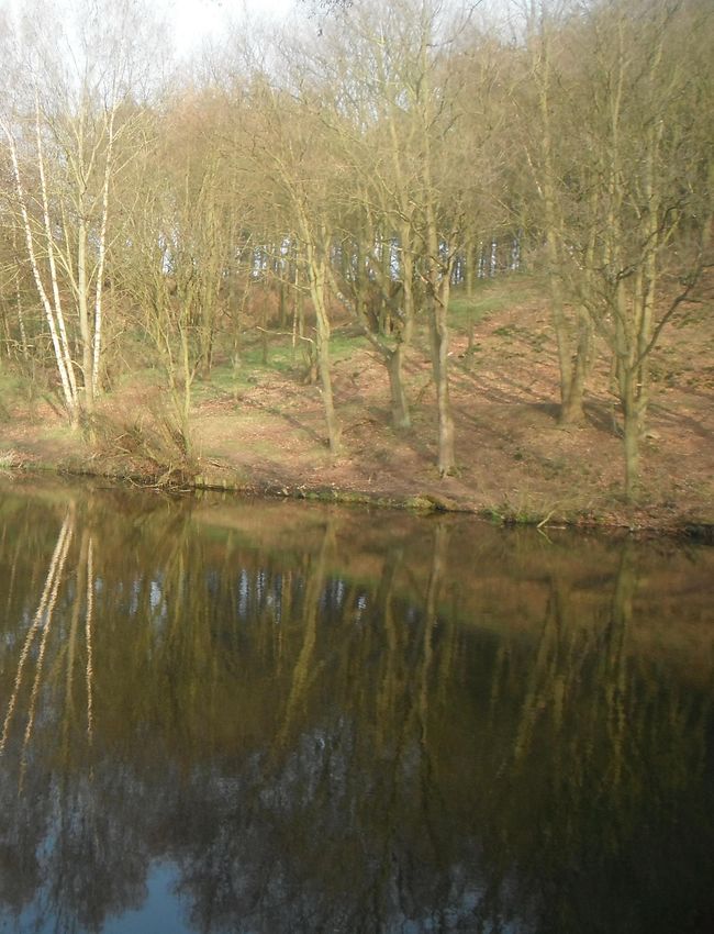
31The Chestnut Walk Path alongside Pond Hill Wood
'Pond 0' entrance to Spa Ponds Nature Reserve

                   Pond 4
You can also read