STONY CREEK METROPARK MULTI-USE, NATURAL SURFACE TRAIL SYSTEM REDEVELOPMENT PLAN
←
→
Page content transcription
If your browser does not render page correctly, please read the page content below
STONY CREEK METROPARK

          MULTI-USE, NATURAL SURFACE
                 TRAIL SYSTEM
            REDEVELOPMENT PLAN
                           DECEMBER, 2018

                      CONTACT INFORMATION

Dr. Jeremy Wimpey, PhD
Owner, Applied Trails Research, LLC
208 E. Maple St.
Mt. Pleasant, MI 48858
443.629.2630

jeremy@appliedtrailsresearch.com
www.appliedtrailsresearch.com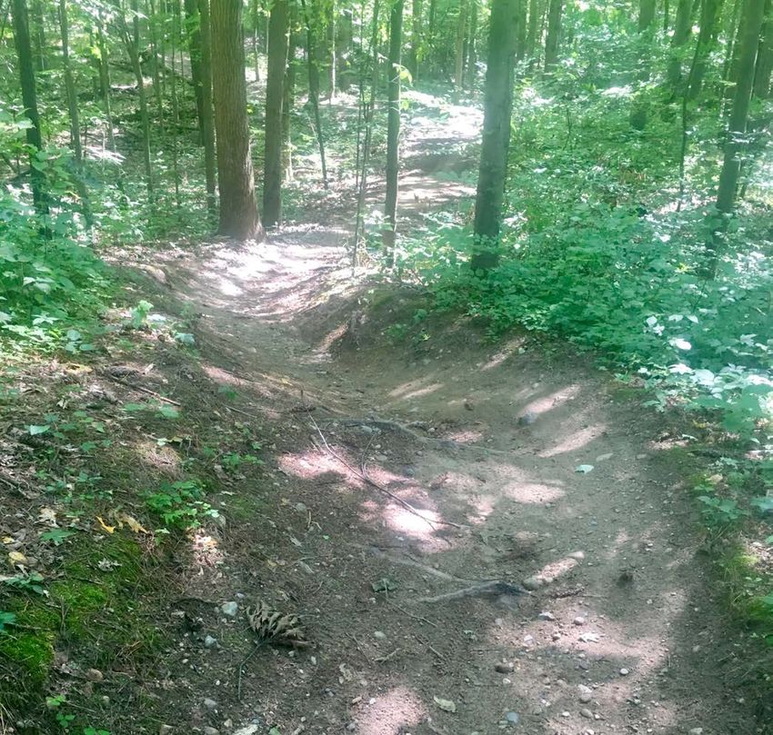
TABLE OF CONTENTS

Background................................................................1

Existing Trail System.................................................3

Trail System Assessment...........................................6

Public/Management Outreach................................15

Conceptual Trail System.........................................16

Implementation........................................................25

Trail Specifications……………………………..…28

Appendices

Appendix A- Trail Closure Best Practices

Appendix B- Trail Signage Best Practices

Appendix C- Volunteer Stewardship Best Practices

Appendix D- Public Survey Results

Appendix E- Metal-Wood Riding Feature
            Information

Appendix F- Large Format Conceptual Trail
            System Maps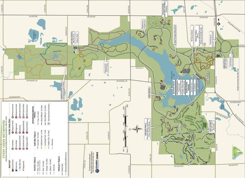
BACKGROUND
PROJECT TIMELINE
As part of the Stony Creek Metropark’s Natural Surface Trail
Redevelopment Project, Applied Trails Research (ATR) was
contracted to undertake a trail inventory/assessment and
redevelopment plan. Following a kick-off meeting with Huron-
Clinton Metropolitan Authority (Metroparks) staff in late July,
2018, ATR mobilized to Stony Creek Metropark in late
August. Field-based trail inventory and assessment activities
were undertaken from August 22 - 28. Site meetings with
Metroparks staff occurred on August 24 and 27, and an invited
stakeholder meeting was held on August 28. A short, electronic
survey was created and disseminated by Metroparks for public HCMA park locations
comments from September 15 to October 15. Combining
public comments with opportunities and constraints identified
during the field assessment, recommendations were developed
for review by Metroparks. Final recommendations are included
in this Trail Redevelopment Plan for presentation to the
Huron-Clinton Metropolitan Authrority Board of
Commissioners.
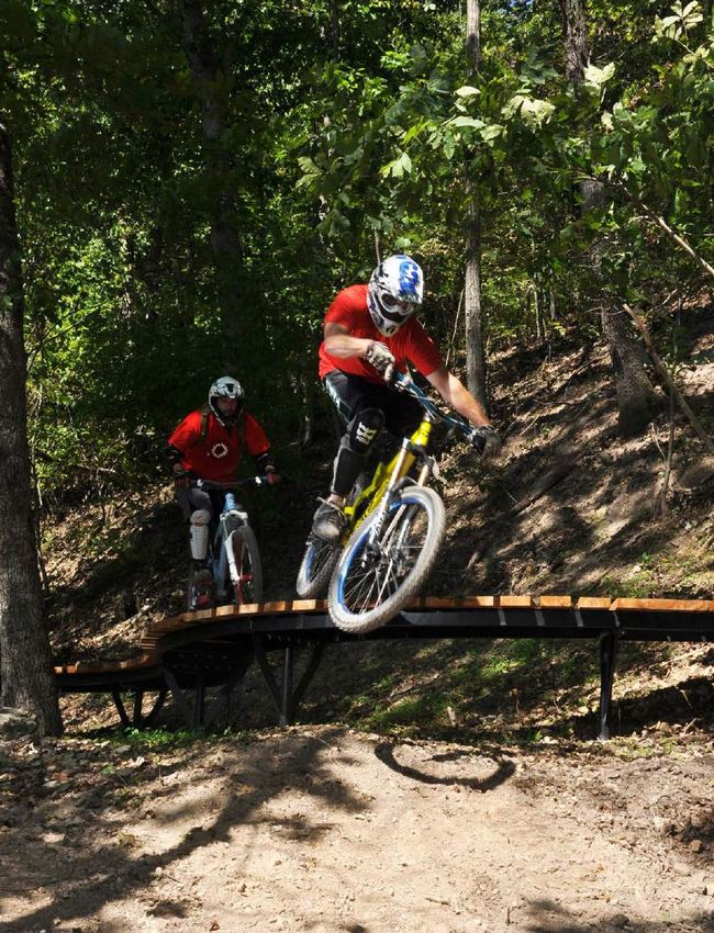
TRAIL SYSTEM HISTORY
The Shelden Trails are an assemblage of routes through a
topographically diverse, forested area covering approximately
650 acres in the southwestern portion of 4,350-acre Stony
Typical condition for Shelden cross
Creek Metropark. Of that acreage, almost 200 are lowland country ski trails that also allow
areas that are seasonally inundated. summer mountain bike and hiking use
The area was first developed for cross country skiing, with a
multi-loop trail system of approximately 8.87 miles. In the
1990’s, local mountain bikers began to develop narrow
singletrack trails that utilized the numerous hills and steeper
slopes in the area, including climbs and descents of the
eponymous Shelden Hill. The steep, fall-aligned nature of
these trails and lack of water management combined to cause
erosion to an extent that many of the original trails were closed
and rerouted.
The newer rendition of the trail system, developed and
Metropark map of cross country ski
maintained by the Clinton River Area Mountain Bike trails at main summer use trailhead. No
Association (CRMABA) is more contour-aligned and sinuous, singletrack trails are shown on map.
and was developed with a single preferred direction of riding.
1
BACKGROUND

    SHELDEN
     TRAILS
      AREA

                                   TROLLEY
                                    TRAILS
                                     AREA

       Location of Shelden and Trolley Trails in Stony Creek Metropark

                                      2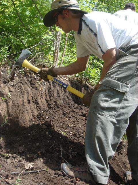
EXISTING TRAIL SYSTEM
STONY CREEK METROPARK
WINTER ACTIVITIES
S ROCHESTER RD
E GUNN RD
NORDIC SKI TRAIL
MAP KEY DIFFICULTY RATING SYSTEM
Rental Shelter The ski trails are marked using
the Nordic Difficulty Rating
Restrooms Open in Winter
System. This system uses a
Restrooms Closed in Winter E GUNN RD
series of squares, diamonds 28 MILE RD
and circles, along with color
Paved Hike-Bike Trail
to indicate the level of difficulty.
Nature/Hiking Trail
Easy
First Aid
More Difficult
Food
Most Difficult
Cross-Country Skiing
Sledding E SNELL RD
Ice Skating
Ice Fishing
Parking
Area B
2 PB
1
SKI TRAILS 3
29
Shortcut WEST BRANCH
Not Groomed PICNIC AREA
Sledding Hills
GOLF COURSE TRAILS
27 PF
A 1.9 Mile Loop Parking
Area F
B 2.0 Mile Loop
26 Stony Cree
23 B
Lake
SHELDON TRAILS B
24 Mt.
PB – 1 0.3 Miles 4 22 16 Shelden
Hill 15 14
PF – 27 0.2 Miles 21 BOAT LAUN
20 18 17 12 13 B Ice Rink
Blue Loop 4.5 Miles 19
(distances in miles) 5 A So
A uth
S D am
S – 10 0.3 11
10 – 15 0.5 10
15 – 23 0.2
6 8
23 – 2 0.6 7 GOLF COURSE
2 – 4 1.1 SKI CENTER
4 – 10 1.5 9
10 – S 0.3 MEAD RD
RD
RD
SHELDON RD
N
N
NO
ILL
Black Loop 4.6 Miles
ER
Winkler
RM
TV
(distances in miles) Pond
KLE
M
S – 10 0.3 2 – 1 0.1
WIN
10 – 15 0.5 1 – 27 0.4
DEQUINDRE RD
15 – 22 0.8 27 – 15 0.5 FEET 0 1000 2000 3000 4000 5000
D
22 – 23 0.6 15 – 10 0.5 MILES 0 ¼ ½ ¾ ONE NR
23 – 2 0.6 10 – S 0.3 GTO
N
HI Shelby
AS
W
Winter trail system in Shelden Hill area of Stony Creek Metropark
3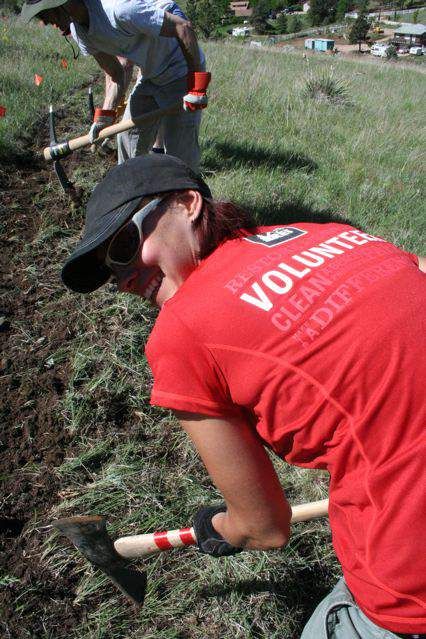
EXISTING TRAIL SYSTEM

       Shelden Trails
        Current System
            Beginner
            Intermediate
            Advanced
            Visitor Created
            Two Track

   0       625          1,250       2,500
                                       Feet                     I
                                Existing Shelden Trail System

                                              4
EXISTING TRAIL SYSTEM

        Trolley Trails
       Conceptual Redesign
           Dirt Path
           Bike Park

   0       250         500   1,000
                                Feet                         I
                             Existing Trolley Trail System

                                           5
TRAIL SYSTEM ASSESSMENT
Currently, there are approximately 6.21 miles of singletrack
Stony Creek Metropark
trails in the Shelden Hill area, accessed primarily via the Mountain Bike Trail Map
2 1 L ot B
Lo
tA
3
cross country ski trails from a single trailhead parking area.
a
4300 Main Park Road, Shelby Township, MI 48316 ranch
Picnic
Are
tB
es
W
Sw
29
am
p Cutou t
1.67 miles of visitor-created trails exist within the system,
C
ot
L
Park Roa d
D
28 Lo t
with numerous short segments that provide connections
Three
Gear Lo
Hill tE
Rest
Area
between the singletrack and ski trails, shortcuts between
Lo
t
F
27
sinuous segments of singletrack, or direct routes up steep Roller Coa
st
er
ad
26
Ro
e
rs
ou
hills. Woohoo Hill
23
Golf
Course
Climb
Go
lf C
25
ac 24 Mt. Shelden
B
k Ni
N
ne
Gravel Pit
16
ke
4 22 n a
he S
The Trolley Trails area has also been open to mountain bike
T
Green
(Two Track / Easier)
Grassy 14
Blue
Knoll 15
(Two Track / More Difficult)
21 Shelden Old Tennis
Estate Court Black
use. Low gradient cross country ski trails are wide and grass-
Wall (Single Track / Most Difficult)
20 18 17 12
13 Other Trails
Road / Parking
Water
covered. A mountain bike park was developed near the
19
Information / Trailhead
i n g H er e
No M T B
Restrooms / Drinking Water
5
Par k Parking
parking area and includes a pump track, a flow trail with Curved
Bridge
Rock
Garden
11 1 Trail Intersection Marker
Point of Interest / Local Name
Single Track Direction Arrow
(One Way for Bicycles)
steep-faced jumps, a dual slalom track, and numerous The
10
Pin e
s This is an unofficial map
developed by the Clinton River
8 Area Mountain Bike
wooden skills features. 6
7
Association (CRAMBA-IMBA).
Information in this map is not
vetted by nor is the map itself
approved by Huron-Clinton
Sheldon Road
Metropolitan Authority (HCMA).
Mead Road Hill
1/4 Mile 9
The two trail systems are not connected by natural surface Mead Road
Map by Steve Vigneau / Clinton River Area Mountain Bike Association (CRAMBA-IMBA) Revised: 07-Jul-2015
Map data © OpenStreetMap contributors, CC BY-SA
trail. The paved trail system within the park can be accessed
CRAMBA-produced map that depicts
near both trailheads, but currently there are not designated,
both singletrack and double track cross
striped crosswalks. country ski trails
TRAIL SUSTAINABILITY
Over the previous 75 years trail sustainability has focused
mainly on the durability of the trail tread, or the physical
sustainability. This framework has utility and best practices
that have been developed in the construction and
maintenance of natural surface trails have served land
managing agencies well when utilized. However, trails are a
facility, just like a road, building, boat launch, or restroom.
Facilities must be kept up to an operational standard by their
owners (Operations and Maintenance) and in a condition that
optimally meets the needs of its visitors. To create a
sustainable trail facility, the conditions must also be analyzed
from standpoints of managerial and social sustainability.
PHYSICAL SUSTAINABILITY
Physical sustainability of a trail relates most closely to its
position on the landscape and the subsequent ability to Carsonite post indicating one way
nature of trail, obscured by placement
manage water and limit sediment movements via surface and surrounding vegetation.
6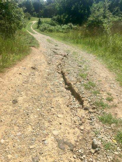
TRAIL SYSTEM ASSESSMENT

water based erosion and deposition. Trails with steep or fall-
aligned (running perpendicular to topographic lines) gradients
create difficulties in managing water off the trail tread. On
poorly aligned steep and/or fall-aligned trails the potential for
unmanaged water volume and velocity along the trail’s tread
leads to erosion of the tread, cupping and decreased utility for
trail users. These conditions often amplify over time as
cupping and incision compound water management.
Simultaneously, users are likely to spread out seeking better
footing compounding erosion issues with trail widening.

At the other end of the trail gradient spectrum, trails with very
low gradients, especially in flatter topography, allow for water-
or user-entrained sediment to deposit. These areas are often
located immediately down trail from steep and poorly aligned
segments. Without topographic slope to drain water off trails in
these landscape positions, the trail tread does not dry and
deposited sediment becomes muddy, exacerbating the wet
conditions. As trail users encounter these conditions, they often    Rutting occurring on double track
diverge laterally to the seemingly driest location at or beyond     where drainage is not directed off the
                                                                                    trail
the edge of the trail. Over time, this trail use pattern combines
with the lack of positive drainage results in wider, muddier
trails.

Trail gradient also plays a role in resisting user-based forces.
Trails that are too steep to withstand the physical stresses
imparted upon the trail tread by users exacerbate trail
degradation caused by a lack of water management.

Shelden Trails- Physical Sustainability
The official, mapped singletrack trail system is relatively
durable in its current format. Most segments are contour-
aligned. Short segments exist that are more fall-aligned or
steeper than the soil can handle, leading to some erosion and
subsequent silt/sand deposition at the bottoms of the descents.
This condition is especially apparent on short trail segments
(20-50’) near the top of hills where the soil matrix is less
cohesive with rounded moraine rock and sand. These fall-
aligned segments have incised to depths from 4-12”, carrying         Trail incision on a steep route up
sediment to downslope locations where sand build up is                           Shelden Hill
occurring.

                                                         7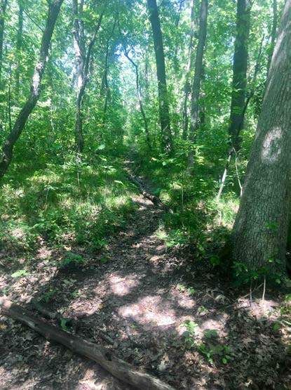
TRAIL SYSTEM ASSESSMENT

 While much of the singletrack is contour-aligned, a lack of
sufficient rolling contour alignment and tread outslope results
in some drainage challenges and unnecessary but minor trail
degradation.

Insufficient trail development (i.e. rake and ride vs. full bench
cut) has resulted in migrating trail tread in many locations.
This is apparent through tread widening and creep down the
side of the hill, multiple trail braids, and “double” turns where
slow and faster riding lines have developed.
Informal, ridden-in turn development show the most significant          Sediment deposition
signs of deterioration, both because of steep gradients, lack of
sufficient water management above and below the turns, and a
lack of berm structure to reduce the sheer stresses of bikes (and
even trail runners) on these trail features.

Trail segments in the far north and southwest areas of the trail
system are located in much flatter areas with high seasonal
moisture content. Muddiness issues have largely been
mitigated with raised puncheon structures and some rock
armoring.

The two-track cross country ski trails do not manage water
sufficiently, resulting in some large erosion incisions, loose/
rubble/gravel trail tread conditions, and sediment deposition/
sand pit development. In some cases, the drainage issues of the
two track routes interacts with the narrow singletrack at or near
the multiple junctions of these routes, causing erosion of the
singletrack.                                                        Contour-aligned, narrow trail

The non-cohesive gravel nature of the steeper two-track routes
is maintained and furthered by users, losing traction going
uphill or trying to reduce speed/maintain balance going
downhill.

                                                                     Fall-aligned, widening trail

                                                        8
TRAIL SYSTEM ASSESSMENT
Trolley Trails- Physical Sustainability
The two-track cross country ski trails are grass-covered where
gradients are low and somewhat unconsolidated on a few
steeper graded slopes. The drainage maintenance challenges
are not nearly as acute as on the steeper Shelden ski trails.
Fill material in the bike skills area is utilized for the creation of
the pump track, dual slalom, and jumps did not have sufficient
clay content to maintain the steep berm and jump faces. This
challenge likely played a role in the challenge of long-term
maintenance. Carpets cover many of the jumps to preserve the
angle of the lips and landings. Where this treatment has not Kiosk at Trolley Trail area. Note the
been utilized, rollers, berms, and jumps have “melted” and dated material and lack of a map.
have not been reconstructed.
SOCIAL SUSTAINABILITY
Social trail sustainability relates how visitors to the forest
interact with the trails and each other. From use patterns and
access to navigability and conflicts, the factors that influence
the quality of a visitor’s experience and the expectations that
they bring to subsequent visits play a significant role in
environmental stewardship, regulatory compliance, and the
stability of the trail system. Where trail conditions, diverse,
high quality experiences, or sufficient access are problematic
in a system of highly used trails, the public will often attempt Carpet covering of jump faces utilized
to satisfy their own needs. Determining what social to mitigate the effects of weather in
“melting” the jump.
deficiencies exist in a trail system is not an easy process, as
diverse interests are often present across a complex system of
trails, users and access. However, continuing an open dialogue,
fostering trust and collaboration, and clearly discussing forest
and visitor goals is foundational to the process of meeting and
shaping public desires while preserving mandated forest goals
and operations.
Shelden Trail Social Sustainability
Use Patterns
Numbered intersection map. Very little
The one-way nature of the singletrack trail system allows space on the map is dedicated to the
fewer user interactions between mountain bikers. However, the trail system.
9TRAIL SYSTEM ASSESSMENT
lack of a well-developed system of loops makes route choice
very limited. Currently the central loop (Snake-Roller Coaster)
seems to get multiple passes per user outing with some of the
peripheral trails like The Pines seeing much lower use
numbers. This repeated looping increases the number of
physical interactions between riders, and when coupled with
the close proximity of these two trails to both each other and
within all the legs, can create a “crowded” feel during heavy
use periods. This is especially true for non-mountain biking
visitors who may be passed by the same rider multiple times on
one trail due to speed of travel differences.
Social trail proliferation exists throughout the system,
including pedestrian short cutting of many switchbacks and
multiple fall-aligned routes spreading around the top of
Shelden Hill, the majority of which also seem to have been
created/used by pedestrians due to the linear nature and very
narrow corridors.
Short-cutting and social trail development seems largely due to Directional signage on singletrack trail,
separate from intersection signage.
the very mtb-centric nature of the trail system, including very
sinuous, non-linear alignments that encourage shortcutting by
pedestrian, tired, or disoriented users.
Significant trail braiding issues exist throughout the singletrack
system. This is caused by either a) a route getting more
challenging (rooty or loose rubble) leading less skilled riders to
attempt avoidance and creation of a new line, or b) mis-
alignment of turns for higher speed riders that can either allow
momentum to help form the new line or be forced to brake
suddenly and initiate additional trail incision.
A number of alternate “rock” and log pyramid challenge lines
exist throughout the system, indicating a desire from users for
more challenging trail experiences. Most of the rock features
are either not long enough or rough enough to provide a
progressive step in challenge, the log features are mostly
rotting and similarly do not provide a progressive challenge,
except where they are placed in sequence down a steep section
of trail to form a dropping step structure. One of many shortcuts between legs of
singletrack trails.
10TRAIL SYSTEM ASSESSMENT
T R A I L S P E C I F I C AT I O N S
Navigation
The current singletrack trails do not originate at the existing
bathroom/water/trailhead kiosk which has a nice repair stand
and wooden infrastructure but fairly challenging maps and
dated attendant information. This creates a potential orientation
and/or navigation challenges. When new visitors do find the
entrance to the trail system, the map present only depicts the
two-track cross country ski trails. Similar, less than ideal
connections (informal, “other” non-official trails) exist at the
other peripheral parking areas. It is not clear whether all use is
directed in the same direction or pedestrian use is to be routed
in opposite direction of mountain bike use. The sum of these
conditions are not problematic for riders that have visited the
trails multiple times, orientation is very challenging for new
visitors or those that do not readily understand maps.
Adding to the initial trailhead orientation challenge, the
mapping information presented and actual trail alignments are
quite dissimilar. The “other” trails are not shown on park- Repair stand and kiosk with CRAMBA
produced maps, creating further confusion for visitors when the map located at opposite end of parking
lot from the trail entrance.
arrive at one of these unsigned intersections of very substantial
and official “looking” trails. At official junctions, numbered
intersection signage is in place, but accompanying paper maps
are fading and some of the posts are deteriorating. Trail
directionality is displayed on additional signage structure of
fiberglass post and stickers. This signage is inconsistent,
sometimes falling apart or off-trail, and provides more
confusion than direction. In some cases, directions to numbered
intersections have been written on posts in permanent marker.
The most challenging navigation decisions occur at multi-trail
junctions, especially when more than four numbered junctions
are directed to with arrows. There are over 40 trail junctions
(27 of which are numbered), a very high number for the
included trail mileage in the system, leading to route choice
challenges, navigation issues, and “truncated” trail experiences,
especially for mountain bikers. A lack of trail segment mileage
numbers hinders route choice, especially for pedestrian users
who are moving at a slower pace on this rather extensive trail
Very confusing intersection signage
system.
11TRAIL SYSTEM ASSESSMENT
TRAIL
Experiential QualityS P E C I F I C AT I O N S
The two-track trails do not provide a positive or high quality
experience for mountain biking. Where trail tread conditions
are firm, these trails ride very much like the paved trails in the
park. The singletrack provides quality experience for
intermediate and higher level riders, but lacks routing options
and requires significant two-track use to make loops.
On the lower end of the skill level spectrum, some of the flatter
two-track can be utilized, but does not develop the bike
handling skills needed by newer riders to access the
singletrack. Steeper, loose portions of the two-track trails are Rotting log pyramid challenge feature
inaccessible tonovice riders and require pushing up or walking
down to negotiate. The lack of lower gradient, wider, looping
singletrack options for less experienced riders limits the overall
accessibility to the trail system.
There are also obvious desires for higher levels of trail
challenge. From the development of the skills area at the
Trolley Trails to feature development on the singletrack, many
experienced riders are seeking more difficult options. These
experiences are not currently met in a sustainable manner in
the rotting log pyramids and eroding log/rock drops on “other”
trails.
Alternate rock garden challenge line in
For pedestrians looking for a narrow trail, the singletrack trail the Pines
experience is limited by the level of sinuosity (i.e. too
mountain bike-specific), the navigation difficulty, and
challenge in creating a loop that aligns with time and fitness
desires.
Trolley Trail Social Sustainability
The mountain bike skills area seems rarely ridden with only a
few tire tracks visible since previous precipitation and grown-
in nature of most of the area. Potentially the area sees “cut-
through” use from outside official parking areas and some level
Alternate wooden “skinny” challenge
of single feature mastery session use. The cross country ski line in the Pines
trails see relatively low summer use, indicated by a lack of a
worn in dirt singletrack on these grassy routes. This lack of use
is likely due to the lack of topography, a low quality riding
12TRAIL SYSTEM ASSESSMENT
T R A Iand
experience, L parking
S Parea’s
E ClackI F I C A T toI other
of connectivity O Npark S
facilities. With connectivity dependent on utilizing the road
shoulder or paved trail in the area and with little experiential draw,
summer mountain bike use offers little utility.
Formerly well-sculpted dirt facilities have not received sufficient
maintenance, vastly decreasing the quality of the experience.
Gradients on two-track trails are more suitable for new rider and
youth use, but lack interest and do not provide the opportunity for
skills progression (i.e. control on narrow trails, bike handling, and
balance) for those riders to comfortably ride singletrack.
MANAGERIAL SUSTAINABILITY
Managerial sustainability relates to the capacity of Park Staff,
working with the public and partners, to manage the trail system
hosted on the public lands. From personnel and funding, to
Confusing directional sign at the top of
stewardship and organization, and public safety, incident response
Shelden Hill.
and risk management, management of recreation systems is a
hands-on process. It is rare that trail systems are wholly managed
by agency staff, yet agency staff are not often trained in
collaborative management or public outreach. Conversely, trail
user groups often don’t consider long-term planning, operational
organization, outreach, promotion or fundraising as part of their
ongoing stewardship needed to meet their desires for an improved
trail system. As such, development of capacity and partnership
around these facets of trail management is often the linchpin to
success and long-term trail sustainability.
Shelden Trails Managerial Sustainability
The trail corridors are largely cleared on official trails, but little
water management maintenance has been attempted throughout the
singletrack or cross country ski trail system. Especially in the
upper topography of the moraine features, this is leading to trail
incision and sediment deposition/sand formation, and in lower
elevations, mudholes or rutting issues. There are dozens of Rock armored tread that mitigates
locations where a rolling grade dip or knick is needed to limit seasonally soft/muddy trail conditions.
runoff volume and velocity.
13TRAIL SYSTEM ASSESSMENT
T Rclosure
Trail A I andL braiding
SPE C I Fhave
treatments I Cincluded
A T Ipiling
ON S
loose
deadfall across what has been determined as an “unwanted”
route. The efficacy of these structures or number of previous
attempts is not understood, but is generally not very successful.
This type of treatment is unsightly and tends to annoy trail
users who interpret the action as a random decision of some
authority to limit their experience.
A number of treatments for seasonally wet conditions exist on
The Pines (between trail markers 6 and 19), including recycled
Visitor created trail and unsuccessful
concrete tread armoring, puncheon (with and without chicken attempt(s) to close it.
wire covering), etc. Generally these structures have been
effective at keeping a dry trail tread through the wet areas.
Rough cut and scored hardwood decking is a more effective
long-term treatment than chicken wire.
Trolley Trails Managerial Sustainability
Little recent maintenance has occurred on the mountain bike
skills area, outside of laying carpet on jump faces. The berms
and rollers have “melted” and grass has grown in over multiple
segments of the trails. The dual slalom only seems to see single
lane use, with riders weaving from one trail to another to take Tread creep/widening where roots have
become exposed and then avoided by
advantage of the more durable/ridden alignment. Open borrow trail users.
pit holes next to some jump features are hazards that should be
filled.
Many wooden features seem to have been removed. However,
nails on the remaining wooden features are pulling out (should
use screws), and some boards or “curve span” pieces are loose
and pose hazards. Framing structures and foundations are solid
and do not have significant deflection. Transfers off of wooden
structures are very flat and seem to discourage use.
Open borrow pit hazard adjacent to a
jump feature.
14PUBLIC/MANAGEMENT OUTREACH
T R A I L SDESIRES
MANAGEMENT P E CFOR
I FTRAIL
I C SYSTEM
AT I O NS
(expressed at 8/24 meeting)
• Improved navigability of the system as a whole, along with
recommendations for signage (kiosk and trailside).
• Broadening accessibility of trails to less experienced riders,
trail runners, and fat bikers.
• Strategies to reduce the number and improve closure
efficacy of social trails
• Better fat biking options to keep riders off groomed ski
trails in winter.
• Potential improved connection to Trolley Trails area
• Assessment of connectivity to a) future Oakland Township Meeting between project team
Park via old road grade and bridge foundation, b) north end members and Metroparks staff.
of park in proximity to Nature Center
• Reduction of impacts to Sheldon Avenue nieghborhoods by
ride-/walk-in use
• Revision of trail system to better avoid historic Shelden
homesite/current wedding venue
• Preservation of priority species habitat
• Development strategy and phasing recommendations
CRAMBA stakeholders are key to the
STAKEHOLDER DESIRES FOR TRAIL SYSTEM long-term success and stewardship of
(expressed at 8/28 invited stakeholder meeting) the trail system.
• More singletrack trail mileage and loop opportunities
• Reduction of winter use conflicts between cross country
skiers and fat bikes, dog walkers, and hikers
• Reduce crowded nature of trails, especially on summer
evenings
• Additional trail connectivity to the north of park boundaries
• Accessibility to a greater demographic, including trails that
are navigable via hand cycle
• Generally better trail conditions
• Less startling potential on narrow singletrack corridors with
challenging sight lines
• Singletrack loop circumnavigating Stony Creek
• Trolley Trail area winter fat bike trail system
GENERAL PUBLIC SURVEY RESULTS
The mountain bike community has
• See Appendix D expressed a desire for better fat biking
experience in the park.
15CONCEPTUAL TRAIL SYSTEM
Shelden Trails
Conceptual Redesign
Difficulty
Beginner
Intermediate
Advanced
Two Track
0 400 800 1,600
Feet I
Conceptual Trail System Map (By Difficulty)
16CONCEPTUAL TRAIL SYSTEM
Shelden Trails
Loop
A
B
C
D
E
Two Track
0 400 800 1,600
Feet I
Conceptual Trail System Map (Indicating stacked loop structure)
17CONCEPTUAL TRAIL SYSTEM
The conceptual trail system presented on the preceding pages
reflects an attempt to 1) reduce many of the issues that are
present in the current trail system in terms of physical and
social sustainability aspects noted during the field assessment,
and 2) provide most of the desired outcomes expressed by
Metroparks management and stakeholders. The result would be
a system with a greater level of managerial sustainability.
Singletrack Mileage Increase
The redeveloped system would provide an overall net
singletrack mileage increase of approximately three (3) miles at
the Shelden Trails, bringing the total singletrack to over nine
(9) miles. When accounting for trail closures and relocations
that will remove unsustainable, eroding trails with high quality,
purpose-developed trails, the gross mileage of newly developed
trail will be nearly six (6) miles.
Loop Diversity
Short relocations of existing trails will spread out the Snake-
Roller Coaster loop to reduce erosion and sightline issues. New
trails will result in the development in five total singletrack
loops of beginner to advanced skill levels and a reduce the
dependency on two-track routes.
Accessibility
Wider trails (depicted in green on difficulty map) that are
accessible to less experienced riders and hand cycles, but still
provide a high quality riding experience for more avid
mountain bikers, will increase the demographic that is served
by the trail system. Trail connections to the picnic areas and
parking around the winter sledding hills increases the
accessibility to the forest for a broader visitor base.
Connectivity
Summer Connectivity: Ingress to the existing trail system, as
well as to Stony Creek Ravine Nature Park, will be redeveloped
as singletrack at the current main trailhead parking area. Trails
will also be formally connected to the four parking and picnic
areas in the vicinity of the sledding hill area to activate this area
as a family-friendly access to the forest.
Winter Connectivity: The redeveloped and connected
singletrack network reduces junctions with groomed XC ski
trails, and provides for meaningful singletrack-based winter
18CONCEPTUAL TRAIL SYSTEM
trail activities (these can include fat-biking, mountain biking,
snowshoeing, hiking and trail running dependent on amount of
snow). Singletrack connectivity from Sheldon Road to the
Metroparks Trailhead is also created, allowing users to create
meaningful loops of singletrack while avoiding cross country
ski trails.
Social Trail Closure
The redeveloped and formalized nature of the trails will help to
improve the social trail challenges by bringing trail users to
desired landmarks efficiently, “unfolding” singletrack loops to
discourage short cutting of switchbacks, and creating cohesive,
navigable loops. Reconfiguring singletrack trails away from the
historic Shelden Estate will reduce the presence of trail users
on the grounds during events.
Skills Progression
The green singletrack around the the picnic areas can be
developed with low-to-ground, durable metal-wood skills
development features adjacent to the trail that improve balance
and bike handling skills. The redeveloped Back Nine trail
(purple on loop map) can be outfitted with more challenging
trail features on the advanced/southern leg of the loop.
Navigation
The orientation of the loops, with minimal crossings of the
two-track trails will reduce the reliance on map interpretation.
Moving away from the trailhead parking areas, each loop
(except for The Pines) returns to a previous loop in a “stacked”
manner through short segments of two-way trail. These two-
way trail segments and single direction use (counter clockwise
for mountain bikes, clockwise for pedestrians) reduce the need
to make navigation decisions at two-track crossings.
Conflict Reduction
New directional signage at the termini of the short, two-way
segments will orient mountain bikers and pedestrians in the
appropriate direction so that face-to-face interactions occur on
the trails. Unfolding some of the existing singletrack and
removing fall-aligned segments will result in longer sightlines.
Creating easy access to the singletrack from multiple trailheads
will reduce crowding during busy trail use periods. Removing
the need to utilize the cross country ski trails/two track to
access singletrack trails from the main trailhead, as well as
Sheldon Road, will reduce winter grooming/use conflicts.
19CONCEPTUAL TRAIL SYSTEM
T R A I CORE
EXISTING L STRAIL
P E SYSTEM
C I F IREDEVELOPMENT
C AT I O N S
1. Minor extensions, closures, and relocations to the Snake Trail to reduce eroding trail segments, increase
sightlines, and unfolding of switchbacks to reduce pedestrian shortcutting.
2. Redevelopment of the Back Nine Trail into two trail segments that form a loop utilizing both aspects of the
prominent ridge and adjacent topography north of the intermediate two-track ski trail. The advanced portion
of the trail can be developed as a mountain bike-optimized flow trail.
3. Redeveloped connectivity at the northeast and southwest ends of the new two loop core trail system that
directly connect to singletrack and do not traverse seasonally wet locations.
4. More direct connectivity from the trailheads and singletrack to the top of Shelden Hill which is also directed
away from the historic Shelden homesite and wedding location.
5. Reduction in two-track crossings to improve navigability and the need for excessive signage.
5
3
1
1
2 2 4
4
5
5
3 0 250 500 1,000
I 0 250 500 1,000
Feet I Feet
Existing Core Trail System Proposed Redeveloped Core Trail System
20CONCEPTUAL TRAIL SYSTEM
T R A ICOASTER-SNAKE
ROLLER L S P E C TRAIL
IFIC AT I O N S
REDEVELOPMENT
1. New trail segment that provides direct connectivity of the climbing leg of trail to the descending leg of trail
without utilizing the two-track.
2. Short trail extensions to spread legs of the trail out.
3. Enhanced, continuous downhill segment.
4. Numerous closures of switchbacks that have sustainability issues and are frequently short cut by pedestrian
users.
5. Redeveloped descending segment on the southeast portion of the hill that provides a singletrack return
toward the proposed new trails near the picnic parking areas.
4
3
2 3
2
2 2
4
4
4 1 5
1
0 250 500 1,000
I 0 250 500 1,000
Feet I Feet
Proposed Redeveloped Roller Coaster
Existing Roller Coaster-Snake Trails
Snake Loop
21CONCEPTUAL TRAIL SYSTEM
T R ADIVERSITY,
TRAIL I L S PACCESSIBILITY,
E C I F I CAND
A TCONNECTIVITY
I O N S IMPROVEMENTS
1. Outbound singletrack trail connectivity from main trailhead and existing kiosk to expanded trail system.
2. Family-friendly, hand cycle-accessible trail connectivity and loops accessible from three additional parking/
picnic areas (green loop).
3. Inbound singletrack connectivity from Shelden Hill back to all trailhead parking areas.
4. Replacement of fall-aligned and eroding “other” trails into longer, contour-aligned loops.
1
1
3
4
2
0 250 500 1,000
I 0 250 500 1,000
Feet I Feet
Proposed Redeveloped Picnic/Sledding
Existing Picnic/Sledding Area Trails
Area Trails
22CONCEPTUAL TRAIL SYSTEM
TRA
LOOP IL SP
CIRCUITRY E C I F I C AT I O N S
1. Sustainable singletrack trail additions that provide improved loop navigability and singletrack connectivity
from Sheldon Road to the Stony Creek trailheads.
1
0 125 250 500
I 0 125 250 500
Feet I Feet
Existing Pines Area Trails Proposed Redeveloped Pines Area Trails
23CONCEPTUAL TRAIL SYSTEM
T R A I TRAIL
TROLLEY L SREDEVELOPMENT
PECIFIC AT I O N S
1. Grade out and remove existing bike park features, seed area, and fence for use as off-leash dog park.
2. Redevelopment of fall-aligned cross country ski trails into two loops of contour-aligned, family-friendly
singletrack that can be utilized for winter fat biking and leashed dog walking to reduce conflicts with these
uses on the Shelden Hill area groomed cross country ski trails.
Trolley Trails Trolley Trails
Dirt Path Two-Track
Bike Park Multi-Use
Dog
1 Park
2 2
0 250 500 1,000 0 250 500 1,000
Feet
I Feet
I
Proposed Redeveloped Trolley Trails
Existing Trolley Trails and Bike Park
Area
24IMPLEMENTATION
T Rredevelopment
The A I L Sof P the E C Creek
Stony I F Inatural
C Asurface
TIO trailN S can be implemented in a phased approach
system
that will allow the trail system to remain open during the redevelopment activities. Initiating the process with
detailed field design of maintenance and new trail construction segments in Winter, 2019 (which will refine the
conceptual plan and redevelopment action estimates presented below) will better help delineate the efforts,
funding, and potential phasing of the project. Funding needs presented below indicate turn-key professional
services and are based conservatively on similar projects undertaken in the last three years.
Recommended project phasing and timelines would be as follows:
1. Shelden Trails (Spring, 2019 through Fall, 2020)- CRAMBA and Conservation Volunteer/
Metropark-led short (less than 250’) trail relocation/closure/restoration
2. Shelden Trails (Fall, 2019)- Professional trail construction of beginner/family/hand cycle
singletrack and Conservation Volunteers/Metropark-led closure of “other” trails
3. Shelden Trails (Spring, 2020)- Professional trail construction of intermediate and advanced
singletrack and installation of technical trail features throughout beginner trails, and
4. Trolley Trails (Fall, 2020)- CRAMBA/Metropark-led construction on new intermediate
singletrack and dog park development
CRAMBA/Metropark Trail Relocation/Closure/Restoration
With field design completed, CRAMBA, conservation volunteers and Metroparks can begin to organize
volunteer work efforts that undertake short segments of trail relocation and restoration of the existing
singletrack. Projects should focus on the sequential redevelopment of individual trails. Small projects, ideally
less than 250 linear feet of new trail, should be aligned with volunteer resources in order to fully complete
projects in a single volunteer work event. Trail closure and restoration work must be undertaken at the same
time as new trail construction for efficacy of the closure/restoration and re-use of excavated soil and woody
materials from construction in the restoration.
Metroparks staff (see Appendices A and C) will have to work closely with CRAMBA and conservation
volunteers early in 2019 to schedule joint work events, organize any training that may be necessary for
successful work that meets the project specifications, purchase and/or stage tools/materials for work events, and
post construction warning or closure signage at trailheads and on trails.
Professional Trail Construction
Larger trail development efforts (greater than 250 linear feet) will be more efficiently and effectively
implemented through contracting with an experienced, professional trail contractor. When funding is available,
the detailed field design information and specifications materials can be attached to a standard Metroparks bid
package and solicited through the Professional Trailbuilders Association (www.trailbuilders.org). Considering
typical project backlogs of professional trailbuilders, Metroparks should plan on releasing the bid before May,
2019 for construction initiation four to six months after contractor selection. A single contract for the full cost of
the new trail construction would be ideal and potentially attract a greater number of qualified contractors and/or
be undertaken in a single construction mobilization. Budgeting and fundraising may require two separate
contracts and moblizations.
25IMPLEMENTATION
Shelden Hill Trail System
Trail Current Redesigned Overall
Type Mileage Mileage Change
Beginner Two-Track 4.4 5.43 + 1.03
Intermediate Two-Track 4.47 3.31 -1.16
Intermediate Cross Country Ski 4.38 4.38 0
Advanced Cross Country Ski 2.13 2.13 0
Beginner/Family Singletrack 0 2.11 + 2.11
Intermediate Singletrack 0 4.3 + 4.3
Advanced Singletrack 4.54 3.26 -1.28
Visitor-Created/”Other” 1.67 0 -1.67
Totals 15.08 18.41
Two-track: 8.87 Two-track: 8.74
Singletrack: 6.21 Singletrack: 9.67
Shelden Hill Redevelopment Actions*
Action Mileage Est. Unit Cost Est. Total Cost
Beginner/Family Singletrack 2.41 $35,000 $84,350
features- 12 $3,250 $39,000
Intermediate Singletrack 3.74 $27,750 $103,785
Advanced Singletrack 1.73 62,500 $108,125
Heavy Maintenance 2.09 $10,500 $21,945
Closure/Restoration 4.55 $15,000 $68,250
Total: $425,455
* Assumes professional contracting for all redevelopment actions
26IMPLEMENTATION
Trolley Trail System
Trail Current Redesigned Overall
Type Mileage Mileage Change
Beginner Two-Track 3.22 2.87 -0.35
Intermediate Singletrack 0 0.9 + 0.90
Bike Park 0.94 0 -0.94
Totals 4.17 3.77
Trolley Trails Redevelopment Actions*
Action Mileage Est. Unit Cost Est. Total Cost
Beginner Two-Track 0.25 $35,000 $17,500
Intermediate Singletrack 0.9 $27,750 $24,975
Closure/Restoration 0.61 15,000 $9,150
Bike Park Decommission 0.94 $10,500 $9,870
Dog Park Development NA NA NA
Total: $61,495
* Assumes professional contracting for all redevelopment actions
Hybrid Contracting
Cost savings may be possible through combining the efforts of professional trail contractors and volunteers.
Not all contractors are comfortable working with volunteers for liability, scheduling, quality control, and other
valid reasons. However, if these challenges are mitigated, volunteers such as CRAMBA can allocate a regular
cadre of individuals to serve as a corridor clearing and/or hand finishing crew with the contractor. The
logistics of this type of project are best negotiated after a preferred contractor is selected and budgets should
be projected for turn key construction solely by the contractor.
Metroparks’ Staff Capacity
Cost savings may be possible through efforts of Metroparks staff. Closure and restoration work was indicated
as work that staff and/or conservation volunteers could undertake and maintenance staff likely can function in
similar manners to CRAMBA volunteers in clearing a trail corridor or hand finishing trail behind a contractor.
That stated, an informed project manager will need to be assigned to the project to provide ongoing volunteer/
staff planning and management that integrates with the professionally contracted portions of the project.
27TRAIL SPECIFICATIONS
All new trails will be developed with rolling contour alignment, relatively low trail gradients, and regular
reversals in grade to better manage runoff and minimize soil erosion and deposition. Construction will be full
bench cut in nature within a corridor as narrow as possible to allow for the specified trail width. Large trees
will not be cut down (except diseased individuals or nuisance species), but instead used to “anchor” the trail.
Typical 1.1: Rolling Contour Trail
Typical 1.2: Grade Reversals
28TRAIL SPECIFICATIONS
Trail Type Name: Green Cross Country (one- and TREAD WIDTH
VARIES: MIN. 36”,
two-way), Hand Cycle-Accessible MAX. 48”
TREES AS ANCHORS,
Difficulty Rating: Less Difficult/Green Circle 36” - 48”
NOT LESS THAN 48”
CORRIDOR
TRAIL TREAD SURFACE
OF NATIVE SOIL AND
ROCK MATERIAL
Typical Tread Width: 36”- 48” LEAF LITTER TO COVER ALL
BACKSLOPE AND SPOILS
Typical Corridor Width: 48”-72” FOLLOWING TREAD CONSTRUCTION
STONE/UNDERSTORY
Tread Rugosity: Relatively smooth, some roots or TRAIL ANCHORS, NOT
LESS THAN 36”
rocks, protrusionsTRAIL SPECIFICATIONS
Trail Type Name: Intermediate and Advanced TREAD WIDTH
VARIES: MIN. 12”,
Cross Country (one- and two-way) MAX. 36”
TREES AS ANCHORS,
Difficulty Rating: More Difficult/Blue Square or 12” - 36”
NOT LESS THAN 36”
CORRIDOR
TRAIL TREAD SURFACE,
Most Difficult/Black Diamond COMPACTED
LEAF LITTER TO COVER ALL
BACKSLOPE AND SPOILS
Typical Tread Width: 12” - 36” STONE/UNDERSTORY
TRAIL ANCHORS, NOT
LESS THAN 24”
Typical Corridor Width: 36”-48”
PROTRUSIONS IN TRAIL
Tread Rugosity: Uneven, with regular rock and 3-7%
TREAD LESS THAN 12”
root protrusions,TRAIL SPECIFICATIONS
Trail Type Name: Mountain bike flow trail Typical Constructed Trail Features
Difficulty Rating: Most Difficult/Black Diamond
Tread Width: 24-72”+ (active tread, fill for features will be
wider)
Corridor Width: 72”-96”+
Tread Rugosity: Varies based on trail type specification and
terrain
Average Gradient: 3-10%
Maximum Sustained Grade: 10%
Maximum Grade: 15%
Typical Tread Materials: Natural surface, full bench cut.
Maximum lift and tilt use of cut/spoil materials for trail feature
development. Where adequate amounts or quality of soil are
not present, borrow pits within 25’ of the trail center line
employed. All constructed features compacted in 6” lifts
Sideslope Steepness: Flat to 45%
Turn Radius: Broad radius, super elevated
Trail/Structure Formality: High formality, 36” minimum
width, width minimum of 2X maximum height
Wet Area Crossing Formality: Armored crossings at grade,
opportunity for constructed bridge riding feature
Duty of Care: Moderate
Intended Experience: These mountain bike-optimized, one-
way trails will be oriented for directional use. Grade reversals
will be larger and enhanced as rollers or roller tables with
excavated or borrow materials. Sinuosity of the trail will be
optimized for higher speeds. All turns will be insloped or
superelevated to keep riders on the trail and sized accordingly.
31APPENDIX A
TRAIL CLOSURE BEST PRACTICESexpertise about what species and sizes of local plants are appropriate for transplanting. Your local
land manager may prefer you to use native plants cultivated and brought in for this purpose. However,
if your local manager approves of local transplanting, make sure to dig up live plants from a sufficient
distance and random locations, so as not to leave a new denuded area. Be sure to disguise all holes
created by digging up plants.
APPENDIX A If available, transplanting nurse logs make fine additional check dams and often increase the likelihood
of the plants surviving. If it can be arranged for someone to come back and water the transplants and
nurse logs through the first dry season, plant success can be increased significantly. See next section
for additional details about transplanting.
Undesired and informally created trailsOf(social
course, it trails)
is ideal toimpact thethat will survive, but if plants are abundant it may be appropriate to
select plants
“plant” large stature plants that likely won’t survive, simply to block and disguise the trail. Sometimes,
landscape and visitor experience at thealready
Shelden trails.areIn“planted”
dead plants additionin a process some call “vertical mulching.” This may also be done
with logsfragmentation,
to trampled vegetation and potential habitat or heavy limbs that still have a
fall
few branches. Plant the butt end of the
line-aligned social trails often increaselimb
surface run
12” in the off,and
ground, which can
lean the other
lead to water-based erosion problems. end As against
socialantrails
existing trailside tree.
receive
more use and/or erode more, these routes If necessary,
become import soil to reduce
more
gullying that is greater than 6” deep.
pronounced and attract use, contributing to the
Obtain confused
soil from aor lostborrow
hidden park pit.
When available, the root wads & wells of
users. Better monitoring of social trail wind-thrown
development andideal
trees offer more
borrow pits,
becauseare
effective closure and restoration techniques you don’t
neededhave totodig a hole and
reduce
disturb new ground. When done, break
natural resource impacts, mitigate habitat
downfragmentation, androcks
edges and fill the pit with
and organic debris so that it is not too
reduce erosion. unsightly a scar or hazard.
If available, collect local native seeds
Effective and permanent closure of undesired
and scattersocial
them over trails andreceptive
the most
soils of the project. Rake them in lightly.
routes is very challenging. Linear “scars” are difficult to obscure
Finally, scatter organic debris over the
without new vegetation growth. Trail restoration projects in
trail: branches, needles, leaves, duff...
locations with relatively high moisture and vegetation
to provide cover areand shade for
for seeds
seedlings when they sprout. Make your
initiated in a “camouflage, sign, barricade” progression
best effort priorsurface
to leave the ground to
looking as natural as possible, so users
the actual restoration of the area hydrology and vegetation.
will not even see the old trail. This is the
“Zen” part of wilderness gardening and Figure 2. Plan for decommissioning
requires a special touch. an abandoned trail. (Image
Camouflage courtesy of ImBa)
Long-term success in closing social routes is dependent upon
PCTA Trail Skills College Curriculum Page 3 of 7
camouflaging the linear feature from users.
Course 207.Simply covering
Trail Decommissioning a Restoration
& Wildland March 2011 Version
linear feature with uprooted vegetation and/or woody debris does
not disguise that the trail and often makes the closed trail more
visually evident. Instead, the vertical corridor should be
camouflaged with creative use of cut brush and transplanted
Grasses, rushes, and sedges generally Figure 4. Transplants on steep slopes must be properly
placed for plant success. (Image courtesy of the sca)
saplings to obscure the linear nature of the closed route
transplant willandbeoffer the
most easily
advantage of being easily dividable
more effective. These materials are placed within, into adjacentTheyto,are also fairly
multiple plants.
durable, though their small stature does
and offset from the linear route to mimic a natural not much assemblage
discourage people offrom using
a closed area. Small herbaceous plants
materials. (flowers without woody stems) can add
texture to a restored area, but are very
vulnerable to crushing-- best to plant
them very close to buried rocks. When
Sign choosing plants to transplant, match
plants to site to be closed.
Consistent signage and messaging is the first step in reducing use
Woody plants (trees and shrubs) offer
on a social trail. Clear and consistent markingtheunauthorized
most discouragement to future use
of a site. The ones most likely to survive
routes is vital, and should be accompanied by transplanting
messaging are less atthan 2’ tall; 6-12” is
best. Dig a circle around the drip line of
trailhead kiosks and nature center that focuses on the broader,in the shovel
the plant selected, driving
vertically as far as you can. If, when you
underlying resource impacts and regeneration usetime needed
the shovel to lift upto
the plant, there
are deep roots still attached, use pruning
mitigate the damage these routes create. clippers to cut them cleanly.
To prepare for a transplant, dig a
generous hole, at least 12-16” deep,
Barricade 3” deeper and 4” wider than the size
of the transplant root ball. With the tip
With signage in place, physical barriers to travel can be of the shovel, loosen the dirt in the
bottom of the hole so that roots can
introduced, if necessary, to reinforce the messaging that use ispenetrate easily. Pour in enough water
to thoroughly moisten the bottom of the
not authorized. Typically this is necessary on wider trail closure
hole and leave 1-2” of water remaining. Insert the root ball of the transplant such that the base of the
stem is 2” below the surrounding terrain. This will leave a dished area to collect rainwater, snow melt,
projects. Effectiveness of the barriers is related to characteristics
and to hold additional water from a bucket after transplanting. Fill in dirt around the transplant and tamp
it well so that there is no air around the roots (air pockets can kill a transplant). Add more water to fill
of naturalness and subtlety. Where larger woody vegetation is the dished area around the plan.
Some restoration workers use root hormone, soil amendments, and other products to give transplants
a better chance of surviving. There are also various products to provide water to roots for an extended
period of time. Local experts will be able to help determine what the best protocol for your area is.
If funds and potted native plants are available, purchasing appropriate species from a native plant
nursery can speed the restoration process immeasurably. Be sure to consult with local land managers
for guidance to appropriate local genetic plant stock, especially for use in Wilderness areas.
Seed Collection: Consult local experts on which plants provide for the most successful seedaptitude or interest in such heavy work, assign them to collectin
restoration, there are many different jobs -- the key is to find the
Site Restoration: Walk the site with the class to discuss the r
of two a clipboard and supplies to prepare a site restoration plan
want to prepare a detailed plan on paper first, while others may
APPENDIX A how drawing a before and after site plan with photos is essentia
completed and monitor the success of the project. Detailed site
transplanting or seeding were inappropriate due to season,different
make an species of time
effort to plantasurvival.
return visit better
the following year. Not following through on a project can result in completely losing the initial work.
Figure 5. Detailed before and after drawings of restorat
success of the project and survival of specific spec
present, a piece or two may be creatively used to mimic
TEACHING a fence.
TIPS & TECHNIQUES:
Before Restoration
Otherwise, an actual simple, low fence Trail
mayDecommissioning:
need to be With students, walk the trail to be decommissioned and discuss what the
conditions call for.signage
developed. When the social route has naturalized, Then give each
andpair of students a few pin flags and ask them to mark candidate
locations for waterbars, check dams, rock placements, borrow pits, etc. Have them describe why
fencing should be removed. they chose their locations. Refine the plan as a group then set each pair to work carrying out various
sections of trail decommissioning.
Supervise closely to be sure that rocks and logs are large enough and the rocks of appropriate shapes.
Restore Encourage students to find and flag a few candidate rocks and have an instructor evaluate them before
they are transported
When use of the route is stopped, restoration of natural to the trail. It is essential that students use rocks and logs of sufficient size. Ask
students to redo their work if it is unsatisfactory; though try to catch it early to minimize frustration.
hydrologic and vegetation patterns can be effectively initiated. If
Rock Shopping: Look uphill or along the sidehill -- The main thing is that rocks need to be big
an erosion gully is present, filling that depression is necessary
and irregularly shaped, and it often to takes patience and persistence to find and transport the right ones.
restore natural hydrologic patterns. CheckRock dams of the
and drainage work,depth
of course, ofare not everyone’s cup of tea. If someone in your group has no
aptitude or interest in such heavy work, assign them to collecting other needed material. Especially in
the gully should be constructed at intervals to catch and retain
restoration, there are many different jobs -- the key is to find the right job for each person.
sediment being transported downslope.Site These dams can be
Restoration: Walk the site with the class to discuss the relevant issues. Then give each team
constructed with woody materials (large rounds
of two from
a clipboard anddead
suppliestrees
to prepare a site restoration plan for their assigned area. Some may
want to prepare a detailed plan on paper first, while others may prefer simply to use pin flags. Discuss
or smaller materials bound together with howtwine
drawingor bailing
a before wire)
and after site plan with photos is essential if it is important to document the work
PCTA Trail Skills College Curriculum
completed and monitor the success of the project. DetailedCourse site plans
207. Trailcan help evaluate the success
Restoration of
or rock (large rocks or rip rap) where available.
different species of plant survival.
Decommissioning & Wildland
Figure 5. Detailed before and after drawings of restoration sites (along with photos) allow monitoring
success of the project and survival of specific species of transplants. (I mage courtesy of the sca)
If sufficient rock and/or woody debris is not available, coconut
coir logs are effective erosion control products that allow
Before water
Restoration After Restoration
to flow through the check dam, but catch and hold rock,
sediment, and seed materials upslope of the dam. These are made
from natural fibers and decompose over time. The coir logs can
also be used to reestablish vegetation by “plugging” live root
specimens into the log. In more extreme cases of erosion and
slope stabilization, jute mat can be laid under the coir logs. This
treatment adds additional organic matter to aid in vegetative
regeneration and can also be used as a planting substrate for seed
or live root seedlings.
In all cases, scarify the gully to aerate any potential native seed
stock and improve permeability. Only revegetate with native
plants that are already present in the vicinity of the restored trail.
PCTA Trail Skills College Curriculum Page 6 of 7
When establishing plants in the erosion gully, seedlings should
Course 207. Trail Decommissioning & Wildland Restoration March 2011 Version
be planted on the upslope edge of check dams.You can also read