Titanic Quarter Development Framework - Planning Service, NI
←
→
Page content transcription
If your browser does not render page correctly, please read the page content below
>Titanic Quarter Development
                  Framework
              Planning Service, NI

                         Final Report August 2004
>Contents
                                            1.0 Introduction . . . . . . . . . . . . . . . . .3

                                            2.0 Maritime Heritage . . . . . . . . . . . .7

                                            3.0 Constraints . . . . . . . . . . . . . . . . . .9

                                            4.0 Strategic Opportunities and

                                                  Concepts . . . . . . . . . . . . . . . . . . .11

                                            5.0 Urban Design Strategy . . . . . . .13

Titanic Quarter
Development Framework
Final Report
August 2004

Urban Initiatives
35 Heddon Street
London
W1B 4BP
tel +44 (0)20 7287 3644
fax +44 (0)20 7287 9489
e-mail@urbaninitiatives.co.uk
www.urbaninitiatives.co.uk
1.1 The Brief                                 • Treatment of the waterfront area
                      This report has been prepared to outline a    • Transport linkages
                      sustainable urban development                 • Structural landscape
                      framework for the Titanic Quarter of
                      Belfast City ‘which responds to the           • The appropriateness of high buildings
                      character of the quarter and its              The brief requires that a significant area
                      relationship to the urban area’ of Belfast    of the study area should be developed for
                      City. The framework is set within the         employment uses. The schedule of uses
                      policy context of current planning            in the brief includes for the following:
                      initiatives at strategic, regional and city   • Science Park (permission granted and
                      scales.                                         under construction)
                      The key elements of the study should          • Light/General Industrial (part of which
                      address:                                        is approved)
                      • Maritime Heritage                           • Residential (maximum of 3,000 units)
                      • The role of the Titanic Quarter as a key    • Museum/Heritage uses
                        employment zone
                                                                    • Recreation/Leisure
                      • Location, extent, scale and massing of
                        development                                 • Local retail/convenience to serve local
   Section 1.0                                                        needs
                      • Civic spaces and linkages between
Introduction            them                                        • Office development in a single building
                                                                      not exceeding 5000 m2

     >Right Context
                                                                                                                 3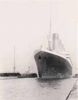
1.2 Background
Context
Located to the east of Belfast City Centre,               The area is strategically located to exploit   • Regional Development Framework for
the Titanic Quarter occupies over 200                     local, national and international                Northern Ireland
acres of land on former Harland and Wolff                 movement connections. To the south,            The regional development framework for
Shipyard lands on Queens Island. The area                 Syndenham Bypass and Newtownards               Northern Ireland identifies the Titanic
is bounded to the west by the Victoria                    Road form key arterial routes connecting       Quarter as a ‘major employment
Channel, to the east by the Musgrave                      the suburbs with the city centre. Queen        development opportunity in the Belfast
Channel and is bounded to the south by                    Elizabeth Bridge and Queens Bridge             Metropolitan Area’. In this context, there
Syndenham Bypass. The former Harland                      connect into the city core. The Ferry          should be a general preference for
and Wolff Shipyard defines the south                      terminals connecting Belfast to Scotland       employment generating uses in the land
eastern edge of the Quarter. The Goliath                  are located to the west in the York            use mix for the study area.
Cranes of the former shipyard form major                  Dock/Spenser Dock area. Belfast City
                                                          Airport is situated less than 3km to the       • Review of Turley Associates
landmarks in the urban landscape, and
                                                          north east. Although there are two rail          Development Framework
are visible from much of the city centre.
                                                          stations in close proximity, at Bridge End     Robert Turley and Associates prepared a
The predominant land uses in the area are                 and Central Station, access to these           ‘Draft Development Principles and
industrial and port related, with limited                 facilities is constrained by the severance     Development Framework’ Document for
amounts of commercial and recreation.                     effect of road infrastructure. There is a      Titanic Quarter Ltd. and Belfast Harbour
There is a metal processing plant on the                  proposal to develop a light rail system in     Commissioners in Autumn 2002. The
north eastern edge of the peninsula. The                  the city centre which will connect key         purpose of this document was to
Odyssey Centre is a major leisure                         transport destinations, and run through        ‘establish long term guiding principles to
attraction, occupying a key location along                the Titanic Quarter area.                      establish a framework for ongoing mixed
the waterfront edge.
                                                                                                         use development of a new city centre
                                                                                                         quarter over a 15-20 year period’.
                                                                                                         The Draft Document was reviewed by
                                                                                                         Urban Initiatives on behalf of the Planning
                                                                                                         Service, DOENI. This appraisal addressed
                                                                                                         the coherence of the Draft Development
                                                                                                         Framework as a masterplanning
                                                                                                         document and the validity of its
                                                                                                         conclusions. The review concluded that
>Below Extract from Regional Development Framework for Northern Ireland,
 ‘The Spatial Framework for the future growth of the BMA’
                                                                                                         although the Draft Framework considered
>The Titanic Quarter major development opportunity area is highlighted in red                            some of the site development
                                                                                                         opportunities, a more comprehensive
                                                                                                         urban design strategy was required which
                                                                                                         responds more fully to the site context and
                                                                                                         aims to link the quarter into the existing
                                                                                                         city core.

                                                                                                                                                       4
I Titanic Quarter Development Framework
5
>Left Site AerialStudy Objectives 1.3 Vision • Ease of understanding (legibility):
On the basis of the review of previous The overriding aim of this document is to Development should form a clear
studies for the Development Lands and set out a robust, flexible and deliverable hierarchy of routes. Primary routes should
the brief from Planning Service, a clear framework for the development of an be recognisable by width and height of
set of objectives have been set for this extensive area of brownfield land on the buildings, landmark buildings should
study. In this context, the proposed edge of of Belfast city which can support signal key intersections and points of
Development Framework should: a new sustainable community with its own entry.
• Integrate the heritage features of the distinctive sense of place. The vision • Adaptability:
site, particularly the historic slipways as guiding this framework is for a mixed-use
development designed to the highest A fine grain of development plots will
generators of the site structure and facilitate incremental change, buildings
character architectural and engineering standards
and integrated with efficient public should be designed with higher floor to
• Define the Titanic Quarter edge as a key transport facilities and surrounding ceiling dimensions on ground floors
element of the east of the city with a communities. allowing a variety of appropriate uses and
clear identity based on its heritage, construction systems should allow future
strategic location and character, To achieve these aims, the study has been adaptations.
including new elements of character developed according to recognised urban
design qualities, embodied in the DETR • Diversity:
such as the Odyssey Centre
Publication ‘By Design’: Development should provide for a variety
• Provide a responsive and adaptable of uses, unit sizes and types of tenure, as
structure which will allow for a variety of • Character and identity:
well as a variety of architectural and
employment uses, and changes to the Development should enhance the landscape design and detailing.
nature and scale of these uses over distinctive character and identity of the
time area including its historical associations • Integration and efficiency:
• Promote urban development based on a and legacy of shipbuilding heritage. Density and land use should relate closely
legible structure of streets, blocks and • Continuity and enclosure of public and to proximity to public transport access.
plots private spaces: Movement patterns should facilitate
access to public transport and
• Exploit key linkages to the city centre Buildings should define a continuous edge surrounding areas and promote walking
and transport network, existing and to streets and public space and provide a and cycling. Building design should
proposed, particularly in terms of clear definition between public and private promote energy efficient construction and
pedestrian movement, cycling and spaces. recycling.
public transport • High quality public realm:
• Explore options to reduce car based Public spaces should be invested with
development in the Quarter high quality street furniture, lighting,
• Define a high quality public realm with a signage and materials. Public spaces
hierarchy of street types should be safe, accessible and easy to
• Utilise existing infrastructure, and maintain. Public spaces should be
explore the opportunities for the overlooked by buildings to provide passive
enhancement of key routes, particularly surveillance.
Syndenham Road • Ease of movement:
• Address the severance effect of existing There should be a choice of routes
road transport infrastructure, forming a network and providing
particularly in terms of accessing public accessible connections regardless of
transport facilities disabilities.
6The Titanic Quarter contains several Cranes that dominate the City’s skyline,
buildings and sites of national and forming imposing landmarks that are
international importance that symbolise visible across the city. The Goliath and
the areas rich ship building heritage, Samson cranes constructed in 1969 and
I Titanic Quarter Development Framework
including the Thompson Graving Dock, 1974 respectively are each capable of
slipways and buildings associated with lifting up to 840 tonnes. The cranes have
the construction of numerous ships recently been designated scheduled
including the ill-fated Titanic. monuments.
This maritime heritage is a key element The Titanic quarter is located on Queens
of the character of the area and must be Island, a peninsular of reclaimed land
integrated into future development formed in the nineteenth century when a
proposals. channel was dug to bypass the shallow
winding curves of the River Lagan to the
Key Elements
north east of the city centre at the mouth
The Thompson and Alexandra Graving of the river. The reclaimed land was
Docks are designated Scheduled named Queens Island and the channel
Monuments and together with the listed was named the Victoria channel in honour
Thompson Pumphouse, the Titanic and of Queen Victoria’s visit in 1849.
Olympic slipways, Hamilton Graving Dock
Founded in 1862 Harland and Wolff
Section 2.0 and the former headquarters of Harland
shipyard continues to operate from
and Wolff shipbuilders define the Titanic
Maritime Heritage Quarter. Other important maritime
modern facilities on Queens Island, the
companies former headquarters are now
features include the Samson and Goliath
listed buildings. These buildings together
Key
Scheduled Monuments:
1 Thompson Graving Dock
2 Alexandra Graving Dock
3 Titanic & Olympic Slipways
4 Hamilton Graving Dock
Listed Buildings:
>Right Heritage sites 5 Former Harland & Wolff Head Quarters
6 Thompson Dock Pump House
>Bottom The launch of the RMS Titanic from
Other:
the slipway, 31st May 1911 7 Samson & Goliath Cranes
>Below RMS Titanic leaving Belfast for
Southampton and her ill-fated maiden voyage
�
�
�
�
�
�
�
�
7with those at the Abercorn Basin and
Hamilton Graving Dock which is also a
Scheduled Monument may provide a focal
point for regeneration of the Titanic
Quarter.
The Thompson Graving Dock was built from
1902 and completed in time for the launch
of the Olympic class of ships which
included the illustrious Titanic and her
sister ships; the Olympic and Gigantic (later
Britannia). At 900ft long and 37ft deep the >Above Titanic and Olympic slipway and the >Above Thompson Graving Dock Pumphouse
remains of the Arroll Gantry
Thompson Graving Dock is 80ft longer than
the adjacent Alexandra Dock and was the
largest dry dock of its time.
The Thompson Dock Pumphouse is a listed
building which contained the enormous
steam powered pumps that emptied and
filled the dry dock with almost 23 million
gallons of water.
Very little remains of the Titanic and
Olympic slipways and Arroll Gantry which
served as a cradle for the Olympic class
ships. The slipways and gantry were filled
and demolished during the 1970s, although
a number of derricks of the types employed >Above Material handling derricks at the >Above Former headquarters of Harland and Wolff
to handle construction materials still exist. Titanic and Olympic slipway Shipbuilders
Heritage Objectives in this study
A key objective for this study is to generate
an integrated development framework for
the Titanic Quarter based on the areas
existing maritime heritage. The existing
scheduled monuments and listed buildings
will be integrated into the proposed urban
design and provide the key drivers for the
layout of the urban structure, the
arrangement and hierarchy of open spaces
and the configuration of the urban grain i.e.
streets blocks and plots, as outlined in
Section 5 of this document.
>Above View of Thompson Graving Dock >Above Former headquarters of Harland and Wolff
Shipbuilders
>Above The launch of RMS Titanic from the >Above RMS Titanic under construction in the
slipway, 31st May 1911 Arroll Gantry
8The study area has a number of Policy Constraints
constraints that will influence the new • COMAH Regulations
layout of the area. The Turley Study
identified a number of the key issues. The COMAH Regulations implement the
However, some subsequent planning Seveso II Directive. The aim of the
decisions and construction works present Regulations is to take all measures
some additional matters for necessary to prevent major accidents and
consideration. The key constraints in the limit their consequences to people and
area are summarised as follows: the environment. In this context, the
Health and Safety Executive has set a
Existing and Proposed Development consultation distance (CD) around major
Very little of the existing building stock is hazard sites after assessing the risks and
regarded as worthy of conservation. The likely effects of major accidents at the
Odyssey Centre is a new landmark in the installation. The CD is expressed in terms
area and the former Harland and Wolff of zones: Inner (IZ), Middle (MZ) and Outer
Headquarters is a listed building. The (OZ). A range of acceptable forms of
Northern Ireland Science Park, located development and land use are specified
around the Thompson Dry Dock is under for each zone.
construction. The Turley Study identified two COMAH
Section 3.0 Physical Constraints CD areas impacting on the Titanic
Quarter: The IFI COMAH Zone and the
Constraints There are a number of features of
Industrial Heritage on the Development Calor Gas COMAH Zone. Following
Lands including: consultation with the Health and Safety
Executive of Northern Ireland, only the
• Graving Docks, pumphouse and Calor Gas zone now applies. Within this
maritime heritage elements in the area, all three CD zones impact on the
vicinity of Thompson Dry Dock Titanic Quarter. The HSE guidance
• Harland and Wolff former HQ suggests that some development is
• Titanic and Olympic Slipways possible in these areas although there are
greater restrictions on development in the
• Alexandra Graving Dock Inner Zone. Typically, low density
• Hamilton Graving Dock development, including residential is
proposed.
The Goliath Cranes in Harland and Wolff
are key city landmarks.
The Turley Study contains a review of the
existing condition of the Dock edges on
the western side of the Titanic Quarter.
Although there are some dock walls,
much of the edge is characterised by
revetment, rock armour and rubble fill.
The quality of this edge varies.
Syndenham Road, Queens Road,
Hamilton Road and Musgrave Channel
Road form an adaptable, existing
development structure.
Although there are no public open spaces
in the Titanic Quarter, there are some
significant amenity areas in close
proximity at Victoria Park, and to the rear
of the former IFI Richardsons to the north
west. These areas are valuable ecological
areas and carry ASSI/SPA/RAMSAR
status.
>Right COMAH Zoning in Belfast Harbour 9• Belfast City Airport Safeguarding Zone Urban Capacity Constraints Other Issues
The Civil Aviation Authority are currently The scale and character of the Titanic There are a number of as yet unknown
reviewing the safeguarding zones in the Quarter, combined with its strategic city factors that will be of critical importance
vicinity of Belfast City Airport. In edge location and access to public to the delivery of the Titanic Quarter
developing detailed proposals for the transport suggest that there is significant including:
Titanic Quarter, the civil aviation will need capacity for high quality, high density • The future of the Metal Processing
to be consulted in detail. residential development on these lands. Industry at the headland of the Titanic
Environmental Constraints However, The Regional Development Quarter peninsula. Continued deliveries
Framework for Northern Ireland sets via Queens Road to the tip will be in
It is likely that there are areas of guidance on residential capacity in the
contamination on the site arising from the conflict with proposed development and
BMAP area. Current analysis by Planning the existing use is bound to have a
port and industrial land uses Service suggests that Belfast is reaching
characteristic of the area. negative impact on adjacent land values
these figures.
Movement Issues • The phasing and availability of sites
BMAP have carried out an appropriate currently in use as part of the Harland
The City Airport Rapid Transit Scheme or assessment of the contributions that the and Wolff shipyard including the
CITI Route proposes a rapid transit Titanic Quarter could make to housing proposed industrial area service road
connection between the City core and the provision which is 3000 units.
airport. Current proposals indicate an • The future of the Harland and Wolff
Analysis also indicates that employment shipyard generally
alignment which serves both the Odyssey uses should occupy in the order of 2/3 of
Centre and the Titanic Quarter. the study area, and that retail and • Infrastructure capacity and location
BMAP are developing a number of commercial uses should be contained to These elements will require more study.
important transport proposals for the reduce potential conflicts and competition
Titanic Quarter area, including the with the city centre.
following:
• City Airport Rapid Transit Scheme (CITI)
which will be connect the airport and
City Centre. This scheme will serve the
Odyssey Centre and Titanic Quarter
• Retention of a direct access between the
M3 and Syndenham Road in the vicinity
of Queens Quay
>Below The Goliath cranes are well known
• Closure of Dee street junction with
landmarks in the city
Syndenham By-pass and development
of a new link near the Oval/Connswater
River
• Removal of Dee Street bridge and
development of a new link between
Syndenham By-pass and Holywood
Arches
10At strategic level, there are a number of The City Centre Ring
opportunities emerging which should It is proposed to define the edge of the
inform the urban development of the city centre with a grand boulevard which
Titanic Quarter. In particular, the guidance follows the line of the inner box. The city
of the Urban Design study of the BMAP ring is conceived in two parts. The first
Plan sets clear principles for the orderly part will contain the existing city centre.
development of Belfast city as a whole. The second part, indicated in red in the
In terms of the Titanic Quarter, the drawing overleaf, may form a part of a
specific opportunities arise out of the future expansion.
following: Character Areas
• Potential eastward expansion of the city Guidance is given for the appropriate
core based around transport nodes at urban development and consolidation of
Central Station and Bridge End Station these areas in terms of urban structure
• The potential expansion of the City density and mix, scale and massing, and
Centre Ring or boulevard as a means of public realm. The key objective of this
defining the edge of the city centre guidance is to promote and enhance the
Section 4.0 • The strengthening of the identity of the
diversity of the city core. The Titanic
Quarter will form a significant new mixed
Strategic Titanic Quarter as a key element of the use character area on the edge of the city,
Opportunities character of the city with a range of distinct urban
and Concepts The key elements of guidance relating to characteristics.
these opportunities emerging from the
BMAP Urban Design Study are outlined Linking the Titanic Quarter to the City
below: ‘Laganside East’ is identified as a key
growth area in the BMAP Urban Design
Consolidation of growth in areas of high Study. The new structure of this area will
accessibility form an extension of the city grid, with a
high density of development and mix of
A key principle of the BMAP Study is that uses. The key elements of the proposals
sustainable growth and expansion of the contained in the BMAP Urban Design
city centre is based on a close relationship Strategy for this area contain the
between accessibility and land use. The following:
study identifies that major new transport
initiatives will be required to increase • Reconfigure Short Strand as a boulevard
accessibility to new development. In this which connects the Odyssey Centre with
Albert Bridge
context, three potential high accessibility
zones are identified: • Middlepath Road and Bridge End Street
• Transport interchange and rail terminus to convert to two way traffic
in the vicinity of the existing Great • Bridge End Road to develop as a high
Victoria Station street, connecting with the existing high
• Development of a new bus station street along Newtownards Road
interchange at Gamble Street • New bridge crossing the Lagan and
• Retention of Central Station as a key connecting the ferry terminal area to the
suburban terminus. National Rail would Odyssey and carrying the CITI Route
terminate at the proposed Great Victoria from the city centre to the airport
Street node. A high quality bus link will • Bridge End Railway station to be moved
link Central Station and the proposed to a more suitable and accessible
Great Victoria Street Interchange. The location
Central Station node provides a The ‘Laganside East’ proposals would
significant growth opportunity, and an provide opportunities to link the major
opportunity to redefine the eastern edge pieces of transport infrastructure in the
of the city city. In this context, the Titanic Quarter
To strengthen the development potential sits in a very strategic position and
of these zones, the BMAP study proposes provides an opportunity to capitalise on
that the CITI Route links to the airport. It many of these concepts.
is proposed that this route serve the
Titanic Quarter.
11>Above Proposed BMAP Growth Zones >Above City Centre Ring Potential. A potential eastward expansion would extend
the City Centre Boulevard concept
4 9
5
3
2
6 1
7
8
>Above Proposed BMAP Character Areas. Part of >Above Laganside East Proposal (BMAP)
the Titanic Quarter is covered in Area 9
>Note: Titanic Quarter is outlined in orange fill 12Urban Structure • Re-alignment of Short Strand and the
To achieve the objective of making a extension of the city grid into the area.
This outline concept is proposed in the
distinctive place, development should pay
regard to those unique elements that BMAP Urban Design Strategy. Detailed
distinguish the area including: study exploring the delivery
requirements of this concept would
• The site's waterside location need to be undertaken with the BMAP
• The history of the shipyards Transport Team and Road Service
• The distinctive 'serrated' dock edge • An urban Boulevard based on the
along the north-west side of the existing spine Queens Road providing
peninsula and the geometry of dock the main north-south structural spine
alignments pointing out to the river • A new linear park traversing the site
mouth aligned with Thompson Dry Dock and
• The established leisure focus at the cutting through one of Harland and
Odyssey Centre Wolff Goliath cranes
• Integrating the new Science Park • The development of a grid of streets
and spaces aligned with the historic
Having considered the key elements of
Section 5.0 the character of the Titanic Quarter, its
slipways, and an extension of the city
Urban Design opportunities and constraints at city scale
grid
Strategy and site scale, the following elements of
urban structure are proposed:
d
Key c c
Principal Avenue
High Street
Focal Point
Linear Park b
Landmarks
Ecology Park
Expansion of City Grid
Motorway
Railway
Linkages:
1 a
1 Cross River
2 Riverside
3 Short Strand
2 4 5
4 New Bridge End Station
Dee Street Link
3
5
Districts:
a Commercial Core & High Street
b Residential Core & Marina
c Light Industrial & Live Work
d Business Park
>Above Urban Design Concept 13• A new 'Main Street' based on the Abercorn Basin Celebrating the Heritage
existing Syndenham Road and providing The Abercorn basin provides an As a general principle, the historic
improved linkages to and under the M3
opportunity to develop a tall landmark slipways are retained as urban spaces and
Motorway (Syndenham By Pass). The
building along the Waterside. This building edges; the geometry of these elements
proposed Main Street serves to
could act as a key point in the city set up the key urban structure of the
physically connect the Odyssey Centre
marking the location of the Titanic proposal. A new public space is proposed
and potential for a proposed bridge in
Quarter and adding to the presence of the along the alignment of the Titanic Slipway.
the south west of the Quarter to a new
the existing landmarks or the Goliath There are a number of opportunities to
public space and interchange associated
Cranes. Speciality shopping including express this space; it could be an external
with Bridge End Station, the new linear
cafes, restaurants and art related retail plaza or covered link, connecting the
park, and the new ‘Titanic Square’ at the
should locate around the edges of the riverside to a proposed museum at the
eastern edge of the Quarter.
basin to capitalise on the waterside former Harland and Wolff HQ. The key
• The adaptation of Hamilton Road, an amenity. consideration is that the alignment and
existing shipyard service road, to create
significance of the slipway be
a new east/west linkage. This street will
appropriately expressed in the proposed
be designed to accommodate the
urban form.
potential route of the proposed Rapid
Transit Service
• The development of Musgrave Channel Key
Road as a route servicing the light Public Open Space
industrial area to the east of the Linear Park
Ecology Park
development lands, minimising traffic City Block
and use conflicts with residential and Road Network
mixed use development on the western Business Park
Potential Footbridge
side of the Quarter Boulevard
High Street Frontage
• Potential bridge connecting the Titanic New Landmark Building
Quarter to the city. This bridge could Landmark Building
Maritime Heritage
develop as a pedestrian and bus/taxi
only link, strengthening public access to
the city centre and complimenting the
proposed Rapid Transit Service
Queens Road Boulevard
Queens Road provides a broad main
infrastructure spine along the length of
the peninsula. This should be retained as
an urban boulevard with street trees lining
the route. A series of connections
orientated to the existing docks provide
glimpses to the Lagan from the boulevard
and a constant reminder of the area's
shipping heritage. This street will be the
key corridor containing the proposed CITI
Route
>Above Urban Framework Plan
14Linear Park Business Park Dock Roads
A key objective of the development The existing Business Park situated Hamilton Road will connect from a new
framework is to integrate the areas around the Thompson and Alexandra public square adjoining the relocated
existing maritime heritage into the new Graving Docks forms the northern edge of Bridge End Rail station through to the
Titanic Quarter. In this context, a new the linear park. New and existing Queens Road Boulevard at the existing
linear park based on the alignment of the buildings may be integrated within the listed Harland and Wolff Headquarters
Thompson Dry Dock, which connects the park. The arrangement of new Building. Musgrave Channel Road would
dockside to Bridge End Station will be a development within the Business Park develop as a dedicated service road to
key element of the proposed urban may provide an opportunity to create a serve proposed light industrial
structure. The Linear park provides a series of open spaces which are more development along the east side of the
strong physical and visual link between enclosed and urban in character. New peninsula allowing commercial vehicles to
the historic dockside and the Samson & development within the business park access from the south east.
Goliath Cranes and the adjacent should be of contemporary design and of Adaptability and Expansion in the Titanic
development parcels. It is proposed that sufficient quality to complement the areas Quarter
the park will pass between the uprights of historic past.
one of the cranes, celebrating this The Urban Design Framework for the
The Main Street Titanic Quarter indicates a main street
structure and the heritage of the area.
This intervention will provide a strong The Main Street provides an opportunity to which extends into land not currently
‘image’ or the future Titanic Quarter. The develop an edge to the existing M3 available. The purpose of this proposal is
park will also strengthen the relationship motorway and Syndenham Bypass. The to illustrate how these lands could
of the area with the river Lagan by: character of this street should be focused develop as an extension of the core urban
on promoting a mix of starter units, sales design principles laid out in this
• Creating a long vista to the Lagan (one and work units, leisure and appropriate document.
of a series of glimpses through to the local retail. Opportunity for residential
Lagan from the Queens Road boulevard) The proposed grid structure is a highly
development over non residential ground adaptable form which can accommodate a
• Creating a direct, legible linkage to the floor units on both sides of the street range of uses and can easily convert to
station for pedestrians and cyclists should be explored. This form of accommodate new uses over time. New
• Providing attractive open space amenity development will create a mixed, active, uses, where identified as being
well-overlooked key element of the urban appropriate to the area in any future
• Integrating the landmark of the Goliath structure of the Titanic Quarter. Retail and reviews of the BMAP plan and Regional
crane as a key feature of the area leisure uses should focus around the Development Framework for Northern
• Contributing to the overall character and Odyssey and Abercorn Basin area, Ireland, should be considered in terms of
legibility of the Titanic Quarter creating the appropriate synergy of uses their grain and character, and how they
which will consolidate this area as a can adapt to the existing block structure.
The Linear Park effectively divides the
leisure and visitor destination.
Titanic Quarter into two precincts. The
eastern side is related to the city in terms
of use and character. The western side is
more related to the requirements of the
port and light industry.
15Urban Grain Plots • Where proposals emerge for larger
The proposed urban grain of streets The success in creating a mixed use urban floorplate developments along these
blocks and plots is largely based on good quarter lies in breaking down large routes, the designer must show how
practice in urban design, ensuring development parcels into smaller units of these façades are broken down to
maximum permeability whilst creating a development, thus promoting the ‘city of achieve a fine grain frontage of
rich and varied urban form. The proposed 1000 designers’, approach, based on the development, using the principles
urban grain of new streets, blocks and following principles: outlined above or, by introducing
plots relates to the pattern of land narrower frontage buildings to line the
• The promotion of a fine grain
ownership within the area, enabling the larger floorplates. This could apply
development along the main pedestrian
Plan to be implemented on a phased particularly to the light industrial area
dominated routes. This involves
basis. The following key principles have proposals for plots with a maximum • A coarser grain of development is
been applied in developing the urban grain width of 18 metres along these routes. permissible in the light industrial
within the newly planned areas: This sets up a pattern of mixed use and precinct where longer views of the
a rhythm of different facades that development are experienced. The onus
Streets still remains on the designer to show
provide a friendlier urban environment
A clear hierarchy of streets is proposed for how the façades is sub-divided to avoid
• Where façades are wider than 6 metres
the Titanic Quarter. (Details of the street long, monotonous developments
they should be vertically articulated into
network are discussed under Public • In other areas an 6 metre wide sub
bays to further break down the scale of
Realm). division is promoted as a guide for
development. This could be achieved by
Blocks changes in colour or texture; minor development
A new block structure, clearly defined by horizontal shifts in elevation; use of bay Clearly, the above rules provide guidance
the hierarchy of routes and spaces, is windows, balconies and other in developing more detailed development
proposed for the masterplan area. This is projections; and, variations in roofscape briefs for the area.
illustrated in the plan opposite and is
based on the following principles:
• The new block structure, which derives
from the key constraints and pattern of
connections to the surrounding areas to
facilitate a variety of different
development conditions
• The block structure is adaptable and can
accommodate a wide range of uses. This
adaptability allows for changes of use
• The blocks to be regular in shape to
facilitate ease of development, sub
division into smaller parcels and
containment of internal private open
space
• In all instances development should
follow the perimeter of the block along a
common building line, without major
setbacks to foster a strong sense of
enclosure to the urban block
>Below The Core Development of the Proposed Titanic
Quarter in context of emerging BMAP proposals 16Movement between the M3 and Syndenham Road will Titanic Quarter suggests that opportunity
The proposed movement network aims to act as the key entry point into the Titanic to link nodes of public transport should be
connect the new quarter to Belfast city Quarter from the City. The proposed Short explored. In this context, three CITI Route
Strand realignment can work with this stops are proposed along Syndenham High
centre to the west and the Laganside
Quarter to the south through a series of junction proposal to connect the Titanic Street. The stops are linked to the wider
strategic transport linkages across the M3 Quarter to adjacent districts. The movement network and are proposed for
motorway which currently severs the development of two Short Strand the following locations:
Titanic Quarter from its immediate proposals will require detailed feasibility • Odyssey
surroundings. and consultation with the BMAP Transport
Team. • Bridge End Station Square
The following section outlines the key • Titanic Square
linkages that are considered critical to Relocated Bridge End Station
the successful integration of the Titanic The existing Bridge End Station should be Pedestrian Bridge
Quarter to the city core and Laganside relocated to a position which is connected A new bridge across the River Lagan is
East. to the proposed linear park and the proposed to provide a new strategic link to
proposed High Street. The proposed CITI the city centre.
Street Network
should link with this station to enhance The new bridge will provide safe access
It is proposed to build the transport interchange opportunities.
network on the following existing elements for cyclist and pedestrians to encourage
of infrastructure: Rapid Transit sustainable movement from the city centre
to the Titanic Quarter. The bridge could
• Syndenham Road, which forms the main The CITI Rapid Transit Route is proposed
also accommodate public transport to
east-west route running parallel to the for the City Centre. This route will connect
maximise penetration into and links with
M3 becomes a Main street with the Titanic Quarter. A review of
the Titanic Quarter.
existing and proposed movement in the
• Queens Road, the main dock road
running along the western side of the >Below Movement Strategy
peninsula, will form the main boulevard
and structural spine in the area. This Key
street will accommodate the proposed Preferred CITI Route
Alternative CITI Route via High Street
CITI Route and Bridge End Station
Potential CITI Stops:
• Musgrave Channel Road, which runs
a
parallel to Queens road along eastern
b
edge of the peninsula will serve as the
c
main service link to the light industrial Boulevard
area High Street
Main Street
• Hamilton Road runs perpendicular to City Street
Pedestrian Footbridge
Musgrave Channel Road/Queens Road Railway
and would provide a main route from Motorway
the south east of the new quarter to the
western waterfront
These routes will be capable of facilitating
pedestrian and cyclist movement. Detail of
how these streets could be developed is
contained in the public realm section of
this report.
Short Strand
The BMAP Urban Design Strategy
proposes that the Laganside East Quarter
should be regenerated as an extension to
the city grid. The new Short Strand road
would run on a perpendicular alignment to c
East Bridge Street and provide a strong a b
linear connection between the Laganside
East and Titanic Quarters beneath the M3
motorway. The proposed retained access
17Density and Mix of Uses provided in this zone based on ecological principles might be
The approach to the distribution of land • Concentration of specialist leisure uses appropriate in this area, particularly in the
uses is based on creating new and around the Odyssey Centre and inner COMAH zone.
sustainable community with sufficient Abercorn Basin The development of the park would
density to support a range of amenities • Provision of complimentary land uses require only limited remediation and
and public transport provision. This complimentary to maritime heritage would form part of a chain of ecological
approach requires a mix of uses that around Titanic Slipways spaces crossing the harbour area,
should include expanding the existing connecting Victoria Park to the ecological
leisure focus based on the Odyssey In addition to the above, we consider that sites adjoining the former IFI site. The
complex including new bars and viable development of the headland will development of the park would provide
restaurants and a new small marina area require some use to provide an anchor opportunities for the development of a
with festival shopping and providing new destination to create sufficient activity and visitor attraction or an educational
local convenience shopping based on the make use of a potentially spectacular establishment (possibly related to the
evolution of Syndenham Road into a new location surrounded by water at the top of nearby Science Park or the ecology of the
'High Street' for the area. The Titanic the peninsula. The impact of the COMAH area).
Quarter provides significant employment Regulations will place some restrictions
on the potential appropriate uses in the In the middle and outer zones,
opportunity for the Belfast area. consideration should be given to the
area. In addition, there is likely to be a
Key land uses should include: requirement for soil remediation works to potential for additional light industrial and
address the impact of ground and soil storage development.
• Residential. High density residential
development maximising the waterfront contamination. In this context, it is
aspect. Mix of unit sizes and tenures considered that some form of park facility,
including apartments and some family
>Below Land Use Strategy
homes with gardens. Live/work units
located to mediate between
Key
predominantly residential areas and
Linear Park
proposed/existing industrial uses Ecology Park
• A strip of light and industrial work units Mixed Use: Commercial/Residential
Mixed Use: Starter units/Work units/Residential/Leisure
will create an edge to the M3 motorway. Residential
This edge creates the opportunity to Live/Work (large work units)
Light Industrial
redefine Syndenham Road as a main Light Industrial/Commercial
street. This street could support a range Commercial
of services which have a front counter Existing Business Park
High Street Frontage
and work unit to the rear. These services a New Museum Complex
could include repair shops and tool b New Landmark Hotel
sales, as well as supporting a range of
community services which could include
healthcare/dentist, créche and other
education subject to assessment of
existing provisions. This type of
development will create opportunities
for small retail including sandwich bars,
corner shops and newsagents
• Hotel next to Odyssey. Abercorn Basin
could develop as a marina with
residential development and speciality
shopping at ground floor enclosing its
a
edges
• Conversion of former Harland and Wolff b
HQ into museum
• Light Industrial units next to the
remaining shipyard accessed from a
dedicated service road
• Some limited small scale commercial in
a zone around the relocated Bridge End
Station. A single user building of
5,000m2 as office space should be 18Site Capacity Plot Ratios For all other areas within the study
Fundamental to the vision of a vital, urban Taking Bridge End Station as the area of boundary, a plot ratio of between 1.0:1 and
quarter is the provision of mixed-use greatest accessibility, a plot ratio of 1.5:1 1.5:1 should be applied, with the potential
development that creates sufficient to 2.0:1 has been applied within a 400m for greater densities occurring in the
density to make a vibrant and sustainable vicinity of the proposed CITI route. For the
radius off this point. This radius is based
place. purpose of the capacity study, a minimum
on the principle of a walkable area in
Density Principles plot ratio of 1.0 to 1 has been assured for
approximately five minutes. This plot ratio
To enable a seamless integration with the the majority of these areas.
should extend to the Abercorn Basin to
city edge context, it is proposed to apply a
sliding scale of plot ratios. On the basis of take account of the riverside context and
the BMAP Urban Design Strategy, a review proximity to the proposed CITI route.
of plot ratios in the city centre, and the This plan should be read in conjunction
accessibility proposals for Titanic Quarter, with the schedule overleaf.
a sliding scale of plot ratios from 1.0:1 to
2.0:1 are proposed. Plot ratio expresses
the relationship between floorspace and
site area. In this context, plot ratio is an
indicator of development form and density. Key
For the purposes of this plan, we have Development Parcel
used the gross site area of the L4 Site Code
Business Park
development parcels to calculate density. Walkband (Metres)
This takes roads and local open spaces Preferred CITI Route
into account.
In order to promote a sufficient intensity of
L5
use and to promote a diverse, mixed and
animated environment, we have specified
L4
minimum acceptable plot ratios. Plot
ratios have been related to accessibility for L3
the purpose of this study. Areas of
greatest accessibility can support a L2
greater intensity and mix of uses. In this
regard the higher range of plot ratios is R6
L1
proposed in these areas. Lower plot ratios
are proposed for development parcels R5
which are located further from areas of
R4
urban accessibility. R3
In all instances, urban design
considerations could be used to make a R1 R2
case for increased densities. These
considerations could include the effective
enclosure of public spaces (the scale of C5 C6
C4
the buildings relative to the size of the
C3
space), community gain (such as the
provision of community infrastructure or C2
C1
open space) and quality of the
architectural design.
Any increase in plot ratio which has an
impact on the height of buildings will need
to be discussed with the aviation
authorities regarding the potential impact
on the safeguarding zone around Belfast
City Airport.
>Above Development Parcels
19Titanic Quarter Development Schedule
Landuse Mix (%) Gross Residential Number of Gross Non-residential
Site Site Gross Area (ha)* Plot Ratio** Gross floor area (m2) Residential Non-residential floor area (m2) Homes**** floor area (m2)
C1 5.9825 2 119,650 0 100 - - 119,650
C2 6.1650 2 123,300 0 100 - - 123,300
C3*** 3.1326
C4 5.1945 2 103,890 26 74 2,675,168 268 77,138
C5 8.3485 2 166,970 30 70 5,009,100 501 116,879
C6*** 7.6868
R1 8.6060 2 172,120 50 50 8,606,000 861 86,060
R2 5.1405 2 102,810 60 40 6,168,600 617 41,124
R3 5.1941 1.5 77,912 55 45 4,285,133 429 35,060
R4 4.3013 1 43,013 10 90 430,130 43 38,712
R5 6.0808 1.5 91,212 20 80 1,824,240 182 72,970
R6 4.4476 1.5 66,714 15 85 1,000,710 100 56,707
L1 5.7511 1 57,511 0 100 - - 57,511
L2 6.1560 1 61,560 0 100 - - 61,560
L3 2.9879 1 29,879 0 100 - - 29,879
L4 4.2257 1 42,257 0 100 - - 42,257
L5 7.1301 1 71,301 0 100 - - 71,301
Total 96.531 1,330,099 29,999,080 3,000 1,030,108
Notes:
* Site Area measurements are based on best available data
** Plot Ratio based on Gross Site Area
*** Sites C3 and C6 are shown to indicate long term development aspirations and are not included within this schedule
**** Maximum number of residential dwellings
20Scale: Height and Massing
Principles
Building Heights in the Titanic Quarter
should have been defined through
Key
consideration of the following:
• The prevailing character of Belfast City 8 - 10 Storeys
Centre as viewed across the Lagan 6
5
• Retention of the Harland and Wolff
4
Cranes as dominant landmarks for the
2-3
area, using the height of this structure
as a datum for tall buildings in the area
• Guidance for the East Laganside
Character Area proposed in the BMAP
Urban Design Study. This guidance
suggests a minimum building height of
3 storeys, with optimum heights of 5
storeys, or up to 6 storeys where
setback storeys are promoted
• Relating the height and massing of
buildings to (a) the hierarchy of public
realm that they face onto, and (b) to the
particular character of the the area in
terms of physical character and land
use
• Establishing local landmarks at key
locations: gateways into the area; key
intersections; and for views across the
Lagan from the City Centre
Recommendations
Height
In general, building heights along the
proposed high street should be a
maximum 4 storeys with a maximum of 5
storeys for development parcels between
the main street and the Abercorn Basin.
Building height in the Abercorn Basin
should relate to the scale of the basin, and
be a maximum of 6 storeys.
>Above Building Heights Plan
The proposed landmark buildings should
be at least 8 storeys high with 10 storey
maximum.
In the light industrial zone, building height
should generally range between 2-3
storeys.
Building heights along the Waterfront
should be 6 storeys high.
Massing
The sketch perspective overleaf indicates
the potential impact for the proposed
building heights and massing.
21>Above Sketch perspective of Titanic proposals
showing proposed massing
22Public Realm Ecological Park Hierarchy of Streets
The urban design strategy considers a The metal processing site located at the The Titanic Quarter is conceived as a well
range of public spaces and street types tip of the peninsula is considered suitable connected piece of city with a well defined
within the Titanic Quarter including for a limited range of land uses. We have hierarchy of streets and spaces. These
suggested that an Ecological Park may be provide the key structuring elements for
• urban squares, the overall plan. On the following pages
appropriate here, although the site may
• a linear park, are illustrated the spatial standards for
accommodate a new sporting venue which these various roads and streets in the
• an ecological park; and would provide the impetus for a further Titanic Quarter.
development in the north of the peninsula
• streets • Boulevard
and potential extension of the way along
The linear park located along an axial line Queens Road. • Avenue
between the Thompson Dry Dock and the • High Street
The proposed redevelopment of the
proposed new space from New Bridge End • City streets
western docks and Abercorn Marina will
Station. This arrangement provides a
provide significant opportunities for the • Musgrave Channel
direct link from the heart of the new
provision of innovative new public realm • Linear Park edge streets
quarter to the historic docks. The formal
along the waterfront. Key streets are • Dock Edge streets
park is designed to pass beneath the
considered in detail later in this document.
massive Goliath crane which will in turn
frame the views. The legs of the crane will Dock Edges
provide an opportunity for two small The Waterside location is a key aspect of
piazzas either side of the linear park which the character of Titanic Quarter. The
will be defined on three sides by the Robert Turley report identifies the
proposed development blocks. The Linear structure and condition of the dock edges,
park provides a green buffer which primarily on the western side of the
separates the predominantly residential quarter. This analysis shows that the dock
edge is composed of a number of features
development to the west from the more
including revettments, slopes and walls.
industrial development to the east of the In terms of public realm, it is proposed to
peninsula. The park will be bounded in allow a street run along each dock edge,
either side by city street and be with a wide reservation for pedestrian
intersected by the principle avenues of amenity on the waterside. However, a
Queens and Hamilton Road. structural survey of all these edges needs
to be undertaken. The detailed treatment
Urban Squares of these edges will be informed by the
A number of new urban squares are results of the survey.
proposed for the Quarter. These are
generally associated with the new high
street and are located around local
transport interchanges. It is envisaged that
these spaces will be enclosed by retail
frontage and take the form of a traditional
city squares, providing robust flexible
spaces capable of being adapted for a wide
variety of uses and activities. A square is
also proposed to provide a focal point and
visual stop to the northern end of the
linear park around the Thompson Dry
Dock. This space should be designed with
reference to the areas coveted industrial
heritage.
>Pictured Examples of public open spaces:
Urban Square, Park, Piazza 23The Boulevard : Queen’s Road
CITI
1.5m 3.0m footway slip road/ 7.5m carraigeway parallel slip road parallel 3.0m footway 1.5m
Rapid Transit
privacy parallel parking zone parking parking privacy
strip zone zone strip
B32.1
B32.1
>Top Boulevard Section
>Above Location of Boulevard type
>Left Boulevard Plan 24The Avenue : Hamilton Road
1.5m 2.75m Parallel 11.5m carraigeway Parallel 2.75m 1.5m
privacy paving/tree parking parking paving/tree privacy
strip planting planting strip
1.5 21m Highway Line 1.5
11.5m
2.75 2 3 2.75 2.75 3 2 2.75
S21.1
>Top Avenue Section
>Above Location of Avenue type
S.21.1 >Left Avenue Plan 25The High Street: Syndenham Road
10.5m
1.5m 3.0m Parallel 5.5m carraigeway Parallel 3.0m 1.5m
privacy path parking parking path privacy
strip strip
1.5 15m Highway Line 1.5
5.5m
2.5 2.25 5.5 2.25 2.5
S15.4
>Top High Street Section
>Above Location of High Street type
S.15.4 >Left High Street Plan 26City Streets
12m
1.5m 1.5m Parallel 5m carraigeway Parallel 1.5m 1.5m
privacy path parking parking path privacy
strip strip
1.5 12m Highway Line 1.5
5m
1.5 2 2.5 2.5 2 1.5
S12.2
>Top City Street Section
>Above Location of City Street type
S.12.2 >Left City Street Plan 27Musgrave Channel
1.5m 3.0m 1.8m 7.5m carriageway 1.8m 4.0m
privacy footwa Parallel Musgrave Channel
Parallel footway
strip y parking parking
1.5m 14.6m Highway
3.0m 1.8m 7.5m 1.8m 4.0m
S15.10
S.15.10
>Top Musgrave Channel Section
>Above Location of Musgrave Channel
>Left Musgrave Channel Street Plan 28Dock Edge
12.4m
4m pier 1.8m 1.8m 5.2m carriageway 1.8m 1.8m 1.5m
footway Parallel Parallel footway privacy
parking parking strip
13m Highway Line
1.5m 5.0m 5.0m 3.0m
S13.11
S.13.11
>Top Dock Edge Section
>Above Location of Dock Edge
>Left Dock Edge Plan 29Linear Park
Linear Park
1.5m 5.0m 1.8m 7.5m carriageway 1.8m 3.0m
privacy footway Parallel Parallel footway
strip parking parking
LP.1
>Above Linear Street Section
>Right Location of Linear Street type
>Below Linear Street Plan
1.5m 14.6m Highway
5.0m 1.8m 7.5m 1.8m 3.0m
LP.1 30You can also read