TRAIL RUNNING ROTORUA - FIRST EDITION | JUNE 2017 - Rotorua Trails Trust
←
→
Page content transcription
If your browser does not render page correctly, please read the page content below
TRAIL
                  RUNNING
                  ROTORUA

FIRST EDITION | JUNE 2017
ALL PHOTOGRAPHY COURTESY OF NZ TRAIL RUNS:
THE TARAWERA ULTRAMARATHON | TARAWERA TRAIL MARATHON AND 50KM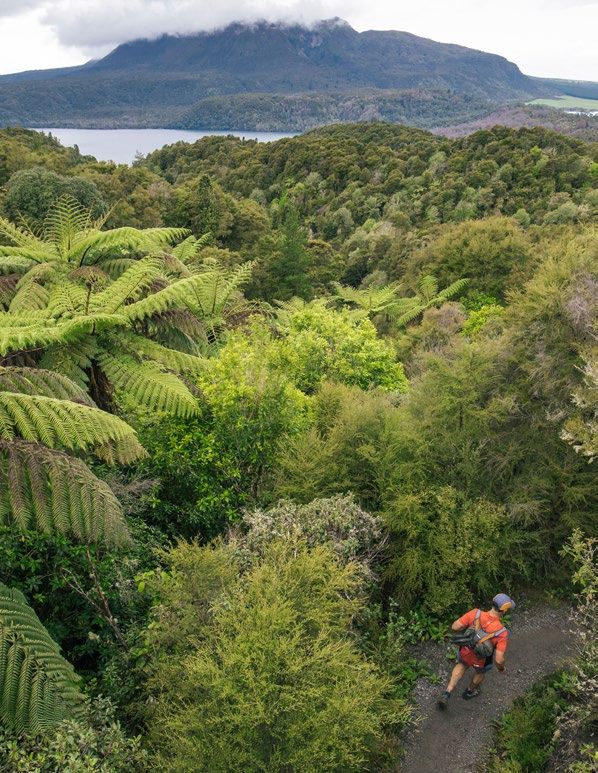
WELCOME    Lets GO Run!

   TO
           The 56 hectare Whakarewarewa Forest has long
           been a favoured playground for horse riders,

ROTORUA!   mountain bikers, walkers and hikers drawn to its
           magnificent stands of towering native and exotic
           trees, especially its Californian Coastal Redwoods.

           We highly recommend that visitors purchase a map
           from the Redwoods Information Center on Longmile
           Road. This will be your guide - there are maps in the
           forest at various locations, however having a map
           with you will greatly help.

           Dogs should be on leashes while on popular
           Redwoods tracks.

           Good luck and if you need any help or support at
           all please feel free to ask by contacting The Trust at
           rotoruatrailstrust.co.nz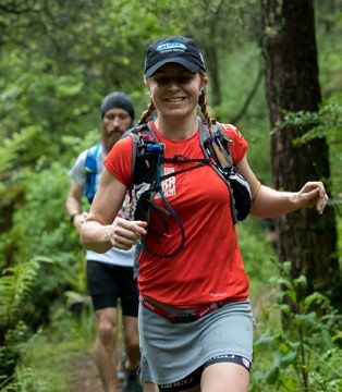
TRAIL   • Plan your trip.

          • Seek local knowledge, plan the route you will
RUNNING     take and the amount of time you can reasonably

ROTORUA
            expect it to take.

          • Tell someone your plans and leave a date for

BEFORE      when to raise the alarm if you haven’t returned.

          • Be aware of the weather.
YOU GO!   • New Zealand’s weather can be highly
            unpredictable. Check the forecast and expect
            weather changes.

          • Know your limits.

          • Challenge yourself within your physical limits
            and experience.

          • Take sufficient supplies.

          • Make sure you have enough food, equipment and
            emergency rations for the worst-case scenario.
            Take an appropriate means of communication.

          • These safety points have been created through
            expert consultation and are the core to all
            outdoor safety practices. They can be found on
            the Mountain Safety Council website.
            FROM - WWW.MOUNTAINSAFETY.ORG.NZ/SAFETY-TIPS/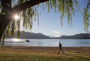
THE     The Redwoods Information Center,
           located on Long Mile Road, is the starting
REDWOODS   point for most forest access.
           If you’re in the city there are a few ways

GETTING    to get there -
           1. Sulphur Point trails. The trail starts behind the
STARTED       Sudima Hotel (opposite Pak N Save supermarket).
              You can follow the trail through to Te Ngae Road,
              follow the path that runs alongside the stream and
              you will eventually end up at SCION. There is a
              dual use trail that follows the fenceline around the
              back of SCION and leads through to the Visitor
              Information Center.

           2. Tarawera Road. Follow Te Ngae Road (heading
              towards Tauranga or Whakatane), turn right at the
              intersection into Tarawera Road, turn right a few
              hundred meters up the road into Long Mile Road.

           3. Hemo Gorge. Make your way to Te Puia, go
              through the car park and join the trail under the
              Waharoa (entrance way), then pass through Hemo
              Gorge and to the Waipa MTB car park. There are
              toilets, showers and a cafe situated here.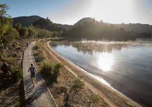
COLOUR    Quarry lookout track
           4.8km (Green Track)
 TRACKS:   The Quarry Lookout Track is a variation on the
           Waitawa walk and ventures a bit further into the
REDWOODS   forest. A stroll through the Redwoods leads you to
           a short climb through mature douglas fir, European
           larch, walnut and various species of eucalypts. The
           lookout point above the old rhyolite quarry gives
           a wonderful view over the Redwood Grove, out to
           Lake Rotorua and the main city centre.

           Once you have descended the steps into the Quarry
           basin you can follow Quarry Rd back down to the
           Redwoods car park. Follow the green arrows to
           continue for the full trail.

           Pohaturoa track
           7.5km (Yellow Track)
           Setting off towards the western side of
           Whakarewarewa, this track goes over varied
           terrain and takes in different aspects of the forest,
           initially passing through The Redwoods and then
           through stands of mature radiata pine, mexican
           pine, japanese larch and douglas fir. Once through
           the Redwood Grove you will take a short sealed
           road section up Nursery Hill before heading back
           into the forest.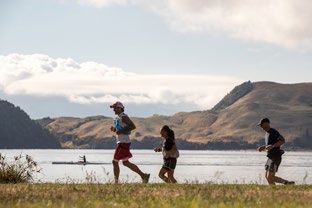
COLOUR    Tokorangi Pa track
           11.5km (Purple Track)
 TRACKS:   The Tokorangi Pa Track takes you through the
           tranquil Redwoods before a steady climb eastward
REDWOODS   to 500 metres above sea level.

           This is a very beautiful walk with views of
           Mt. Ngongotaha, Rotorua City, the lake, airport
           and countryside.

           The trip through douglas fir, European Larch,
           walnut and various eucalypts leads to the site of an
           ancient Maori pa (fortified village). This was once a
           small Maori village although nothing remains today.
           The track then continues down to the valley floor
           along ‘The Wash’. Watch for bikes on the Water
           Reservoir and Lynmore Link sections as these are
           dual-use tracks. ‘Cardiac Steps’ brings you back up
           past the wastewater treatment ponds to return via
           Katore and Nursery Roads.

           Whakarewarewa Circuit
           34km (Black Track)
           Run on a mixture of forestry roads and forest
           trails, the Whakarewarewa circuit gives you the
           opportunity to discover all the beauty and wonders
           of the Whakarewarewa Forest. See spectacular
           panoramic views of Rotorua and walk the shores of
           the beautiful lakes Tikitapu and Rotokakahi.
FAMILY Mokopuna Trail
FRIENDLY
The Mokopuna track is 3.6kms long and is the only
track in the heart of the Redwoods that is designed
for both easy walking and biking. The track was
originally designed for families to take their children
while they were learning how to ride ‘balance bikes’
while their parents walk or run beside them. There
are no steep hills or sharp corners like many of the
other tracks in the Redwoods.
Puarenga Stream
The stream track is one of the crown jewels in the
forest. The beautiful Puarenga Track is dual- use
meaning it is open for MTB riders and people on
foot. Weaving over the stream via several short
bridge crossings, take in views of the big pongas
and carvings along the way.
SCION and the Dog Park
This park can be accessed from Long Mile Road,
on the opposite side to The Redwoods. This area is
private land made available by SCION for the public
to use as an off-lead dog exercise area. Like a public
area, all Rotorua Lakes Council dog control and
registration bylaws apply.AROUND Jubilee Track
2.4 km return via same track.
TOWN The first part of the walk follows an easy grade
through unlogged native bush, which features
a large rata tree (40 m tall with a 1.8 m girth)
with a viewing platform. It continues on the Mt
Ngongotaha Nature Loop Track.
When you reach the Jubilee Track the walk becomes
moderately steep until near the summit. Once
Mountain Rd is reached it is a short walk to the
summit. Runners can return down the Jubilee Track
or follow Mountain Road down and back around to
the start for a distance of about 10kms.
Sulphur Point
2kms.
Sulphur Point (Te Kauanga) can be used as a link
track to get to the Redwoods Forest via Sala Street.
The path starts at the rear of the Sudima Hotel near
the Polynesian Spa. Sulphur Point contains many
active geothermal features including mud pools and
sulphur vents. The trail eventually intersects with
Te Ngae Road. To get across the road there is an
underpass beneath the bridge that links two ways -
to the right - a footpath that links up with Tarawera
Road straight ahead - the trail follows the stream
along Sala Street.LAKES: Tikitapu (Blue Lake) loop track
5.5kms.
OUTBACK Going in a clockwise direction, the track begins
at the north-east end of the Lake. Head along the
shore and follow the path south. Along the path
the track enters the bush, following the lake until
coming to a secluded beach at the southern end.
Head up the stairs to the car park and take a right
to continue around the lake.
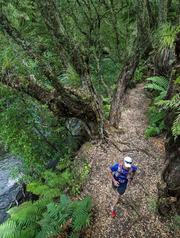
Tarawera Trail - Hot Water Beach
Te Wairoa car park to Hot Water Beach:
15 km.
A marked track that is for fit, experienced and
adequately equipped people. Hot Water Beach is
a natural geothermal area at Te Rātā Bay on the
southern shores of Lake Tarawera, popular with
visitors and locals.
Natural hot springs under the sand provide a
relaxing, warm swim.HILLS: Some recommendations
for a good 20k hilly run -
Start at Redwoods Information Centre
OUTBACK on Longmile Road
Follow the yellow track markers - the yellow track
route is 7.5kms in total and has some great views
plus hills! Then follow the purple track markers - the
purple track is 11.5kms. This also has some good hills
and starts and finishes at the Info Centre.
Other options -
Blue Lake and return. Start at the Info Centre, make
your way to Tarawera Road (this is the main road
to Blue lake), run on the grass heading away from
Lake Rotorua (or uphill), then when you get to the
top of the road at the water tower follow the trail
down the other side of the hill. Turn left just after
you cross the bridge and then run out to the Blue
Lake. It is about 8kms to the Blue Lake one way. So
if you run around the Blue Lake and then back to
the Information Centre following the same route this
is about 20kms.
Tuhoto Ariki. This is the MOST beautiful section of
technical trail and is uphill! Start at the information
centre. Follow the purple track markers until you
get to the intersection of Direct Road and Red Tank
Road. Go up Direct Road, then go up the dual use
MTB track called Frontal Lobotomy, then go up to
the very top of the hill (staying on the road) until
you get to the track entry. Then at the other end of
Tuhoto Ariki - run down Hill Road and then find your
way back to the Info Centre (which is quite straight
forward from here).HILLS: Rainbow Mountain
(distance options between 6kms
and 10kms)
OUT OF Rainbow Mountain lies 26 km south-east of
TOWN Rotorua, beside SH 5 (the Rotorua-Taupo highway).
Approaching from Rotorua the carpark is situated
just past the turnoff for SH 38 (the Murupara/
Waikeremoana highway), on the left-hand side of
the road.
On a clear day at the summit, you can see Mt Tarawera
in the north, Paeroa Range to the west and the
volcanic peaks of Tongariro National Park to the south.
Follow the trail from the car park up to the top of
the mountain. This is a GOOD solid climb! The trail is
2.5kms from bottom to top. From the top you have
three options to come back down again:
1. Go back down the same trail you came up
2. The Te Ranga mountain biking track (3.2kms) is
dual use, very technical and a lot of fun!
3. Follow the gravel road down around the back of
the mountain and then join up with the trail that
runs alongside the highway and loops back to
the car park.
When you’re finished Kerosene Creek is located a
kilometer from the car park. You can swim and relax
in the thermal stream that is warm all year round.RAINBOW The Rainbow Run is a challenge set in the
Whakarewarewa Forest of Rotorua. The Rainbow
RUN: Run requires the runner to complete every colour
track in any order they wish but the tracks must be
ULTRA done in the signposted direction.
The tracks are:
• Red Track
• Blue Track
• Green Track
• Yellow Track
• Purple Track
• Black Track
Total distance - 61.2 kms or - 38 miles.
So far three runners have completed the challenge
(that we know of):
Mike Leopard - 6.15.19 (time moving)
- Rotorua Trail Running Club
Dean Muggeridge - 8.05.36
- Rotorua Trail Running Club
Clive Start - 8.52.58
- Rotorua Trail Running Club
These runs were self supported with a central
start point which became a base for which all the
running loops veer off.THE
The work of the Trust continues the achievements
of the Rotorua Mountain Bike Club. The Club has
ROLE OF already developed such a superb range and quality
of trails in the Whakarewarewa forest as to make
ROTORUA Rotorua the world’s best all-year-round mountain
biking centre. The Trust has accepted the challenge
TRAILS of extending these trails and improving the network.
TRUST User groups: As well as extending trails in the
Rotorua District for mountain biking, the Trust will
develop trails that are suitable for walkers, trampers,
runners, cyclists, and horse riders. Some trails will
be multipurpose; others primarily for one or other of
these users.
The Trust will work to enhance the value of existing
trails by linking them together and improving them,
for multi-use where possible.
This includes better links with trails in the surrounding
districts and with national networks. The Trust
will work with iwi and other landowners, RLC,
BOPRC, DOC and other government agencies, and
recreational and environmental groups.
The Trust will be an advocate for new and better trails
and new uses of trails.
The Trust will develop and manage trails. It will seek
funding, sponsorships and contracts to do so. The
Trust will not seek a marketing role itself but will
cooperate and assist others in marketing.
Join and Donate
Rotorua Trails Trust is a New Zealand based non-
profit organisation. Your membership subscription
and/or donation will contribute to the continued
development of new trails and the ongoing
maintenance of existing trails:
rotoruatrailstrust.co.nz/joinALL PHOTOGRAPHY COURTESY OF NZ TRAIL RUNS: THE TARAWERA ULTRAMARATHON | TARAWERA TRAIL MARATHON AND 50KM
CONTENT COURTESY OF ROTORUA TRAIL RUNNING CLUB | DESIGN COURTESY OF ZEROSEVENYou can also read