UNTAMED WATERS - LICEUL REGINA MARIA DOROHOI TEAM DETECTIVES OF HAZARDS - BESAFENET
←
→
Page content transcription
If your browser does not render page correctly, please read the page content below
Liceul Regina Maria Dorohoi
Team Detectives of Hazards

  Untamed
 Waters
BeSafeNet 2021 – Untamed Waters

                                                    CONTENTS

1.Choosing the theme ........................................................................................... 3
2.Geographical location ........................................................................................ 3
3. The floods of 2010 – Causes and specific .......................................................... 4
4. Timeline and aftermath .................................................................................... 6
5. Then and now .................................................................................................... 7
References ............................................................................................................. 9

                                                                                                                        2
Team Detectives of Hazards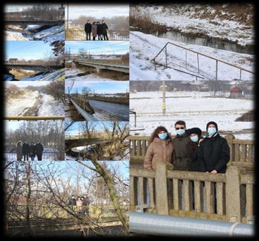
BeSafeNet 2021 – Untamed Waters
1.Choosing the theme
Based on the mass media news from summer related to the floods of the Prut river located in the North
of the Botoșani County and added the fact that those news brought back the memories of the events from 10
years ago, we’ve thought of talking about the floods from 2010 from Dorohoi, this event which marked our
town forever.
2.Geographical location
The coordonates of Dorohoi: 47º57’29’’ northern latitude and 26º23’52’’ eastern longitude show its
location in the Nord-East of Romania, highlighting a contact line between the high hills area of Bour-Ibănești,
and Moldavian plain, on the superior course of Jijia River, downstream of its confluence with Buhai River.
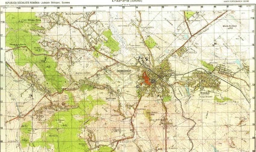
Fig 1 Dorohoi – Topographic Map
The city’s intravilan includes a colinar region fragmented by Jijia and its afluents (Buhai, Morii, Lădărița
and Zahorna creek), with a maximum altitude of 193 m in Țirinca Hill in North-West and a minimum one of
140-150 m in the major riverbed of Jijia in South-East.
As a result of the influence of the excessive temperate - continental climate, the low altitude of the terrain
and the substrate formed predominantly of clays and marl, Jijia and its tributaries are generally characterized
by low discharges. In the years when torrential rain occurred, there were small and medium duration floods with
significant consequences on social life, economic activity and the environment. The slopes, although relatively
low in value, play an important role in the production of floods and flooding.
3
Team Detectives of Hazards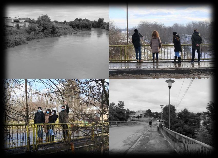
BeSafeNet 2021 – Untamed Waters

                                  3. The floods of 2010 – Causes and specific

           From the floods analysis in the upper Jijia basin, it was found that the largest floods through discharges
and effects occurred in the years 1991, 1998, 2005, 2008 and 2010.
           The main cause of the historical floods in June 2010 was the high rainfalls during the period of
instability from June 18- July 9, 2010, when they accumulated over 300 mm, exceeding 2-3 times the normal
climatological values. The atmospheric instability was due to the contrast between the very warm tropical mass
in eastern Romania over the entire tropospheric column and the cold altitude air mass above our country, as
well as the advection of humidity and the retrograde cyclone formed in the Black Sea.
           Another cause was the torrential rain from June 28-29, 2010, during which in the upper Jijia basin fell
over 200 mm in 24 hours. These torrential rainfalls were generated by the thermal convection that developed
after midday on June 28, 2010, which triggered rapid flash floods that caused massive material damage and loss
of life.
           The precipitations that occurred at the end of June and the beginning of July 2010 in the upper Jijia basin
in the form of high intensity downpours were distributed in three episodes: 21-24 June 2010, over 100 mm;
June 26-27, 2010, with values between 50-100 mm, and June 28-July 1, 2010, over 100 mm. These have led to:
increased soil moisture, significant slope discharges, forming of torrents, streams and repeated floods at short
intervals.
           The flood produced on the Buhai River at the Pădureni hydrometric station between 28 and 29 June
2010 had two peaks of 64 m³/s and 85 m³/s, respectively. The maximum discharge was of 85 m³/s, 467 times
higher than the multiannual average flow from 1978-2010 and had an exceeding probability of 6%. The flood
was determined by a precipitation of 164 mm and the flood duration was 33 hours.

                                                Fig 2 Buhai River June 30, 2010

                                                                                                                    4
Team Detectives of Hazards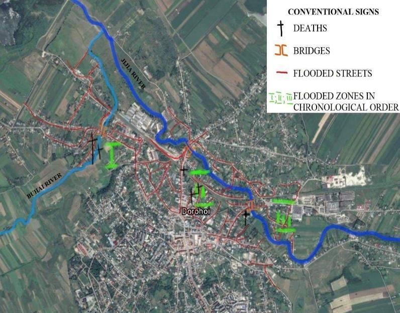
BeSafeNet 2021 – Untamed Waters
       At the Dorohoi hydrometric station, located on the Jijia River, the peak flow discharge during the
period 28.06 - 30.06.2010 was 190 m3/s, being 274 times higher than the multiannual average discharge of 0.694
m3/s, with the exceeding probability of 2 %. The flood at the Dorohoi hydrometric station on the Jijia River was
determined by a rainfall quantity of 250 mm and the total flood time was 144 hours. The total flood volume was
22.5 million m3 and the equivalent surface runoff was 94.4 mm.

                                             Fig 3 Jijia River June 30, 2020

                                  Table 1 Flood wave elements from June 28 - 29, 2010
                                                 data source: INHGA

                                                                                                              5
Team Detectives of Hazards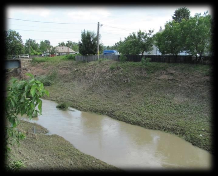
BeSafeNet 2021 – Untamed Waters

                                       4. Timeline and aftermath

                               Table 2 and Fig 4 Dorohoi Flooded areas June 29, 2010
                                             data source: Mayor's Office

       As the mentioned data shows, the water no longer had patience and "understanding" for strictly
respecting the announced hours. In these conditions, the following damages were registered with an estimated
value of over 17 million RON (3.9 million euros).

                                   Table 3 Dorohoi – Floods’damages, July 1, 2010
                                             data source: Mayor's Office

                                                                                                          6
Team Detectives of Hazards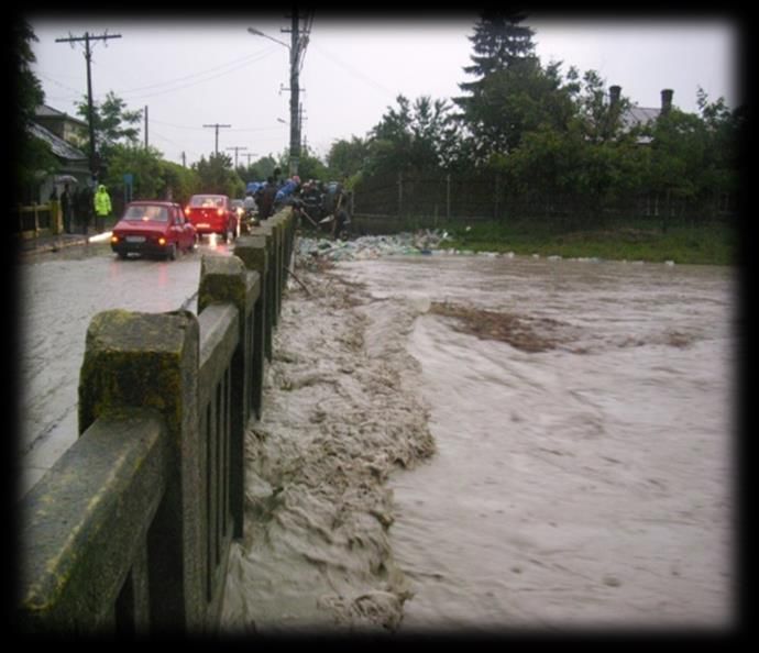
BeSafeNet 2021 – Untamed Waters
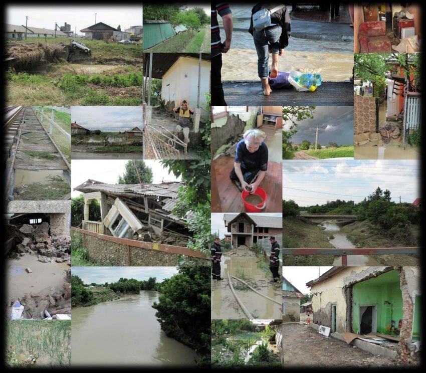
Fig 5 Dorohoi – June 30, 2010
5. Then and now
During the floods, emergency measures were taken to protect the population and the flood was very well
monitored by the SGA, the town hall, and emergency situations authorities.
719 people took action those days, managing to save 267 people from drowning and evacuating 4420
others.
Right after, action was taken to eliminate the effects of the natural disaster by lifting the debris,
disinfecting the wells, psychological counseling, transport of the dead animals, and vaccinating the population.
On the 14th of July 2010, after the evaluation, financial support was requested from governmental funds, non-
governmental organizations, sponsors, or donors. A total of 314 houses have been rebuilt.
7
Team Detectives of Hazards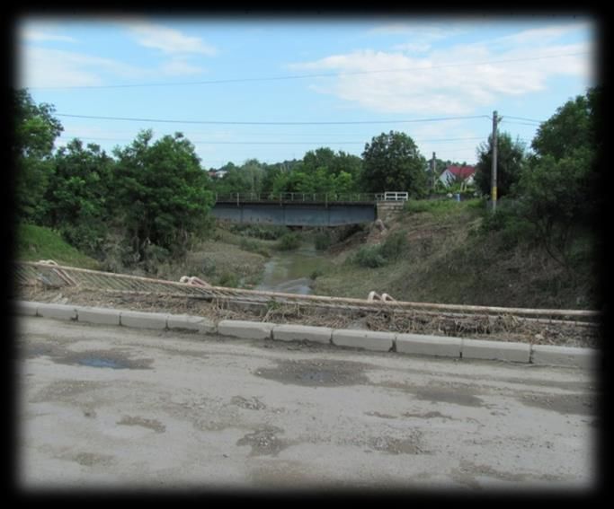
BeSafeNet 2021 – Untamed Waters
       A year after the floods, the bridge over Buhai was rebuilt and the flood-risk sectors have been defined
for which construction permits will not be granted.

                                            Fig 6 Dorohoi Floods risk areas
                                              data source: Mayor's Office
       In 2020, the authorities started a project financed by European funds for „Reconnection and restoration
of the floodable meadow”, which will ensure the effectiveness of flood prevention interventions.
       However, ten years after the floods, the population seems unprepared and not much has been done
to prevent damages in case this natural disaster strikes again.

                                       Fig 7 Dorohoi – February 4, 2021

                                                                                                            8
Team Detectives of Hazards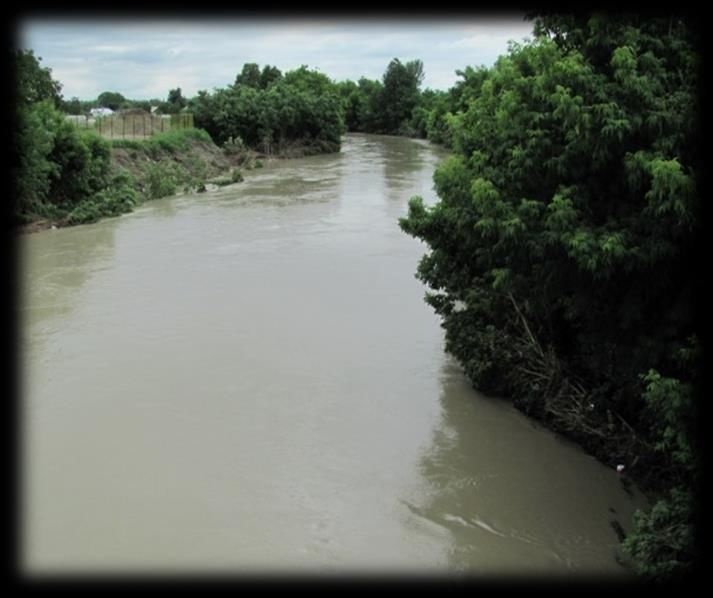
BeSafeNet 2021 – Untamed Waters

                                  REFERENCES

                                               9
Team Detectives of Hazards
You can also read