Virtual Alpine Observatory - Strategy - DLR
←
→
Page content transcription
If your browser does not render page correctly, please read the page content below
Strategy
Virtual Alpine Observatory
Status as of 19th June, 2017
Strategy – Virtual Alpine Observatory
                   th
      Status as of 19 June, 2017

                                        1 | 52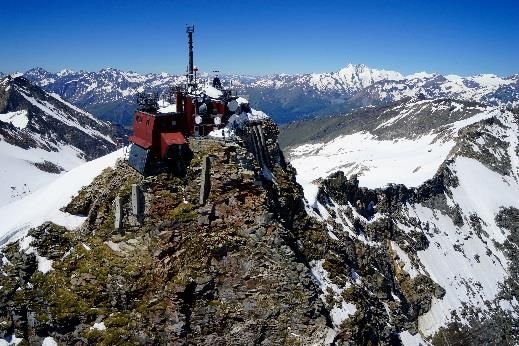
Strategy – Virtual Alpine Observatory
                                                                                            th
                                                                      Status as of 19 June, 2017

Content

1     Executive Summary ............................................................................................................... 4
2     Objectives ............................................................................................................................. 8
3     Status ................................................................................................................................... 12
    3.1       VAO-Partners..................................................................................................................................................... 14
      3.1.1       Austria – Sonnblick Observatory ..................................................................................................................... 14

      3.1.2       Switzerland – High Altitude Research Stations Jungfraujoch/Gornergrat (HFSJG) .......................... 17

      3.1.3       Germany – Umweltforschungsstation Schneefernerhaus (UFS) ............................................................ 22

      3.1.4       Germany – Deutscher Wetterdienst /Hohenpeissenberg Meteorological Observatory (DWD).. 25

      3.1.5       Italy – EURAC Research ..................................................................................................................................... 27

      3.1.6       France – Observatoire des Sciences de l’Univers de Grenoble (OSUG) ............................................. 29

      3.1.7       Slovenia – UNG Atmospheric Observatory at Otlica, Center for Atmospheric Research (CRA).. 34

    3.2       Associated VAO-Partners ...................................................................................................................................... 36
      3.2.1       Norway – Arctic Lidar Observatory for Middle Atmosphere Research (ALOMAR) ......................... 36

      3.2.2       Georgia – Evgeny Kharadze Abastumani National Astrophysical Observatory ............................... 38

4     Perspective .................................................................................................................................... 39
    4.1       Scientific challenges ................................................................................................................................................. 39
      4.1.1       Atmospheric and climatic variability .............................................................................................................. 39

      4.1.2       Climate impact on Alpine environment, hazards and risks .................................................................... 43

      4.1.3       Alpine water cycle ............................................................................................................................................... 44

      4.1.4       Environment and human health ..................................................................................................................... 45

    4.2       Improving the Infrastructure ................................................................................................................................. 46
5     VAO Governance ............................................................................................................................50
List of VAO-Board-Members ...................................................................................................................51
List of associated VAO-Partners .............................................................................................................51
Scientific challenges - Overview .............................................................................................................52

                                                                                                                                                                                           2 | 52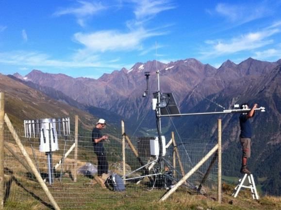
Strategy – Virtual Alpine Observatory
                   th
      Status as of 19 June, 2017

                                        3 | 52
Strategy – Virtual Alpine Observatory
th
Status as of 19 June, 2017
1 Executive Summary
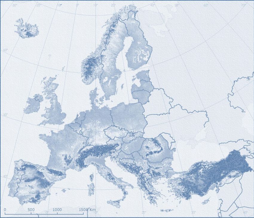
The alpine region with its eight neighbouring countries and about 14 million inhabitants represents
a significant economic region within Europe. From an ecological point of view the Alps belong to the
most complex parts of the “System Earth” and are particularly affected by environmental change
processes.
Especially, climate change more and more leaves its mark on this system. Consequences are mani-
fold being among the greatest threats to the ecosystem of the Alps and having far‐reaching impacts
for the economy, the traffic and the environment including health related issues of human beings. In
order to monitor and to understand these complex processes a transnational and interdisciplinary
approach is needed. Therefore, conducting joint efforts in order to observe understand and predict
the impact of climate change on the alpine region with respect to the environment including health
related issues of human beings, economy, and traffic is the foremost objective of the Virtual Alpine
Observatory, VAO.
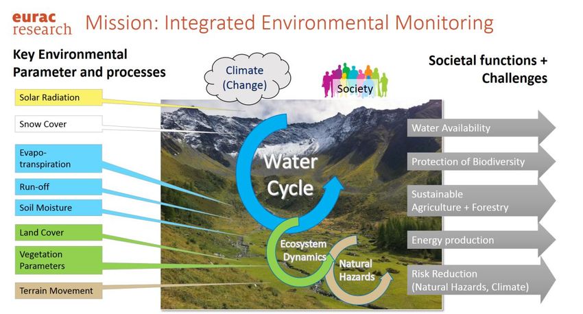
VAO serves to give coherence – where appropriate - to the various research efforts and programs
undertaken by the VAO partner organisations or within their infrastructures to try to create the max-
imum possible scientific profits. As an example, VAO gives the scientific community the flexibility to
conduct highly specialised field measurements each in very diverse scientific areas through coordi-
nated simultaneous campaigns at different sites and also promotes an interdisciplinary approach in
order to help better addressing demanding specific scientific questions. VAO supports such activities
further through granting access to additional resources (additional data and information, computing
power, numerical models, analysis tools etc.). Consequently, VAO helps improving understanding the
environment and thus contributes to the development of a consolidated fundamental knowledge
which also supports decision makers best balancing economic, social and environmental interests in
a sustainable way (see figure below). In fact, VAO is already part of the European Alpine Convention
as well as of the Alpine Strategy of the EU1.
VAO brings together already existing infrastructures (observatories, data centres, and high-
performance computing centres), scientists, engineers, medical experts and technicians from various
disciplines and facilities (universities, large research institutions, and public authorities). Synergism is
thus created - even at an interdisciplinary level - which allows achieving results and new knowledge
within ever shorter time intervals and with comparatively less resources. Obviously, cross-linking
these capacities yields a higher outcome than just the sum of its individual parts. The motto is: “Join-
ing forces instead of duplicating efforts”.
1
https://www.alpine-region.eu/
4 | 52
Strategy – Virtual Alpine Observatory
                                                           th
                                              Status as of 19 June, 2017

   The abovementioned cross-link to well-established WMO/ICSU World Data Centres and other data
 repositories (e.g., other data archives, the COPERNICUS Atmospheric Service CAMS2) allows the sci-
   entific communities a standardized (based on state-of-the-art Information Technology) access to
    additional data, information and services such as from satellite-based measurements (e.g. EU-
  COPERNICUS, other ESA-satellites) or from other ground-based observational networks (e.g. Long-
 Term Ecosystem Research network, LTER). The cross-link to supercomputing centres not only facili-
 tates the scientific communities to use complex numerical models and advanced data analysis tools
  but also allows optimization of computational applications (e.g. parallelization of numerical codes,
  better using big data concepts through support from IT experts). Scientists are thus empowered to
even better assess their own results and therefore to enhance their scientific knowledge and to turn
this new knowledge into innovative services tailored to the user’s needs (for example: new concepts
for near real time (NRT) satellite validation in order to improve NRT-services such as better forecast-

                             VAO’s vision from data to understanding to action

ing mesoscale phenomena or implementing health services more focussing on individual persons,
etc.).

 As a result, this concept strengthens the international competitiveness of European research and
development in the long term.

  Where appropriate, cooperation with European industrial sectors could be advantageous for both
parties, for example, if it comes to technology development (e.g., improving the performance of in-
strumentation or adapting technologies to other fields of application). It is equally conceivable that
parties may cooperate in the development of services tailored to user’s needs (so-called ‘down-
stream services’ such as the provision of information products).

2
    https://atmosphere.copernicus.eu/

                                                                                                          5 | 52
Strategy – Virtual Alpine Observatory
                                                      th
                                         Status as of 19 June, 2017

  From what has been said above, it follows that the vision of VAO is characterized at least within five
dimensions:

    (1) it sets new standards in terms of commonly developing new instrumentation (“open hard-
        ware”) often in cooperation with industries,
    (2) providing information products and data analysis tools tailored to the scientists needs
        (“computing-on-demand”),
    (3) scheduling measurement procedures harmonised between various measurement sites and
        customised to a specific application (“operating-on-demand”),
    (4) archiving and delivering data (and meta-data) as well as value added information adjusted to
        specific requirements (“data-on-demand”), and
    (5) delivering services addressing especially – but not exclusively - public needs (“service-on-
        demand”).

  The VAO is already established and constantly increases its attractiveness and visibility. Therefore,
it became clear during the first VAO-Board-Meeting, held on the 8th of September 2016 at the
Bavarian State Ministry for the Environment and Consumer Protection in Munich that a strategy is
required for the upcoming decade assisting to further develop VAO in a target-oriented way. This
document describes the VAO strategy. Our mission statement is based on broad discussions within
the scientific communities and reads:

The overarching objective of the VAO is to bring together already existing infrastructures (observa-
tories, data centres, and high-performance computing centres), scientists, engineers, medical ex-
perts and technicians from various disciplines and facilities (universities, large research institutes,
and public authorities) to perform environment, climate and climate change research in the Alps.
Cross-linking all these capacities therefore means a lot more than just the sum of it. The motto is:
“Joining forces instead of duplicating efforts”. This permits an investigation of environment-
relevant topics from different perspectives as it is required due to the complexity of the manifold
underlying processes; it creates synergies and opens up a more comprehensive approach in formu-
lating solutions than would otherwise be possible.

 The implementation of the VAO strategy rests on four pillars:

   Pillar I: advancing the research infrastructures in the Alps, especially at high altitudes,

   Pillar II: enhancing the scientific and technological portfolio,

   Pillar III: advancing the services, and

   Pillar IV: strengthening public outreach.

                                                                                                           6 | 52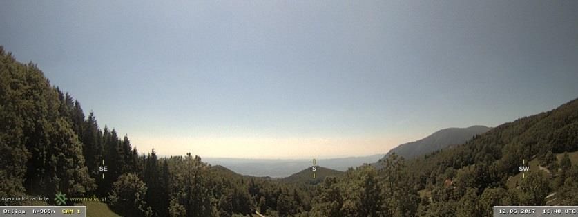
Strategy – Virtual Alpine Observatory
                                                       th
                                          Status as of 19 June, 2017

  Understanding alpine processes means - to a certain extent - understanding similar sensitive re-
gions of the Earth. This is why VAO is already being contacted or even joined by associated partners
in other parts of Europe and beyond.

  The structure of the strategy paper is as follows: chapter two “Objectives of VAO” introduces the
mission statement. The substantial benefits of VAO are highlighted. Chapter three “Status” gives a
description of the current status of the observatories / facilities (including facilities such as the Leib-
niz Supercomputing Centre of the Bavarian Academy of Sciences and Humanities (LRZ), and the
World Data Center for Remote Sensing of the Atmosphere (WMO/ICSU). The chapter four “Perspec-
tive” outlines the chances of the collaboration including aspects such as addressing more complex
scientific questions, enhancing competitiveness, establishing services for science, society and others,
dissemination of information, and addressing technological questions. The last chapter five describes
the “Governance” of VAO. Compilations of the current VAO partners as well as the identified VAO-
challenges round off this paper.

                                                                                                              7 | 52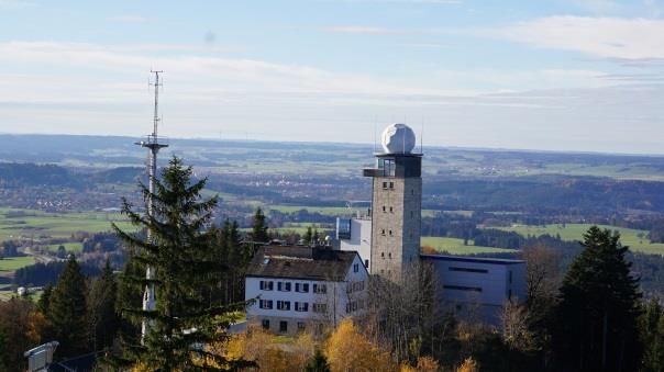
Strategy – Virtual Alpine Observatory
th
Status as of 19 June, 2017
2 Objectives
Mission
The Alpine region is one of the Earth’s areas that are particularly affected by climate change. It is to
be expected that the strong warming in the Alpine region of about +2o C since the year 1900 (being
nearly twice as much as the global warming trend) already has and will have clear impacts on differ-
ent parts of the Alpine environmental system, namely the atmosphere, biosphere, hydrosphere and
the cryosphere. As the environment represents a complex system, all these parts are coupled to each
other and shall not be regarded isolated. Especially, how these coupling mechanisms work is still an
open question. It belongs to the most demanding questions and is therefore a key topic of current
research. Consequently, in order to fully understand the complex Alpine environmental system an
interdisciplinary and cross-border research approach is required.
VAO: Network of European Alpine and associated Observatories, research facil-
ities, data archives and supercomputing centres with cross-linked infra-
structure and joint research topics
Motto: Scientific cooperation – joining forces and resources to avoid duplicate
work
Goal: Conducting joint efforts in order to observe understand and predict the
impact of (climate) change on the alpine (mountainous) region with re-
spect to the environment including health related issues of human be-
ings, economy, and traffic.
Countries participating: Austria, France, Germany, Italy, Slovenia, Switzerland
Countries associated: Georgia, Norway
Elements of innova- + Data-on-Demand
tion: + Computing-on-Demand
+ Operating-on-Demand
+ Service-on-Demand
+ Open Hardware
VAO in a nutshell
As already outlined above, it is therefore an overarching objective of the VAO to bring together al-
ready existing infrastructures (observatories, data centres, and high-performance computing cen-
tres), scientists, engineers, medical experts and technicians from various disciplines and facilities
(universities, large research establishments, and public authorities). Cross-linking all these capacities
therefore means a lot more than just the sum of it. The motto is: “Joining forces instead of duplicat-
8 | 52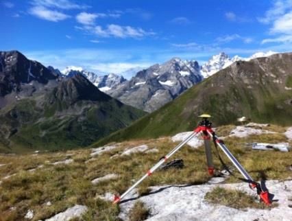
Strategy – Virtual Alpine Observatory
                                                      th
                                         Status as of 19 June, 2017

ing efforts”. This permits an investigation of environment-relevant topics from different perspectives
as it is required due to the complexity of the manifold underlying processes; it creates synergies and
opens up a more comprehensive approach in formulating solutions than would otherwise be possi-
ble.

Challenges and unique features
  The particular vulnerability of the Alpine region to climate change represents both, a challenge and
an opportunity. Providing sustainable measurements of key geophysical variables of the Alpine envi-
ronmental system poses the first considerable challenge. Such measurements have often to be car-
ried out at different sites in the Alpine region in a highly specialised, campaign based fashion. Alt-
hough such measurements are often rather unique (as is common when working at the forefront of
science) it should be tried to conduct these measurements using comparable standards, synchro-
nized to other instruments where appropriate, and with adequate precision and accuracy. There is a
broad agreement that reliable and quality-assured observations are paramount for a sound scientific
basis. A comparison of such observations with our current understanding of the Alpine environmen-
tal system will reveal inconsistencies and deficiencies, and this in turn will lead to additional insights
and help improving our knowledge and understanding of the alpine environment.
  This is where a further challenge appears: A state-of-the-art IT infrastructure, the so-called Alpine
Environmental Data Analysis Centre (AlpEnDAC) ensures that the measurements taken at the various
sites are easily and conveniently accessible and exchangeable within the VAO according to interna-
tional standards, irrespective of where the scientists or engineers are located („data-on-demand“),
and according to a data policy which is accepted by all partners. Furthermore, it will be possible to
access data available elsewhere (e.g. satellite-based measurements, ground-based data, etc.). The
core of the AlpEnDAC is formed by high-performance computing centres such as the Leibniz Super-
computing Centre in Garching and networked data centres like the WMO/ICSU World Data Centre
for Remote Sensing of the Atmosphere in Oberpfaffenhofen. These partnerships also allow support-
ing further initiatives, such as the optimisation of numerical computer codes (e.g. parallelisation) or
to handle large data volumes (e.g. big data). It is expected that such opportunities can also contribute
to further supporting, enhancing and speeding up scientific progress in general.
  AlpEnDAC is also a platform to turn appropriate tools developed by scientists and engineers to sup-
port data interpretation (e.g., special statistics) into easy-to-access services which may be used or
adapted by other scientists for their individual purposes. Besides enabling data visualisation and the
combination of different datasets, this “toolbox” of the AlpEnDAC also allows access to more com-
plex numerical computer models (e.g. 3D-trajectory and air quality models, meteorological models
etc.) that can be assembled and used by the scientists in accordance with their individual require-
ments („computing-on-demand“). These functions of the AlpEnDAC provide “services” for the scien-
tific community itself and are meant to support scientists in their research activities.
  It is also a goal of the VAO to develop and operate services that are directed to the outside world
(public society, other stakeholders) where they can help to face up to major challenges confronting

                                                                                                             9 | 52
Strategy – Virtual Alpine Observatory
th
Status as of 19 June, 2017
society today (so-called societal benefit areas). This is a further challenge and is described in greater
detail below.
Benefits of the VAO and added value
VAO supports the development of measuring equipment and sensor technology in order to allow
researchers to stay at the forefront of scientific research. Regarding the remarkable success of the
“open-software-concept” in the world of information technology it shall be tried to adapt this con-
cept to the development of instrumentation (“open hardware”). This would help to avoid duplicate
work, to shorten development cycles, and to achieve the best possible technological solution. Where
appropriate (e.g., in the design of instrumentation to be used within international measurement
networks), experts from different facilities – but working on similar technological developments - are
encouraged to contribute their skills, knowledge, and competences and therefore guarantee an op-
timal achievement of the envisioned target.
The scientific and technical expertise gathered under the umbrella of the VAO can also be turned
into valuable contributions towards meeting the major challenges of our times (so-called “Societal
Benefit Areas”). One example for this is to help creating a better understanding of the interaction
between individual human health and the environment (“health sentinel”). This knowledge may then
be used to help further developing kinds of bioclimatological information services (BioClIS) in the
foreseeable future for the public (“service-on-demand”).
Another example illustrating the potential value that VAO can add to applications beyond the pure
scientific world is to use the VAO also to contribute to a permanent quality assurance (in particular in
near-real-time) of satellite-based measurements in the tomographic complex alpine region. This as-
pect of assuring quality should be of interest in the context of the European COPERNICUS program,
which is essentially dedicated to further improve the competitiveness of European industry in the
field of technologies and services using satellite-based remote sensing data of the Earth. On the oth-
er hand, establishing closer contact to ESA means a promising approach in order to get access to
satellite-based data which are of special value for the alpine region and which can be used to better
reach VAO’s goals (see also chapter four).
It is further noteworthy that specific VAO activities are linked to the European GALILEO program. As
an example, VAO may also work on concepts to use swarms of unmanned aerial vehicles (UAV) in
order to better answer dedicated scientific questions or to invent a new stage of satellite validation
quality. Commanding not only the flight route of such a swarm but also the distance between indi-
vidual UAV’s (variable mesh width) does not only require innovative solutions for sensor miniaturisa-
tion but also a very efficient navigation, which can be based on GALILEO.
Finally, VAO may initiate developments which allow the operation of specific instruments at the
different sites on demand. As an example, instruments may be switched on or triggered remotely on
a specific request (e.g., tracking a satellite’s overpass, measuring the approaching plume of a Sahara
dust outbreak or forest fires, triggering probes of air if a contaminated air mass is expected to arrive)
(“operating-on-demand”).
10 | 52Strategy – Virtual Alpine Observatory
th
Status as of 19 June, 2017
Political and societal integration
The VAO is part of the Alpine Convention3, in which the Contracting Parties have agreed to promote
and harmonise research and systematic observations in close cooperation that will serve a better
understanding of the interaction between region, economy, and environment in the Alps and help to
forecast future developments. In this context, the platforms „ABIS/SOIA“(System for Observation and
Information on the Alps of the Alpine Convention) and the AlpEnDAC of the VAO shall be cross-linked
where appropriate and technically feasible.
The VAO is, moreover, one of the tools to be used for implementing the Alpine Strategy of the EU4.
This strategy is aimed to cover the political topics of economic growth, innovation, mobility and envi-
ronment as well as energy. The main goal of the strategy is to ensure that this region remains one of
Europe’s most attractive spaces, leveraging on its benefits and initiating a sustainable, innovative
development in a European context. One of the tasks in this respect is to manage climate change and
its consequences. The VAO delivers a scientific basis for addressing this task.
3
http://www.alpconv.org
4
http://www.alpine-region.eu
11 | 52Strategy – Virtual Alpine Observatory
th
Status as of 19 June, 2017
3 Status
Participating observatories and institutions
Since 2013 the “Virtual Alpine Observatory“ (VAO) has been operating as a network of European
High Altitude Research Stations based in the Alps and with associated partners in similar mountain-
ous regions, and now includes eight countries: With the already well established institutions in the
Alpine and foothill regions, such as the observatories Sonnblick (Austria), Jungfraujoch/Gornergrat
(Switzerland), Schneefernerhaus (Germany), Otlica (Slovenia), EURAC Research (Italy) and OSUG
(France) and its associated facilities, outstanding research infrastructures have joined to form the
VAO. Other institutions such as ALOMAR (Norway) and Abastumani (Georgia) are associated with the
VAO.
The above mentioned observatories and institutions are assisted by the Leibniz Supercomputing
Centre in Garching (Germany) and the WMO/ICSU World Data Centre for Remote Sensing of the At-
mosphere in Oberpfaffenhofen (Germany). Furthermore, the VAO is always open to new partners,
conducting research in alpine or foothill regions in Europe and beyond, and is set for continuous ex-
pansion in the coming years.
The following two chapters (3.1 VAO-Partners and 3.2 Associated VAO-Partners) give a short de-
scription of the current status of the participating observatories and facilities as well as a description
of the scientific foci of each observatory and institution.
A) VAO-Partners:
Research stations / institutions in the VAO: Country: Altitude:
Environmental Research Station Schneefernerhaus (UFS) Germany 2.650m
Schauinsland Observatory Germany 1.284m
Hohenpeißenberg Observatory Germany 975m
Observatoire de Haute-Provence France 650m
Station Alpine Joseph Fourier, Lautaret-Pass France 2.058m
Vallot Observatory, Mont Blanc France 4.362m
Sentinel Alpine Observatory, Ritten Italy 2.260m
Eurac-LT(S)ER site Macia/Matsch Italy 2.700m
Sonnblick Observatory Austria 3.106m
High Altitude Research Station Jungfraujoch (HFSJG) Switzerland 3.580m
High Altitude Research Station Gornergrat (HFSJG) Switzerland 3.135m
Otlica Observatory Slovenia 945m
Supporting research infrastructures:
Leibniz Supercomputing Centre (LRZ), Garching Germany
World Data Centre for Remote Sensing of the Atmosphere (WDC- Germany
RSAT), Oberpfaffenhofen
Observatoire des Sciences de l’Univers de Grenoble (OSUG) France
European Academy of Bolzano (EURAC) Italy
12 | 52Strategy – Virtual Alpine Observatory
th
Status as of 19 June, 2017
B) List of associated VAO-Partner:
Research stations / institutions in the VAO: Country: Altitude:
Abastumani Astrophysical Observatory Georgia 1.700m
Alomar Observatory Norway 380m
Supporting research infrastructures:
- -
VAO participating and associated observatories, status as of June 2017
Map: © European Environment Agency
Alomar Observatory, NO
WDC-RSAT, DE
LRZ, DE
Jungfraujoch, CH Hohenpeissenberg, DE
Schneefernerhaus, DE
Schauinsland, DE
Gornergrat, CH Abastumani, GE
Sonnblick, AT
Mont Blanc, FR Otlica, SI
Lautaret-Pass, FR
Rittner Horn, IT
Haute Provence, FR
Eurac Research, IT
OSUG, FR Mazia, IT
13 | 52Strategy – Virtual Alpine Observatory
th
Status as of 19 June, 2017
3.1 VAO-Partners
3.1.1 Austria – Sonnblick Observatory
Homepage: http://www.sonnblick.net
Location/Altitude:
Geographical coordinates: 473’15’’N, 012°57’28’’E
Altitude of station: 3106 m a.s.l
Minimum altitude within study area: 1600 m a.s.l
Maximum altitude within study area: 3254 m a.s.l
Zittelhaus and Sonnblick Observatory in winter Sonnblick Observatory at mountain “Hoher
Sonnblick” in early summer
The Sonnblick Observatory is owned by the association Sonnblick Verein and managed by the Austri-
an Central Institute for Meteorology and Geodynamics (in German: ZAMG: Zentralanstalt für Mete-
orologie und Geodynamik), Regional Office Salzburg, in cooperation with the Sonnblick Verein.
The Sonnblick Observatory is located in the Austrian Central Alps at elevation of 3106 m a.s.l.. It is
situated at the alpine main divide, which is a natural climatological border. It lies in the core zone of
the national conservation park “Nationalpark Hohe Tauern” which covers 1856 km² of the Austrian
Alps at the border between the provinces of Salzburg, Carinthia and Tyrol. Nearest villages are Heili-
genblut to the South (10 km away) and Rauris to the North (20km away). Access to Sonnblick Obser-
vatory is possible throughout the year either by cable car from the North or by hiking from Rauris or
Heiligenblut. As Sonnblick is situated within the “Nationalpark Hohe Tauern” the use of helicopter is
restricted. However, scientific activities usually will get permission for required flights. Sonnblick
Observatory is built together with an alpine hut “Zittelhaus” which offers additional accommodation
and space.
14 | 52Strategy – Virtual Alpine Observatory
th
Status as of 19 June, 2017
The Sonnblick Observatory was built in 1886 at the summit of the mountain “Hoher Sonnblick”, mo-
tivated from the need for information on meteorology in higher altitudes of the atmosphere. Very
soon other scientific disciplines became interested in the extreme location of the observatory, e.g.
Nobel-prize winner V.F. Hess for his measurement of cosmic rays. In 1986, the observatory was re-
built to a modern observatory with cable car access, electricity, and a large research platform. From
that time onwards investigations on atmospheric chemistry became a new research field at
Sonnblick. Today, Sonnblick is a station of interdisciplinary research covering the atmosphere, the
cryosphere, the biosphere, the lithosphere, and the hydrosphere
Sonnblick Observatory covers an area under roof of about 200 m² with 20 m² used for scientific la-
boratories and 80 m² are used for logistics. In collaboration with the management of the hut “Zittel-
haus” the area of scientific laboratories will increase within the next years. Within the observatories
there are 4 bed rooms and additional 50 beds in the hut “Zittelhaus”. The power supply comes from
a cable (230V 50Hz) and can be used 24 hours per day. WLAN is offered as well as workshop facilities
for metal, wood, plexiglas and other material is available to assist with constructions every day. The
station operates round the clock having always two people stationed who also take care of running
projects at the station. Communication facilities are a fixed telephone (mobile phone works too),
VHF, internet, computer, printer, scanner and Fax. Data can be stored at Sonnblick Observatory.
The Sonnblick Observatory supports technological development regarding analyses of ageing pro-
cesses of different materials and security equipment. It is also in contact with various companies to
improve scientific instruments.
Beside national networks the Sonnblick Observatory is part within NDACC, WMO-GAW, WMO-GCW,
BSRN, WGMS, GTN-P, LTER, INTERACT, MONET, GTS, VAO. Soon, Sonnblick Observatory will partici-
pate in ACTRIS and ICOS.
Sonnblick is outstanding with respect to its long-term climate observations and studies on glacier
changes. Thus, the impact of Climate Change on the cryosphere is a major research topic at
Sonnblick. Since 1886, Sonnblick was also involved in many international projects on atmospheric
chemistry and atmospheric physics. Sonnblick Observatory cooperates with several Austrian and
international universities/research institutions.
The main disciplines the Sonnblick Observatory is involved are astrophysics, atmospheric chemistry
and physics, isotopic chemistry, climatology, climate change, environmental sciences and pollution,
geodesy, geology and sedimentology, geophysics, glaciology, geocryology and geomorphology, soil
science, human biology and high altitude medicine, mapping, GIS, hydrology, terrestrial biology and
ecology, paleolimnology, paleoecology and limnology. The features within the study area include ice
cap or glacier, permanent snowpatches, mountain and valley.
Research at Sonnblick Observatory is currently formulated in the research program ENVISON (ENVi-
ronmental Research and Monitoring SONblick). The program covers three main topics (atmosphere,
15 | 52Strategy – Virtual Alpine Observatory
th
Status as of 19 June, 2017
cryosphere, biosphere) in an extensive monitoring program (ATMON, CRYMON, BIMON) and with
many research projects:
ATMON: “The monitoring of the Atmosphere covers the acquisition of meteorological parameters as
well as the determination of atmospheric trace gases, particulate matter and radiation by in-situ and
remote sensing techniques. Regarding air constituents the Sonnblick Observatory allows a determi-
nation of the background boundary layer as well as free tropospheric air masses. While a limited set
of parameters, e.g. defined by the demands of GAW (Global Atmosphere Watch), is determined on a
routine basis, research projects introduce additional components, novel techniques and additional
short term programs. The continuous monitoring of the above mentioned parameters allows the
evaluation of satellite data, model calculations and the interpretation of short term programs (e.g.
measuring campaigns, vertical profile data obtained by airplane measurements) in the scope of long
term observations.” (ENVISON 2016-2020)
CRYMON: “The general aim of CRYMON is to monitor the status and the changes of the Cryosphere
in the spatiotemporal domain at high elevation sites of the Alps as well as its linkages to the atmos-
phere and the biosphere. This includes the measurements of glaciers, perennial snow and perma-
frost. In order to capture all these aspects of the monitoring spatially distributed observations at
glaciers, test fields of permafrost distribution and the snow cover are established. The spatial varia-
bility of atmospheric conditions in the region demands for meteorological observations not only at
the summit of Sonnblick but also at various sites covering local variability. CRYMON contributes to
various international monitoring programmes as e.g. WGMS (World Glacier Monitoring Service) GTN-
P (Global Terrestrial Network for Permafrost) and WMO GCW (Global Cryosphere Watch).” (ENVISON
2016-2020)
BIMON: “BIMON establishes a regular monitoring of vegetation changes and of changes of stream-
flow ecology. Thus it will be possible to explore high added value from linking atmospheric changes
to changes in the cryosphere and finally to the consequences for the biosphere, not observed else-
where in the Alps. Several ecological observations are currently performed as part of research pro-
jects. The cooperation with NP Hohe Tauern is part of BIMON. “(ENVISON 2016-2020)
16 | 52Strategy – Virtual Alpine Observatory
th
Status as of 19 June, 2017
3.1.2 Switzerland – High Altitude Research Stations Jungfraujoch/Gornergrat (HFSJG)
Homepage: http://www.hfsjg.ch
Location/Altitude:
Research station Jungfraujoch: 3450 meters a.s.l.
Sphinx observatory at Jungfraujoch: 3580 meters a.s.l.
Jungfrau East ridge: 3700 meters a.s.l.
Gornergrat: 3135 meters a.s.l.
Sphinx Observatory at Jungfraujoch
Research station Jungfraujoch: besides the hosting facilities for scientists - including a library, a din-
ing and recreation room, a kitchen, ten bedrooms and two bathrooms – the station comprises five
laboratories, a mechanical workshop with a small equipment room and a compressor for liquid air
production. Two custodian couples guarantee a 365 day presence to look after these facilities, the
running projects and to host the scientists.
Sphinx observatory: It has an astronomical dome, two large and two small laboratories, a workshop,
two terraces for scientific experiments, and a weather observation station run by MeteoSwiss.
Jungfrau East ridge: Since 2014 additional laboratory space is available in the former Swisscom relay
station at the Jungfrau East Ridge. There is a room available on the second floor as well as one in the
attic. A heated inlet system is installed on the roof of the house.
Gornergrat: In the southern part of the Swiss Alps, near Zermatt, the sister station Gornergrat hosts a
public outreach project in astronomy named Stellarium Gornergrat (https://stellarium-
gornergrat.ch/).
Online data: most of the measurements made at Jungfraujoch are publicly available via the respec-
tive databases, many of them in real or near real-time: http://www.hfsjg.ch/en/jungfraujoch/online-
data/
17 | 52Strategy – Virtual Alpine Observatory
th
Status as of 19 June, 2017
Services and regulations: Several services are provided by our homepage which includes a descrip-
tion of past and current research projects, details about project application, regulations for stays in
the research facilities at Jungfraujoch, information about local emissions etc. see e.g. un-
der:www.hfsjg.ch/en/jungfraujoch/regulations
IT capabilities: All working places at in the labs are equipped with a phone and wired broad-band
internet connection. Wireless connection is available in the library, the recreation room, and the
bedrooms in the research station.
History of the Foundation: After the early death of the prime father and planner of the Research
Station, the meteorologist and polar explorer Alfred de Quervain, the physiologist (and later Nobel
Laureate) Walter Rudolf Hess implemented the plans for a scientific laboratory at Jungfraujoch. Un-
der his leadership the International Foundation High Altitude Research Station Jungfraujoch (now the
International Foundation High Altitude Research Stations Jungfraujoch and Gornergrat) was estab-
lished in 1930. The Research Station was inaugurated one year later already. Research which, to
some extent, had started before, could now be performed extensively and conveniently from a solid
home base. Initially investigations focused on cosmic rays, astronomy, glaciology, meteorology and
physiology. The Sphinx Observatory, located about 120 m above the initial building of the Research
Station was completed in 1937. A first astronomical dome was installed on the roof of the Sphinx
building in 1950. This has become a symbol of scientific activity at Jungfraujoch for millions of tour-
ists.
Former Research Highlights: Research work at Jungfraujoch has brought many outstanding results,
documented by close to 1000 peer-reviewed publications originating from studies either conducted
at the research infrastructures or related to work being done there. Research on cosmic rays by
Blackett and Powell provided basic results whose importance were recognised by two Nobel prizes in
physics (Blackett, 1948; Powell, 1950). In 1951 a large Wilson cloud chamber was installed by Black-
ett in 1951 at the Sphinx Observatory. Many additional and exceptional results have been obtained
since then.
Actual Research: Besides this multi-facetted research on atmospheric chemistry and physics, extend-
ed investigations in meteorology, glaciology, monitoring of permafrost, radionuclides and cosmic
rays are being conducted and make Jungfraujoch a lively research site. Furthermore, internationally
coordinated campaigns on cloud-aerosol interaction research, i.e. CLoud and Aerosol Characteriza-
tion Experiment (CLACE) were started in 2000 by the Paul Scherrer Institute. Studies investigating the
effect of high altitude exposure on healthy persons or on patients with cardiovascular disease are
important for both visitors and workers at the Jungfraujoch. Common during the early times of re-
search at the Jungfraujoch, medical campaigns have ceased during a certain period, but are lately
going through a revival. Current medical experiments on Jungfraujoch are focusing on themes, such
as “Human adaptation to high altitude” or on the “Effect of high altitude exposure on hemodynamic
response to exercise in patients with mild congenital heart disease”.
18 | 52Strategy – Virtual Alpine Observatory
th
Status as of 19 June, 2017
The Research Station Jungfraujoch has been, and still is frequently used as a testing platform for new
technologies. Electronic devices (i.e. computers, controlling units, storage disks etc.), detector units
(for cosmic rays, for gas concentrations, for meteorology, etc.), photovoltaic cells, medical equip-
ment, building materials and even textiles for outdoor activities can easily be tested to many ex-
tremes at Jungfraujoch – namely very cold temperatures, heavy snowfall, high wind velocities up to,
and beyond 200 km/h, and significantly reduced atmospheric pressure. The results of such tests lead
to rugged and robust instrumentation. Improvements in building design and of outdoor wear have
emerged, too.
Quality assurance and quality control (QA/QC): QA/QC, i.e. ensuring known and adequate quality
and traceability of the measurements e.g. through frequent comparisons with standards is part of
any research, but it turns into a central issue with the ambition to perform high-accuracy long-term
monitoring of decisive atmospheric components. Jungfraujoch participates in the dedicated QA-
Programme of GAW and also within several other international monitoring programmes, including
some that belong to European Framework Programmes. Therefore, in the past and at present quality
assurance has been given highest priority by both the HFSJG Foundation and its infrastructure users.
It is indispensable to continue this in future.
List of major nationally and internationally coordinated networks and/or research programs where
Jungfraujoch is a key station:
NDACC: Network for the Detection of Atmospheric Composition Change Primary Site
GAW, GAW-CH: Global Atmosphere Watch, Global GAW Station
GAW-PFR: GAW Aerosol Optical Depth (AOD) Network
GCOS: Global Climate Observing System
GCOS-CH: Swiss GCOS office
AGAGE: Advanced Global Atmospheric Gases Experiment Collaborative Sampling Station
NADIR/NILU: NILU's Atmospheric Database for Interactive Retrieval
EUMETNET: Network of European Meteorological Services
SwissMetNet: Automatic Measuring Network of MeteoSwiss
RADAIR: Swiss Automatic Network for Air Radioactivity Monitoring
ICOS: Integrated Carbon Observation System
NADAM: Netz für automatische Dosis-Alarmierung und Meldung
NABEL: Nationales Beobachtungsnetz für Luftfremdstoffe - National Air Pollution Monitoring Net-
work
AGNES: Automated GPS Network for Switzerland
19 | 52Strategy – Virtual Alpine Observatory
th
Status as of 19 June, 2017
PERMASENSE: Wireless Sensing in High Alpine Environments
PERMOS: Permafrost Monitoring Switzerland
NMDB: Real-Time Database for High Resolution Neutron Monitor Measurements
E-GVAP I + II: EUMETNET GPS Water Vapour Programme
ACTRIS: ACTRIS: European Research Infrastructure for the observation of Aerosol, Clouds, and Trace
gases
Swiss Glacier: Federal Office for the Environment (BAFU) Monitoring Network
EARLINET-ASOS: European Aerosol Research Lidar Network – Advanced Sustainable Observation
System
InGOS: Integrated non-CO2 Greenhouse Gas Observing System
NORS: Network of Remote Sensing (http://nors.aeronomie.be)
AGACC-II: Advanced exploitation of Ground based measurements, Atmospheric Chemistry and Cli-
mate applications
EMEP: European Monitoring and Evaluation Programme
GAIA-CLIM: Gap Analysis for Integrated Atmospheric ECV Climate Monitoring
QA4ECV: Quality Assurance for Essential Climate Variables
Most of the measurements made at Jungfraujoch are publicly available via the respective databases,
many of them in real or near real-time. Further information can be found at www.hfsjg.ch.
Network examples: Here we introduce two of the leading long-term atmospheric monitoring and
research programmes, namely the Global Atmosphere Watch (GAW) programme of the World Mete-
orological Organization (WMO) and the Network for the Detection of Atmospheric Composition
Change (NDACC).
The Swiss GAW programme (GAW-CH) was launched in 1994 as national contribution to the interna-
tional GAW programme. It is coordinated by MeteoSwiss. Within GAW-CH, federal offices and na-
tional research institutions have organised a strong collaboration in atmospheric observations and
analyses. Thus, the Swiss GAW programme includes the monitoring of various physical and chemical
atmospheric variables, research activities and advanced services. The programme is regularly re-
viewed: the 5th GAW-CH conference discussed the results of the period 2006 to 2009 and decided on
projects for the period 2010 to 2013. In 2014, another series of research projects started, with a sig-
nificant involvement of Jungfraujoch. The next call for the period 2017 to 2019 will be placed soon.
Empa started continuous in-situ observations of atmospheric constituents at Jungfraujoch in 1973.
Since 1978, these are part of the Swiss National Air Pollution Monitoring Programme (NABEL), a pro-
gramme runs jointly by Empa and the Federal Office for the Environment (FOEN). Today, Jung-
fraujoch is one of 16 NABEL monitoring sites. These stations cover the entire range of air pollution
levels – from curb side to the free tropospheric background. The NABEL site at Jungfraujoch provides
background measurements for the lower free troposphere in central Europe and also contributes to
20 | 52Strategy – Virtual Alpine Observatory
th
Status as of 19 June, 2017
the European Monitoring and Evaluation Programme (EMEP). The Swiss Global GAW Station on Jung-
fraujoch measures more than 70 gaseous species of reactive and greenhouse gases including some of
their isotopes. This is made possible through a joint commitment of Empa and FOEN that is part of an
on-going long-term international co-operation within the international Advanced Global Atmospheric
Gases Experiment (AGAGE) network and the U.S. National Oceanic and Atmospheric Administration
(NOAA). Today the greenhouse gas measurements on Jungfraujoch are fully integrated into the glob-
al activities of this renowned worldwide measurement network. An additional, noteworthy aspect of
these measurements is that they are often used as ‘ground truth’ for satellite observations.
The aerosol programme of the Paul Scherrer Institute (PSI) was started in 1988 and has continuously
been expanded by adding a variety of long-term measurements of physical, optical, and chemical
properties of aerosols. These measurements aim at quantifying the influence of aerosols on climate.
Jungfraujoch is an ideal site for studying an aged aerosol above a continental area with an anthropo-
genic influence. The measurements are embedded into the Swiss GAW programme (GAW-CH) under
the auspices of MeteoSwiss since 1995. Today, Jungfraujoch has one of the most comprehensive
aerosol programmes worldwide, and is among the few stations providing aerosol datasets that are
long enough for trend analyses (see www.psi.ch/lac/gawmonitoring). The Jungfraujoch aerosol pro-
gramme is linked to numerous past and current EU infrastructure projects and other large integrated
projects, such as EUSAAR, EUCAARI, GEOMON, ACTRIS, and BACCHUS. All aerosol measurements as
well as the previously mentioned in-situ trace-gas measurements taken on Jungfraujoch are in full
compliance with the Essential Climate Variables (ECVs) requirements at an atmospheric surface site
of the Global Climate Observing System (GCOS).
Jungfraujoch is also deeply involved in the Network for the Detection of Atmospheric Composition
Change (NDACC) – another major contributor to the worldwide atmospheric research effort. In this
programme a set of globally distributed research stations provide standardized and inter-calibrated
long-term measurements of atmospheric trace gases and particles, of the spectrum of UV radiation
reaching the Earth’s surface, as well as of physical parameters from the wide range of observations.
Since its inception in the early 1990s, NDACC (formerly NDSC) is a major contributor to the Global
Atmosphere Watch (GAW) as well as to many other internationally and nationally coordinated re-
search networks and programmes such as NORS (NORS – the Demonstration Network Of ground-
based Remote Sensing Observations in support of the Copernicus Atmospheric Service).
Long-term comparability of multi-decadal time series for the detection of change in the atmospheric
composition, such as those obtained by the Université de Liège, requires not only environmental
conditions with minimal local perturbations but also frequent comparisons of methods and instru-
ments. Jungfraujoch is a key site for this kind of quality assurance (QA) activities.
For the investigation of the chemistry and physics of the Earth’s atmosphere about 25 longterm pro-
jects with automated measurements are in operation on Jungfraujoch. In addition there are a num-
ber of short-term measuring campaigns. Advanced investigation methods and techniques, such as
multi-axis differential optical absorption spectroscopy (MAXDOAS) and instruments based on a quan-
tum cascade laser (QCL) provide high-precision isotope measurements on carbon dioxide and NOx.
21 | 52Strategy – Virtual Alpine Observatory
th
Status as of 19 June, 2017
3.1.3 Germany – Umweltforschungsstation Schneefernerhaus (UFS)
Homepage: http://www.schneefernerhaus.de/en/home.html
Location/Altitude:
Research station Schneefernerhaus: 2650 meters a.s.l.
Summit of Zugspitze: 2962 meters a.s.l.
Umweltforschungsstation Schneefernerhaus (UFS), Zugspitze
The Environmental Research Station Schneefernerhaus is located at 2650 m above sea level near the
summit of the mountain Zugspitze – Germany's highest mountain. The Schneefernerhaus is an inter-
nationally linked center of competence for high altitude, climate, and environmental research with
focus on development, demonstration, and operation of innovative technologies in the context of
atmospheric and climate research, satellite validation, model verification, quality assurance for value
added products, analyses for the understanding of climate system and hydrology processes, envi-
ronmental and high altitude medicine, early detection of natural hazards, cosmic radiation and radi-
oactivity. The UFS has the status of a global station within the Global Atmosphere Watch Programme
(GAW) of the World Meteorological Organization (WMO). It is in addition part of the NDACC program
and linked with the ICSU/WMO World Data Center for Remote Sensing of the Atmosphere (WDC-
RSAT). Linked to UFS are various climate and environmental monitoring stations on the Zugspitzplatt
and in the surrounding Werdenfelser Land (subalpine to mountain forests) including a unique botani-
cal garden at the Schachen.
The Schneefernerhaus is organized as a Virtual Institute for altitude and climate research under the
auspices of the Bavarian State Ministry of the Environment and Consumer Protection. Ten leading
German research institutes are currently members of the Virtual institute:
22 | 52Strategy – Virtual Alpine Observatory
th
Status as of 19 June, 2017
Partners are the Free State of Bavaria, the German Aerospace Center (DLR), the Karlsruhe Institute of
Technology (KIT), the German Research Center for Environmental Health (HMGU), the Technical Uni-
versity of Munich (TUM), the Ludwig-Maximilians-University München (LMU), the University of Augs-
burg as well as the Federal Republic of Germany represented by the German Meteorological Service
(DWD), and the Federal Environment Agency (UBA).
This consortium has a contractual agreement over the use of the infrastructure of the UFS whereby
each of the partners has a long-term rental arrangement for the laboratory space and the outdoor
platforms for their respective research activities. It is also responsible for defining the future scien-
tific strategy. Each partner of the consortium has a representative in the so-called UFS-Science Team
which is responsible for the organization and coordination of the different research interests and the
definition of common R&D-projects.
Currently there are eight research topics:
Satellite-based observations and early detection
Regional Climate and Atmosphere
Cosmic radiation and radioactivity
Hydrology
Environmental and high-altitude medicine
GAW (Global Atmosphere Watch)
Biosphere and Geosphere
Cloud dynamics
The UFS is one of the most modern high-altitude research stations in the world and offers a unique research
environment:
Year round access and year round transportation of heavy loads independent of weather conditions
High-Speed internet connection to the Munich Scientific Network (operated by LRZ), connecting all
scientific institutions in the Munich metropolitan area
750 m2 laboratory and office space
480 m2 outdoor experiment platforms
“Room Prof. Siegfried Specht” large conference room (144 m2) for 80-90 persons
“Gletscherstube” panorama room (56 m2) for up to 25 persons
Lobby (60 m2) for presentations
South facing patio (82 m2) with direct access from the conference area
Overnight facilities for 51 persons
Emission-free concept
Ultra-pure water and liquid nitrogen available
The UFS fosters the cooperation with other institutions in order to develop new technologies.
The most recent are:
23 | 52Strategy – Virtual Alpine Observatory
th
Status as of 19 June, 2017
An electric, battery-powered snow-blower developed in cooperation with the Technical University of
Munich
A pilot study about the use of UAVs (Unmanned Aerial Vehicle).
WMO World Meteorological Organization
GAW Global Atmosphere Watch
GAWTEC Global Atmosphere Watch Training & Education Centre
NDMC Network for the Detection of Mesospheric Change
SPARC Scholarly Publishing and Academic Resources Coalition
ICOS Integrated Carbon Observation System
ENVRI+ Environmental and Earth System Research Infrastructures
24 | 52Strategy – Virtual Alpine Observatory
th
Status as of 19 June, 2017
3.1.4 Germany – Deutscher Wetterdienst /Hohenpeissenberg Meteorological Observatory
(DWD)
Homepage: http://www.dwd.de
Location/Altitude:
Hohenpeissenberg Meteorological Observatory: 975 meters a.s.l.
Hohenpeissenberg Meteorological Observatory
The Hohenpeissenberg Observatory (HPB, www.dwd.de/mohp) is one of two meteorological ob-
servatories run by the German Meteorological Service DWD (Deutscher Wetterdienst). It is located in
Southern Germany, 985 m a.s.l., on a foothill of the Alps. It is situated in a rural area, which is typical
for central and Western Europe. In 1994 HPB became, together with its sister station Zugspit-
ze/Schneefernerhaus, a Global Station in WMO's Global Atmosphere Watch program (GAW) and an
EMEP supersite. Since 2007 HPB is a regular (founder) member of the UFS Schneefernerhaus consor-
tium (http://www.schneefernerhaus.de/). In 2009 HPB became an associated partner of EUSAAR,
since 2011 the observatory is partner in follow-on projects ACTRIS and ACTRIS-2. HPB is further ac-
tively involved in EUMETNET/E-Profile, ICOS, AERONET and EARLINET. Since 2005 HPB is part of the
GEMS/MACC I-III development team and responsible for the validation of modelled aerosol and trace
gas distributions using GAW data. In 2016 HPB became a member of the COPERNICUS Atmospheric
Monitoring Service (CAMS) consortium and is responsible for validating the spatio-temporal distribu-
tion of aerosols.
Hohenpeissenberg is well-known for routine ozone monitoring, which started in 1967 with balloon-
soundings and total ozone measurements. Monitoring of surface ozone started back in 1971. Since
1987 a differential absorption UV-LIDAR is profiling ozone and temperature between 15 and 50 km
altitude. A more powerful Lidar has been installed from 2013-2015 and is currently extensively tested
in parallel to the existing device. All data are routinely submitted to the international NDACC, WMO
and NILU data centers. Since 1994, when HPB became a GAW Global Station and an EMEP supersite,
25 | 52Strategy – Virtual Alpine Observatory
th
Status as of 19 June, 2017
continuous measurements of the trace gases O3, NO, NO2, NOX, NOY, NH3, PAN, SO2, and CO, the
greenhouse gases CO2 and CH4, as well as non-methane hydrocarbons (NMHC, C2 to C14, up to 100
different species) and selected OVOC have been started. Continuous measurements of OH radicals
and gaseous H2SO4 have been run since 1998. Aerosol parameters, including total suspended matter
(TSP), PM10, optical parameters (scattering by nephelometer) and absorption ('equivalent' black car-
bon by aethalometer, MAAP and PSAP), condensation nuclei number concentrations (3 and 11 nm
cut-off) and size distributions (SMPS and optical) are monitored, complemented by routine analyses
of the chemical composition of precipitation and (size resolved) aerosols by a 4-stage Berner im-
pactor and an aerosol chemical speciation monitor (ACSM). The full set of standard meteorological
parameters is routinely recorded, as well as the shortwave global radiation (global and diffuse), the
longwave atmospheric radiation and the NO2 and O1D photolysis frequencies. More details of the
state-of-the-art monitoring program at HPB are summarized at www.dwd.de/mohp , in the meta-
data of the GAW world data centers, and the GAW Station Information System (GAWSIS, see
https://gawsis.meteoswiss.ch/).
Aerosol profile network: As the decided German 'Volcanic Ash Advisory Center' the HPB observatory
is scientifically responsible for DWD’s ceilometer network of currently ~100 stations (~70 more to
follow until end of 2018) of Lufft (former JENOPTIK) CHM15k ceilometers in Germany, which are con-
tinuously operated (24/7). Information about cloud layers, the height of the mixing layer and aerosol
vertical profile measurements are routinely retrieved and performed, interpreted and evaluated. The
parallel operation of CIMEL/AERONET and PFR AOD instruments complements the set of aerosol
parameters and supports calibrating the ceilometer profiles. DWD is further involved in the EUMET-
NET project E-Profile within a community algorithm for rigorous ceilometer profile analysis and abso-
lute calibration is developed until the end of 2017. A mobile multi-wavelength-depol-Raman Lidar
(POLLYXT of TROPOS, Leipzig, Germany) is operated at HPB since September 2015. It is part of
ACTRIS/EARLINET but operations are performed continuously provided the meteorological conditions
are in favour of aerosol profiling (no precipitation, no fog).
Access to further measurements: A MAXDOAS instrument is operated for NO2 and SO2 profiles in the
lower troposphere. HPB is also involved in the installation and the operations of finally eight German
ICOS tall towers for height-resolved measurement of CO2, CH4 and meteorology in the lowest
(You can also read


