What is GIS?
Presented by: Donna Chesnut, June 24, 2014
←
→
Page content transcription
If your browser does not render page correctly, please read the page content below
What is GIS? Presented by: Donna Chesnut, June 24, 2014

What is GIS?

    Geographic

     Information

    System
Definition of GIS
A geographic information                  Hardware
system (GIS) is an organized
collection of computer hardware,      Software
software, geographic data, and
personnel to efficiently capture,           Data
store, update, manipulate, analyze,
and display all forms of              People
geographically referenced
information.
GIS is more then just a map

The maps have tables of data (attributes) behind
them, and the data is displayed in layers.
Think of GIS like this…
             Remember those overlay
             “maps” of the human body
             from grade school…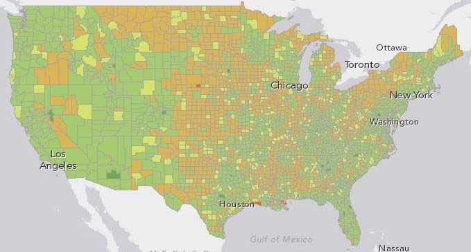
Think of GIS like this…
               …A GIS is similar, layering
               mapped information in a
               computer to help us view
               our world as a system
GIS is Unique
Multidisciplinary
Identify features
See patterns
Perform queries
Statistical Analysis
Predictive Modeling
Turn data on/off
Tell a story
Using Maps to Analyze Data Isn’t
New

Early Spatial Analysis
One of the most
famous early
examples of spatial
analysis can be
traced back to
London in the year
1854 when Dr. John
Snow was able to
predict the           Original map by John Snow showing
                      the clusters of cholera cases in the
occurrence of         London epidemic of 1854. The pump
                      is located at the intersection of Broad
cholera outbreak.     Street and Cambridge Street.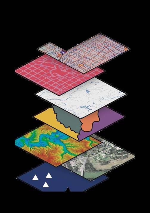
The Birth of GIS
The first modern GIS    “The Father of GIS”
“computerized
mapping system”
was created by Dr.
Roger Tomlinson
and then introduced
in the early 1960s in
Canada.

                         Dr. Roger Tomlinson
                             (1933-2014)
What Can You Do with GIS?
Map Map Where
Change Things Are
Find What’s Map
Nearby Quantities
Find
Map
What’s
Densities
InsideChances are you are already using GIS! GIS has already affected most of us in some way without us even realizing it. If you have ever used an Internet mapping program to find directions, congratulations, you’ve personally used GIS. The new supermarket chain on the corner was probably located using GIS to determine the most effective place to meet customer demand.
Top Five Benefits of GIS
                    Cost Savings &
                      Increased
                      Efficiency

     Managing                        Better Decision
   Geographically                        Making

            Better              Improved
         Recordkeeping        Communication
Cost Savings and Increased Efficiency GIS is widely used to optimize maintenance schedules and daily fleet movements. Typical implementations can result in a savings of 10 to 30 percent in operational expenses through reduction in fuel use and staff time, improved customer service, and more efficient scheduling.
Better Decision Making
GIS is the go-to technology for making better
decisions about location. Common examples
include real estate site selection,
route/corridor selection, evacuation
planning, conservation, natural resource
extraction, etc. Making correct decisions
about location is critical to the success of an
organization.
Improved Communication
GIS-based maps and visualizations greatly
assist in understanding situations and in
storytelling. They are a type of language
that improves communication between
different teams, departments, disciplines,
professional fields, organizations, and the
public.
Better Recordkeeping
Many organizations have a primary
responsibility of maintaining authoritative
records about the status and change of
geography. GIS provides a strong framework
for managing these types of records with full
transaction support and reporting tools.
Managing Geographically
GIS is becoming essential to understanding
what is happening—and what will happen—
in geographic space. Once we understand,
we can prescribe action. This new approach
to management—managing
geographically—is transforming the way that
organizations operate.
Who Uses GIS
Aid and Development Defense and Intelligence
Humanitarian Aid Military Operations
Sustainable Development Intelligence
Installations and
Business Environment
Insurance The Geospatially Enabled
Retail Enterprise
Manufacturing
Real Estate Education
Banking Libraries and Museums
Marketing Schools (K–12)
Media Universities and
Community CollegesWho Uses GIS
Government Health and Human
Federal, State, Local Services
Resilient Communities Public Health
Architecture, Engineering, Human Services
and Construction Hospital and Health
Economic Development Systems
Elections and Redistricting Managed Care
Facilities Academic Programs and
Land Administration Research
Public Works
Surveying Mapping and Charting
Urban and Regional Aeronautical
Planning Cartographic
Nautical
TopographicWho Uses GIS Natural Resources Public Safety Agriculture Emergency Call Taking and Climate Change Dispatch Conservation Emergency/Disaster Environmental Management Management Fire, Rescue, and EMS Forestry Homeland/National Security Mining Law Enforcement Oceans Wildland Fire Management Petroleum Water Resources
Who Uses GIS Transportation Utilities and Communications Aviation Electric Highways Gas Logistics Location-Based Services Railways Pipeline Ports and Maritime Telecommunications Public Transit Water/Wastewater
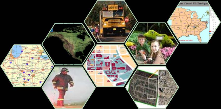
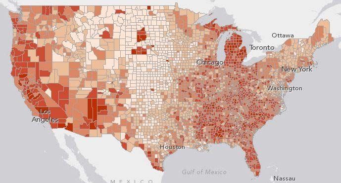
Examples of GIS Maps
Weather Prediction
Mapping
Disease
Patterns
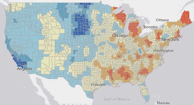
Unemployment Rate
Population Change
Relationship of Population Change to
Unemployment Rate
Crime Mapping
Election Results

 Electoral Vote, Presidential Election 2012
Questions ???
You can also read