10 Advanced Features of Google Maps for the Classroom - www.edurolearning.com - Eduro Learning
←
→
Page content transcription
If your browser does not render page correctly, please read the page content below
10 Advanced Features
   of Google Maps
  for the Classroom

      www.edurolearning.com
2 | www.edurolearning.com

10 Advanced Features of
Google Maps for the Classroom
Google Maps has been out for 14 years now. Digital maps - starting
with Mapquest have been out since 1996 (well technically 1993 but
mapquest was the first mainstream map most people remember). For
those of you keeping track that puts us almost 22 years into the digital
mapping word. We have been using digital maps for 22 years and yet,
for some reason, digital maps haven’t really changed or replaced
mapping in our schools.
In 2007 Apple put a map in our pocket. In 2018 almost everyone has
a digital map in their pocket. Pilots fly with iPads. Ship Captains
navigate with GPS and digital maps. Truck drivers drive via digital
maps and GPS location. Professionals that need to use maps are using
digital maps.
We don’t need to stop teaching students how to read a paper map
but it should be 10% of the mapping work a student does, not 99%.
In this PDF we share 10 interesting ways to use Google Maps in the
classroom.
Quick Links
            1. Latitude Longitude Scavenger Hunts
            2. Earth Picker
            3. Smarty Pins
            4. My Maps
            5. Video Tour
            6. Create a Map for Your Community
            7. Create a Route
            8. Measure Distance and Area
            9. See Your World in 3D
            10. Mobile Maps
            Continue Learning with Eduro
            Contact Us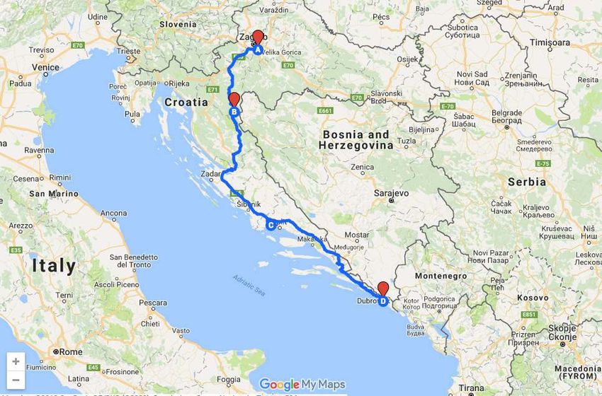
www.edurolearning.com | 3

1. Latitude Longitude Scavenger Hunts
Do you remember learning about latitude and longitude? In a paper
map world it’s a place “kind of there” where your two fingers meet. In
a digital world it’s a specific location. This allows us to do some fun
stuff and learn about latitude and longitude simultaneously.
Using google maps, ask your students:
                     What do these three places have in common?
                                  24.007233, 38.210118
                                  31.204263, 121.281686
                                 46.986944,-123.812859
Then ask your students to go to the opposite hemisphere from where
these places are and see what’s there.
In a math context, this could be looking at x y axis and how we divide
our world. In a social studies context students might be studying
landmarks. Or this might be used during English when checking out
the settings of the books students have read. In History students
might be comparing and contrasting battle sites.
In a digital mapping world latitude and longitude mean more than
where your fingers meet - it’s an exact location.

                                Bonus Blog!
                                View some great images from
                                around the world on the
                                Google Sightseeing blog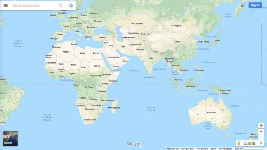
4 | www.edurolearning.com

2. Earth Picker
Fun (and addicting) Earth Picker is a great little game to start teaching
students digital mapping skills. Be warned, if you click on the link, be
prepared to say goodbye to at least the next 30 minutes of your life!
Earth Picker reminds us a bit of the classic game Carmen Sandiego.
However, in Earth Picker you need to “read an image”. This is a new
skill that we need to be teaching students as more and more of our
information becomes visual.
Ask students:
      • What do you see?
      • What clues can you find?

                            Bonus Resources!
                            Google Maps for Education
                            provides resources to help teachers
                            and students explore, create and
                            collaborate with mapping tools.

3. Smarty Pins
Smarty Pins is a Google Maps
based geography and trivia
game. The game asks you a
random trivia question about
a specific city or country, and
you’re tasked with dropping a
pin on the right spot. Players
can pick between six categories that influence the line of questions
they’re given. Although the questions are quite American-centric, it
is the questions that Google is asking and how the game works that
makes it a valuable educational tool. Once you get the hang of it, you
could create your own questions around your content area.
You could ask students to put a pin on the map where they think
a place is. Once the true place is revealed they could get driving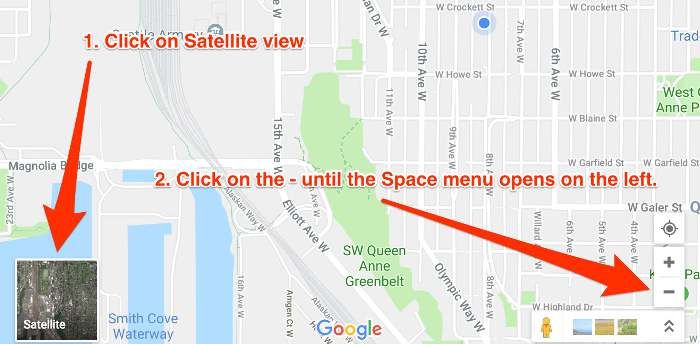
www.edurolearning.com | 5

directions to see how far they were off. This is one possible way to
integrate math. You could also have students add and keep track of
their own distances.
Other possible ideas:
   • Book settings
   • Battles in history
   • Create country trivia questions for a world language class to
      practice language skills.
For an added challenge if you really know your surroundings, try
GeoGuesser. It drops you into a random position in Street View and
requires you to identify what part of the world you’re looking 5. VUsing

                          Bonus Game!
                          Learn how to create your own game
                          with Google Maps

4. My Maps
                My Maps is quite simply amazing. It’s so amazing that
                the next six ways to use Google Maps in the classroom
                is all to do with My Maps.
                My Maps allows you to create maps - not just read
                and use them. We can all become digital map
                creators and the possibilities are endless! There are
                options to save places, driving directions, add photos
                and videos, and more. Google has also added new
                features such as the ability to share your maps with
                others, using different colors, embedding images and
                videos, adding labels and different features, and the
                functionality of using layers.
One of the things we like best about Google Maps is the ability to
create custom maps to share with others. This is a wonderful way
to document our travels as well as create an interactive database of
whatever we can think of!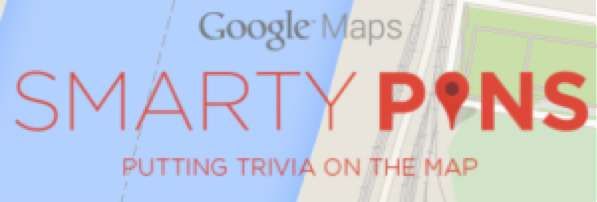
6 | www.edurolearning.com

Google Maps are a fun and visual way to help students understand
geography concepts, map reading, location, and distance
measurement.

                            Bonus Video!
                            5 Google Maps Engine
                            Project Ideas for the Classroom.

5. Video Tour

A My Maps marker allows you to add a variety of content to places
on your map. It is possible to add images and/or video to a marker
simply by clicking on the camera icon inside a placed marker.
One idea to try in Social Studies is to have students create a map
and add markers along the route of the Explorer Ferdinand Magellan.
Students could create videos, or record their voice, embed them into
a marker for others to learn about what happened at that spot on his
travels.
www.edurolearning.com | 7
You can share a map with various levels of viewing and editing access
just like you can with a Google Doc. It’s possible to have a group of
students working on a different explorer each but adding their routes
and videos to the same shared map. By working in collaboration on
one map we can start to see patterns of routes, patterns of where
explorers were going and what the explorers were trying to do.
Bonus Training!
Google Maps Help Center
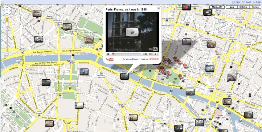
6. Create a Map for Your Community
When the earthquake struck Haiti in 2010, an interactive map was
quickly created (OpenStreetMap) recording damaged buildings and
campsites, that allowed rescue organisations from around the world
and rescue workers on the ground to more easily identify needs and
target resources.
This map was created for friends who came to visit when Jeff and his
wife lived in Shanghai, China.
Are your students studying their community, state/province or
country? They could create a map either collectively or individually of
important places to visit or stay, places to eat, places to play etc for
other people both locally and/or globally to use.
Bonus Maps!
See how others are using Google
Maps to help their communities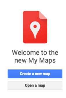
8 | www.edurolearning.com

7. Create a Route
Creating a route can involve some real-life problem-solving skills.
When traveling to Croatia Jeff and his wife had no idea about the
roads or how long they should expect to drive between destinations.
Using MyMaps, Jeff was able to create a route from hotel to hotel and
get a close approximation of the driving time required each day. You
can click the image below to see the route he created.

                            Bonus Tip!
                            Keep up with what Google is doing
                            with Maps
www.edurolearning.com | 9

8. Measure Distance and Area
In MyMaps you can calculate the distance between two or more
points on the map. For example, you can measure the mileage in a
straight line between two cities. You can also use the Google Maps
Area Calculator Tool to draw an area on a map and find out the
measurement of the enclosed area. The areas can be saved for use
later on too.

Ask your students:
   • Have you ever wonder how big Russia is?
     Then have students draw an area map around their country and
     move that area over Russia.
   • Ask them how many of your countries do you think fit in Russia?
     In China? On the continent of Africa?

                          Bonus Article!
                          Using Google Maps in math class
10 | www.edurolearning.com

9. See Your World in 3D
                      Google Earth received a major update in 2017. It’s no
                      longer a standalone app just for desktop and mobile
                      users, it can be accessed right from a browser (perfect
                      for any laptops, chromebooks and education!). The new
                      3D features are incredible! It’s better than ever and
                      changing the way we view our world.
Once you are in Google Earth check out the Voyager link under the
menu on the left. Voyager is a collection of map-based stories written
by Google Earth partners that’s updated weekly. You can see Guided
Stories, or tours, on topics like travel, culture, nature, and history.
These stories are essentially themed journeys around the planet with
media such as 360 videos, and Street View (including inside buildings
and underwater). The possibilities for student learning are endless!

                                Bonus Resource!
                                40+ Ways to Use Google Earth and
                                Maps in the classroom
www.edurolearning.com | 11
10. Mobile Maps
Google Maps is downloadable on every mobile device
(Android, iOS) as is My Maps! It is possible to create
maps and use maps on your phone, tablet, and watch.
There’s no need to have a class set of laptops when
almost every student has a phone in their pocket.
This opens up a whole new way to engage with information, create
information, and teach students the skills they’ll need for their future
in a digital mapping world!
Bonus Tips & Tricks!
26 more Google Maps tips and tricks
But Wait! There’s More ...
It is possible to visit the International Space Station and Moons and
Planets in our Solar System! This significantly changes the way we
study our universe, our moon and our solar system. Google Maps now
includes everything NASA has mapped in our own universe.
How to find it:
• Go to google.com/maps
• In the lower right hand corner click on Satellite View
• In the lower left hand corner continue click on the - button to
zoom out of earth and into space.
• Keep clicking the - button until the Space menu appears on the
left.12 | www.edurolearning.com Not so long ago these maps were found in an antique shop. It’s official - paper maps are now considered antiques. They may be around for a while yet but It would seem that the paper map’s days are numbered. Some of our students will never touch a paper map, never have to be frustrated with trying to fold it back up, never have to worry about it ripping nor worry about whether it’s up to date! It’s time for us to embrace a new digital mapping world and all it’s possibilities for our students in the classroom.
www.edurolearning.com | 13

Continue Learning with Eduro
In addition to our excellent teacher resources, resources for parents
and online courses,(including our Micro-Credentials pathways), there
are many other ways we can help you and/or your school or district.

Click on an icon to find out more

                   ONLINE COURSES
                   Practical, relevant, and engaging online
                   courses for teachers, designed by teachers.

                   MICROCREDENTIALS
                   The perfect way for teachers to demonstrate
                   their expertise and gain recognition for their
                   new skills.

                   EVENTS
                   Innovative, engaging, and practical
                   professional development events.

                   RESOURCES
                   Practical resources that can be used in the
                   classroom today!

                                     Go to Eduro Learning’s Website
14 | www.edurolearning.com
Contact Us
www.edurolearning.com
services@edurolearning.com
© Eduro Learning 2017You can also read