Coastal Change in Fingal - A Local Authority Response
←
→
Page content transcription
If your browser does not render page correctly, please read the page content below
Comhairle Contae Fhine Gall
Fingal County Council

                         Coastal Change in Fingal -
                        A Local Authority Response
                                  Kevin Halpenny
                          Senior Parks & Landscape Officer
                               Fingal County Council

                          Exchanging Knowledge and
                          Best Practice Across Borders

Fingal County Council          Planning & Strategic Infrastructure Department   fingal.ie
Comhairle Contae Fhine Gall
Fingal County Council

                         Coastal Change in Fingal -
                        A Local Authority Response

         • Fingal Coastal Liaison Group
         • Rogerstown Estuary Coastal Flooding
           and Erosion Risk Management Study
         • Coastal Communities Adapting Together (CCAT)

Fingal County Council         Planning & Strategic Infrastructure Department   fingal.ie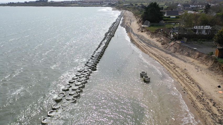

Skerries
Malahide
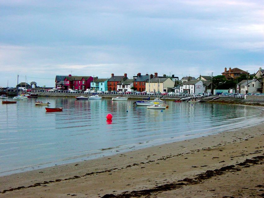
Howth

Rush

Burrow
Peninsula
Portrane
Reasons for Establishment of the
Fingal Coastal Liaison Group
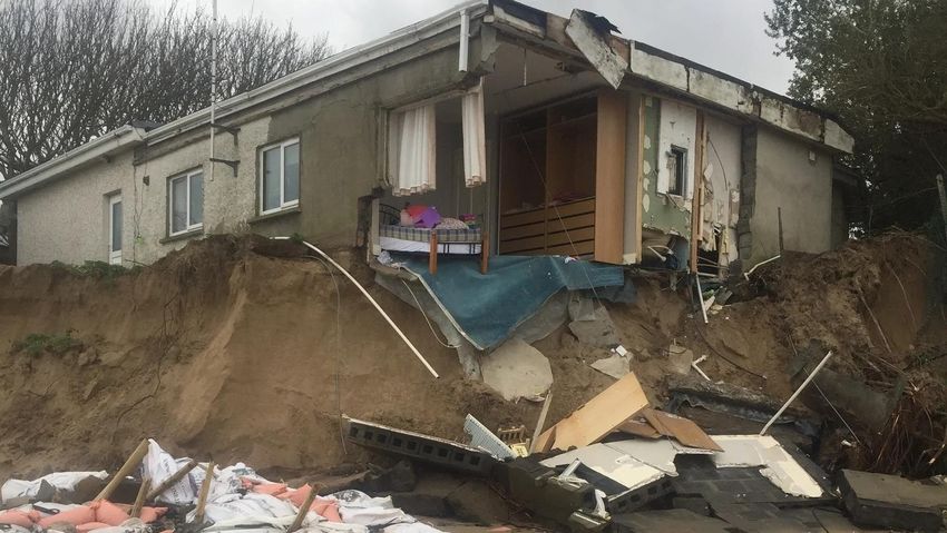
In Response to ongoing concerns in relation to Coastal
Erosion/Coastal Flooding in Fingal.
Need for Coherent Structured Response to these
concerns and improved communication between
relevant stakeholders.
To provide a Forum for Discussion on approaches to
planning for and dealing with the problems of Coastal
Erosion/Flooding .Membership of Liaison Group
County • 2 Councillors each elected from the
Councillors Swords/Balbriggan &Howth/Malahide
Areas
(4)
Residents Group • 2 Local Residents form each of the
Representatives affected areas i.e. Portrane (The Burrow),
Sutton (Claremont Strand) and Rush (South
(6) Strand).
• Planning & Strategic Infrastructure Dept:
• Senior Parks Superintendent, Heritage Officer,
Council Officials Biodiversity Officer, Administrative Officer
• Operations Department:
(6) • SEO and/or Senior Executive Engineer from each of
the affected areas.Terms of Reference for Fingal Coastal Liaison
Group March 2016
To discuss and as far as possible address any matters of concern to the
communities living in Rush, Portrane and Sutton in relation to coastal erosion
and coastal flooding in these areas.
To review and make recommendations in relation to the management of coastal
erosion and coastal flooding in Fingal.
To facilitate broader community participation in coastal, and natural
resource management through informing and liaising with member
community groups .
To foster opportunities for joint projects, information sharing and grant
funding to address issues of concern in relation to coastal management.Terms of Reference for Fingal Coastal Liaison
Group continued.
To provide best practice advice in accordance with the provisions of the
Fingal Development Plan and other relevant policy documents in the context
of integrated planning and management of the Fingal coastline.
To incorporate the latest knowledge on climate change into coastal
planning to assist the Council with the integration of adaptation strategies
into planning policies.
To review scientific advice and integrate this knowledge into the preparation
and review of coastal management plans.Rogerstown Outer Estuary Long Term Approach to Coastal Erosion and Flooding
ROGERSTOWN ESTUARY
COASTAL FLOODING AND EROSION RISK MANAGEMENT STUDY

 Consultation Event – September 2020

rpsgroup.com
The Burrow: 1 in 200 year flood event (current and HEFS erosion projections by 2100)

     Current erosion projection            HEFS erosion projection             HEFS erosion projection
     & current flood event                 & MRFS flood event                  & HEFS flood event

                                                                                       Preliminary Findings

                                                                                                              31
Shortlisted options used to develop Coastal Management Schemes for the
Rogerstown Outer Estuary – The Burrow Beach & Rush South:
Optioneering – Short listed Options
Shortlisted Options
Rock Armour Revetment Dune Management:
Seawalls - Dune Reprofiling
Embankments - Sand Trap Fencing
Fishtail Groynes Beach Renourishment
No Active Intervention Shoreline Monitoring
Managed Retreat
Limited flooding and erosion risk at Rush North
▪ Recommend No Active Intervention with Shoreline * Full description and assessment of options can be found
Monitoring Programme in the Technical Report on the consultation portal *
Study Update
32Rogerstown The Burrow
Estuary Peninsula
PortraneBurrow Peninsula To address Erosion:
Portrane ▪ T - Groynes and Beach Nourishment
1a The Burrow Option 3
To address Flooding:
1b ▪ Embankments & Sea Walls 3
1
1c T Groyne
Embankment
3
2 4
1d
2a
4
Urban Wall Beach Nourishment
Study Update
3
2b
4Areas prone to Coastal Flooding in Rush
Rush                                 1b
To address Flooding:
▪ Embankments & Sea Walls                 3a
                                                                                 1
                       1c       3b

                                               1a
            2c

                                                    2b
                                                                        Flood Wall

                                                    2a

                            3                                                   2

                                                                        Flood Gates
  Culvert

                                                         Study Update

                                                                                 3
                                                                                 6
✔
PROGRESS TO DATE
Historical Review
Flooding and Erosion
Risk Assessment
✔
Format and objectives of this
✔
Develop Management CFERM study are based on
Plans guidance developed by the Office of
Public Works
Prelim. Environmental
Assessment ✔
Consult with Authorities
✔
Consult with the Public We are here
Study Update
37Planning Timeline for Long Term Solution at Rogerstown • IROPI (Imperative Reasons of Overriding Public Interest) review – Approximately 7 weeks (i.e. delivery on / before 1st July). However, part of the review will be part-dependent on receiving information in a timely manner from various Government agencies, which is somewhat beyond our control. • EIA Scoping report – Approximately 7 weeks (i.e. delivery on / before 1st July). This may require elements from our numerical modelling assessment and refinement of the proposed option. • Numerical Assessment and Refinement of Proposed Option, including assessment of potential impact– Approximately 10 weeks (i.e. around mid July). • Preparation of Planning Report/Statement of Case/ Justification/Mitigation/Possible Compensatory Measures for submission to An Bord Pleanála in 2021
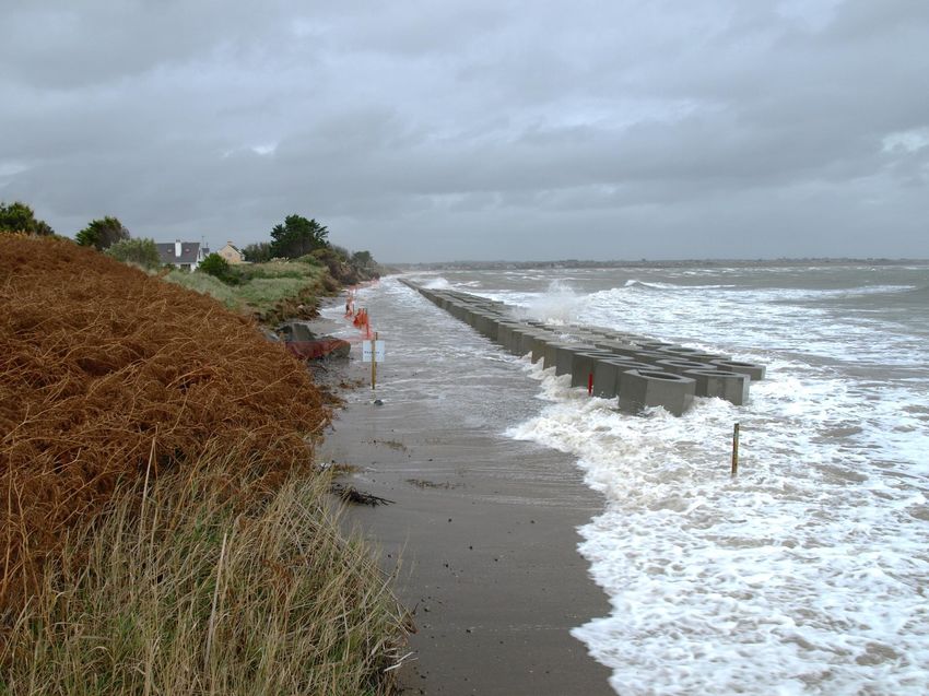
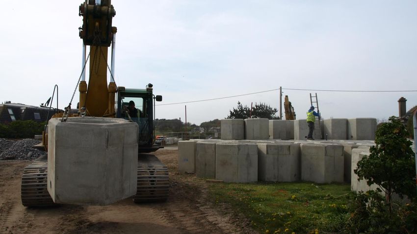
Long Term Solution at Portrane Beach
Installation of Groynes and Beach Nourishment
CCAT - Future Approach

               Policy

    Planning            Practice
Comhairle Contae Fhine Gall
Fingal County Council
Coastal Change in Fingal -
A Local Authority Response
Thank You !
Kevin Halpenny
Senior Parks & Landscape Officer
Fingal County Council
Fingal County Council Planning & Strategic Infrastructure Department fingal.ieYou can also read