Cultural Guiding - Explore The Limpopo Province - "Then the Kolokolo Bird said with a mournful cry, "go to the banks of the great, grey-green ...
←
→
Page content transcription
If your browser does not render page correctly, please read the page content below
Cultural Guiding - Explore
 The Limpopo Province

 “Then the Kolokolo Bird said with a mournful cry, "go to the banks of
 the great, grey-green greasy Limpopo River, all set about with fever-
 trees, and find out.” - Rudyard Kipling, The Elephant's Child
2
                       – WildlifeCampus Cultural Guiding Course – Limpopo

Module # 1 – Province Overview

Component # 1 – Limpopo Province Overview

Module # 2 – Cultural Overview

Component # 1 – Limpopo Cultural Overview

Module # 3 – Historical Overview

Component # 1 – Limpopo Historical Overview

Module # 4 – Wildlife and Nature Conservation Overview

Component # 1 – Limpopo Wildlife and Nature Conservation Overview

Module # 5 – The Waterberg District

Component # 1 – Explore The Waterberg District

Module # 6 – The Capricorn District

Component # 1 – Explore The Capricorn District

Module # 7 – The Mopani District

Component # 1 – Explore The Mopani District

Module # 8 – The Vhembe District

Component # 1 – Explore The Vhembe District

Module # 9 – The Sekhukhune District

Component # 1 – Explore The Sekhukhune District

Limpopo Province Overview
This course material is the copyrighted intellectual property of WildlifeCampus. It may not be copied, distributed or
reproduced in any format whatsoever without the express written permission of WildlifeCampus.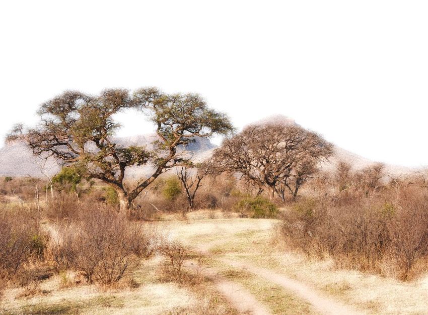
3
                       – WildlifeCampus Cultural Guiding Course – Limpopo

Module 1 - Component 1

           Limpopo Province Overview
Limpopo is the most northern province of South Africa. It is sometimes described as the
“Golden Horseshoe”, which refers to the huge arc of unspoiled natural countryside.
Limpopo is the gateway to the rest of Africa. A unique feature of this province is that it
shares international borders with three countries: Botswana, Zimbabwe and
Mozambique, as well as the provinces of Mpumalanga, Gauteng and North West. In
1994, the province was formed from the northern region of the Transvaal, and initially
named Northern Transvaal. The following year, it was renamed Northern Province, which
remained the name until June 2003, when the name was formally changed to Limpopo.
The name is a tribute to the province’s most important river, the Limpopo, located on the
borders of Botswana and Zimbabwe. The name “Limpopo” is derived from the Nguni
word, “iLimpopo” meaning “rapids” or “waterfalls”.

Limpopo Province Overview
This course material is the copyrighted intellectual property of WildlifeCampus. It may not be copied, distributed or
reproduced in any format whatsoever without the express written permission of WildlifeCampus.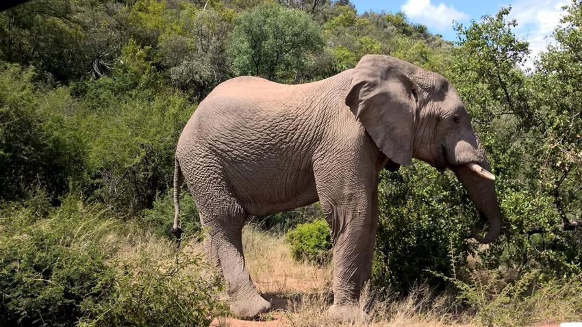
4
                       – WildlifeCampus Cultural Guiding Course – Limpopo

According to legend, the name was given by the fleeing army of Mzilikazi on their way
to Bulawayo. This referred to the sound of the running water over the rocks where they
crossed over to Zimbabwe, somewhere close to the confluence of the Limpopo and
Sashe Rivers and Mapungubwe. Limpopo consists of mainly rural communities,
comprising several ethnic groups that are distinct in their cultures. The largest group are
the Northern Sotho (Bapedi) accounting for more than half the population in Limpopo.
They are followed by the VaTsongaand VhaVenda. The Afrikaans community only
accounts for a small percentage. Home to two World Heritage Sites, Mapungubwe and
Makapan’s Valley (annexe to the Cradle of Humankind, Gauteng) and the renowned
Kruger National Park. It is also the land of the Rain Queen, Modjadji and the sacred
Funduzi lake. Truly, a legendary place and distinctly Africa.

Limpopo is divided into five regions, strategically located according to the cultural
inhabitants. Capricorn is the central region predominantly occupied by the Bapedi
people. Waterberg is the largest region in the province with the majority of people being
the Batswana people. The Vhembe region in the far north is dominated by VhaVenda
and Vatsonga people. The Mopani region towards the Kruger National Park is dominated
by Vatsonga, whereas the Sekhukhune region is dominated by Bapedi and Ndebele
people.

Limpopo Province Overview
This course material is the copyrighted intellectual property of WildlifeCampus. It may not be copied, distributed or
reproduced in any format whatsoever without the express written permission of WildlifeCampus.
5
                       – WildlifeCampus Cultural Guiding Course – Limpopo

Location of The Limpopo Province in South Africa

Limpopo Province Overview
This course material is the copyrighted intellectual property of WildlifeCampus. It may not be copied, distributed or
reproduced in any format whatsoever without the express written permission of WildlifeCampus.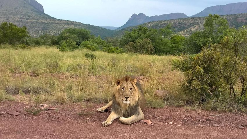
6
                       – WildlifeCampus Cultural Guiding Course – Limpopo

Municipal map of the Province

                                 Image source: www.municipalities.co.za

Limpopo Province Overview
This course material is the copyrighted intellectual property of WildlifeCampus. It may not be copied, distributed or
reproduced in any format whatsoever without the express written permission of WildlifeCampus.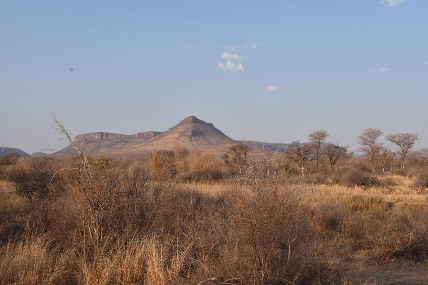
7
                       – WildlifeCampus Cultural Guiding Course – Limpopo

Coat of Arms

                                    Motto: “Peace, Unity and Prosperity”

The colours of the Coat of Arms are green, golden yellow, red, white and black.

     The Buffalo: Presents unity, strength and political stability.
     The Shield: The government’s commitment to protecting human rights.
     The Baobab: These magnificent trees, found in the northern parts of the province,
     have been around for hundreds of years, providing food, healing and shelter. It
     symbolises the strength and steadfastness of the people.
     Mountain ranges in the shield: Depicts the mountains and rich agricultural lands.
     The coronet (small crown) with cycads leaves: Depicts royalty and encourages the
     continuation of traditional leadership, just as the endangered Cycads are preserved.

Limpopo Province Overview
This course material is the copyrighted intellectual property of WildlifeCampus. It may not be copied, distributed or
reproduced in any format whatsoever without the express written permission of WildlifeCampus.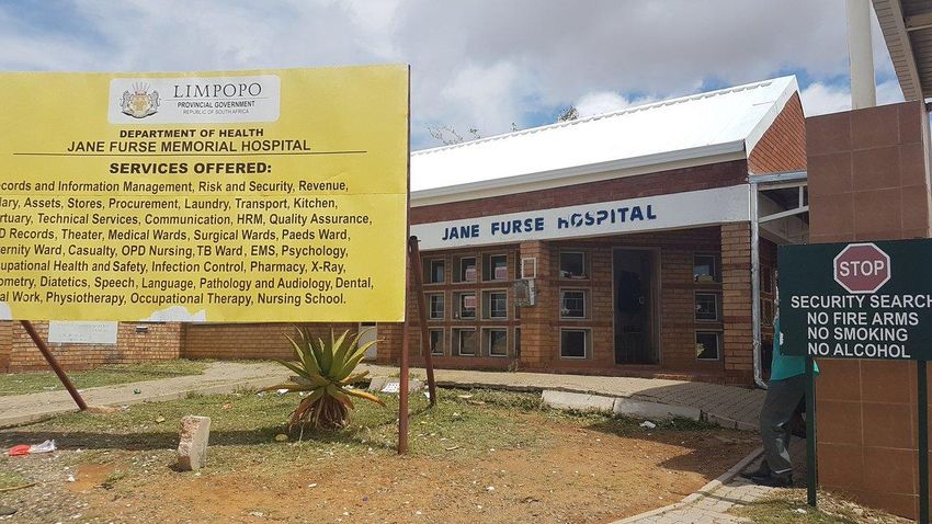
8
                       – WildlifeCampus Cultural Guiding Course – Limpopo

Demographics

             Land surface area                      Total:             125,754km2 (48,554 sq. mi)
                                                    Area rank:         5th in South Africa

             Highest elevation                      2,126m (6,975 ft)

                                                     Total (2011)           5,404,868
                                                     Estimate (2018)        5,797,300
                  Population                         Rank                   5th in South Africa
                                                     Density                43/km2 (110/sq. mi)
                                                     Density rank           5th in South Africa

                                                     Northern Sotho               52.9%
                                                     Tsonga                       17.0%
                 Languages                           Venda                        16.7%
                                                     Afrikaans                     2.6%
                                                     Tswana                        2.0%
                                                     Southern Ndebele              2.0%

                                                    Black African         96.7%
                     Races                          White                 2.6%
                                                    Indian or Asian       0.3%
                                                    Coloured              0.3%

                    Capital                         Polokwane

                 Largest city                       Polokwane

                                                    The current Premier (2020) of Limpopo Province is
                    Premier                         Stanley Mathabatha, representing the African
                                                    National Congress.

* The last census was held in 2011, the next will be in 2021 – statistics included in the
Cultural Guiding Series are based on the 2011 census and will be updated once the 2021
census results are released.

Limpopo Province Overview
This course material is the copyrighted intellectual property of WildlifeCampus. It may not be copied, distributed or
reproduced in any format whatsoever without the express written permission of WildlifeCampus.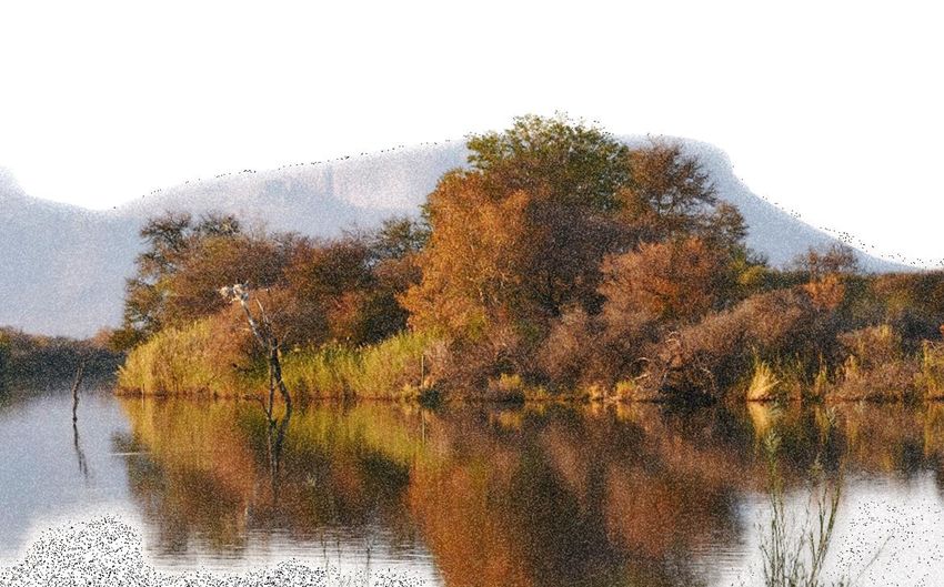
9
                       – WildlifeCampus Cultural Guiding Course – Limpopo

Municipalities and Districts
During apartheid, the administrations of Lebowa, Gazankulu, Venda and the Transvaal
were created. Today, Limpopo Province is divided into five municipal districts, subdivided
into 25 local municipalities:

Capricorn District

The name "Capricorn" is derived from the tropic of Capricorn (southern tropic). The tropic
of Capricorn lies 23 o 26' 22'' south of the Equator. It marks the most southerly latitude at
which the sun can appear directly overhead at noon when the southern hemisphere is
tilted towards the sun to its maximum extent in December. This region stretches from the
Ysterberg, all along the foothills of the Wolkberg, to the tropic of Capricorn in the north.

     Blouberg
     Lepele-Nkumpi
     Molemole
     Polokwane

Mopani District

The name is derived from the local Mopane tree, growing in abundance in the region.
The district inherited the Maruleng Local Municipality (Hoedspruit) in March 2006. It was
previously part of the Bohlabela District Municipality that has since been dissolved.
Maruleng means “place of the Marula”.

     Ba-Phalaborwa
     Greater Giyani
     Greater Letaba
     Greater Tzaneen
     Maruleng

Limpopo Province Overview
This course material is the copyrighted intellectual property of WildlifeCampus. It may not be copied, distributed or
reproduced in any format whatsoever without the express written permission of WildlifeCampus.
10
                       – WildlifeCampus Cultural Guiding Course – Limpopo

Sekhukhune District

The region is named after Sekhukhune, King of the Maroteng (commonly known as the
Bapedi) in Sekhukhuneland during the 19th century. Sekhukhune used to be a cross-
border municipality between Limpopo and Mpumalanga Province, but on 27 December
2005, was incorporated into the Limpopo Province in accordance with proclamation No.
422.

     Elias Motsoaledi
     Ephraim Mogale
     Fetakgomo/Greater Tubatse
     Makhuduthamaga

Vhembe District

“Vhembe”, meaning “the receiver”, is the Venda word for Limpopo. The Nzhelele River
(“the giver”) flows into this major river. The district is sometimes referred to as “the land of
legend”, so-called for its rich indigenous cultural heritage.

     Makhado (Louis Trichardt)
     Musina (Messina)
     Collins Chabane
     Thulamela

Waterberg District

The Waterberg is the main feature and tourist attraction in this region. The name was
given by the Voortrekkers when they first arrived in the area in the 1930s. It refers to the
numerous streams running down its slopes.

     Bela-Bela
     Lephalale
     Modimolle/Mookgopong
     Mogalakwena
     Thabazimbi

Limpopo Province Overview
This course material is the copyrighted intellectual property of WildlifeCampus. It may not be copied, distributed or
reproduced in any format whatsoever without the express written permission of WildlifeCampus.
11
– WildlifeCampus Cultural Guiding Course – Limpopo
Cities and Towns
*Names in brackets are previous town names
Afguns
Alldays
Bandelierkop
Ba-Phalaborwa (Phalaborwa)
Bela-Bela (Warmbaths)
Bosbokrand
Elim
Gravelotte
Haenertsburg
Hoedspruit
Klaserie
Lebowakgomo
Lephalale (Ellisras)
Letsitele
Leydsdorp
Makhado (Louis Trichardt)
Modimolle (Nylstroom)
Modjadjiskloof (Duiwelskloof)
Mogwadi (Dendron)
Mokopane (Potgietersrus)
Mookgophong (Naboomspruit)
Musina (Messina)
Ofcolaco
Polokwane (Pietersburg)
Roedtan
Sekgopo
Senwabarwana (Bochum)
Seshego
Thabazimbi
Thohoyandou
Tzaneen
Vaalwater
Vivo
Zebedeila
Zion City Moria
Limpopo Province Overview
This course material is the copyrighted intellectual property of WildlifeCampus. It may not be copied, distributed or
reproduced in any format whatsoever without the express written permission of WildlifeCampus.12
– WildlifeCampus Cultural Guiding Course – Limpopo
Geographical features of the landscape
The main rivers
The Limpopo river originates near Johannesburg at the Braamfontein Spruit and
Crocodile Rivers, before joining the Pienaar’s Rivier after Hartbeespoort Dam. It follows a
course of approximately 1, 600km before flowing into the Indian Ocean at Xai-Xai in
Mozambique. The subcontinental tilt of the Angolan highlands, millions of years ago,
diverted much of the water from what used to be one of the mightiest rivers in Africa, to
the Okavango and Zambezi Deltas.
The major rivers flowing into the Limpopo (Vhembe) River
The major rivers feeding it in the north, include the Sand, Nzhelele (“the giver”), Nwanedi
and the Luvuvhu Rivers.
The western region is drained by the north-flowing rivers:
Crocodile
Matlabas
Mogalakwena
Mokolo
Palala
The eastern regions are drained by the Olifants and Great Letaba rivers, as well as their
tributaries.
Limpopo Province Overview
This course material is the copyrighted intellectual property of WildlifeCampus. It may not be copied, distributed or
reproduced in any format whatsoever without the express written permission of WildlifeCampus.13
– WildlifeCampus Cultural Guiding Course – Limpopo
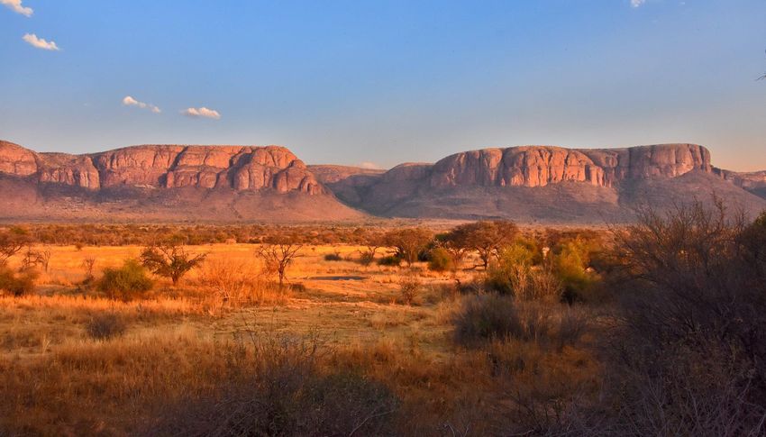
The main mountain ranges
Drakensberg Escarpment
The “Dragon mountains” or “Mountain of Spears” (Ukhakhlamba) as it is known in Zulu,
forms the eastern border of the Bushveld. It starts in the vicinity of Tzaneen and includes
the Wolkberg. The Strydpoort Mountains is a western spur of the Drakensberg, running
towards Mokopane (Potgietersrus). It is believed that the two Voortrekker leaders, Hans
van Rensburg and Louis Trichardt had some differences here. Ever since they moved
through the defile (“poort”) in these mountains in 1836, it has been known as “strydpoort”
(“defile of conflict or struggle”).
Waterberg
The Waterberg stretches from Thabazimbi to Mokopane (Potgietersrus). The average
elevation is 600m. Some peaks exceed 1, 400m.
Marakele National Park
Limpopo Province Overview
This course material is the copyrighted intellectual property of WildlifeCampus. It may not be copied, distributed or
reproduced in any format whatsoever without the express written permission of WildlifeCampus.14
– WildlifeCampus Cultural Guiding Course – Limpopo
Soutpansberg
The Soutpansberg is the most northern mountain range in South Africa. Situated to the
north of Makhado (Louis Trichardt), at the foot of the Soutpansberg.
Lebombo Mountains
Springbok Flats
An extensive, featureless plain that is part of the Bushveld. It stretches on either side of the
Pretoria-Zimbabwe railway.
Northern boundary: Strydpoort mountain
Western boundary: Waterberg Range
Eastern boundary: Olifants River
The Springbok Flats forms the border between the Kruger National Park and
Mozambique. The name was derived from the fact that in the 18 th and 19th centuries,
thousands of springbok roamed these parts. The average altitude is 1, 000m. The average
annual rainfall is 620mm.
Marakele National Park
Limpopo Province Overview
This course material is the copyrighted intellectual property of WildlifeCampus. It may not be copied, distributed or
reproduced in any format whatsoever without the express written permission of WildlifeCampus.15
– WildlifeCampus Cultural Guiding Course – Limpopo
Routes
The “Great North” road or "Cape to Cairo” road.
The most important route is the N1, also known as “the Great North”, road or "Cape to
Cairo". It more or less cuts through the middle of the province, passing most of the
important towns until it reaches the Zimbabwean border at Beit Bridge. Almost any route
in Limpopo will take you through unspoilt bushveld scenery.
Scenic and adventure driving
The R71 from Polokwane to Tzaneen on route to the Kruger Park (Phalaborwa gate) is one
of the country’s most spectacular scenic drives. Arriving from Mpumalanga via the JG
Tunnel provides spectacular views of the Valley of the Elephant.
Lions typically spend 20 - 21 hours a day resting. To see lions doing anything
other than conserving energy requires luck or persistence.
Limpopo Province Overview
This course material is the copyrighted intellectual property of WildlifeCampus. It may not be copied, distributed or
reproduced in any format whatsoever without the express written permission of WildlifeCampus.16
– WildlifeCampus Cultural Guiding Course – Limpopo
The Ivory Route
The ivory hunters and gold traders who roamed these areas in the past, inspired the Ivory
Route. It offers a real experience of the African Wilderness, encompassing about
3.6million acres of game farms, nature reserves and national parks across Limpopo. The
roads also cross all major mountains in the province, and some areas would require an
off-road vehicle (4x4). Good sightings of lions and leopards are possible in the Manyeleti
Game Reserve, while the Letaba Ranch has vast numbers of elephant and buffalo. Some
cultural highlights on route include the “kraal” (homestead) of the Modjadji, the Rain
Queen, San Rock Art and the Iron Age sites at Thulamela and Mapungubwe.
Mapungubwe was declared a World Heritage Site, along with the Caves in the
Makapan’s Valley, taking the visitor back to the Early Stone Age. Several tented bush
camps offer accommodation on this route.
The Ribolla Open African Route
The primary areas of Thohoyandou, Makhado (Louis Trichardt) and Giyani are covered
by the route. It focuses on arts and crafts offered by the province, including famous artists
such as Noria Mabasa, Jackson Hlungwane, Phineas Masuvhelele and Sarah Munyai.
Traditional VaTsonga/Shangaan and VaVenda culture can be experienced here.
Elephants have more environmental impact than any mammal but man. The
beneficial effects (trails, wells, bringing food within reach of sma ller browsers)
are overshadowed by their destruction of trees, which has been spectacular in
many African parks.
Limpopo Province Overview
This course material is the copyrighted intellectual property of WildlifeCampus. It may not be copied, distributed or
reproduced in any format whatsoever without the express written permission of WildlifeCampus.17
– WildlifeCampus Cultural Guiding Course – Limpopo
Climate
The province falls within a summer-rainfall region (October to March) and thunderstorms
in the afternoon are common. The eastern and northern parts are subtropical, with humid
and hot summers. Polokwane (previously Pietersburg), lies more or less in the middle of
the province and therefore, except for the eastern region, give a good reflection of the
province’s temperatures. The average temperatures in summer are around 27°C. In
winter (May to September), the nights are cold and mostly frost-free, with chilly mornings
and dry, sunny days. The Lowveld (eastern parts) can get very hot. Towns such as Ba-
Phalaborwa (Phalaborwa) can reach up to 45°C, but temperatures in the Kruger Park
itself are usually around 30°C. Frequent mist occurs in the mountainous areas
(Haernertsburg and Magoebaskloof area).
Limpopo Sunset. Image: Andrew Russell
Limpopo Province Overview
This course material is the copyrighted intellectual property of WildlifeCampus. It may not be copied, distributed or
reproduced in any format whatsoever without the express written permission of WildlifeCampus.18
– WildlifeCampus Cultural Guiding Course – Limpopo
Economy
The province is a typical developing area, exporting primary products and importing
manufactured goods and services. It is also one of the poorest regions of South Africa
with a big gap between poor and rich residents, especially in rural areas. It boasts some
of the greatest reserves of agriculture, mineral and tourism resources many of which
remain hugely under-exploited.
Image: Andrew Russell
Limpopo Province Overview
This course material is the copyrighted intellectual property of WildlifeCampus. It may not be copied, distributed or
reproduced in any format whatsoever without the express written permission of WildlifeCampus.19
– WildlifeCampus Cultural Guiding Course – Limpopo
Agriculture
Many rural people still practice subsistence farming (most of the produce is consumed
by the farmer, leaving little to sell or trade). Cattle ranching flourishes in the bushveld
region and is often combined with controlled hunting. Most of the hunting in South Africa
takes place in this province. In terms of agriculture, Limpopo could be described as the
“garden of South Africa” with its rich fruit and vegetable production. Other products
include coffee, nuts, guavas, sisal, cotton, sunflower, maize, wheat and tobacco and
timber (more than 170 plantations). Grapes are also successfully cultivated in the
Modimolle district. ZZ2 Natuur Boerdery is the largest tomato farm in South Africa and lies
between Tzaneen and Makhado (Louis Trichardt).
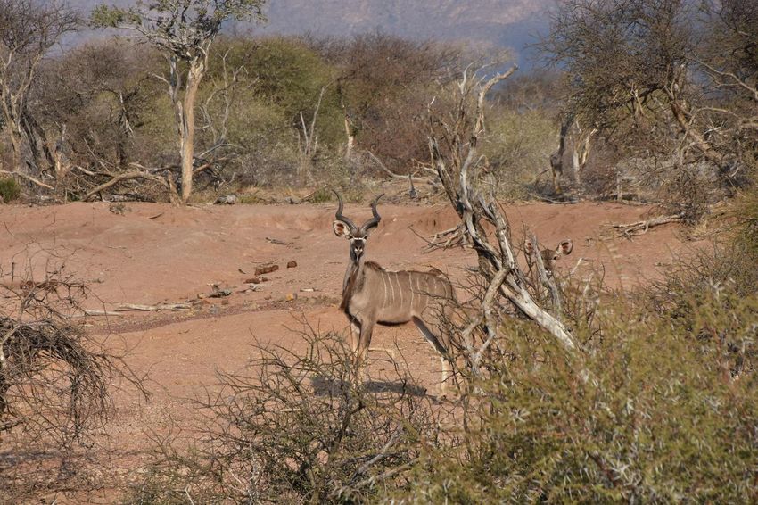
During flight, the Kudu can jump over and easily clear obstacles up to 2½ m
high.
Limpopo Province Overview
This course material is the copyrighted intellectual property of WildlifeCampus. It may not be copied, distributed or
reproduced in any format whatsoever without the express written permission of WildlifeCampus.20
– WildlifeCampus Cultural Guiding Course – Limpopo
Mining
The mining sector is also of great importance in the province and employs about 88, 000
people in Limpopo (Stats SA 2018). As can be expected, mining contributes the biggest
share in Mopani, Waterberg, and Sekhukhune, while in Vhembe and Capricorn,
community services are the biggest sector.
An abundance of minerals occur here:
Antimony
Chromium
Coal (high and middle grade)
Copper
Diamonds
Emeralds (the only mine in South Africa is found at Gravelotte)
Gold
Iron-ore
Magnetite
Mica
Phosphate
Platinum-group metals (PGM)
Silicon
Vermiculate
The follow base commodities are also present:
Black granite
Corundum
Feldspar
Limpopo Province Overview
This course material is the copyrighted intellectual property of WildlifeCampus. It may not be copied, distributed or
reproduced in any format whatsoever without the express written permission of WildlifeCampus.21
– WildlifeCampus Cultural Guiding Course – Limpopo
Infrastructure
Transport
The province is linked to the Maputo Development Corridor through Phalaborwa Spatial
Development Initiative, which consists of a network of road and rail corridors connecting
to the major seaports. This enhances trading and investment opportunities in the
Province. The major airport in the province is Polokwane International Airport. The
International Airport falls under the administration of Gateway Airport Authority Limited
(GAAL) and is the most north international point of entry to the Republic of South Africa.
R76million was spent by the Limpopo Department of Roads and Transport, to upgrade
airport facilities for the 2010 Fifa Soccer World Cup. The money was used to upgrade the
airports at Giyani and Thohoyandou, as well as the one at Polokwane. Two other major
airports are also used, one at Ba-Phalaborwa (Phalaborwa) and the other at Hoedspruit.
Limpopo Province Overview
This course material is the copyrighted intellectual property of WildlifeCampus. It may not be copied, distributed or
reproduced in any format whatsoever without the express written permission of WildlifeCampus.22
– WildlifeCampus Cultural Guiding Course – Limpopo
Education and schools
The Department of Education is charged with the responsibility of effecting quality
education and training for all. In 1994, the national classroom backlog stood at 65, 000.
70 schools for children studying under trees and storm-damaged schools had been
completed. 2, 500 schools had been declared no-fee schools (meaning, that children
who cannot afford it, does not need to pay school fees). The schools also received R319
per-learner per annum (excluding learner support material). 1.14million learners
benefited from the national school nutrition programme in the province. 8, 651 temporary
teachers were appointed permanently by the Department of Education. 7, 000 teachers
were trained on the national curriculum statement.
After 1994 the Government introduced two programmes that are aimed at reducing the
direct costs of education for poor families:
The fee exemption policy - No fee schools
In 2008, two years after the introduction of the ‘’No fee’’ school policy, approximately
1million learners and 2, 832 schools in Limpopo benefited (OECD 2008). By 2013, more
than 97% of the schools in Limpopo were classified as “no fee” schools to the benefit of
more than 96% of the learners in the province (Motshekga 2013).
Educational institutions:
Capricorn College for TVET (Polokwane)
Lephalale TVET College (Lephalale)
Letaba TVET College (Tzaneen)
Mopani South East TVET College (Phalaborwa)
Sekhukhune TVET College (Motetema)
University of Limpopo (Polokwane, Ga-Rankuwa)
University of Venda (Thohoyandou)
Vhembe TVET College (Venda)
Waterberg TVET College (Mokopane)
Limpopo Province Overview
This course material is the copyrighted intellectual property of WildlifeCampus. It may not be copied, distributed or
reproduced in any format whatsoever without the express written permission of WildlifeCampus.23
– WildlifeCampus Cultural Guiding Course – Limpopo
Health care
The revitalisation of the Lebowakgomo, Jane Furse, Nkhensani and Dilokong hospitals
had been completed. (The total number of provincial hospitals is currently 42). The
Department of Health purchased 100 ambulances, 12 paramedic response vehicles, 20
scene management and 10 rescue vehicles as well as six multiple patient carriers. 914
emergency care practitioners were appointed by the Department of health. The number
of people who got access to HIV and AIDS treatment increased more than six times over
the MTEF period from 1, 453 in 2004 to 8, 907 in 2006.
Jane Furse Hospital
Limpopo Province Overview
This course material is the copyrighted intellectual property of WildlifeCampus. It may not be copied, distributed or
reproduced in any format whatsoever without the express written permission of WildlifeCampus.You can also read