John Paul Landing Reservoir - 2019 Fisheries Management Survey Report
←
→
Page content transcription
If your browser does not render page correctly, please read the page content below
John Paul Landing Reservoir
2019 Fisheries Management Survey Report
                       PERFORMANCE REPORT

                             As Required by

          FEDERAL AID IN SPORT FISH RESTORATION ACT

                                 TEXAS

                  FEDERAL AID PROJECT F-221-M-4

INLAND FISHERIES DIVISION MONITORING AND MANAGEMENT PROGRAM

                              Prepared by:
      Niki Ragan-Harbison, Assistant District Management Supervisor
                                     and
                Alice Best District Management Supervisor

                         Inland Fisheries Division
             College Station – Houston District, Snook, Texas

                              Carter Smith
                            Executive Director

                              Craig Bonds
                        Director, Inland Fisheries

                              July 31, 2020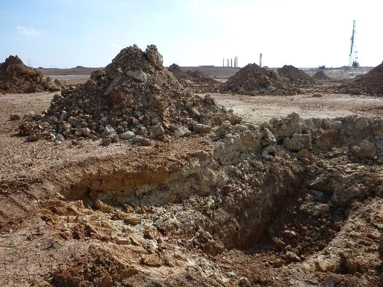
i

                                                                     Contents
Contents ......................................................................................................................................................... i
Survey and Management Summary ............................................................................................................. 2
Introduction.................................................................................................................................................... 3
   Reservoir Description ................................................................................................................................ 3
   Angler Access ............................................................................................................................................ 3
   Management History ................................................................................................................................. 3
Methods......................................................................................................................................................... 4
Results and Discussion ................................................................................................................................. 4
Fisheries Management Plan for John Paul Landing Reservoir, Texas ......................................................... 5
Objective-Based Sampling Plan and Schedule (2020–2024) ....................................................................... 6
Literature Cited .............................................................................................................................................. 8
Tables and Figures ....................................................................................................................................... 9
   Reservoir Characteristics .......................................................................................................................... 9
   Harvest Regulations .................................................................................................................................. 9
   Stocking History ....................................................................................................................................... 10
   Objective-Based Sampling Plan for 2019-2020 ...................................................................................... 11
   Structural Habitat Survey......................................................................................................................... 12
   Aquatic Vegetation Survey ...................................................................................................................... 12
   Gizzard Shad ........................................................................................................................................... 13
   Bluegill ..................................................................................................................................................... 14
   Longear Sunfish ...................................................................................................................................... 15
   Channel Catfish ....................................................................................................................................... 16
   Largemouth Bass .................................................................................................................................... 18
   White Crappie .......................................................................................................................................... 19
   Proposed Sampling Schedule ................................................................................................................. 21
APPENDIX A – Catch rates for all species from all gear types .................................................................. 22
APPENDIX B – Map of sampling locations ................................................................................................. 23
APPENDIX C – Engineering schematic of total (future) reservoir area ...................................................... 24
APPENDIX D – Examples of habitat types and amenities ......................................................................... 25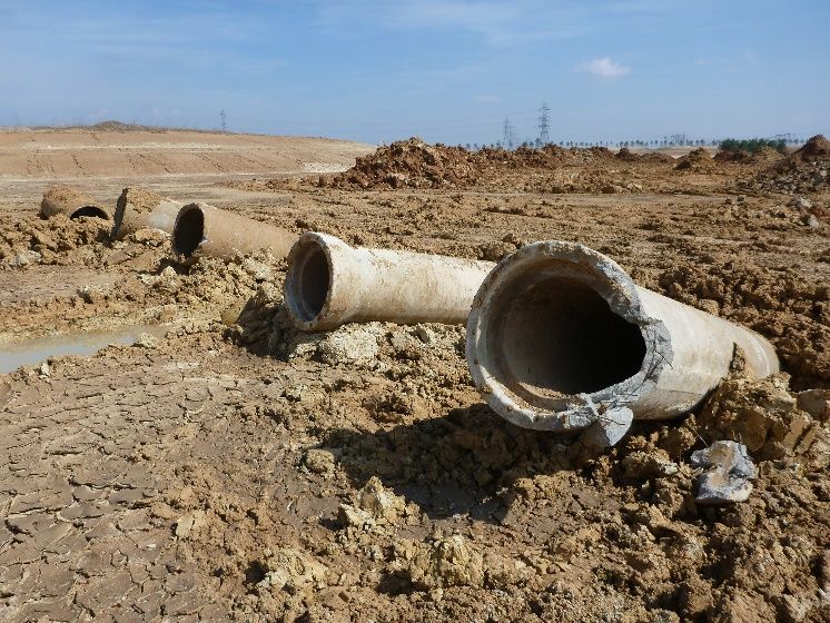
Survey and Management Summary
Fish populations in John Paul Landing Reservoir were surveyed in 2019 using electrofishing and in 2020
using electrofishing and tandem hoop netting. Historical data are not available for comparison. This
report summarizes the results of the surveys and contains a management plan for the reservoir based on
those findings.
Reservoir Description: John Paul Landing Reservoir is currently a 176-acre impoundment located
between the headwaters of Bear, Cypress, and Langham Creeks approximately 6.8 miles north of Katy,
Texas. Water level has been within 2 feet of spillway elevation since the initial section filled in 2016.
John Paul Landing Reservoir will eventually contain 450 surface acres once construction is complete.
Habitat features consisted of standing timber, submerged timber piles, rock and concrete rip rap piles, a
highly contoured bottom surface, native submerged and emergent aquatic plants, and alligator weed.
Management History: Important sport fish include Largemouth Bass, White Crappie, and Channel
Catfish. Initial stockings of Bluegill occurred in 2016 and 2017. Florida Largemouth Bass and Channel
Catfish have been stocked annually since 2016. All sport fish have been managed under statewide
regulations since the lake opened to the public in April 2018. Recent efforts to minimize erosion issues
along banks have included placing riprap along highly eroded areas.
Fish Community

    •   Prey species: Threadfin Shad were present in the reservoir. While electrofishing catch rate of
        Gizzard Shad was low, most were available as prey to larger sport fish. Electrofishing catch rates
        of Bluegill and Longear Sunfish were low, dominated by small individuals under 4-inches in
        length.
    •   Catfishes: Channel Catfish were abundant with legal-size fish available to anglers. Body
        condition of Channel Catfish was fair.
    •   Largemouth Bass: Largemouth Bass were present in the reservoir, but sampling efforts
        produced few small individuals.
    •   White Crappie: White Crappie were abundant with legal-size fish available to anglers. Most
        crappie reached legal size (10 inches) within three years.

Management Strategies: Inform the public about the negative impacts of aquatic invasive species.
Conduct general monitoring surveys with electrofishing and hoop net surveys in 2023-2024. Access and
full vegetation surveys will be conducted in 2023-2024. Vegetation surveys assessing invasive species
will be conducted yearly.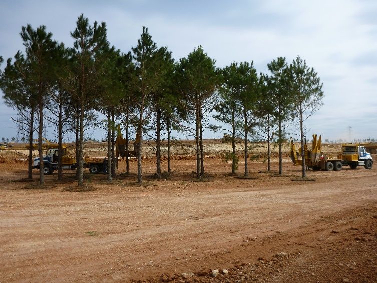
Introduction
This document is a summary of fisheries data collected from John Paul Landing Reservoir in 2019-2020.
The purpose of the document is to provide fisheries information and make management
recommendations to protect and improve the sport fishery. While information on other fishes was
collected, this report deals primarily with major sport fishes and important prey species. Historical data
are not available for comparison.
Reservoir Description
John Paul Landing Reservoir is currently a 176-acre impoundment that opened to the public in 2018.
Construction began in 2012 as local developments needed fill dirt for their construction sites and has
progressed in phases as new developments arise and contract with Harris County Precinct 3 (HCP3) for
their fill-dirt needs. Construction will continue in phases until the waterbody reaches its full size of
approximately 450-acres. John Paul Landing Reservoir is located approximately 6.8 miles north of Katy,
Texas and is operated and controlled by Harris County Precinct 3. Primary water uses include storm
water retention and recreation. Water depth increases quickly from shore and reaches 15-20 feet within
casting distance of the shoreline. The reservoir has a maximum depth of 30 feet in various locations due
to artificial creek channels. Habitat at time of sampling consisted of standing timber, submerged timber
piles, rock and concrete rip rap piles, a highly contoured bottom surface, native submerged and emergent
aquatic plants, and alligator weed. Native aquatic plants included bulrush, spike rush, pickerel weed,
Illinois pondweed, smartweed, and multiple sedges. Alligator weed, a non-native, has been observed in
the connecting drainage ditch on the north end of the reservoir and in patches along the northeastern
shoreline, but does not seem to be spreading. Water level has been within 2 feet of spillway elevation
since the initial section filled in 2016, except for a brief period of flooding after Hurricane Harvey in 2017
where debris and construction downstream prevented flood waters from draining properly. Other
descriptive characteristics for John Paul Landing Reservoir are in Table 1.
Angler Access
John Paul Landing Reservoir currently has no boat ramps. Shoreline access is good around the full
perimeter of the reservoir except for within existing construction areas. There are 3 covered fishing piers
on a peninsula on the south bank, as well as multiple walking bridges over deeper channels between
reservoir sections. A fourth pier is dedicated to a fish cleaning station with four cleaning tables and
running water; however, fishing is not allowed from this pier.
Management History
Previous management strategies and actions: John Paul Landing Reservoir was opened to the public
in 2018. No prior assessments have been conducted by TPWD.
Harvest regulation history: The reservoir is currently managed under statewide regulations (Table 2).
Stocking history: John Paul Landing Reservoir has been stocked annually with Florida Largemouth
Bass and 9” Channel Catfish since 2016. A full stocking record can be found in Table 3.
Vegetation/habitat management history: As HCP3 digs each new section of reservoir, riprap piles, log
piles, concrete culverts, and other hard structure are added to the bottom as near shore as possible.
Artificial channels, dips, and humps are also created along the bottom of each new section prior to filling.
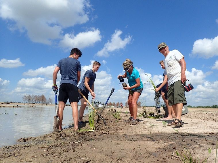
Native vegetation was planted on one of the islands at John Paul Landing Reservoir in August 2017.
Shortly thereafter, Hurricane Harvey flooded the reservoir and water levels remained high for months,
negating previous planting efforts. Current native plants are thought to originate from upstream drainage
canals or from planting efforts that were scattered during stormwater rises. The Magnolia West Anglers
Club (Friends of Reservoirs Chapter for John Paul Landing Reservoir) installed several Mossback
Artificial Fish Habitat structures around the fishing piers in April 2018.
Water transfer: John Paul Landing Reservoir is primarily used for recreation and flood control. No
interbasin transfers are known to exist.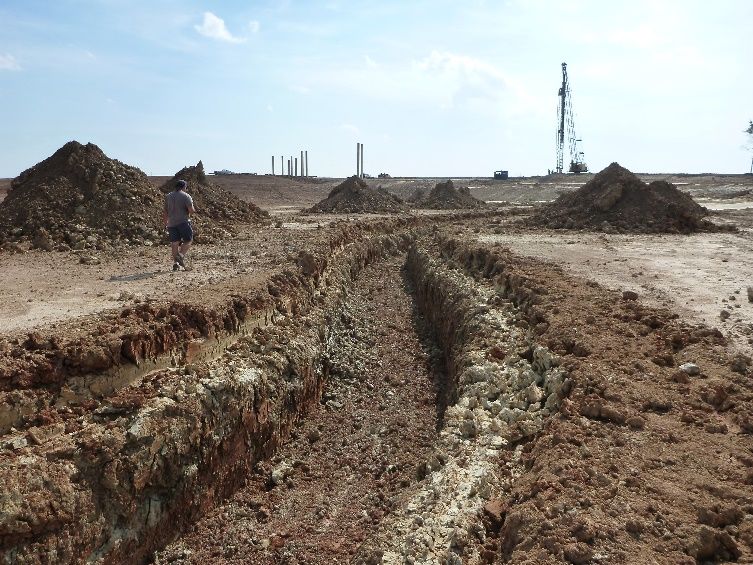
Methods
Surveys were conducted to achieve survey and sampling objectives in accordance with the objective-
based sampling (OBS) plan for John Paul Landing Reservoir which was designed with the goal of
collecting baseline data and describing fisheries present in the young reservoir. Primary components of
the OBS plan are listed in Table 4. All survey sites were randomly selected, and all surveys were
conducted according to the Fishery Assessment Procedures (TPWD, Inland Fisheries Division,
unpublished manual revised 2017).
Electrofishing – Largemouth Bass, crappies, sunfishes, and shads were collected by daytime
electrofishing (1 hour at 12, 5-min stations) in both fall 2019 and spring 2020. Catch per unit effort
(CPUE) for electrofishing was recorded as the number of fish caught per hour (fish/h) of actual
electrofishing. Ages for crappie were determined using otoliths from 23 randomly selected fish (range 9.0
to 10.9 inches).
Tandem hoop nets – Channel Catfish were collected using 5 tandem hoop-net series at 5 stations. Nets
were baited with soap and deployed for 2-night soak durations. CPUE for tandem hoop netting was
recorded as the number of fish caught per tandem hoop net series (fish/series).
Statistics – Sampling statistics (CPUE for various length categories), structural indices [Proportional Size
Distribution (PSD), terminology modified by Guy et al. 2007], and condition indices [relative weight (Wr)]
were calculated for target fishes according to Anderson and Neumann (1996). Index of Vulnerability
(IOV) was calculated for Gizzard Shad (DiCenzo et al. 1996). Standard error (SE) was calculated for
structural indices and IOV. Relative standard error (RSE = 100 X SE of the estimate/estimate) was
calculated for all CPUE and creel statistics.
Habitat – A structural habitat survey was conducted in 2019. Habitat was assessed with the digital
shapefile method (TPWD, Inland Fisheries Division, unpublished manual revised 2017).
Water level – No recorded water level data exists. Water level was determined by communications with
Harris County Precinct 3 and TPWD staff observations.

                                 Results and Discussion
Habitat: Structural shoreline habitat consisted primarily of natural shoreline (Table 5) with 3 fishing piers,
3 bridges with pilings, and a fish cleaning station pier. As HCP3 digs each new section of reservoir,
riprap piles, log piles, concrete culverts, and other hard structure are added to the bottom as near shore
as possible. Artificial channels, dips, and humps are also created along the bottom of each new section
prior to filling. The Magnolia West Anglers Club (Friends of Reservoirs Chapter for John Paul Landing
Reservoir) installed several Mossback Artificial Fish Habitat structures around the fishing piers in April
2018. Native vegetation covered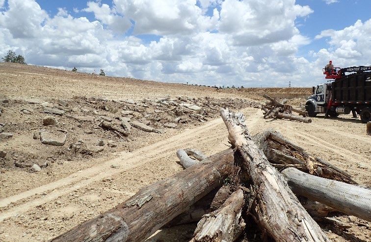
or smaller, indicating they are a good prey source for predators. Index of Vulnerability (IOV) for Gizzard
Shad was excellent for the fall electrofishing sample, indicating that 100% of Gizzard Shad were available
to existing predators, while IOV for the spring electrofishing survey indicated that 0% of Gizzard Shad
were available to existing predators. Sample sizes were small for both surveys with 9 individuals
collected in the fall and 2 in the spring.
Channel Catfish: The hoop net catch rate of Channel Catfish was 44.5/net series in 2020 (Figure 7).
Few stock-sized individuals (≥ 11 inches) were also of quality size (≥ 16 inches), indicated by a PSD of
13. Body condition was sub-optimal with relative weights averaging around 80. Reproductive success
was observed by collecting multiple individuals well under the 9-inch stocking size (Figures 8 and 9)
during electrofishing surveys.
Largemouth Bass: The electrofishing catch rate of Largemouth Bass was 1.0/h in fall 2019 (Figure 10)
and 2.0/h in spring 2020 (Figure 11). No legal-sized or stock-sized Largemouth Bass were captured
during either the fall or spring electrofishing surveys, preventing age-and-growth analyses from being
conducted. Individuals collected during surveys were also too small to calculate relative weights but were
in extremely good condition. Low catch rates may indicate that Largemouth Bass have yet to fully
establish in this young reservoir or that high turbidity, low conductivity, ample deep-water cover, and lack
of adequate shoreline vegetation concentrated Largemouth Bass in deep water, lowering the efficacy of
electrofishing.
White Crappie: The electrofishing catch rate of White Crappie was 64.0/h in 2019 (Figure 12) and 41.0/h
in 2020 (Figure 13). The size distribution for fall and spring electrofishing were similar with PSDs of 81
and 73. Mean relative weight was close to 90 for most size classes in fall 2019, indicating adequate prey
availability, but ranged from 75 to just over 90 in spring 2020. Growth of White Crappie at John Paul
Landing Reservoir was slow. Average age at 10 inches was 3.11 years (N = 9; range = 1 – 4 years;
Figure 14) during the fall survey and 2.86 years (N = 14; range = 2 – 3 years; Figure 15) in the spring.

Fisheries Management Plan for John Paul Landing Reservoir,
                         Texas
                                           Prepared – July 2020

ISSUE 1:        Due to the young age of John Paul Landing Reservoir, consistent Katy Prairie winds, and
                continued construction activities, native vegetation isn’t well established in the reservoir
                and is mostly found immediately along the shoreline.
MANAGEMENT STRATEGY
    1. Work with HCP3 and the John Paul Landing Friends of Reservoirs group on efforts to establish
       native shoreline vegetation to both stabilize banks as well as provide shoreline habitat for young-
       of-year fish.

ISSUE 2:        Florida Largemouth Bass were stocked yearly from 2016-2019, yet electrofishing surveys
                yielded only 3 young-of-year individuals. John Paul Landing Reservoir’s high turbidity
                and low conductivity limit productivity of electrofishing surveys for all target species.
                Continued construction perpetuates turbidity issues and has released colloidal clay into
                the reservoir, minimizing shoreline vegetation that is crucial for young-of-year survival as
                well as making foraging difficult. In a small system such as John Paul Landing, top
                predators like Largemouth Bass are needed to help keep species such as crappie from
                overpopulating and stunting.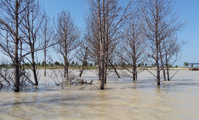
MANAGEMENT STRATEGIES
    1. Discontinue Florida Largemouth Bass stocking until construction is complete and vegetation
       begins to establish. Address any remaining colloidal clay issues as able.
    2. Survey Largemouth Bass population again in 2023 and resume stocking if shoreline vegetation
       has established.
    3. Work with local anglers and HCP3 to collect volunteer angler catch data to gain additional
       information about target species that may not be captured with standard sampling techniques.

ISSUE 3:        Electrofishing surveys indicate a promising White Crappie population at John Paul
                Landing Reservoir.
MANAGEMENT STRATEGY
    1. Promote crappie fishery during conversations with anglers. Should volunteer angler data show
       abundant legal-sized fish in the next 4 years, then promotion through press releases and social
       media will be warranted.

ISSUE 4:        Many invasive species threaten aquatic habitats and organisms in Texas and can
                adversely affect the state ecologically, environmentally, and economically. For example,
                zebra mussels (Dreissena polymorpha) can multiply rapidly and attach themselves to any
                available hard structure, restricting water flow in pipes, fouling swimming beaches, and
                plugging engine cooling systems. Giant salvinia (Salvinia molesta) and other invasive
                vegetation species can form dense mats, interfering with recreational activities like
                fishing, boating, skiing, and swimming. The financial costs of controlling and/or
                eradicating these types of invasive species are significant. Additionally, the potential for
                invasive species to spread to other river drainages and reservoirs via watercraft and
                other means is a serious threat to all public waters of the state.

MANAGEMENT STRATEGIES
    1. Cooperate with the controlling authority to post appropriate signage at access points around the
       reservoir.
    2. Contact and educate marina owners about invasive species, and provide them with posters,
       literature, etc… so that they can in turn educate their customers.
    3. Educate the public about invasive species through the use of media and the internet.
    4. Make a speaking point about invasive species when presenting to constituent and user groups.
    5. Keep track of (i.e., map) existing and future inter-basin water transfers to facilitate potential
       invasive species responses.

  Objective-Based Sampling Plan and Schedule (2020–2024)

John Paul Landing Reservoir was opened to the public in 2018, is still under construction, and has only
been sampled 2019-2020; therefore, baseline fisheries information is still being compiled. The proposed
sampling schedule to meet the following OBS plan can be found in Table 7.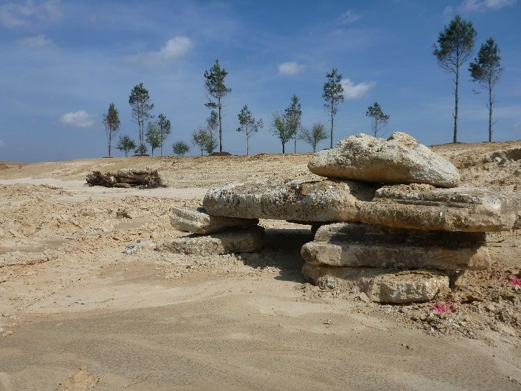
Negligible Fisheries
Reservoir maturation, construction completion, and future vegetation growth may significantly alter the
sport fish community. Additional data collection using standard survey methods will be needed to
determine negligible fisheries.

Sport fish, forage fish, and other important fishes
Sport fish in John Paul Landing Reservoir include Channel Catfish, White Crappie, and Largemouth Bass.
Important forage species include Gizzard and Threadfin Shad, Bluegill, and Longear Sunfish.

Survey objectives, fisheries metrics, and sampling objectives
Channel Catfish: A second exploratory hoop net survey will be conducted to evaluate recruitment of the
current population. Additional population-level data (relative abundance, size composition, relative
weight) will be collected for specimens sampled. Baited tandem hoop netting will be conducted in the
summer of 2023 at randomly selected sites. In order to make direct comparisons with the 2020 data,
hoop nets will be set at 5 randomly selected sites in the summer of 2023 for a 2-night soak.
Largemouth Bass: A second exploratory electrofishing survey will be conducted to identify
presence/absence and to aid in evaluating past stocking success. Additional population-level data
(relative abundance, size composition, relative weight) will be calculated for specimens collected.
Because there is currently no boat ramp at John Paul Landing Reservoir; boat access must be gained
from the bank in a non-secured area. Due to limited boat access, daytime electrofishing will continue to
be conducted with 12 randomly selected 5-minute stations in the fall of 2023. Should Harris County
Precinct 3 construct a boat ramp, nighttime electrofishing will be considered.
Crappies: An exploratory trap net survey will be conducted to identify presence/absence and to aid in
evaluating success of the current population. Additional population-level data (relative abundance, size
composition, relative weight) will be collected for specimens sampled. A minimum of 5 randomly selected
trap net sites will be sampled to collect crappies.
Prey Species: Sampling with electrofishing per Largemouth Bass and crappies will be sufficient to
identify presence/absence of forage fishes. Additional population level data (relative abundance, size
composition) will be recorded on specimens collected.
Literature Cited
Anderson, R. O., and R. M. Neumann. 1996. Length, weight, and associated structural indices. Pages
     447-482 in B. R. Murphy and D. W. Willis, editors. Fisheries techniques, 2nd edition. American
     Fisheries Society, Bethesda, Maryland.
DiCenzo, V. J., M. J. Maceina, and M. R. Stimpert. 1996. Relations between reservoir trophic state and
     Gizzard Shad population characteristics in Alabama reservoirs. North American Journal of
     Fisheries Management 16:888-895.
Guy, C. S., R. M. Neumann, D. W. Willis, and R. O. Anderson. 2007. Proportional size distribution
      (PSD): a further refinement of population size structure index terminology. Fisheries 32(7): 348.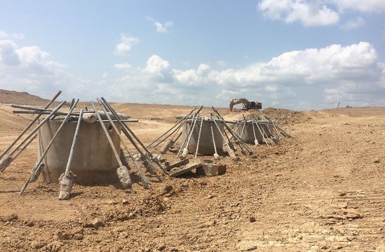
Tables and Figures

Table 1. Characteristics of John Paul Landing Reservoir, Texas.

 Characteristic                                                        Description

 Year constructed                               2018 opened to public - construction ongoing
 Controlling authority                          Harris County Precinct 3
 County                                         Harris
 Reservoir type                                 Flood Detention Basin
 Conservation Elevation                         150 feet above mean sea level (MSL)
 Conductivity                                   86-94 µS/cm

Table 2. Harvest regulations for John Paul Landing Reservoir, Texas.

 Species                                         Bag limit                      Length limit

 Catfish: Channel and Blue Catfish,                 25                       12-inch minimum
 their hybrids and subspecies              (in any combination)
 Catfish, Flathead                                  5                        18-inch minimum

 Bass, White                                        25                       10-inch minimum

 Bass, Largemouth                                   5                        14-inch minimum

 Crappie: White and Black Crappie,                  25                       10-inch minimum
 their hybrids and subspecies              (in any combination)
Table 3. Stocking history of John Paul Landing Reservoir, Texas. FGL = fingerling; AFGL = advanced
fingerling.

 Species                    Year           Number                           Size
 Bluegill                   2016           12,013                           FGL
                            2017           41,993                           FGL
                            Total          54,006

 Channel Catfish            2016           1,079                            AFGL
                            2017           10,001                           AFGL
                            2018           10,150                           AFGL
                            2019           10,052                           AFGL
                            Total          31,282

 Florida Largemouth Bass    2016           3,102                            FGL
                            2017           43,950                           FGL
                            2018           40,508                           FGL
                            2019           40,562                           FGL
                            2020           40,855                           FGL
                            Total          168,977
Table 4. Objective-based
sampling plan
components for John Paul Survey objective Metrics Sampling objective
Landing Reservoir, Texas
2019–2020.Gear/target
species
Electrofishing
Largemouth Bass Presence/Absence N>0
Bluegill Presence/Absence N>0
Gizzard Shad Presence/Absence
N>0
Prey availability IOV
Crappie Presence/Absence N>0
Tandem hoop netting
Channel Catfish Presence/Absence N>0Table 5. Survey of structural habitat types, John Paul Landing Reservoir, Texas, 2019. Shoreline habitat type units are in miles and standing timber is acres. Habitat type Estimate % of total Natural shoreline 4.64 miles 97.5 Piers and docks/open water 0.14 miles 2.9 Standing timber 0.59 acres
Gizzard Shad

Figure 1. Number of Gizzard Shad caught per hour (CPUE) and population indices (RSE and N for CPUE
and SE for IOV are in parentheses) for fall electrofishing survey, John Paul Landing Reservoir, Texas,
2019.

Figure 2. Number of Gizzard Shad caught per hour (CPUE) and population indices (RSE and N for CPUE
and SE for IOV are in parentheses) for spring electrofishing survey, John Paul Landing Reservoir, Texas,
2020.
Bluegill

Figure 3. Number of Bluegill caught per hour (CPUE) and population indices (RSE and N for CPUE and
SE for size structure are in parentheses) for fall electrofishing survey, John Paul Landing Reservoir,
Texas, 2019.

Figure 4. Number of Bluegill caught per hour (CPUE) and population indices (RSE and N for CPUE and
SE for size structure are in parentheses) for spring electrofishing survey, John Paul Landing Reservoir,
Texas, 2020.
Longear Sunfish

Figure 5. Number of Longear Sunfish caught per hour (CPUE) and population indices (RSE and N for
CPUE and SE for size structure are in parentheses) for fall electrofishing survey, John Paul Landing
Reservoir, Texas, 2019.

Figure 6. Number of Longear Sunfish caught per hour (CPUE) and population indices (RSE and N for
CPUE and SE for size structure are in parentheses) for spring electrofishing survey, John Paul Landing
Reservoir, Texas, 2020.
Channel Catfish

Figure 7. Number of Channel Catfish caught per series (CPUE) and population indices (RSE and N for
CPUE and SE for size structure are in parentheses) for spring hoop net survey, John Paul Landing
Reservoir, Texas, 2020.
Figure 8. Number of Channel Catfish caught per hour (CPUE) and population indices (RSE and N for
CPUE and SE for size structure are in parentheses) for fall electrofishing survey, John Paul Landing
Reservoir, Texas, 2019. Vertical line indicates minimum length limit.

Figure 9. Number of Channel Catfish caught per hour (CPUE, bars), mean relative weight (diamonds),
and population indices (RSE and N for CPUE and SE for size structure are in parentheses) for spring
electrofishing survey, John Paul Landing Reservoir, Texas, 2020. Vertical line indicates minimum length
limit.
Largemouth Bass

Figure 10. Number of Largemouth Bass caught per hour (CPUE) and population indices (RSE and N for
CPUE and SE for size structure are in parentheses) for fall electrofishing survey, John Paul Landing
Reservoir, Texas, 2019.

Figure 11. Number of Largemouth Bass caught per hour (CPUE) and population indices (RSE and N for
CPUE and SE for size structure are in parentheses) for spring electrofishing survey, John Paul Landing
Reservoir, Texas, 2020.
White Crappie

Figure 12. Number of White Crappie caught per hour (CPUE, bars), mean relative weight (diamonds), and
population indices (RSE and N for CPUE and SE for size structure are in parentheses) for fall
electrofishing survey, John Paul Landing Reservoir, Texas, 2019. Vertical line indicates minimum length
limit.

Figure 13. Number of White Crappie caught per hour (CPUE, bars), mean relative weight (diamonds), and
population indices (RSE and N for CPUE and SE for size structure are in parentheses) for spring
electrofishing survey, John Paul Landing Reservoir, Texas, 2020. Vertical line indicates minimum length
limit.
Figure 14. Length at age for White Crappie collected from electrofishing at John Paul Landing Reservoir,
Texas, November 2019.

Figure 15. Length at age for White Crappie collected from electrofishing at John Paul Landing Reservoir,
Texas, April 2020.
Proposed Sampling Schedule

Table 7. Proposed sampling schedule for John Paul Landing Reservoir, Texas. Survey period is June
through May. Hoop netting surveys are conducted in the summer, while electrofishing surveys are
conducted in the fall. Standard survey denoted by S and additional survey denoted by A.

                                                                   Survey year

                                            2020-2021     2021-2022       2022-2023    2023-2024
 Angler Access                                                                              S
 Structural Habitat                                                                         S
 Vegetation – Complete                                                                      S
 Vegetation – Exotic                            A              A                 A
 Electrofishing (Daytime)                                                                   S
 Baited tandem hoop netting                                                      S
 Trap netting                                                                               S
 Report                                                                                     S
APPENDIX A – Catch rates for all species from all gear types
Number (N) and catch rate (CPUE) (RSE in parentheses) of all target species collected from all gear
types from John Paul Landing Reservoir, Texas, 2019-2020. Sampling effort was 5 net series for hoop
netting and 1 hour for electrofishing.
Species Hoop Netting Fall Electrofishing Spring Electrofishing
N CPUE N CPUE N CPUE
Spotted Gar 3 3.00 (72)
Gizzard Shad 9 9.00 (41) 2 2.00 (100)
Threadfin Shad 23 23.00 (28) 2 2.00 (67)
Common Carp 3 0.30 (71) 7 7.00 (33) 5 5.00 (46)
Red Shiner 1 1.00 (100)
Bullhead Minnow 59 59.00 (23) 7 7.00 (58)
Yellow Bullhead 24 2.40 (46)
Channel Catfish 445 44.50 (43) 18 18.00 (24) 29 29.00 (34)
Green Sunfish 7 7.00 (33)
Warmouth 6 6.00 (46)
Bluegill 13 1.30 (47) 32 32.00 (23) 12 12.00 (35)
Longear Sunfish 1 0.10 (100) 13 13.00 (45) 19 19.00 (32)
Redear Sunfish 11 1.10 (66)
Largemouth Bass 1 1.00 (100) 2 2.00 (100)
White Crappie 64 64.00 (20) 41 41.00 (22)
Black Crappie 1 1.00 (100)
Freshwater Drum 41 41.00 (34) 1 1.00 (100)
Hybrid Tilapia 2 2.00 (67)APPENDIX B – Map of sampling locations Location of sampling sites, John Paul Landing Reservoir, Texas, 2019-2020. Fall electrofishing, spring electrofishing, and hoop net sites are indicated by F, S, and H, respectively. One spring electrofishing site was located in the newest addition to the reservoir, which is not visible on satellite imagery, so it has not been added to the GIS shapefile yet. Water level was near full pool at time of sampling.
APPENDIX C – Engineering schematic of total (future)
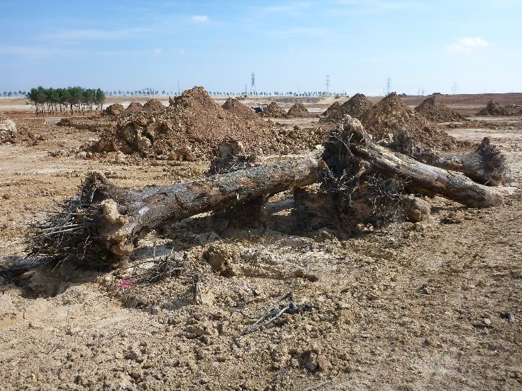
reservoir areaAPPENDIX D – Examples of habitat types and amenities
In accordance with Texas State Depository Law, this publication is available at the
                   Texas State Publications Clearinghouse and/or Texas Depository Libraries.

                          © Texas Parks and Wildlife, PWD RP T3200-2729 (09/20)

TPWD receives funds from the USFWS. TPWD prohibits discrimination on the basis of race, color, religion,
national origin, disability, age, and gender, pursuant to state and federal law. To request an accommodation or
obtain information in an alternative format, please contact TPWD on a Text Telephone (TTY) at (512) 389-8915
or by Relay Texas at 7-1-1 or (800) 735-2989 or by email at accessibility@tpwd.texas.gov. If you believe you
have been discriminated against by TPWD, please contact TPWD, 4200 Smith School Road, Austin, TX 78744,
or the U.S. Fish and Wildlife Service, Office for Diversity and Workforce Management, 5275 Leesburg Pike, Falls
Church, VA 22041.
You can also read