Kangaroo Island MAY 2021 - Department for Environment and Water
←
→
Page content transcription
If your browser does not render page correctly, please read the page content below
National parks of
 Kangaroo
            Island
              MAY
              2021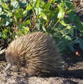
Welcome to
Kangaroo Island’s parks
Fires on Kangaroo Island burnt more than            So head out, have a good time and be
200,000 hectares of land – nearly half the          assured that we’re working closely with local
island – in the January 2020 bushfire.              staff, tourism operators and the community
                                                    on fire recovery. We take the safety of our
More than a year on and as green shoots
                                                    visitors and staff seriously, particularly during
take hold in the landscape, parks are
                                                    the COVID-19 pandemic, and our wide open
reopening to visitors to share in a once-in-a-
                                                    spaces are the perfect place to relax and
lifetime opportunity to see the bush
                                                    renew while practicing social distancing.
regenerating around iconic sites such as
Remarkable Rocks and Admirals Arch.                 Flinders Chase National Park and the iconic
                                                    sights of Remarkable Rocks, Admirals Arch,
As many people remark when they land on
                                                    Cape du Couedic Lighthouse and Weirs Cove
Kangaroo Island, it’s a big place – bigger than
                                                    are open. Several trails and campgrounds
they expected it to be. The third largest island
                                                    have reopened. Seal Bay is ready to welcome
off the coast of Australia, Kangaroo Island is
                                                    you to a beach tour, walking trails across the
home to unique natural beauty and a wide
                                                    island remain open and at the end of the day
variety of things to see and do.
                                                    you can put your feet up with a stay in a
Even as some parks experiences remain               unique lighthouse keeper’s cottage.
restricted because of bushfire recovery or
                                                    Thank you for visiting and being part of the
to be COVID-safe, there’s still so much to
                                                    recovery of this special place. Every trip you
explore here, particularly in the parks that
                                                    make and every dollar you spend will make a
conserve an array of natural environments
                                                    bigger difference to the Kangaroo Island
and provide habitat to an abundant range
                                                    community than you’re ever likely to know.
of wildlife.
                                                    To keep up to date with fire recovery, park
This little book is a moment in time that
                                                    openings and COVID-19 updates check
shares some of the best parks and parks
                                                    parks.sa.gov.au and facebook.com/NPWSSA
experiences that are ready to welcome you
right now.

Cover image © South Australian Tourism Commission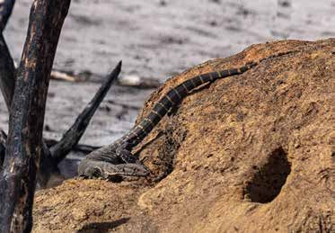
Contents
Map......................................................................2
What’s open?....................................................4
Welcome, you’re here. Now what
can you do that’s near?.................................8
Five of Kangaroo Island’s best
wildlife experiences........................................10
Know before you go.......................................12
Parks that are open now...............................14
Stay in parks.....................................................20
Bushwalking.....................................................21
Walking trails that are open now...............22
Marine parks.....................................................38
Wildlife notes....................................................42
Bushfire safety for travellers.......................44
Plan your trip.....................................................45

                                        National parks of Kangaroo Island 1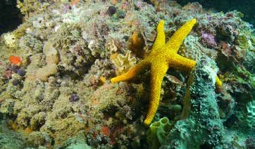
Map
INVESTIGATOR STR
INVESTIGATOR ST
Southern Spencer Gulf
Marine Park
Southern Spencer Gulf
Stokes
Marine Park
BayStokes
Snelling Bay
Western River
Sanctuary Beach
Snelling
Cove
Western River
Zone
Sanctuary Beach
Cove
Zone
Lathami CP
Sanctuary
Sanctuary
Zone Western River WPA
Flinders
13 Zone
Cape Borda
Chase NP Cape
13
Cape Borda Torrens WPA
Parndana CP
Western Ravine
Kangaroo Western 12 des Casoars RD Parndana
PL AYFO
IslandKangaroo 12 Parndana
Marine Island K A N G A R O O
D
ROA
Park Marine
AY
Flinders
HW
Park Ravine des
Chase NP Seddon CP
G
Casoars WPA
HI
LE
West
SHACK
Bay West
END
Bay
T
ES
Rocky River Mount
W
Taylor CP
Flinders S
SOUTH B
Chase NP COAST D
Maupertuis Kelly Hill CP ROA
Maupertuis Vivonne
Bay Cape Vivonne
Bay Bay
Bouguer WPA Bay
Sanctuary
11 8 8 Hanson
Hanson
Sanctua
10 1011 Bay Bay Vivonne Zone
Zone
Cape du Couedic Bay CP
Cape 9
du Couedic
9 Remarkable RocksRocks
Remarkable
Sanctuary
Sanctuary Admirals
Zone Zone Arch
Western
Western SOUTHERN
SOUTHERN OCO
Kangaroo IslandIsland
Kangaroo
Marine Park Park
Marine
Sealed road road
Sealed Open DEWDEW
Open managed parkpark
managed
Unsealed
Unsealed road road Closed
Closed DEWDEW managed
managed parkpark
1 1 Walking
Walking trail location
trail location FireDEW
affected
Fire affected
Closed
Closed areas parkpark
areas
DEW managed
managed
(see page
(see page 22) 22)
2 National parks of Kangaroo Island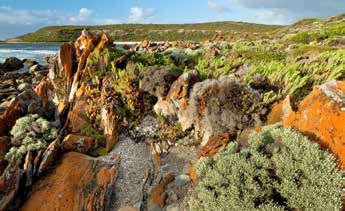
STRAIT Sanctuary
TRAIT Zone
Emu
Emu Bay Encounter
okes
ay Bay Bay Encounter Marine Park
Sanctuary Cape Jervis
of Shoals
Zone Marine Park
Sanctuary Cape Jervis
Zone Beatrice Talisker CP
Islet CP Kingscote
B
Kingscote Deep AC KS
BAC TA
Western KST Creek CP IRS
Cygnet
Cove AIR P
Estuary CP Western S
Cove Penneshaw PA 2
Y 2
WA
SS
H Sanctu
HIG Baudin CP
AG
Nepean Bay CP
AD
American Sanctuary Zone
E
HO 1 Eastern
RO
G American Zone
Parndana 1 Eastern River Cove Antec
a River Cove Antechamber B
Pelican Lashmar CP
Bay
I S L A N D Beyeria CP BA
Y Lagoon CP D
ROA
Sanctuary Zone Cape
RE Zone Willoughby CP
O
Dudley CP 3
HM
BI R C
Simpson CP
7 6
7 6 5
Cape 5 Lesueur CP
D'Estrees Bay
Gantheaume CP D'Estrees Bay
Seal
Bay CP
vonne Cape 4
Cape 4
Bay Gantheaume WPA Gantheaume CP
Sanctuary
ary
Zone
Southern Southern
Kangaroo Island 0 0 20 20
Kangaroo Island km
km
Marine Park
OCEAN OCEAN
Marine Park
Marine Park Marine Park NP National Park NP National Park
CP CP
Conservation Park Conservation Park
Marine
Marine Park - Sanctuary Park - Sanctuary Zone
Zone
WPA Wilderness Protected Area
WPA Wilderness Protected Area
Ferry Ferry
National parks of Kangaroo Island 3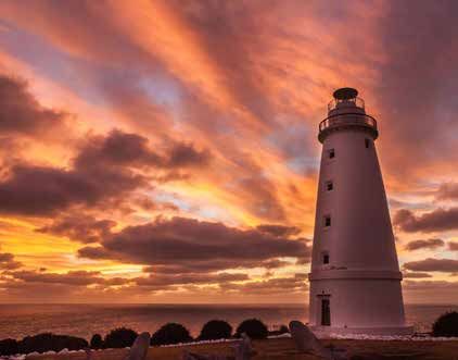
What’s open?

                                                                                                                                  Accommodation

                                                                                                                                                   Accommodation
                                                        Opening hours

                                                                                                                   Camping fees

                                                                                                                                                                   Dogs allowed
                                                                                            Entry fees
                                                                                Tour fees

                                                                                                         Camping
                                                                        Tours

                                                                                                                                                   fees
    Baudin CP                                    24/7                   N       N           N            N         N               N              N                N

    Beyeria CP                                   24/7                   N       N           N            N         N               N              N                N
    Cape Gantheaume CP

                         Murray Lagoon           24/7                   N       N           N            N         N               N              N                N

                         D'Estrees Bay           24/7                   N       N           N            Y         Y               N              N                N

                         Cape Gantheaume
                         Wilderness Protection   24/7                   N       N           N            Y         Y               N              N                N
                         Area

                                                                                                                                                  Y
    Cape Willoughby CP                           See pg 7               Y       Y           N            N         N               Y                               N
                                                                                                                                                  See p.18

    Flinders Chase NP                            24/7                   N       N           Y            Y         Y               N              N                N
    Cape Borda Lightstation
                                                 24/7                   Y*      Y*          Y            N         N               N              N                N
    (Flinders Chase NP)
    Lashmar CP                                   24/7                   N       N           N            Y         Y               N              N                N

    Seal Bay CP                                  See pg 6               Y       Y           N            N         N               N              N                N

    Ravine des Casoars WPA
                                                 24/7                   N       N           Y            Y         Y               N              N                N
    (including Harveys Return)

R
  Campfire restrictions apply, see page 20 and parks.sa.gov.au for more information.
* Self-guided tour

4 National parks of Kangaroo Island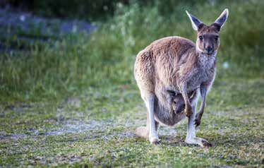
ing,
                                                                                                                        Book camp tion
                                                                                                                                oda
                                                                                                                        accomm at
                                                                                                                          and toursv.au
                                                                                                                                      o
                                                                                                                            parks.sa.g

                                                                                                                                                      Drones allowed
                                                                         and souvenirs
                                                                         Refreshments
                                          Walking trails

                                                                                                                             Public phone
                                                           Information
          Campfires R

                                          (see pg. 19)

                                                                                                               Wheelchair
                                                                                         Picnic area

                                                                                                                                            Lookout
                                Fishing

                                                                                                               access
Toilets

                                                           centre
                        Water

                                                                                                       BBQ
N         N             N       N         Y                N             N               N             N       N            N               N         N
N         N             N       N         Y                N             N               N             N       N            N               N         N

N         N             N       N         Y                N             N               N             N       N            N               Y         N

N         N             N       N         Y                N             N               N             N       N            N               Y         N

N         N             N       N         Y                N             N               N             N       N            N               N         N

Y         N             Y       N         Y                Y             Y               N             N       N            N               Y         N

Y         N             N       Y         Y                Y             N               Y             Y       Y            N               Y         N

Y         N             N       N         Y                N             N               Y             N       N            N               Y         N

Y         Y             N       Y         Y                N             N               Y             Y       N            N               N         N

Y         N             Y       N         Y                Y             Y               N             N       Y            Y               Y         N

Y         N             N       N         Y                N             N               Y             N       N            N               Y         N

                                                                                                             National parks of Kangaroo Island 5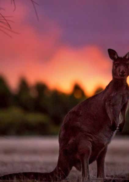
Seal Bay CP                  Certificate of Excellence

  Park opening hours: 9 am-5 pm daily                      bookable up to 9 hours before
  (except Christmas Day) - last entry 4 pm.                tour departure.
  Please note: additional tours run
                                                           Seal Bay also offers sunset, private and
  during South Australian school holidays
                                                           research tours.
  and public holidays – please check our
  website for details. Tour times are                      Self-guided boardwalk tours are also
  subject to change.                                       available for walk-ins.
  Seal Bay guided tours                                    T: 08 8553 4463
  Guided tours are available, book at
  sealbay.sa.gov.au before you go
  to avoid disappointment. Tours are

  Flinders Chase NP
  Park opening hours: 24/7                                 Note: The park has limited toilets, no
  Visitors can explore the iconic                          rubbish bins and there is no food or
  drawcards of Remarkable Rocks,                           drink available for purchase throughout
  Admirals Arch, Cape du Couedic                           the park.
  Lighthouse and Weirs Cove.
                                                           Please be COVID-safe by maintaining
  West Bay (including the campground)                      good hygiene and social distancing,
  and Shackle Road are open.                               particularly at the boardwalk to
                                                           Admirals Arch.
  Cape Borda Lightstation is open for self-
  guided walking tours. Details on page 16.                T: 0428 766 269

6 National parks of Kangaroo Island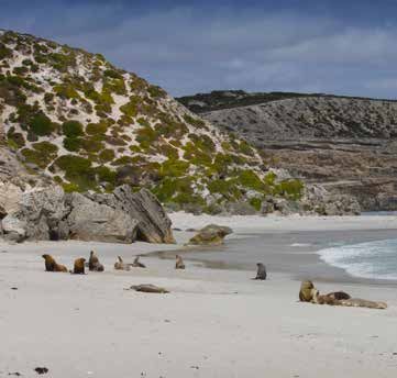
Cape Willoughby CP
  Park opening hours: sunrise to sunset.             Accommodation
  Visitor centre: 10 am-4 pm daily                   Heritage lightkeepers’ cottages open,
                                                     book at parks.sa.gov.au
  Tours
  Tours of the lightstation and grounds are          T: 08 8553 4466
  available. Self-guided tours of the
  grounds are also available. Bookings and
  details at parks.sa.gov.au

Notes:
Opening hours, tour times and prices are subject to change.

                                                                   National parks of Kangaroo Island 7
                 © Quentin Chester
Welcome, you’re here.
Now what can you do
that’s near?

1      Get your ‘gram on at
       Flinders Chase
Much of Flinders Chase National Park was burnt in the
January 2020 bushfires, but the landscape is
recovering. Drive along Cape du Couedic Road –
including the part that has become one of the most
instagrammable roads in South Australia. Explore the
iconic drawcards of Remarkable Rocks, Admirals Arch,
Cape du Couedic Lighthouse and Weirs Cove. You’ll
find car parking at each of these sites.

2        Stay in a heritage-listed
         lighthouse keepers’ cottage
Not only can you tour the grounds of Cape Willoughby
Lighthouse, you can stay nearby. Enjoy spectacular
sunrises, listen to the waves crashing onto the nearby cliffs
and catch glimpses of wildlife while staying in one of two
restored five-bedroom heritage-listed lighthouse keepers’
cottages at Cape Willoughby Conservation Park. The
cottages are great places for families and friends to relax
and unwind with cosy bedrooms, a kitchen and even board
games. Both cottages sleep up to nine people and can be
booked at parks.sa.gov.au. More information on page 16.

8 National parks of Kangaroo Island
3 Take a self-guided drive
to D’Estrees Bay
This self-guided nature drive at Cape Gantheaume
Conservation Park begins at the second boat ramp
seven kilometres from the junction of Elsegood Road
and D’Estrees Bay Road. Look out for the osprey trail
markers along the eight kilometre drive that takes in
bushland and coastal views. Download a self-guided
drive booklet at parks.sa.gov.au.
4 Join a tour
with a local
Whether you’re on Kangaroo Island for 48 hours or five
days, southaustralia.com has you covered with
itineraries that share the best of the island and include
ideas for experiences with local tour companies. Explore
marine parks by swimming with dolphins, staying dry on
deck with a sightseeing tour or going fishing; and
discover terrestrial parks with tours that traverse Seal
Bay and beyond.
© South Australian Tourism Commission
5 Take a walk amongst
nature’s best
With its diverse landscapes that range from bushland to
rugged coastline and abundant wildlife, Kangaroo Island
is a walker’s dream. And there’s a lot of it to walk – the
island is 155 km long and up to 55 km wide, ringed by
509 km of pristine coastline and has walking trails that
stretch throughout its parks. Turn to page 19 for ideas on
walks that range from easy 20 minute strolls to a more
challenging five-day trek.
© South Australian Tourism Commission
National parks of Kangaroo Island 9Five of Kangaroo
Island’s best wildlife
experiences
Kangaroo Island is celebrated for its Kangaroos
extraordinary wildlife and has many
Kangaroo Island was named for its
opportunities to see Australian kangaroos, which have evolved differently
animals in their native habitats. from mainland kangaroos since the island
Here are just a few of the island’s was connected to the mainland 9500
best wildlife experiences. years ago. Kangaroo Island kangaroos
often rest during the day under vegetation,
Australian sea-lions coming out to graze in the early morning
Seal Bay is the only place in the world and late afternoon.
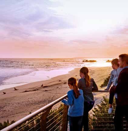
where you can see Australian sea-lions at
close quarters and walk on a beach where Tammar wallabies
pups play, bulls fight for supremacy and Kangaroo Island has the largest remaining
resting mothers suckle their young. natural population of Tammar wallabies.
There are no enclosures or cages here. Much smaller than kangaroos, Tammar
You can walk to the heart of the sea-lion wallabies have a dark grey coat with
colony on the beach with an experienced reddish-brown arms, feet and flanks, and
guide who will teach you about these white cheek stripes.
endangered animals. If you prefer, you can They’re nocturnal and best seen at dawn
set your own pace on the wheelchair and dusk in Cape Gantheaume
accessible 900 metre (return) boardwalk Conservation Park along the D’Estrees Bay
which meanders through the dunes to a Road up to Wheatons Beach and in Baudin
number of viewing platforms. More Conservation Park. Access to the carpark
information on page 17. is along Frenchmans Terrace and south
along Binneys Track.
Long-nosed fur seals
The rocks around Admirals Arch are a Short-beaked echidnas
popular haul-out spot for long-nosed fur Kangaroo Island short-beaked echidnas
seals. Watch their playful antics as they appear to be abundant across the island
frolic in rock pools and surf the waves. due to suitable habitat and no significant
predators. They can be found across the
10 National parks of Kangaroo Islandisland and are generally solitary,
feeding day and night and sheltering
in hollow logs, under piles of debris, in
self-constructed burrows and among
tree roots.
Echidnas have exceptional hearing and a
good sense of smell. They’ll freeze when
disturbed and then curl into a ball, often
trying to bury themselves in the leaf litter or
soil. If you find an echidna, watch quietly
and patiently from at least 20 metres away.
If they change their behaviour while you are
watching then you are probably too close.
Dolphins
Kangaroo Island’s pristine waters are home
© South Australian Tourism Commission
to a diverse and important range of marine
life. The island is surrounded by four
marine parks that ensure increased
protection to approximately two-thirds of
its waters. Pennneshaw’s Hog Bay looks
out over Encounter Marine Park and is
home to a pod of dolphins that cruise
though every day. The perfect spot to see
them is from the rocks at the eastern end
of the beach, near Frenchmans Rock.
Know before you go
Turn to page 42 for information
on how to experience wildlife
safely and responsibly.
11Know before you go
What’s open Getting about
Most key sites and experiences operated The island is traversed by 1600km of
by National Parks and Wildlife Service are roads. The majority are unsealed. The
now open following the January 2020 ironstone gravel used to form some
bushfires. However, sites may operate unsealed roads resembles small marbles
under restrictions because of bushfire and can make the surface slippery.
recovery activities and to be COVID-safe. Unsealed roads are often corrugated and
bumpy – please drive carefully.
It’s best to check parks.sa.gov.au for
up-to-date information before you go. Kangaroo Island has an abundance of
wildlife. Please drive slowly. The best way
What’s closed to avoid a collision with wildlife is to reduce
Kelly Hill Conservation Park is closed until speed and avoid driving in the early
further notice. morning, late afternoon and at night.
Parks may close seasonally or for The island is much bigger than
conservation activities to be undertaken. people think:
Information on park closures is regularly • 4500 km2 in area
updated at parks.sa.gov.au or contact • 155km long and up to 55km wide
your local parks office for further • Two hours by car from east to west
information. • Most of the beaches and coves are
located many kilometres off the major
COVID-19 update: Social distancing ring roads – allow extra driving time
should be practiced at all times. Please
do not visit a park if you are feeling
sick or are required to self-isolate.
12 National parks of Kangaroo Island
© Quentin ChesterYour safety • Coastal treks need to be discussed with
a ranger in advance.
Your safety is important. You can do much • Stay on walking trails as these have
to ensure your personal safety while in
been routed to ensure the easiest and
parks by observing the following:
safest passage to your destination.
• Obey all road, track and trail signs – • Please read the important fire safety
they have been provided for your safety. information on page 44.
• Large areas of the island’s coastline • Be aware of park closures (for purposes
are dominated by tall limestone cliffs – such as feral animal control, public safety,
stay well clear and use lookouts threatened species breeding, trail
where provided. maintenance etc). Check
• If you are hiking or trekking, leave an parks.sa.gov.au for up to date
itinerary with a responsible person. information on park or trail closures.
They should contact police if you have
not returned by a pre-arranged date
and time. Leave your pets at home
Pets are not permitted in any
Kangaroo Island parks.
The recreational use of drones
is generally not permitted in Assistance dogs are welcome. Before
national parks or reserves, taking your assistance dog into a park
including for photography and that does not normally allow dogs, it is
filming. This is because they can highly recommended that you contact
severely disrupt resting and breeding us so we can provide you with the
animals. They also take away from latest information on any potential
the remote wilderness experience hazards that may affect your dog.
that many of our parks offer.
National parks of Kangaroo Island 13Parks that are open now
Baudin Conservation Park Lashmar Conservation Park
This small park adjoins the long sandy
beach at Antechamber Bay.
The Ironstone Hill Hike in Baudin
Conservation Park follows the historic Antechamber Bay
Bullock Track to Cape Willoughby and leads
to Ironstone Hill. Interpretive signs explore
the life of Harry Bates and his early farming Picnic and camping facilities are available at
endeavours. Get a sense of this area’s this popular swimming and fishing beach.
farming heritage and see some stunning Explore the park further by canoeing or
seascapes and sheoak woodlands. kayaking your way along the tranquil
Hike Chapman River which flows through the
Ironstone Hill Hike page 26. park and into the sea at Antechamber Bay.
Beyeria Conservation Park Solid fuel fires are not permitted during fire
danger season. Comfort fires are permitted
in fire pits only, and are not permitted during
the fire season. See page 18 or visit
Discover some of Kangaroo Island’s rare
www.parks.sa.gov.au for more
plants. Interpretive signs along the short
information about fires in parks.
Beyeria Walk give an insight into ‘the many
faces of the mallee scrub’. Visitors have the
opportunity to read about the mallee Book
broombush plant community, the natural campingt
process of change and rare endemic plants online a
o
that grow in the area.
parks.sa.g
Walk
Beyeria Walk page 25.
14 National parks of Kangaroo IslandCape Gantheaume Tadpole Cove Walk, camping, or walking
the secluded beaches.
Conservation Park
Walks
Murray Lagoon Tadpole Cove Walk page 28.
Self-guided drive
Birdwatchers: visit Kangaroo Island’s largest Follow the signs marked with the osprey
lagoon. The walks and hike take bird and discover the natural and cultural
you through a range of wetland plant significance of the area.
communities with spectacular views
Cape Gantheaume
and birdwatching opportunities.
Wilderness Protection Area
Walks and hikes
Timber Creek Walk page 29, Bald Hill Walk
page 30, Curley Creek Hike page 31. Cape Gantheaume Wilderness Protection
Area covers 20 000 hectares. Visitors may
D’Estrees Bay
access the area on foot. For further
information please speak to a ranger at
the National Parks office, Kingscote.
Historically D’Estrees Bay was the site of a
Trek
whaling station and later partly cleared for
Cape Gantheaume Coastal Trek (Seasonal
farming. Today the area conserves coastal
closure applies, contact park office or visit
vegetation and provides habitat for wildlife.
parks.sa.gov.au for latest closure
g Relax at D’Estrees Bay by doing the
information).
t
ov.au
National parks of Kangaroo Island 15Cape Willoughby Walks and tours
A range of walks, tours and self-guided
Conservation Park
tours are available.
Cape Willoughby Lightstation Accommodation
Heritage lightkeepers’ cottages – Seymour
Cottage, Thomas Cottage page 27.
On the way to or from Cape Willoughby, visit
Baudin and Lashmar conservation parks.
The ocean backdrop to Cape Willoughby
Lightstation is spectacular. Tours of the Seal Bay Conservation Park
lightstation grounds and lighthouse are
available. Hear stories about working and
living in such a harsh and remote
environment. Learn about the importance of
coastal shipping to early colonial trading
Seal Bay is home to a large population of
and passenger transport well into the 20th
one of the world’s rarest marine mammals,
century. Self-guided tours are also available.
the Australian sea-lion. Guided beach tours
Bookings and details at parks.sa.gov.au
give visitors the opportunity to observe the
Light refreshments are available for natural behaviour of these wild animals.
purchase.
The 900 metre Don Dixon boardwalk is an
easy stroll through the terrestrial habitat of
the Australian sea-lion. A platform
16 National parks of Kangaroo Islandoverlooking the beach gives visitors a great
view of sea-lions resting and coming and Pay online before you go
going from foraging trips at sea. The Tours at Seal Bay are very popular so
boardwalk has interpretive signage along book early to avoid disappointment.
the way giving visitors an overview of the
habits of the Australian sea-lion. Book and pay online at w
ww.parks.sa.gov.au.
Allow time to look at the visitor centre
displays (including a touch table) and
for buying quality souvenirs. Picnic and
barbecue facilities are available at nearby
Bales Bay, a few kilometres drive away. The
beach at Bales Bay is part of the Cape
Gantheaume Wilderness Protection Area.
Seal Bay Sanctuary Zone adjoins Seal
Bay Conservation Park to protect the
immediate marine habitat of the Australian
sea-lions. Please be aware of the
restrictions in these zones.
Opening hours and tours
See page 6.
National parks of Kangaroo Island 17Flinders Chase National Park West Bay (including the campground) and
Shackle Road are open (subject to seasonal
closures). Note: West Bay Road and the
campground are 4WD accessible only.
Please pack enough water and snacks for
This park is home to beautiful coastal your visit, take your rubbish with you and
landscapes and iconic features such as leave no trace. This will give our bushland
Remarkable Rocks, Admirals Arch and the best chance of recovery. The park has
Cape du Couedic Lighthouse. limited toilets, and there is no food or drink
available for purchase throughout the park.
The majority of the park and much of its
infrastructure was burnt in the January Take extra care of roaming wildlife,
2020 bushfire. The good news is that green particularly when driving at dawn and dusk.
shoots are emerging from vegetation in the Remain on roads and trails to give the
park and there are native animal sightings fragile environment time and space for
in the area such as goannas, eagles, regeneration and recovery. The roads within
kangaroos and KI echidnas. Flinders Chase are not suitable for caravans
and large trailers.
It now offers an incredible opportunity to
witness a landscape regenerating after fire. Walks and hikes
You can explore the iconic drawcards of Kangaroo Island Wilderness Trail - Fire
Remarkable Rocks, Admirals Arch, Cape du Recovery Experience page 24, Remarkable
Couedic Lighthouse and Weirs Cove. You’ll Rocks Walk page 32, Admirals Arch Walk
find car parking at each of these sites. page 33, Cape du Couedic Hike page 34,
Lighthouse Heritage Walk page 35.
Pay online before you go
Entry and camping fees apply and
can be paid online. Internet/phone
connection is very limited at Flinders
Chase National Park, Ravine des
Casoars Wilderness Protection Area
and Cape Borda so it’s best to pay
before you go.
Book and pay online at
www.parks.sa.gov.au.
18 National parks of Kangaroo IslandCape Borda Lightstation Flinders Chase National Park and covers
40 000 hectares. Visitors may access some
areas on foot.
Cape Borda Lightstation is open for self- Visit Scott Cove and Harveys Return
guided tours. Visit South Australia’s third Cemetery.
oldest lighthouse, wander around the
Hike
historic buildings and discover the stories of
Ravine Hike page 36
the lighthouse keepers and their families.
Follow the 1 km Clifftop Hike for views from Harveys Return
some of the tallest cliffs in the state.
Hike
Clifftop Hike page 37. Harveys Return was initially used by sealers
to load salted seal skins collected from the
Ravine des Casoars area in the early 1800s. Later, Harveys
Wilderness Protection Area Return was used as a landing site for
supplies for Cape Borda Lightstation. The
landing site is now used as a campground.
The Ravine des Casoars Wilderness
Protection Area is located to the north of
National parks of Kangaroo Island 19Stay in parks
Heritage accommodation
Bookings and details at
Cape Willoughby parks.sa.gov.au
eymour and Thomas Cottages are
S
for up to nine guests. They are fully
located on the rugged easternmost point
furnished with five bedrooms, a
of the Island overlooking the treacherous
comfortable living and dining room, a fully-
Backstairs Passage. These cottages,
equipped kitchen and a refurbished
built in 1927, form part of the lightkeepers’
bathroom. Take in scenic views of the
settlement of Cape Willoughby. They offer
lighthouse and coast from the verandah.
spacious self-contained accommodation
Campground Online Caravan Public Toilets Water Hot Camp Gas
bookings accessible phone showers fires BBQs
required
Flinders Chase National Park
West Bay
Ravine des Casoars WPA
Harvey’s Return
Cape Gantheaume
Wilderness
Protection Area*
D’Estrees Bay
Lashmar Conservation Park
Antechamber
Bay **
* Contact parks office, Kingscote ** See fire information below.
Solid fuel fires Gas fires
Solid fuel fires are prohibited at all times Gas fires permitted all year, except on
in reserves across Kangaroo Island. The declared Total Fire Ban Days. The Country
only exception is at Antechamber Bay Fire Service (CFS) broadcasts notices on
South Campground in Lashmar CP local radio 891 ABC (AM) and 765 5CC (AM),
where small comfort fires are permitted phone CFS hotline 1800 362 361 or check
within designated fire pits outside of fire cfs.sa.gov.au
danger season. Please use the fire pits
provided, do not leave fires unattended
and carefully extinguish all fires before
you leave. Follow all CFS standards
cfs.sa.gov.au
20 National
Flinders parks
Chase of Kangaroo
National Park IslandBushwalking
Kangaroo Island’s parks offer walking The Australian Walking Track Grading
trails that will revitalise your spirit and System is a national standard to help you
senses. The trails and their features offer work out if a walk will suit your level of
visitors an overview of the variety of fitness and experience.
habitats and species conserved in the
parks of Kangaroo Island.
Grade 1
No bushwalking experience required. Flat even surface with no steps or steep
sections. Suitable for wheelchair users who have someone to assist them. Walks
no greater than 5 km.
Grade 2
No bushwalking experience required. The track is a hardened or compacted
surface and may have a gentle hill section or sections and occasional steps. Walks
no greater than 10 km.
Grade 3
Suitable for most ages and fitness levels. Some bushwalking experience
recommended. Tracks may have short steep hill sections, a rough surface and
many steps. Walks up to 20 km.
Grade 4
Bushwalking experience recommended. Tracks may be long, rough and very
steep. Directional signage may be limited.
Grade 5
Recommended for very experienced bushwalkers with specialised skills, including
navigation and emergency first aid. Tracks are likely to be very rough, very steep
and unmarked. Walks may be more than 20 km.
Walk safely
Be prepared when bushwalking:
• Wear sturdy shoes, hat and sunscreen. • Weather conditions can change quickly.
• Carry sufficient drinking water. Do not Ensure you have appropriate clothing.
rely on tanks or creeks for drinking • Be aware of fire danger and severe
water. weather warnings.
• Keep to the defined walking trail. Trails are subject to closures, check
• Inform a responsible person of your www.parks.sa.gov.au for up to date
proposed route and expected time information on trail closures.
of return.
National parks of Kangaroo Island 21Walking trails that are
open now
Trails Trail time Distance
Kangaroo Island Wilderness Trail – Fire Recovery
5 days 61 km
Experience
1. Beyeria Walk 30 minutes 1.5 km loop
2. Ironstone Hill Hike 1.5 hours 4 km return
3. Cape Willoughby Lightstation Heritage Hike 1 hour 1.9 km return
4. Tadpole Cove Walk 20 minutes 800 m return
5. Timber Creek Walk 1 hour 1.5 km return
6. Bald Hill Walk 30 minutes 1 km return
7. Curley Creek Hike 4 hours 11 km return
8. Remarkable Rocks Walk 15 minutes 1 km return
9. Admirals Arch Walk 15 minutes 1 km return
10. Cape du Couedic Hike 40 minutes 2 km loop
11. Lighthouse Heritage Walk 10 minutes 600 m loop
12. Ravine Hike 3 hours 7 km return
13. Clifftop Hike 30 minutes 1 km return
22 National parks of Kangaroo IslandTrail
Highlights Trail notes classification
Recovering fire-affected landscape, A mix of trail surfaces and landscapes. Available
Grade 4
rugged coastline as five day-walks via a licensed operator.
Endemic plants Great for all ages. Grade 2
European heritage, coastal views, Some steep sections, two small creeks to cross in
Grade 3
wildlife winter.
Great views, European heritage site Some sections rocky and uneven underfoot. Grade 3
European heritage, coastal views,
Gently undulating, great for all ages. Grade 2
wildlife
Can be slippery when wet, seasonally under
Wetland, wildlife Grade 2
water.
Wetland, wildlife Can be very windy, seasonally under water. Grade 2
Wetland, wildlife, unexpected Can be slippery when wet, seasonally under
Grade 3
vegetation water.
Remarkable Rocks, views of Cape
All ages, observe the warning signs. Grade 2
du Couedic
Admirals Arch, fur-seal colony. Boardwalk leads to steps down to viewing
Grade 2
Casuarina Islets. platform.
Coastal clifftop views, coastal plants Some steep sections, a little rocky and uneven
Grade 3
and shipwreck information underfoot.
Lighthouse, lightkeepers’ cottages Great for all ages. Grade 2
Spectacular views, river habitats, Some steep sections, a little rocky and uneven
Grade 4
forest. underfoot.
Coastal views, remoteness Rocky and uneven underfoot. Grade 3
National parks of Kangaroo Island 23Kangaroo Island Wilderness Trail - Fire Recovery
Experience
Following the devastating fires of summer offer a range of packages from trail
2019-20, the bush is bouncing back in transfers to fully escorted trips.
spectacular form.
Camping is not available on the trail; instead
Weave your way through green shoot complete the trail as a series of day walks
enveloping blackened landscapes and and enjoy the luxury of a hot shower and
enjoy expansive views and easier wildlife soft bed each night.
spotting opportunities before reaching the
Find a list of licensed operators at
rugged, remote and spectacular coastline of
www.kangarooislandwildernesstrail.
the Southern Ocean.
sa.gov.au
A modified Kangaroo Island Wilderness Trail
has reopened for walkers hosted by our
licensed tour operators. These operators Grade 4
Five days / 61 km
Emu Bay
Emu Bay Cape Jervis
Cape Jervis
Kingscote
Kingscote Penneshaw
Penneshaw
Parndana
Parndana American River
Kangaroo Island Parndana
Parndana American River
Wilderness Trail
0 20
km
0 20
km
DAY
1
FLINDERS CHASE
KELLY HILL CONSERVATION PARK
NATI ON A L PA RK Hanson Bay
DAY Wildlife Sanctuary
2
Maupertuis DAY
Bay
5
CAPE BOUGUER WILDERNESS
DAY PROTECTION AREA
4
DAY Hanson
3 Bay
Cape
Younghusband
Remarkable
Kirkpatrick Rocks
Point
Weirs
Cape du Couedic Cove Sanderson
Bay
Admirals
Arch
24 National parks of Kangaroo Island1. Beyeria Conservation Park, Beyeria Walk
This walk is a delightful short stroll through Access
Kangaroo Island narrow-leaved mallee The walk begins at the car park adjoining
with broombush understorey. Beyeria Willsons Road.
Conservation Park was named after the
endemic turpentine bush, Beyeria subtecta. Suitable for all ages.
The walk has twenty interpretive signs
along the way highlighting ‘The Many Faces
of Mallee Scrub’.
Grade 2
30 min return / 1.5 km return
Emu Bay
Emu Bay Cape Jervis
Cape Jervis
Kingscote
Kingscote Penneshaw
Beyeria Walk
Penneshaw
Parndana
Parndana American River
Parndana
Parndana American River
0 20
km
0 20
km
Beyeria
ROAD
Conservation Park
ON S
WILLS
Beyeria
Walk
BEYERIA
CONSERVATION
PARK
0 150 300
metres
National parks of Kangaroo Island 252. Baudin Conservation Park, Ironstone Hill Hike
This hike follows the coast east Access
of Penneshaw along a section of Follow Frenchmans Terrace along the
the original bullock track to Cape foreshore at Penneshaw to the car park
Willoughby and provides spectacular at the start of Binneys Track.
views across Backstairs Passage
to the Fleurieu Peninsula.
After climbing through regenerating
sheoak vegetation, the hike leads to Grade 3
the ruins of Harry Bates’ cottage and 1.5 hours return / 4 km return
a stone threshing floor on Ironstone
Hill. The farming heritage of the area is Emu BayEmu Bay
Emu Bay Cape Jervis
Cape Jervis
Cape Jervis
interpreted on signs along the hike. Kingscote
Kingscote
Kingscote Penneshaw
Penneshaw
Ironstone Hill Hike
Penneshaw
Parndana
Parndana AmericanAmerican
River River
Parndana
Parndana
Parndana
Parndana American River
Backstairs Passage
Encounter Marine Park
0 0 20 20
km km
0 20
km
Hog Bay
ill Hike
n e H Baudin
sto Conservation Park
I r on ruin
Penneshaw (Harry Bates
Cottage)
Ironstone
Hill
BAUDIN
BIN
Creek
NE
CONSERVATION
YS
PARK
ruin
ruin
Pork
Dudley Peninsula
TRACK
0 250 500
metres
CAPE
WILLOUGH D
BY ROA
26 National parks of Kangaroo Island3. Cape Willoughby Conservation Park, Cape Willoughby
Lightstation Heritage Hike
This hike will take you into the sheltered information about the original lightstation
gully of the early 1853 settlement. It will settlement at points of interest along
give you an insight into the early the trail.
lightkeepers' lives and how their
Fees apply.
demanding routine and sense of isolation
was heightened by the distance between Access
their homes and the lighthouse. This return loop hike begins and ends at the
A self-guided walking trail brochure visitor centre.
is available at the Cape Willoughby
Lighthouse Visitor Centre. It gives Grade 3
1 hour return / 1.9 km return
htstation Heritage
Cape Hike Lightstation Heritage Hike
Willoughby Emu Bay
Emu Bay Cape Jervis
Cape Jervis
Kingscote
Kingscote Penneshaw
Penneshaw
Parndana
Parndana American River
Parndana
Parndana American River
0 75 150 0 75 150
Moncrieff Moncrieff
Bay metres metres
Bay 0
0
20
km
20
km
Encounter Encounter
Marine Cape Willoughby
C a Park Marine Park
pe Conservation Park
ati W illo ug h by Lightsta
on tio
n
H
it ag
H
er
it ag
er
eH eH
ike ike
CAPE WILLOUGHBY CAPE WILLOUGHBY
Cape Cape
ONSERVATION PARK
CA
Willoughby CONSERVATION PARK
PE
Willoughby
WIL
Southern Southern
LOU
OAD GH B Ocean ROA
D Ocean
Y
Dudley Peninsula
National parks of Kangaroo Island 274. Cape Gantheaume Conservation Park,
Tadpole Cove Walk
This walk combines unusual coastal scenery Access
with early settlement heritage sites. The The walk begins in the car park adjacent to
walk starts at an old grain threshing floor, the threshing floor just south of Wreckers
used by early settlers to process locally Beach, D’Estrees Bay Road.
grown grain, and takes you past the ruins of
a small cottage dating from the same
period. The walk then meanders through
regenerating vegetation to a lookout above Grade 2
Tadpole Cove, which is named after an 20 min return / 800 m return
unusual rock formation in the centre of the
cove. Watch for ospreys soaring along the
Emu Bay
Emu Bay Cape Jervis
Cape Jervis
cliff edge as they hunt for fish in the calm
Tadpole Cove Walk
Kingscote
Kingscote Penneshaw
Penneshaw
waters of the cove.
Parndana
Parndana American River
Parndana
Parndana American River
0 20
km
0 20
km
Wreckers Beach Southern Cape Gantheaume
Campsite Kangaroo Island Conservation Park
Marine Park
ROAD
CAPE GANTHEAUME
CONSERVATION PARK
Y
BA
Tadpole
ES
T RE Cove Walk
ES
D'
Southern
Ocean
Big Sand Dune
Campsite
0 50 100
metres
28 National parks of Kangaroo Island5. Cape Gantheaume Conservation Park,
Timber Creek Walk
This walk at Murray Lagoon offers the visitor Access
a tea-tree swamp experience. Waterfowl The walk begins 500 metres west of
such as ducks, swans and waders flock to Murray Lagoon park headquarters off
the lagoon to create a bird-lovers’ delight. Seagers Road, which can be seasonally
Hawks and eagles prey upon the waterfowl, flooded.
while chats and little grassbirds sing Note: walking trail subject to flooding in winter months.
among the thickly vegetated shorelines.
During drought years and late in the
summer the best views of Murray Lagoon Grade 2
can be seen from the Bald Hill (6) and Curly 1 hour return / 1.5 km return
Creek (7) trails.
Timber Creek Walk Emu Bay
Emu Bay Cape Jervis
Cape Jervis
Kingscote
Kingscote Penneshaw
Penneshaw
Parndana
Parndana American River
Parndana
Parndana American River
ek
Cre
0 20
km
0 20
km
Bald Hill
SEA r
Walk GE be Cape Gantheaume
RS m
Ti Conservation Park
ROA
D ruins
lk
a
W
k
ee
Cr
Timber
CAPE GANTHEAUME
CONSERVATION PARK
0 150 300
metres
National parks of Kangaroo Island 296. Cape Gantheaume Conservation Park, Bald Hill Walk
Bald Hill provides spectacular views intersection. Bald Hill can also be accessed
overlooking Murray Lagoon and is an ideal via the Curley Creek Hike from Curley
spot to observe a variety of wetland birds as Creek, 4 km from the South Coast Road off
they feed from the lagoon below. In the Seagers Road.
distance the visitor can see the dense bush Note: walking trail subject to flooding in winter months.
and impressive sand-dunes of the Cape
Gantheaume Wilderness Protection Area
to the south.
Access
Bald Hill can be accessed via the Bald Hill Grade 2
Walk from Seagers Road, 3.75 km west of 1 hour return / 1.5 km return
the Woods Road-Seagers Road
Bald Hill Walk Emu Bay
Emu Bay Cape Jervis
Cape Jervis
Kingscote
Kingscote Penneshaw
Penneshaw
Parndana American River
COAST
Parndana
Parndana
Parndana American River
TH ROAD
SOU
0 20
km
0 20
km
Cape Gantheaume
Cu
Conservation Park
r
le
y
SEAGERS ROAD
Cre
ek
Hike
ek
Cre
Curley Cre
ek SEA r
GE
RS be
Tim
ROA
Bald Hill D
Walk
campsite
CAPE GANTHEAUME
CAPE GANTHEAUME
CONSERVATION PARK CONSERVATION PARK
Murray
Lagoon
0 500 1,000
metres
30 National parks of Kangaroo Island7. Cape Gantheaume Conservation Park,
Curley Creek Hike
This hike follows an old fire access track Seagers Road intersection or 4 km from
which skirts the edge of Murray Lagoon. the South Coast Road off Seagers Road.
Walkers will not only discover a large range The Curley Creek Hike can also be
of birdlife but also a variety of vegetation accessed via the Bald Hill Walk.
communities. Bald Hill provides spectacular Note: walking trail subject to flooding in winter months.
views overlooking Murray Lagoon and is an
ideal spot to observe migratory waders as
they feed from the lagoon below.
Grade 3
Access
4 hours return / 11 km return
The Curley Creek Hike begins at Curley
Creek, 8 km west of the Woods Road-
Curley Creek Hike
Emu Bay
Emu Bay Cape Jervis
Cape Jervis
Kingscote
Kingscote Penneshaw
Penneshaw
Parndana
Parndana American River
Parndana
Parndana American River
COAST
TH ROAD
SOU
0 20
km
0 20
km
Cape Gantheaume
Cu
Conservation Park
r
le
y
SEAGERS ROAD
Cre
ek
Hike
ek
Cre
Curley Cre
ek SEA r
GE
RS be
Tim
ROA
Bald Hill D
Walk
campsite
CAPE GANTHEAUME
CAPE GANTHEAUME
CONSERVATION PARK CONSERVATION PARK
Murray
Lagoon
0 500 1,000
metres
National parks of Kangaroo Island 318. Remarkable Rocks Walk
Follow this trail to the stunning geological The path is narrow and can be busy at
feature of Remarkable Rocks. The wind- peak visitation times.
sculpted rocks can be seen as artworks in
The recreational use of drones is
progress – a 500 million year old story of
generally not permitted in national parks
change. Interpretive signs explain the
and reserves, including for photography
formation of the granite boulders.
and filming.
Drownings have occurred at Remarkable
Rocks. Please read the warning signs. For Grade 2
safety reasons access to the seaward side 15 min return / 1 km return
of the granite dome is prohibited.
Emu Bay
Access Emu Bay Cape Jervis
Cape Jervis
Kingscote
The walk starts at the Remarkable Rocks
Kingscote Penneshaw
Penneshaw
Parndana
Parndana American River
Parndana
Parndana American River
car park, 16 km from the Rocky River
Remarkable Rocks Walk 2021
precinct.
0 20
km
0 20
km
BO
XE
R
DR
Flinders Chase
IV E
National Park
0 50 100
metres
Remarkable
Rocks Walk
Remarkable Rocks
Southern
Ocea n
Western Kangaroo Island Kirkpatrick
Marine Park Point
32 National parks of Kangaroo Island9. Admirals Arch Walk
Follow the signs to the boardwalk and Access
ponder on the eventual creation of the third The walk begins at the Admirals Arch car
Casuarina Islet. Allow plenty of time to enjoy park at Cape du Couedic, situated on the
the frolicking long-nosed fur-seals. Learn south-west corner of Flinders Chase
about their remarkable recovery from the National Park.
uncontrolled hunting of the early 1800s.
WEIRS COVE
Interpretive signs tell the story of seals, Grade 2
Cape du Couedic Hikes 2021
marine park coastal habitats and the other 15 min return / 1 km return
wildlife that call this rugged coastline home.
Emu Bay
D
ROA
Emu Bay Cape Jervis
Cape Jervis
Kingscote
Kingscote Penneshaw
Penneshaw
Parndana
Parndana American River
Parndana
Parndana American River
Lighthouse
Heritage
Walk 0
0
20
km
20
km
Ca p e
du C o
ue
Cape du Couedic
CAPE DU C O UE DIC
d ic
Lightstation Flinders Chase
H
National Park
ik
e
FLINDERS CHASE
NATIONAL PARK
e
ik
c
H
i
Cape du Coued
Western
Kangaroo Island
Marine Park
Admirals Arch
Walk
Admirals Arch
Southern
0 50 100
Ocean
metres
Cape du Couedic
National parks of Kangaroo Island 3310. Cape du Couedic Hike
This hike provides spectacular coastal cliff ago. Look for the water pool built by the
top views as it meanders between the lighthouse builders and watch for those
Cape du Couedic Lightstation and who still use it today.
Admirals Arch car park. Discover the
varied and impressive techniques that Access
plants use to grow here. Find out about This hike begins at the lighthouse sign
Aboriginal connections with Cape du shelter.
Couedic and how they survived in this WEIRS COVE
harsh environment. Contemplate the
Cape du Couedic Hikes 2021 Grade 3
perils of being shipwrecked here 110 years 40 min loop / 2 km loop
D
ROA Emu Bay
Emu Bay Cape Jervis
Cape Jervis
Kingscote
Kingscote
Kingscote Penneshaw
Penneshaw
Parndana
Parndana American River
Parndana
Parndana American River
Lighthouse
Heritage
Walk
Ca p e 0 20
du C o
km
0 20
km
ue
Cape du Couedic
CAPE DU C O UE DIC
d ic
Lightstation
Flinders Chase
H
ik
e
National Park
FLINDERS CHASE
NATIONAL PARK
e
ik
c
H
i
Cape du Coued
Western
Kangaroo Island
Marine Park
Admirals Arch
Walk
Admirals Arch
Southern
0 50 100
Ocean
metres
Cape du Couedic
34 National parks of Kangaroo Island11. Lighthouse Heritage Walk
Take a stroll around the Cape du Couedic Access
Lightstation and immerse yourself in history. Follow the signs from the lighthouse sign
Marvel at the magnificence of the tower, the shelter to begin this walk. Please respect
endurance of the lightkeepers and their the privacy of cottage occupants.
families, and learn about ‘Life on the Edge’
from signs along the trail.
Grade 2
WEIRS
10 min loop / 600 m loop
COVE
Cape du Couedic Hikes 2021 Emu Bay
Emu Bay Cape Jervis
Cape Jervis
Kingscote
Kingscote Penneshaw
Penneshaw
Parndana
Parndana American River
D
ROA
Parndana
Parndana American River
0 20
km
0 20
km
Lighthouse
Heritage
Walk
Flinders Chase
Ca p e
du C o National Park
ue
Cape du Couedic
CAPE DU C O UE DIC
d ic
Lightstation
H
ik
e
FLINDERS CHASE
NATIONAL PARK
e
ik
c
H
i
Cape du Coued
Western
Kangaroo Island
Marine Park
Admirals Arch
Walk
Admirals Arch
Southern
0 50 100
Ocean
metres
Cape du Couedic
National parks of Kangaroo Island 3512. Ravine Hike
This trail follows the ravine valley to the Access
coast, passing along the creek bank and The hike begins on the Ravine des
high above the valley floor, providing Casoars Road, 7 km south of the Cape
spectacular views. The French explorer, Borda Road, near Cape Borda
Nicolas Baudin, observed the Kangaroo Lightstation.
Island Dwarf Emu here in 1802, mistakenly
identifying them as Cassowary. Tragically,
the Kangaroo Island Dwarf Emu became
extinct at least ten years before the first Grade 4
official settlement in 1836. 3 hours return / 7 km return
Emu Bay
Emu Bay Cape Jervis
Cape Jervis
Ravine Hike
Kingscote
Kingscote Penneshaw
Penneshaw
Parndana
Parndana American River
Parndana
Parndana American River
0 20
km
0 20
km
Ravine des Casoars
Wilderness
Protection Area
RAVINE DES CASOARS
Western WILDERNESS PROTECTION AREA D
Kangaroo ROA
Island
Marine
RAVINE
Park Ravine Hike
Ravine
des
Cas
oa rs
0 500 1,000
metres
36 National parks of Kangaroo Island13. Clifftop Hike
This short trail is the perfect complement to Access
the self-guided tour at Cape Borda This trail starts at Cape Borda Lightstation.
Lightstation. Meander through the
picturesque rocky outcrops, and observe
how the vegetation shortens and changes
as you near the cliff top.
A stone lookout provides an ideal vantage
point for spotting whales and dolphins.
Grade 3
30 min return / 1 km return
Emu Bay
Emu Bay Cape Jervis
Cape Jervis
Clifftop Hike 2021
Kingscote
Kingscote Penneshaw
Penneshaw
Parndana
Parndana American River
Parndana
Parndana American River
Investigator Strait 0 20
km
0 20
km
Southern Western Kangaroo Island
Ocean Marine Park Flinders Chase
National Park
Clifftop D
ROA
Hike
DA
Cape Borda BOR
CAPE
radio
mast
0 250 500
metres
National parks of Kangaroo Island 37Marine parks
Encounter Marine Park There are eleven Sanctuary Zones in the
Encounter Marine Park, three of them in the
waters off Kangaroo Island:
Pelican Lagoon Sanctuary Zone
The Encounter Marine Park covers an area
of approximately 3,119 km2 and
encompasses the waters off southern
metropolitan Adelaide and the Fleurieu This regionally unique coastal lagoon
Peninsula, extending past the Murray Mouth contains shallow sponge beds, tidal
to the Coorong coast. At its western channels and key nursery areas for a variety
boundary, the Marine Park includes all of fish. It is the oldest protected aquatic
waters of Backstairs Passage and the north area in South Australia and has been a
eastern shores of Kangaroo Island. ‘no-take’ reserve since 1971.
The Encounter Marine Park contains a
diverse range of habitats: high energy Sponge Gardens Sanctuary Zone
sandy beaches and dune systems; coastal
cliffs and rocky headlands; intertidal,
shallow and deep-water limestone and
granite reefs; islands, sheltered bays,
estuaries and saltmarshes; seagrass One of only two known deep sea trenches
meadows, sandy seafloors and deep-water in SA waters with powerful tidal flows that
trenches. provide nutrients for large, deep water
For more information on the wildlife sponges. Closer to shore there are
and diversity of species in this particular spectacular walls of subtidal rocky reef,
area, please visit the website: fantastic for diving.
www.environment.sa.gov.au/
marineparks.
38 National parks of Kangaroo IslandBay of Shoals Sanctuary Zone This region of Kangaroo Island is fully
exposed to the strong winds and large
swells of the Southern Ocean that have
shaped its rugged coastline over thousands
of years. Exposed cliffs, rocky headlands
The seagrass meadows of Bay of Shoals and wave-cut shore platforms dominate the
provide a highly important nursery area for park with high energy sandy beaches and
a wide range of marine animals including dunes at Seal Bay and Bales Beach.
commercially valuable fish species, while Fringing and deep-water reefs are
the tidal flats provide an important feeding interspersed by sandy seafloor whilst the
area for local and migratory birds. The slightly more sheltered waters of D’Estrees
sanctuary zone also includes Busby Islet, Bay support the only significant seagrass
which is recognised as a Wetland of bed on the south coast of the island.
National Importance and an important
There is only one Sanctuary Zone within
location for numerous sea and shorebirds.
Southern Kangaroo Island MP:
Southern Kangaroo Island Seal Bay Sanctuary Zone
Marine Park
Seal Bay is one of the State’s most
Covering 673 km the Southern Kangaroo
2 important breeding sites for Australian Sea-
Island Marine Park abuts the southern lions. The sanctuary zone for Seal Bay and
coast of Kangaroo Island between Bales Bay has been extended to further
D’Estrees Bay and the western end of protect key feeding areas for mothers and
Seal Bay Conservation Park. Offshore, it pups. It also provides increased protection
also includes North Rock, Young Rocks of foraging grounds for ospreys, white-
and South West Rock. bellied sea eagles and white-faced storm
petrels that nest in the area.
National parks of Kangaroo Island 39Southern Spencer Gulf Waterfall Creek Sanctuary Zone
Marine Park
The Southern Spencer Gulf Marine Park
This small, 1 km2 area joins on to the
covers 2,972 km2 and extends around the
Western River Wilderness Protection Area
western tip of Yorke Peninsula and across to
and protects the area where Waterfall
the central north coast of Kangaroo Island.
Creek and Billy Goat Creek flow out into the
Out in Investigator Strait, waters are up to sea. The spectacular coastline here is
50 metres deep and include deeper water dominated by high cliffs with rocky
seagrass meadows and sandy seafloor shorelines and boulder beaches, while the
habitats. The north coast of Kangaroo Island rocky reefs support a wide range of
comprises exposed cliffs and headlands resident reef fish.
fronted by high energy intertidal reefs and
rocky shore platforms, occasionally
Western Kangaroo Island
interspersed with small sandy or boulder Marine Park
beaches. Small, scattered seagrass
meadows can also be found in some of the
sheltered areas along the coast. The Western Kangaroo Island Marine Park
One of the three sanctuary zones within covers 1,020 km2 and is situated between
Southern Spencer Gulf Marine Park Cape Forbin and Sanderson Bay, and
is located off Kangaroo Island: includes the Casuarina Islets and Lipson
Reef.
The southern and western coasts of the
park are highly exposed to strong winds
and large swells and experience seasonal
nutrient-rich upwellings. The park’s
40 National parks of Kangaroo Islandshoreline is dominated by rugged, exposed Southern Kangaroo Island
cliffs and headlands interspersed by pocket
Marine Park
beaches. Reefs extend from intertidal wave-
cut shore platforms along most of the
coastline and transition to sandy seafloor
habitats in deeper waters.
Two of the sanctuary zones within the Joining on to the Ravine des Casoars
Western Kangaroo Island Marine Park Wilderness Protection Area and Cape
are located off Kangaroo Island: Torrens Wilderness Protection Area, this
significant stretch of remote coastline
Cape du Couedic Sanctuary Zone
contains some of the tallest cliffs in South
Australia and nesting sites for coastal
raptors. While the near-shore reef is known
to provide habitat for site-attached fish
including western blue groper, harlequin
The seasonal upwelling in this region fish, and western blue devils, within 2 km of
creates a nutrient-rich environment which the shore the sea floor can be as much as
strongly influences the food webs within 80 metres below sea level.
this Marine Park. The result is highly
productive waters close to shore, making
this an attractive location for seabirds, fur
seals, sharks and other predatory fish.
Famous as a breeding site for long-nosed
fur seals, Cape du Couedic is also the only
known breeding site in South Australia for
the lesser known Australian fur seal.
National parks of Kangaroo Island 41Wildlife notes
Slow down for native wildlife • Feeding can cause dangerous situations
Kangaroo Island is refuge to an abundant when animals become aggressive and
array of native wildlife. Please reduce your cause injury.
speed because: • Keep our wildlife healthy.
• Echidnas are slow moving animals. Wildlife watching guidelines
• Goannas need to bask in the sun before Always remember:
becoming active.
• Nocturnal animals are active at night. • Stay on the trail.
• Your headlights can dazzle • Put the animal’s welfare first.
nocturnal animals. • Move slowly and quietly.
• Observe from a distance.
Please don’t feed the wildlife • Use binoculars for that close-up look.
Let wildlife fend for themselves because:
For your safety
• Human food may be poisonous to All native animals in national and
wildlife. It can seriously disrupt their conservation parks are wild and should be
digestive systems. observed and photographed from a
• Feeding changes natural behaviour distance. This minimises disturbance to the
patterns which are essential for survival animal and allows you to observe many of
in the bush. the natural behaviours exhibited by native
animals in the wild.
© Quentin Chester
42 National parks of Kangaroo IslandWhen observing wildlife along roadsides, National Parks Code
take care when parking and ensure that Please ensure that you:
your car is completely off the road when
• leave your pets at home
parked. Turn on your hazard lights so that
• do not feed birds or other animals–it
other drivers can see you.
promotes aggressive behaviour and an
Help stop the spread unbalanced ecology
of Phytophthora • do not bring generators, chainsaws or
Phytophthora (fy-TOFF-thora), otherwise firearms into parks
known as root-rot fungus, is killing our • place rubbish in the bins provided
native plants and threatens the survival or take it with you
of animals depending on plants for food • abide by the road rules
and shelter. (maintain the speed limit)
This introduced fungus can be found in • respect geological and heritage sites
plant roots, soil and water. Help stop the • do not remove native plants
spread by using hygiene stations, staying • are considerate of other park users
on tracks and trails and by complying with • do not use a drone in parks.
all Phytophthora management signs. Important: Collection of firewood within
national parks is prohibited.
© Quentin Chester
National parks of Kangaroo Island 43Bushfire safety for
travellers
Bushfires can occur without Think about what you will do on those days:
warning and can quickly impact obey fire bans, avoid activities that could
your travel route. start a fire (such as driving through long
grass, campfires), and avoid activities that
In South Australia, bushfires occur regularly. can place you in areas of high risk.
Being out on the road during a bushfire
is extremely dangerous – last minute For your safety
evacuations are a life-threatening option. Go to www.cfs.sa.gov.au
Fire danger ratings Monitor ABC Radio 891 (AM)
Every day during the Fire Danger Season, Contact Bushfire Information Hotline
weather and other factors are used to 1800 362 361 (TTY 133677)
calculate Fire Danger Ratings for each
district. These ratings are not predictors of Seek advice from the National Parks office,
how likely a bushfire is to occur, but how Kingscote 8553 4444
dangerous it could be if it did occur. To report a fire, dial 000.
Total Fire Bans Bushwalking
The CFS may declare Total Fire Bans It is advisable not to go bushwalking on
on days of severe weather, when high Total Fire Ban days, but if you are caught
temperatures, strong winds and low in a bushfire you should:
humidity could cause fires to become
uncontrollable. Certain activities like • Never try to outrun the flames.
barbeques and campfires are banned • Head for a natural fire break,
on these days. e.g. streams, clearings or rock outcrops.
• Keep away from high ground
Do you know what you can in the path of the fire.
and can’t do on Total Fire • Never shelter in an above ground water
Ban days? tank or dam.
• Cover yourself or shelter behind a solid
On Total Fire Ban days object such as a rock, to protect
On Total Fire Ban days, it is best to yourself against radiant heat.
postpone a trip into the bush, since the
dangers of fires starting and moving rapidly
are extremely high.
44 National parks of Kangaroo IslandYou can also read


