North Eastern Waikato - Community Plan Mangatangi Mangatawhiri
←
→
Page content transcription
If your browser does not render page correctly, please read the page content below
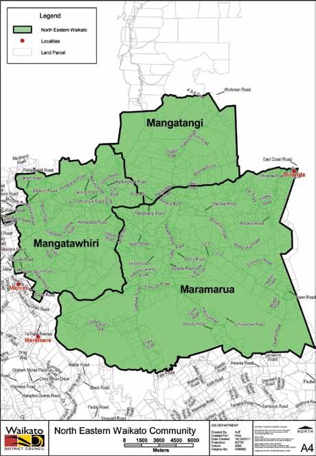
North Eastern Waikato
               Community Plan
                             2011-2021

                Mangatangi

Mangatawhiri

                     Maramarua
2
The NEW area

         North Eastern Waikato Community Plan 2011-2021   3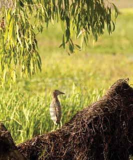
Vision
    Close caring communities with pride and spirit

    A safe haven with an eye towards the future

    Preserving our heritage and remembering our past

    A commitment to our youth as they are our future

    A place where people grow

    A place where resource-based businesses are supported and can thrive

4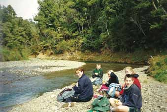
Key Statistics
These figures are based on Census 2006 data held by Statistics New Zealand.

                                                                       Waikato District
                                                      Mangatawhiri

                                                                                            New Zealand
                       Maramarua

                                    Mangatangi

Population               1029            297                     747     43,959           4,027,947

Percentage aged       20.99%       28.28%             26.10%           25.50%               21.54%
under 15 years

Percentage aged        7.28%        7.07%               9.24%          10.00%               12.30%
over 65 years

Private dwellings           366              99                  258     15,090           1,471,746

Ethnicity –           13.90%       16.16%               7.23%          25.85%               14.65%
Percentage of
Maori

Post school           29.12%       29.58%             31.52%           44.80%               46.18%
qualifications

Unemployment           1.74%        4.69%               3.11%                3.54%             3.37%
rate

Median income        $26,700 $23,200                 $33,100 $25,700.00 $24,400.00

                                                 North Eastern Waikato Community Plan 2011-2021           5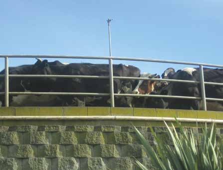
Maramarua history
    Maramarua is a small village located in the middle of everywhere. It lies on
    State Highway Two - connecting Auckland to Tauranga and the Coromandel -
    and in the northern reaches of the Waikato District. If you tell someone you
    come from Maramarua, the general response is, “Where’s that?”, until you
    remind them of our local icons; The Red Fox Tavern, The Pink Pig Cafe and the
    Maramarua Golf Course, which most people seem to know.

    There is some
    confusion over
    where the name
    ‘Maramarua’
    comes from. One
    legend tells of
    a Maaori chief,
    who visited the
    lake (which no
    longer exists) one
    night. He saw a
    secondary moon
    reflected on the
    lake’s calm, crystal water. Startled, he shouted “Maramarua!” Hence the name
    of the location became famous for its two moons: Marama – moon, Rua – two.

    A second legend tells of two old Maaori Chieftains called Mara, who were
    brothers. These men were much loved by their people and when they died, the
                         place where they had lived was called Maramarua in their
                         memory.

                         Waikarakia was the major Maaori settlement in the area,
                         with the direct descendants of Tamatira Totaia who came
                         from Omahu, near Thames. Descendants of this family
                         still live in the area and their ancestors are buried at the
                         Waikarakia Cemetery, a registered family burial ground.
6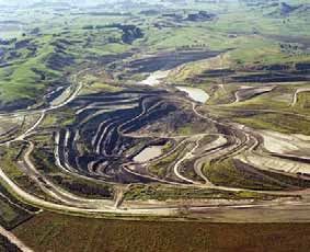
The first European settlers came to Maramarua in approximately 1869 and
named the area Bridgewater, a name which only lasted a few years. Families
were encouraged into the area and over the years Maramarua and the
surrounding districts
grew. The telephone was
connected to the area in
1917 and the power in
1933. The main road was
upgraded and the school,
post office, community
hall and Plunket rooms
were established. Tea
rooms and a butchery
also serviced the local
people.
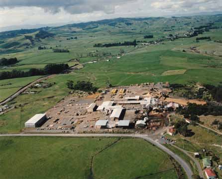
Three local industries have been the backbone of Maramarua. Coal mining
and farming were established in the early 1870s, and the Maramarua Forest
was planted in 1927 which led to the Maramarua Mill opening in the early
1950s. These industries have, to a large extent, dictated the highs and lows
of the population of Maramarua as whole villages were created to house the
many workers. In 2011 mining and farming continue in the area, joined by
a diverse range of other industries including piggeries, poultry farms, cafes,
transport haulage, explosives, vets, service stations, quarries, orchards, clothing
manufacturing, drilling, apiary and our iconic tavern.
Maramarua is a strong
community with a wide
range of clubs and
associations. The Lions and
Women’s Institute both
have a strong presence.
The community is well
looked after with the
Maramarua Volunteer Rural
Fire Force and St John First
Response Unit, both based
by the Community Hall.
North Eastern Waikato Community Plan 2011-2021 7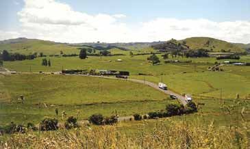
Maramarua School provides a focus point for the community and is supported
    by the Maramarua-Kopuku Playcentre.

    Sport is also well represented by the rugby club, golf club, squash club, karate,
    indoor bowls and teams and individuals representing and playing hockey,
    netball, horse riding, rowing, cycling and using the gym based at the Rugby Club.
    The Maramarua Forest regularly hosts car rallies and moto-cross rides.

    Maramarua is also well known for the hunt club, which started in 1932. The
    Maramarua Hunt is still a renowned event on the hunting calendar, providing
    another iconic event for our village.

    Maramarua really is in the middle of everywhere. Living here it’s central
    to Hamilton and Auckland, Thames and Pukekohe, Te Kauwhata, Matamata

                                              and Kaiaua. It’s a wonderful little
                                              community that has a very caring
                                              heart. There’s something here for
                                              everyone, and our residents, both
                                              long term and more recent come
                                              together for the good of the area.
                                              We look forward to the future and
                                              watching our village continue to
                                              grow.

                                                                        M. Holtham

8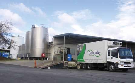
Mangatangi history
Mangatangi
‘Rippling Stream’
or ‘Babbling
Brook’ that is its
literal meaning.

Mangatangi
is a farming
community
bounded on the
north by the
southern Hunua
Ranges, along the south-east by what was known as the Miranda Government
Block, while the west bounds Mangatawhiri and Maramarua.

Pre- European occupation of our district by Maaori was extensive albeit
sporadic. The marae or meeting house, ‘Tamaoho’ at Mangatangi has been in
operation for 100 years. The marae has continued to develop and recently a
whare kai (or dining room)has been built. The annual Pokai Day is held on 12
October each year.

There are some very good Pa sites around the area namely Tui Pa on
Roulston’s farm and others on Vining’s, Taylor’s and Vollebregt’s. Our well-
known Porcupine Hill or Whatarua did have some excellent store pits.

We also have three redoubts, the Miranda, Esk and Surrey. These fortifications
were built to stop Maaori infiltrating behind the lines after the Waikato land
wars in the 1860’s.

Prior to the 1900’s sawmillers came into the district and started cutting kauri
from the virgin bush. 1915 saw the end of the kauri era but gum diggers were
still around. There was also a flaxmill in operation.

                                         North Eastern Waikato Community Plan 2011-2021   9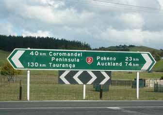
Land was first taken up in the Mangatangi district in the 1860’s by the Field-
     Porter family, an area of 10,000 acres. Early 1870’s saw this land divided up.
     The Vining Bros arrived in 1871 after purchasing 3000 acres. Another block
     of over 2000 was sold to the Waller family. Mangatangi was still deemed to be
     out in the backblocks until the arrival of Mr George Stubbs and two partners
     who purchased 7,000 acres from local iwi and formed the Mangatangi Land
     Company. This was the start of organised development in Mangatangi. The land
     was divided into farming blocks, which were ring-fenced, with a house, a shed
     and a portion of grass.

     From 1918 settlers started arriving to take up their land. Each milked a few
     cows by hand and slowly increased their stock, farming and prices were going
     well but the Post War boom was over, prices fell and Mangatangi succumbed to
     the slump days. Times started to improve for them only to have the depression
     of 1930s on their hands and like everyone else in the country, those that were
     able to weather this period were able to carry on, while others left their land.
     It was said that people gained a very real sense of values and understanding
     during this time.

     A school was soon needed for the families of these settlers and one was
     opened in Dec 1919
     with 13 pupils. Today it is
     the largest school in our
     area with a steady roll of
     over 100 pupils catering
     for many varied activities.
     The school is the centre
     of the community and
     still has the tradition of
     calf and lamb day, which
     is well supported, by the
     district.

     Between 1931-35 most of the roads had been metalled and some farmers and
     relief gangs provided the labour. Up to this time dairying was the only industry
     but sheep farming was introduced. In the 1930s the government Small Farm
10
Settlement Scheme came into being and the bigger blocks of land were divided
up, meaning more farmers were settled on the land.
The population growth provided impetus for a store and a garage. These were
set up in 1936. Electricity came to the district in 1931 and this helped to
improve the lives of the folk on the land. Gone were the candles, the smelly
kerosene lamps and petrol engines for the milking sheds.
The war years came again and many of the men were sent overseas while
others joined the Home Guard to defend the home front.
Trucking businesses for carrying stock, general goods and lime from Miranda
were set up in the early 1930s. Mr Josh de Jongh’s depot was situated on the
Kaiaua Road
and another
truck depot
started by
Mr Pippin
was down
at the
Mangatangi,
Monument
Rd and
Miranda
junction.
1952-53 saw a few changes. The Mangatangi Garage was sold to Mr J Davis and
Bell-Booths took over the store. Mr Norm Frederiksen took over the school
bus run and setup an engineering business.
The earliest Post Office and telephone exchange was situated in Bentley’s
house before a Post Office was built beside the hall around 1931. The
telephone was operated from Hartmaan’s house on Monument Rd for
some time before an exchange was built beside the Fire Station and became
Automatic in 1950s. Rural Delivery came in 1936.
North Eastern Waikato Community Plan 2011-2021 11The first hall was built in 1940
and in 1960 a new hall was built
incorporating a Plunket Room
and a Library.
Montana came into the area in
1968 and planted 450 acres of
grapevines. The vines succumbed
to the phylloxera and they closed
the operation in 1984 and sold off the land. Many of the locals were employed
by Montana particularly during the harvest season.
In 1972 we saw the formation of the Mangatangi Fire Party, progressing to a full
fire brigade and is an important facility throughout our area. The Mangatangi
Dam, which provides water for the Auckland area, was opened in1977 and this
lovely area is worth a visit.
12Tennis has always been strong
in Mangatangi since the courts
were first built in 1948-49. Today
we have three Astroturf courts
adjacent to the school and they
are used for hockey and netball
practice. Mangatangi Tennis Club
survives today with junior teams
in interclub competitions.
The Kaiaua-Miranda Play Centre was formerly situated at Miranda but in May
2004 a new Play Centre was opened at Mangatangi and caters for all pre-
schoolers in the area. Church had always been held in the hall but in July 2010
the congregation moved into their lovely building, the Christian Crossroads
Centre.
Over the years farming methods have altered and diversification came in the
1980s, where we saw goat farming, rabbits, ostriches and horticulture including
squash, onions and maize and bull farming introduced, but cattle and dairying
are now the dominant farming pursuits. We have many lifestyle blocks and
residents commute to Auckland and other urban centres to work.
Today Mangatangi is still a predominantly a rural settlement, proud of its past
achievements and will continue to prosper.
Compiled by Kath Banks
North Eastern Waikato Community Plan 2011-2021 13Mangatawhiri history
Mangatawhiri is a farming district located 62kilometres south of Auckland on
the old Thames-Paeroa highway. Mangatawhiri translates as ‘the stream where
the tawhiri tree grows’, and refers to the boundary between Maaori and
Pakeha at the time of the land wars in 1863. General Cameron crossed the
river in 1863 and declared war upon the Waikato tribes.
At the conclusion of the wars, land in this area was balloted for. Access to
Mangatawhiri was along Valley Road, the settlers came over the hills from
Drury via a track known as Happy Valley Road and now called Paparimu
Road. The highway was not built until after the turn of the century and has
just undergone change in 2010. With the realignment of State Highway 2,
Mangatawhiri has been bypassed but still remains as an alternative route to the
firth of Thames, and Coromandel.
The first white settler, Robert John Lyons, took up land on March 12, 1867,
with his wife Margaret and son William. James Lyons now farms the family
farm on Lyons Road and operates part of the sheep and beef farm as an
organic dairy farm. The Lyons were soon followed by other families. These
included the Reeds, whose Crown grant in August, 1867, was registered in
1868, and the Popes in the same year. Pope’s Lagoon is known to many duck
shooters and is on the original Pope property. Aloe Reed married Charles
Pope and the family are in their seventh generation of farming today in the
district.
The Keith, Mabey, McPherson, Pendergrast, Appleby, Twining, McIlroy, Motion,
Caie and Parker families were all settled in the valley before the turn of the
19th century.
One of the first homesteads built of locally sourced pit sawn kauri in 1875 cost
189 pounds and the timber for its 2000 sq. ft area weighed 40 pounds. Several
other houses were built of timber taken from the valley.
14In the early 1890s one of the last Maaori war canoes was made from a
kahikatea tree growing in the valley at a place known as Canoe Corner. Until
1980, Seacraft milled kauri trees from the surrounding bush in the valley and
used these to make pleasure craft. Up until 2010, pine was milled at Twining
Road and the timber was supplied to build Haines Hunter boats.
Much hard work was required by the settlers to clear the land and build roads.
Many helped with road construction taking the metal from the Mangatawhiri
River. Flax milling was an early industry, replaced by dairying and sheep as
pastures were developed.
After the turn of the 19th century a dairy factory was built by the settlers on
Keith’s property and later moved to the new one on McKenzie’s farm. Today,
however milk is taken out of the valley by tanker. A lot of the sheep farms in
Mangatawhiri have now converted to dairying and the size of the average dairy
farm in Mangatawhiri has increased through farm amalgamations. Mangatawhiri
has its own organic dairy factory where Green Valley Milk processes milk
on-site to sell throughout the country. Marphona Farms is the largest organic
dairy farm in Australasia holding AsureQuality full organic certification. Their
Mangatawhiri farm also houses the dairy factory to produce top quality Green
Valley milk products. There are also several farms supplying organic milk to
Fonterra and milk is also supplied to Open Country Cheese dairy company.
North Eastern Waikato Community Plan 2011-2021 15The fertiliser bulk store Altum formally Summit Quinphos is situated on the
new Mangatawhiri Road and supplies fertiliser to the local farmers. Twining
Nurseries is located on Twining Road and supplies grown hedging in metre
long bags to New Zealand markets.
Among the other early occupations were timber felling and gum digging, a
marked contrast to todays industry of organic milk production, dairy farming
engineering, chicken farming and hatching, and nursery growing.
The valley is served with a daily mail delivery from Pokeno. The nearest town
to Mangatawhiri is Pukekohe where many of the residents go to shop and
work. A number of the smaller farms in Mangatawhiri have been cut into
smaller lifestyle blocks. Many of these residents commute to Auckland to work,
and enjoy a rural lifestyle in Mangatawhiri.
The first school was held in the Lyons’ homestead. As the population grew, Mr
Robert J. Lyons gave land on the Valley Road corner for the school. The school
16was moved across the river by traction
engine to its present site on McKenzie
Road in 1925. A new school was built in
1962 and is a strong focus point for the
community today. The school celebrated
its 125 year reunion in 2003 and a book on
the history of Mangatawhiri School and its
district was written by Donnelle Hamilton.
The Mangatawhiri Hall was burnt down by
a mystery fire in 1961 and was rebuilt in
1962. 2012 will mark 50 years of the hall’s
popular existence. The preschool is held
in the hall three times a week and has a
thriving roll. Many other groups also use the
hall for their events.
When people ask for directions to Mangatawhiri, the locals will often use The
Mangatawhiri Castle as a point of reference, well known for its large ice-
creams. The castle was built by Mr Banner
around the original Mangatawhiri Store of
1934. It features pictures of Snow White and
the seven dwarfs on the outside and medieval
paintings on the inside of the turrets. Today
with the bypass of the highway, the castle has
closed down. The petrol station opposite is
now a dairy servicing the local area.
Mangatawhiri has undergone change over the years and the new by-pass
has challenged the area. However Mangatawhiri will maintain its strong
community spirit, a legacy of its rural roots.
Excerpts have been taken from the Mangatawhiri Valley Centennial
Celebrations booklet of 1967 for parts of this writing.
S Young
North Eastern Waikato Community Plan 2011-2021 17A plan for North
Eastern Waikato
What will this plan achieve?
Your North Eastern Waikato Community Plan is the vehicle for
community discussion, on which future outcomes for the area can be
determined.
The views expressed here will be taken into account when Waikato
District Council undertakes more detailed consultation on specific
topics.
It is important to remember, this is not a council plan.
Your community plan is a collection of ideas for action. It is a priority
list of desired works and activities that have been identified.
As well as focusing community debate and getting people involved in
the future of their community, the plan will help influence Waikato
District Council’s programme of works during its annual and long-
term planning processes.
A number of the issues raised are not the council’s responsibility but
the council will work with the community and the North Eastern
Waikato Community Committee to advocate and facilitate the
process.
18Link to Community Outcomes
Under the Local Government Act 2002, Councils are required to facilitate
the identification of, and report on the achievement towards Community
Outcomes for their residents. Having consulted with the Waikato District
community, the following Community Outcomes have been identified:
Accessible A district where the community’s access to
Waikato infrastructure, transport and technology meets its needs.
Sustainable A district where growth is effectively managed and
Waikato natural resources are protected, developed and
enhanced for future generations.
Thriving A district that prides itself on economic excellence and
Waikato where heritage and culture are protected and celebrated.
Healthy A district with services and activities that promote a
Waikato healthy community.
Safe A district where people feel safe and supported within
Waikato their communities.
North Eastern Waikato Community Plan 2011-2021 19Key Issues and Projects
The following key issues and projects are consistent with the Council’s five Community
Outcomes. Following the public consultation and based on the feedback we received the
North Eastern Waikato Community Committee will prioritise the issues and projects.
Specific issues and projects
The North Eastern Waikato Community Committee has identified
the following key issues and projects:
Environment - links to Sustainable , Healthy and Safe Waikato:
Clean culverts and drains
Address flooding issues
Clean all waterways
Beautification – more planting and maintenance
Green waste facility
Road safety - links to Accessible and Safe Waikato:
The schools need
improved signage for
warning of proximity and
to reduce speed
Improve road, safety and
visibility near the schools
20 Safe pedestrian crossing near the schools
Bus shelters for school children
Maintain tidy roadsides
Upgrade street lighting
Upgrade and maintain footpaths
Main road in Maramarua from Mobil Garage to the Red Fox
Seal Fire Station car park
Improved parking area at community halls
Review speed limits in and around the area
Review road safety due to increasing traffic levels
Traffic calming measures need to be put in place to control traffic movement
and speed
Liaise with the Police to monitor speeds
Install emergency traffic control
Improve visibility on Monument Road/State Highway 2 intersection due to
obstructions of signage
‘No parking’ sign at top of Maxwell Road opposite the Pink Pig.
North Eastern Waikato Community Plan 2011-2021 21Transport/Roading - links to Accessible, Safe, Sustainable and Thriving
Waikato:
Communication and consultation with New Zealand Transport Agency on
future development
Widen road and trim trees at Garage Services
Roadsides need to be regularly mown
Tarseal Ferndale Road and other metal roads
Upgrade kerb and channel
‘No engine braking’ signs at both ends of Maramarua
Check and repair
all bridges and
culverts
On/off ramps
around the
expressways
Welcome signage
Full diamond at the intersections - Monument Road and Maxwell Road
Development of Maxwell Road / State Highway 2 intersection
Median strip along the whole of the 70kph zone and the zone to be extended
Investigate warning signs for side roads
22Recreation Facilities - links to Healthy, Accesible and Thriving Waikato:
Create walkways in future developments
Public park on State Highway Two
Playground
Picnic/barbeque area
Skateboard ramp
Minigolf
Toilets
Upgrade rest areas
Upgrade and maintain the swimming pool for the community
New library service
Upgrade rugby club facilities
North Eastern Waikato Community Plan 2011-2021 23Social - links to Sustainable, Healthy and Safe Waikato:
Ensure general upkeep and tidiness of the area
Address any graffiti problems.
Community Development - links to Sustainable,Thriving, Healthy,
Accesible and Safe Waikato:
Support and development of local businesses
Consultant to assess further business potential
Improved service centre
Protection of existing resource based business from incompatible land uses and
land use activities
Update the History
Promote the area and look at the development of community events
Recognition of the heritage of the area including cultural significance
Work with Solid Energy for end result for the mine
Update of Civil Defence plans for the area
Support emergency services
The council to support social agencies which benefit the community
Liaise with Glen Coal Energy Ltd. regarding platforms in wetlands
24Subdivision - links to Accesible,Thriving and Sustainable Waikato:
Structure Plan in place for future subdivision
Improved zoning
Work with New Zealand Transport Agency to support growth
North Eastern Waikato Community Plan 2011-2021 25Where to From Here?
The next steps
This community plan was developed by the North Eastern Waikato
Community Committee and is their aspiration for the future. It does not
reflect the Waikato District Council’s priorities or funding availability.
The committee will continue to work with the council to communicate any
issues and advance on approved projects.
Please contact North Eastern Waikato Community Committee or
Waikato District Council if you would like further information.
26North Eastern Waikato Community Plan 2011-2021 27
Ngaruawahia District Office
                 15 Galileo Street
           Telephone: 07 824 8633
                 Fax: 07 824 8091

              Huntly Area Office
                   142 Main Street
            Telephone: 07 828 7551

              Raglan Area Office
                      7 Bow Street
            Telephone: 07 825 8129

              Tuakau Area Office
                 2 Dominion Road
           Telephone: 0800 492 452

        Waikato District Council
                   Postal Address:
                  Private Bag 544
                     Ngaruawahia
                NEW ZEALAND

                  0800 492 452
     www.waikatodistrict.govt.nz

28
You can also read