OTMC TRIP REPORTS 1989 - Sourced from the 1989 OTMC Bulletins
←
→
Page content transcription
If your browser does not render page correctly, please read the page content below
OTMC TRIP REPORTS
1989
Sourced from the 1989 OTMC Bulletins

       Otago Tramping and Mountaineering Club – Trip Reports 1989 (V1.0)
                                                      © www.otmc.co.nz
OTMC TRIP REPORTS – 1989

CONTENTS
Introduction ....................................................................................... 3
Scarlet Lady, Blue Boy and Bag Lady In The Huxley ....................... 4
The East Eglinton Valley .................................................................... 6
The Five Passes .................................................................................. 8
Sugarloaf, Rockburn, Park Pass...................................................... 10
Ahuriri (Canyon Creek).................................................................... 13
Bushcraft ’89 – Directors Report .................................................... 15
Lake Ohau Bushcraft Weekend - Huxley........................................ 16
The Extended Ohau Weekend ......................................................... 18
A Geriartic Grovel ............................................................................ 20
Bushcraft 1989 – Silver Peaks Weekend ....................................... 23
Lake Ohau Two/Three Day Trip ...................................................... 25
Maungatua Traverse ........................................................................ 27
Mueller Hut, Mt Cook ....................................................................... 28
Copland At Easter ............................................................................ 29
Cascade Creek – Livingstone Mountains ........................................ 31
Bushcraft Huxley Weekend ............................................................. 33
Mt Cook – Mueller Hut ..................................................................... 35
Waitangi Weekend – The Trip That Wasn’t.................................... 38
Canyon Creek to Ahuriri & Little Canyon Creek ............................. 40
Homer Area – Waitangi Weekend .................................................. 42
Ahuriri Valley ................................................................................... 44
Jim Freeman Track – Craiglowan Falls ........................................... 46
Hooker Valley ................................................................................... 48
Kohurau – Hundred Mists................................................................ 50
West Matukituki Trip ....................................................................... 52

                                                                                         1|Page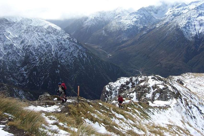
OTMC TRIP REPORTS – 1989

Matukituki Weekend ....................................................................... 54
Trotters Hut Wine & Dine ................................................................ 56
North Col – Park Pass - Rockburn .................................................. 58
Chinaman’s Hut................................................................................ 61
That’s The Worst Of It? – Bledisloe Gorge ..................................... 63
Mt Luxmore Cooking Competition .................................................. 65
Climbing Avalanche Peak ................................................................ 66
Key Summit to Cascade Creek ........................................................ 68
Possum Hut Workparty ................................................................... 70
Macetown ......................................................................................... 71
Parakeet Ridge ................................................................................ 73
Geriatrics Attack Dore and Glade Passes ....................................... 74
The Grand Three Pass Travese........................................................ 78
OTMC Committee (1989-90) ........................................................... 81
OTMC Trip Programme 1989 ........................................................... 82
OTMC Bulletin Covers (February to May) ....................................... 84
OTMC Bulletin Covers (June to September) .................................. 85
OTMC Bulletin Covers (October to December) .............................. 86

                                                                                        2|Page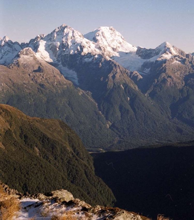
OTMC TRIP REPORTS – 1989
INTRODUCTION
Two major issues were resolved more or less by the OTMC in 1989. The first was a final
decision that we should purchase a suitable building as our own clubrooms, assuming we could
find a property that was affordable. The preferred area would be somewhere between North
Dunedin and the Oval – a sub-committee set about looking at possible properties throughout
the year.
Another big issue that had caused much deliberation over many years was the removal of the
exotic plantings on our Ben Rudd’s property. The trees were planted with the best intentions
(anticipating untold wealth for the club), but over the years the club’s ethics on exotic trees on
our property had changed, and by the end of 1989 the majority of the plantation was gone.
The cost of extraction eroded heavily into the club’s eventual financial return, but the resultant
surplus has been used to fund various projects on the property over the years, and the capitol
from the trees remains today and is ably managed by the Ben Rudd’s Management Trust.
Good numbers on Bushcraft 1989 continued a trend from the recent years, and the
participation and enthusiasm from those on the course ensured we had some very well
supported trips over the year.
The optional Bushcraft trip to the Ohau area encountered heavy rain on the Saturday night to
the point that multiple parties were trapped in various locations across the Maitland, Temple,
Hopkins and Huxley valleys. The trip was a large one, with 59 trampers. Remember this was
the days before email and mobile phones, so the job of our Dunedin based SAR contact was
huge in contacting friends and families to say that all were safe but will not be home on Sunday
night. The weather fortunately cleared during Sunday night, and the trip arrived back in
Dunedin on Monday afternoon. Bushcraft 1989 was my first time running the course, and I
remain proud of the way all the party leaders managed the risk and made sound decisions.
After a dry and hot weekend in the Silver Peaks two weeks earlier, the Ohau trip certainly
provided a glimpse of some quite different weather conditions.
Coincidentally, a return bus trip to Ohau in December 1989 suffered the same weather, but we
managed to get out on the Sunday – maybe there will be reports on this trip in the 1990 Trip
Report collection.
Overall trips were well supported in 1989, with an average of 20.3 per weekend trip, and two
carloads on the day trips. The 1989 Annual Report mentioned that we were disappointed that
only 20 people turned up to the Club Picnic – that would be regarded a great number today, an
indication of how the club has evolved over the years.
Antony Pettinger
March 2021
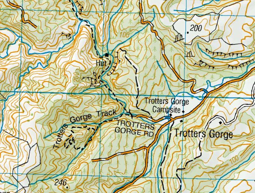
Cover Photo: Hidden Falls Creek (back valley), Park Pass and the head of the Rockburn from near lakelets to the
north of Lake Nerine (PHOTO Antony Pettinger)
3|Page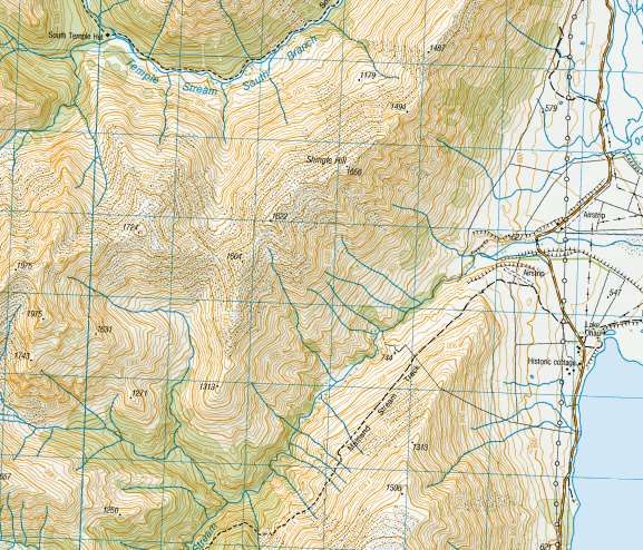
OTMC TRIP REPORTS – 1989

SCARLET LADY, BLUE BOY AND BAG LADY IN THE
HUXLEY
November 1988
Author: Teresa Wasilewska
Published in Bulletin 474, February 1989

Having decided to explore the South Huxley area, we headed off via greasies in Oamaru
(Gastronomic Note - we recommend the Chinese down the road from the usual stop although
Heather didn’t think much of the chips, Cafe de Curb had excellent if slightly more expenses
fish and chips. Bill’s remarks about his paua pattie are unrepeatable!) We carefully recorded
the mileage to separate points along the Ohau Road for those who wish to find the Maitland or
Temple turnoff in the dark and took advantage of the Temple Shelter for our night’s sleep,
giving the new ultralite sleeping mats suitable initiation on hard concrete!
Saturday morning we decided against driving all the way to Monument Hut, although there is a
track across the shingle, it is not very clear and the river has been known to rise, cutting off
routes for vehicles. It is an easy walk and the riverbed had plenty of flowers to
investigate. The track is well marked up after Monument Hut, along the valley and into the
bush and on up to the Huxley swing bridge. The meadow just after this, was filled with lovely
spring flowers, well worth pottering slowly along. Unfortunately, rain began to fall so we
headed for Fork’s Hut for lunch and contemplation. (Gastronomic note - cucumber and salmon
sandwiches really should be eaten with crusts off!)

                   Huxley Forks Hut (Officers Hut behind) (PHOTO by Antony Pettinger)

                                                                                        4|Page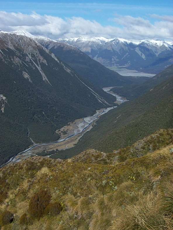
OTMC TRIP REPORTS – 1989

The rain continued but we pressed on, along a well-marked track towards the South
Huxley. We reached the forked stream on the true left of the river where the map shows the
track crossing well below the fork, then heading towards the river edge of a small plateau,
crossing diagonally and into the South Huxley. Having had some difficulty crossing the stream
due to both the rain and the snow melt, we could not find the track and decided to return to
the forks. On final inspection, we looked above the fork and saw a feeble marker on a fallen
tree - there had been quite extensive and recent avalanche spill in the stream, which washed
away cairns and knocked down some trees on the stream edge - and the map shows the track
incorrectly. Because of the continuing rain and being uncertain whether the track would once
again mislead we decided to return to the Forks Hut for the night. Just as well, as we hear that
the ‘Bivy’ in the South Huxley is little more than a dachshund’s dog kennel!!
After Heather’s wonderful dinner (Gastronomic Note - always check who is bringing the sherry -
we ended up with two bottles, how wasteful - there being only two empty bottles
remaining). We retired to the honeymoon suite - the original Forks Hut, which is very small but
still on site, where Bill and Blue Boy chose the floor and Heather left her scarlet lady clip behind
the bunk. Anyone going to that area please check behind the bottom bunk! We decided to
head up Broderick on Sunday - a good track, although lots of recent slip and avalanche debris
and lovely views.

                            North Huxley River (PHOTO by Antony Pettinger)

Because we took the weekend at a leisurely pace we all felt that we had seen and done more -
hares, a wallaby, a variety of bird life and (I’m convinced) a wild mink!?? The flowers - lupins
along the lake, mistletoe, orchids, curisia, Mt Cook lilies, celmisia and all the ones that we
couldn’t name were lovely.
Teresa Wasilewska for Heather and Bill Roberson (for those of you with fanciful minds, Bill and
Heather had bright coloured silk sleeping bag liners!)

                                                                                        5|Page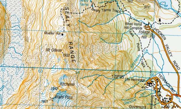
OTMC TRIP REPORTS – 1989

THE EAST EGLINTON VALLEY
November 5-6, 1988
Author: Sue Harding
Published in Bulletin 474, February 1989

The forecast was promising, and we had a pleasant crew to tramp with, so it looked like we
were in for a great weekend. Our trip involved making our way up the East Eglinton
Valley. Saturday morning was overcast but not too bad. The route was undulating, and the
track was covered with windfall and overgrown in parts. However, by lunchtime we had made
our way to the first clearing. After a rather wet lunch (it started to rain), we lost John and
Sandy, however 40 minutes later we were all reunited, well up the valley. The Livingstone
Mountains now surrounded us and Cascade Creek Saddle was coming into sight. By 6.30pm
we were tired, wet, cold and miserable so we decided to call it a day. Luckily we did as the
rain became heavier and soon it began to snow.

           Exiting the bushline from Cascade Creek, heading towards the head of the East Eglinton
                                        (PHOTO by Antony Pettinger)

Sunday morning we awoke to a white, cold world. Walking up to Cascade Creek Saddle was a
rather miserable affair as the snow continued to fall on us. We all had frozen feet so we
decided to change our plans. Rather than make our way across the tops of the Livingstones
we’d drop into the Greenstone. An excellent decision as it was much warmer and drier in the
valley. We lunched in the Lake McKellar Hut with Gary Nixon who also happened to be

                                                                                                    6|Page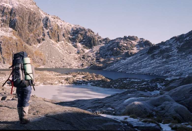
OTMC TRIP REPORTS – 1989

tramping in the area. We continued down the valley and finally reached the Routeburn Shelter
and vans at 4pm. A long but very enjoyable trip.
Sue Harding for John Robinson, Michelle Williams, Arthur Blondell, Doug Forrester and Sandy
Gordon.

On the Livingstone Mountains, the valley behind the trampers is the head of Cascade Creek, the one going straight
                    back is the head of the East Eglinton River (PHOTO by Antony Pettinger)

                                                                                                   7|Page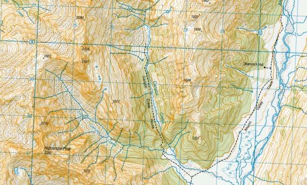
OTMC TRIP REPORTS – 1989

THE FIVE PASSES
January 31 – February 3, 1989
Author: Sue Harding
Published in Bulletin 474, February 1989

Our epic trip began with a rather late start of 9.30am, however by 11am we had reached the
Routeburn Flats Hut and were heading up towards North Col. The North Branch is often
overlooked by trampers doing the Routeburn, however it is a very beautiful valley, well worth a
visit. North Col was covered in snow and so John and I were thankful we had taken ice
axes. The snow was soft however it still felt more secure with an ice axe in my hand.

             In the North Routeburn, cloud spilling over North Col (PHOTO by Antony Pettinger)

That night we camped on top of North Col in the mist. The following morning there was low
cloud hanging around, however we were on our way by 8.30am. The climb around to Lake
Nerine was rather lovely, as the cloud slowly disappeared revealing all the glorious peaks and
valleys of Fiordland. To our surprise Lake Nerine was partially frozen which destroyed any
ideas of a quick dip. Snow lay all around the lake and the surrounding slopes. The journey to
Park Pass was very quick but hot work as the sun beat down on us. We lunched by a little tarn
on Park Pass before heading down to Hidden Falls Creek. It was a fast trip down but rather
hard on our knees. We still had plenty of energy to make our way up to Cow Saddle. We
camped in a rock biv, a short distance from Cow Saddle where we were joined by some rather
shy kea.
The next morning was bright and sunny. We were heading up by 8.30am to Fiery Col which
turned out to be heaps easier than I imagined. We reached the top by 10.30am. Being in high

                                                                                                 8|Page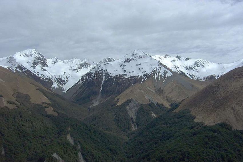
OTMC TRIP REPORTS – 1989

spirits we decided to climb Fiery Peak. This I didn’t enjoy very much as the rock was rotten
and crumbly, so I stopped about 80m short of the top, but John continued to the summit. We
then continued on to the Olivine Ledge in the heat of the day. About 1.30pm we had a much-
needed lunch break by another pretty little tarn. We had views of the Olivine’s, Forgotten
River, Alabaster Pass, etc. The afternoon was to prove long and tiring. Getting to Fohn Lakes
involved climbing 2000 feet under the hot sun. It was an interesting area with rock ledges and
a gorged river.

               Camping at the lakes below the main Fohn Lake (PHOTO by Antony Pettinger)

By 4.30pm we had reached Fohn Lakes which were frozen over but very beautiful. We had
planned to climb Sunset Peak but felt too stuffed so just headed onto Fohn Saddle which was
also covered in snow. The descent was quick at first as we bounded down the snow
slopes. However further down we ended up bashing through nasty Matagouri. By 6.45pm we
were down at the rock bivy where we planned to stay but it was so dark and dingy and had
unsavoury occupants (sandflies) that we decided to pitch our tent instead. That night it
rained.
Next morning, we didn’t leave until 9.30am as we thought we would have an easy day (ha ha
ha!) I visualized John and I both having a drink in the Glenorchy Pub but after 6½ hours of
grovelling down the Beans Burn we had only reached the Dart River. This included a detour we
made due to a certain (nameless) friend’s instruction. We reached Rock Burn Hut at 5.30pm
and continued on to Lake Sylvan which took a lot longer than we had anticipated. We arrived
at the road end at about 8.45pm very weary. John then ran to the Routeburn car park which
took about ½ hour. We arrived in Dunedin at about 3am. A very enjoyable trip but next time
we’ll take 5 days and will avoid the Beans Burn.
Sue Harding for John Robinson

                                                                                           9|Page
OTMC TRIP REPORTS – 1989
SUGARLOAF, ROCKBURN, PARK PASS
December 29, 1988 – January 2, 1989
Author: Teresa Wasilewska
Published in Bulletin 474, February 1989
A slow start to see if the weather would lift, it did and we headed off with good instructions -
the Sugarloaf track is well marked, apart from the initial turn off form the Routeburn. This is
just after the 5th board bridge along the track, ignoring some of the little ones, about 20
minutes down the track. There is a definite track leading off to the right, but only an old axe
blaze on the tree. 2 hours to the pass is definite puff material for the likes of Linda and me.
The tussock, heading towards the left side of the pass where the track goes over and down
quite steeply. I’m told that a trip to the ‘false’ top of Sugarloaf is wonderful on a clear day - it
takes about an extra hour and there is a tarn for swimming with panoramic views - this was not
to be for us, as a cold wind came up while we picnicked and we headed smartly off down to
the bush.
Rockburn Valley side of Sugarloaf Pass, looking up the Rockburn Valley (PHOTO by Antony Pettinger)
Having been warned to watch carefully for the point where the track divides, one to the gorge
and one up to Park Pas we found it extremely well marked, with about 4 different markers,
arrows and directions! Obviously many have been caught out before! Although rain was falling
steadily and the river was obviously high, we had no problem crossing the streams on the
10 | P a g eOTMC TRIP REPORTS – 1989
track. There is a small bivy just after the second stream - the track crosses the stream just
above a waterfall and then goes down along the edge, skirting round the bivy rock - a
wonderful spot for a morning shower! Once we reached the river, the track was fairly easy to
follow to the first small flat (good camping spots) and the 2nd flat (good swimming spots) and
varied bush and beech forests. Staying fairly close to the true right, the track follows the river
up to the swing bridge just below Theatre Flat, crosses and heads across the flats to go into
the bush, marked by cairns.
Theatre Flat has three small clusters of trees with excellent camping sites for whatever weather
conditions occur - the largest has a bivy rock, which has been well used, as well as three well
established campsites. There are good swimming areas in the river and around different rocks
in the flat. We based ourselves in a corner sheltered from the southerlies, pitched our tents
and retired early after John’s gallant efforts finally got the fire going in the rain! Other
trampers sheltering around the flat had met with Chris’s party doing the Five Passes trip and
dreadful stories of rain, cold and misery.
Theatre Flat from below Lake Nerine (PHOTO by Antony Pettinger)
New Year’s Eve dawned misty but got better so we headed off for the day to Park Pass - over
Janus Knob at the head of Theatre Flat - making a side trip for wonderful views of Amphion,
Minos and the flats, a swim in a tarn and study of a wonderful little ecosystem on top of the
rock. Through the flats on the other side and into an area called the Deer Trails - the track
goes up quite steeply immediately after crossing the stream that comes off Amphion and is
relatively well marked but I was warned not to be tempted to go too high. After coming out of
11 | P a g eOTMC TRIP REPORTS – 1989
that area, the track winds down to the river where it opens out and is easy to cross, following
up the true right towards the pass. At the bottom of the pass there is a substantial bivy - a big
triangular rock near the stream coming off the pass, which is a good shelter in all weather
conditions except southerlies.
We reached the pass and looked carefully for Chris’s party who were to join us for New Year’s
celebrations but were hiding in Hidden Falls. Celebrating with an exothermic swim in the tarn,
we headed back down and almost had to resort to violence to keep Linda awake to see in the
New Year.
New Year’s Day was spent in total laziness on Janus Knob, swimming, sunning, photographing,
fossicking round for different flowers, orchids, water creatures and watching Linda being dive
bombed by curious kea! We never even heard Chris and party trudge by but met them later on
the second flat en-route out (gastronomic note - never eat a scrumptious tea after 3 days
tramping being watched by a group that have lived on muesli bars for a week). We bribed
Rosemary with a cold sausage, toast and honey and were treated to a New Year’s hymn in
return. I lent my poofta pad to John for the night (generous soul I am) and he didn’t even
snore at ALL! We were grateful to Chris’s party for being relatively quiet in departing at some
ungodly hour - we enjoyed toast and honey before out via the gorge.
The track does most of the climbing before dividing into the gorge and Sugarloaf directions;
however, the gorge track does have a fair amount of guts and gully’s to cross, some of them
quite steep. There are excellent views up valley to the Pass and across to Earnslaw and Leary
Peak. The track returns to the river at a refreshing swimming spot and then meanders through
the final shoulder of beech and divides right towards Lake Sylvan and out and towards the
McIntyre Hut and the Rockburn outlet into the Dart. The extra 10 minutes to the hut and river
are well worth it - the river comes out spectacularly through a narrow gorge, quietly but swiftly
and is wonderful to swim in.
The track to Lake Sylvan is well marked, the lake itself is full of frogs, ducks and jumping fish.
Thanks for a wonderful start to 1989.
Teresa Wasilewska for Linda Miles and John Galloway
12 | P a g eOTMC TRIP REPORTS – 1989
AHURIRI (CANYON CREEK)
January 14-14, 1989
Author: Heather and Bill Robertson, with Teresa Wasilewska
Published in Bulletin 475, March 1989
We reached the Ahuriri well after dark and thought we should establish some landmarks en-
route down the valley. 103 rabbits after the turn-off, you should reach the Ben Ohau/Birchdale
boundary where the road divides (beware kamikaze rabbit #57 who dared Bill to run him over
and #87 who did a double somersault in front of the car before running away and #151
appeared drunk and ran towards the car in a wobbly line; #156 should be a sign that your
destination is near!)
Ahuriri Base Hut is easily visible in daylight, very near the edge of the bush, however neither
the bush nor the hut are obvious in the dark. Start looking for a grass track just beyond the
first fence line after the cattle yards. We had a decadent start to the weekend with a brew-up
and biscuits on arrival (while Bill locked the car to keep the possums out!) and discussed what
happens to our brains when soaked in Formalin. The strain was so much that Heather
dreamed of sharks (what would Freud say?) and Bill had to have his breakfast in bed.
We walked up the valley road about 1½ hours to Canyon Creek - Moir says ‘the road ends at
Canyon Creek and a four-wheel drive track continues up the valley (obtain permission first)’ as
we did not intend to go beyond Canyon Creek we did not contact the run holder in question
and did not take vehicles on his track. En-route on Sunday we were questioned as to where
we had been and whether we had thought about obtaining permission first - our questioner
13 | P a g eOTMC TRIP REPORTS – 1989
drove past us and was seen to stop at Ahuriri Base Hut, possibly to check the intentions book,
before driving on.
Canyon Creek is easily reached, on a well-marked track that starts through bush slightly
upstream from the junction with little Canyon Creek. It climbs steeply for about 1½ hours to a
lookout into the top of the valley and then down to the valley floor. We followed the stream,
the track sometimes marked in bush or across the flats, keeping to the true right until we
reached the foot of the waterfall at the head of the valley. Cairns mark the steep route up to
the left of the cliffs, through scruffy low bush and into the south side of the hanging
valley. Some are difficult to find, but it is worth persevering, the valley is dramatic, with
flowers, streams and interesting corners. We camped surrounded by gentians and panoramic
views.
Towards the head of the valley, there are sporadically placed cairns marking the route to a
luxury bivvy rock. Moir describes it as being in the middle of the valley. We found it very near
the head of the valley, easily visible as the largest rock on the flat area just past a large scree
fall on the left-hand side.
Both levels of the hanging valley were fascinating networks or waterfalls, streams, vegetation
and views with good camping spots. Access looked far more difficult than it was, as long as
patience was used to follow the track and as we came out we were sorry we hadn’t had an
extra day to fossick around the hanging valley, climb the ridge overlooking the Ahuriri and
generally explore. Nobody can tell us the Ahuriri Valley is a boring valley!
Heather and Bill Robertson with Teresa W.
14 | P a g eOTMC TRIP REPORTS – 1989
BUSHCRAFT ’89 – DIRECTORS REPORT
February - March, 1989
Author: Antony Pettinger
Published in Bulletin 476, April 1989
The Bushcraft Course is now over, and once again the course was a roaring success. 51 people
participated in the course, which is about the same as the past couple of years. We had 11
school students who were partly subsidised by AMP Perpetual Trustees and the Family
Tramping Group. I would like to extend the club’s gratitude to these organisations.
The course would not have worked if it wasn’t for the help and dedication of all club members
who instructed, led etc. so they all deserve a BIG thank-you. I would also like to personally
thank David Peacock for Tirohanga, Peter Mason for the Silver Peaks, Bill Robertson for Ohau,
Mike Floate for Rivercrossing and Ross Cocker, Stu Mathieson and Debbie Williams for all your
help, advice and encouragement since last October.
I enjoyed co-ordinating this year’s Bushcraft, and I wish Ross Cocker all the best for next year
and hope he will get the same level of club members involvement as I did.
Course Director
Antony Pettinger
Bushcraft 1989 – Tirohanga Weekend, tent instruction with Debbie Williams and Stu Mathieson
(PHOTO by Antony Pettinger)
15 | P a g eOTMC TRIP REPORTS – 1989
LAKE OHAU BUSHCRAFT WEEKEND - HUXLEY
March 11-13, 1989
Author: Suzanne Mackay
Published in Bulletin 476, April 1989
After a damp bus trip we stumbled off in the dark to set up our tent at the road end. An
uneasy nights sleep was spent by all with the tent billowing and flapping in the driving
rain. When we crawled out for a leisurely breakfast around 8.30am we realised that we
commanded the best view in the carpark, and the most exposed campsite! Just one of the
hazards of setting up camp by torchlight. Fortified by breakfast and preceded by all the other
parties we set off up the valley over the riverbed toward Monument Hut. The views left a little
to be desired being mostly obscured by a low-lying cloud layer.
Signs of approaching front, Hopkins Valley (PHOTO by Antony Pettinger)
The track was well marked, not by the usual trail markers but also by a profusion of Minty and
Barley Sugar papers. As we drew closer to the Forks area we came upon a flock of Canada
Geese, but didn’t see many other birds. We forded the North Branch of the Huxley easily and
set up camp about 1pm. A light rain began to fall as we ate lunch but enthusiasm
undampened we set off up the North Huxley track with the aim of visiting Broderick Hut and its
inhabitants. Two hours later we were very wet, the rain was still falling, and we still had an
estimated 15 minutes to Broderick Hut - including a couple of old avalanche chutes which were
16 | P a g eOTMC TRIP REPORTS – 1989
developing into terrific torrents! We did the sensible thing and went back to camp for tea! We
hit our ‘pits’ early that night and played a few rounds of cards.
On waking in the morning a loud thunder like rumbling could be heard and it was still
raining! The rumbling was large boulders travelling down the river - which had risen several
feet overnight. An empty four litre billy that we’d left out overnight had filled almost to the
brim in 12 hours! We chomped through breakfast and decided to flag our excursion up the
South Huxley Valley. Leaving our campsite was quite different to arriving, in that the track was
now covered by 6-8 inches of water in places! We chatted with a few other parties at the Forks
Hut before meeting some damp and discouraged people coming back from the first ávo’ chute
which had become a stroppy little stream. After some discussion we decided to put our newly
acquired river crossing skills to the test. Bill handed us a good-sized log and checked our holds
and we were off. The crossing was actually much easier than it looked but the really
disconcerting things was the number of pieces the log broke into when we dropped it on the
other side. We showed the pieces to Bill and thanked him! Unfortunately, about five minutes
further on we encountered another stream - slightly larger and swifter than the first. We
trudged quite a long way upstream before we found a halfway possible crossing. Having been
persuaded to try it in spite of a few misgivings, we were all rather proud of ourselves when we
arrived safely on the opposite bank. Credit to our leader and mini Moro bars all around! The
rest of the trudge back to Monument Hut was fairly uneventful except for my ability for finding
the deepest mud holes in the creeks to fall into!
At the hut we found a note from the bus driver to say that he was unable to get through as the
roads were badly washed out - and that he would try again next day. We were joined by three
other parties just as wet as we were, but we all warmed up and dried out once we got the fire
blazing. A lot of the things I heard about instant spud, I found were true but faced with no
alternative it actually does the job of filling you up. A cosy night was spent by all and most of
us were much drier when Monday dawned clear and sunny - a pleasant surprise. After a little
conversation and some hard labour on the roads we were on our way home. Just so that the
trip home couldn’t be called uneventful the bus blew a tyre a bit before Omarama. The fine
weather deteriorated steadily as we came down the coast - tea in Oamaru and eventually back
in steady rain to Dunedin.
Even though this trip turned out to be an excellent one for checking the water repellent (or not)
qualities of our gear - our enthusiasm for being out there’ hasn’t dampened!
Suzanne Mackay for John Cox, Tim More and Brynley Crosado.
17 | P a g eOTMC TRIP REPORTS – 1989
THE EXTENDED OHAU WEEKEND
March 11-13, 1989
Author: Megan Park
Published in Bulletin 476, April 1989
We left on Friday night in the pouring rain, and it didn’t look good for the weekend. We had
our normal feast of fish and chips at Oamaru. Our group consisted of Rosemary, Les, Lisa and
myself - a good mix between experienced and amateur.
Falling off the bus on our arrival we spent further time finding a decent campsite. As we were
sleeping under a fly it was necessary to find ‘a dry spot’, sheltered from the wind. When this
proved impossible, we camped on open ground. Next morning as the weather cleared we
moved up the Huxley Valley. We crossed a swing bridge, open ground, streams and walked
through beech forests until we decided that our walking was done for the day. We set up
camp and prepared tea then the weather changed.
Huxley River swing-bridge, not far from the Hopkins River confluence (PHOTO by Antony Pettinger)
Suddenly our inspiration of a peaceful and relaxing evening was shattered by 11 shrill
chattering voices - a group of 6th formers were doing a Bushcraft course. As I had been over
enthusiastic on my cooking quantities, we shared some food with the others. During the night
weather conditions became worse. Because of the driving rain the fly leaked, and we were
18 | P a g eOTMC TRIP REPORTS – 1989
drenched. Our equipment was wet, and we were kept awake for the rest of the night. At
7.30am on Sunday with no change in the weather we arose, packed our gear and headed back
to the carpark where the bus was going to meet us.
We met up with David’s party who had attempted to cross one of the rivers with no
success. We successfully crossed the first river but were not so lucky with the second. Feeling
depressed we turned back as I slid down the gravely bank. I watched ‘Batman’ (David) and
‘Robin’ (Bill) come to the rescue. We all hibernated into Huxley Forks hut for the night. Our
spirits were revived by the sunshine the next morning and despite being very hungry we
walked out.
From my point of view I experienced many emotions . . . fear, happiness, wet, cold and hunger
but have come out looking forward to my next experience, hopefully not so dramatic. Many
thanks to Rosemary for leadership qualities which made for a successful trip.
By Megan Park
19 | P a g eOTMC TRIP REPORTS – 1989
A GERIARTIC GROVEL
March 11-13, 1989
Author: Chris Ehrhardt
Published in Bulletin 476, April 1989
First, so I heard, there were to be four on the trip, then three and finally we were down to two
- perhaps we shouldn’t have gone. Both of us are in our fifties and neither had led a trip
before (we still don’t know who led this one). Still, we arrived with about twenty others at the
Temple Shelter and rather than fighting for a few inches of concrete we set up a tent and
passed a comfortable night. On Saturday morning we were appropriately enough, the last to
leave. The idea was to follow the South Temple Stream to its most southern point, follow the
valley which flows south north and cross the range into the Maitland Valley, coming back out
down the Maitland Stream.
South Temple Stream – the valley this party traversed to the Maitland is assumed to be the one straight ahead (the
Temple turns to the right at the junction) (PHOTO by Antony Pettinger)
At the stream junction the easiest way seemed to be the east (true right) side ridge rather than
the creek; the mist at about 3500 feet hid the tops. There was, in fact, no difficulty though the
upper slopes were often loose and gravelly and we felt cheated that we had climbed (with
great effort) to over 5000 feet and got no view at all. We had aimed rather too far east and
reached the crest at almost its highest point, 5291. From there we were first southwest and
then south along the long spur pointing to the Maitland Valley before turning south east and
20 | P a g eOTMC TRIP REPORTS – 1989
reaching the valley at about ref 499770. We walked a short way along the valley, crossing the
stream twice looking for a campsite and by great good luck, found one on the left bank. By
now the rain was falling heavily.
Possible route this party took?
On Sunday morning, it was pouring and the creek we had twice crossed the previous day was a
furious river. After about 150 yards along the cattle track, we had to climb up out of the bush
and keep on climbing to get past the head of a creek running down a deep and wide ravine -
that took us to about 3700 feet (the valley floor was 2100). After crossing a second creek, we
made our way down to the valley again (in places dropping practically vertically or so it
seemed, from one Matagouri bush to the next) because the map suggested that it would be
easy going for about half a mile by the creek and then we would have to climb a couple of
hundred feet to reach open slopes for another mile and a half. How wrong can a map be?
We went along the valley floor for about a quarter mile, crossed a big shingle fan, then came
into bush and met a creek in steep eroded ravine. So we climbed up the side expecting we
would soon be high enough. Once above the bush line, and with the mist fortunately clearing
21 | P a g eOTMC TRIP REPORTS – 1989
for a while we saw that the hillside was totally blocked by two deep ravines, the only way was
to climb above them. So back up to well over 3000 feet again and the contours on the ground
bore very little relation to those on the map. In all, there are five long and deep ravines on
that stretch of hillside, none of them marked on the map. The first three have to be
circumvented, the other two can be crossed some way below their tops. So altogether, what
should have been two and a half miles along the valley, took us six hours of hard work. It
would have been better to have stayed high all the way - and we might have profited from
studying aerial photographs, rather than relying only on the map.
Looking from the Maitland towards the South Temple, this party crossed over in this area
(PHOTO by Antony Pettinger)
Moir says that the best way along the Maitland is high up on the right bank. We kept looking
there, whenever the mist allowed and the track is very clear, but it also seemed clear that it
would be impossible to reach it from anywhere along the valley floor. So if we had happened
to camp on the right bank of the stream, we might have had a very long and damp wait till the
creek subsided!
The rest of the story - how we came to a motel, provided warmth, shelter and cups of tea to
over a dozen soaked trampers, and finally returned to Dunedin on the Monday by ‘bus and
thumb’is irrelevant to tramping. Thanks Brian for your company and support and sincere thanks
to Trevor Pullar who organised the food and our sympathy that he couldn’t be with us.
Chris Ehrhardt for Brian Laws.
22 | P a g eOTMC TRIP REPORTS – 1989
BUSHCRAFT 1989 – SILVER PEAKS WEEKEND
February 25-26, 1989
Author: Mike Jaket
Published in Bulletin 476, April 1989
Our four ‘man’ party for this weekend comprised of our leader Michelle (Mountain Goat)
Williams and three ‘bushcraftees’, Lindsay Aitcheson, Chris Wild and myself, Mike Jaket. Our
pre-tramp meeting lasted two hours where we discussed the tramp while downing some of
Lindsay’s well known home brew. That set the atmosphere for the tramp proper.
On Saturday morning we were dropped off on the motorway at Leith Saddle and walked up the
new Leith Saddle Walkway to Swampy Summit. The weather was perfect with brilliant
sunshine and a very light breeze. On Swampy we picked out a few landmarks and set off along
the track past Hightop and round to the clearing at Green Hut where we stopped for lunch and
discovered our first oversight. No one had brought a decent knife, excluding the two-
centimetre job on Lindsay’s pocketknife. Not a problem, the only problem we could see was
that Michelle ran the risk of drowning in her honey sandwiches if she wasn’t careful!
On the climb to Pulpit Rock the party was showing definite signs of wear and tear and slowed
up a few times for air and to cool down while being budgeted by our intrepid leader (the one
with the yellow brolley and the sharp point) to keep going. We dropped our packs on the track
just below the top and walked up to the top of Pulpit Rock. Arthur Blondell came bounding up
the hill and caught us in about four strides. At the top we were covered in flying ants which
were harmless enough but there were too many of them for comfort. They were flying from
the highest peaks on the hills.
From Pulpit Rock we made our way past the Painted Forest and down the Devils Staircase. At
the bottom we turned right up the valley and pitched our fly under a stand of large Manukas
and Beech Trees. After a walk past other campsites to Jubilee Hut we got down to cooking tea
while taking advantage of the chilled refreshments that had been cooling in the stream. Later
on that chocolate cheesecake went down well too. We spent a couple of hours swapping
stories and telling jokes. If you get the chance, ask Michelle to tell you the real story of
Cinderella and the Pumpkin.
At night a few glow worms lit up on the far bank and two of us decided to sleep out in the
open. One hardy soul in our party didn’t even bother to take a sleeping mat - next time I’ll
know better! Glancing at the map, our first day looked to have been a long one and Sunday’s
trip seemed fairly easy in comparison. Should have used those bushcraft skills and had a closer
look at the contour lines. We got underway about 8.30am and worked up the far side of the
valley to Hermits Cave - ‘worked’ and ‘up’ being the two operative words. Even Michelle was
complaining of sore balls by this time - it is all true, believe it or not.
23 | P a g eOTMC TRIP REPORTS – 1989
Lindsay Aitcheson, Mike Jaket & Chris Wild outside Jubilee Hut, February 25, 1989 (Photo OTMC Archives)
Once up on the ridge we headed north. Any query on direction was met with the standard
‘don’t ask me, I’m following you guys’ Our only hint was when she stopped and stood
still. After a while we would realise someone was missing (the chatter had stopped), turn back
and reassess the situation. We left our packs on the ridge and did a quick inspection of ABC
Cave then onto The Gap and back to our packs for lunch. From there we set a good pace
down Yellow Ridge but were passed by Alistair Metherell’s party who were virtually running.
We cooled off down at the Waikouaiti Stream where Lindsay ‘never dare me to do anything’
Aitcheson then picked up our intrepid leader and, despite her protests, dropped her right in the
middle of the pool - and she reckons we gave her a hard time. After all the posing in the
stream for a photo we headed up the Tunnels Track to meet the bus, still with half an hour to
spare. This turned out to be a really enjoyable weekend with a good solid tramp with warm
weather and good company. When’s the next one?!
By Mike Jaket
24 | P a g eOTMC TRIP REPORTS – 1989
LAKE OHAU TWO/THREE DAY TRIP
March 11-13, 1989
Author: Lindsay Aitcheson
Published in Bulletin 476, April 1989
Leader: Michelle (Mountain Goat) Williams
Co Leader: Russell Godfrey
Party: Mike Arnott, Mike Jaket, Lindsay Aitcheson
The bus arrived at the end of the road at approximately 12.30am and unlike other parties who
camped where the bus stopped, Michelle talked us into walking to Monument Hut and camping
there. Off we go in the rain and the dark of night. I think she found the hut more by good
luck than good management. We pitched our fly, tying one end to a BBQ table in front of the
hut.
Naumann Range from Elcho Stream, Mt Glenisla on left, Dasler Pinnacles with Mt Glencairn behind on right
(PHOTO by Antony Pettinger)
We were woken in the morning by a dog who came alone to have a good sniff. We set off for
Elcho Hut at about 8.30am. It was a waste of time putting on dry socks as they only stayed
dry for about 30 seconds. At Elcho Hut we pitched our fly in what we thought was a good dry
spot and headed off for a walk up Elcho Stream. We walked for half an hour through beech
forest, across a swing bridge then on till the track disappeared. By this time it had started
25 | P a g eOTMC TRIP REPORTS – 1989
raining and lunch was had under a rock overhang, trying to keep dry. The rest of the day was
spent rock hopping up the side of the stream sometimes on avalanche debris. We came across
two climbers who were also sitting under a rock waiting on the weather to clear (they would
have a long wait). Through a gap in the cloud we managed a glimpse of the glacier at the
head of the valley.
We returned to Elcho Hut at about 5.30 to be met by Dave Levick and Doug Forrester’s parties
who offered us a hot Raro. Tea was cooked in the hut with the three parties trying to outdo
each other. By this time the rain was bucketing down and when it came time to hit the pit
Michelle said anyone sleeping in the hut was a wimp’ so armed with bivvy bags out our party
goes. It was hosing down and in the dark we had trouble finding the fly and I had visions of
wandering around the valley all night looking for it. I have become a fan of these Gore-Tex
bivvy bags (made by a Texan living in Gore so Dave Levick reckons). It is hard to get to sleep
with drips off the fly landing on your face and my sleeping bag did get a little wet but I didn’t
mind as I would be back in my own bed the next night - or so I thought.
In the morning we had a creek running down both sides of the fly and a dam behind
us. Russell’s boots were fill to overflowing so we went back to the hut for breakfast. Rhonda’s
rivercrossing at Tirohanga on the road came in handy only this time it was for real. What a
change in the rivers with rocks rolling down the Huxley making an eerie sound.
Back at Monument Hut the bus driver had been in on a four-wheel drive tractor and left a note
saying the bus was unable to negotiate the wash outs on the road and we would have to stay
the night at the hut. How intimate with seventeen in a six-bunk hut. Doug ‘the OLD buggar’ as
he seems to be known started playing silly games which seemed to fill in the hours. Time for
bed by double bunking with five on the floor (it looked a bit like sardines) but we all fitted
in. The Old Buggar tried to burn the hut down with his cooker and he was the guy talking
about safety with cookers at Tirohanga!
Monday was spent waiting on other parties to come out. The two words to describe the trip
would WET and LATE but a very enjoyable and educational end to the bushcraft
course. Thanks to Michelle, Russell, and the members of the tramping club. I am looking
forward to my next trip.
26 | P a g eOTMC TRIP REPORTS – 1989
MAUNGATUA TRAVERSE
April 2, 1989
Author: Pam Cocker
Published in Bulletin 477, May 1989
Sunday morning dawned cool, windy and cloudy. Let’s cancel this day trip and get some more
beauty sleep. Can’t do that, the phone rang all yesterday with interested day-trippers so by
9am at the clubrooms we arranged 14 people into two cars and a van and headed for
Maungatua, collecting Doug at the Wine Shop and meeting Kathy and Chris at Outram in their
car. One car was parked at McKendry Road and three went on with all trampers aboard to
Wesleydale Camp at the Southern end.
On and up through the bush with a couple of sightings of Strikemasters in training at
Momona. As soon as we left the bush it was on with the wind-proofs and up again. Good
views of the Taieri River and Plains in the earlier stages but the cloud ceiling, wind and cold
made our stops very brief and cameras remained packed away. Our lunch stop in a bushy
patch near the highest trig was also short and sweet. The Pinus Contorta that were growing on
the tops were sorry we hadn’t cancelled the trip. Passed a couple of tarns, not very inviting
and as we dropped at the Northern end views inland towards Middlemarch and Mosgiel area
made it seem as though we had covered a greater area. A 4-wheel drive road has been
pushed through and was easy to pick up and follow down to cross the stream on a new
bridge. A short map and compass exercise ensured we were on the right ridge to McKendry
Road (the road marked on the map does not meet up with the new 4-wheel drive road).
As we dropped the weather changed to warmth and sunshine and we rested in the grass at the
end of McKendry Road while our drivers collected the vehicles parked at
Wesleydale. Permission to cross land was obtained from Donald Phillips, a trustee from
Wesleydale and Ken Harrex of Horsehoof Station.
Pam Cocker (leader) for Glenda Swift, Neville Mulholland, David Barnes, Eric Callaghan, Laurie
Parker, Sharon St-Clair Newman, Garth Brown, Angela Pearson, Chris Rodley, Doug Forrester,
Kathy & Chris Pearson and the ones who ran away’ Ross Cocker, Megan Park, Lindsay
Aitcheson and Ken Mason.
27 | P a g eOTMC TRIP REPORTS – 1989
MUELLER HUT, MT COOK
April 8-9, 1989
Author: Garth Brown
Published in Bulletin 477, May 1989
We headed off on a drizzly Mount Cook day up the Mueller track. Driving sleet necessitated us
wrapping up well. We stopped for a brief look at the Sealy tarns on the way up. On the ridge,
the wind was very strong, but the views of Sefton with the occasional avalanche made up for it,
and we battled onto the hut. Darcy, Peter and I then headed up onto Mt Ollivier for the first
views of Hicks, Malte Burn and the Minarets although Aorangi was still engulfed in cloud. We
picked our way down a rock chute and headed up as far as a snow pocket for some self-
arresting practice. The light was failing and so we returned to the hut which was packed with
16 people in total that night.
Aoraki Mt Cook and the Hooker Valley from Mt Ollivier (PHOTO by Antony Pettinger)
Strong winds and the occasional snow shower persisted until the early hours of Sunday
morning and the new day greeted us with clear skies and crystal-clear views of the alps. We
refrained from the urge to spend the day there basking in the sun and enjoying the view and
instead returned back down the track the way we had come. The views of the Hooker Valley
and beyond were superb and we finished our Mount Cook sojourn with an easy stroll up the
Hooker as far as the glacier lake.
Garth Brown for Darcy Espie, Jane Caldwell and Peter Swarbrick.
28 | P a g eOTMC TRIP REPORTS – 1989
COPLAND AT EASTER
March 10-12, 1989
Author: Not recorded
Published in Bulletin 477, May 1989
Friday we woke in a lovely dry shelter at Pleasant Point Picnic area on the West Coast in low
mist. From here we had a two-hour drive to the start of the Copland Valley. It was a chilly
start as we crossed the first creek at 9.50am, the start of our trip.
Throughout the day we wandered through beautiful lush green native cedar and southern
rata. Along the where were many slippery tree stumps, over one I decided to take diving
lessons, headfirst. Landing with my feet up in the air and on my head. Everyone else thought
it was funny, except me. Lunch was had in the sun beside the Copland River, followed by Sue’s
squashed Easter eggs.
Copland Valley from the pass (PHOTO by Doug Forrester)
Arrived at Welcome Flats after an enjoyable stroll at 4.30pm and we set up camp on the old
unused airstrip. Lovely tea by Sue, then it was off to the natural hot pools for an hour in the
drizzle covered night. Saturday morning we waited for the rain to stop before venturing on at
9.50am. Weather cleared slowly as we meandered along Welcome Flats where we had
amazing views through the low cloud of the surrounding freshly covered snow peaks and of the
29 | P a g eOTMC TRIP REPORTS – 1989
Lyttle Glacier. We arrived at Douglas Rock Hut in time for lunch at 12.30pm and from Douglas
Rock the track drifted int’s way up to the base of the Copland River where it ascended steeply
through tussock and rock.
By 6.30pm we all got quite cold and hungry so it was decided to build a flat camp spot at
5,100ft. After a warm cosy night we rose early to mist and drizzle despite a good weather
forecast (typical weather man!) So we decided from there it was a no go and we packed up
and raced back down to Douglas Rock Hut then onto Welcome Flats where we met Peter once
again.
Sue Harding and John Robinson in the Copland Valley, March 11, 1989 (PHOTO by Michelle Williams)
We pitched our tent then spent the rest of the night with the University Club in the natural hot
pools by candlelight. Sunday, for some of us, it was a four hour stretch back to the cars and
off home.
Thanks for a restful weekend, Sue Harding, John Robertson, Kerstin Mueller, Peter Mason and
Michelle Williams.
30 | P a g eOTMC TRIP REPORTS – 1989
CASCADE CREEK – LIVINGSTONE MOUNTAINS
February 4-6, 1989
Author: Teresa Wasilewska
Published in Bulletin 477, May 1989
Having heard horror stories of badly marked tracks and knee deep bog up the East Eglington
and being faint hearted and lazy, I amended our initial route and we were unceremoniously
dumped at Cascade Creek late on Friday night, to wake seven hours later to the constant roar
of Works trucks going by every 90 seconds to the depot at the end of the road!
Start up the creek on the true right past the generator and along the pipeline track crossing the
creek on the pipe at one point, until the water inlet is reached. From this point we spent some
time in the creek bed and found new plastic markers in the areas where the track went through
bush. We reached the forks in under 1½ hours and crossed the South Branch just up from the
junction, bush bashing up the ridge to gain the trail again above the blue cliffs visible from the
forks. John spotted the old axe blazes, now well grown over, on some of the older trees along
the ridge and we followed them ever upwards and out of the bush. We lunched in the rain and
swirling mist, grabbing the map each time the mist rose momentarily and planned our route.
Head of Cascade Creek (PHOTO by Antony Pettinger)
31 | P a g eOTMC TRIP REPORTS – 1989
After a side trip attempting to look into the East Eglington (the saddle is wide and boggy at the
base, we stayed high but couldn’t see very far) we headed up towards the Cascade Saddle - a
slow leisurely potter, gradually uphill through some soggy, boggy areas and tussock and
scrub. The weather gradually improved and our stops became more frequent to admire the
view and snooze in the sun and to discuss the meaning of Waitangi Day, explain the treaty to
our American companion . . . . Once on the saddle, the views into the Greenstone and over the
McKellar Saddle were spectacular, despite a strong cold wind. We tucked away in a little hollow
just on the Greenstone side of the saddle, Pam did champion work cooking tea in a billy whose
sides cooled as fast as the bottom heated! There is not a lot of shelter near the saddle, and we
kept our options open as to whether we would head down Williamson’s track into the
Greenstone. Despite waking up in the clouds the next morning we decided against going
down.
To avoid the bluffs beside the saddle, we climbed higher almost to the top of the ridge on the
Eglington side and meandered back and forth across the Livingstons looking down into
whichever valley was clear as the day went on. When the weather is clear there are some
wonderful vantage points and views from either side. As you get closer to Key Summit there
are good sized tarns with views either way. We picked up the track from Key Summit about ½
hour from the end and (after John and I decided that the plane table must be wrong because
we couldn’t find Hidden Falls Creek) descended via Pass Creek track to the Hollyford. There
are not many places to camp along the Hollyford Road and we found a small meadow just short
of Gunn’s Camp.
Monday dawned cloudless and we meandered up to Lake Marion for swimming and sunbathing,
somewhat disturbed by a low fly-over from the Helicopter Line! Rhonda’s party having stopped
for their hot showers at Gunn’s Camp made the pickup a little late. They then threatened
mutiny unless we stopped for food in Te Anau!
Teresa Wasilewska for Pam Bardsley, Dan Hummel and John Galloway
32 | P a g eOTMC TRIP REPORTS – 1989
BUSHCRAFT HUXLEY WEEKEND
March 11-13, 1989
Author: Neville Mulholland
Published in Bulletin 477, May 1989
It all started with one small rain drop. We met in the usual place on the usual day at the usual
time for the usual reason. The single rain drop unfortunately multiplied and spread and
multiplied and spread.
The bus, on the way to Lake Ohau, was just as wet on the inside as it was on the outside due
to the condensation. We dropped into Oamaru to embarrass the locals then off to the Lake
Ohau road end we went. Surprisingly enough the rain was still falling when we joyfully leapt
off the bus and into the cold darkness. Almost as if overnight a small city had been formed
around the carpark and next morning it was still raining.
We got up really early (7.30am) and after doing the necessary house calls, we packed our gear
and roared off to Monument Hut. Unfortunately, we were pursued by a very noisy party
consisting of an elderly gentleman and three young ladies. By this time, it had stopped raining
and the rain stayed stopped until we got to Huxley Forks when, while we were having lunch
(outside the hut) it started really pissing down so my deputy (David P) said that since this was
a bushcraft trip we weren’t to use the hut so we finished our lunch and headed off up the North
Huxley to a campsite which David knew was 10 minutes from the bridge. We camped and
were in bed by 3pm as the weather did not really encourage the thought of more tramping.
By the next morning David’s summer campsite had become a leaky waterbed with half a food
of water under the tent floor. We packed and made a very hasty retreat to Huxley Forks Hut
only to find the track cairns had moved about five metres into the river, so we went up and
over the large land-slide. At the hut we found a group of LPHS people. We greeted Bill R’s
party then made for Monument Hut only to be confronted by a raging torrent which was only a
small side creek the day before. We nearly lost our dear president before deciding to turn back
for the hut.
After returning to the hut, along with Bill R and Les’s parties, we had a well appreciated hot
brew then went off to attempt to cross the side creeks again. We managed to cross the first
stream but then spent an hour trying to outwit the second. Eventually, as everyone was very
cold, we returned to the hut and resigned ourselves to the weather. By that time, we only had
half an hour to get to the bus and had decided that we were spending the night there. Later
that night while we were having what there was as our evening meal, Arthur B arrived from
Broderick where he had left his party. We spent the night in an overcrowded hut with wet
clothes and wet sleeping bags.
33 | P a g eYou can also read