PEDESTRIAN PLAN FOR THE BAY AREA T4 - DIST
←
→
Page content transcription
If your browser does not render page correctly, please read the page content below
SUMMARY REPORT

                  DISTRICT 4
                 PEDESTRIAN    PLAN
                  2021
                       FOR THE BAY AREA
                                  DIST

                                  4

                                     RI
                                         CT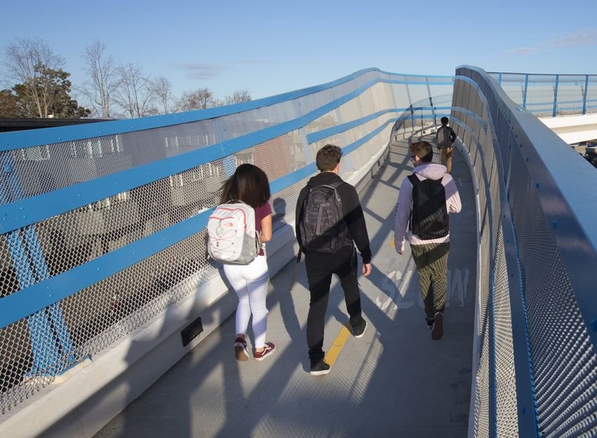
CONTENTS
MESSAGE FROM THE DISTRICT 4 DIRECTOR 4
PURPOSE AND OVERVIEW OF PLAN 5
STATEWIDE CONTEXT 6
PUBLIC ENGAGEMENT 8
WALKING IN DISTRICT 4 TODAY 12
NEEDS FOR PEOPLE WALKING ON
THE STATE HIGHWAY SYSTEM 18
NEXT STEPS FOR IMPLEMENTATION 23
ACKNOWLEDGEMENTS 26
CONTACTING CALTRANS 27
Several pedestrians use an overcrossing above US Highway 101 near Ralston Avenue. Photo by the California Department of Transportation. All rights reserved.
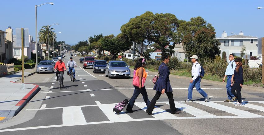
Cover photo: SR 35 (Sloat Boulevard) in San Francisco. Photo by the California Department of Transportation. All rights reserved.
2 CALTRANS DISTRICT 4 / Pedestrian Plan for the Bay Area / SUMMARY REPORT
KEY TERMS
The list below defines key terms used throughout this Plan document. While the
definitions below apply to the Caltrans District 4 Pedestrian Plan, other jurisdictions
and government agencies may use different terms or definitions.

ROADWAY NETWORK
State Highway System (SHS): Legislatively designated highway network that
  supports the movement of people and goods across California. The SHS
  includes a variety of highway infrastructure assets, including but not limited to
  pavement lane miles, bridges, tunnels, and culverts. This document uses the
  terms highways, state highways, and Caltrans highways interchangeably to
  refer to the State Highway System.
State Transportation Network (STN): Refers to the State Highway System (SHS)
  and all other multimodal facilities owned and operated by Caltrans, including
  parallel paths, frontage roads, and other facilities not directly on a SHS mainline.
Highway: Roads, streets, arterials, parkways, and connected infrastructure elements
  such as on- and off-ramps, bridges, and tunnels. Freeways are divided highways
  with full access-control elements and grade separation at intersections. Highways
  that are not freeways are conventional highways.
Main Street: A community street on the State Highway System that typically has
 speeds of less than 40 mph and serves pedestrians, bicyclists, transit riders and
 drivers. Examples in District 4 include El Camino Real and San Pablo Avenue.
Pedestrian: In this document, the terms pedestrian and walk are applied broadly to
  travel by all users of sidewalks, including people walking or rolling using a mobility
  assistance device such as a walker, stroller, or wheelchair.

ANALYSIS
Gap: A specific location where pedestrian facilities such as sidewalks and crossing
  treatments are missing, narrow, or incomplete.
Barrier: A physical element (typically a freeway) which restricts the movements of
  pedestrians between elements of the pedestrian network.
Location-based need: A specific location on the State Highway System where
  infrastructure changes would most benefit people walking and best achieve the
  State’s active transportation goals from Toward an Active California. Need
  types include those for people walking along or across the highway.
Communities of Concern: Census tracts that have a concentration of both minority
  and low-income households, or that have a concentration of other disadvantage
  factors. This term is used as defined by the Metropolitan Transportation
  Commission (MTC) as part of the Equity Framework for Plan Bay Area.

                                CALTRANS DISTRICT 4 / Pedestrian Plan for the Bay Area / SUMMARY REPORT   3
MESSAGE FROM THE DISTRICT 4 DIRECTOR
                                                               I am pleased to present the Caltrans District 4 Pedestrian                 The Pedestrian Plan will guide Caltrans Bay Area investments
                                                               Plan for the San Francisco Bay Area. This Plan furthers the                to support walking and connect people with opportunities,
                                                               2017 State Bicycle and Pedestrian Plan, Toward an Active                   while seeking to reconnect previously divided communities.
                                                               California, which established statewide policies, strategies               Collaboratively working with our partners from local and regional
                                                               and actions to advance active transportation and transit                   agencies, community organizations, and advocacy groups is
                                                               safety, mobility, preservation, and equity. It also builds on the          central to the development of this plan, and will be central to its
                                                               success and ongoing implementation of the 2018 District 4                  implementation. I would like to acknowledge and thank all who
                                                               Bike Plan.                                                                 participated in this process, with a special recognition of the
                                                                                                                                          important role and contribution of the Pedestrian Plan Working
                                                               The Caltrans Bay Area team is already working to
                                                                                                                                          Group in guiding the development of the plan.
             District 4 Director,                              incorporate pedestrian elements into our projects, and
             Dina A. El-Tawansy
                                                               embracing a complete streets approach to our planning,                     We look forward to working with our local and regional partners
                                                               project development, operation, and maintenance activities.                and communities on implementing the Pedestrian Plan.
                                                               This plan provides valuable guidance by identifying and
                                                               prioritizing needs informed by our department and our public
                                                                                                                                                                                      Dina A. El-Tawansy
                                                               agency and community partners.
                                                                                                                                                                                              District Director
                                                                                                                                                                                         District 4 – Bay Area

WHERE IS CALTRANS
DISTRICT 4?
District 4 covers the Bay Area,
which includes the counties of
Alameda, Contra Costa, Marin,
Napa, San Francisco, San Mateo,
Santa Clara, Solano, and Sonoma.

                                                                                            SR 1 at Tam Junction. Photo by Sergio Ruiz.

   4   CALTRANS DISTRICT 4 / Pedestrian Plan for the Bay Area / SUMMARY REPORT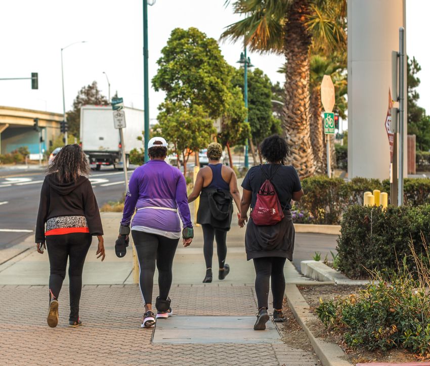
WHAT’S INSIDE THE PLAN?
                                                                                                                                              This Plan identifies and prioritizes pedestrian needs along

  PURPOSE AND OVERVIEW OF PLAN                                                                                                                and across the State Highway System to inform future
                                                                                                                                              investments. The Plan’s main output is a prioritized list
                                                                                                                                              and map of location-based pedestrian needs and a toolkit
  This Plan implements the Vision Statement and Goals in            more often by identifying needs and priorities for future
                                                                                                                                              with strategies to address these needs.
  Toward an Active California, the statewide bicycle and            investments. When more people are able and encouraged
  pedestrian plan, and is part of a comprehensive planning          to walk for short trips and to access transit, our communities            The following sections present key information about
  process to identify locations with bicycle and pedestrian         experience improved air quality, health benefits, social                  the planning process and identify next steps to support
  needs in each Caltrans district across California. The Plan       equity, quality of life, and economic vitality.                           implementation:
  will be used by Caltrans staff, as well as regional and local     The District 4 Pedestrian Plan is comprised of two elements:              STATEWIDE CONTEXT
  agency partners, to address high priority needs along
                                                                    ⊲ This Summary Report provides an overview                                This section describes how the goals of the statewide
  and across the State Transportation Network (STN), which
                                                                      of conditions for people walking on Caltrans                            active transportation plan, Toward an Active California,
  includes the State Highway System (SHS) and all other
                                                                      roadways today, a look at locations in the district                     guided the development of this Plan, and how this Plan
  multimodal facilities owned and operated by Caltrans,
                                                                      where significant needs exist for people walking,                       fulfills the next step in the process of addressing active
  including parallel paths, frontage roads, and other facilities
                                                                      and includes a description of next steps in the                         transportation needs along the State Highway System.
  not directly on a SHS mainline. Needs identified in this Plan
  will inform future investments on the SHS by Caltrans and           implementation process. A description of the
                                                                                                                                              PUBLIC ENGAGEMENT
  local partners. This Plan complements the District 4 Bike           methodology for the planning analysis is currently
                                                                                                                                              This section details stakeholder and public engagement
  Plan, which was completed in 2018; for more information,            in revision and will be made available on the District
                                                                                                                                              efforts to learn directly from people who walk along and
  visit this webpage: Caltrans District 4 Bike Plan.                  4 page of the Caltrans Active Transportation Plan
                                                                                                                                              across the District 4 STN.
                                                                      website upon completion.
  State highways play a critical role in towns and cities across
  California. They serve as main streets, provide access            ⊲ A companion online Story Map provides an                                WALKING IN DISTRICT 4 TODAY
  to destinations people visit every day, and are often the           opportunity to view and interact with a series of                       Maps, text, and charts in this section describe what it
  primary routes connecting communities. This Plan identifies         District 4 maps that highlight the pedestrian issues and                is like to walk or connect to transit along the SHS in
  challenges and needs related to walking along and across            opportunities described in this report. The Story Map                   District 4 today, and where there are opportunity areas
  Caltrans roadways. It recognizes that many people rely on           is available at the Story Map website.                                  to replace driving with walking trips.
  Caltrans roadways to walk and connect to transit. It also         A supplementary Pedestrian Toolkit that outlines                          NEEDS FOR PEOPLE WALKING ON
  acknowledges that people of color, people with lower              strategies and measures to address pedestrian needs is                    THE STATE HIGHWAY SYSTEM
  incomes, people with disabilities, and younger and older          currently in development and will be published on the                     The process for identifying and prioritizing location-based
  people experience disproportionately higher crash risks           District 4 page of the Caltrans Active Transportation Plans               needs to address barriers and gaps for pedestrians on
  than other groups do. This Plan seeks to make it safer, more      website upon completion.                                                  the District 4 State Highway System is described here.
  comfortable, and more convenient for everyone to walk
                                                                                                                                              NEXT STEPS FOR IMPLEMENTATION
District 4 Pedestrian Plan Process Timeline                                                                                                    The final section describes coordination, facilitation,
                                                                                                                                                     and project development steps for Caltrans, local
      2019          APR                  OCT         2020          APR                OCT         2021                                                     partners, and the public to implement this
                                                                                                                                                                 Plan’s recommendations.

                            May 2019 - January 2020                      May-July
                                                                        Partner                Draft          Public
     Project                UC Berkeley SafeTREC Street                                                                        Final Plan
                                                                     Survey period          Plan public       Survey
     kickoff                    Story survey period                                                                             released
                                                                                              review          period

                                          Working Group Meetings
                                                                                                                         CALTRANS DISTRICT 4 / Pedestrian Plan for the Bay Area / SUMMARY REPORT   5
TOWARD AN ACTIVE CALIFORNIA
                                                                                                                                 VISION STATEMENT
       STATEWIDE CONTEXT                                                                                                   By 2040, people in California of all ages, abilities,
       In alignment with the vision in the statewide plan, Toward an Active                                               and incomes can safely, conveniently, and comfortably
       California, this Plan establishes methods for identifying and evaluating
       pedestrian needs on and across the State Highway System. It focuses on
                                                                                                                            walk and bicycle for their transportation needs.
       increasing social equity throughout the planning process, strengthening
       community partnerships, and improving connections between the State and
       local networks.                                                                                             communities to jobs and other destinations, historically, the SHS has often done
       Toward an Active California outlines four goals, which guided the                                           the opposite. Freeways, expressways, and high-speed arterials act as barriers,
       development of the District 4 Pedestrian Plan:                                                              often disconnecting people from the services and locations they need to
                                                                                                                   access, and dividing previously-established communities.
                                                                                                                   The historical impacts of this have been intensified by land use and housing
           ⊲ MOBILITY: Reduce dependency on motor vehicle travel through mode
                                                                                                                   policy decisions, particularly those made between the 1930s and 1960s. The
             shift to bicycling, walking, and transit.
                                                                                                                   practice of redlining during this era allowed white families to purchase homes
                                                                                                                   in environmentally-advantaged areas through use of government-backed home
           ⊲ SAFETY: Facilitate safe travel for all users (modes) and abilities, as                                loans. These loans were denied to people of color, particularly Black families,
             expressed through Toward Zero Deaths (Caltrans) and Vision Zero (local                                who then had to find housing in places with higher levels of exposure to
             agencies) initiatives.                                                                                hazardous waste and other pollutants. Because these areas had the lowest land
                                                                                                                   values and the least political power, new high-speed routes in the SHS were
                                                                                                                   often built through these communities, dividing, disconnecting, and displacing
           ⊲ EQUITY: Promote active transportation solutions that serve the
                                                                                                                   the people who lived there.
             communities within the district by improving accessibility and healthy
             transportation options for disadvantaged communities.                                                 Due to this history, Caltrans has an obligation not just to seek equal treatment in
                                                                                                                   its projects and other works, but to actively pursue equity to correct the division
                                                                                                                   in these communities caused by the construction of the SHS. The District 4
           ⊲ PRESERVATION: Ensure district active transportation strategies and actions
                                                                                                                   Pedestrian Plan, alongside Toward an Active California and all of the Caltrans
             adequately discuss the long-term maintenance needs and resources
                                                                                                                   Active Transportation Plans, includes equity as one of its main goals, and is
             required to maintain a state of good repair for state highways.
                                                                                                                   intended to be a step toward meeting the agency’s equity obligations.

       The District 4 Pedestrian Plan is the second in a series of steps that will                                 As part of that goal, the prioritization metrics of this Plan include the
       support the delivery of active transportation infrastructure in California, as                              CalEnviroScreen1 and Communities of Concern scores, median household
       shown in the graphic on the next page. The work will continue with Caltrans                                 income, rate of free or reduced price school meals, and household access to a
       collaborating with local partners to identify, fund, construct, and maintain                                vehicle as key factors in determining the prioritization level the location-based
       pedestrian projects.                                                                                        need receives. Additionally, the in-person public engagement activities were
                                                                                                                   focused on locations near the SHS and within or adjacent to Communities of
                                                                                                                   Concern as designated by the Metropolitan Transportation Commission (MTC).
       BUILDING A MORE EQUITABLE FUTURE                                                                            Meeting the needs of people with disabilities is also central to ensuring
       Caltrans has an important role to play in advancing equity in California so that                            pedestrian networks work for everyone. All Caltrans pedestrian improvements
       everyone can thrive, starting with the most vulnerable and regardless of race,                              will meet the standards of the Americans with Disabilities Act (ADA). Refer to the
       socioeconomic status, identity, physical ability, or where and how they travel.                             Caltrans ADA Infrastructure Program for more information about ADA-specific
       Although the goal of a modern transportation network should be to connect                                   planning efforts.

       1    CalEnviroScreen is a mapping tool developed by the California Office of Environmental Health Hazard Assessment that helps planners and policy-makers identify California communities that are most affected
            by many sources and effects of pollution. A location with a high CalEnviroScreen score experiences much higher such pollution burdens than one with a low score.

6   CALTRANS DISTRICT 4 / Pedestrian Plan for the Bay Area / SUMMARY REPORT
HOW CALTRANS MEETS ACTIVE TRANSPORTATION NEEDS
While Caltrans has addressed active transportation needs throughout the state in the past, this
Pedestrian Plan and the D4 Bike Plan that preceded it are part of an updated process that aims
to better meet those needs in the future. The six steps are described below.

        1
                     Toward an Active California sets statewide active transportation
 STEP                vision, goals, and policy.

        2
                     D4 Bike Plan, Pedestrian Plan, and local plans locate needs on
 STEP                the SHS and establish a baseline for assessing future progress.

        3
                     Caltrans and its partners in local agencies and community-based
 STEP                organizations develop projects that respond to the identified needs.

        4
                     Projects are funded through state and federal funding and grant
 STEP                programs or via local funding sources.

        5
                     Projects are constructed, owned, and operated by Caltrans or by
                     local agencies.
 STEP

 STEP
        6            Projects are maintained and repaired by Caltrans or by local agencies.

                                                                                                      A group of four people walk together along a well-maintained sidewalk.

    VISION ZERO INITIATIVES AND THE CALTRANS TOWARD ZERO DEATHS GOAL
    Vision Zero is an organizing framework for eliminating fatalities                   Caltrans developed its Toward Zero Deaths goal as its
    and serious injuries caused by traffic crashes. Agencies and                        expression of the Vision Zero approach. The need for the
    jurisdictions around the world have adopted Vision Zero goals                       initiative is critical: 407 people died, and 880 were severely
    to reduce the loss of life on local roadways and work towards                       injured, in the more than 5,000 crashes that involved
    safer roadways through engineering and programming changes.                         pedestrians on Bay Area roadways of all kinds between 2015
    A defining feature of Vision Zero Action Plans is their ability to                  and 2019. Visit the Caltrans Safety Programs web page for
    coordinate and focus the ongoing work of agency departments                         more information about Toward Zero Deaths.
    and partner jurisdictions towards this singular goal.

                                                                                                               CALTRANS DISTRICT 4 / Pedestrian Plan for the Bay Area / SUMMARY REPORT   7
PUBLIC ENGAGEMENT                                                                   DISADVANTAGED COMMUNITIES
       The public has a nuanced understanding of the transportation systems they
                                                                                           AND COMMUNITIES OF CONCERN
       use every day and their input is critical to meeting the objectives of this plan.
                                                                                           What are disadvantaged communities?
       Engagement efforts for this Plan focused on the following objectives:
       ⊲ Seek input from the public (with a special focus on hearing from disadvantaged
                                                                                           Disadvantaged communities are places that are most
         communities through targeted outreach efforts).                                   likely to experience disproportionately negative impacts
       ⊲ Establish new relationships and strengthen existing relationships between
                                                                                           of poor air quality and underinvestment in transportation
         Caltrans and local community groups.                                              infrastructure. Disadvantaged communities are often also
       ⊲ Deepen understanding within Caltrans of local contexts and needs.
                                                                                           low-income communities. Investment of targeted funds
                                                                                           into these communities can help support improved health
                                                                                           outcomes. This plan uses a composite disadvantaged
                                                                                           community definition that takes into account a census
                                                                                           tract’s median income, enrollment in free and reduce priced
                                                                                           school meal programs, and score on CalEnviroScreen
                                                                                           (a tool for evaluating pollution burdens in California).

                                                                                           What are Communities of Concern?
                                                                                           Communities of Concern, as designated by the MTC,
                                                                                           include a diverse cross-section of populations and
                                                                                           communities that could be considered disadvantaged or
                                                                                           vulnerable now and in the future. Communities of Concern
                                                                                           can have high levels of households with minority or low-
                                                                                           income status, seniors, people who have limited English
                                                                                           proficiency, people who have disabilities, and more.

                                                                                           This Plan’s needs prioritization framework emphasizes
                                                                                           locations in disadvantaged communities and Communities
                                                                                           of Concern. Refer to page 20 for more information about
                                                                                           the prioritization process.

       Participants complete a Street Story survey. Photo by Sergio Ruiz.

8   CALTRANS DISTRICT 4 / Pedestrian Plan for the Bay Area / SUMMARY REPORT
HOW DISTRICT 4 CONNECTED WITH STAKEHOLDERS
COORDINATION WITH LOCAL AGENCIES TARGETED IN-PERSON OUTREACH
AND ADVOCATES In-person outreach focused on several locations near the SHS:
District 4 created a Pedestrian Plan Working Group, • Areas in or near disadvantaged communities or other
composed of County Transportation Agency and MTC staff, Communities of Concern
advocates, and key Caltrans District 4 staff. The Working • Areas around major transit hubs and other popular
Group guided development of the Plan and provided input pedestrian destinations
and support for public engagement. District staff also
• Areas that did not receive many online map comments
presented to standing active transportation committees
at the regional, county, and local levels throughout the District staff distributed fliers during commute and lunch
Bay Area to provide updates and receive input from local hours to promote the Plan. As a part of this process,
agency partners and advocates, including California Coastal approximately 200 fliers were distributed.
Commission staff.
PARTNERSHIP WITH UNIVERSITY OF PUBLIC ENGAGEMENT SUMMARY
CALIFORNIA, BERKELEY
District staff partnered with staff and students from the Coordination with local agencies
and advocates
University of California, Berkeley, on innovative outreach
strategies. The Plan uses data that District staff collected
from Street Story, an interactive online map developed by
In-person activities
University of California, Berkeley SafeTREC. District staff
also worked with a team of students to conduct targeted
outreach in East Palo Alto, a historically underserved
community in San Mateo County. The students tabled at Interactive webmap input
a farmer’s market and the Community Revitalization Fair
to solicit input on the planning process.
Public review of Pedestrian Plan
CALTRANS DISTRICT 4 / Pedestrian Plan for the Bay Area / SUMMARY REPORT 9A walk audit along Interstate 880 at Tennyson Road in Hayward. Photo by Sergio Ruiz.
HOW PUBLIC ENGAGEMENT INFORMED THIS PLAN
WHAT WE HEARD HOW WE BROUGHT THOSE INSIGHTS INTO THE PLAN
Stakeholders and members of the public referred to specific The project team used early community engagement findings to confirm
locations and project needs. assumptions made about the potential needs. Caltrans has received over
one thousand responses to the project survey, where participants added
They mentioned these challenges: pins to an interactive webmap input indicating pedestrian needs at nearly
• Places where sidewalks were missing 1,600 locations. These pins are spread across the region and include
• Intersections without marked crosswalks on all legs responses on nearly every freeway, expressway, and conventional route,
and in urban, suburban, and rural areas.
• Uncontrolled intersections that are uncomfortable to cross.
To see these crowd-sourced locations, visit the project Story Map. Public
They shared their desire for:
input also influenced the components included in the Pedestrian Toolkit,
• More shade and landscaping in places where people walk which will be made available upon its completion as an appendix to this
• Pedestrian-scale lighting Plan. Caltrans will continue to collect additional survey data beyond the
• Continued opportunities for public engagement during the publication of this Plan, since needs and priorities will shift over time.
project development phase.
10 CALTRANS DISTRICT 4 / Pedestrian Plan for the Bay Area / SUMMARY REPORTNEXT STEPS FOR PUBLIC ENGAGEMENT
CONTINUING CONVERSATIONS COORDINATION WITH ACTIVE AND ONGOING LOCAL
The level of committed engagement that
AND REGIONAL PLANS
contributed to this Plan’s development Starting in early 2019, local and regional public agencies provided active
doesn’t end with its publication. District 4 transportation infrastructure and planning data from completed and ongoing plans,
will continue these conversations as the as well as other input that was used to identify the location-based needs that are
Plan’s recommendations are implemented included in this Plan. The information included in the Plan represents a snapshot of
and projects are developed to ensure they conditions at the time the Plan was written.
reflect local needs and priorities.
Caltrans continues to collect information from stakeholders and the public about local
needs through its online surveys and other efforts. Survey input that was available
at the time this report was published is shown on the Story Map that accompanies
this report and is described on page 21. This Plan helps to coordinate District-level
planning work with ongoing, region-wide planning efforts such as the California
Coastal Trail, the San Francisco Bay Trail, the MTC’s Active Transportation Plan, and
other regional initiatives.
CALTRANS DISTRICT 4 / Pedestrian Plan for the Bay Area / SUMMARY REPORT 11
Highway 101 (Lombard Street) in San Francisco. Photo by Sergio Ruiz.WALKING IN DISTRICT 4 TODAY
No matter where they are in the Bay Area, walking is a daily activity for most people. To better understand the walking conditions and experience
along the SHS, a detailed analysis was performed and captured in the full Existing Conditions Report, which is available on the District 4 page of
the Caltrans Active Transportation Plans website. This section summarizes the key highlights from that report.
WHO USES THE STATE TRANSPORTATION
NETWORK?
People walk to work, to school, to the grocery
store, or to get to the next trailhead.
The diversity in land use context along the
STN within District means that needs and
recommendations to serve pedestrians might vary
based on the relationship between the highway
and its surrounding land use. For example, people
walking along or across the STN in more urban
areas may be more likely to be taking commuter
related trips to work or school, or making short
distance errands. In contrast, people walking
along or across the STN in rural areas may be
more likely to be taking recreational walks.
These differences should be confirmed with local
partners and stakeholders and can be used to
inform appropriate design treatments during the
project development stage.
Top photo: A person crosses a multi-lane roadway in an urban setting.
Bottom photo: US 101 at 2nd Street, San Rafael. Photo by Sergio Ruiz.
12 CALTRANS DISTRICT 4 / Pedestrian Plan for the Bay Area / SUMMARY REPORTSURROUNDING LAND USE
CONTEXT
The SHS in District 4 includes 1,408 miles of roadway.
The diversity in land uses surrounding the SHS means
that pedestrian facilities also vary widely, depending on
the context. The pedestrian needs identified in this Plan
reflect these different contexts, emphasizing locations
where the frequency and quality of crossing
opportunities are low for urban areas, and where
walking along roadways is impeded in rural ones.
SHS AND LAND-USE CONTEXT
Main Street
24%
Urban
44%
Rural
32%
Percentage of District 4 State Highway System
by land use (centerline miles)
Source: Caltrans Transportation System Network,
SB127 Main Streets layer
CALTRANS DISTRICT 4 / Pedestrian Plan for the Bay Area / SUMMARY REPORT 13WALKING ON THE STATE
HIGHWAY SYSTEM
Historically, many Caltrans roadways were built specifically
to serve motor vehicle trips. As a result, walking is prohibited
on about half of the highway miles in District 4. Areas where
walking is not prohibited vary widely depending on the context:
while only 10% of urban highway miles are available for walking,
82% of rural highway miles and all Main Street miles are. This
leaves many opportunities available to adapt roadways to be
safer and more inviting to people walking.
While areas where people can walk may need sidewalks and
crossing enhancements for them to do so comfortably, areas
where pedestrians are prohibited will require different kinds of
design treatments, such as overcrossings, to provide continuity
in the pedestrian network.
For locations where walking is currently prohibited, Caltrans
will weigh several considerations to determine whether to
adjust access in the future. These include whether the
location has been identified as a major priority for
improvement in this Plan, whether more favorable local
alternatives exist, and whether local plans have prioritized
WALKING ON THE STATE HIGHWAY SYSTEM
improvements to alternative routes.
Pedestrians 45%
Prohibited
55% Pedestrians
Not Prohibited
Pedestrian access along the State Highway System in
District 4 (centerline miles)
Source: California Transportation System Network, OpenStreetMap.
Pedestrians are assumed to be prohibited from freeways except when a
multi-use path parallels the freeway.
14 CALTRANS DISTRICT 4 / Pedestrian Plan for the Bay Area / SUMMARY REPORTPEDESTRIAN TRIP POTENTIAL
Land use patterns, demographics, and characteristics of the
built environment influence the extent to which a person can
or will choose to walk for daily needs or recreation. A number
of factors can help determine the likelihood that people will
take future trips on foot at a particular location.
Distance is one of the simplest determinants of walking trips.
Most adults can comfortably make trips of less than one mile on
foot or with the aid of a mobility device. Focusing infrastructure
investments in places where short trips are frequently taken by
car is an effective way to encourage travel by walking instead.
Short trip opportunities tend to be concentrated in the urban
and suburban parts of the District, with major arterial roadways
emerging as clear centers of activity. Not surprisingly, relatively
fewer short trips are made in more rural areas in the District,
suggesting limited opportunity to convert vehicle trips to
walking in those areas unless convenient connections to
transit are available. While infrastructure that supports walking
will continuePedestrian Trip everywhere,
to be needed Potential investments in more
urban areas where more short trips are concentrated can help
meet the State’s goal of increasing walking.
8%
23%
57% 60%
40%
19%
23%
40%
11% 19%
URBAN RURAL M AI N ST R E E T
High Medium Low Zero
More than 4,744 to 0 to 4,744 Represents
48,227 daily 48,226 places where
trips per approximately
square mile zero trips occur
Density of short driving trips along the D4 SHS by land use
context (lane miles)
Source: California Statewide Travel Demand Model (CSTDM)
CALTRANS DISTRICT 4 / Pedestrian Plan for the Bay Area / SUMMARY REPORT 15SIDEWALK COVERAGE
Sidewalks are the foundation of most pedestrian
networks. Along the SHS, they may be present on
one or both sides of a highway, or not present at all.
The presence of sidewalks is closely correlated with
land use context: 25% of Main Streets have sidewalks
on both sides, whereas rural highways rarely have
sidewalks at all. Urban highways are often freeways
that prohibit pedestrian access and therefore also do
not have sidewalks.
As a general practice, Caltrans will consider installing
sidewalks in highway locations where:
⊲ many people walk;
⊲ land use patterns, or a concentration of destinations
along the highway, suggest many people could walk;
⊲ past vehicle crashes have involved pedestrians;
⊲ sidewalks can help connect to the local pedestrian
PEDESTRIAN:
network. SIDEWALK COVERAGE ALONG THE SHS
One Side Two sides
No Sidewalk 45% 46% Prohibited
Sidewalk coverage along the State Highway
System in District 4 (lane miles)
Source: Active Transportation Data Pilot Project Data, District Staff
16 CALTRANS DISTRICT 4 / Pedestrian Plan for the Bay Area / SUMMARY REPORTSIDEWALK CONDITIONS
Sidewalks that are connected, accessible, and in good
condition can support increased walking along state
highways. For this Plan, sidewalk conditions were
evaluated using data from the Active Transportation
Asset Inventory,1 and supplemented by research using
Google Streetview images captured in 2018 and 2019.
This data is not comprehensive and may not reflect
current conditions since sidewalks degrade and are
repaired over time.
Sidewalks where the state of repair is known (86%) are
largely in good or fair condition. There are no major
differences between the condition of sidewalks in different
land use contexts. This Plan prioritizes needs for the 47%
of sidewalk miles where conditions are fair or poor.
1 The Active Transportation Asset Inventory is a pilot program to catalogue
and evaluate the presence and physical conditions of the facilities on the
State Highway System that people use for walking and biking. Data from
this program are used in analysis throughout this Plan.
SIDEWALK CONDITIONS
Poor
Unknown
8%
14%
Fair
39%
Good
39%
Sidewalk conditions along the State Highway System
in District 4 (sidewalk miles)
Source: Active Transportation Asset Inventory, District Facility Inventory
CALTRANS DISTRICT 4 / Pedestrian Plan for the Bay Area / SUMMARY REPORT 17NEEDS FOR PEOPLE WALKING
ON THE STATE HIGHWAY
SYSTEM
The primary purpose of this planning effort was to establish a prioritized
list of “location-based needs,” or specific locations along the SHS where An example of a place with pedestrian needs is along the highway segment shown here, which lacks a sidewalk.
infrastructure investments would most benefit people walking and bicycling
and best achieve the goals identified in Toward an Active California. To
identify these needs, Caltrans conducted an assessment of gaps and barriers IDENTIFYING NEEDS
along the SHS that affect walking. Now that the needs have been identified, a
The need for pedestrian infrastructure along the SHS has been inventoried and
set of design solutions will be developed to address them. This information is
documented by multiple sources over time. Needs included in this Plan reflect
available for review on the online Story Map.
analysis of data collected in 2019 from local agency plans, public engagement
efforts, Caltrans highway data, and other sources.
As a starting point, planned pedestrian facilities along or across the SHS that
are identified in plans adopted by cities, counties, or the MTC were analyzed
as potential needs. Since these needs have been vetted through a completed
planning process, they therefore qualify for continued Caltrans planning and
implementation support. In some cases, local plans identify the need for
pedestrian facilities that would cross a Caltrans roadway. In those instances,
crossing needs at those locations are included in this Plan to support local
networks. The local plans referred to in this planning process are available on
the District 4 page on the Caltrans Active Transportation Plans website.
In addition, Caltrans collected data to identify needs through partner and public
surveys and other engagement efforts. The feedback was used to confirm
assumptions made about the potential needs identified from the local plans,
and will be used to inform the project development process in the future.
Moving forward, Caltrans will continue to collect additional survey data beyond
the publication of this Plan, since needs and priorities will shift over time.
As the list of pedestrian needs was compiled, Caltrans also conducted a
detailed automated and manual analysis of SHS data to identify needs in the
following categories:
State Route (SR) 4 near Slatten Ranch. Photo by Sergio Ruiz.
18 CALTRANS DISTRICT 4 / Pedestrian Plan for the Bay Area / SUMMARY REPORTMAIN STREET SIDEWALK GAPS
Main street locations lacking sidewalks on one or both sides of the road.
SIDEWALKS IN FAIR OR POOR CONDITION
SHS segments with sidewalks in fair or poor condition, as determined by Caltrans staff.
SIDEWALKS ALONG HIGHER-SPEED HIGHWAYS
SHS segments with sidewalks along roadways with a posted speed limit of 35 mph or higher.
STRESSFUL PEDESTRIAN CROSSINGS
Intersections on conventional highways (that is, those that aren’t freeways or expressways) that are
stressful for people walking to cross. This analysis accounts for characteristics like the presence or
absence of median islands and marked crossings, posted speed limits, and other factors.
INFREQUENT CROSSINGS
Freeway sections where pedestrian crossings (like bridges or undercrossings) are infrequent.
This analysis does consider the local land use (e.g. the presence of destinations on both sides
of the road), but it does not take into account the quality of the surrounding pedestrian network.
FREEWAY INTERCHANGE NEEDS
These needs are at locations that meet various gap criteria, including the presence of a narrow
sidewalk, a lack of sidewalks, an uncontrolled highway on- or off-ramp crossing, unmarked highway
ramp crosswalks, or poor crosswalk visibility. A freeway ramp intersection meeting at least one of these
criteria is included as a need in this Plan.
CALTRANS DISTRICT 4 / Pedestrian Plan for the Bay Area / SUMMARY REPORT 19The result of this analysis is a map and list of individual location-based needs at
specific locations where gaps and barriers may exist for people walking along or GOAL WEIGHT MEASURE(S)
across the highway. An example of one such location-based need is across Sloat
Boulevard (State Route (SR) 35) at Forest View Drive in San Francisco. Short-distance travel demand; access to transit; existing
Mobility 30%
walk trips
PRIORITIZING NEEDS Safety 25%
Reported crash density; public/stakeholder input on
safety; severity-weighted crash density
Locations with needs on the SHS were evaluated and prioritized according to
the goals of Toward an Active California. The purpose of this is to assess which CalEnviroScreen score; median income; subsidized
location-based needs may be best suited to move into Caltrans project development Equity 30% school meals; locally identified disadvantaged
community; household vehicle access
phases over time. Prioritization may be used as a factor to inform future Caltrans
efforts in seeking competitive funds to implement the Pedestrian Plan.
Preservation 15% Improvement to existing crosswalk or sidewalk
The first step in the prioritization process was to break the SHS in the district into
smaller segments, such as areas around freeway crossings or 1- to 3-mile segments
between major intersections. These segments are scaled to roughly align with
segments Caltrans uses to develop improvement projects on the SHS, which is Finally, scored segments and freeway crossings were ranked and sorted into
helpful so that individual needs can be grouped with other projects on the system. three tiers based on their relative intensity of need, with Tier 1 representing
the highest intensity. The maps following this section show prioritized highway
As a second step, each highway segment and freeway crossing was then scored
segments and freeway crossings in the District. All of the location-based needs
based on factors like those described in the Walking in District 4 Today section of
on each highway segment and freeway crossing are assigned the same score
this report. These include the potential to shift short trips from driving to walking, the
and tier as the segment or freeway crossing itself.
history of pedestrian crashes nearby, the presence of a disadvantaged community
nearby, and the condition of sidewalks and crosswalks along the facility. This process provides a comparative indication of need. Needs at a given
location should always be considered for incorporation into nearby projects on
The scoring calculations incorporated input from District 4 staff on weights and
the SHS, regardless of their assigned tier. Caltrans has access to datasets with
measures assigned to each goal from Toward an Active California, reflecting the
additional details describing the specific infrastructure conditions that resulted in
localized vision and priorities of stakeholders and the public across the district, as
individual needs being identified at specific locations. These details are intended
summarized in the table on this page. These weights refer only to the data-driven
to be used to support the project development process. The needs in this plan
prioritization in this plan, and do not intend to suggest that Caltrans District 4 assigns
will also be used to build Complete Streets performance targets used in the
these weights to Safety, Mobility, Equity, and Preservation in all of its work. Safety
Caltrans project development process. The performance targets use safety data
remains the highest priority for Caltrans. In the context of the District 4 Pedestrian
from other sources, so the Safety goal is weighted slightly lower than Mobility
Plan, it was given a slightly lower weighting because funding for safety-based (and
and Equity in this Plan.
preservation-based) pedestrian projects already exist, while methodically funding
pedestrian equity or mobility projects does not yet occur at Caltrans.
This plan identifies 994 needs for
people walking across highways.
The plan identifies 2,753 needs for
people walking along highways.
20 CALTRANS DISTRICT 4 / Pedestrian Plan for the Bay Area / SUMMARY REPORTSTORY MAP AND PEDESTRIAN TOOLKIT This Summary Report has a companion Story Map. This interactive mapping tool provides greater detail on a full range of existing conditions measures and illustrates the individual and prioritized location-based needs. The map also provides the following information about each need: ⊲ Whether the location of a need is along or across the highway ⊲ Relative priority (Tier 1, Tier 2, or Tier 3) ⊲ Prioritization goal scores This information can help stakeholders and the public understand where needs and opportunities exist in their local community, the nature of those needs, and how those needs relate to the full picture of active transportation initiatives across the district. A Pedestrian Toolkit contains an array of potential treatments to address location-based needs, and will be available on the District 4 page of the Caltrans Active Transportation Plans website. A person walks a dog across a divided multilane roadway using a marked crosswalk. CALTRANS DISTRICT 4 / Pedestrian Plan for the Bay Area / SUMMARY REPORT 21
22 CALTRANS DISTRICT 4 / Pedestrian Plan for the Bay Area / SUMMARY REPORT
HOW WILL THIS PLAN IMPROVE OUTCOMES FOR
NEXT STEPS FOR IMPLEMENTATION                                                                       PEDESTRIANS?
The District 4 Pedestrian Plan (and Bike Plan) are critical steps in implementing the Caltrans
statewide vision for improving the walking and bicycling experience along the STN in the            The data analysis and findings from this study process will:
Bay Area. Caltrans and partners at local agencies and community-based organizations all
have important roles to play in supporting highway improvement projects that meet the               • Inform and serve as an input to the Caltrans project
needs of people walking, including those needs identified in this Plan. Next steps for project
implementation are described below.
                                                                                                      identification and development processes.

                                                                                                    • Foster coordination and alignment between state,
NEXT STEPS FOR CALTRANS
                                                                                                      regional, and local planning and project development.
LEVERAGE LOCAL PARTNERSHIPS
This Plan will be used to help identify subsequent planning efforts and specific projects           • Elevate the profile of pedestrians in asset management
located on or near the STN. Caltrans and local agency staff will meet early in the project
planning and development process to coordinate on project objectives, design, and execution.          and other data-driven decision-making processes.
This coordination can occur during meetings of the District 4 Pedestrian Advisory Committee,
a body of local agency representatives, advocates, and residents who meet regularly and             • Support competitive funding applications.
advise Caltrans on the planning and implementation of pedestrian policies and projects.
Coordination can also occur as part of other stakeholder engagement efforts. Site visits with
local partners will provide further understanding of the local context, and connectivity needs
                                                                                                    • Help to integrate active transportation needs as part of
between the local pedestrian network and the STN.                                                     other project types.

IDENTIFY AND INITIATE PROJECTS                                                                      • Inform planning and project development activities at
The pedestrian needs in this Plan provide baseline information that Caltrans will use
                                                                                                      the District and statewide levels.
to further understand issues at specific locations and identify potential improvements.
Caltrans has further detail on the needs identified in this Plan, which the public can view
on the project Story Map.

Crossing needs                                                                                   Active transportation elements are often integrated into other highway
                                                                                                 projects. This can be a strategy to leverage existing project resources
⊲ Stressful pedestrian crossings                                                                 and funding to implement active transportation improvements. Caltrans
⊲ Infrequent crossings                                                                           is developing interim Complete Streets performance targets, which will
                                                                                                 inform District-led efforts to measure progress toward addressing the
⊲ Freeway interchange needs                                                                      active transportation needs identified in this Plan. These performance
⊲ Other crossing needs identified through local input or by partner agencies                     measures will become part of an asset management strategy to invest in
                                                                                                 both existing facilities and gaps in the active transportation network.
Corridor needs                                                                                   Maintenance needs should be considered when planning and
⊲ Main street sidewalk gaps                                                                      developing new facilities on the STN. Caltrans will continue to work
                                                                                                 with local partners to ensure maintenance needs are addressed with
⊲ Sidewalks in fair or poor condition                                                            locally-sponsored projects. The need to maintain new facilities, including
⊲ Sidewalks along higher-speed highways                                                          pedestrian facilities, is a continued challenge that will need to be
                                                                                                 addressed at the district and statewide level.
⊲ Other corridor needs identified through local input or by partner agencies

                                                                                                                 CALTRANS DISTRICT 4 / Pedestrian Plan for the Bay Area / SUMMARY REPORT   23
FUND PROJECTS
Caltrans views all transportation projects as opportunities to
accommodate the needs of people walking on its highways, and many
funding programs similarly require consideration of Complete Streets
elements as part of projects. Funding is always the most challenging
part of implementing any kind of project on the highway. These are
three primary funding mechanisms for projects to meet the needs
outlined in this Plan:
⊲ The State Highway Operation and Protection Program (SHOPP) is Vine Trail along SR 29 in Oak Knoll. Photo by the California Department of Transportation. All rights reserved.
Caltrans “fix-it-first” program that funds the repair and preservation,
emergency repairs, safety improvements, and some highway TAKE DISTRICT-LEVEL ACTION
operational improvements on the STN. The needs identified in this Each District plays a key role in achieving the goals and objectives
Plan can be incorporated into the SHOPP and provide co-benefits to of Toward an Active California. District 4 staff can take the following
the primary purpose of the project. The baseline needs from this Plan actions to track progress and implement strategies that further those
will directly contribute to establishing interim performance targets goals and objectives:
that will set aside funds specifically for active transportation.
⊲ Track implementation of pedestrian improvements along and across
⊲ The Active Transportation Program (ATP) directs funds to local and the STN in District 4.
regional agencies through a competitive selection process. This
Plan helps identify and prioritize improvements that might be most ⊲ Provide guidance to local agency partners on the Caltrans approval
competitive for these funds. process for Complete Streets improvements on the STN.
⊲ Senate Bill 1 (SB 1) establishes local and State transportation ⊲ Identify and promote best practices from District 4 and local
programs and funding to repair and enhance roads, bridges, transit, jurisdictions developing pedestrian facilities on and along State
and other transportation assets. SB 1 provides opportunities to Highway corridors in the Bay Area.
address active transportation needs while also infusing the ATP with ⊲ Develop recommendations based on Bay Area best practices for
an additional $100 million annually. future updates to Caltrans statewide guidance and policies.
⊲ Local and regional jurisdictions may also contribute project funds ⊲ Explore opportunities to partner with local agencies and organizations
to meet the capital needs of projects in this Plan. Funds generated on short-term pilot projects and events to promote walking.
by local sales tax measures, for example, can be used for matching
grants or to provide additional financial leverage for projects. ⊲ Strengthen engagement with communities of color and low-income,
rural, and tribal communities during planning and project development
to understand their mobility and safety needs on the STN.
⊲ Collect additional data about the STN and local networks, including
more detailed data in places where potential for improvements is high.
24 CALTRANS DISTRICT 4 / Pedestrian Plan for the Bay Area / SUMMARY REPORTREGIONAL PLAN COORDINATION
There are several large, regional efforts to advance active
NEXT STEPS FOR LOCAL AND REGIONAL transportation networks within the Bay Area. These include the San
JURISDICTIONS AND STAKEHOLDERS Francisco Bay Trail, the Bay Area Ridge Trail, the California Coastal
Trail, the Bay Area Trails Collaborative, and others. The District 4
COORDINATE AT THE LOCAL LEVEL Pedestrian Plan incorporated data from these initiatives, and seeks to
Local knowledge and expertise are critical for Caltrans and local agency leaders to
be in agreement with these plans, and to also improve connections
understand the needs of people walking at specific locations and to identify, fund,
and implement projects to address those needs. Communities throughout the Bay to these facilities where the existing SHS acts as a barrier. The
Area can help coordinate the gathering and sharing of knowledge to advance forthcoming MTC Active Transportation Plan will be another important
projects. For example, members of the public can advocate for their local or regional opportunity to elevate regional coordination across the Bay Area.
leadership to undertake a study of local needs. Local and regional agencies can
likewise lead planning studies to identify relevant funding sources. This step should To learn more about these ongoing initiatives, visit:
include community engagement to understand the public’s experiences and
priorities. Funding is available from Caltrans to support this planning work through its • San Francisco Bay Trail: https://baytrail.org/
Active Transportation Program, Sustainable Transportation Planning Grant Program, • Bay Area Ridge Trail: https://ridgetrail.org/
Urban Greening Program, Transformative Climate Communities Program, and other • California Coastal Trail: https://scc.ca.gov/projects/california-coastal-trail/
initiatives.
• Bay Area Trails Collaborative: https://www.railstotrails.org/our-work/
Project needs may also be incorporated into local general plans, specific plans, or trailnation/bay-area-trails-collaborative/
other planning documents to address the gaps identified in the District 4 Pedestrian
Plan; consistency across plans is a key factor in making projects attractive for
funding.
PARTNER WITH CALTRANS TO DEVELOP PROJECTS
Local agency representatives are key partners with Caltrans in providing
information about local needs and priorities related to the STN. Coordination
can strengthen projects that are led by local agencies and those led by
Caltrans to better address needs for people walking on State Highways and
the streets and roads that connect to them. Local partners can provide critical
input about how incorporating active transportation elements into projects will
provide improved connections to the local road network.
SEEK FUNDING TO BUILD PROJECTS
Projects or plans on the STN frequently include funds provided directly from Caltrans,
such as through its Active Transportation Program or Sustainable Transportation
Planning Grant Program. In addition to grant funding, Caltrans is also seeking
opportunities to fund active transportation needs by incorporating them into projects
funded by the State Highway Operation and Protection Program, which is described
on the preceding page. Project funding packages sometimes include additional
sources, such as local or regional sales tax measures, grants from the Greenhouse A walk audit crosses SR 1 in Point Reyes Station. Photo by Sergio Ruiz.
Gas/Air Resource Board (e.g. Sustainable Transportation Equity Projects), funds from
the State Coastal Conservancy, funds from regional partners (e.g. MTC), funds from
the Transportation Demand Act, other gas tax revenue, or general funds.
CALTRANS DISTRICT 4 / Pedestrian Plan for the Bay Area / SUMMARY REPORT 25ACKNOWLEDGEMENTS
This Plan was developed through the combined commitment, energy, and guidance of current and past District 4 and Caltrans Headquarters team members, the
District 4 Pedestrian Plan Working Group, partner organization representatives, advocacy group members, and community members. The following organizations
and individuals, in particular, contributed significantly to the Plan’s development and were instrumental in its completion.
DISTRICT 4 PEDESTRIAN WORKING GROUP CALTRANS PROJECT TEAM
⊲ Colin Clarke, Contra Costa Transportation Authority ⊲ Greg Currey, Project Manager
⊲ Triana Crighton, Solano Transportation Authority ⊲ Sergio Ruiz, Complete Streets Coordinator
⊲ Colin Dentel-Post, San Francisco County Transportation Authority ⊲ Erik Alm, Chief, Office of Transit and Community Planning
⊲ Kathrina Gregana, Solano Transportation Authority ⊲ Jacob Buffenbarger, Pedestrian and Bicycle Branch
⊲ Mikaela Hiatt, City/County Association of Governments of San Mateo County ⊲ Jake Freedman, Pedestrian and Bicycle Branch
⊲ James Hinkamp, Contra Costa Transportation Authority ⊲ Elliot Goodrich, Pedestrian and Bicycle Branch
⊲ Josephine Hsai, Caltrans District 4 Office of System and Regional Planning ⊲ Michelle Matranga, Pedestrian and Bicycle Branch
⊲ Lee Huo, MTC/Bay Trail Project ⊲ Amie Mohai, Pedestrian and Bicycle Branch
⊲ Lauren Ledbetter, Santa Clara Valley Transportation Authority ⊲ Kimberly Overton, Pedestrian and Bicycle Branch
⊲ Chris Marks, Alameda County Transportation Commission ⊲ Dianne Yee, Pedestrian and Bicycle Branch
⊲ Marty Martinez, Safe Routes to School National Partnership ⊲ Jessica Downing, Smart Mobility and Active Transportation Branch,
Caltrans HQ
⊲ Scott McDonald, Transportation Authority of Marin
⊲ Diana Meehan, Napa Valley Transportation Authority
COMMUNITY PARTNERS
⊲ Mike Pickford, San Francisco County Transportation Authority
⊲ Kate Beck, University of California, Berkeley, SafeTREC
⊲ Phillip Rodriguez, Caltrans District 4 Sustainability Manager
⊲ Garrett Forntin, University of California, Berkeley, SafeTREC
⊲ Hung Tran, Caltrans District 4 Office of Traffic Safety
⊲ Trista Hu, University of California, Berkeley
⊲ Dana Turréy, Sonoma County Transportation Authority
⊲ Ian Martin, University of California Berkeley
⊲ Andrew Tate, University of California, Berkeley
CONSULTANT TEAM
⊲ Toole Design
⊲ WSP
⊲ Cambridge Systematics
26 CALTRANS DISTRICT 4 / Pedestrian Plan for the Bay Area / SUMMARY REPORTCONTACTING CALTRANS
Additional information about this planning effort can be
found on the District 4 page on the Caltrans Active
Transportation Plans website. The Caltrans District 4
Complete Streets Coordinator can provide additional
information about upcoming projects in your community,
provide input, and coordinate on project identification,
development, and implementation:
Caltrans District 4 Complete Streets Coordinator:
Sergio Ruiz – sergio.ruiz@dot.ca.gov
Caltrans District 4 Pedestrian Plan Project Manager:
Greg Currey – gregory.currey@dot.ca.gov
Caltrans District 4 Public Information Officer:
Jeffrey Weiss – jeffrey.weiss@dot.ca.gov
Caltrans District 4 Public Information Office:
caltrans_d4@dot.ca.gov
A pedestrian bridge over SR 1 in Pacifica. Photo by the California Department of Transportation. All rights reserved.
CALTRANS DISTRICT 4 / Pedestrian Plan for the Bay Area / SUMMARY REPORT 27
Back cover: SR 82 in San Carlos. Photo by Sergio Ruiz.DISTRICT 4
PEDESTRIAN PLAN
2021
FOR THE BAY AREA
DIST
4
RI
CT
SUMMARY REPORTYou can also read