Progressive Enterprises Ltd - Beachlands Village Business Centre Private Plan Change
←
→
Page content transcription
If your browser does not render page correctly, please read the page content below
Progressive Enterprises Ltd

                                Beachlands Village Business Centre
                                Private Plan Change

                                Integrated Transportation
                                Assessment Report

                                April 2010

PO Box 2592, Shortland Street
Auckland 1140
P: +64 9 531 5006
www.tdg.co.nz
New Zealand

10560-1_ITA_Final.doc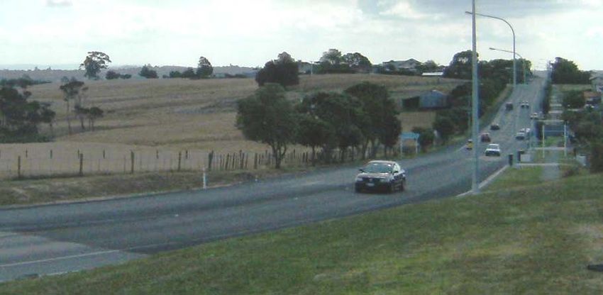
Progressive Enterprises Ltd

Beachlands Village Business Centre
Private Plan Change

Transportation Assessment Report
Quality Assurance Statement

Prepared by:
Samantha Boone
Transportation Engineer

Reviewed by:
Daryl Hughes

Associate

Approved for Issue by:
Daryl Hughes

Associate

Status:          Final report

Date:            3 May 2010

                                10560-1_ITA_Final.doc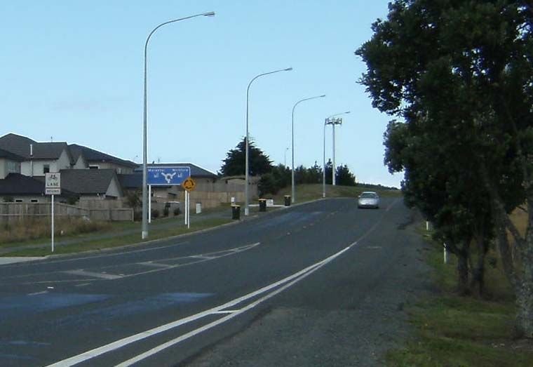
Table of Contents

Executive Summary........................................................................................................................1

1.    Introduction .............................................................................................................................2
2.    Existing Environment ..............................................................................................................3
      2.1         Location.....................................................................................................................3
      2.2         Transport Network .....................................................................................................3
3.    Existing Travel Patterns ........................................................................................................10
      3.1         Daily Traffic Volumes...............................................................................................10
      3.2         Hourly Traffic Volumes ............................................................................................10
      3.3         Intersection Turning Volumes ..................................................................................13
      3.4         Road Safety Record ................................................................................................16
4.    Accessibility ..........................................................................................................................18
      4.1         Private Vehicle Accessibility ....................................................................................18
      4.2         Public Transport Accessibility ..................................................................................18
      4.3         Walking Accessibility ...............................................................................................20
      4.4         Cycling Accessibility ................................................................................................20
5.    Proposed Private Plan Change.............................................................................................24
6.    Proposed Transport Provisions.............................................................................................26
      6.1         Vehicle Access ........................................................................................................26
      6.2         Pedestrian Access...................................................................................................27
      6.3         Public Transport Provisions .....................................................................................27
      6.4         Parking and Loading................................................................................................27
7.    Trip Generation .....................................................................................................................29
      7.1         Trips Generated by the Business Centre.................................................................29
      7.2         Trips Generated by Proposed New Residential Areas ............................................31
8.    Trip Distribution.....................................................................................................................33
      8.1         Business Centre Trip Distribution ............................................................................33
      8.2         Trip Distribution of Proposed New Residential Areas ..............................................34
9.    Traffic Effects ........................................................................................................................40
      9.1         Sidra Model .............................................................................................................40
      9.2         Model Results..........................................................................................................42
      9.3         Traffic Effects Conclusions ......................................................................................49
10. Planning and Policy Framework............................................................................................50
      10.1        Regional Policy Statement ......................................................................................50
      10.2        Regional Growth Strategy .......................................................................................51
      10.3        Auckland Regional Land Transport Strategy ...........................................................52
      10.4        Auckland Passenger Transport Plan 2006 – 2016 ..................................................53

                                                   Progressive Enterprises Ltd, Beachlands Village Business Centre Private Plan Change:
                                                                                           Integrated Transportation Assessment Report
                                                                                                                 10560-1_ITA_Final.doc
10.5       District Plan .............................................................................................................53
      10.6       Summary .................................................................................................................54
11. Summary and Conclusions ...................................................................................................55

                                                 Progressive Enterprises Ltd, Beachlands Village Business Centre Private Plan Change:
                                                                                         Integrated Transportation Assessment Report
                                                                                                               10560-1_ITA_Final.doc
1
Executive Summary
Progressive Enterprises Ltd has purchased a section of land at the corner of Whitford-Maraetai
Road and Beachlands Road, at Beachlands, with the intention of constructing a mixed use
development; hence they are pursuing a Private Plan Change, to create the “Beachlands Village
Business Centre” zone to enable this.
The location of the proposed Business Centre provides accessibility to a range of transport
modes, including private vehicle, public transport, walking and cycling, which will provide a wide
mode choice for employees and customers of the Centre.
Key transport provisions for the centre include new connections to the existing road network;
vehicle access points; pedestrian links; and parking and loading areas. These will be designed
so as to provide an integrated transport environment suitable for such a development.
The traffic generating potential of the development was assessed using the potential market
demand of the surrounding area for such activities which will be enabled by the Private Plan
Change. To assess the effects of the trips generated by the Business Centre this traffic was
added to base scenarios which included the potential traffic generation of a number of new
residential areas provided for by various plan change in the areas; namely Beachlands Village
New Avenues, Pine Harbour Marina and Spinnaker Bay.
It was found that the extent of potential development can be accommodated by the immediate
road network while maintaining appropriate levels of safety and performance. If higher level of
development is implemented at a later stage, the assessment showed that modifying the layout of
the Whitford-Maraetai Road / Beachlands Road roundabout can mitigate any adverse effects that
may arise. Accordingly, this report concludes that the potential adverse effects of additional
traffic generated by development enabled by the Private Plan Change will be no more than minor.
The proposed Business Centre can be achieved in a manner that is consistent with, and
encourages, key regional and district transportation objectives and policies.
Therefore, it is found that there is no traffic engineering or transportation planning reason to
preclude acceptance of this proposal, and the full extent of development enabled by the Private
Plan Change will have no more than minor effects on the safety and efficiency of the surrounding
road network using the appropriate transport provisions described in the report.
Progressive Enterprises Ltd, Beachlands Village Business Centre Private Plan Change:
Integrated Transportation Assessment Report
10560-1_ITA_Final.doc2
1. Introduction
Manukau City Council (Council) is developing a Plan Change to enable the establishment of
residential and mixed-use development in Beachlands, Manukau City. This is supported by the
publication of a document entitled “Discussion Document for Beachlands Village - New Avenues”.
The entire area of that Plan Change lies to the southeast of the existing Beachlands settlement.
Progressive Enterprises Ltd (Progressive) has purchased a section of land within this area with
the intention of constructing the mixed use element, and is pursuing their own Private Plan
Change, to create the “Beachlands Village Business Centre” zone to enable this.
The result will be that Council’s Plan Change will now deal exclusively with the residential
element of their original area.
This Integrated Transport Assessment was prepared for Progressive by Traffic Design Group Ltd
(TDG) to describe the traffic engineering and transportation planning aspects of the proposal.
The transportation issues that are central to this proposal include:
the ability of the site to meet key national, regional and local policies relating to the site
accessibility and sustainability
the ability of the surrounding road network to safely and efficiently support the development
potential of the site that will be enabled by the Private Plan Change
the ability of the site accesses to provide safe and efficient movement of vehicles, public
transport users, cyclists and pedestrians – into, within or out of the site.
These and other matters will be addressed in the detail of this report. The report will focus on the
Beachlands Village Business Centre (Business Centre), but when assessing possible future
effects, will also consider the neighbouring Beachlands Village New Avenues area that is to be
rezoned for residential purposes in line with the Beachlands Village New Avenues Structure Plan,
as well as the proposed Pine Harbour Marina Zone Proposed Private Plan Change (Pine Harbour
Plan Change) and anticipated future residential expansion proposed at Spinnaker Bay.
By way of summary, it has been found that:
the development of the Business Centre enabled by the Private Plan Change is consistent
with, and encourages key regional transport policies
the extent of development enabled by the Private Plan Change can be accommodated by
the surrounding road network while maintaining appropriate levels of safety and
performance.
Accordingly, this report concludes that the potential adverse effects of additional traffic generated
by development enabled by the Private Plan Change will be no more than minor, given the
proposed transport provisions.
Progressive Enterprises Ltd, Beachlands Village Business Centre Private Plan Change:
Integrated Transportation Assessment Report
10560-1_ITA_Final.doc3
2. Existing Environment
2.1 Location
The Private Plan Change site is located to the southwest of the Beachlands Road / Whitford-
Maraetai Road roundabout, southeast of the existing Beachlands settlement. Figure 1 shows the
location of the proposed Private Plan Change site in relation to the existing road hierarchy and as
defined by the Manukau District Plan (District Plan), and also demonstrates the remaining
Beachlands Village New Avenues area. Figure 2 shows the site location on an aerial
photograph.
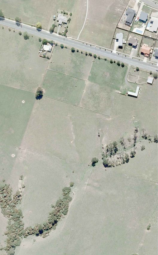
The proposed Business Centre area is currently Special Rural 1 Zone. It is currently
undeveloped, providing a greenfields site between the existing Beachlands settlement to the
north, and Jack Lachlan Drive, which provides the only link to the Pine Harbour Marina and
residential area.
2.2 Transport Network
2.2.1 Road Network
The Proposed Business Centre area is bounded by Beachlands Road and Karaka Road to the
north, Whitford-Maraetai Road to the east, and Jack Lachlan Drive to the south. An extension of
Constellation Avenue will form a key connection to the town centre.
2.2.1.1 Whitford-Maraetai Road
Whitford-Maraetai Road is classified as a District Arterial Road under the District Plan, and
therefore forms part of the Primary Road Zone. Roads within this zone are concerned with
providing for the safe and efficient through-movement of vehicles.
Whitford-Maraetai Road generally provides a two-way two-lane carriageway of around 6m in
width, with a centre line. Wide shoulders are provided, which are sealed to varying extent along
the length of the road. Whitford-Maraetai Road is shown in Photograph 1 below:
Photograph 1: Whitford-Maraetai Road, north of Beachlands Road, looking north
Progressive Enterprises Ltd, Beachlands Village Business Centre Private Plan Change:
Integrated Transportation Assessment Report
10560-1_ITA_Final.docDR
E
IVE
IV
I
MARA ETA
DR
TAI
AE
AR
M
PO
NY
COLU
PA R
MBIA
K
PL
FER ROAD
N
I
AETA
MAR
-
D
FOR
WHIT
National Route
Thursday, 29 April 2010
Regional Arterial Road
District Arterial Road
Site Location
Beachlands Village Business Centre Plan Change
Road Hierarchy
1
SCALE: 1:30,000
J:\10550-99\10560\Drawings\10560w1c.dwgIntre
pid
Cresc
ent
ue
Aven
ation
stell
Con
Libe
rty C
resc
ent
Bea
chla
nds
Roa
d
SITE
Road
etai
Mara
ford
Whit
Thursday, 29 April 2010
REVISION DATE DESCRIPTION
DRAWN: Quentin O'Shaughnessy
A 24/03/2010 Create from aerials and boundary data Beachlands Village Business Centre Plan Change
Site Location
DATE: 28.04.2010
SCALE: 1:2,000 @ A3
DWG NO:10560W1C
2
J:\10550-99\10560\Drawings\10560w1c.dwg6
Beachlands Road meets Whitford-Maraetai Road at a recently constructed three-leg roundabout,
shown in Photograph 2 (although this is not shown on the aerial photograph). An informal fourth
leg provides access to a quarry and other properties to the east.
It should be noted that the design and construction of this roundabout is over-designed to allow
for significant future increases in traffic flows.
The design of the roundabout was carried out to accommodate a formed fourth leg into the
Private Plan Change area.
Photograph 2: Whitford-Maraetai Road / Beachlands Road roundabout, looking south
2.2.1.2 Beachlands Road
Beachlands Road is a Collector Road in the vicinity of the site, and forms part of the Secondary
Road Zone in the District Plan. The Secondary Road Zone provides for locally generated vehicle
movements and direct property access. Beachlands Road is currently the only access road
to/from the current Beachlands Village. This zone is typically a low speed traffic environment,
providing comparative safety for pedestrians and cyclists, where traffic calming measures may be
employed.
Beachlands Road generally provides a carriageway of some 10m -12m in width, with one lane in
each direction separated by a centre line. In the vicinity of the site, footpaths are provided on the
north side of the road, separated from the road carriageway by a berm. In most locations on the
south side of the road there is no footpath provided. Beachlands Road is shown in Photograph
3.
Progressive Enterprises Ltd, Beachlands Village Business Centre Private Plan Change:
Integrated Transportation Assessment Report
10560-1_ITA_Final.doc7
Photograph 3: Beachlands Road, east of Constellation Avenue, looking east
2.2.1.3 Constellation Avenue
Constellation Avenue is defined as a Local Road under the District Plan, and therefore forms part
of the Secondary Road Zone. It is the only access point from the residential area of Spinnaker
Bay to the wider transport network. Constellation Avenue has a two-way carriageway, divided by
solid and flush medians in the first block, with lanes of around 4m in width. Following this, a
carriageway width of some 10m is provided. The carriageway is formed with kerbs, with
footpaths on both sides of the road separated from the carriageway by grass berms.
Constellation Avenue connects with Beachlands Road at a priority T-intersection, controlled with
‘Give Way’ signs and markings, as shown in Photograph 4.
Photograph 4: Beachlands Road / Constellation Avenue intersection, looking north
2.2.1.4 Karaka Road
Karaka Road is defined as a Local Road under the District Plan, forming part of the Secondary
Road Zone. It has a two-way undivided carriageway of some 5m-5.5m in width, providing a low
speed environment, and runs parallel to Beachlands Road. Informal shoulders and berms flank
the carriageway, without kerbs or footpaths.
Progressive Enterprises Ltd, Beachlands Village Business Centre Private Plan Change:
Integrated Transportation Assessment Report
10560-1_ITA_Final.doc8
2.2.1.5 Jack Lachlan Drive
Jack Lachlan Drive also forms part of the Secondary Road Zone, providing a two-way two-lane
carriageway divided by a centreline, with a width of around 7m. It is currently the only access
road to Pine Harbour. Wide unsealed shoulders are provided along its length on both sides of the
carriageway.
2.2.2 Walking & Cycling Facilities
Walking and cycling is well provided for around the existing Beachlands settlement. Wide traffic
lanes or slow speed environments allow for vehicles and cyclists to safely share the road within
Beachlands. There are only limited footpaths in the area; however the informal nature of the
existing local road network, with no kerbs and narrow roads, provides a safe shared space for
pedestrians and motorists.
Other links for pedestrians and cyclists are provided within and around Beachlands, as shown in
Figure 3. A number of off-road links for pedestrians and cyclists are provided within Beachlands
and Spinnaker Bay. Additionally there is a foot/cycle path provided along the shorefront from
Maraetai to Beachlands; this is completed from Maraetai Beach to Kelly’s Beach, and is formed
as a dirt path from Kelly’s Beach to Shelly Bay in Beachlands.
Whitford-Maraetai Road forms part of a popular recreational cyclist route. As part of the recent
Whitford-Maraetai Road / Beachlands Road roundabout construction, cycle lanes were
introduced along the realigned Whitford-Maraetai Road and Beachlands Road approaches to the
roundabout.
Progressive Enterprises Ltd, Beachlands Village Business Centre Private Plan Change:
Integrated Transportation Assessment Report
10560-1_ITA_Final.docKEY
SITE LOCATION
OFF-ROAD ROUTE FOR
CYCLISTS OR PEDESTRIAN
CYCLE LANE
CYCLE ROUTES PROPOSED
PO
NY
COL
PAR
UMB
K
IA
PL
FER
N
Tuesday, 30 March 2010
REVISION DATE DESCRIPTION
DRAWN: SP
---- ---- ---- Beachlands Village Business Centre Plan Change
----
----
----
----
----
----
----
----
----
----
----
----
----
----
----
----
----
----
Cycle Routes
DATE: 30.03.2010
SCALE: N.T.S
DWG NO:10560A7A
3
J:\10550-99\10560\Drawings\10560A7a.dwg10
3. Existing Travel Patterns
3.1 Daily Traffic Volumes
Manukau City Council (Council) provided daily traffic counts on Beachlands Road and Whitford-
Maraetai Road in the vicinity of the Business Centre. The latest average daily traffic (ADT)
volumes counted on these roads are summarised in the table below:
DAILY TRAFFIC VOLUME (vpd)
Road Location Date
Weekday Average 7 day Average
West of Whitford- April
Beachlands Road 7,066 6,790
Maraetai Road 2007
West of Whitford- December
Beachlands Road 7,557 7,252
Maraetai Road 2008
South of October
Whitford-Maraetai Road 8,123 7,765
Beachlands Road 2007
South of October
Whitford-Maraetai Road 8,749 8,253
Beachlands Road 2009
North of October
Whitford-Maraetai Road 4,337 4,373
Beachlands Road 2007
Table 1: Daily Traffic Volumes
The 7-day ADT’s are slightly lower than the weekday ADT’s for Beachlands Road and Whitford-
Maraetai Road south of Beachlands Road, showing that the prevalence of commuter movements
during the week from Beachlands. However, this difference is small, which shows that the area is
similarly frequented during the weekend. This is in line with the recreational destination provided
by the beach settlement. The ADT’s for 7-days and weekdays only on Whitford-Maraetai Road
north are almost the same.
The older 2007 ADT’s on Whitford-Maraetai Road south of Beachlands road have been included
to provide a comparison with this road north of Beachlands. The traffic volume almost halves
from south to north of Beachlands Road, showing that Beachlands is a key origin/destination in
the area.
3.2 Hourly Traffic Volumes
Council also provided hourly traffic volumes in the vicinity of the Business Centre. The latest
hourly traffic volumes counted on Whitford-Maraetai Road south of Beachlands Road are shown
in Graph 1.
Progressive Enterprises Ltd, Beachlands Village Business Centre Private Plan Change:
Integrated Transportation Assessment Report
10560-1_ITA_Final.doc11
1000
900
Hourly traffic volume (vph) 800
700
600
500
400
300
200
100
0
00:00
01:00
02:00
03:00
04:00
05:00
06:00
07:00
08:00
09:00
10:00
11:00
12:00
13:00
14:00
15:00
16:00
17:00
18:00
19:00
20:00
21:00
22:00
23:00
Hour beginning
Saturday Sunday Weekday Average
Graph 1: Whitford-Maraetai Road South, Hourly Traffic Volumes, Week Beginning 12 October 2009
Graph 1 shows that Whitford-Maraetai Road, south of Beachlands Road, experiences typical
commuter peak patterns during the week, from 7.00am to 8.00am and 5.00pm to 6.00pm. During
the weekend, traffic volumes remain steady during the day on both Saturday and Sunday from
around 10.00am to 5.00pm.
The latest hourly traffic volumes counted on Whitford-Maraetai Road north of Beachlands Road
are shown in Graph 2.
Progressive Enterprises Ltd, Beachlands Village Business Centre Private Plan Change:
Integrated Transportation Assessment Report
10560-1_ITA_Final.doc12
600
500
Hourly traffic volume (vph)
400
300
200
100
0
00:00
01:00
02:00
03:00
04:00
05:00
06:00
07:00
08:00
09:00
10:00
11:00
12:00
13:00
14:00
15:00
16:00
17:00
18:00
19:00
20:00
21:00
22:00
23:00
Hour beginning
Saturday Sunday Weekday Average
Graph 2: Whitford-Maraetai Road North, Hourly Traffic Volumes, Week Beginning 1 October 2007
Graph 2 shows that Whitford-Maraetai Road, north of Beachlands Road, experiences some
commuter peaks during the week, also from 7.00am to 8.00am and 4.00pm to 5.00pm however,
these are significantly lower than the weekend peak periods. During the weekend, traffic volumes
peak around mid-afternoon on both Saturday and Sunday. This shows that the settlements
northeast of Beachlands are smaller, attracting people as a recreational destination.
The hourly traffic volumes counted on Beachlands Road in 2007 are shown in Graph 3. The
latest volumes recorded in 2008 have not been used as these were recorded during a school
holiday period.
Progressive Enterprises Ltd, Beachlands Village Business Centre Private Plan Change:
Integrated Transportation Assessment Report
10560-1_ITA_Final.doc13
800
700
Hourly traffic volume (vph)
600
500
400
300
200
100
0
00:00
01:00
02:00
03:00
04:00
05:00
06:00
07:00
08:00
09:00
10:00
11:00
12:00
13:00
14:00
15:00
16:00
17:00
18:00
19:00
20:00
21:00
22:00
23:00
Hour beginning
Saturday Sunday Weekday Average
Graph 3: Beachlands Road Hourly Traffic Volumes, Week Beginning 16 April 2007
Graph 3 shows that Beachlands Road displays similar traffic patterns to Whitford-Maraetai Road
south. Typical commuter peak patterns are seen during the week, from 7.00am to 8.00am and
5.00pm to 6.00pm. During the weekend, traffic volumes remain steady during the day on both
Saturday and Sunday from around 9.00am to 5.00pm.
3.3 Intersection Turning Volumes
TDG undertook traffic surveys of vehicle movements at the intersections of Beachlands Road
with Whitford-Maraetai Road and with Constellation Avenue on Friday 5 February 2010 from
4.00pm to 7.00pm and Saturday 6 February 2010 from 11.00am to 5.00pm. The peak hour was
found to be 4.45pm to 5.45pm on Friday evening and 11.15am to 12.15pm on Saturday; the
vehicle movements during the peak hours are shown in Figures 4 and 5.
On Friday evening a high left turn movement from Whitford-Maraetai Road south to Beachlands
Road (almost double that of the through movement) was recorded. This demonstrates a strong
commuter trend of Beachlands residents working elsewhere in the Auckland region. Similarly,
there is a strong right turn movement from Beachlands Road east into Constellation Avenue
compared to the other turning movements at this intersection, which reinforces this trend.
During the Saturday peak hour both intersections show relatively balanced turning movement
volumes in each direction.
Progressive Enterprises Ltd, Beachlands Village Business Centre Private Plan Change:
Integrated Transportation Assessment Report
10560-1_ITA_Final.docue
A ven
ation
stell
23 (00)
)
25 (
Con
27
213 (0)
(9)
79 (73)
)
79 (
62 ( 107
418 1) 129 (2)
oad
Bea (11) (7)
chla
nds
etai R
Roa
d
Mara
ford-
Whit
210 (9)
(5)
401
Friday 5 February 2010
Peak Hour : 4:45 - 5:45pm
Friday, 30 April 2010
Key
XXX : Light Vehicles
(XX) : Heavy Vehicles
Beachlands Village Business Centre Plan Change
Weekday Existing Peak Hour Intersection Volumes
4
SCALE: n.t.s.
J:\10550-99\10560\Drawings\10560w1c.dwgue
A ven
ation
stell
28 (10)
)
16 (
Con
2
268 3 (0)
(12)
(5)
124 1)
82 (
28 ( 11
249 0) 183 3 (3)
(10)
oad
Bea (7)
chla
nds
etai R
Roa
d
Mara
ford-
Whit
166 (6)
(3)
195
Saturday 6 February 2010
Peak Hour : 11:15am - 12:15pm
Friday, 30 April 2010
Key
XXX : Light Vehicles
(XX) : Heavy Vehicles
Beachlands Village Business Centre Plan Change
Saturday Existing Peak Hour Intersection Volumes
5
SCALE: n.t.s.
J:\10550-99\10560\Drawings\10560w1c.dwg16
3.4 Road Safety Record
A search of the road safety record of the road network surrounding the Private Plan Change area
was undertaken using the New Zealand Transport Agency Crash Analysis System for the period
from 2004 to 2009. The search area is bounded by Beachlands Road from Whitford-Maraetai
Road to Sunkist Bay Road, Whitford-Maraetai Road and Jack Lachlan Drive to the Tui Brae.
A total of 40 crashes were recorded within the search area, 17 of which occurred at intersections,
and 23 of which occurred midblock. Four were serious injury crashes, 17 were minor injury
crashes and 19 were non-injury crashes. The crash locations and injury types are summarised in
the table below:
Injury Type
Location Total
Fatal Serious Minor Non-injury
Whitford-Maraetai Road / Jack Lachlan Drive 0 1 0 0 1
Whitford-Maraetai Road / Beachlands Road
0 1 3 6 10
(before construction of roundabout upgrade)
Whitford-Maraetai Road / Beachlands Road
0 0 2 0 2
(during/after construction of roundabout upgrade)
Beachlands Road / Bell Road 0 0 1 0 1
Beachlands Road / Sunkist Bay Road 0 0 0 2 2
Karaka Road / Bell Road 0 0 1 0 1
Whitford-Maraetai Road (midblock) 0 0 4 5 9
Jack Lachlan Drive (midblock) 0 0 2 2 4
Beachlands Road (midblock) 0 2 3 2 7
Karaka Road (midblock) 0 0 1 2 3
Total 0 4 17 19 40
Table 2: Crash Locations and Injury Type
Of the crashes that occurred at intersections, the main cause was failure to give way with 12
crashes. There were three loss of control crashes, two of which were related to maintenance on
the road. One crash was caused by a driver evading enforcement.
The majority of intersection crashes, 11 of a total of 17 crashes at five intersections, occurred at
the intersection of Whitford-Maraetai Road and Beachlands Road. This intersection shows a
pattern of crashes caused by failure to give way. However, this intersection was recently
upgraded from a priority T-intersection, with Beachlands Road being the minor leg, to a
roundabout. This new layout, which was completed in January 2009, better accommodates the
strong left turn in and right turn out from Beachlands Road, and is likely to reduce the occurrence
of crashes at this intersection. Indeed, the incidence of crashes appears to have reduced as a
result of the roundabout upgrade. Of the total of 12 crashes that occurred at this intersection, ten
occurred before the roundabout was constructed while the remaining two occurred during the
construction period. There have been no reported crashes at this roundabout in the year post-
construction.
Progressive Enterprises Ltd, Beachlands Village Business Centre Private Plan Change:
Integrated Transportation Assessment Report
10560-1_ITA_Final.doc17
Of the mid-block crashes, loss of control was the most common type, with 13 crashes; seven of
these related to alcohol, five related to speed, and the remaining five related to a variety of factors
including fatigue, rain, inexperience and distraction. The remaining five crashes were all
unrelated, comprising a rear end crash, an overtaking crash, a head on crash, an alcohol related
crash, and failure to give way from a private driveway.
The above analysis demonstrates typical crash statistics for a rural route. Council appears to
have successfully addressed the safety concern at Beachlands Road / Whitford-Maraetai Road
intersection for the future.
Progressive Enterprises Ltd, Beachlands Village Business Centre Private Plan Change:
Integrated Transportation Assessment Report
10560-1_ITA_Final.doc18
4. Accessibility
The Business Centre will be well located in the existing and proposed Beachlands residential
community and will be readily accessible via the existing and planned transport networks, as
described below. Catchments for the various modes of travel described below are based on
Census 2006 mesh block data and full development projections for the proposed Beachlands
Village New Avenues, Spinnaker Bay and Pine Harbour new residential areas.
4.1 Private Vehicle Accessibility
For private vehicles travelling from outside Beachlands, the Business Centre will be accessible
from Whitford-Maraetai Road, which forms the eastern frontage of the site. Whitford-Maraetai
Road is a District Arterial and therefore aims to provide efficient through-movement of vehicles,
so will carry vehicles from further afield. This will provide links to the site via other roads on the
primary road network from surrounding areas such as Maraetai, Whitford and Clevedon.
Local connectivity will be provided by existing and proposed lower-hierarchy roads in the vicinity,
including Beachlands Road, which will provide the main route to the site for existing residential
areas within Beachlands. In addition, extensions of Constellation Avenue and Karaka Road will
connect Spinnaker Bay and the proposed Beachlands Village New Avenues residential areas to
the proposed Business Centre.
4.1.1 Private Vehicle Catchment
Although the potential catchment area for cars could include all households within a 30 to 45
minute drive of the site, it is less likely that customers who are within reach of a nearer
comparable business or shopping centre will travel longer distances to access the proposed
Business Centre.
4.2 Public Transport Accessibility
One bus service, route 689, is currently provided to Beachlands. This travels from the Botany
town centre through Whitford to Shelly Bay Road in Beachlands with the return journey travelling
from Beachlands to Maraetai and back to Whitford and the Botany town centre, bypassing
Beachlands. This service runs seven times during weekdays and five times on Saturday, with no
Sunday service.
It is considered that although the current bus service is adequate, a higher frequency and
extended route could be provided if demand for public transport by employees and users of the
facilities warrant this.
In addition, Beachlands is serviced by a ferry from Pine Harbour which travels to the Auckland
City Centre. There are currently 13 services per day in each direction.
4.2.1 Public Transport Catchment
Passenger transport studies reveal that a typical walking distance for bus passengers to a bus
stop is approximately 400m. Therefore, those households currently and proposed to be within
400m the bus route are considered to be within the public transport catchment area for the site.
Figure 6 presents the bus route to Beachlands and the catchment area for this route.
Progressive Enterprises Ltd, Beachlands Village Business Centre Private Plan Change:
Integrated Transportation Assessment Report
10560-1_ITA_Final.docPO
NY
COLU
PARK
MBIA
PL
FERN
KEY
SITE LOCATION
400m BUS CATCHMENT AREA
BUS ROUTE
Tuesday, 30 March 2010
REVISION DATE DESCRIPTION
DRAWN: SP
---- ---- ---- Beachlands Village Business Centre Plan Change
----
----
----
----
----
----
----
----
----
----
----
----
----
----
----
----
----
----
Bus Catchment Area
DATE: 30.03.2010
SCALE: N.T.S
DWG NO:10560A7A
6
J:\10550-99\10560\Drawings\10560A7a.dwg20
There are around 5,300 households currently within this catchment area; this equates to around
17,000 persons within the bus service catchment area. However, as Botany Town centre is a
major bus terminal, providing connections to and from wider destinations such as Auckland City,
Manukau, and Newmarket, bus travel has a potentially higher catchment.
The ferry service lies just within 2km of the site, which is outside the usual public transport
catchment; however employees travelling to and from the Auckland city centre could be expected
to use this service as it provides a faster travel time to the Auckland City Centre from Beachlands
than other methods of transport (approximately 35 minutes).
4.3 Walking Accessibility
The existing site benefits from its placement adjacent to several surrounding residential areas,
and therefore pedestrian connectivity around the site is good. Footpaths adjacent to roads,
shared informal space within the road corridor, as well as several other off-road pedestrian routes
in the vicinity of the site offer a network of route choices for pedestrians. The main routes which
are anticipated to provide access to the site are generally along the same routes that vehicles will
use to access the Business Centre from within Beachlands, namely Beachlands Road, Karaka
Road and Constellation Avenue and its proposed extension.
4.3.1 Walking catchment
The Austroads Guide to Traffic Engineering Practice Part 13 – Pedestrians indicates that the
practical walking distance for non recreational walking trips is in the order of 1.5km. The primary
catchment area for pedestrians shown in Figure 7 has therefore been based on a 1.5km walking
distance from the site. The number of households currently and proposed to be within this
catchment area is approximately 2,000 households, which equates to around 6,000 persons
4.4 Cycling Accessibility
There will be cycle parking provided within the Business Centre so it is considered that users and
employees of the centre may access the Business Centre by cycling. There are currently no
dedicated cycle lanes along roads within Beachlands, except directly adjacent to the site on the
Beachlands Road approach to the Whitford-Maraetai Road roundabout. However, it is
considered that the relatively low traffic volumes in the vicinity of the site provide a safe on-road
route for cyclists within Beachlands to the Business Centre.
Outside of Beachlands, the recreational cycle route often utilised along Whitford-Maraetai Road,
with on-road cycle lanes on the approach to Beachlands Road provides a potential route for
cyclists from outside of Beachlands to access the site. It is considered that employees or
recreational cyclists during the weekend may use this route.
Progressive Enterprises Ltd, Beachlands Village Business Centre Private Plan Change:
Integrated Transportation Assessment Report
10560-1_ITA_Final.docPO
NY
COLU
PARK
MBI
A
PL
FERN
R1500
KEY
Tuesday, 30 March 2010
SITE LOCATION
WALKING CATCHMENT AREA
Beachlands Village Business Centre Plan Change
Walking Catchment Area
7
SCALE: N.T.S
J:\10550-99\10560\Drawings\10560A7a.dwg22
4.4.1 Cycle Catchment
The Ministry of Transport document, Getting there – on foot, by cycle. A strategy to advance
walking and cycling in New Zealand Transport indicates that the average cycle trip distance is
3km. This distance has therefore been used to establish the cycle catchment area for the
Business Centre.
The catchment area for cyclists has therefore been calculated based on the number of
households within a 3km radius of the site. This catchment area is shown in Figure 8 and
contains some 3,400 households, which equates to around 10,200 persons.
Progressive Enterprises Ltd, Beachlands Village Business Centre Private Plan Change:
Integrated Transportation Assessment Report
10560-1_ITA_Final.docPO
NY
COLU
PARK
MBI
A
PL
FERN
R3000
KEY
Tuesday, 30 March 2010
SITE LOCATION
CYCLE CATCHMENT AREA
Beachlands Village Business Centre Plan Change
Cycling Catchment Area
8
SCALE: N.T.S
J:\10550-99\10560\Drawings\10560A7a.dwg24
5. Proposed Private Plan Change
The proposed Private Plan Change area is currently Special Rural 1 Zone. It is proposed to
change the zoning to the new “Beachlands Village Business Centre” zone, which will
accommodate the retail and commercial needs of the existing and future Beachlands settlement.
The proposed Concept Plan for the new zone is shown in Figure 9.
The Beachlands Village Business Centre Zone will enable a wide range of retail and commercial
activities in order to service the needs of the growing community. The Private Plan Change will
provide for:
One supermarket of up to 5,000sqm GFA (excluding loading areas)
Convenience shops
Entertainment facilities and cinemas
Commercial services
Offices
Hotels, motels and travellers accommodation
Garden centres
Building improvement centres
Service stations
Community and healthcare services and facilities and medical centres
Community buildings and facilities
Care centres, pre-school centres and educational facilities
Cafes, restaurants and takeaway food premises
Taverns
Retail sales, retail activities, shops and stalls, and
Associated parking, loading and access.
To enable an assessment to be carried out to determine the ability of the surrounding
transportation network to accommodate the traffic generated by the site, a market analysis and
design exercise was carried out to ascertain the likely development potential. This has resulted in
the proposed Concept Plan for the new zone, as shown in Figure 9.
Progressive Enterprises Ltd, Beachlands Village Business Centre Private Plan Change:
Integrated Transportation Assessment Report
10560-1_ITA_Final.docFriday, 30 April 2010
Plan Produced by Connect Urban Deisgn Ltd
Beachlands Village Business Centre Plan Change
Concept Plan
9
SCALE: n.t.s.
J:\10550-99\10560\Drawings\10560w1c.dwg26
6. Proposed Transport Provisions
6.1 Vehicle Access
6.1.1 Road Connections
The proposed road connections for the Business Centre are shown as blue lines in Figure 9.
It is proposed to link the Business Centre to the existing road network in three places:
Whitford-Maraetai Road / Beachlands Road roundabout
Beachlands Road / Constellation Avenue, and
Karaka Road.
The Whitford-Maraetai Road / Beachlands Road intersection was recently upgraded from a
priority T-intersection to a four leg roundabout, including a minor link to the quarry to the east,
aligned to allow for a fifth leg to the southwest. It is expected that the fifth leg into the Business
Centre site will form the main access point into the Business Centre area. The access road will
be of similar composition to the existing legs of the roundabout, with one lane in each direction
separated by a solid median on the approach to the roundabout, but will likely have narrower
lanes to slow vehicles down as they enter the Business Centre area.
Karaka Road will be extended east into the site, to provide a link through the Business Centre,
which is expected to continue around to the north to form a leg of the Whitford-Maraetai Road /
Beachlands Road roundabout, as described above.
Constellation Avenue will be extended to the south to provide a link from Beachlands Road to
Karaka Road where it enters the Business Centre area. It will continue south to connect with the
new avenues proposed by the Beachlands Village New Avenues Structure Plan.
Another new road aligned north-south, Karo Road, will join the Karaka Road extension at the
bend to the east. This road will link to the new avenues proposed by the Beachlands Village New
Avenues Structure Plan.
All of the proposed roads and extensions connecting to the external road network will generally
be classified as Local Business Roads under the District Plan, providing access through a
business area. The extension of Karaka Road through the Business Centre will be classed as
such, but will also have more of a collector function. Appropriate carriageway provisions will be
made according to the expected road types.
6.1.2 Access Points
The proposed access points to the Business Centre are shown as blue arrows in Figure 9.
Vehicle access and egress will be distributed to the wider road network at a number of points
around the Business Centre area. The main vehicle access point is proposed to be from Karaka
Road, linking to the surface car park in the northern block of the Business Centre. Another
access point will link this car park to Beachlands Avenue.
Progressive Enterprises Ltd, Beachlands Village Business Centre Private Plan Change:
Integrated Transportation Assessment Report
10560-1_ITA_Final.doc27
Two access points to basement parking areas in both the northern and southern blocks of the
Business Centre will be provided towards the west end of Karaka Road and Seventh View
Avenue, respectively.
Vehicle access to the southern block of the Business Centre will be provided from Karo Road;
access will be provided opposite this to the eastern block.
Other access points to the eastern block are likely to be provided from the extension of Karaka
Road and from Whitford-Maraetai Road. The Whitford-Maraetai Road link will only provide
ingress to the site.
6.2 Pedestrian Access
Pedestrians will be well catered for around the Business Centre area: footpaths will be provided
on both sides of all new roads within and around the area, which will have priority over driveways.
The use of pedestrian priority combined with traffic calming, will ensure that the Business Centre
will experience relatively slow speeds thereby providing an amenable and safe environment for
other transport modes such as cyclists.
An internal network of footpaths, pedestrian ramps and stairs within the Business Centre will
provide pedestrians safe and convenient access around and within parking areas. A key
pedestrian link between Beachlands Road and Seventh View Avenue to the south will be
provided via an open space north-south network through the middle of the Business Centre.
6.3 Public Transport Provisions
It is anticipated that the existing bus service through the Beachlands settlement will continue to
travel its existing route, but with an additional stop at the Business Centre. The frequency of the
bus service can be increased as demand for the service rises.
Bus stops and other associated facilities are expected to be provided on Beachlands Road
adjacent to the Business Centre for passengers travelling in both directions. The bus stop will
align with the key north-south pedestrian link through the site.
6.4 Parking and Loading
Parking for the Business Centre will be provided primarily within the centre of the northern block,
and is therefore likely to be screened by the surrounding development and landscaping.
Underground parking is also proposed, which will be well-connected internally to the above-
ground areas. The basement parking areas will be accessed from the west end of Karaka Road
and Seventh View Avenue, as mentioned above.
Furthermore, there is expected to be some on-street parking allowed on the roads through and
immediately around the Business Centre. It is considered that the on-street parking directly
adjacent to the Business Centre, particularly on Karo Road and the extension of Karaka Road
which run through the Centre, is integral to the site and should be counted within the District Plan
requirement.
Parking provisions will include spaces for mobility impaired users and taxis.
Progressive Enterprises Ltd, Beachlands Village Business Centre Private Plan Change:
Integrated Transportation Assessment Report
10560-1_ITA_Final.doc28
A number of loading areas will be required for the Centre, particularly for any retail development.
It is expected that loading arrangements for the major retail tenancies (those which can expect to
be serviced by vehicles such as articulated trucks) will be on the western edge of the
development, accessed off the Constellation Avenue extension as shown in Figure 9 with trucks
travelling via Beachlands Road.
A number of smaller loading areas will be required, for use by vans or smaller single-unit trucks,
to service smaller tenancies. These are generally expected to be provided within parking areas
adjacent to the appropriate tenancies.
It is anticipated that the parking and loading requirements of the existing District Plan will be
adequate to apply to the proposed new zone; therefore there is no need for specific provisions in
the Private Plan Change. However, it is expected that this provision will include the use of shared
parking and loading facilities and on-street parking, as described in the policies and explanations
of the Private Plan Change document.
Progressive Enterprises Ltd, Beachlands Village Business Centre Private Plan Change:
Integrated Transportation Assessment Report
10560-1_ITA_Final.doc29
7. Trip Generation
7.1 Trips Generated by the Business Centre
It is necessary to calculate the development potential of the site to ensure that the transportation
network can accommodate the generated traffic flows. The marketing analysis undertaken by
Market Economics established the additional area of various activities that could be developed
given the demand from households within the catchment area for the Business Centre.
A robust assessment of the expected development on the site has been undertaken by Market
Economics, using a projected completion date of 2016. In addition, a sensitivity analysis has
been carried out of the maximum development potential of the site, once all of the residential plan
change areas have been fully implemented. The future year for this scenario is 2026.
The market analysis split the development into the following activities:
retail and associated services
cinema
community facilities
medical service providers (including a wide variety of medical facilities such as GPs, dental,
optometry, physiotherapy, chiropractic and others)
childcare
hotel, and
office.
It is also anticipated that a service station will be provided, and therefore this has been included in
the development also. This has been assessed as having a gross floor area of some 200sqm
with a site area of 4,000sqm, which is considered to represent a typical service station.
It should be noted that the Market Economics analysis of the two scenarios provides the total
demand for these activities for the catchment in each future year, which is not necessarily
representative of what will eventually be developed at the Business Centre, but represents a
worst case scenario from a transportation perspective, which has been used to develop a robust
analysis.
The industry-recognised Roads and Traffic Authority, New South Wales guideline “Guide to
Traffic Generating Developments” (“RTA Guide”), supplemented by the local Transfund New
Zealand report Trips and Parking Related to Land Volume 1 and local surveyed trip rates, was
used to estimate the vehicle trips that would be generated by the aforementioned activities. The
total trip generation of the Business Centre during the weekday evening and Saturday peak
periods, which are generally the worst cases for a shopping centre, have been assessed. Where
Saturday peak trip rates were unavailable these were estimated to be the same as the weekday
evening peak period, except for the office/services activities which were estimated as 10% of the
weekday evening peak trip rate as most offices would be little used on Saturdays.
The tables below show the trip generation for the 2016 interim year and the 2026 future sensitivity
test, using individual rates for each activity. Retail and services, cinemas and community facilities
have been assessed using trip rates for a shopping centre as these are activities that are typically
found in a shopping centre.
Progressive Enterprises Ltd, Beachlands Village Business Centre Private Plan Change:
Integrated Transportation Assessment Report
10560-1_ITA_Final.doc30
Trip Rate Trips Generated (vph)
Activity Area
PM Sat PM Sat
Supermarket 4,000sqm GFA 13.2/100sqm GFA 11.6/100sqm GFA 528 464
Shopping Centre 5,400sqm GFA 12.5/100sqm GFA 16.3/100sqm GFA 675 880
Medical 2,500sqm GFA 8.8/100sqm GFA 8.8/100sqm GFA 220 220
Childcare 3,000sqm GFA 9.0/100sqm GFA 9.0/100sqm GFA 269 269
Office 4,900sqm GFA 2.0/100sqm GFA 0.2/100sqm GFA 98 10
Hotel 1,000sqm GFA 1.3/100sqm GFA 1.3/100sqm GFA 13 13
200sqm GFA + 0.3 x sqm GFA + 0.3 x sqm GFA + 220 220
Service Station
4,000sqm site area 0.04 x sqm site area 0.04 x sqm site area
Total - - - 2,023 2,076
Table 3: Trip Generation of Business Centre 2016 Scenario using Individual Rates
Trip Rate Trips Generated (vph)
Activity Area
PM Sat PM Sat
Supermarket 4,000sqm GFA 13.2/100sqm GFA 11.6/100sqm GFA 528 464
Shopping Centre 11,000sqm GFA 7.6/100sqm GFA 7.5/100sqm GFA 836 825
Medical 3,700sqm GFA 8.8/100sqm GFA 8.8/100sqm GFA 326 326
Childcare 4,500sqm GFA 9.0/100sqm GFA 9.0/100sqm GFA 404 404
Office 7,200sqm GFA 2.0/100sqm GFA 0.2/100sqm GFA 144 14
Hotel 1,000sqm GFA 1.3/100sqm GFA 1.3/100sqm GFA 13 13
200sqm GFA + 0.3 x sqm GFA + 0.3 x sqm GFA + 220 220
Service Station
4,000sqm site area 0.04 x sqm site area 0.04 x sqm site area
Total - - - 2,470 2,266
Table 4: Trip Generation of Business Centre 2026 Scenario using Individual Rates
The trip rates shown in the tables above do not take into account shared trips between the
various activities, which will occur given the nature of the development, therefore the total trips
calculated above are very unlikely to occur in reality. It is considered that the supermarket, retail
and services, cinema, community, medical and childcare activities should all be treated as an
overall shopping centre use, which takes account of the high incidence of shared trips. This is
common traffic engineering practice. Hotel and office activities are considered less likely to have
shared trips, and are therefore still assessed separately. The assessed trip generation of the
Business Centre for the 2016 and 2026 scenarios is shown in the tables below:
Trip Rate Trips Generated (vph)
Activity Area
PM Sat PM Sat
Shopping Centre 14,900sqm GFA 7.6/100sqm GFA 7.5/100sqm GFA 1,132 1,118
Office 4,900sqm GFA 2.0/100sqm GFA 0.2/100sqm GFA 98 10
Hotel 1,000sqm GFA 1.3/100sqm GFA 1.3/100sqm GFA 13 13
200sqm GFA + 0.3 x sqm GFA + 0.3 x sqm GFA + 220 220
Service Station
4,000sqm site area 0.04 x sqm site area 0.04 x sqm site area
Total - - - 1,463 1,360
Table 5: Trip Generation of Business Centre 2016 Scenario using Individual Rates
Progressive Enterprises Ltd, Beachlands Village Business Centre Private Plan Change:
Integrated Transportation Assessment Report
10560-1_ITA_Final.doc31
Trip Rate Trips Generated (vph)
Activity Area
PM Sat PM Sat
Shopping Centre 23,200sqm GFA 5.9/100sqm GFA 5.6/100sqm GFA 1,369 1,299
Office 7,200sqm GFA 2.0/100sqm GFA 0.2/100sqm GFA 144 14
Hotel 1,000sqm GFA 1.3/100sqm GFA 1.3/100sqm GFA 13 13
200sqm GFA + 0.3 x sqm GFA + 0.3 x sqm GFA + 220 220
Service Station
4,000sqm site area 0.04 x sqm site area 0.04 x sqm site area
Total - - - 1,746 1,547
Table 6: Trip Generation of Business Centre 2026 Scenario using Individual Rates
The trip generation shown in the table above has been used to assess the potential traffic effects
that the activities enabled under the Private Plan Change will have on the transport network
immediately surrounding the site during each future year.
7.2 Trips Generated by Proposed New Residential Areas
The Structure Plan provided by Council in their Beachlands Village New Avenues Discussion
Document detailed the anticipated layout of the proposed new residential areas surrounding the
proposed new Business Centre. Council have indicated that the high density residential area is
likely to be changed to medium density. Using the areas of varying residential lot density shown
in their Structure Plan, but changing the high density area to medium density, the number of
households within the residential area was estimated at approximately 760.
Similarly the Pine Harbour Concept Plan has been used to estimate the number of households of
various types that are proposed within the Pine Harbour Private Plan Change. This showed that
a total of 480 residences are proposed as follows:
124 studios/one bedroom apartments
162 two bedroom apartments
124 three or more bedroom apartments, and
70 terraced houses.
The retail and office components of the development proposed for Pine Harbour are relatively
small, 1,633sqm and 3,267sqm respectively. It is therefore considered that trips generated from
these activities will only originate from within Beachlands and therefore will have a negligible
effect on the intersections modelled, and therefore have not been assessed.
Existing residential development at Spinnaker Bay has been counted to be approximately 150
households. The Manukau City Council has indicated that 420 lots will be developed in total at
Spinnaker Bay. Assuming one household per lot this means that around 270 households may
still be developed in the Spinnaker Bay area.
To estimate the number of trips generated by the proposed new residential area, the RTA Guide
trip rates for residential activities was used. It is considered that the dwelling house definition
applies best to residential activity in the Beachlands Village New Avenues and Spinnaker Bay
areas, as well as the terraced houses proposed within the Pine Harbour Plan Change. This gave
a weekday peak hour trip rate of 0.85/dwelling.
Progressive Enterprises Ltd, Beachlands Village Business Centre Private Plan Change:
Integrated Transportation Assessment Report
10560-1_ITA_Final.doc32
The remaining residential types proposed within the Pine Harbour Plan Change have been
estimated as medium density residential flat buildings, with weekday peak hour trip rates of 0.4-
0.5vph for smaller units of up to two bedrooms and 0.5-0.65vph for larger units and townhouses.
The total number of new lots/households likely to be developed for each of these three new
residential areas, as detailed above has been used to assess the 2026 scenario. The interim
2016 partial development scenario has been assessed by Market Economics. The highest
growth scenario for 2016 has been adopted to provide a robust analysis of the effects of the
additional traffic. For Pine Harbour, these have been assessed as the larger household units.
The total trips anticipated to be generated by the new residential areas is shown in the tables
below:
Number of Trip Rate Trips Generated
Area Type of Residence
Households (vph/household) (vph)
Beachlands Village New Avenues Dwelling Houses 457 0.85 388
Pine Harbour Dwelling Houses 194 0.85 165
Pine Harbour Medium Density (larger units) 107 0.65 70
Spinnaker Bay Dwelling Houses 104 0.85 88
Total - 862 - 711
Table 7: Assessed Trip Generation of Proposed New Residential Areas for 2016
Number of Trip Rate Trips Generated
Area Type of Residence
Households (vph/household) (vph)
Beachlands Village New Avenues Dwelling Houses 760 0.85 646
Pine Harbour Dwelling Houses 194 0.85 165
Pine Harbour Medium Density (larger units) 162 0.65 105
Pine Harbour Medium Density (smaller units) 124 0.5 62
Spinnaker Bay Dwelling Houses 270 0.85 230
Total - 1,510 - 1,208
Table 8: Assessed Trip Generation of Proposed New Residential Areas for 2026
The weekday peak hour trip generation rates have been applied to the evening peak hour and it
has also been assumed that the same number of trips will be generated during the Saturday peak
hour.
Progressive Enterprises Ltd, Beachlands Village Business Centre Private Plan Change:
Integrated Transportation Assessment Report
10560-1_ITA_Final.docYou can also read