Preparing Australia for future extreme bushfire events - Delivering science and technology to reduce the impact of fire on Australia's people ...
←
→
Page content transcription
If your browser does not render page correctly, please read the page content below
Australia’s National
                                           Science Agency

Preparing Australia for future
extreme bushfire events
Delivering science and technology to reduce the impact
of fire on Australia’s people, environment and economy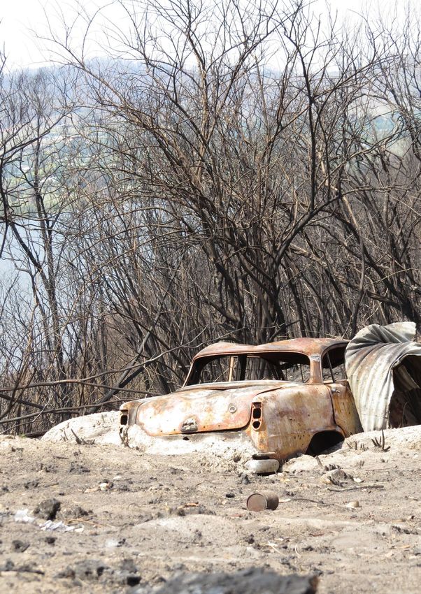
CSIRO bushfire expert Justin Leonard conducts bushfire behaviour experiments in the field.

2
Creating a bushfire ready nation

CSIRO is Australia’s national science agency and a trusted advisor
on fire prediction, management, behaviour and recovery.

For almost 70 years we have been working collaboratively     CSIRO works with rural fire agencies and other research
in bushfire-research, from understanding and modelling       agencies so our scientists can apply knowledge of ecosystem
impact of bushfires on the environment to post-fire          and bushfire dynamics to real events. These partnerships
assessments and improving infrastructure design.             enable CSIRO to share its bushfire research with the
                                                             wider community.
Our scientists are developing reliable tools to predict
bushfire behaviour, and advance fire spread prediction       We also work with state fire authorities to predict, manage
and bushfire suppression systems. We train all state         and assess the impacts of bushfires. Predictions conducted
fire agencies in fire behaviour and prediction and use       using CSIRO research and expertise have been critical
world‑class facilities and models to understand and manage   to timely identification of potential impacts and issue of
fires under future climate conditions.                       emergency warnings.

CSIRO was the first agency internationally to link an        Whether it’s state fire agencies, Traditional Owners,
increase in bushfire weather severity to climate change      government, business or a community in need, we are
in 1988. Our research and practical resilience measures      here to help. We apply cutting edge science and technology
in relation to bushfires and climate change are more         to deliver material benefit to Australian communities.
important than ever before as Australia faces continued
extreme fire weather into the future.

As a multidisciplinary science agency, CSIRO draws
on a wide range of expertise to understand, predict,
and manage fires and support recovery, rehabilitation
and resilience.

Solving the nation’s biggest challenges like increased
extreme fire weather cannot be done alone.

                                                             Working with other agencies to study bushfire behaviour
                                                             at Ipswich in 2017.

                                                                                                                           3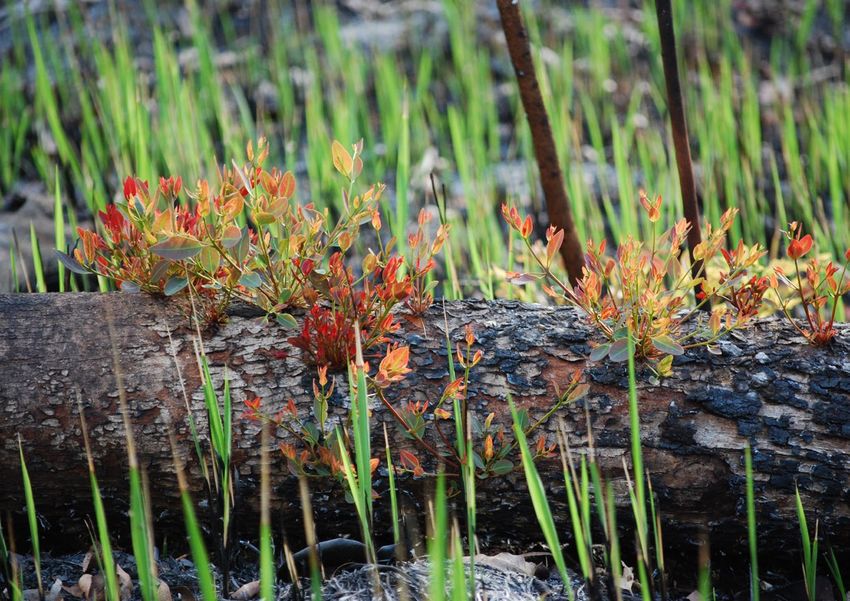
A proven record in bushfire
research and providing
expert advice

    CSIRO is involved in a range of bushfire-related
    research, including:

    • understanding and predicting bushfire behaviour
    • developing prediction and fire data analysis tools
    • impact of bushfires on infrastructure
    • disaster management
    • ecological responses to fire
    • Indigenous fire knowledge and practice
    • pollutants and greenhouse gases as a result
      of bushfires
    • smoke forecasting for bushfires and
      prescribed burns
    • building community resilience and                        Research Scientist with the CSIRO Land and Water Bushfire
      risk management                                          Behaviour and Risks group, Matt Plucinski, conducts
                                                               out-door fire experiments.
    • reducing impacts in the face of disasters
    • preparing for climate change and extreme events
    • investigating and reconstructing major wildfire
                                                               We provide regular advice to
      events to aid learning and model development.
                                                               governments to help with policy decisions
    CSIRO has performed post-bushfire surveys since
                                                               Following the 2019–20 Australian bushfire season,
    the 1940s. In addition to our array of other bushfire
                                                               the Australian Government called on CSIRO for help to
    research, this in-the-field work provides invaluable
                                                               deliver practical resilience measures in relation to bushfires
    information on how fires start, what influences their
                                                               and climate change. We were tasked by the Prime Minister
    spread, how they impact buildings and how they can
                                                               to deliver a report to Australian governments on climate
    be stopped. Through this work, CSIRO developed the
                                                               and disaster resilience, working with an Expert Advisory
    Forest Fire Danger Index in 1967, which, even today,
                                                               Panel led by Australia’s Chief Scientist Alan Finkel.
    forms the basis of Australia’s fire-risk warning system.

4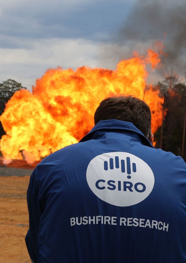
An abandoned car sits among the ash as a reminder of the Kosciuszko fire, Snowy Mountains.
Pictured on the shores of Jounama Pondage, January 2020.

                                                                                             5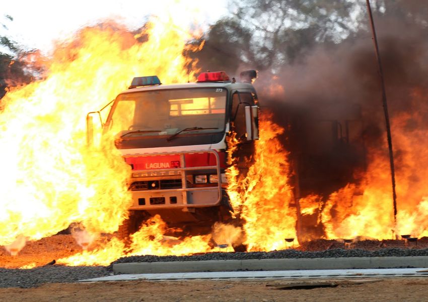
National science agency
delivering impact
Bushfire research involves working in partnership with different levels
of government, the private sector and communities. Our research
areas and bushfire-related projects are helping Australians better
understand and respond to a changing climate and environment.

Bushfire behaviour and risks                                  Emergency Situation Awareness
The Bushfire Behaviour and Risks team focuses on the          Data61’s Emergency Situation Awareness (ESA) software
study of the behaviour of bushfires and the development       provides situation awareness by using data mining
of systems to predict their spread and behaviour. CSIRO       techniques on Twitter to detect when disaster events,
trains all state agencies in fire behaviour and prediction,   such as fires, are being broadcast on social media, and
and has world-class facilities and models to understand,      alerts users. ESA also stores complete Twitter stream
predict, and manage fires under future climate conditions.    information, allowing for post-event analysis.

Predictions conducted by agencies using CSIRO’s suite         Such useful and accessible information can provide
of models have been critical to the timely issue of           timely situation awareness for disaster managers and
emergency warnings.                                           emergency response agencies, allowing them to prepare
                                                              their responses prior to receiving official confirmation of
                                                              an event.
Spark
CSIRO is working on better detection methods,
enhanced fire spread simulation models and suppression
effectiveness models. When these are linked into a single
modelling environment (Spark), they allow agencies
to prioritise efforts to suppress new and running fires
according to their potential to cause loss.

Spark, developed by CSIRO’s Data61, is a state-of-the-
art fire spread simulation framework for simulating
the spread of fire across the landscape and is used by
NSW, SA, QLD, VIC and Tas fire authorities.

National bushfire life and house
loss database
CSIRO has compiled a comprehensive dataset of the
life and house loss during bushfires from 1900 to 2018.
The database forms the basis of many advice guides and
warning systems by the Australasian Fire Authorities          Our post-bushfire teams have used standard post-bushfire
                                                              surveys since the 1983 Ash Wednesday fires in South Australia.
Council (AFAC), the peak Australasian body for the fire       Pictured right is CSIRO bushfire expert Justin Leonard.
and emergency services, and various fire agencies. It has
influenced the timeliness and targeting of messaging in
recent fire events.

6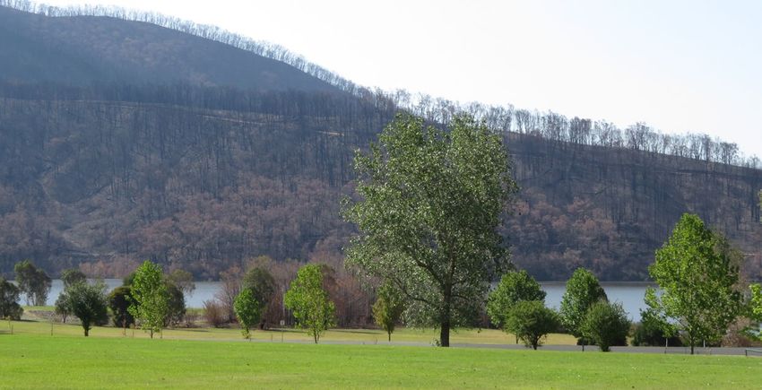
CSIRO testing of firefighting vehicles to support development of crew protection systems.

Sentinel Hotspots                                                   The impact of these protective measures for fire trucks was
                                                                    demonstrated in the 2009 Black Saturday fires in Victoria
Sentinel Hotspots is an internet-based satellite mapping            when 12 fire trucks were impacted by fire and their crews
system hosted by Geoscience Australia (GA) which provides           emerged safely with no loss of life. These protection
emergency service managers access to the latest fire                systems continued to provide crews with increased safety
location information using satellite data collected up to           in subsequent fires including the 2019–2020 bushfires.
three times a day. Since it was launched in 2003, firefighting
organisations in all Australian states have used this tool to
identify and zoom in on fire hotspots. This formed part of          Post-bushfire surveys
the early warning system for fire agencies and community            Our post-bushfire surveys and research provide invaluable
during the 2019–2020 fires. The system was developed by             information on how fires impact buildings and communities.
CSIRO in collaboration with Department of Defence and               Our bushfire scientists visit non-active fire zones to
Geoscience Australia.                                               survey damage and gather data. This research effort has
                                                                    underpinned extensive policy and regulatory development
Fire tanker protection systems                                      and reform for building design, planning and education
                                                                    through various fire agencies and other state agencies.
Burnover-protection systems for Victorian crew-cabs
have been developed in collaboration with CSIRO over
20 years and are now fitted as a standard requirement in
all Victorian fire trucks. NSW and WA fire departments are
also developing prototypes using this knowledge base.

                                                                                                                                  7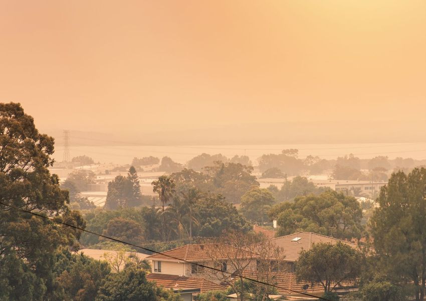
The CSIRO Pyrotron
This is a 25-m-long combustion wind tunnel designed, built
and operated by CSIRO to enable the safe and repeatable
study of the behaviour and spread of fires. This facility at
the CSIRO Yarralumla site, Canberra allows statistically
robust investigation of the processes of flame propagation
in a range of bushfire fuels from grass, to forest litter,
to small shrubs. Published results include analysis of
greenhouse gas emission as a function of fire behaviour
and spread mode and investigation of fire growth
and acceleration.

Full scale house burnover
experimentation                                                 Experimental fire in CSIRO’s Pyrotron. Scientists study
                                                                ignition shrub fuels from surface fire.
CSIRO has conducted a series of full-scale house burnover
experiments to assess the viability of conventional and
novel building systems in a bushfire situation. This work has
resulted in various building design innovations including       Protecting fire crews and assets
an approved eco-house design and the development of a
national bushfire building standard adopted by the National     • Training – a firefighter safety training package was
Construction Code in 2015. These codes have influenced a          created by Western Australia’s Fire and Emergency
significant number of houses built since their adoption.          Services Authority, Department of Conservation and Land
                                                                  Management and CSIRO. CSIRO fire behaviour scientists
                                                                  helped to develop a training course for fire behaviour
Personal Bushfire Shelter (PBS)                                   analysts and regularly trains first responders.
experimentation and advice
                                                                • Firefighter health – CSIRO has worked with state fire
CSIRO has played a key role in providing technical support        agencies to assess firefighter smoke and toxic air exposure
and scientific input to ensure the guidelines and regulatory      while firefighting. This work has led to changes in the
systems for personal bushfire shelters are effective and          operating procedures and personal protective equipment
reliable. Following the 2009 Victorian fires, the Victorian       specifications for firefighters across the nation.
Building Authority engaged CSIRO to provide science input
to support the development of policy guidelines around the      • Cars trapped in firestorms – CSIRO evaluated the maximum
use of personal bunkers for bushfire protection.                  heat load that a vehicle could face while remaining a safe
                                                                  haven for its occupants, in terms of both air temperature
                                                                  and air quality inside the vehicle. This research was used
                                                                  by AFAC (national council for fire and emergency services)
                                                                  to refine their policy documents on guidance for people
                                                                  caught in vehicles during bushfires.

                                                                • Weather forecasting – CSIRO has improved our ability to
                                                                  forecast bushfire weather that affects bushfire spread
                                                                  behaviour and this has been adopted in Bureau of
                                                                  Meteorology (BOM) operations.

An example of an accredited bushfire bunker before being
installed in the ground.

8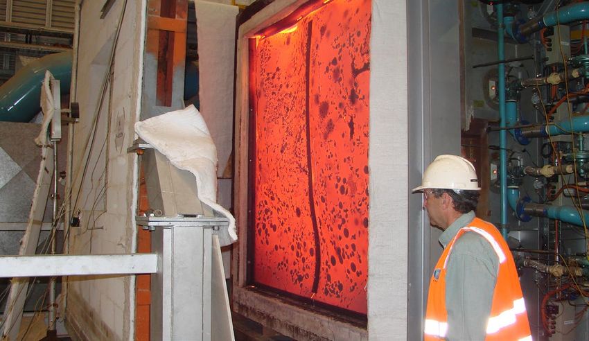
Smoke forecasting for bushfires                                   Our research has led to the adoption of AQFx by land-use
                                                                  agencies in Victoria and NSW to aid in smoke management
and prescribed burns
                                                                  from prescribed burning and issue targeted health warnings
CSIRO has worked with Victoria’s Department of                    when needed. AQFx has also been used to forecast smoke
Environment, Land, Water and Planning (DELWP), the BOM,           exposure from bushfires, with this information being made
and the university sector to develop a tool that is being         available to the emergency management centres and the
used to help manage smoke exposure from prescribed                state environment protection authorities. This capability
burns and bushfires.                                              has been extensively used since 2016. Forecasts provided
                                                                  by AQFx in 2019–20 were used in Victoria and NSW to
AQFx (the air quality forecasting system) is run operationally    anticipate hazards to health, aviation and Australian
by BOM and uses a fire spread model to calculate                  Defence Force operations. A national rollout of AQFx
smoke emissions from ongoing fires and planned burns.             (endorsed by AFAC) is being planned to ensure that
Wind‑blown dust and urban sources of pollution are also           advanced warnings of community exposure to smoke from
included in AQFx. The transport of smoke by the wind is           vegetation fires are available for all Australians. The smoke
forecast using the meteorology from BOM’s ACCESS                  forecasts will also be applied to other industries such as
weather forecasting system.                                       agriculture (e.g. viticulture) and solar photo-voltaic systems.

A suburb in a smoke haze. Sydney, 4 December 2019. Source: Shutterstock.

                                                                                                                               9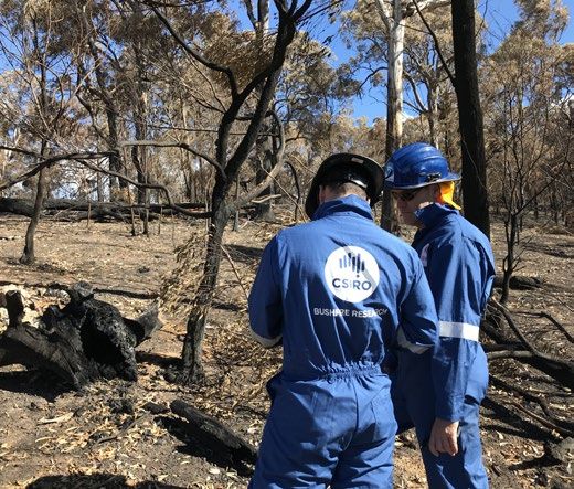
Fire safe material
Several fire safe materials have been developed, including
pre-cast concrete panel technology (HySSIL) that is fire
resistant for four hours. These new materials can be
utilised as fire-proof insulative building materials in fire
shelters, bunkers, sheds and panic rooms.

Fire resistant coatings based on inorganic polymers have
also been trialled to provide improved fire protection for
timber products used for construction and furniture.

Testing and evaluation of
construction products
We conduct laboratory testing and assessment of
materials, elements of construction and systems in
accordance with Australian requirements for the
                                                                     Testing on a small scale for radiant heat exposure for
construction of buildings in bushfire prone areas. We also           building materials. CSIRO, Clayton site, Victoria.
provide large scale evaluations for buildings exposed to
radiant heat and large flaming sources for bushfire attack
levels up to the flame zone.

Large scale AS1530.8 test for buildings exposed to bushfire attack (radiant heat) at CSIRO, North Ryde site, NSW.

10
Building resilient communities
To support improved bushfire resilience, CSIRO has
researched the root causes of our vulnerabilities, rather
than focussing only on managing the hazards. This requires
understanding of the interdependent systems that
our society depends on to deliver essential goods and
services, such as energy, water, food, health, education
and other social services, transport, and communications.
CSIRO has used this approach in aiding the development
of the federal government’s National Disaster Risk
Reduction Framework, and in developing Climate Compass.
This is a framework designed to help Australian public
servants manage the risks from the changing climate and
incorporate this into developing policies, programs and
asset management approaches.
CSIRO was a partner of the Australian Government’s
National Resilience Taskforce, established in 2018 and led
the national engagement process to build understanding
of the causes of disaster vulnerability. We also worked on
scenarios to understand disaster risk, reduce vulnerability,
and deliver better outcomes by focusing on governance
and communities.
Data
• Big Data used to decrease fire risk – following the
2009 Victorian Bushfires Royal Commission the
State Government established a 10-year, $750 million
Powerline Bushfire Safety Program (PBSP). Using data on
electrical infrastructure and ignitions starting from 2007,
CSIRO was able to show that by carefully targeting PBSP
investment, a large percentage of the bushfire risk from
Using big data to reduce the risk of fires from powerlines.
powerlines could be removed across the state.
• Victoria wide evacuability hotspots – CSIRO’s Data61
is working with agencies to develop a tool that will
allow state-wide assessment of evacuability for given
fire weather conditions. Following validation and
benchmarking, this tool is expected to be used on
an operational basis at the state control centre in
Victoria from the 2020–21 fire season.
• Data and infrastructure for wildlife and environment impact
assessment and recovery monitoring – The Atlas of Living
Australia provided the most comprehensive biodiversity
data available for modelling of the 2019–20 fire season’s
impacts on biodiversity and ecology. This facility also
supports and integrates the extensive national citizen
science community into the data ecosystem underpinning
CSIRO’s fire-related activities.
11Understanding the link between • Biodiversity and Ecology – CSIRO’s in-depth research on
the dynamics of Australian ecosystems enables impacts
climate, emissions and bushfires
of fire on biodiversity and ecosystem processes to be
• State of the Climate – CSIRO and the Bureau of monitored and predicted. This enables effective design
Meteorology have regularly reported on climate variability and testing of response and adaptation pathways and
and change in Australia including bushfire weather informs development of carbon methodologies such
via the biennial State of the Climate report since 2010. as the widely applied savanna burning methodology.
By utilising its world-renowned capability in
• Greenhouse gas accounting of forest fires – CSIRO continues macroecological modelling, CSIRO adds significant
working closely with the Australian government to value to existing efforts to estimate the impact of the
develop national greenhouse gas accounting methods for 2019- 20 fires on biodiversity, and to identify priority
use in the Australian National Greenhouse Gas Inventory. areas of habitat to maintain as fire refugia. Our approach
This will lead to improved confidence in estimates of fire allows estimation of potential extinction levels,
impacts on carbon stocks and emissions. We are also and priority habitat mapping, to be extended well
developing novel modelling approaches to understand the beyond better-known vertebrate species, to consider
consequences of both wildfires and prescribed burning on overall biodiversity across a much broader range of
carbon budgets. biological groups, including plants and invertebrates.
Post‑fire initiatives include using heat-mapping satellite
Understanding land management data to reveal the extent and intensity of the fires, and
overlaying records of plant occurrence to discover the
and wildlife impacts
plant species and ecosystems impacted.
• Indigenous fire regimes – CSIRO has a growing track
• National Research Collections Australia – We are
record of working in collaborative partnerships with
custodians of collections of plant and animal species
indigenous groups in the application of traditional
that contribute to our national biological knowledge,
knowledge to bushfire management. This includes
providing a key resource to support rehabilitation efforts
the development of protocols for indigenous fire
post fire. This vast storehouse of information ground
management partnerships through the Northern Australia
truths our regeneration efforts by confirming what
Environmental Research Portal. CSIRO recognises that
species existed, and where, in the landscape.
indigenous cultural fire management or ‘cultural burning’
practices have been crucial to the successful management
of Australian landscapes for thousands of years.
• Revegetation – The ACT government used CSIRO
revegetation options for burnt catchments following
the 2003 ACT fires to plan rehabilitation efforts.
The options developed drew on previous work on the
impacts of bushfire on the long-term quantity of water
in rivers and reservoirs, and the impacts following
bushfires on water quality, sediment movement and
vegetation rehabilitation.
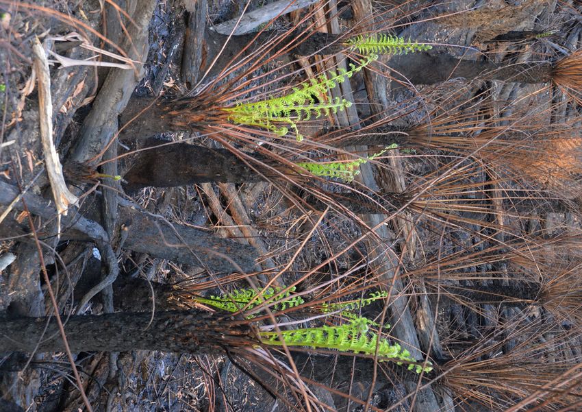
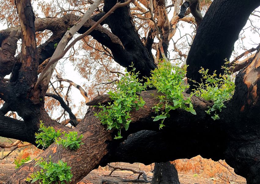
12Tree ferns resprouting three weeks after fire at Martins Creek in NSW, 19 January 2020.
13Looking to the future
The impact of climate change has led to longer, more intense fire seasons and an increase in the average
number of elevated fire weather days. So preparing for and managing bushfires is critical to minimise the
risk and potential damage of bushfires.
In the same way we have solved some of Australia’s greatest challenges for more than 100 years
CSIRO continues to apply scientific and technological solutions to help Australia face the challenges
and opportunities of a variable and changing climate.
CSIRO’s bushfire research science outputs
1993
1953 Importance of
fire size and
Alan McArthur, 1983 shape on rate of
Australia’s first Ash Wednesday spread in grass 2007
full time bushfire South Australia fires discovered. CSIRO predict
behaviour researcher and Victorian earlier starts to the
employed. bushfires
fire seasons, more
1966–67 frequent and more
Introduction of
1988 intense fires by 2020
(Lucas, Hennessy, Mills
first operational CSIRO first
versions of links bushfire
2000 and Bathols).
1939 the Forest and weather Development of
Creation of national
training curriculum for
Black Friday Grassland Fire severity appliances for
fire behaviour analysts.
Victorian fires Danger Rating increase to crews and trucks
Systems (still in climate change that can resist
use today). (Beer 1988). bushfire burnover.
1944 1983 2003
First post‑bushfire Standard Burnover-protection
house loss survey. post‑bushfire systems fitted to
Beaumaris surveys Victorian fire trucks.
fire, Victoria. implemented
following
1989 Firefighting 2008
organisations use
1967 every CSIRO pioneered
CSIRO Sentinel
Pyrotron launched
major fire. SiroFire which at CSIRO Yarralumla
Black Tuesday Hotspots satellite
was the first site, Canberra to
Tasmanian fires tool to identify
major effort to test and better
fire hotspots.
computerise the understand bushfire
task of graphically ACT Government uses spread.
predicting CSIRO revegetation Investigation of
landscape fire options in burnt effectiveness
spread utilising catchments from of different
operational fire ACT fires. suppressant
behaviour models dropped by aircraft.
for grasslands
and forests.
14Burnt hills are featured in the background following the
Kosciuszko National Park fire in NSW, February 2020.
2009 2016
First fully digital post bushfire AQFx air quality
survey following 2009 Black forecasting system
Saturday Fires. to measure smoke 2019–20
exposure from bushfires.
Work with Victorian Government South Eastern
to rebuild houses using best
2012 Development of Australian
practice sustainability principles. Bushfire hazard protocols for indigenous bushfires
mapping methodology fire management
CSIRO support 10-year, partnerships.
incorporates climate
$750 million Powerline
change projections into
Bushfire Safety Program (PBSP)
established in Victoria.
Queensland bushfire 2017 2021–22
planning (Leonard,
State-wide mapping AQFx air quality
Inform the Victorian Royal Blanchi 2012).
of annual bushfire forecasting rolls
Commission on design
CSIRO and Melbourne fuel loads introduced out nationally for
and construction standard
University develop in Queensland warnings
for bunkers.
nationally recognised (Newnham, Opie, of community
bushfire course. Leonard, 2017). exposure to smoke.
2011 2015 2019–20
2009 CSIRO supports
development of
National bushfire building Australian Government
standard is adopted by the calls on CSIRO to
Black Saturday Community fire National Construction Code help deliver practical
Victorian fires refuges across resilience measures in
in 2015.
Victoria. relation to bushfires
Publication of A Guide to Rate
and climate change.
of Fire Spread Models for
Australian Vegetation.
2010 2018
A ‘fire-proof’ house is CSIRO named the
tested at the Rural Fire 2013 official project partner
Services Hot Test Fire for the Australian
Bushfire life and house loss database Government’s National
Facility at Mogo, NSW. underpins national policy reform Resilience Taskforce.
Evaluation of DC‑10 (Blanchi, Leonard 2013).
air tanker for aerial Commencement of development
firefighting. of Spark wildfire spread simulation
framework (completed in 2015).
15As Australia’s national science
agency and innovation catalyst,
CSIRO is solving the greatest
challenges through innovative
science and technology.
CSIRO. Unlocking a better future
for everyone.
Contact us For further information
1300 363 400 Dr Peter Mayfield
+61 3 9545 2176 Executive Director – Environment, Energy and Resources
csiroenquiries@csiro.au +61 2 4960 6046
csiro.au peter.mayfield@csiro.au
Ben Creagh
Executive Manager – Corporate Affairs
+61 7 3833 5523
ben.creagh@csiro.au
Cover: New post fire regrowth in the Adelaide Hills. February 2020.
Above: Resprouts of blady grass (Imperata cylindrica) and pink bloodwood (Corymbia intermedia) on the foothills of the
Great Dividing Range on the Atherton Tablelands in September 2009.
B&M | 20-00117You can also read