Presentation of September 4, 2010 Canterbury Earthquake - William Godwin, PG, CEG
←
→
Page content transcription
If your browser does not render page correctly, please read the page content below
Presentation of
  September 4, 2010
Canterbury Earthquake
   William Godwin, PG, CEG
  AEG Vice President, 2019-20
    Webinar – May 6, 2020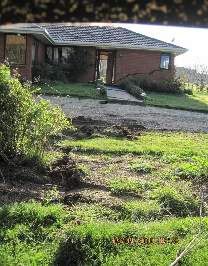
Introduction
► This   presentation is on the 2010 Mw 7.1
  Canterbury Earthquake. The earthquake occurred
  as I was traveling from San Francisco to Auckland,
  New Zealand to attend the IAEG Congress. Upon
  arrival I was asked to join the Geotechnical
  Extreme Events Reconnaissance (GEER) team to
  document damage from the event in the
  Christchurch area of the South Island. Little did I
  know that another smaller (Mw 6.2), yet deadlier
  earthquake would strike 5 months later in close to
  the same area.
Introduction
► The  purpose of the GEER is to observe and record
  earthquake induced phenomena and impacts to
  infrastructure before evidence is removed or
  altered as part of cleanup efforts.
► The reconnaissance was conducted by a joint
  USA-NZ-Japan team with the main funding for the
  USA contingent coming from GEER and partial
  support from PEER and EERI.
► This presentation includes my photographs from
  Sept. 8-10 supplemented with a few photos and
  observations noted in the GEER report, Nov. 2010.
  I also describe other seismic events from 2011-16.
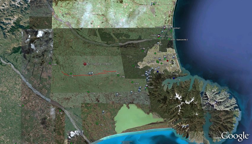
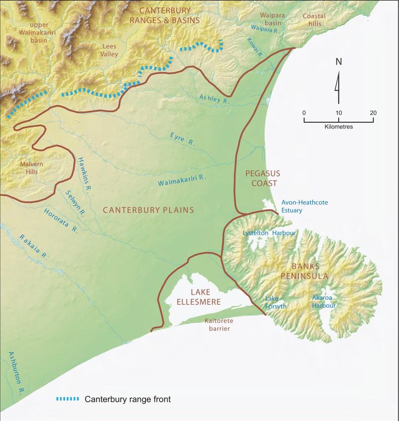
Sept   4th   Darfield Earthquake
► At  4:35 am on September 4th NZ Standard Time
  (16:35 Sept 3rd UTC) the rupture of a previously
  unrecognized strike-slip fault (Greendale Fault)
  beneath the Canterbury Plains of New Zealand’s
  South Island produced a Mw 7.1 earthquake that
  caused widespread damage throughout the
  region. Surprisingly only two people were seriously
  injured, with approximately 100 total injuries. This
  compares with 185 deaths in the 2011 event
Canterbury Earthquake Sequence
Greendale Fault Rupture
    Characteristics

 Epicenter (focal) depth: 10.8km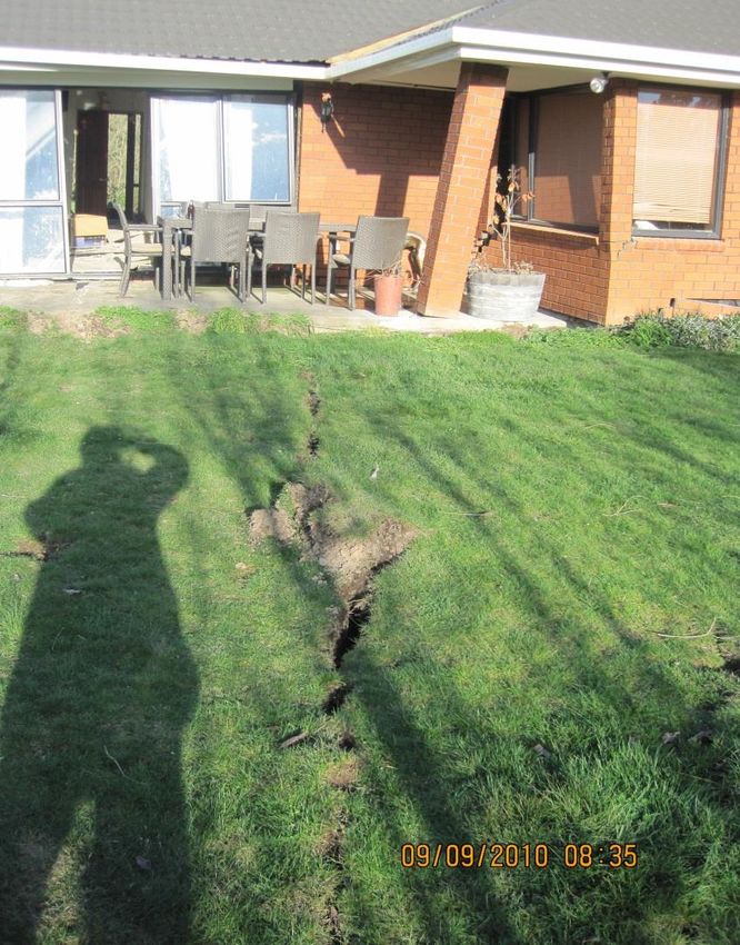
Tectonic Setting
Ground Motion
(pga)
Geographical
Setting
Preliminary Observations
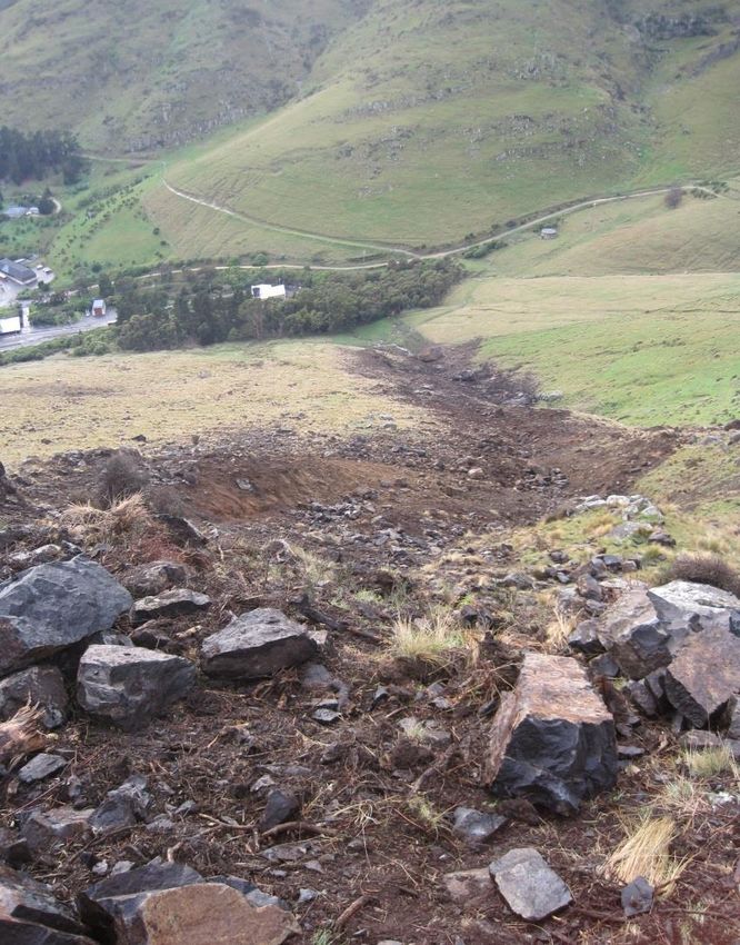
► Rock Avalanche, Castle Rock Reserve, Littleton,
Christchurch
► Fault Offset, Telegraph Rd at Grange Rd.
► Fault Offset, Highfield Rd at Grange Rd
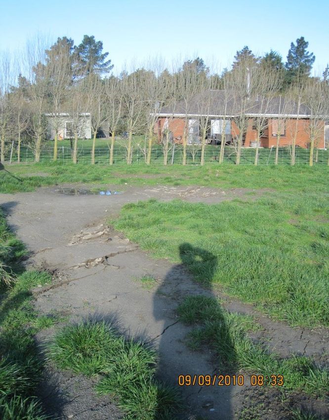
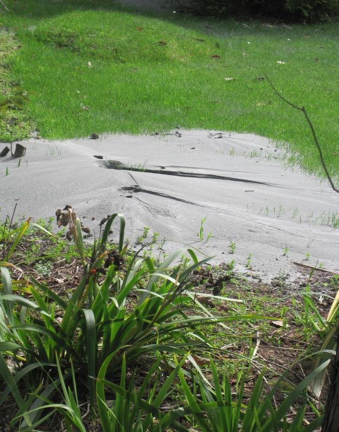
► Sand Boils, Christchurch
► Liquefaction features, Kalapoi
► Railroad deformation south of Kirwee
► Waimakariri River bridge near Sheffield
► Ashely Bridge crossing of Waimakariri RiverRock Avalanche, Castle Scenic Reserve, Littleton, Christchurch
Rock Avalanche

View upslope towards source   View down the chute towards
                              tunnel portal
Fault Offset, Highfield Rd south of
Telegraph RdPhoto by David Burrell, courtesy of GNS Science
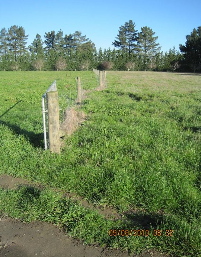
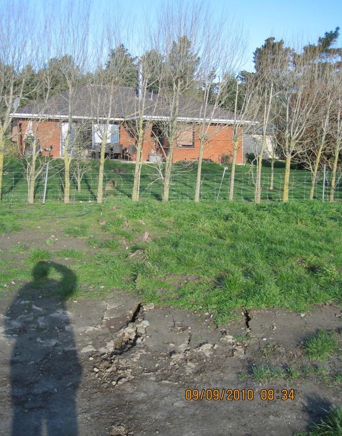
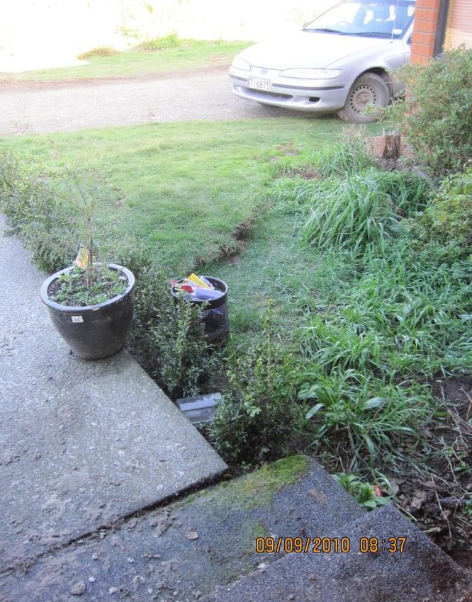
Impacts to Structures

     Christchurch
Liquefaction Features
Liquefaction features, Christchurch
         and Kaiapoi Area
Kaiapoi River lateral spreading
Railroad damage
Railroad deformation south of Kirwee
Railroad embankments

         Rolleston (at left). Woodford Glen
         (top)
Bridge Sites
Waimakariri River bridge near
         Sheffield
Ashely River Bridge Retrofit
Darfield EQ References
► Bridges: Wotherspoon et al, 2011. Performance of Bridges during the 2010
  Darfield and 2011 Christchurch Earthquakes. Seismological Research Letters; 82
  (6): 950–964.
► Liquefaction: Beyzaei et al, 2018. Depositional environment effects on observed
  liquefaction performance in silt swamps during the Canterbury earthquake
  sequence, Soil Dynamics and Earthquake Engineering; 107 303–321
► Ground Motion: Seguo and Kalkan, 2011. Ground motion attenuation during M
  7.1 Darfield and M 6.2 Christchurch, New Zealand, earthquakes and
  performance of global predictive models ; Seismological Research Letters; 82
  (6): 866–874.
► Rockfall: Khajavi et al, 2012. Seismically induced boulder displacement in the
  Port Hills, New Zealand during the 2010 Darfield (Canterbury) earthquake; New
  Zealand Journal of Geology and Geophysics Volume 55, Issue 3 271-278
► GEER Report: Geotechnical Reconnaissance of the 2010 Darfield (New Zealand)
  Earthquake, Version 1 Report Nov. 2010 Editors: Russell A. Green - US Lead
  (Virginia Tech, Blacksburg, VA, USA), Misko Cubrinovski - NZ Lead (University of
  Canterbury, Christchurch, New Zealand), 172pp. doi:10.18118/G6D59F
2011 Mw 6.3 Christchurch
    Earthquake
•   On Tuesday 22 February
    2011 at 12.51 p.m.
    Christchurch was badly
    damaged by a magnitude
    6.3 earthquake, which killed
    185 people and injured
    several thousand.
•   The earthquake epicentre
    was near Lyttelton, just 10
    kilometres south-east of
    Christchurch’s central
    business district.
•   15-kilometre-long fault did
    not express surface rupture
•   Predominantly reverse
    movement
•   Peak ground accelerations
    of more than 2g                https://www.gns.cri.nz/Home/Our-
                                   Science/Natural-Hazards-and-Risks/Recent-
                                   Events/Canterbury-quake/Hidden-fault
Recent New Zealand Earthquakes
2013 Cook Strait earthquake 2016 Kaikōura earthquake
Mw 7.8. The rupture lasted nearly 2 minutes
Mw 6.5. Unknown offshore fault ground was displaced, horizontally and
Ground accelerations 1/10th that of vertically by up to 12 metres. 20 separate fault
similar magnitude Christchurch ruptured (world record)
earthquakeYou can also read