Radioactivity on the Move 2020 - Recontamination and Weather-related Effects in Fukushima
←
→
Page content transcription
If your browser does not render page correctly, please read the page content below
Greenpeace | Radioactivity on the Move 2020

Radioactivity
on the Move 2020
Recontamination and Weather-related E ffects
in Fukushima

March 2020
                                 1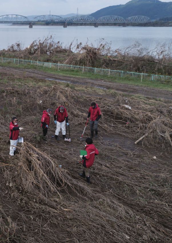
Greenpeace | Radioactivity on the Move 2020

Contents

04       1. Executive summary
06       2. Introduction
08       3. Radiation survey methodology
10       4. Namie and Okuma exclusion zone survey results
17       5. Lifted evacuation areas - Namie and Iitate
23       6. Typhoon Hagibis effect?
             Radioactive mobility and recontamination resulting
             from high rainfall

26       7. The 2020 Olympics
             Radiation risks (including hotspots) and human rights

32       8. Conclusion and recommendations

36           Endnotes

37           Appendix

Greenpeace Japan Survey Report, March 2020

Nuclear Monitoring & Radiation Protection Survey Team:
 Coordinators: Shaun Burnie, Michael Meyer-Krotz (Greenpeace Germany), and
 Jan Vande Putte (Greenpeace Belgium)
 Radiation Protection Advisors: Mai Suzuki (Greenpeace Japan), Ray Lei (Greenpeace East Asia),
 Heinz Smital (Greenpeace Germany) and Mathieu Soete (Greenpeace Belgium)
 Team members: Mari Chang (Greenpeace East Asia), Kazue Suzuki, Mitsuhisa Kawase and
 Maia Baconguis (Greenpeace Japan)
 UAV technology development: Steve Wallace
 Survey data compilation: Mai Suzuki and Jan Vande Putte
Report and analysis written by Shaun Burnie and Kazue Suzuki

Editing by Aniello Alioto and Maia Baconguis (Greenpeace Japan)

Photographs: © Christian Åslund / Greenpeace, Shaun Burnie / Greenpeace

A very special thanks to all house owners in Namie, Iitate, and Okuma and in particular Fukushima evacuees
Ms. Kanno and Mr. Anzai who were so very generous with their time and much appreciated and necessary
guidance during our survey work. We also would like to express our deep appreciation to Japanese citizens
who kindly donated to this project. Their critical support made this survey project possible.
                                                        2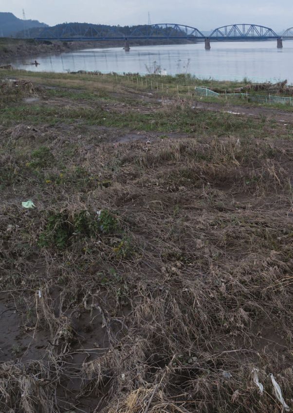
Greenpeace | Radioactivity on the Move 2020

                                          Cover: Aerial view of Azuma baseball stadium in
                                       Fukushima city which will host baseball and softball
                                          games during the 2020 Olympic (October, 2019)
                                   Page 2-3: Radiation survey team along Abukuma river in
                                                     Fukushima prefecture (October, 2019)
                                                            © Christian Åslund / Greenpeace
                    3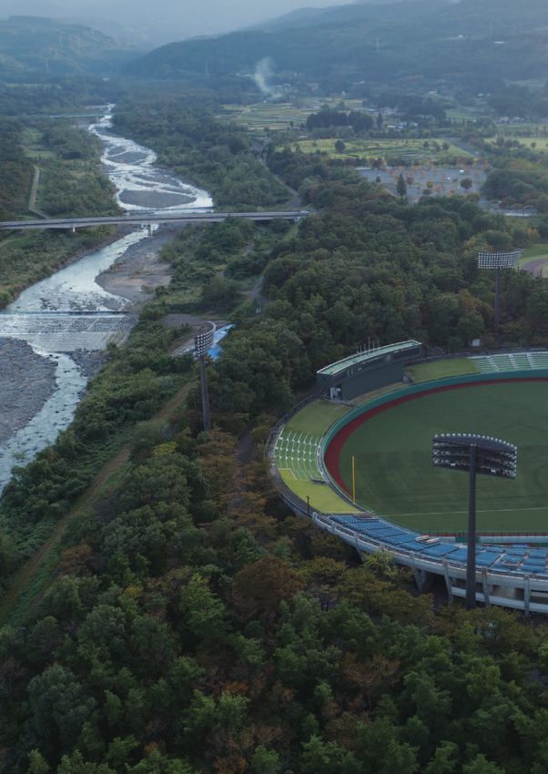
Greenpeace | Radioactivity on the Move 2020

1
Executive summary
Greenpeace Japan’s latest extensive radiation survey           streets of central Fukushima City, including tens of
has found evidence of recontamination caused by                meters from the entrance to the Shinkansen train
Typhoon Hagibis, which released radioactive cesium             line to Tokyo, highlights the ongoing scale of the
from the forested mountains of Fukushima prefecture            nuclear disaster in 2011 and the continuing need for
which make up 70% of the region, and which cannot              decontamination.
feasibly be decontaminated. The Greenpeace Nuclear
Monitoring and Radiation Protection survey team                In the case of the J-Village, our conclusion is that
observed concentrated radiation levels throughout              radioactive contamination is not under control.
Fukushima Prefecture, including significant radiation          The situation remains complex, with high levels of
hotspots, localized areas where radioactivity has              radiation in the area having the potential to spread
been observed at higher levels than in previous years,         and re-concentrate with additional amounts of heavy
a reduction in radiation levels in some areas, and             rainfall. The highest radiation hotspot identified by
recontamination elsewhere. This ongoing radiological           Greenpeace at J-Village on 26 October was 71 micro-
emergency in parts of Fukushima prefecture runs                Sieverts per hour (µSv/h) close to the surface and 32
directly counter to the narrative of the Japanese              µSv/h at 10 cm (i.e. over 1,750 times above pre-2011
government which continues to push its propaganda              background levels). This prompted Greenpeace Japan
of normalization in Fukushima.                                 to provide details to the Japanese government,
                                                               as well as the domestic and international Olympic
The survey, which was conducted during three weeks             committees and Fukushima prefecture, calling for:
of October and November 2019 by Greenpeace’s
survey team, also identified high-level radiation               1. an immediate extensive radiation survey of the
hotspots, including within Fukushima City. The                     public area in and around the J-Village and
complexity of the radiological situation in Fukushima              nearby Olympic/Paralympic venues;
prefecture, specifically in both the open and exclusion         2. decontamination of the identified hotspots in
zones of Namie, Iitate, and Okuma, leads Greenpeace                particular, but also of a wider area of soil (grass,
Japan to conclude that levels remain too high for the              forests, etc.) near the public area; and
safe return of thousands of evacuees to these areas.            3. regular screening of the radiation levels in
                                                                   J-Village to monitor possible re-contamination
The survey took place in the immediate aftermath                   of public areas.
of Typhoon Hagibis during which heavy rainfall fell
across Japan. The survey team found significant                Whilst the Japanese government generally chooses
variation in radiation levels at specific locations            to ignore the presence of radiation hotspots even
when compared with previous years, suggesting that             after notification from Greenpeace Japan, the
the radiation levels were affected by the weather.             government issued instructions to Tokyo Electric
The Greenpeace survey team extended its survey to              Power Company (TEPCO) on 3 December 2019
locations related to the upcoming Olympic Games in             to decontaminate the three highest contaminated
Fukushima. Radiation levels were measured at both              spots specifically identified in the communique by
the Azuma stadium and in central Fukushima City,               Greenpeace Japan on 18 November 2019.
where two Olympic events will be held in summer
2020, as well as at the J-Village in Iwaki, where the          On 13 December our survey team returned to
Olympic Torch Relay will start.                                the J-Village and found additional radiation
                                                               hotspots. Remarkably, we also found that standard
The survey team discovered the widespread                      procedures for decontamination, including removal
presence of radioactive hotspots in Fukushima City             of contamination up to 20 meters from public
and the J-Village. Over a period of four hours, the            roads, had not been followed by TEPCO. In this
Greenpeace survey team identified 45 hotspots in               case, only the few specific 1 square meter hotspots
the streets of Fukushima City in the area around               were removed, despite the fact that the wider
the central station. The fact that these hotspots are          surroundings also showed high levels of radiation.
located in public areas along the pavements and                As a high profile location for the start of the Olympic

                                                          04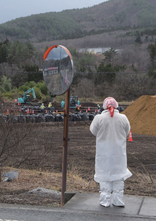
Greenpeace | Radioactivity on the Move 2020

Torch Route one would have expected the authorities           • In the interests of worker protection, suspend
to have made all possible efforts to remove high                 current decontamination programs in the “Difficult
concentrations of radiation upon specific notification           to Return” zones;
by Greenpeace Japan. The fact that this has not               • E
                                                                 stablish a fully transparent process to reflect
been done, raises many questions and uncertainties,             and consider residents’ opinions on evacuation
including how such high levels of radiation (71 µSv/h           policy, including opening a council of citizens
at close to surface) were not detected during the               including all evacuees;
earlier decontamination work by TEPCO.
                                                              • P
                                                                 rovide full compensation and financial support
                                                                to evacuees, and take measures to reduce
Through the support of local citizens, Greenpeace
                                                                radiation exposure based on science and the
was able to continue its survey work in Iitate
                                                                precautionary principle to protect public health
and Namie as well as in the highly contaminated
                                                                and allow citizens to decide whether to return or
exclusion zone of Namie and Okuma.
                                                                relocate free from duress and financial coercion;
                                                                and,
The complex conditions in Fukushima resulting from
the 2011 Daiichi triple reactor meltdown cannot be            • R
                                                                 espond in full to the offer of dialogue and
ignored to suit the propaganda objectives of the                guidance from UN Special Rapporteurs, including
Japanese government. Neither can this complexity                accepting outstanding requests for Special
be explained in absolutist, simplistic slogans – for            Rapporteurs to visit Japan.
example, neither “all is under control” nor “all of
Fukushima is radioactive and dangerous” reflect the
reality. Such an approach is an enormous disservice
to the people of Fukushima.

The complexity of the radiation situation in
Fukushima needs to be further studied, explained,
and understood by the wider Japanese society
and international community. The attention Japan,
including Fukushima prefecture, will receive in 2020
as a result of the Olympic games is an opportunity
for attaining a deeper understanding of the
consequences of the Fukushima Daiichi disaster.

Recommendations to the Japanese
government and Fukushima Prefecture

 • S
    uspend the current return policy which ignores
   Fukushima citizens and ignores science-based
   analysis, including potential lifetime exposure
   risks;
 • Immediately clarify its long-term decontamination
    target of 0.23 μSv/h, equal to 1 mSv/y exposure
    based on the government’s calculation, including
    setting a date for when 0.23 μSv/h is to be
    attained, and halt any plans to revise the target
    level to a higher limit;
 • U
    rgently assess the risks posed by radioactive
   hotspots, including the presence of cesium-
   rich microparticles, including the long-term
   consequences for public health;
 • A
    bandon plans to lift evacuation orders in the
   six municipalities of Futaba, Okuma, Namie,
   Tomioka, Iitate and Katsurao, including the Namie
   districts of Tsushima, Murohara, Suenomori and
   Obori;

                                                         05
Greenpeace | Radioactivity on the Move 2020

2
Introduction
Complexity of radiological situation                          further evidence of the complex reality that remains
                                                              in Fukushima despite the Japanese government’s
The results of Greenpeace Japan’s latest survey in            propaganda of “normalization”.
areas of Fukushima prefecture continue to reveal the
highly complex nature of radioactive contamination,
with evidence that recontamination and levels of              Radiation, Human Rights and the Olympics
radiation exposure remain too high for the safe
return of populations to Iitate, Namie and Okuma.             In the last two years, there have been multiple
                                                              and sustained interventions from United Nations
The survey was conducted from 17th October to 4th             Human Rights Special Rapporteurs (SRs) and other
November 2019, in both the open and closed areas              United Nations (UN) Human Rights bodies which
of Namie and Okuma municipalities, as well as the             have exposed and challenged Japanese government
open area in the village of Iitate. While the survey          Fukushima Reconstruction policies as they relate
schedule had been planned months in advance, the              to the rights of children, women, and the wider
Greenpeace survey team found itself in Fukushima              community of evacuees from Fukushima Prefecture
in the immediate aftermath of Typhoon Hagibis,                (see Appendix). The rights of tens of thousands of
also known as Typhoon No.19. This exceptional                 nuclear and decontamination workers have also
typhoon deposited large volumes of rain across                been raised by UN SRs. Despite the extensively
Japan, including in Fukushima Prefecture. In recent           documented failure of the Japanese government to
years, scientists have been reporting the effect              comply with its international obligations to protect
of heavy rainfall leading to increased migration of           human rights, including the setting of unacceptable
radioactivity from mountainous forests through                and hazardous public radiation exposure limits,
the river systems. When flooding occurs, this                 the Japanese government remains committed to
leads to increased radionuclide deposition and                policies which aim to pressure tens of thousands
recontamination of land downstream. Greenpeace                of Japanese Internally Displaced Persons (IDPs) to
Japan documented this occurrence in 2016 in its               return to their former homes.
report Radiation Reloaded, and highlighted the issue
that due to the impossibility of decontamination              Radiation levels remain one, but not the only factor,
throughout the mountainous forests of Fukushima,              in determining whether people return to Fukushima.
which make up 70% of the region, high amounts of              As the latest population figures show, in the most
rainfall had the potential to lead to significant land        contaminated areas of Fukushima the Japanese
contamination (including recontamination) as well as          government has largely failed in its aim of convincing
an influx of radioactivity into the Pacific Ocean.            people that radiation dose rates are at a level
                                                              where it is safe to return. It is therefore important
Greenpeace used the opportunity of being in                   to understand that in 2020 the Abe government
Fukushima immediately following Typhoon Hagibis’s             is extending its efforts to convince the people of
heavy rainfall to determine if it was possible to             Japan, including Fukushima citizens, that nine
identify specific radiological impacts. As we                 years after the beginning of the Fukushima Daiichi
explain in this report, we found strong indications           accident, radiation levels pose no risk, and that the
of weather-related effects where radioactivity                situation is ‘under control’. The platform for this
levels were significantly different from past years in        attempt to distort the complex reality in Fukushima
patterns that could not be explained by radioactive           will be the XXXII Olympiad, better known as the
decay. The Greenpeace Nuclear Monitoring                      2020 Tokyo Summer Olympics and Paralympics. For
and Radiation Protection survey team observed                 the Japanese government these are labeled as the
concentrated radiation levels throughout Fukushima            ‘Reconstruction Olympics’, a branding that attempts
Prefecture, including significant radiation hotspots,         to change the perception of the region of Japan
localized areas where radioactivity has been                  devastated by the tragic events of 11 March 2011.
observed at higher levels than in previous years,
a reduction in radiation levels in some areas, and            Greenpeace Japan takes no formal position on
recontamination elsewhere. These examples are                 the decision to host the 2020 Olympics in Japan.

                                                         06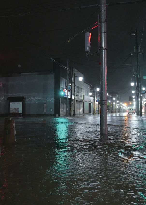
Survey in Namie exclusion zone,
                                                            Fukushima prefecture.
                                                            Novermber 1, 2019

However, the decision to host two sporting events
in Fukushima City raises genuine and important
questions about radiation risks. Of great concern
is the route of the Olympic Torch Relay through
all the municipalities of Fukushima prefecture,
including the districts of Iitate, Namie, and Okuma.
Greenpeace has measured radiation levels in both
the open areas of these municipalities and, in the
remaining exclusion zones, and it is clear that
radiation levels are too high for the safe return of
the population.

What does all this mean for the hosting of Olympic
events, including for athletes and visitors, and,
most importantly, for residents? By conducting
extensive radiation investigations, Greenpeace
Japan attempts to explain the complex radiological
environment, where nothing is straightforward.

                                                                                              © Shaun Burnie / Greenpeace

                                                       07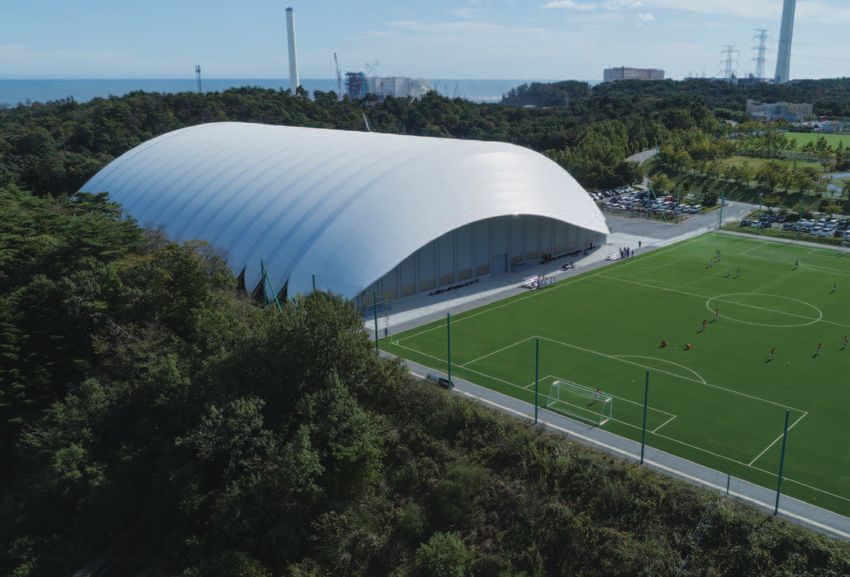
Greenpeace | Radioactivity on the Move 2020

          3
          Radiation
          survey
          methodology

© Shaun Burnie / Greenpeace

          The Greenpeace radiation team used different                 • In line with scientific standards, statistics are
          methods for survey work. Radio-cesiums (Cs-                    collected for each of these zones (average,
          137 and Cs-134) contribute almost all (98%) of                 minimum, and maximum for each zone). The
          the long-term cumulative exposure. During the                  average of all the zones of one house and land
          Fukushima nuclear disaster, equal amounts of Cs-               area is then calculated as a weighted average,
          137 and of Cs-134 were released.                               with the same weight for each zone. This also
                                                                         allows a comparison between different years (as
                                                                         the number of measurement points for each year
          Scanning                                                       is not identical).
          Systematic measurements:
           • Ambient dose rate measured at one meter                  Hotspots
             (m) with a highly-efficient and calibrated NaI
             scintillator (Georadis RT30: 2000 cps / μSv.h-1          In addition, radiation hotspots, which are areas with
             (Cs-137) with one measurement each second.               concentrated radioactivity, as well as other points
                                                                      of interest around the houses, were identified and
           • Walking in a systematic way, without searching
                                                                      measured as follows:
             for hotspots, where possible in a grid pattern.
                                                                        • Ambient dose rate at 10 / 50 / 100 cm using
           • We took measurements around individual
                                                                           a NaI scintillator (Radeye PRD- ER) and GPS
             houses (with permission of the owners of the
                                                                           position from handheld Garmin Montana 650
             houses). The area around each house was
                                                                           were used.
             divided into zones (typically: a field, path, and
                                                                        • These points were collected for each of the
             forests around the house) and each zone was
                                                                           defined zones.
             measured separately. We defined around 5-10
             zones around each house, with a minimum of
             100 measurement points per zone, and a median            Car Scanning
             range of 200 - 300 points per zone. The overall
             total of radiation measurement points for each           To cover a wider area, we also measured radiation
             house and land area typically ranged between             levels from a vehicle, with the Georadis RT30
             3,000 - > 5,000 points.                                  mounted outside the vehicle opposite the driver’s

                                                                 08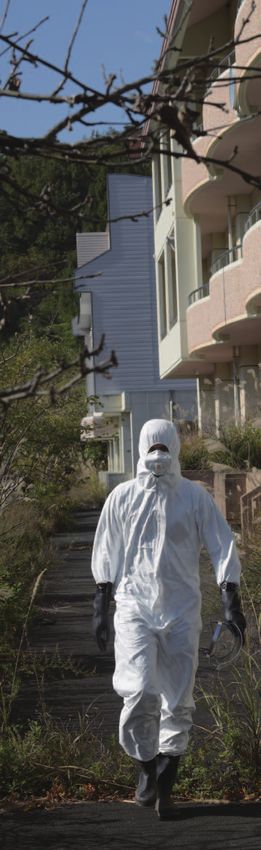
Greenpeace | Radioactivity on the Move 2020

side of the vehicle at 1 meter above the street level,        importantly, we used a very light but sensitive
recording one measurement every second.                       CsI(Tl) thallium activated caesium iodide scintillator
                                                              Kromek (Sigma-50), a LIDAR system to measure
                                                              the altitude, a precise GPS system for locating
Unmanned Aerial Vehicle Scanning                              the measurements, and a radio transmission to
                                                              have real-time readings on the ground. The data
The systematic measurements with the Georadis                 was recorded and synchronized on a Raspberry Pi
and precise Global Navigation Satellite System                mini-computer mounted under the UAV, with one
(GPS) have proven to be highly accurate and reliable.         reading (GPS coordinates, altitude, and radiation
As mentioned later in this report and in earlier              measurements) every second.
Fukushima reports from Greenpeace Japan in 2018,
the measurements collected since 2015 allow us to             Our new monitoring system is performing extremely
compare trends in radiation levels. However, there            well. We tested the use of the UAV monitor at
are some limitations to this approach. As 70% of              different altitudes and found multiple applications
Fukushima prefecture is mountainous forest there is           starting from low altitude at 2 meter up to more than
a physical challenge to accessing on foot, including          100 meter. Even at 100 m, which enables virtually
areas where vegetation is becoming more dense                 all obstacles to be avoided (but still well below
each year. Precise replication between one year and           the Japanese regulatory limit of 150 m for UAV
the next under such conditions is difficult. Given the        permissible altitudes), the sensitivity of the Kromek
growth of vegetation in evacuated areas such as in            Sigma-50 is sufficient with a count rate mostly
the “Difficult to Return” Namie areas, access has             between 500-4000 cps in the areas we measured,
been particularly problematic around houses and in            including the more highly contaminated areas in the
the surrounding forests.                                      “Difficult to Return” area in Namie.

In order to surmount these limitations, in 2018 we            After a successful demonstration of the concept
developed a highly sensitive Unmanned Aerial                  in 2018 and 2019, in 2020 Greenpeace will further
Vehicle (UAV) measurement system (i.e. drone). The            calibrate the UAV monitor. A detailed explanation of
availability of technology that is both light and very        the methodology and results will be given once the
sensitive allowed us to demonstrate, in October               system is fully operational.
2018, the feasibility of precise measurements
from the air. From the technology point of view,
we deployed the DJI Matrice 200 UAV. More

                                                                 ap1: Fukushima Special Decontamination
                                                                M
                                                                Area – SDA. Whole area decontamination in the
                                                                SDA was completed at the end of March 2017.
                                                                (Source: Environmental Remediation in Affected
                                                                Areas in Japan December, 2018 Ministry of the
                                                                Environment, Japan)

                                                         09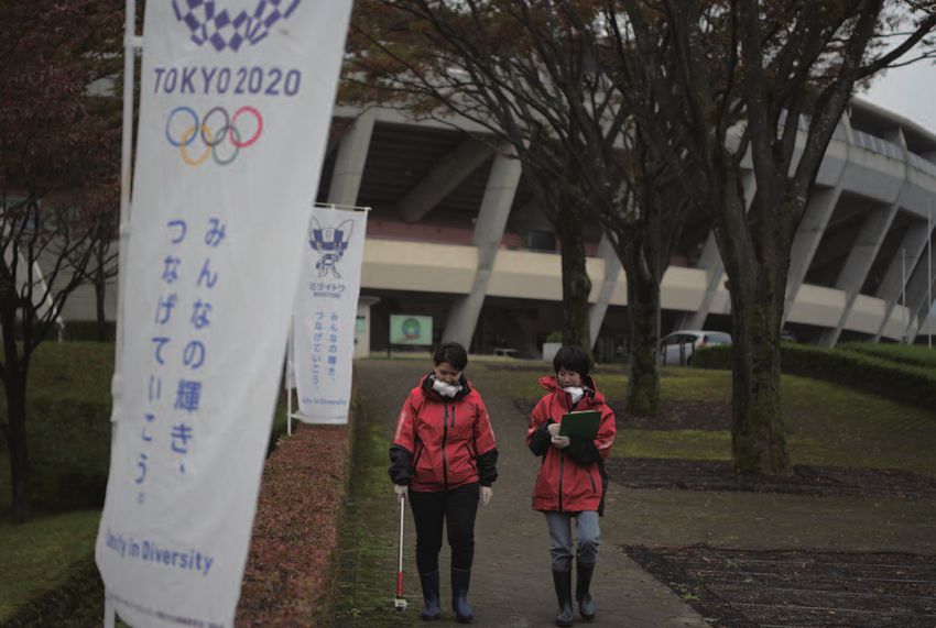
Greenpeace | Radioactivity on the Move 2020

4
Namie and Okuma
exclusion zone
survey results
        The global standard for radiation exposure is set by the International
        Commission for Radiation Protection (ICRP). The maximum recommended
        exposure for the general public was one milliSievert per year (mSv/y), and
        this was applied by the Japanese government until 2012. However, as result
        of the contamination of Fukushima prefecture by the nuclear disaster, these
        levels were exceeded. As part of its strategy to lift evacuation orders, the
        Japanese government in April 2012 increased the maximum recommended
        annual exposure to twenty (20) mSv/y.1

        Before the March 2011 Fukushima Daiichi nuclear disaster, the average
        radiation levels in Fukushima prefecture were 0.04 μSv/h. In March 2012, the
        Japanese government set a long-term decontamination target of 0.23 μSv/h,
        which they calculate (if attained) would lead to a maximum annual exposure
        of 1 mSv. However, as this survey report and earlier Greenpeace Japan
        surveys have shown, in many areas of Fukushima, in particular in Iitate,
        Namie, and Okuma, the levels far exceed 0.23 μSv/h. The government, nine
        years after the start of the disaster and after 2.8 trillion yen assigned to its
        decontamination program, has still failed to provide any timeframe for when it
        thinks it will reach the 0.23 μSv/h target. As our 2018 report detailed, in some
        cases it will be well into the 22nd century and beyond when levels in some
        areas will reach 0.23 μSv/h, which remains nearly six (6) times higher than
        background levels pre-March 2011.

               Namie exclusion zone
               House of Ms. Kanno

        The home of Ms. Kanno is located in Shimo-Tsushima in the district of
        Namie, 30 km west-northwest of the Fukushima Daiichi nuclear plant. It was
        subjected to significant radiation contamination resulting from the March
        2011 nuclear accident. The government selected Ms. Kanno’s house for
        demonstrating its decontamination techniques and her home was subjected
        to considerable effort during December 2011 and February 2012. Greenpeace
        conducted its first radiation survey at the home of Ms. Kanno in September
        2017, with a follow up survey in October 2018. In October 2019, we returned
        to Ms. Kanno’s home with a focus on the immediate area around the house,
        as well as on the family’s farmland and forest.

        Overall, the weighted average recorded in October 2019 was 0.9 μSv/h for
        the seven zones measured, compared with 1.3 μSv/h for the four zones
        measured in 2018 (Table 1). Maximum levels in October 2019 were 2.2 μSv/h
        compared with 5.9 μSv/h in 2018, and 5.8 μSv/h in 2017.

                              10
Greenpeace | Radioactivity on the Move 2020
There are significant variations that cannot be explained either by
radioactive decay or by further official decontamination. Overall, the four
zones for which we have data from 2018 and 2019, show a reduction of
31% on the average levels in a year, which is significant, compared with a
zero reduction between 2017 and 2018. One plausible explanation for this
contrast may be the absence of major rainfall comparable with Typhoon
Hagibis, which struck Japan in October 2019, during the year preceding our
2018 survey. An explanation for the significant reduction in both the average
and maximum levels for all zones can be found in zone 9, the path to the
rice field. Here the average radiation measurement declined from 1.6 μSv/h
in 2018 to 1.1 μSv/h in 2019, and the maximum declined from 5.9 μSv/h to
2.1 μSv/h in the respective years. The question is: why this reduction in this
zone? Greenpeace Japan’s analysis indicates that the lower radiation levels
measured in 2019 very possibly could be the result of the very high rainfall
experienced during Typhoon Hagibis.
Annual radiation dose rates for 30% of the areas measured at Ms. Kanno’s
house (Table 2) could lead to an exposure between 5-10 mSv/y based on
Japanese government methodology and between 8-17 mSv/y based on
sustained exposure over one full year. 2 The International Commission on
Radiological Protection (ICRP) recommendation for the public sets the
maximum additional recommended dose at 1 mSv/y. 3 100% of the 3,722
measuring points exceeded the government’s current long-term radiation
target level of 0.23 μSv/h. In zone 1, which is in the immediate vicinity
of the house (within 5-10 meters) and where workers had conducted
decontamination, radiation levels were on average 0.5 μSv/h in 2019,
compared to 0.6 μSv/h in 2018.
< = 2 and > =1.5μSv/h
< 1.5 and > =1 μSv/h
< 1 and > = 0.5μSv/h
9 Gray areas are zones not measured in 2019
Rice field
North
6
9
5
Forest behind
house
Path to rice field
North
Farmland
1 4
Around house 2
3
Garden and farmland
Diagram1: Schematic of Ms. Kanno’s house 8 Around
in Shimo-Tsushima, Namie exclusion warehouse
zone, Fukushima prefecture, showing the 7 and path
designated Zones for the Greenpeace Road
radiation survey team. Rice field, South
11Greenpeace | Radioactivity on the Move 2020
The house itself is surrounded on three sides by forest which has grown
extensively since 2011. The survey results in zone 5 (see Table 1), a forest
area just behind the house, reveal the limited impact of decontamination
as well as variations in radiation levels for which there are no obvious
explanations. The average of the radiation levels measured in zone 5 were
1.5 μSv/h, with peak levels of 2.2 μSv/h in 2019 (compared with 2.0 μSv/h
and 2.4 μSv/h in 2018 respectively). The 25% reduction in the average level
in zone 5 cannot be explained either by radiation decay or decontamination.
The possibility of a heavy rainfall effect due to Typhoon Hagibis requires
further analysis by Greenpeace and other scientific bodies.
Table 1 : Breakdown of doserate in all Zones at Ms. Kanno house (walking on- and off-road, height 1m), 2017 - 2019.
Table 2 : Radiation in all Zones at Ms. Kanno’s house (walking on- and off-road, height 1m),
October 24, 2019.
12Greenpeace | Radioactivity on the Move 2020
House Z
Located 25 km northwest of the Fukushima Daiichi plant, the survey of
House Z in October 2019 revealed, as in earlier years, very high levels of
contamination, including hotspots. Greenpeace Japan did not conduct a
survey at House Z in 2018, so this was our first return to this site since 2017.
The overall average for all zones shows a decline from 3.3 μSv/h in 2017 to 2.4
μSv/h in 2019, with a similar decline from the maximum in 2017 of 8.2 μSv/h
to 6.8 μSv/h in 2019. The average levels in zone 2 of House Z, which is in
front of the house, were 3.0 μSv/h; with a maximum level of 6.1 μSv/h. 6% of
annual radiation dose rates in Zone 2 would be in excess of 20 mSv/y (based
on Japanese governmental methodology), and 33 mSv/y based on sustained
exposure over one full year. For 70% of the whole area around House Z, the
dose rates were in excess of 10 mSv/y (based on Japanese governmental
methodology), and 17 mSv/y based on sustained exposure over one full year.
In zone 5, around a warehouse of House Z, the average 2019 readings were
2.5 μSv/h compared with 3.4 μSv/h in 2017, with a 2019 maximum level of
6.8 μSv/h compared with 8.2 μSv/h in 2017.
In zone 6, along Route 114, an average of 2.1 μSv/h was measured in 2019
compared with 2.71 μSv/h in 2017, and a 2019 maximum level of 5.3 μSv/h
compared with 7.3 μSv/h in 2017. It should be noted that this is a higher
maximum reading than the road scanning conducted both by the Japanese
government and by Greenpeace Japan, due to the fact that this is based on
a walking scan at an altitude closer to ground.
Table 3 : Breakdown of doserate in all Zones at House Z (walking on- and off-road, height 1m), 2017 and 2019.
Walking scan in Namie exclusion zone.
Novermber 1, 2019
© Shaun Burnie / Greenpeace
13Greenpeace | Radioactivity on the Move 2020
Table 4 : Radiation in all Zones at House Z (walking on- and off-road, height 1m),
November 1, 2019.
Okuma exclusion zone
The Japanese government has opened a small area of Okuma following
decontamination, but much of the area remains within the exclusion zone.
A citizen of Okuma requested that Greenpeace survey their family home,
which lies in the exclusion zone of Okuma at a distance of 7.5 km from
Fukushima Daiichi. This is our first review at this location, with the intention
of returning in 2020. The average dose rate for the 3,263 points at House
X was measured at 1.1 μSv/h with a maximum of 4.2 μSv/h. 56% of points
were over 1 μSv/h and 100% of the 3,263 points measured were above
the government decontamination target of 0.23 μSv/h. These were not the
highest levels of contamination measured in Okuma.
Within meters of the new Ono train station, which was under construction
during the time of our 2019 measurements in Okuma, we found radiation
hotspots of 6 µSv/h at 1 m and 41 µSv/h at 10 cm. In the newly opened area
of Okuma, near the new town hall and within a few hundred meters of the
planned route for the Olympic torch, we measured radiation hotspots of 1.5
µSv/h at 1 m and 2.5 µSv/h at 10 cm in the small forest.
14Greenpeace | Radioactivity on the Move 2020
Dose rate (µSv/h)
< 0.1
< 0.25 and > = 0.1
< 0.5 and > = 0.25
< 0.75 and > = 0.5
< 1 and > = 0.75
< 2 and > = 1
< 5 and > = 2
< 10 and > = 5
< 50 and > = 10 Map data © 2020 Image © 2020, Maxar Technologies
Image 1 : Aerial image of hotspots in Okuma, near Ono station (November 2, 2019)
Made from Google Maps
Table 5 : Breakdown of doserate in all Zones in Okuma (walking on- and off-road, height 1m), 2019.
Table 6 : Radiation in all Zones in Okuma (walking on- and off-road, height 1m),
November 2, 2019.
15Greenpeace | Radioactivity on the Move 2020
Aerial view of Okuma exclusion
zone, Fukushima prefecture.
November 2, 2019
16
© Christian Åslund / GreenpeaceGreenpeace | Radioactivity on the Move 2020
5
Lifted evacuation
areas - Namie and
Iitate
On 31 March 2017, the Japanese government lifted the evacuation orders
for areas in Namie Town and Iitate Village, which lie north and northwest of
the Fukushima Daiichi nuclear plant, and are not in the “Difficult to Return”
zone. In March 2011, the populations of Iitate and Namie districts were
6,509 and 21,434 respectively.4 As of 31 January 2020, the population of
Namie was 1189 (compared with 896 in 2019), and the population of Iitate,
as of 1 January 2020, was 1,392 (compared with 1,003 as of 1 February
2019).
Greenpeace Japan conducted radiation surveys in Namie and Iitate in
2011; we resumed survey work in Iitate in 2015 and have revisited each year
subsequently. In September 2017, Greenpeace Japan extended its survey
to the central area of Namie Town where the majority of the population
formerly lived. As with the results of our surveys in Iitate conducted in 2015,
2016, and 2017, we found that as of October 2019 radiation levels in the area
of Namie where the evacuation order has been lifted are still significantly
higher than the government’s current long-term target level of 0.23 μSv/h.
As confirmed in our survey of these open areas, radiation exposure for
people returning to Namie and Iitate would, in some cases, be well in excess
of the recommended maximum of 1 mSv/y. The Japanese government
maintains that exposure up to 20 mSv/y is acceptable in these lifted
evacuation order areas. This is despite clear scientific evidence of the cancer
risks from low dose radiation exposure in the 1-5 mSv/y range, which the
Japanese government continues to disregard.5
Namie Town
The town of Namie lies 10 km north-northwest of the Fukushima Daiichi
nuclear plant, and has clearly undergone extensive decontamination between
2014 and 2017. However, in areas surveyed by Greenpeace Japan in 2019,
this decontamination has clearly failed to reduce radiation levels to the
government’s current long-term target of 0.23 μSv/h.
The Takase river, which flows through Namie, acts as a crossing point
between the publicly open area and “Difficult to Return” zone of Namie.
17Greenpeace | Radioactivity on the Move 2020
Takase river
At the Takase river, near the hamlet of Tawatsuda, we extended our survey
further than in previous years. This is in an area of Namie where the
evacuation order was lifted in March 2017. Radiation levels in this area are
consistently above the Japanese government’s 0.23 μSv/h long-term target.
Along the river bank and road where we measured 5,581 data points, levels
averaged 0.8 μSv/h with maximum of 1.7 μSv/h, with 99% exceeding the
government’s long term decontamination target. These average levels are
twenty (20) times higher than the pre-2011 background level of 0.04 μSv/h.
For Zone 1 of the Takase river survey (the path along the river), levels in
2019 matched those of 2018, with an average of 0.7 μSv/h and maximum
of 1.5 μSv/h. It was not possible to accurately measure zone 2 as in 2018,
due to deforestation work underway. Instead, we proceeded to measure
along a slope by the bank of the river. Measurements along the river showed
higher levels than on the higher roadway above, and there were indications
of hotspots due to possible recontamination. The Takase river, like all the
rivers of Fukushima, experienced major flooding in October 2019, leading
to a major flux of radioactivity moving through the waters of Fukushima
Prefecture. It is worth noting that directly upstream from this area lies one of
the most contaminated areas in the Namie exclusion zone, Obori Village. The
Takase river passes directly through Obori Village.
In 47% of the area along the river bank slope, in the publicly accessible area
of Namie Town surveyed in October 2019, radiation levels would give an
annual radiation dose between 5-8 mSv/year (based on the revised Japanese
government methodology) and between 8-13 mSv based on full exposure
over one year.
Survey along Takase river,
Fukushima prefecture.
October 24, 2019
© Shaun Burnie / Greenpeace
18Greenpeace | Radioactivity on the Move 2020
Table 7 : Breakdown of doserate in all Zones in Takase river (walking on- and off-road, height 1m), 2019.
Table 8 : Radiation in all Zones in Takase river (walking on- and off-road, height 1m),
October 29, 2019.
Namie kindergarten
and school
Greenpeace Japan first surveyed a kindergarten and school in Namie in
2017 when we investigated radiation levels, including in a small forested area
adjacent to the school.
In our October 2019 survey the average radiation level in the forested area
adjacent to the school, was 1.6 μSv/h, compared to 1.8 μSv/h in 2018; and
with a maximum of 2.3 μSv/h compared to 2.9 μSv/h in 2018. These radiation
levels remain much too high or any area that has been declared open for
human settlement, let alone a place where children are likely to gather.
In 45% of the recently surveyed area around the school, the annual dose would
be between 8-10 mSv based on the Japanese government methodology and
between 13-17 mSv based on sustained exposure over a full year. For 8% of
the forested area, the annual dose would be between 10-20 mSv based on the
Japanese government methodology and between 17-33 mSv based on sustained
exposure over a full year. 100% of the 2,190 points measured in 2019 exceeded
the Japanese government’s long-term decontamination target of 0.23 μSv/h.
19Greenpeace | Radioactivity on the Move 2020
Table 9 : Breakdown of doserate in Namie school (walking on- and off-road, height 1m), 2019.
Table 10 : Radiation in Namie school (walking on- and off-road, height 1m),
October 29, 2019.
Mr. Anzai’s house
in Iitate village
Since 2015, Greenpeace Japan has been conducting radiation surveys at the
house of Mr. Toru Anzai, which is located in the south-east of Iitate, 35 km
from the Fukushima Daiichi nuclear power plant. Mr. Anzai was evacuated from
his home on 24 June 2011. Mr. Anzai’s house and the surrounding area were
subjected to extensive decontamination by the authorities during the 2014-
2015 period. This involved scraping away a layer of more than 5 cm of topsoil,
which was then removed from the site and stored as radioactive waste. In some
cases, the surface was covered with uncontaminated soil. The survey results
from Mr. Anzai’s house in 2015-2019 are shown in Tables 11 and 12.
Readings at Mr. Anzai’s house were taken at a total of 3,651 measurement
points in October 2019. When conducting the survey in October 2015,
decontamination work was still in progress, which led us to conclude
in 2016 that the measured decrease was a combined effect of further
decontamination, decay, and erosion.
In October 2019, while there has been a noticeable decline in the overall
average radiation level for all zones, 100% of all measurements in seven of
the ten zones still exceeded the government target of 0.23 μSv/h. In 2018,
20Greenpeace | Radioactivity on the Move 2020
the average was 0.7 μSv/h whereas the level measured in 2019 was 0.5
μSv/h, a 29% reduction. For the maximum levels of radiation observed,
there was an even wider variation with levels measured at 1.3 μSv/h in 2019
compared with 1.7 μSv/h in 2018, a 24% decline. Levels recorded in 2016
and 2017, after the completion of decontamination in 2015, had mostly
remained stable. The decline in radiation levels cannot be explained by
radioactive decay alone, and indicates a weathering effect perhaps due to
the heavy rainfall of Typhoon Hagibis.
In earlier years we noted that decontamination efforts had been much
less effective in zone 5. A similar problem was experienced by houses in
Iitate which are also located in close proximity to hillside forests, where
decontamination is not possible. As is standard practice throughout the
contaminated regions, an area up to 20 meters from Mr. Anzai’s house into
the forest has been ‘decontaminated’. In 2019, we measured the levels in
Zone 5 at an average of 0.9 μSv/h and a maximum of 1.3 μSv/h compared
to 1.0 μSv/h and 1.7 μSv/h, respectively, in 2018. The radiation levels on
the steep slopes close to houses are crucial as they have a direct impact
on the radiation levels inside houses. We can also expect that radioactivity
from the non-decontaminated forest might re-contaminate the already
decontaminated area below and closer to houses. In the case of Mr. Anzai,
his house was demolished in 2018 and there are currently no plans to
rebuild at this location.
The most noticeable variation in levels between 2018 and 2019 were in zone 4
and zone 7, both are agricultural fields that were subjected to decontamination
in 2015. Average radiation levels in 2019 were 68% and 58% of the previous
year (see Table 11). This cannot be explained by radioactive decay alone,
and suggests resuspension and weather related effects resulting from heavy
rainfall. These significant changes are particularly evident when examined
across the five year period for which we have data. Our return to Mr. Anzai’s
land in October 2020, in the absence of further heavy rainfall, will provide us a
means to confirm the cause of these significant variations in dose rates.
For 57% of the area at Mr. Anzai’s land, dose rates would be in excess of 3
mSv/y based on Japanese government methodology, and 4 mSv/y based on
sustained exposure over one full year. For 4% of the area, radiation exposure
would be in excess of 5 μSv/y based on Japanese government methodology,
and 8 mSv/y based on sustained exposure over one full year.
Inside house
< 1.5 and > = 1μSv/h
Forest behind house < 1 and > = 0.5 μSv/h
Under the roof of house < 0.5 and > = 0.23 μSv/h
Field up and Path right of Gray areas are zones not measured in 2019
left of house the house
11 Front and sides of house
5 Field with former greenhouse
12 3 Field
4
2
1 7 10 Road on both sides
6
Rice field
Diagram 2: Schematic of other side of road
Mr. Anzai’s house in Iitate, 9 8
showing the designated
Zones for the Greenpeace Road to house
radiation survey team. Field at road
21Greenpeace | Radioactivity on the Move 2020
Table 11 : Breakdown of doserate in all Zones in Mr. Anzai’s house (walking on- and off-road, height 1m),
2015 - 2019.
Table 12 : Radiation in all Zones in Mr. Anzai’s house (walking on- and off-road, height 1m),
October 28, 2019.
22Greenpeace | Radioactivity on the Move 2020
6
Typhoon Hagibis
effect?
Radioactive mobility and
recontamination resulting
from high rainfall
© Shaun Burnie / Greenpeace
Flooding in Minamisoma city,
Fukushima prefecture. 23
October 25, 2019Greenpeace | Radioactivity on the Move 2020
Greenpeace Japan’s annual radiation survey in areas fine particles to which most of the mineral-bound
of Fukushima coincided with the region being struck cesium is attached are also the most likely to be
by one of the most powerful typhoons of the last 100 carried into forest streams by rain and over long
years, Typhoon Hagibis. The resulting heavy rainfall distances in rivers. Some of this particulate cesium in
caused localized flooding and landslides, as well as rivers is not mineral-bound, but rather a wash-down
tragic loss of life. A lesser known fact is that flooding of the hot glassy particles that were also released in
is one of the major factors increasing downstream the most acute phases of the radioactive releases.
migration of radioactivity.
The effect of heavy rainfall on radioactive
Heavy rains – such as typhoons – can further concentrations of Fukushima’s river systems, and
increase cesium (Cs) discharge rates from releases into the Pacific Ocean, were studied in the
Fukushima forests by one or two orders of initial years after the Fukushima Daiichi disaster.
magnitude. The radioactivity, principally radio- According to one study,7 an estimated 84-92% of the
cesium, that was deposited in the mountainous radiocesium transported in the Abukuma watershed
forests of Fukushima in March 2011 is a long- was carried in the form of suspended solids between
term source of downstream contamination. As August 10, 2011 and May 11, 2012.
Greenpeace Japan reported in its 2016 report
Radiation Reloaded,6 the stocks of radio-cesium The authors of that same study further stated that
in forests, hill slopes, and floodplains can be “The total flux of radiocesium into the Pacific Ocean
remobilized and contaminate areas downstream estimated at the outlet station (basin area 5,172
by significant rainfall events, typhoons, and spring km 2 ) was 5.34 terabecquerels (TBq) for 137Cs,
snowmelt. That would include areas that did not and 4.74 TBq for 134Cs, corresponding to 1.13%
receive fallout from the radioactive plumes in of the total estimated radiocesium fallout over the
2011, as well as areas that have already been basin catchment (890 TBq). This was equivalent to
decontaminated, as increased water flows resulting the estimated amount of direct leakage from the
from typhoons can re-suspend or mobilize Fukushima Daiichi Nuclear Power Plant to the ocean
contaminated sediment and organic matter – i.e. during June 2011 to September 2012 of 17 TBq and
rather than cesium simply being buried under the Level 3 Scale Leakage on 21 August 2013 (24
newer sediments, it can be mechanically remixed, TBq).” 8
creating secondary contamination. In addition,
the contaminated particulates and organic In particular, typhoons cause significant increases
matter brought down from forests and fields with in cesium discharges into the Pacific Ocean. This
heavy rains and typhoons will create continuing, study estimated that storm-mobilized cesium
subsequent influxes of radiocesium into lakes and discharges were at 6.18 TBq, accounting for 61.4%
coastal ecosystems for years and decades to come. of the total cesium discharges to the coastal areas
Whether radio-cesium is transported via particulate during the observation period. Another study of the
matter (i.e. bound to minerals) or dissolved in Natsui River and the Same River in 2011 reported
water is a critical factor in understanding both its that heavy rain and Typhoon Roke were responsible
movement and its bioavailability – this is expressed for 30-50% of the total annual radio-cesium flux
as the ‘Kd factor’ which is the distribution coefficient to coastal regions for these rivers.9 Further, during
for cesium. Kd is one of the most important base-flow conditions, the particulate fraction of the
parameters used in estimating the migration of total radio-cesium inventory was between 21–56%,
contaminants. Fukushima discharges have been but increased to nearly 100% after Typhoon Roke
documented to have a Kd factor 1-2 orders of which struck Japan in September 2011, six months
magnitude higher than those found in Chernobyl after the triple reactor meltdown, and spread radio-
watersheds in the initial years after the disaster. cesium deposits widely across the region.
This means that the ratio of particulate-bound
cesium transported in Fukushima river catchments Eight years after Typhoon Roke, 2019’s Typhoon
in relation to dissolved (bioavailable) cesium was Hagibis, traversed Japan on 12 October 2019.
an order of magnitude or two higher than that in Rainfall totals exceeding 400-500 mm fell over
Chernobyl. east central Honshu, with many areas receiving at
least 200 mm. Locally, over 900 mm (0.9 meters)
This has been attributed to several factors, including was reported over a 24 hour period southwest of
higher precipitation levels in Fukushima compared to Tokyo. A few weeks later, Typhoon 21 (Bualoi) struck
Chernobyl, the high clay content of Fukushima soils, parts of Japan on 25 October, including Namie in
and that fine clay particles, to which cesium has a Fukushima prefecture, where 245 mm of rain was
particular affinity, are also eroded soil particles. The recorded in 12 hours.
24Greenpeace | Radioactivity on the Move 2020
Without comprehensive data of the cesium flows from the forest to the north of the screening
concentrations of river water prior, during, and station across the side road and across Route 114,
after the October 2019 typhoons, it is not possible indicating the pathway for radio-cesium migration.
to say with absolute certainty that they brought During our survey work in October 2020, we will
about much higher radiation releases from the seek to verify this hypothesis and to observe, in the
mountainous forests of Fukushima. But the evidence absence of additional occurrences of heavy rain,
from earlier typhoons and resulting data strongly whether the major fluctuations in radiation levels
suggests that there was a substantial increase in measured in the environment are confirmation of
downstream contamination from October 2019. the effect of heavy rain induced mobilization of
Greenpeace Japan’s measurements showing major radioactivity.
variations in radiation levels over previous year(s)
are indicative of these weather related effects. The The results of our 2019 survey demonstrate the
example of Ms. Kanno’s house, for which we have complex and persistent nature of radionuclide
data sets covering three years (2017-2019), show contamination in areas of Fukushima prefecture.
that while both the maximum and average radiation We hypothesize that the significant reduction of
levels between 2017 and 2018 remained relatively radioactivity in certain zones, as measured around
constant, in October 2019, there was a 63% Ms. Kanno’s and Mr. Anzai’s homes, results in
reduction in the maximum measured (and 31% in downstream contamination and eventual release to
average). Greenpeace Japan proposes that such a the Pacific Ocean. The fact is that the radioactivity
reduction could be a direct result of the very heavy does not disappear but relocates.
rainfall washing out radioactive cesium from the
concrete surface. While there have been some changes in radio-
cesium in the forests of Fukushima, including the
The location of the highest hotspot in Zone 9 at rapid decay of Cs-134 and how cesium is located
Ms. Kanno’s house, on the path to the rice field, in the soil structures/forest canopy, it can be
was first measured in 2017. The levels measured speculated that there was a significant increase
in 2019 show almost no change from 2017. The in the radioactivity of Fukushima rivers during the
specific topography creates a small stream of water, October 2019 period. That increased radioactivity in
carrying radioactive material out of the forest rivers results in deposition of radio-cesium in areas
and across the path. The highest concentrations flooded downstream, including floodplains, and
of observed radiation at this site are at the point eventually higher deposition into the Pacific Ocean.
where the water flows from the concrete path into
the immediate vegetation, before it carries on into
a ditch. The conclusion of Greenpeace Japan is
that this is an example of recontamination. One
trigger for this appears to be high rainfall and
flooding resulting from that rainfall. Our 2019
survey at Mr. Anzai’s house in Iitate also provided
evidence of probable typhoon effects. Average
radiation levels in zones 4 and 7 in 2019 were 68%
and 58% of the previous year. This cannot be
explained by radioactive decay alone, and suggests
resuspension and weather related effects resulting
from heavy rainfall. These significant changes are
particularly evident when taken across the five year
period from 2015-2019 for which we have data sets.
A clear example of how radioactivity relocates from
contaminated forests was observed along Route 114
in the exclusion zone of Namie. While the road was
opened to the public in September 2017, the land on
either side remains closed to visitors and habitation.
Along Route 114, from the junction opposite the
TEPCO Kakura screening station, Greenpeace
measured (by road scanning) 2,511 points with an
average of 0.4 μSv/h, and a maximum of up to 3.7
μSv/h. At the highest spots, which were measured
by handheld Radeye, we witnessed clear water
25Greenpeace | Radioactivity on the Move 2020
7
The 2020 Olympics
Radiation risks (including
hotspots) and Human rights
© Shaun Burnie / Greenpeace
The decision by the Japanese government to host 2020 Summer Olympics
and Paralympics events in Fukushima prefecture, as well as the opening of
the Olympic Torch relay at the J-Village (20km south of the Fukushima Daiichi
nuclear plant), has highlighted both Japanese government propaganda and
important questions concerning the current radiological conditions in the
region. The Abe government is seeking to use the Olympics/Paralympics
as a global media platform to communicate that the entirety of Fukushima
prefecture has returned to ‘normal’ and that the devastating effects of
exploding reactors and radioactive fallout plumes across Fukushima are
all in the past and no longer relevant. The answer is, of course, far more
complicated and nuanced. Many areas of Fukushima have returned to a sort
of normality. At the same time, areas of Fukushima including Namie, Iitate,
Okuma and Futaba remain highly contaminated. Since 70% of Fukushima
prefecture is mountainous forest, as a result of the contamination in 2011
these uphill forests serve a long-term source of radioactivity for the areas
below. The principle radioactive source, Cesium-137 has a half life of 30
years, and therefore will remain a hazard for around ten half lives, or 300
years. The forested mountains of Fukushima cannot be decontaminated and
pose a radioactivity recontamination risk to all areas downstream after heavy
rainfall.
Greenpeace Japan surveyed the area around the Azuma sports complex
stadium, which lies to the west of Fukushima City. Two Olympic events will
be hosted at this location in July 2020 – baseball and softball. The sporting
site lies around 80 km to the northwest of the Fukushima Daiichi nuclear
plant and outside the Japanese government evacuation and exclusion zones.
The area was subjected to radioactive contamination in 2011 and as such,
levels of radio cesium can still be detected. Greenpeace Japan, measuring
data in October 2019, showed for 2,965 points average levels were 0.1 μSv/h,
26Greenpeace | Radioactivity on the Move 2020
Dose rate (µSv/h)
< 0.1
< 0.25 and > = 0.1
< 0.5 and > = 0.25
< 0.75 and > = 0.5
< 1 and > = 0.75
< 2 and > = 1
< 5 and > = 2
< 10 and > = 5
< 50 and > = 10 Map data © 2020 Image © 2020, Maxar Technologies
Image 2 : Aerial image of hotspots at the Azuma stadium, path in the South
(October 18, 2019)
Made from Google Maps
with all points below the government long-term decontamination target of
0.23 μSv/h. Nonetheless, these levels are 2.5 times higher than the average
background levels prior to the Fukushima Daiichi accident in March 2011,
which was 0.04 μSv/h.
For Fukushima City, where many visitors attending the Olympic events will
arrive from Tokyo, the radiation situation is more complex than at the Azuma
stadium. Greenpeace Japan measured 7,284 points in the area around
the central train station (see map). Average levels were 0.1 μSv/h with a
maximum of 0.2 μSv/h. These are 2.5 times higher than before the accident
March 2011, and the maximum is 5 times higher. The principal concern from
a human health perspective with these radiation levels relates to long-term
residents, and not so much short term visitors, including competing athletes
and spectators.
However, the presence of large numbers of radiation hotspots in Fukushima
City (as detailed below), and other areas of Fukushima, including the
J-Village, is not normal. They raise important questions of radiation health
risks, the answers to which are not simple.
© Christian Åslund / Greenpeace
Survey team walking beside Azuma
stadium, Fukushima city. 27
October 18, 2019Greenpeace | Radioactivity on the Move 2020
Radiation hotspots
- J village
On 18 November 2019, Greenpeace Japan provided results of its October
survey at the J-Village to the Japanese Minister of the Environment, as well
as the domestic and international Olympic Committees Chairpersons and
Fukushima Governor. The October survey had identified significant levels
of radiation in so-called hotspots. We decided at that time to give the
authorities one full month to respond to our request for urgent intervention
and to put in place a decontamination program at the J-Village. During
the following weeks, in our oral communication with the Ministry of the
Environment and J-Village management there was little indication that action
was being planned. However, on 12 December, the Japanese Ministry of
Environment publicly confirmed the presence of the highest radioactive
hotspot identified by Greenpeace Japan, as well as a newly-identified
hotspot. Under instructions from the government, these specific hotspots
had been removed by the Tokyo Electric Power Company (TEPCO). However,
on 13-14 December, a small Greenpeace survey team returned to J-Village
where we measured public areas in and around the sports complex and
where we detected additional radioactive contamination, and observed
the results of decontamination efforts that did not follow established
decontamination protocols.
Dose rate (µSv/h)
< 0.1
< 0.25 and > = 0.1
< 0.5 and > = 0.25
< 0.75 and > = 0.5
< 1 and > = 0.75
< 2 and > = 1
< 5 and > = 2
< 10 and > = 5
< 50 and > = 10 Map data © 2020 Image © 2020, Maxar Technologies, Planet.com
Image 3 : Aerial image of hotspots in J village area
(October 26, 2019)
Made from Google Maps
Remarkably, after TEPCO removed just two of the hotspots identified
by Greenpeace Japan on 3 December, we observed that the standard
procedures for decontamination had not been followed by TEPCO. The
standard practice for Fukushima decontamination is to remove vegetation
and soil up to 20 meters from the public road. In this case, only the specific
hotspots were removed over an area of about 1 square meter, despite the
fact that the wider surroundings of the hotspots also showed high levels of
radiation as well.
28Greenpeace | Radioactivity on the Move 2020
Our conclusion, at the time of our second radiation survey of 2019 around
J-Village, was that radioactive contamination at J-Village is not under
control. The original location of the highest radiation hotspot identified by
Greenpeace Japan on 26 October was 71 µSv/h close to the surface and 32
µSv/h at 10 cm. On 13 December, Greenpeace’s radiation survey team found
the radiation levels of the same location to be lower than 1 µSv/h at 10 cm
during the re-test. However, just to the north of this hotspot, Greenpeace
Japan identified a patch of ground adjacent to the parking lot where levels
were up to 2.2 µSv/h at 10 cm. Near the entrance of this same parking lot,
Greenpeace measured 2.6 µSv/h at 10 cm and 1 µSv/h at 1 m. Additionally, at
the edge of a forest north of the car park, radiation hotspots of 2.6 µSv/h at
10 cm were identified. A second forest, 300 meters north showed consistent
levels of 0.6 μSv/h at 10 cm, and 0.4 µSv/h at 1 m, which is almost double the
government’s decontamination target.
As is well known, the J-Village is the location for the start of the Japanese
leg of the Olympic Torch Relay. As such, one would have expected the
authorities to have made all possible efforts to remove high concentrations
of radiation. The fact that this has not been done, raises many questions
and uncertainties, including how such high levels of radiation (71 µSv/h at
close to surface) were not detected during the earlier decontamination by
TEPCO. Why were only the most alarming hotspots, which were identified by
Greenpeace Japan, removed and not the wider areas following the standard
decontamination procedures? Given these apparent failures to ensure public
safety, the ability of the authorities to accurately and consistently identify
radiation hotspots appears to be seriously in doubt.
© Christian Åslund / Greenpeace
J-Village soccer facility in Naraha town,
Fukushima prefecture, the starting point
of the 2020 Tokyo Olympic torch relay. 29
October 26, 2019You can also read