SENSORVIEW A Look at the Advanced Tech Bringing You the Clearest Imagery - Deutsches Geoforum 2021
←
→
Page content transcription
If your browser does not render page correctly, please read the page content below
SENSORVIEW A Look at the Advanced Tech Bringing You the Clearest Imagery
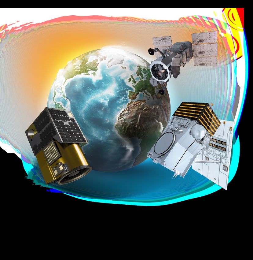
OVERVIEW
Since the launch of the first Very High Resolution commercial satellite, European
Space Imaging has been providing the best possible spatial resolution to the European
market. From our inception in 2002, we have established and maintained strong
relationships with the industries premium satellite imagery leaders and this has
allowed us to ensure that we stay at the forefront of the geospatial industry.

Through our long-standing partnership with Maxar Technologies, we have direct
access to the WorldView constellation, the World’s best satellites in terms of spatial
resolution. From our ground station at the German Aerospace Center (DLR) our expert
operations staff directly access the satellites as they pass over Europe and North Africa.
Utilising optimised and flexible collection planning, we can confidently guarantee the
best possible image in terms of clarity, and always with 15% cloud cover or less. The
WorldView constellation collects over 3 million square kilometres of data per day and
can cover approximately 60% of the Earth’s surface monthly with intraday revisits.

Expanding our satellite portfolio to extend beyond just that of Very High Resolution,
we entered into a partnership with Satellogic in 2020 and have access to their entire
satellite portfolio, including their Aleph-1 constellation, delivering up to 0.7 m and
beyond spatial resolution satellite imagery in both multispectral and hyperspectral.
The Aleph-1 constellation can collect more than 4 million square kilometres per day
and has a revisit rate of up to 4 times per day.

Through these innovative partnerships, European Space Imaging now has access to
25 orbiting satellites at resolutions of 30 cm – 1 m and with a combined daily revisit of
close to 10 times per day. In addition, we have access to an extensive imagery archive
incorporating billions of square kilometres of dating from all over the world dating
back as far as 2000.
SATELLITES

  WORLDVIEW LEGION
  MAXAR TECHNOLOGIES | 2021 | 6 SATELLITES PLANNED

  • 29 cm Resolution*
  • 8 Multispectral Bands
  • < 5.0 m CE90

  ALEPH-1
  SATELLOGIC | 2020 | 14 SATELLITES ACTIVE | 300 PLANNED

  • 70 cm Resolution*
  • 4 Multispectral / 29 Hyperspectral Bands
  • < 10.0 m CE90

  WORLDVIEW-3
  MAXAR TECHNOLOGIES | 2014

  • 31 cm Resolution
  • 16 Multispectral Bands (Including 8 SWIR)
  • < 3.5 m CE90

  WORLDVIEW-2
  MAXAR TECHNOLOGIES | 2009

  • 46 cm Resolution
  • 8 Multispectral Bands
  • < 3.5 m CE90

                              * Best possible resolution f rom constellation
GEOEYE-1
MAXAR TECHNOLOGIES | 2008

• 41 cm Resolution
• 4 Multispectral Bands
• < 3.0 m CE90

WORLDVIEW-1
MAXAR TECHNOLOGIES | 2007

• 50 cm Resolution
• Panchromatic
• < 4.0 m CE90

WORLDVIEW-4            (DECOMMISSIONED)

MAXAR TECHNOLOGIES | 2016

• 31 cm Resolution
• 4 Multispectral Bands
• < 4.0 m CE90

QUICKBIRD         (DECOMMISSIONED)

MAXAR TECHNOLOGIES | 2001

• 61 cm Resolution
• 4 Multispectral Bands
• < 23.0 m CE90

IKONOS      (DECOMMISSIONED)

MAXAR TECHNOLOGIES | 1999

• 82 cm Resolution
• 4 Multispectral Bands
• < 9 m CE90
WORLDVIEW LEGION
WorldView Legion is the next generation of VHR optical satellites from European Space Imaging partner,
Maxar Technologies. Planned to begin launching in 2021, the WorldView Legion constellation will contain
six high-performance satellites that deliver continuity for existing customer missions and dramatically
expand revisit over high-interest areas to better inform critical, time-sensitive decisions.

                                 COLLECTION CAPACITY
                                 Ability to image 5 million km² per day with multiple daily revisits

                                 ACCURACY
                                 Predicted
ALEPH-1
The Aleph-1 constellation from Satellogic offers European Space Imaging customers the “sweet spot” of
collecting data with enough clarity to extract meaningful insights at a revisit frequency and cost that
is competitive within the industry. The total constellation of 300 planned satellites delivers sub-meter
multispectral and 25 m hyperspectral imagery with a goal to image the entire Earth on a daily basis.

                                  COLLECTION CAPACITY
                                  Ability to image 4 million km² per day with multiple daily revisits

                                  ACCURACY
                                  Predicted
WORLDVIEW-3
Launched in 2014, WorldView-3 set a new standard as the industry’s first multi-payload, super-
spectral, high resolution commercial satellite delivering imagery at 31 cm resolution. With
29 spectral sensors on board, the data from WorldView-3 allows you to differentiate between
objects with far greater accuracy than ever before.

                             COLLECTION CAPACITY
                             Ability to image 680,000 km² per day with a
WORLDVIEW-2
Launched in October 2009, WorldView-2 is the first Very High Resolution 8-band
multispectural commercial satellite. Operating at an altitude of 770 km, WorldView-2
incorporates industry-leading geolocation accuracy and is able to geolocate to less than
5 m to create maps in remote areas, thereby maximizing the utility of available resources.
Multispectural resolution imagery is acquired by use of bi-directional scanning and rapid
retargeting using Control Moment Gyros - more than two times faster than any competitor.

                               COLLECTION CAPACITY
                               Ability to image 1 million km² daily with a 1.1 day revisit rate

                               ACCURACY
                               Predicted
GEOEYE-1
Launched in 2008, the GeoEye-1 satellite is equipped with some of the most advanced
technology ever used in a commercial remote sensing system. Operating at an altitude of 681 km,
GeoEye-1 provides 41 cm panchromatic resolution and 1.65 m multispectral resolution. Utilising
GeoEye-1, European Space Imaging currently offers customers stereoscopic collection on a
single pass (synoptic) collection ensuring continuity and consistency of image quality.

                                COLLECTION CAPACITY
                                Ability to image 350,000 km² daily with a 2.6 day revisit rate

                                ACCURACY
                                < 5 m CE90, 3 m CE90 (measured)

                                CONTIGUOUS AREA COLLECTED
                                Mono: 45 km x 112 km (3 strips)
                                Stereo: 15 km x 112km (1 pair)

                        y Altitude: 681 km
  Orbit                 y Type: SunSync, 10:30 am descending node
                        y Period: 98 minutes

  Dynamic Range         11-bits per pixel

  Swath Width           At Nadir: 15.3 km

                        Panochromatic
                        450 - 800 nm

                        4 Multispectral
  Sensor Bands
                        Blue:      450 - 510 nm
                        Green:     510 - 580 nm
                        Red:       655 - 690 nm
                        Near IR: 780 - 920 nm

                        Panochromatic               Multispectral
                        Off Nadir Angle (ONA)
  Resolution            0˚ ONA:           0.41 m    0˚   ONA:        1.65 m
WORLDVIEW-1
WorldView-1, launched in September 2007, is the first of our next-generation satellites - the
most agile satellites ever flown commercially. The high-capacity, panchromatic imaging system
features half-meter resolution imagery. Operating at an altitude of 496 km, WorldView-1 has an
average revisit time of 1.7 days. The satellite is also equipped with state of the art geolocation
accuracy capabilities and exhibits stunning agility with rapid targeting and efficient in-track
stereo collection.

                              COLLECTION CAPACITY
                              Ability to image 1.3 million km² daily with 1.7 day revisit rate

                              ACCURACY
                              Predicted
WORLDVIEW-4
WorldView-4 was launched in 2016 and was decommissioned in 2019. It operated at an
altitude of 617 km and provided 31 cm panchromatic resolution and 1.24 m multispectral
resolution. Although the satellite spent only a short amount of time in space, it collected
millions of square kilometres of data that is accessible through the archive for our customers.
Additionally WorldView-4 data can also be found in Maxar’s online subscription based platform,
SecureWatch.
Archive Contribution
Captured over 165 million km2
ACCURACY
PredictedQUICKBIRD
The QuickBird satellite is no longer collecting imagery but continues to offer sub-meter
resolution imagery with high geolocational accuracy through the imagery archive. With global
collection of panchromatic and multispectral imagery, QuickBird imagery supports a wide
range of geospatial applications.
Archive Contribution
Captured over 649 million km2
ACCURACYIKONOS
Launched on Sept. 24, 1999, the IKONOS satellite was a pioneering step in the new commercial
Earth observation industry. It was the first commercial satellite to collect high-resolution images
of the Earth. Over its lifetime, IKONOS took 597,802 public images, covering more than 154
million square miles (400 million square kilometers) — about three times the size of Earth’s land
surface area.
Archive Contribution
Captured over 405 million km2
ACCURACYIMAGERY TYPES &
PROCESSING METHODS
Atmospheric Compensation
Atmospheric compensation (ACOMP) is a fully automated framework that enables the
extraction of information using physical quantities to improve the performance of multi-
temporal data analysis. It has the ability to cut through haze and thereby improves image
quality, clarity and usability.
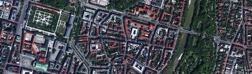
15 cm HD
15 cm HD is achieved through a process that intelligently increases the number of pixels in
a native 30 cm resolution image, resulting in an improved visual experience. Analysts and
machines can then utilise 15 cm HD imagery to better extract features and meaningful
information. Not limited to any certain resolution, HD technology can also be applied to native
40-60 cm imagery, rendering a 30 cm HD image and thus, increasing the availability of 30 cm
resolution imagery across the historical archive.
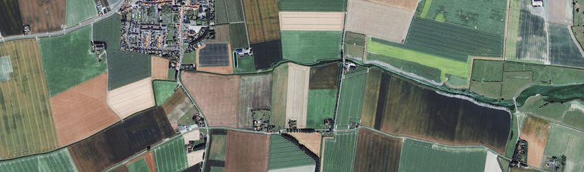
Standard Imagery
Standard Imagery products are suitable for users requiring modest absolute accuracy and/
or large area coverage. These products are radiometrically corrected, sensor corrected,
and projected to a plane using the map projection and datum of the users choice. The
radiometric corrections applied to this product include: relative radiometric response between
detectors, non-responsive detector fill, and a conversion for absolute radiometry. The sensor
corrections account for internal detector geometry, optical distortion, scan distortion, any
line-rate variations, and registration of the panchromatic and multispectral bands. Geometric
corrections remove spacecraft orbit position and attitude uncertainty, Earth rotation and
curvature, and panoramic distortion.
Standard Imagery comes in two varieties:
• View Ready (2A) Imagery: Standard Imagery has a coarse DEM applied to it, which
is used to normalize for topographic relief with respect to the reference ellipsoid. The
degree of normalization is relatively small, so while this product has terrain corrections, it
is not considered orthorectified.
• Ortho Ready Standard (OR2A) Imagery: Ortho Ready Standard Imagery has no
topographic relief applied with respect to the reference ellipsoid, making it suitable
for orthorectification. Ortho Ready Standard Imagery is projected to a constant base
elevation, which is calculated on the average terrain elevation per order polygon or can
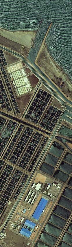
be supplied by the customer.IMAGERY TYPES & PROCESSING METHODS Orthorectified Imagery Orthorectified imagery is fully processed and ready to be integrated into your GIS workflow. Orthrectified images provide a perfect base for creating and revising mapping and GIS databases or for registering existing feature layers. It can be used for change detection and other analytical applications that require a high degree of absolute accuracy. It comes with all the geolocation information applied, including the refined ephemeris, attitude, rotation, terrain elevation, and alignment to the map projection. Multiple images can be mosaicked to minimize seamlines, and tonal balancing can be applied if desired. It is available in two different accuracy specifications: Mapping: No ground control points Precision: With ground control points Basic Stereo Pair Imagery Products Basic Stereo Pair Imagery products are suitable for customers with a high level of image expertise and who have software that is capable of ingesting, processing, and/or displaying stereo imagery. Basic Stereo Pair Imagery products are typically used to create Digital Elevation Models (DEMs) or for three-dimensional feature extraction. Basic Stereo Pair Imagery products are comprised of one or more pairs of Basic Images with 100% overlap over the customer’s Area of Interest (AOI). Stereo mates are collected on the same satellite orbit and with specific look angles in order to attain imagery appropriate for stereo viewing. Basic Stereo Imagery is available in Panchromatic, 4-band Multispectral, or Pan + 4-band Multispectral Products. Ortho Ready Stereo Imagery Products Ortho Ready Standard Stereo Imagery products are suitable for customers with a high level of image expertise and software that is capable of ingesting, processing and/or displaying stereo imagery. They are typically used to create Digital Elevation Models (DEMs) or for three dimensional feature extraction. Customers ordering stereo products who require a small area of interest (AOI) should order the Ortho Ready Standard Stereo Product while customers requiring large area coverage should opt for the Basic Stereo Product. Ortho Ready Stereo Imagery is map projected but has no topographic relief applied with respect to the reference ellipsoid, making it suitable for orthorectification. Ortho Ready Stereo Imagery is projected to a constant base elevation, which is calculated on the average terrain elevation per order polygon or can be supplied by the customer.
About European Space Imaging

Since the launch of the first commercial VHR satellite, we at European
Space Imaging have committed ourselves to providing much more
than the world’s highest quality satellite imagery.

We provide solutions. Utilising our multi-mission ground station at the
German Aerospace Center, the team of geospatial experts at European
Space Imaging are able to bring together unique partnerships,
innovative techniques and tailored services to achieve results for any
project.

European Space Imaging GmbH                      + 49 089 130 1420
Arnulfstrasse 199
80634 Munich                                     info@euspaceimaging.com
Germany                                          www.euspaceimaging.com

                                © European Space Imaging / Maxar Technologies / Satellogic
You can also read