Thunderbird Elementary - Year 1 Initial Report School Active Travel Planning - School Active Travel executive ...
←
→
Page content transcription
If your browser does not render page correctly, please read the page content below
Thunderbird Elementary
           Year 1 Initial Report
  School Active Travel Planning
Table of Contents
1   School Active Travel Planning	������������������������������������������������������������������������������������������3

2 School Profile .  .  .  .  .  .  .  .  .  .  .  .  .  .  .  .  .  .  .  .  .  .  .  .  .  .  .  .  .  .  .  .  .  .  .  .  .  .  .  5

3 School Travel Patterns .  .  .  .  .  .  .  .  .  .  .  .  .  .  .  .  .  .  .  .  .  .  .  .  .  .  .  .  .  .  .  .  .  .  7

4 Action Plan and Next Steps  .  .  .  .  .  .  .  .  .  .  .  .  .  .  .  .  .  .  .  .  .  .  .  .  .  .  .  .  .  .  .  9

          Appendix A: Action Plan 	�����������������������������������������������������������������������������������������12

          Appendix B: Map Package 	������������������������������������������������������������������������������������� 14

          Appendix C: Surveys  .  .  .  .  .  .  .  .  .  .  .  .  .  .  .  .  .  .  .  .  .  .  .  .  .  .  .  .  .  .  .  . 19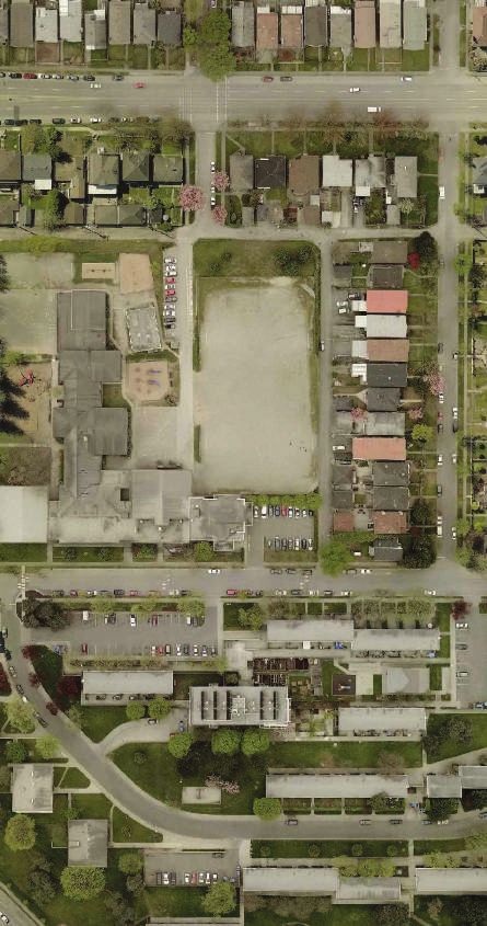
1       School Active Travel Planning

  In 2017, Thunderbird Elementary School (Thunderbird) began the City of Vancouver’s
School Active Travel Planning (SATP) program. This program is a partnership between the
City and the Vancouver School Boa

  The SATP program encourages and promotes walking and cycling to school. The
program’s focus is to:

    • Improve the safety and comfort of walking and cycling infrastructure around schools
    • Increase education and awareness around active travel

  The program is supported by the City of Vancouver’s long-range Transportation 2040
Plan which includes policies to support the encouragement, promotion and education of
sustainable travel in school and to move towards zero traffic fatalities and serious injuries.
Transportation 2040 also sets a target that at least two-thirds of all trips will be made by
foot, bike, and transit.

  The SATP program is a community-based model for implementing school travel
planning. Known collectively as the 5E’s, the program takes a comprehensive approach to
support active and sustainable travel to and from school. The 5Es are:

    • Evaluation: Collect information to understand context and monitor changes.
    • Engineering: Improve infrastructure near the school.
    • Enforcement: Increase compliance with traffic laws and parking regulations.
    • Education: Change perceptions of active travel and support programs to improve
      safety and reduce conflicts between modes.
    • Encouragement: Promote active travel as a fun, easy and exciting way to get to
      school.

    3                                             School Active Travel Plan | Thunderbird Elementary
The SATP process is defined by four phases of implementation over two to three years
(see Figure 1).

                         Figure 1. School Active Travel Planning Process

     SHARE & LEARN             PLAN TOGETHER          TAKE ACTION          KEEP IN TOUCH

       PHASE 1                     PHASE 2               PHASE 3               PHASE 4
      (4 months)                  (4 months)            (1+ Years)            (4 months)

         Evalute                    Develop             Implement               Review
    the local context          a draft action plan    the action plan      action plan status

                                                         Implement               Follow-Up
        Initial Survey              Action Plan
                                                            5Es                   Survey

                                       Inital                                    Follow-Up
         Walkabout
                                      Report                                      Report

  The City of Vancouver, the Vancouver School Board, the Principal and the Parent
Advisory Council (PAC) are the key partners in this process. Other stakeholders may
be involved in the program, such as the Vancouver Police Department (VPD), Insurance
Corporation of B.C. (ICBC), Translink’s TravelSmart and other community organizations
and agencies.

School Active Travel Plan | Thunderbird Elementary                                              4
2 School Profile
Thunderbird’s current catchment area is bordered by Grandview Highway, Boundary
Road, E 1st Ave, Lillooet Street (north of Broadway) and Renfrew Street (south of
Broadway)(see map in Appendix B). In 2017, Thunderbird had 225 enrolled students and
families speak over 21 different languages at home. The school was built to serve the
nearby BC Housing Complex and the close proximity to the complex means many student
can easily walk to school. The school is physically attached to the Thunderbird Community
Centre to the north. School staff and centre staff work together to support Thunderbird
families.
During phase 1 (October 2017-January 2018), City staff collected information from
the Thunderbird community to learn about the school. Figure 2 summarizes the public
engagement and data collection conducted in this phase.
Figure 2. Evaluation Summary
4 meetings with 192 student
parents and staff hands-up survey
3 school visits
to observe 83 take-home surveys
5 School Active Travel Plan | Thunderbird ElementaryFeedback received through meetings and surveys helps to prepare a school transportation profile and highlights preliminary school-based travel concerns. Walking: The neighbourhood around Thunderbird is predominately local streets with sidewalks on both sides of the street. Many students walk from the higher density Skeena Terrace Housing Complex as well as the surrounding neighbourhoods. Parents reported that traffic volumes and speeds on Rupert Street were barrier to walking is a barrier for some parents. Many families use the raised crosswalk at Cassiar Street and Hermon Drive, while other cross in front of the Community Centre where visibility is limited. Biking and Rolling (wheelchairs, skateboards and scooters): The neighbourhood around Thunderbird few bike routes. The closest off-street bike route is the Central Valley Greenway to the south and Slocan Street local bikeway to the west. Students can cycle or scooter on to school grounds at the east and west entrances. A bicycle rack is located in a secure and dry spot at the main entrance. Taking Transit: The school is located close to Rupert Skytrain Station and several bus routes along E Broadway and Rupert Street. Staff and parents reported that many students will begin to bus when they begin to attend Vancouver Technical Secondary. Driving: The school is bordered by local residential streets and two lanes border the site to the north and west. These lanes are often used as informal access routes to the school. has local roads to the north, south and east. Staff and parents reported vehicle drop-off and pick-up happen on Cassiar Street, E 8th Avenue, and in the west laneway. Parents reported unsafe behaviour during pick-up and drop-off times, with vehicles parking the wrong way on Cassiar Street and high speeds in the laneway. Staff reported that some parents used the staff parking lot for pick-up and drop-off. Students coming from the west, via the E 7th Avenue pedestrian traffic signal, enter the school grounds at the staff parking lot. Additional vehicle activity and unpredictable turning movements has created an unsafe area for students which requires they reverse for up to 30 meters. Short-term solutions are proposed in the action plan. A long-term solution to separate students and vehicles is needed if the school’s layout is changed. Finally, parents and staff reported that vehicles may be shortcuttinging from Lougheed Highway to Cassiar Street and vehicles are often still travelling at higher speeds as they travel by the school. City and school staff will continue to monitor the volume and speed near the school for any further changes. A school infrastructure map is included in the report to help students and families plan a comfortable and convenient route to school (see Appendix B). School Active Travel Plan | Thunderbird Elementary 6
3      School Travel Patterns

  During phase 1, an in-class hands-up survey and a take-home survey for parents were
used to learn about how families travel to and from school. These surveys give every
student and family a chance to provide feedback. The collection process is summarized
below and the survey questions can be found in Appendix C.

 Hands-Up Survey

       Number of Divisions (Students Represented)                                        9 Divisions (192 Students)

                                       Hands-Up Survey dates                                October 2 - 6, 2017

 Take-Home Survey

      Approximate Response Rate (Students Enrolled)                                        54% (of 211 Students)

        Number of Families (Students Represented)                                        83 Families (114 Students)

                                   Take-Home Survey Dates                                   October 2 - 16, 2017

  In the hands-up survey, 60% of students reported walking, 35% reported being driven
to school and 5% reported taking transit (see Figure 3). Overall, 65% of families chose
sustainable transportation to get to school. Most families traveled home the same way.

                                                  Figure 3.     Hands-Up Survey Results
                                 120

                                            60%
                                 100
                                                                        61%
            Number of Students

                                 80                                                                 Walk

                                                  35%                                               Car
                                 60
                                                                              35%
                                                                                                    Transit
                                 40

                                 20
                                                           5%                       4%
                                  0

                                               To School                 From School

  7                                                                     School Active Travel Plan | Thunderbird Elementary
In the take-home survey, families reported on their travel patterns and barriers to active
travel. Weather and time pressure were the most common reasons parents drove children
to school (see Figure 4). Parents were also concerned about traffic safety and personal
safety.
Figure 4. Reasons for Driving
35 26% 20% of families said
this question was not
applicable as they
30
Number of families
chose active travel
or transit regularly.
Percentages do not
25 add to 100 due to
16% rounding.
20
15 11% 11%
8%
10 7%
5 2%
0
Weather Quicker On the way to Traffic safety Child’s It’s too far to Other
somewhere concerns personal safety bike or walk
else concerns
Parents were also able to select three top three greatest barriers to allowing their child
to walk (see Figure 5). Distance was the top barrier, but based on the reasons for driving,
it may be related to the time pressure of walking with students. Encouraging group travel,
even informal buddies, could reduce the time pressure and reduce the other top barriers
(age and walking alone).
Figure 5. Parents Would Allow Youngest Child To Walk More if...
40
35 37%
Number of families
34%
30
25 25%
20
15
10
5 3%
1%
0
We lived closer They were older They walked There were Other
with others improved routes
Additional survey results can be found in Appendix C.
School Active Travel Plan | Thunderbird Elementary 84 Action Plan and Next Steps
An action plan for the school has been created through collaboration and consultation
with the school administration, the PAC, VSB staff, City staff and other local stakeholders.
This plan will guide the implementation of the 5Es in the coming years. A summary of the
infrastructure improvements can be found in the map below (Figure 6) and a detailed
action plan can be found in Appendix A.
Figure 6. Proposed Infrastructure Improvements
E 6th Avenue
Cassiar Street
Rupert Street
a n Drive
rm
P
P He ay
P w
E 8th Avenue gh
Hi
ed
g he
u
Lo
East Broadway
N
Legend:
Parking Signs
P Changed or Installed Countdown Timer
9 School Active Travel Plan | Thunderbird ElementaryThese infrastructure improvements are targeted at areas where students are walking
and biking. The improvements above:
• Create more comfortable facilities
• Increase the visibility of students using facilities
• Communicate clearly to students where they should cross
The City of Vancouver looks after action items related to evaluation and engineering.
The City, the SATP partners and other organizations work together to provide the other
3Es.
• Enforcement: VPD, ICBC and City of Vancouver Parking Enforcement
• Education & Encouragement: The school, PAC, VPD, ICBC, Translink, City of
Vancouver and community organizations
Thunderbird is a small school with limited staff and parent capacity to take on large-
scale encouragement initiatives. Encouragement programs should be sustainable
initiatives that are easy to run and promote. Details of these actions are also provided in
the Action Plan in Appendix A. Additional resources in the appendices include:
• A transportation infrastructure map for families planning their active travel routes
to school (Appendix B).
• A parking map to promote safe pick-up and drop-off behaviour around the school
(Appendix B).
• Extended survey results for use by the school community (Appendix C).
In phase 4, the City will lead another data collection process to measure the success of
the initial action plan and as a check-in point to update the plan.
School Active Travel Plan | Thunderbird Elementary 10Appendices
Appendix A: Action Plan

         Item                              Details                 Complete                    Comments

 City of Vancouver

    School Active                       Year 1 Report            Summer 2018
   Travel Planning
       Report                          Year 2 Report            Anticipated 2020

   Hands-Up and                        Year 1 Surveys               Fall 2017
 Take-Home School                                                 Anticipated
   Travel Surveys                      Year 2 Surveys
                                                                  2019-2020

                                             Map                 Summer 2018           For distribution by school.
 Infrastructure Map
                                        Map Update              Anticipated 2020

                                             Map                 Summer 2018           For distribution by school.
     Parking Map
                                        Map Update              Anticipated 2020

                                                                                         Clearly marks areas for
       Parking             Install “3 Min Parking 8am to 5pm”     Anticipated
                                                                                       quick pick-up and drop-off.
    Improvements               on Cassiar St. and E 8th Ave.     Summer 2018
                                                                                                Complete.

                           Add “No Stopping Anytime” signs                         Parked vehicles reduce the visibility
   Cassiar St. and                                                Anticipated
                                 to clear intersection                             of students and residents crossing.
     E 8th Ave.                                                  Summer 2018
                                  of parked vehicles                                           Complete.

School Active Travel Plan | Thunderbird Elementary                                                                    12
Item Details Complete Comments
Replace southbound “Hazard”
Maintain Summer 2017 Maintenance ensures these
marker on Cassiar St.
infrastructure infrastructure pieces are visible and
assets Repaint stop bars at reduces conflicts between modes.
Summer 2017
Cassiar St. and E 5th Ave.
Timers let pedestrians know the
Install Countdown
Rupert St. and E 7 Ave.
th
Summer 2017 amount of time left to complete their
Timers
crossing. Complete.
Thunderbird Elementary School & Parent Advisory Council (PAC)
Close staff parking During first week(s) of September, September 2018 Keeping lot chained off to parents
lot during drop-off have volunteer close lot with chain (and ongoing will discourage pick-up and drop-off
and pick-up to non-staff vehicles. as needed) in this narrow lot.
Register for HUB’s Bike to School
Active Travel Anticipated 2018 These annual events promote and
Week and Dash BC’s Walk and
Weeks and ongoing encourage active travel.
Wheel to School Week
Students will create sign
Organize Student- Anticipated City provides dimensions and print
promoting Thunderbird as an
Designed Sign 2018-2019 weather-proof sign.
active travel school.
Promote a regular (weekly or
Regular Travel Examples include “Walking
monthly) active travel event or Ongoing
Event Wednesday” or “Fitness Friday”
celebration
Thunderbird Community Centre
Support school initiatives by Partnerships help build
Support Active
participating and promoting in the Ongoing neighbourhood support for active
Travel Initiatives
Centre as appropriate. travel events.
13 School Active Travel Plan | Thunderbird ElementaryItem Details Complete Comments
Vancouver School Board (VSB)
Trim Hedge Near To increase site lines and visibility
Trim hedge Ongoing
Staff Parking Lot near staff parking lot.
Principal to use the VSB
Improve The VSB can support costs for Timing depedant maintenance system to log the
Infrastructure For installation of 2 additional bike on school request. Connect with Sustainability
Bicycle Parking racks if desired by the school request department to have the cost transfer
arranged.
Vancouver Police Department (VPD)
Pedestrian Safety Present to students on walking Anticipated To encourage safe walking
Presentation safety. 2018-2019 behaviour.
TravelSmart
Present to grade 6 and 7 students Anticipated To increase student’s awareness of
Present Transit 101
on sustainable travel choices 2018-2019 active travel options in Vancouver.
wwwww
School Active Travel Plan | Thunderbird Elementary 14Appendix B: Map Package
The following package is intended to provide all families at the school with the
information to plan their route to school however they travel. Both maps can be sent home
and posted within the school for review.
The infrastructure map (and accompanying back page) helps families make the best
decision about their active travel route to school. The map of parking (and accompanying
back page) near the school lays out the different types of parking available for parents.
School Active Travel Plan | Thunderbird Elementary 15Thunderbird Elementary ~ Active Travel Infrastructure Map
Sir Matthew Begbie
Legend
GRANT ST Elementary School
GRANT ST
BOUNDARY RD
RENFREW ST
SLOCAN ST
GRAVELEY ST GRAVELEY ST Rupert Park
GRAVELEY ST
Traffic Signal
Pitch & Putt
E 1ST AVE E 1ST AVE
Pedestrian/Bike Signal
NOOTKA ST
CASSIAR ST
KASLO ST
WINDERMERE ST
LILLOOET ST
Thunderbird
Park
E 2ND AVE
RUPERT ST
E 2ND AVE E 2ND AVE
KOO
E 3RD AVE Marked Crosswalk
TEN
E 3RD AVE
TRANS
AY S
Traffic Circle
T
E 4TH AVE Sunrise E 4TH AVE E 4TH AVE
C
Park
ANADA
BOUNDARY RD
SKEENA ST
E 5TH AVE
Bus Stop
E 5TH AVE
HIGHW
Frog Hollow
Neighbourhood
House
E 6TH AVE E 6TH AVE
AY
Transit Station
Thunderbird
AY
CASSIAR ST
Community
W
Kaslo Centre
H
Park
IG
R
E 7TH AVE E 7TH AVE
D
H
Thunderbird
N
D
O
WINDERMERE ST
RENFREW ST
Elementary
M
EE
SLOCAN ST
School
ER
School
RUPERT ST
H
LILLOOET ST
H
NOOTKA ST
G
U
E 8TH AVE
KASLO ST
E 8TH AVE
LO
E BROADWAY
E BROADWAY
Landmark/Destination
NOOTKA ST
LILLOOET ST
E 10TH AVE
TR
D Arterial Street (busy)
ET
RN
CO
BOUNDARY RD
HEBB
AVE Local Street (less busy)
BENTALL ST
SKEENA ST
NATAL ST
Real
E 12TH AVE Canadian
Superstore
Bike Route
GRANDVIEW HIGHWAY GRANDVIEW HIGHWAY
WINDERMERE ST
NOOTKA ST
LILLOOET ST
SkyTrain
SLOCAN ST
KASLO ST
VIMY CRES
RUPERT ST
ES
Falaise
RENFREW ST
Park
N CR
E 14TH AVE
E
AV
APA
E
IS
LA
School Catchment
MAT
FA
E 15TH AVE FA
LA
E 15TH AVE
IS
WANETA PLACE
E
PL
AV
A
Safety Tips
LT
A
M
Safe places to cross the street are at the corner of the street with a stop sign, traffic or
pedestrian signals or at a marked crosswalk. N
0 100 200 300 400m
Always make eye contact with others before crossing the street.
Traffic Circles - Cars or bikes should yield to the right and stop for people walking. July 2018
Disclaimer: This map is produced as a public resource for general information purposes only. The City, it’s employees, officers, directors and
representatives do not guarantee the accuracy of the information contained therein nor warrant the safety of any route, highway, road, street,
designated cycling route or other shown in the map information.Walk+Bike+Roll Safety Tips
Keep the area around your school a safe place to walk, cycle and roll by
following the posted signs. If you are driving, consider parking several blocks
away and walking to the school. It’s an active way to start and end the day.
School Crosswalk
Drivers must yield to School Zone
pedestrians and remain This sign reminds drivers they
stopped at every marked and are entering a school zone and
unmarked intersection until they should be alert.
they reach the other curb.
Speed Humps School Zone Speed Limit
Speed humps are installed to 30 On local streets in the school
reduce the speed of traffic and km/h zone, drivers need to slow
8 AM - 5 PM
calm the street. Slow down SCHOOL down to 30 km/hr between
around the school. DAYS 8 AM to 5 PM.
WA 22 No Stopping (School days) Bus Zone
No vehicles are allowed here Only buses may park here.
between 8 AM - 5 PM. This
8 AM - 5 PM keeps sightlines clear and
SCHOOL gives emergency vehicles
DAYS somewhere to park.
No Parking (School days) 3 Minute Parking (School days)
Drivers may stop for no more These spots are for quick
than five minutes to drop-off pick-ups and drop-offs. Park
8 AM - 5 PM and pick-up. A legal parking 3 min and collect your child quickly
SCHOOL spot should be found to wait 8 AM - 5 PM to create a spot for another
DAYS longer or enter the school. MON - FRI vehicle.
Safety Patrols
Patrols direct and help students at intersections near the
school. Please respect all safety patrols around schools in
Vancouver. Children are still learning the rules of the road and
may not do as directed or expected. Be prepared to react.
Be mindful about how you travel on our city streets, sidewalks, paths and bike facilities.
Learn more: vancouver.ca/streets-transportation/school-active-travel-planning.aspxAppendix C: Surveys
Appendix C contains additional surveys results as well as the hands-up survey form
distributed to classrooms and take-home survey distributed to families.
The results in the figures below are a continuation of those in Chapter 3. The surveys
asked parents how their youngest child travels to school and their relationship with active
travel. Comparing the hands-up survey on mode share (Figure 3 on page 7) and the
take-home survey (Figure 7 below), active travel mode share is slightly greater in the
take-home survey results and slightly more variation in mode choice. This may be related
to the difference in questions (“how did you travel to school” vs. “how does your youngest
child usually travel to school”) however it is likely related to self selection for the survey.
Families that choose active travel may be more likely to fill out a survey on active travel.
Figure 7. Take-Home Survey Mode Share Results
60
50 64%
Walk
Number of Families
40 Car
30 Transit
33%
20 Carpool
10 Roll
1% 1% 1%
0
Families also provided details about how often their youngest child walks or bikes
and how long the trip takes or would takes (Figure 8 to Figure 11). From this results,
the majority of students walk almost everyday (57%) while a small minority bike even
occasionally (11%). Since over 80% of students live within a 10 minute walk of the school,
promoting walking as a fun way to travel may encourage students to ask to walk alone,
with friends, or with family. Promoting cycling to students who live further away should
include connecting families with bike safety hardware (helmets, lights, bells) and bike
education, one barrier to cycling for families (see Figure 13 on page 23).
20 School Active Travel Plan | Thunderbird ElementaryFigure 8. How Often Youngest Child Walks to School
50 57%
45
40
Number of Families
35
30
25
24%
20
15
10 8% 7%
5 4%
0
Almost 2-3 days 2-3 times 2-3 times Never
Everyday per week per month per year
Given that anecdotal feedback indicates many students will transition to transit for
their commute to high school, encouraging older students to choose transit may reach
families who live a 20+ minute walk or bike away from the school. Opportunities to reach
these students include the Transit 101 program (presented by TravelSmart) or encouraging
students to take the bus during “I Love Transit Week” each fall when Kindergarten to
Grade 12 students travel for free.
Figure 9. Length of Time for Youngest Child to Walk to School
35
30 38%
Number of Families
35%
25
20
15 17%
10 10%
5
0
1-5 min 5-10 min 10-20 min More then
20 min
Many families also reported that almost 20% of students travel together or alone
(Figure 12). Informal buddy programs and walking school buses that emphasize the social
and leadership aspects of active travel may encourage older students to walk with friends,
siblings and extended family that live nearby (e.g. cousins). This could support parents
who drive because of time pressure (see Figure 4 on page 8). It may also support
families who listed student age (22%) or needing others to bike with (12%) as barriers to
cycling for their family.
School Active Travel Plan | Thunderbird Elementary 21Figure 10. How Often Youngest Child Bikes to School
80
89%
70
Number of Families
60
50
40
30
20
10
2% 1% 4% 4%
0
Almost 2-3 days 2-3 times 2-3 times Never
Everyday per week per month per year
Figure 11. Length of Time for Youngest Child to Bike to School
25
20 48%
Number of Families
43%
15
10
15%
5 10%
0
1-5 min 5-10 min 10-20 min More than
20 min
22 School Active Travel Plan | Thunderbird ElementaryFigure 12. Who Youngest Student Travels to School With
60 78%
Number of families 50
40
30
20
13%
10
4% 6%
0
Parent or Other adult Other children Alone
guardian
Allow bike more if
Figure 13. Parents Would Allow Youngest Child to Bike More if...
35
30 22%
Number of families
19% 18%
25
20
12%
15 9% 8%
10 6%
5%
5
0
They were We lived They knew They biked There were There were There were Other
older closer how to bike with others improved less cars secure
routes around bike racks
school
School Active Travel Plan | Thunderbird Elementary 23Thunderbird Elementary School
Classroom Transportation Survey
Please complete this survey by asking students to raise their hands for the week of:
Monday, October 2, 2017 to Friday, October 6, 2017
Teacher: Grade Division #: # of Students:
“How did you travel to school this morning?”
Other Other
OtherOther Other Other
Other Other
Car- School
Walk Bike Roll Transit Car Other Total
pool Bus
Mon
Tues
Wed
Thurs
Fri
Total
“How will you travel from school today?”
Other Other
OtherOther Other Other
Other Other
Car- School
Walk Bike Roll Transit Car Other Total
pool Bus
Mon
Tues
Wed
Thurs
Fri
Total
Additional instructions:
• Ask students to report how they arrived and left the school grounds.
• The “Roll” category includes children who skateboard, scooter, rollerblade, etc.
• The “Carpool” category refers to a student who travels in a private vehicle with multiple
children from different homes (i.e. not siblings).
If you or your students have any questions, please email: schoolactivetravel@vancouver.caENGINEERING SERVICES
Jerry Dobrovolny, General Manager
Dear Thunderbird Parent:
Thunderbird is participating in the City of Vancouver’s School Active Travel Planning
program to encourage and promote walking and cycling to school. The program takes
place over two years and includes several types of projects to address barriers to
active travel:
• Gathering information from students and families about their travel choices
• Conducting a walkabout with City staff and the school community to identify
school travel challenges and opportunities
• Consulting with stakeholders such as the Vancouver Police, Translink and HUB
• Creating a school travel action plan
• Upgrading transportation infrastructure near the school
• Promoting active travel education and awareness
Studies have shown that active travel has many benefits for students, the community,
and the environment, including:
• Increasing physical activity among students, leading to healthier, happier, and
more alert learners
• Creating opportunities to engage with neighbours and socialize on the way to
school
• Reducing car travel to school, in turn decreasing traffic congestion, greenhouse
gas emissions, and air pollution
• Inspiring active travel habits early in life to carry into adulthood
To learn more about the program, please visit
http://vancouver.ca/streets-transportation/school-active-travel-planning
Every family’s feedback is important to the success of the program. Take 10 minutes
to complete the attached survey and tell us about your family’s travel choices. This
information will help us create a school travel plan that considers the needs of the
school’s students and families.
Please return ONE survey per family with your youngest child by
Monday, October 16, 2017.
If you have any questions about the survey or the School Active Travel Program, please
contact our team at schoolactivetravel@vancouver.ca.
Thank you,
Liliana Quintero
Transportation Engineer
Engineering Services
City of Vancouver
schoolactivetravel@vancouver.caThunderbird Elementary School
Transportation Survey
This survey is part of the City of Vancouver’s School Active Travel Planning
program which seeks to improve the safety and comfort of walking and Div:
cycling to school. Your input is vital to the success of this program.
Please fill out ONE survey per family and return it with your youngest child by Oct 16, 2017.
Tell us about your family...
1. How old are your children attending 2. What is your postal code?
Thunderbird?
Child Age
1
2
3
Tell us about how your family travels...
3. How does your youngest child 5. Who usually travels with your youngest
usually get TO school? (Choose one) child TO school?
Walk Parent/Guardian
Bike Other adult (e.g. grandparent,
Roll (e.g. skateboard, scooter) childcare worker)
Bus or Skytrain Other children (e.g. sibling, friends)
Carpool (Your children & other children) Child travels alone
Car (Your children only)
Other: 6. If you usually drive your youngest
child to school, what are the 3 most
important reasons why?
4. How do you usually get to your Weather
daily activities? It’s on my way to somewhere else
It’s quicker
Walk
I’m worried about traffic safety
Bike
I’m worried about my child’s personal
Roll (e.g. skateboard, scooter)
safety (e.g. bullying, stranger danger)
Bus or Skytrain
It’s too far for my child to bike or walk
Carpool (Traveling with others to work)
Not applicable
Car
(We walk/bike/roll/transit regularly)
Other: Other:Tell us about walking and biking to school...
Oth
7. How often does your youngest child 10. How often does your youngest child
walk TO school? bike TO school?
Almost everyday Almost everyday
2-3 days per week 2-3 days per week
2-3 times per month 2-3 times per month
2-3 times per year 2-3 times per year
Never Never
8. How long does it take your youngest 11. How long does it take your youngest
child to walk to or from school? child to bike to or from school?
1-5 minutes 1-5 minutes
6-10 minutes 6-10 minutes
11-20 minutes 11-20 minutes
+20 minutes +20 minutes
9. I would allow my youngest child to 12. I would allow my youngest child to
walk to and from school more if: bike to and from school more if:
(check the 3 most important reasons) (check the 3 most important reasons)
We lived closer We lived closer
They were older They were older
They walked with others They biked with others
There was an improved walking There was an improved biking route
route (e.g. crosswalk improvements) (e.g. bike lanes)
There were less cars around the There were less cars around the
school during pick-up & drop-up school during pick-up & drop-up
Not applicable (we walk regularly) There were secure bike racks
Other: They knew how to bike
Not applicable (we bike regularly)
Other:
13. Do you have any other comments about your child’s journey to school?14. Please mark your usual walking or biking route to school on the map.
Circle whether this is a walking route or biking route
OR Other Other
Sunrise Park
E 5th Avenue
N
Skeena Street
Trans-Canada
Cassiar Street
E 6th Avenue
Hermon Drive
Highway
Windermere Street
E 7th Avenue
Thunderbird
Elementary
ay
Rupert Street
hw
ig
H
E 8th Avenue
d
ee
u gh
Lo
Legend:
ath
ep Traffic signal
E Broadway bik
ay
enw
Gre
Pedestrian activated signal
Marked crosswalk
Skeena Street
Skytrain station
Rupert d
oa
Station t tR Dedicated bikepath
r ne
Co
School
15. If applicable, circle and number up to two areas of concern on the map. Describe
these concerns below.
Concern Description
1
2
More information about the City of Vancouver’s program is available at
http://vancouver.ca/streets-transportation/school-active-travel-planning.aspx.
Your personal data and responses will remain confidential. Any personal information is collected
in accordance to BC’s Freedom of Information and Protection of Privacy Act.You can also read