Tim Howard
GIS Coordinator
 City of Solon
←
→
Page content transcription
If your browser does not render page correctly, please read the page content below
Tim Howard GIS Coordinator City of Solon
GIS Discussion Began As Early As 1988
Early Efforts Mostly From Engineering & Planning Departments
Engineering Applications Had Priority So The Terms GIS & CAD
Became Intermixed
CAD Software, Such As MicroStation Were Used For Early
Mapping
Around 1998-1999 GIS Began In True Form With The Hiring Of A
GIS Specialist And Purchase Of ArcInfo/ArcView Software From
ESRI
Enter COSGIS (City of Solon GIS)
COSGIS Was Built On Top Of ArcView, Which Made Deployment
Expensive As A License Was Required For Each User
Functionality Of COSGIS Were Advanced Since It Was Fully
Licensed GIS
Model Could Not Be Sustained Moving Forward For GIS To
Reach More Employees & The General Public
2002 - My Predecessor Leaves With GIS Surviving By Updates
Done From An Assistant Engineer
2003 - GIS Was Moved To The Planning Department With
Myself Being Hired
Immediately Focus Put On Getting GIS To Everyone (Public &
Employee)
Purchase Of ArcIMS from ESRI To Build Web Maps
2005 - City Contracts With Latitude Geographics In BC, Canada
To Host Our Public GIS Website
2009 - Acquire ArcGIS Server From ESRI To Begin Next Gen GIS

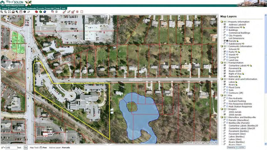
Property Search (Parcel, Address, Owner, Business)
Utility Information (Water, Sanitary, Storm)
Attributes (Zoning, Wards, Subdivisions, Parks, Buildings)
Links To City Databases, County Auditor
Quickly Retrieve Zoning Code, Lot Topos, Engineering Plan &
Profile Sheets
Creation Of Mailing Lists For Public Notifications
Distance & Area Calculations
Aerial Imagery (1999 - 2009 available)
Map Generation
Solon GIS Contains Hundreds Of Different Layers Of Information
Either Project Specific Or General
Every Day GIS Is Used To Help Answer Questions In Minutes
That Used To Take Hours
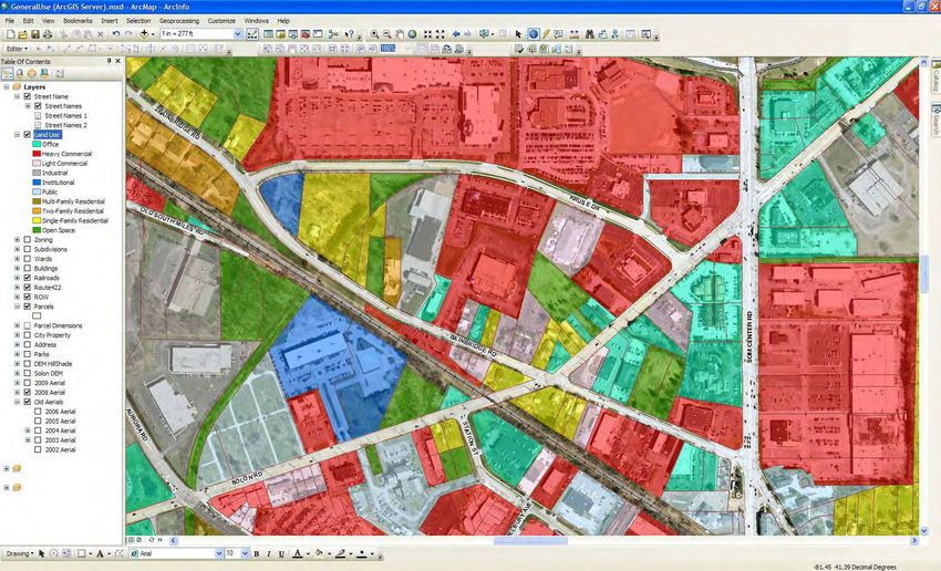
Land Use Mapping & Analysis
Zoning Enforcement
Aerial Imagery Used Daily
   Planning Commission/Council meetings
        Helps show location of variances, new buildings
   Assist with violations of zoning code
   Used for general inquiries about new buildings, additions,
   driveways
   Measure lot sizes, distances, setbacks
Master Plan
   GIS was integral to the recent master plan update
   Prepared future land use & zoning maps to guide the
   development in the city

Quote From A City Planner: “Can’t Do My Job Without It, Well
  At Least I Wouldn’t Want To”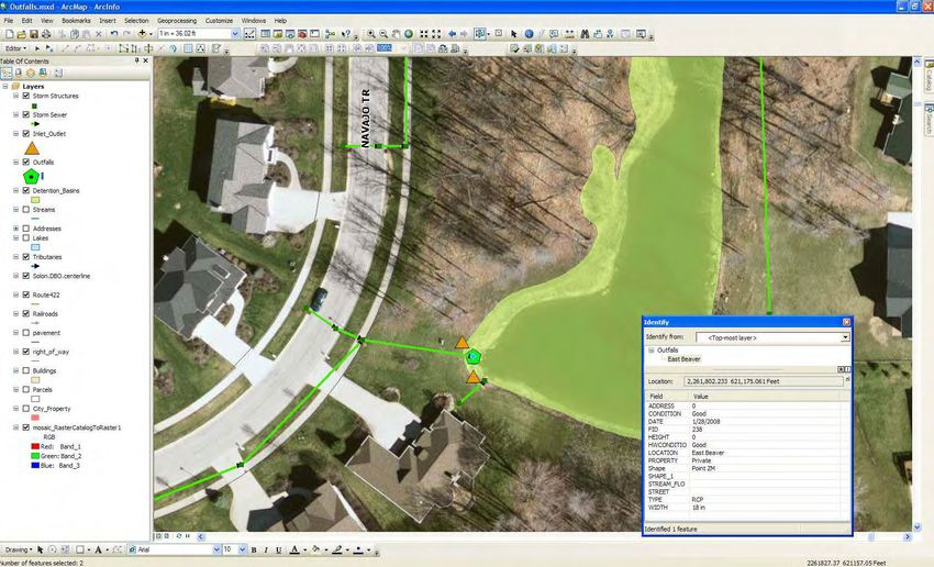
GIS Is Valuable To Help Market Properties, Both For The City &
The Broker
Having GIS Tools Online Helps The General Image Of The City
    Website is often the first impression a company gets of the
    city
Used GIS To Help Analyze A Power Outage Issue We Were
Having In Our Industrial Zone
Will Be Using GIS To Help Identify Existing & Future Fiber
Optics Needs In An Industrial Park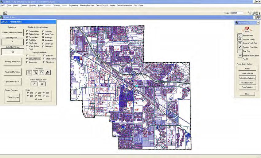
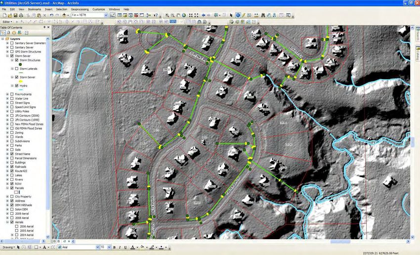
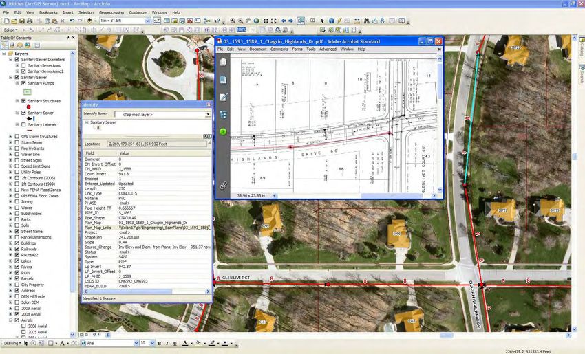
Sanitary Sewers
   Location, flow, inverts
   Links to plan & profile sheets
   Sewer video inspection linked to GIS
Storm Sewer
Storm water management, analysis, flooding
Evaluation of the new FEMA flood zones
Used GIS to track calls from 2006 floods
GPS collection of inlets/outlets, detention basins & outfalls
Currently using GPS/GIS to collect stream tributary outfall
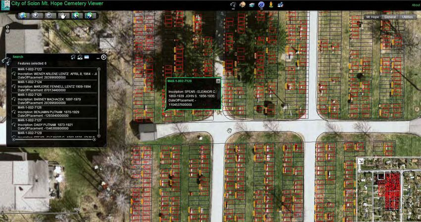
conditionsCemetery Management Modernization from old books falling apart with paper cemetery plot maps & markers
Other Stuff
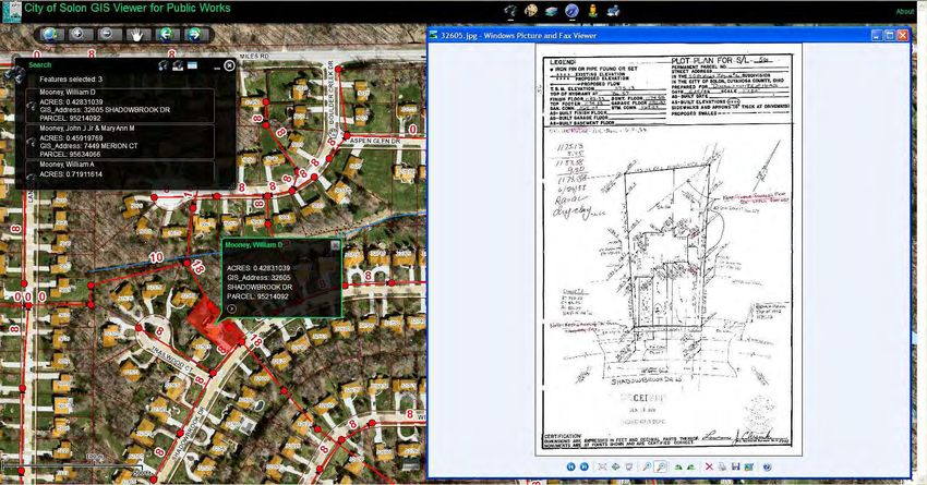
Quick Access To Lot Topography Plans
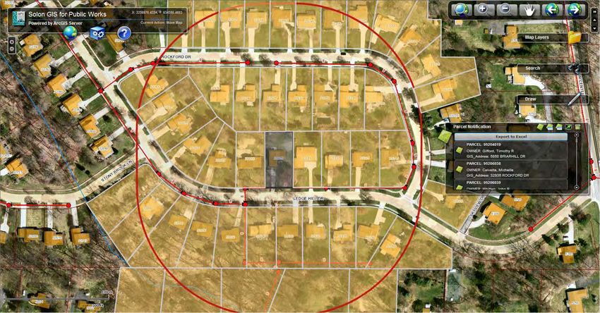
Project Oriented Mailings
Right of entry
Who’s connected to sewers
Project notification & progress
GPS Collection Of Signs, Utility Poles
In The Works
Snow plowing GIS assistance
Better work order managementSupport Mapping Of Incoming Calls To 911 Dispatch Center
Address point data, property info, & surrounding
community data are provided
Creation & Maintenance Of Fire Dept. Map Books & Hydrant
Locations
GIS Used For Placement Of Sirens
Looking Ahead
Incorporate police pin mapping into core GIS for crime
analysis & prevention
Mobile mapping for emergency vehicles & police MDTs
Linking of fire pre-planning /building floor plan
documents to GIS for fast retrievalContinue Development Of Our ArcGIS Server Flex Viewer For
Both Internal & Public Interest
DemoCollaboration With The County
Resource We Did Not Have Before
Knowledge & Resource Sharing Between County & City
Invaluable To Both
County Could Be A Conduit (Central Repository) Of Public
Data From County & Municipal Sources
Things Happen That Effect All Of Us
Example - Mutual Aid & Emergency Response Crossing
Municipal Boundaries
Hopefully Build New Relationships With Other Municipalities
GIS stakeholders meetingsWe Are Still A “One-Man Shop”
We Still Do Not Have A True Enterprise GIS
MS Access is primary DBMS of many departments
We Still Have Elements Of A “Request & Deliver” GIS, Though It’s
Getting Better
Still Many Employees Look At Me As The “Map Guy”
Need To Get Departments To Expand Their Understanding & Use Of
GIS Beyond Current Levels
Especially true for public safety & public works
Still Have Some Departments That Use GIS Very Little & Some That
Think GIS Doesn’t Apply To Them
In government there are very few departments that GIS does not
or can not apply to
General Public & Employee Knowledge Of GIS Must Improve
GIS Day event a possibility
I Need To Become A Better ProgrammerHave A Good Idea Of What You Expect From GIS Going In
Don’t just purchase software, hire someone to use it &
then expect it will all work itself out
You need a vision and buy-in from multiple departments
GIS Personnel Need Input & Feedback
Expect Some Resistance To Change & Even Some Fear In Using
The Technology
GIS Personnel Have To Educate & Motivate Staff To Use The
Technology…Training Sessions Needed
Many Employees View GIS Staff As Just “Map Makers”
This is a very tough mindset to break
When Tasked With A Problem, GIS Should Not Be A Secondary
Consideration Or That Thing You Use To Make A Map For Your
Presentation…GIS Should Be Amongst The First Things You Use
To Help In Problem Solving…..It Does Make Nice Maps TooQUESTIONS?
You can also read