2018 Albert-Eden Local Paths (Greenways) Plan - Auckland Council
←
→
Page content transcription
If your browser does not render page correctly, please read the page content below

2018 Albert-Eden Local Paths (Greenways) Plan
2|Page
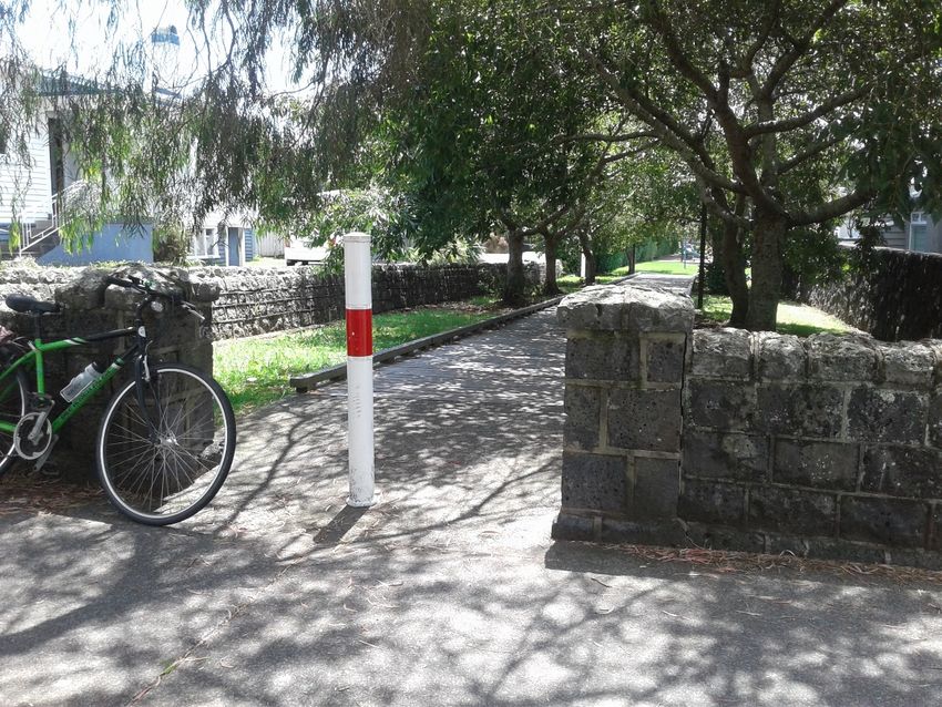
Table of Contents

Albert-Eden Local Paths (Greenways) Review November 2018...................................................................................................................................................................................... 1
Introduction...................................................................................................................................................................................................................................................................... 4
   Greenways and Local Paths ........................................................................................................................................................................................................................................ 4
The purpose of this document ......................................................................................................................................................................................................................................... 4
Routes 1.0 – 17.0 are identified as priority routes in the 2018 Programme ..................................................................................................................................................................... 5
Activation, maps and other aspects ................................................................................................................................................................................................................................. 6
   Maps and wayfinding ................................................................................................................................................................................................................................................... 6
   Facilities along the way ................................................................................................................................................................................................................................................ 6
   Signage recommendations .......................................................................................................................................................................................................................................... 6
   Events .......................................................................................................................................................................................................................................................................... 6
   Openings ..................................................................................................................................................................................................................................................................... 7
   Greening of Local Paths............................................................................................................................................................................................................................................... 7
Centres in Albert-Eden .................................................................................................................................................................................................................................................... 8
Key Guidelines and Benchmarks..................................................................................................................................................................................................................................... 9
Auckland Local Path Design Guide 2017 ...................................................................................................................................................................................................................... 10
Route prioritisation analysis ........................................................................................................................................................................................................................................... 11
Analysis criteria ............................................................................................................................................................................................................................................................. 11
   Albert-Eden Local Paths Routes Analysis .................................................................................................................................................................................................................. 12
Maps.............................................................................................................................................................................................................................................................................. 15
   Map showing existing and funded paths .................................................................................................................................................................................................................... 16
   Map recommended routes ......................................................................................................................................................................................................................................... 17
   Map showing existing and funded paths and recommended routes ........................................................................................................................................................................... 18
   Coast to Coast map (also the Te Araroa route).......................................................................................................................................................................................................... 19

                                                                                                                                                                                                                                                                     3|Page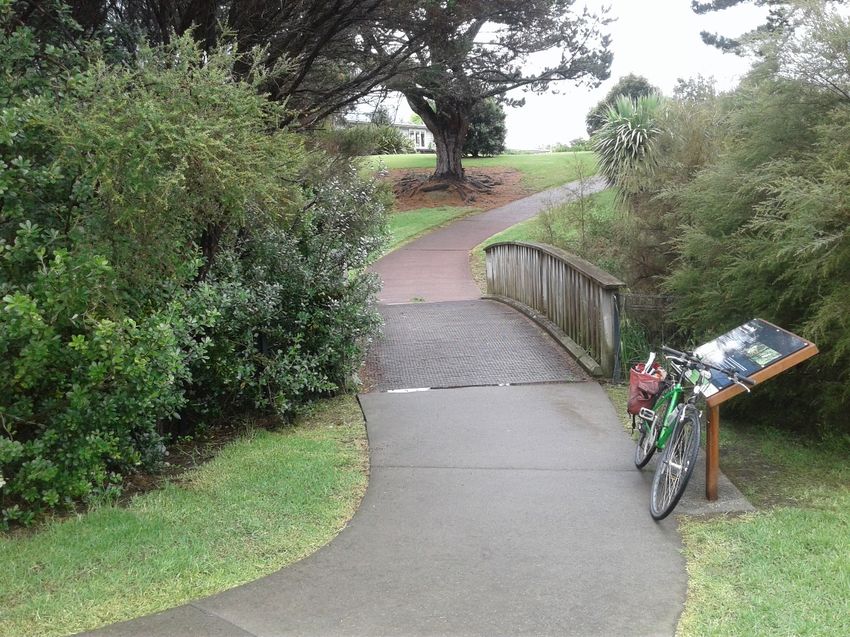
Introduction
The Albert-Eden Greenways Plan 2013 identified a network of Greenways connections throughout the local board area. It also selected some priority routes to progress. Some of
these have been successfully completed or are progressing. Most of the connections in the 2013 document are still relevant, but five years on, the reality of providing better walking
and cycling (active transport) options for communities have become more important. To reflect this, Greenways have been reframed as Local Paths. Local Paths provide active
transport opportunities for people to use safe routes for everyday journeys (i.e. to work, schools, shops, transport hubs and visits to community and recreational facilities) throughout
local board areas. This document is a review of the Albert-Eden Greenways plan and covers the Local Paths network for the Albert-Eden Local Board area.

Central to the concept of Auckland Local Paths is that they are designed to provide active transport options, appealing especially to those in the community that may not be
comfortable cycling or walking on streets where cars are prioritised. The adoption of term ‘Local Paths’ is a reflection that these routes may well be on pleasant, greened paths in
parks, but some sections may need to be on (preferably quiet) roads to make useful destinations accessible. Given the highly-developed and busy road network in the Albert-Eden
area, this plan also includes some ‘Express Paths’ on major transport routes, which can be used for longer cross-board routes.

The Albert-Eden Local Board Plan 2017 includes outcomes that value natural and cultural heritage. The environment is respected and protected. Local Paths mean transport is
achieved with a lighter footprint on valued sites. The Local Paths guide prescribes that routes should be ‘leafy and green’ and contribute positively toward ecological well-being.

Albert-Eden had many pleasant neighbourhood and wider community commercial hubs. Good safe access to service and retail centres by active modes are mutually beneficial for
local businesses and customers. There are seven train stations in Albert-Eden. Access to trains can extend the length of recreational bike rides or walks and make linking through
the local board area to neighbouring areas possible. People can experience one-way walks or rides with one leg of their trip being by train.

Longer on-road routes have been identified by Auckland Transport in the Auckland Cycle Network (ACN). Delivery of the ACN will be reviewed and/or progressed by Auckland
Transport when the area becomes a regional priority in Auckland Transport’s Cycling Programme for Investment, unless there are parts where vital safety issues arise in relation to
prioritised routes.

Auckland Transport advises that the Albert-Eden area has priority for the Cycling Investment Programme in 2018–2023 in Sandringham and the ‘Central Isthmus’. In 2023- 28 the
Mount Albert and Point Chevalier areas are earmarked for prioritisation of cycling projects. Specific routes have not yet been confirmed although ACN routes are likely to be the
focus. Local Paths implementation will therefore often rely on funding from the local board. Funding could come from projects in relation to growth, park developments or renewals
and Transport Capital Funding. The board can advocate for Auckland Transport funding; however, Auckland Transport will prioritise projects which address safety issues.

Greenways and Local Paths
The term “Local Path”, rather than “Greenway”, is used throughout this report, as this is the current term agreed by Auckland Council and Auckland Transport. However, when
referring directly to the original Albert-Eden Greenways Planning Document the original title is used.

The purpose of this document
The purpose of this review is to provide the Albert-Eden Local Board with:

    • A reviewed Albert-Eden Local Paths (Greenways) Plan, including recommended updated priority Local Paths routes.

    • Recommendations for implementation of aspects of Local Path priority routes which will enable the board and staff to prioritize Local Paths network projects in current and
        future work programs and advocate to Auckland Transport and other potential partners or agencies for funding.

                                                                                                                                                                              4|Page
Routes 1.0 – 17.0 are identified as priority routes in the 2018 Programme

1.0    Point Chevalier Beaches

2.0    Waititiko Connection

3.0    Waterview Spine

4.0    Waterview Path to Train

5.0    Cross Isthmus ‘Wend‘

6.0    Owairaka Connection

7.0    Wairaka Express to Morningside

8.0    Western Springs to Greenlane Express

9.0    Sandringham to Kerr-Taylor Park

10.0   Dominion Road Parallel West

11.0   Dominion Road Parallel East

12.0   Epsom South to Maungawhau

13.0   Market Road to Maungawhau via Mount Saint John

14.0   Cornwall Park to Greenwoods Corner

15.0   Owairaka Maunga Walking

16.0   Dominion Road Straight

17.0   Motu Manawa

                                                                            5|Page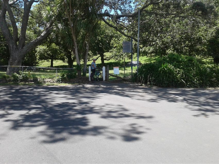
Activation, maps and other aspects
The use of local paths to encourage active transport in the area is dependent on people’s awareness of the opportunity, convenience and pleasure of getting to destinations by
walking or cycling.
Maps and wayfinding
With population growth and more intensive living and working environments, demand for recreational activity in natural settings is increasing. Auckland Transport encourages the
use of its great local paths in the region by providing shared path maps (paper and on-line), which include features along the way and connections to other active routes. The Albert-
Eden Local Board may request an extension of the Waterview path map to include the route to the Point Chevalier beaches and the foreshore walking route from Howlett Reserve
to Heron Park once the routes are complete.
Facilities along the way
Active travellers get thirsty and drinking water sources along the way provide a healthy option. Drinking fountains should be included in detailed planning of routes.
Likewise, walkers and cyclists appreciate the opportunity for a rest and appreciate convenient, accessible seating along the way. Auckland Transport’s shared path
maps show the location of drinking fountains, playgrounds, toilets, cultural features and train stations. It is recommended that any maps developed for local paths do
the same.
Signage recommendations
1. Signage should be installed concurrently with route delivery. Visibility in relation to long-term foliage growth must be addressed.
2. Route markers as per the Local Paths Design Guide indicate destination alternatives offered by the route at start points and at significant junctions. These
should be installed on all routes.
3. Route direction signs as per the Local Paths Design Guide, indicate destinations and distances just before path junctions. These should be installed on all
routes. Finger posts (directional pointers with destinations) can be added right at junctions where significant destinations justify further emphasis.
4. The full suite of route markers, direction signs, makers and sharrows should be installed on all more complex routes (as below).
5. The Coast to Coast walking route crosses the Albert-Eden local board area. Signage for this regional facility should be integrated with local paths signage,
especially where it coincides with the national Te Araroa trail.
The more complex ‘wending’ routes shown on the maps attached to this plan such as 2.0 Waititiko Connection, 5.0 Cross Isthmus ‘Wend‘ and the Dominion Road
parallel routes (10.0 and 11.0) prompt ’bread-crumbing’ as an appropriate way-finding strategy. The Local Paths Design Guides outlines ‘markers’ to give detailed
clues that reassure that walkers and cyclists are to remain on their intended route where few infrastructure clues exist. These are inexpensive sticker-type strips that
are can be applied to power and light poles. They are visible enough to those looking out for them without adding undue clutter. In some cases, ‘sharrows’ (painted
markers on the road itself), can be used to help guide direction on calmed streets.
Events
Auckland Transport and their advocacy partners have an ongoing interest in providing bicycle parking and safe active routes to large community events in parks
where vehicle traffic and parking is often at full capacity. Examples include Movies in Parks in Chamberlain Park and the Big Gay Out in Coyle Park. The presence of
Auckland Transport and advocacy partners at such events usually provide information on walking and cycling in the wider area. Communication about events at larger
venues such as the Mount Eden and Mount Albert War Memorial halls should promote all transport options. The Mount Albert venue is particularly accessible by
cycling and walking. Also, there are public transport options via Baldwin Avenue railway station. Active and public transport options should be included in the advice
on ‘getting to the venue’.
ASB Showgrounds and Logan Campbell Centre at Greenlane and Eden Park are other venues where all-modes transport advice would help with parking capacity and
ease congestion. Libraries and schools (especially those with public event venues such as Ray Freedman at Epsom Girls Grammar and the Centennial Theatre at
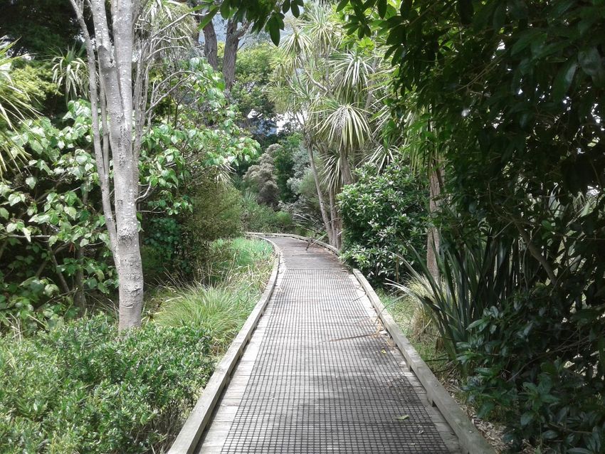
Figure 1 Bridge over Waititiko from Motions Road
Auckland Grammar) would also benefit from better communication about alternative transport options. Local business hubs often host local street events such as
6|Page
Kingsland Flavours, White Nights and street festivals in Sandringham and Greenwoods Corner. Carols at Potters Park is also a crowd-drawing occasion. In all cases, all-mode
‘getting there’ options can help with travel convenience, parking capacity and avoiding traffic mayhem.

Figure 2 Bridge on south path at Heron Park                                                     Figure 3 Entry to One Tree Hill Domain from Golf Road

Openings
A new or upgraded Local Path, or even a significant portion of one, is a great opportunity to celebrate and promote active transport in a community. Auckland Transport’s cycling
and walking team can help with such events. This may include providing maps, merchandise, great advice and possibly a bike repair service.

Greening of Local Paths
Local Paths that comply with ‘multi-use’ situations (room for two people and two cyclists all side by side) are 4 metres wide. In some parks a narrower 3-metre wide shared path may
be appropriate. With either of these path types the expanse of paving can have quite an impact on the more natural setting of a park or where only a 1.2 metre footpath or track
existed before. In smaller parks, some flexibility on widths and gradients may be required. In a highly urbanised local board area such as Albert-Eden, the opposite, adding natural
landscapes to streets where Local Paths run, may be desirable. Water sensitive design, tree planting and rain gardens in extended kerbs can all enhance calmed streets and add to
the sense of continuity of a Local Path. With such treatments extending to parts of routes on streets, the potential ecological benefits of sequestering carbon, regulating local climate
conditions by reducing urban heat island effect, stabilizing soils, contributing towards biodiversity and wildlife habitat, filtering of water and reducing stormwater runoff can be
increased. A current issue with several parks is that the entry is flanked with right-angle parking that crosses current cycling (and sometimes pedestrian) access. Implementation or
upgrade to routes into parks should provide specific, safe access for people on foot and on bikes.

                                                                                                                                                                             7|Page
Centres in Albert-Eden
  Good safe access to service and retail hubs are vitally important for encouraging active trips. It also encourages the support of local businesses.
  One of the drivers in the selection of the priority routes is ‘getting to business hubs’.

  •   Point Chevalier: Proposed on-road paths and route 1.0 Point Chevalier Beaches will serve this centre well.
  •   Mount Albert: The upgrade of Mount Albert town centre has improved local conditions for active travel. Connections to Mount Albert are via proposed route 7.0. Wairaka
      Express to Morningside.
  •   Saint Lukes: This car-centric facility has local routes close by: route 5.0 Cross Isthmus ‘Wend‘, route 2.0 Waititiko Connection and route 9.0 Sandringham to Kerr-Taylor
      Park. Until route 8.0 Western Springs to Green Lane route is realised, direct safe cycling is not available.
  •   Kingsland: This area can be reached on route 10.0 Dominion Road parallel west.
  •   Sandringham: This centre is reached reasonably well by route 10.0 Dominion Road Parallel West and route 9.0 Sandringham to Kerr-Taylor Park.
  •   Dominion Road: This centre is skirted by its parallel routes 10.0 and 11.0 with reasonably quiet connecting streets.
  •   Mount Eden: Mt Eden Road is an Auckland Cycle Network route that is only partially realised. Routes 5.0 the Cross Isthmus ‘Wend’ and 12.0 Epsom South to Maungawhau
      supplement the 11.0 Dominion Road Parallel East connection.
  •   Greenlane: Manukau Road is an Auckland Cycle Network route that is not yet developed. Until that and the express 8.0 Western Springs to Green Lane route is realised,
      direct safe cycling is not available.
  •   Market Road: A direct safe cycling route is not prioritised in this proposal.
  •   Greenwoods Corner: A short loop from Cornwall Park included in the current proposal for 14.0 Cornwall Park to Greenwoods Corner. It is envisaged that this will encourage
      connections with the Coast to Coast and Te Araroa walking routes.

  Figure 2 Roy Clements Treeway                                                                     Figure 5 Ellerton Road to Thames Street connection

                                                                                                                                                                    8|Page
Key Guidelines and Benchmarks
The Auckland Local Path Design Guide 2017 has been used as a guide in prioritising recommendations for implementation of the Albert-Eden Local Paths network. The Albert-Eden
Greenways Plan 2013 pre-dates the publication of the Auckland Local Path Design Guide, and therefore did not refer specifically to the types of routes and benchmarks used in the
design guide. This report has assessed each of the routes within the current framework of the design guide using the following definitions and benchmarks:

 Path types        Function                                                                    Key benchmarks for Local Paths                   Measurable benchmarks
 Local Paths       Connect destinations, such as schools, public transport and                 Maximum average of 2,000                         Vehicle volumes
                   recreation areas, and connect to the cycle network.                         vehicles/day
                   On-street Local Path: has pedestrians on footpaths and are safe             30kph vehicle speed                              Vehicle speeds
                   enough to cycle on without separated cycle lanes.
                   Open space Local Path: runs through parks and open spaces                   Cyclist maximum speed 20kph                      Bicycle speeds
                   and accommodates both cyclists and pedestrians.
 Express           Busy streets, with designated cycleways separated from                      Provide “active transport” options               Arterial road crossings
 Paths             vehicles to provide safe cycle facilities.
                   Form the base structure of the cycleway network.                                                                             Accessibility and safety

 Trails            Rural or bush setting and are primarily for recreation.                                                                      Green infrastructure
                   Accessibility limitations may be a factor.

                                                                                                                                                                       9|Page
Auckland Local Path Design Guide 2017

                                        10 | P a g e
Route prioritisation analysis
Many of the 17 routes in the Albert-Eden Greenways (Local Paths) review are formed by joining sections often with differing character, type of environment or implementation
issues. Many routes combine paths through parks with quiet roads, often linked together by busy roads
Analysis criteria: This analysis addresses the overall route and issues at this stage. Factors considered for each route include:
• Route number
• Name of route
• Brief route description
• Type of route
• Budget source: Auckland Transport (AT)/ Albert-Eden Local Board (AELB)
• Length
• Gradient
• Destinations and connections
• Opportunities for delivery and synergies with other projects
• Predicted level of relative use (per user group)
• Complexity of delivery
• Constraints and risks
• Albert-Eden Local Board benefits
• Notes
11 | P a g eAlbert-Eden Local Paths Routes Analysis
Route Route name Brief route description Type of route Budget source Length Gradient Destinations and Opportunities for Predicted level of Complexity of Constraints Albert-Eden Notes
Number Auckland connections delivery and relative use (per delivery and risks Local Board
Transport (AT) / synergies with user group) benefits
Albert-Eden other projects
Local Board
(AELB)
1.0 Point Eric Armishaw to Walker Calmed streets, AT, AELB 2.3 km Gentle to Beaches and Point Chevalier Moderate to high Low Muripara Supports access Safe priority
Chevalier Park and Coyle Park possible moderate schools and Meola Road local use in level Avenue is no to beaches crossing needed
Beaches protected lane cycle facility topography. longer on the from Muripara
(moderate from project Selwyn Village Avenue to
Eric Armishaw Moderate use by bus route. Humariri Street
Reserve up to local school 'bike
Maranui train'.
Avenue)
2.0 Waititiko Chamberlain Park to Local paths and AT, AELB 3.6 km Gentle Parks, train station Chamberlain Park High use by local Low Rail crossing at Improved access Wayfinding
Connection Rawalpindi Reserve, Mt calmed streets and schools Masterplan path commuter access to Asquith Avenue. to Chamberlain needed in Mt
Albert Memorial Park and connections North West Park Albert War
Roy Clements Treeway cycleway Central Memorial Park
Interceptor
Moderate use as works in Mt
attractive Albert War
recreational route. Memorial Park
and Roy
Clements
Treeway may
disrupt access.
3.0 Waterview Heron Park to Waterview Calmed streets AT 1.7 km Gentle to Schools (including High use by schools Low (excluding A connection Connections Land purchase
Spine Reserve (additional and park paths (additional moderate schools in the and commuters Tutuki Reserve link) through Tutuki across local board would be needed
connections along Alford 250 metres Whau Local Board Reserve is not areas. for a link through
Street) along Alford (moderate on area) High (Tutuki currently Tutuki Reserve
Street) Fairlands Reserve link) possible. It is Completes local
Avenue) cut off by private links and
land increases use of
remote paths.
4.0 Waterview Harbutt Reserve to Mount Calmed streets AT, Kiwirail 1 km Gentle to Express path to Integrate with High use by schools Low Calm connection
Path to Train Albert and train station and crossings (additional moderate train Auckland and commuters to train from
140 metres to Transport connecting to the intensified housing
Mount Albert (moderate near wayfinding signs train. areas
train station) Mount Albert
train station)
5.0 Cross Fowlds Park to Cornwall Calmed streets AT, AELB 10.3 km Gentle to Schools, parks, Coincides with the High use for local Low to high Sections of the Overlaps suburbs Safe crossings
Isthmus Park (via Gribblehirst Park, and park paths moderate Saint Lukes Coast to Coast journeys on quiet route are on and allows a needed at
‘Wend’ Potters Park and Melville commercial centre route sections. land owned by longer recreational Morningside
Park) the Cornwall urban wander Drive,
High use by Park Trust Sandringham
commuters linking Road and
to other direct Manukau Road
routes.
6.0 Owairaka Alan Wood Reserve to Calmed streets AT, AELB 0.9 km Gentle to Schools, parks, Auckland High use by schools Low Good local link Safe crossing
Connection Kukuwai Park and and park paths moderate housing Transport Safe for school needed at
Owairaka District School intensification areas School Project. Hendon Road
(via Murray Halberg Park) (moderate in Moderate use for
Murray Halberg Housing, Lives, recreational
Park) Communities journeys to parks
(HLC) housing
intensification
7.0 Wairaka Carrington Road to Protected paths AT 4.2 km Flat to Schools, Mount High use by schools Moderate, (upgrade Narrow over Good link to
Express to Morningside on major roads moderate Albert centre, north- and commercial existing facilities) railway bridge express routes for
Morningside west cycleway area customers confident riders
express route, and Link for
cross isthmus Future increased confident riders
express route use from Wairaka only (until there
housing are significant
intensification improvements)
12 | P a g eRoute Route name Brief route description Type of route Budget source Length Gradient Destinations and Opportunities for Predicted level of Complexity of Constraints Albert-Eden Notes
Number Auckland connections delivery and relative use (per delivery and risks Local Board
Transport (AT) / synergies with user group) benefits
Albert-Eden other projects
Local Board
(AELB)
8.0 Western Saint Lukes Road to Protected paths AT 8 km Moderate to Commercial High for commuters High Narrow in parts Good link to Safe crossings
Springs to Balmoral Road and on major roads steep centres, train (once there are express routes for needed at major
Greenlane Greenlane West Road stations and other significant Link for confident riders intersections
Express (steep at Mount express routes upgrades) confident riders
Eden Road only (until there
crossing) are significant
improvements)
9.0 Sandringham Sandringham Road shops Calmed streets AT, AELB 1.1 km Flat Auckland Moderate use for Moderate to high Good local link
to Kerr- to Kerr-Taylor Park (via and park paths Transport traffic schools and local between shopping
Taylor Park Harwood Park) calming project shopping journeys High (intersections area on quiet
at Sandringham streets and
Road and Saint through parks
Lukes Road, 200
metre section along
Sandringham Road)
10.0 Dominion Existing route extended to Calmed streets AT 4.7 km Gentle to Schools, Eden park, Links to High use by schools High (Bond Street A connection Links to Land purchase
Road Parallel north-west cycleway (via moderate local retail hubs Puketapapa and extension and New between Puketapapa and would be needed
West Bond Street), New Waitemata Local North Road Burnley Terrace Waitemata Local for a link between
connection at the south end (moderate at Paths crossing) and King Paths Burnley Terrace
of the route (via Renfrew Bond Street Edward Street is and King Edward
Avenue). and Mount not currently Street.
Albert Road) possible. It is
cut off by private Safe crossing
land needed at New
North Road
intersection.
11.0 Dominion Existing route extended to Calmed streets AT 4.6 km Gentle Schools Links to Moderate use by Moderate Closer links to Safe crossing
Road Parallel the local board boundary to Puketapapa and schools, local Mount Eden train needed at
East the north Waitemata journeys and less station and the northern
confident central city extension
City Rail Link commuters and
Station shoppers
12.0 Epsom South Watling Reserve to Calmed streets, AT, AELB 2.4 km Moderate to Schools, Mount Links to Coast to High use by school Low to high Busy crossing at Aberfoyle Reserve Footpath
to Aberfoyle Reserve, and park paths. steep Eden shops Coast route and for local Balmoral Road and Balmoral connection and
Maungawhau Windmill Park, Nicholson Protected lane journeys. High (Aberfoyle Road crossing is push rail needed
Park and Mount Eden on Mount Eden (steep through Diversion to shops Reserve footpath an important in Aberfoyle
Village. Access to Road Aberfoyle and cafes from the Moderate use by and Balmoral Road connect to the Reserve. Safe
Maungawhau is along Mt Reserve) Coast to Coast commuters. crossing) south Epsom area crossing needed
Eden Road and Batger route across Balmoral
Road. Road.
13.0 Market Road Market Road to Mount Saint Walking route AT, AELB 2.9 km Steep on Connects maunga Links to Tupuna Moderate use by Moderate Busy crossings Encourage Needs new
to John/Te Kopuke, Epsom along roads. (includes 400- Mount Saint and Epsom Library Maunga projects recreational users. on Manukau appreciation of access route from
Maungawhau Library and Maungawhau Track over metre track John/Te Road at Epsom and access to Mount Saint
via Mount Mount Saint over Mount Kopuke Connects to Coast Library and maunga John/Te Kopuke
Saint John John/Te Saint John/Te to Coast route crossing Gillies to Warborough
Kopuke Kopuke) Avenue Avenue
14.0 Cornwall Golf Road and Ngaroma Calmed streets AT 600m via Moderate Cornwall Park and A safe crossing on Moderate use by Low to moderate Links into One Link to the Coast Opportunity to
Park to Road loop between and protected Ngaroma Greenwoods Manukau road recreational users. Tree Hill to Coast and Te enhance the
Greenwoods Cornwall Park and lane Manukau Road Corner shopping could extend the Moderate (Manukau Domain are Araroa routes entrance into
Corner Greenwoods Corner Road area route to Banff Road crossings) within the Cormwall Park
650m via Golf Road, schools and Maungakiekie- and One Tree Hill
Road Diversion to shops link to route 12. Tamaki Local Domain from Golf
and cafes from the Board area Road
Coast to Coast
route
15.0 Owairaka Owairaka Park to Owairaka Walking route, AT, AELB 1.6 km Steep Access to maunga Links to Tupuna Moderate use by Moderate Encourage Needs upgrade of
Maunga Domain Summit Road (via quite streets Maunga projects recreational users. appreciation of route to summit
Walking Owairaka Avenue and and park paths and access to
Mountfield Terrace) maunga Possible cycling
options from
Grande Avenue.
13 | P a g eRoute Route name Brief route description Type of route Budget source Length Gradient Destinations and Opportunities for Predicted level of Complexity of Constraints Albert-Eden Notes
Number Auckland connections delivery and relative use (per delivery and risks Local Board
Transport (AT) / synergies with user group) benefits
Albert-Eden other projects
Local Board
(AELB)
16.0 Dominion Dominion Road (direct link Dedicated AT 3.8 km Gentle City centre and Design in High use by High (limited space Auckland Commuter
Road between Puketapapa and cycling lanes Dominion Road conjunction with commuters on Dominion Road Transport light connection
Straight Waitemata Local Board businesses and Auckland to accommodate all rail project between
areas) shops Transport light rail modes of transport) Puketapapa and
Waitemata Local
Board areas
17.0 Motu Howlett Reserve to Walking route AELB 1.8 km Gentle Foreshore access High use by High Ecological Allows access to
Manawa Fairlands Reserve and on boardwalk to Motu Manawa recreational users sensitivity and the foreshore and
Heron Park (via marine and stairs Marine Reserve difficulty of marine reserve
reserve and boardwalks) construction in
the marine
reserve
14 | P a g eMaps
15 | P a g eAlbert-Eden Local Paths: Map showing existing and funded Greenways
LEGEND LEGEND LEGEND
Proposed Greenways 2018: Proposed Greenways 2018: Proposed Greenways 2018:
Routes Routes Existing paths
1 Point Chevalier Beaches 1 Point Chevalier Beaches Existing paths (walk only)
CENTRAL CITY
COYLE
PARK
2 Waitikiko Connection 2 Waitikiko Connection Existing paths (tide dependant)
3 Waterview Spine 3 Waterview Spine Funded paths
PONSONBY 4 Waterview Path to Train 4 Waterview Path to Train Funded paths (walk only)
5 Cross Isthmus ‘Wend‘ 5 Cross Isthmus ‘Wend‘
HARBOUR
VIEW
RESERVE
Boundary
6 Owairaka Connection 6 Owairaka Connection
Motorway
MEOLA REEF 7 Wairaka Express to Morningside 7 Wairaka Express to Morningside
PARNELL
RESERVE Major road
8 Western Springs to Greenlane Express 8 Western Springs to Greenlane Express
WAITEMATA Minor road
RAYMOND LOCAL BOARD 9 Sandringham to Saint Lukes 9 Sandringham to Saint Lukes Railway
RESERVE
POINT CHEVALIER
SCHOOL
10 Dominion Road parallel West 10 Dominion Road parallel West Train station
AD
OLA
RO 11 Dominion Road parallel East 11 Dominion Road parallel East Primary school
ME
GRAFTON
MOA
12 Epsom South to Maungawhau 12 Epsom South to Maungawhau Intermediate school
RESERVE
13 Market Road to Maungawhau 13 Market Road to Maungawhau Secondary school
via Mount Saint John via Mount Saint John
PO
WALMER
WALKER
NEWTON Tertiary institution
INT
PARK RESERVE
NORTH PASADENA
14 Cornwall Park to Greenwoods Corner 14 Cornwall Park to Greenwoods Corner
CH
INTERMEDIATE GREY LYNN Park
EV
SELWYN
AL
WESTERN IAN MCKINNON
KIW
15 Owairaka Maunga 15 Owairaka Maunga Walking
IER
VILLAGE
AD
SPRINGS DRIVE RESERVEWalking
I RO
IR
RO
TU
OA
AD
AD
RO
16 Dominion Road straight 16 Dominion Road straight
D
R
L KE
WA
H ROAD STATE HIG
17 Motu Manawa
NORTH-WESTERN MT EDEN 17 Motu Manawa
NORT HWAY 16
ERIC GREAT CYCLEWAY
ARMISHAW
STATION
0 500m
PARK
POINT CHEVALIER
NIXON AUCKLAND NEWMARKET
SAINT FRANCIS CHAMBERLAIN
PARK
PARK
Express commute GRAMMAR Express commute
SCHOOL EDENVALE
GOLF COURSE
Local destination or commute PARK
Local destination or commute
KINGSLAND
NORTH WESTERN Neighbourhood EDEN TERRACE Neighbourhood
CARRINGTON ROAD
SCHOOL VIEW
CYCLEWAY PARK KOWHAI RO AD
HOWLETT INTERMEDIATE FICINO
RESERVE AIS
FOWLDS Local with walk only SCHOOL
VIEW ROAD
Local with walk only
PARK WALT BELLEVUE TENNIS COURTS
ER
WATERVIEW SEAGAR
AVE ROSSMAY S ROA
D Recreational
RESERVE
BELLE
VU
wend Recreational wend
EDEN E RO
RESERVE AD
PARK
RO
SS
WITHIEL
Boundary ORAKEI
MORNINGSIDE
GR THOMAS
WATERVIEW FONTEN
OY STRE
ET OV
EA
Existing paths MAUNGAWHAU/ LOCAL BOARD
MT EDEN
SCHOOL
VE
NORMAL MT EDEN Motorway
UNITEC
MT ALBERT
Existing paths (walk only) SCHOOL EPSOM
GIRLS
SCHOOL GRAMMAR Major road
WATERVIEW OAKLEY BALDWIN AVE MOUNT ALBERT Existing paths (tide dependant)
ST
KENN
CREEK WAR MEMORIAL ETH ST Minor road
LU
GLADSTONE BALLANTYNE
WALKWAY RESERVE ROCKET REET
Funded paths
K
SQUARE
ES
SCHOOL
RO
TERRACE D
ROA Railway
E
SEAVIEW
AD
AV
FIR ENS
Funded paths (walk only) OW
ITH
ST DIOCESAN
VE
RE
QU
SCHOOL
RI
ET
Train
FOR GIRLS station
ED
AS
GRIBBLEHIRST
UE
SID
ELIZA
MARIST PARK DILWORTH
REMUERA
S AVEN
BETH
Boundary
NG
GRAN
MOUNT EDEN
ROAD
COLLEGE/ STRE SCHOOL
ET GE R
Primary school
NI
SCHOOL OAD
OR
GILLE
SAINT LUKES
M
TUTUKI
OAD
HAM
FERDALE
H ROAD
FAIRLANDS
RESERVE
RESERVE PARK ROY CLEMENTS Motorway EDEN
EPSO
M AVEN
UE Intermediate school
ION R
RING
TREEWAY CAMPUS MOUNT SAINT JOHN
UNIVERSITY
NORT
WARREN FREER
Major road OF AUCKLAND DOMAIN
SAND
IN
PARK MON
T LE Secondary school MARKET ROAD
DOM
BALMORAL GRA
E ND R
GREAT
ENU SCHOOL OAD
HERON LEIG
HA
V MT ALBERT
GRAMMAR
Minor road NICHOLSON
PARK AUCKLAND RANFU Tertiary institutionD
ING
GR
PARK
SPR M SCHOOL KOHIA RLY RO OA
NORMAL
TR
E
OU TAYLORS A D
Railway
AT
ROAD
KE
UE
INTERMEDIATE TERRACE
NT
Park R
S
PARK WOO
EN
MA
PHYLLIS
OU
AL DSID SCHOOL
MARIVARE
AV
RESERVE E RO
TH
BE
BURN
E POTTERS AD
ON
RESERVE
ENU RT
Train station
RO
KERR-TAYLOR
AD
AV PARK
AD
RO
RT
MOUNT ALBERT
AD
TT PARK
RO
AD
BE
RBU
T
MEW
Y RO
STREE
AL
HA MELVILLE
H
EDENDALE GRIFFIN
RT
Primary school PARK WAIP
HENLE
NO
SCHOOL RESERVE ITI AVEN
WINDMILL
PINE
TK KM o NGA UE
W
EDENDALE BALMORAL BALM
NE
PARK
ENUE
MAUNGARONOGO ORA ST CUTHBERTS
RESERVE S.D.A
Intermediate school
BALMORAL
L RO
AD
EDEN EPSON
COLLEGE
HEBRON SCHOOL TENNIS & SQUASH
0 500m
LDS AV
CHRISTIAN CLUB W
HE
HARBUTT
COLLEGE
Secondary school UDYS
TU
RA GREENLANE EAST
FOW
RESERVE OWAIRAKA BALMORAL RESERVE NG
SANDRINGHAM
HEIGHTS IR
VOLCANIC
HA Tertiary institution ABERFOYLE OA
AD
LANDSCAPES VE KENSI EPSOM D
RS NGTO RESERVE
HALE NORMAL
EN RO
RIC
ANDERSON
TO SOW GOOD N RO ALEXANDRA N
C
U ROAD
EN A AD SCHOOL
KR
ParkMAUNGAWHAU W
HA
VENU SHEPHERD
PARK OA E PARK
NO
AD
RD
SCHOOL
RE
NT ED
D SCHOOL MERIVALE
SO
RO
ELLE
RTON
N
MANUKA
RESERVE CORNWALL
ON
ROAD
MOU
RO
PARK DISTRICT
ST
WATEA
AD
EU
MORVERN SCHOOL
RESERVE
HE PEARY CENTENNIAL RESERVE GREEN LANE WEST
ND AV ENUE ROAD PARK WATL
IN
ON IRAKA G ST
OWA REET
AVONDALE RO TAUMATA
AD
AD RESERVE PA
RRY
HARWOOD
GREENLANE WEST
S RO
R RESERVE
OA
D
DREW
OWAIRAKA OWAIRAKA WATLING
POLLARD
ET DISTRICT PARK SHAC
RE PARK KLETO RESERVE
MURRAY SCHOOL N RO
T AN
HALBERG AD
SAIN
PARK ST LEON
ALAN
ARDS RO
D
WOOD AD OUR LADY
ROA
RESERVE LAND SACRED HEART
FREYBERG SCAP EMPIR SCHOOL
FREW
RESERVE E RO E RO
AD
WHAU
AD
REN
AD
LOCAL BOARD
PAH RO
GOLF
VE
ROA
D
RI
THE D
GREENWOODS CORNER
MAUNGAKIEKIE TAMAKI
PUKETAPAPA
LOCAL BOARD
LOCAL BOARDAlbert-Eden Local Paths: Map showing recommended routes, 1.0 to 17.0
LEGEND LEGEND
Proposed Greenways 2018: Proposed Greenways 2018:
Routes Routes
1 Point Chevalier Beaches 1 Point Chevalier Beaches
2 Waitikiko Connection 2 Waitikiko Connection
CENTRAL CITY
COYLE
PARK
1 3 Waterview Spine 3 Waterview Spine
4 Waterview Path to Train 4 Waterview Path to Train
PONSONBY
HARBOUR 5 Cross Isthmus ‘Wend‘ 5 Cross Isthmus ‘Wend‘
VIEW
RESERVE
6 Owairaka Connection 6 Owairaka Connection
7 Wairaka Express to Morningside 7 Wairaka Express to Morningside
MEOLA REEF PARNELL
8 Western Springs to Greenlane Express 8 Western Springs to Greenlane Express
RESERVE
WAITEMATA 9 Sandringham to Saint Lukes 9 Sandringham to Saint Lukes
RAYMOND LOCAL BOARD
RESERVE
POINT CHEVALIER
10 Dominion Road parallel West 10 Dominion Road parallel West
SCHOOL
OA
D 11 Dominion Road parallel East 11 Dominion Road parallel East
AR
OL
ME
GRAFTON 12 Epsom South to Maungawhau 12 Epsom South to Maungawhau
MOA
RESERVE
13 Market Road to Maungawhau 13 Market Road to Maungawhau
via Mount Saint John via Mount Saint John
16
PO
WALMER
WALKER
NEWTON
14 Cornwall Park to Greenwoods Corner 14 Cornwall Park to Greenwoods Corner
INT
PARK RESERVE
NORTH PASADENA
CH
INTERMEDIATE GREY LYNN
EV
SELWYN
15 Owairaka Maunga Walking 15 Owairaka Maunga Walking
AL
WESTERN IAN MCKINNON
KIW
IER
VILLAGE SPRINGS
AD DRIVE RESERVE
I RO
IR
RO
TU
OA
D
16 Dominion Road straight 16 Dominion Road straight
AD
OA
RR
D
LKE
WA
H ROAD STATE HIG NORTH-WESTERN MT EDEN
17 Motu Manawa 17 Motu Manawa
NORT HWAY 16
1 ERIC
ARMISHAW
GREAT CYCLEWAY STATION
PARK
POINT CHEVALIER 10
2 8 5 11
CHAMBERLAIN
NIXON
PARK
AUCKLAND
GRAMMAR
NEWMARKET
Express commute Express commute
SAINT FRANCIS
SCHOOL PARK
GOLF COURSE EDENVALE
PARK Local destination or commute Local destination or commute
7 KINGSLAND
NORTH WESTERN
EDEN TERRACE Neighbourhood Neighbourhood
CARRINGTON ROAD
SCHOOL VIEW
CYCLEWAY PARK KOWHAI ROAD
HOWLETT
RESERVE AIS
INTERMEDIATE FICINO
SCHOOL
Local with walk only Local with walk only
FOWLDS
17
VIEW ROAD
PARK WALT
ER S ROA
BELLEVUE
RESERVE
TENNIS COURTS
Recreational wend Recreational wend
3 WATERVIEW
RESERVE
SEAG AR AVE ROSSMAY
EDEN
D BELLE
VUE
ROAD
PARK
RO WITHIEL
ORAKEI Boundary
SS
GR
MORNINGSIDE
THOMAS Existing paths
WATERVIEW FONTEN
OY STRE
ET OV
EA MT EDEN MAUNGAWHAU/ LOCAL BOARD Motorway
SCHOOL
VE
NORMAL MT EDEN
EPSOM
Existing paths (walk only)
UNITEC SCHOOL
MT ALBERT GIRLS Major road
SCHOOL GRAMMAR Existing paths (tide dependant)
WATERVIEW OAKLEY BALDWIN AVE MOUNT ALBERT
Minor road
ST
KENN
CREEK WAR MEMORIAL ETH ST Funded paths
LU
GLADSTONE BALLANTYNE
WALKWAY RESERVE ROCKET REET
K
SQUARE
ES
SCHOOL
Railway
RO
TERRACE
7 OA D
Funded paths (walk only)
E
SEAVIEW NS R
AD
AV
FIR E
OW
ITH
ST DIOCESAN
Train station
VE
RE
QU
SCHOOL
RI
ET
ED
AS
GRIBBLEHIRST FOR GIRLS
UE
BoundaryDILWORTH
SID
ELIZA
MARIST PARK
13 REMUERA
S AVEN
BETH
Primary school
NG
GRAN
MOUNT EDEN
ROAD
COLLEGE/ STRE GE R SCHOOL
ET
NI
SCHOOL OAD
OR
Motorway
GILLE
SAINT LUKES
M
TUTUKI
Intermediate school
OAD
HAM
FERDALE
H ROAD
FAIRLANDS RESERVE EPSO
PARK M AVEN
4
ROY CLEMENTS EDEN
RESERVE UE
ION R
RING
TREEWAY CAMPUS
UNIVERSITY Major road
MOUNT SAINT JOHN
Secondary school
NORT
WARREN FREER OF AUCKLAND DOMAIN
SAND
IN
PARK MON
T LE
12 MARKET ROAD
DOM
BALMORAL GRA
17 UE ND R Minor road
GREAT
SCHOOL
IG HA
VEN MT ALBERT OAD NICHOLSON Tertiary institution
GLE
HERON GRAMMAR PARK AUCKLAND RANFU AD
GR
PARK
SPR
IN M SCHOOL NORMAL KOHIA RLY RO
Railway RO
Park
E
OU TAYLORS A D T
AT
ROAD
E
UE
TERRACE
NT INTERMEDIATE RK
S
PARK WOO
EN
3 MA
PHYLLIS
OU
AL DSID SCHOOL
MARIVARE
AV
RESERVE E RO
13
Train station
TH
BE
BURN
UE POTTERS AD
ON
N RT RESERVE
RO
KERR-TAYLOR
AVE
AD
PARK
AD
RO
RT
MOUNT ALBERT
AD
UT T PARK
RO
2
AD
BE
T
MEW
Y RO
RB
Primary school
STREE
AL
HA MELVILLE
H
EDENDALE GRIFFIN
RT
9 PARK WA
HENLE
IPITI
NO
SCHOOL RESERVE
WINDMILL AVEN
PINE
TK KM o NGA U
W
4 EDENDALE BALMORAL BALM
Intermediate E
school
NE
PARK
ENUE
MAUNGARONOGO ORA ST CUTHBERTS
HEBRON
RESERVE S.D.A
SCHOOL
L RO
AD BALMORAL
EDEN EPSON
TENNIS & SQUASH COLLEGE 0 500m
LDS AV
CHRISTIAN
COLLEGE
CLUB
Secondary school W
HE
TU
HARBUTT
15
UDYS RA GREENLANE EAST
5
FOW
RESERVE BALMORAL
OWAIRAKA
VOLCANIC
HA SANDRINGHAM
HEIGHTS
RESERVE
ABERFOYLE
Tertiary institution NG
IR
OA
AD
LANDSCAPES VE KENSI EPSOM D
RS NGTO RESERVE
HALE NORMAL
Park 8
EN RO
RIC
ANDERSON
TO SOW GOOD N RO ALEXANDRA N
C
U ROAD
EN A AD SCHOOL
KR OW
HA
VENU SHEPHERD PARK
9
PARK OA E MAUNGAWHAU N
AD
RD
SCHOOL
RE
NT ED
D SCHOOL MERIVALE
SO
RO
ELLE
RTON
N
MANUKA
RESERVE CORNWALL
ON
ROAD
MOU
RO
PARK DISTRICT
ST
WATEA
AD
EU
MORVERN SCHOOL
RESERVE
HE PEARY CENTENNIAL RESERVE GREEN LANE WEST
ND AV ENUE ROAD PARK WATL
IN
ON IRAKA G ST
OWA REET
AVONDALE RO TAUMATA
AD
AD RESERVE PA
RRY
HARWOOD
GREENLANE WEST
S RO
R RESERVE
OA
D
16
DREW
OWAIRAKA OWAIRAKA WATLING
POLLARD
ET DISTRICT PARK SHAC
RE PARK KLETO RESERVE
MURRAY SCHOOL N RO
T AN
6
HALBERG
15 AD
6 11
SAIN
PARK ST LEON
ALAN
ARDS RO
D
WOOD AD OUR LADY
ROA
RESERVE LAND SACRED HEART
FREYBERG SCAP EMPIR SCHOOL
FREW
RESERVE E RO E RO
AD
WHAU
AD
12
REN
AD
LOCAL BOARD
PAH RO
GOLF
VE
ROA
10 14 D
RI
THE D
GREENWOODS CORNER
MAUNGAKIEKIE TAMAKI
PUKETAPAPA
LOCAL BOARD
LOCAL BOARDAlbert-Eden Local Paths: Map showing existing and funded greenways, and recommended routes, 1.0 to 17.0
LEGEND
Proposed Greenways 2018:
Routes
1 Point Chevalier Beaches
2 Waitikiko Connection
CENTRAL CITY
COYLE
PARK
1 3 Waterview Spine
4 Waterview Path to Train
PONSONBY
HARBOUR 5 Cross Isthmus ‘Wend‘
VIEW
6 Owairaka Connection
RESERVE
7 Wairaka Express to Morningside
MEOLA REEF PARNELL
RESERVE
8 Western Springs to Greenlane Express
WAITEMATA 9 Sandringham to Saint Lukes
RAYMOND LOCAL BOARD
RESERVE
POINT CHEVALIER
10 Dominion Road parallel West
SCHOOL
OA
D 11 Dominion Road parallel East
AR
OL
ME
GRAFTON 12 Epsom South to Maungawhau
MOA
RESERVE 13 Market Road to Maungawhau
via Mount Saint John
16
PO
WALMER
WALKER
NEWTON 14 Cornwall Park to Greenwoods Corner
INT
PARK RESERVE
NORTH PASADENA
CH
INTERMEDIATE GREY LYNN
EV
SELWYN
15 Owairaka Maunga Walking
AL
WESTERN IAN MCKINNON
KIW
IER
VILLAGE SPRINGS
AD DRIVE RESERVE
I RO
IR
RO
TU
16 Dominion Road straight
OA
D
AD
OA
RR
D
LKE
WA
H ROAD STATE HIG NORTH-WESTERN MT EDEN
17 Motu Manawa
NORT HWAY 16
1 ERIC
ARMISHAW
GREAT CYCLEWAY STATION
PARK
POINT CHEVALIER 10
2 8 5 11 Express commute
CHAMBERLAIN
NIXON
PARK
AUCKLAND
GRAMMAR
NEWMARKET
SAINT FRANCIS
SCHOOL PARK
GOLF COURSE EDENVALE
PARK
Local destination or commute
7 KINGSLAND Neighbourhood
NORTH WESTERN
EDEN TERRACE
CARRINGTON ROAD
SCHOOL VIEW
CYCLEWAY KOWHAI ROAD
HOWLETT
RESERVE AIS
PARK
INTERMEDIATE FICINO
SCHOOL
Local with walk only
FOWLDS
17
VIEW ROAD
PARK WALT
ER S ROA
BELLEVUE
RESERVE
TENNIS COURTS Recreational wend
3 WATERVIEW
RESERVE
SEAG AR AVE ROSSMAY
EDEN
D BELLE
VUE
ROAD
PARK
RO
SS
WITHIEL
ORAKEI Existing paths
MORNINGSIDE
GR THOMAS
WATERVIEW FONTEN
OY STRE
ET OV
EA MT EDEN MAUNGAWHAU/ LOCAL BOARD
SCHOOL
VE
NORMAL MT EDEN
EPSOM
Existing paths (walk only)
UNITEC SCHOOL
MT ALBERT GIRLS
SCHOOL GRAMMAR Existing paths (tide dependant)
WATERVIEW OAKLEY BALDWIN AVE MOUNT ALBERT
ST
KENN
CREEK WAR MEMORIAL ETH ST Funded paths
LU
GLADSTONE BALLANTYNE
WALKWAY RESERVE ROCKET REET
K
SQUARE
ES
SCHOOL
RO
TERRACE Funded paths (walk only)
7 ROA
D
E
SEAVIEW
AD
AV
FIR ENS
OW
ITH
ST DIOCESAN
VE
RE
QU
SCHOOL
RI
ET
ED
AS
GRIBBLEHIRST FOR GIRLS
UE
Boundary
SID
ELIZA
MARIST PARK
13 DILWORTH
REMUERA
S AVEN
BETH
NG
GRAN
MOUNT EDEN
ROAD
COLLEGE/ STRE GE R SCHOOL
ET
NI
SCHOOL OAD
OR
Motorway
GILLE
SAINT LUKES
M
TUTUKI
OAD
HAM
FERDALE
H ROAD
FAIRLANDS RESERVE EPSO
PARK M AVEN
4
ROY CLEMENTS EDEN
RESERVE UE
ION R
RING
TREEWAY CAMPUS
UNIVERSITY MOUNT SAINT JOHN
Major road
NORT
WARREN FREER OF AUCKLAND DOMAIN
SAND
IN
PARK MON
T LE
12 MARKET ROAD
DOM
BALMORAL
UE
GRA
Minor road
17 ND R
GREAT
SCHOOL
VEN MT ALBERT OAD
HA NICHOLSON
HERON LEIG GRAMMAR PARK AUCKLAND RANFU D
ING
GR
PARK
SPR M SCHOOL NORMAL KOHIA RLY RO
TR
OA Railway
E
OU TAYLORS A D
AT
ROAD
E
UE
TERRACE
NT INTERMEDIATE RK
S
PARK WOO
EN
3 MA
PHYLLIS
OU
AL DSID SCHOOL
MARIVARE
Train station
AV
RESERVE E RO
13
TH
BE
BURN
E POTTERS AD
ON
RESERVE
ENU RT
RO
KERR-TAYLOR
AD
AV PARK
AD
RO
RT
MOUNT ALBERT
AD
TT PARK
RO
2
AD
BE
RBU
T
MEW
Y RO
Primary school
STREE
AL
HA MELVILLE
H
EDENDALE GRIFFIN
RT
9 PARK WAIP
HENLE
NO
SCHOOL RESERVE IT I AVEN
WINDMILL
PINE
TK KM o NGA UE
W
4 EDENDALE BALMORAL BALM Intermediate school
NE
PARK
ENUE
MAUNGARONOGO ORA EDEN EPSON ST CUTHBERTS
S.D.A
BALMORAL
RESERVE L RO COLLEGE
HEBRON SCHOOL AD TENNIS & SQUASH
LDS AV
CHRISTIAN
COLLEGE
CLUB W
HE Secondary school
TU
HARBUTT
15
UDYS RA GREENLANE EAST
5
FOW
BALMORAL
RESERVE OWAIRAKA RESERVE NG
Tertiary institution
SANDRINGHAM
VOLCANIC HEIGHTS IR
HA ABERFOYLE OA
AD
LANDSCAPES VE KENSI EPSOM D
RS NGTO RESERVE
HALE NORMAL
8 Park
EN RO
RIC
ANDERSON
TO SOW GOOD N RO ALEXANDRA N
C
U ROAD
EN A AD SCHOOL
KR OW
HA
VENU SHEPHERD PARK
9
PARK OA E MAUNGAWHAU N
AD
RD
SCHOOL
RE
NT ED
D SCHOOL MERIVALE
SO
RO
ELLE
RTON
N
MANUKA
RESERVE CORNWALL
ON
ROAD
MOU
RO
PARK DISTRICT
ST
WATEA
AD
EU
MORVERN SCHOOL
RESERVE
HE PEARY CENTENNIAL RESERVE GREEN LANE WEST
ND AV ENUE ROAD PARK WATL
IN
ON IRAKA G ST
OWA REET
AVONDALE RO TAUMATA
AD
AD RESERVE PA
RRY
HARWOOD
GREENLANE WEST
S RO
R RESERVE
OA
D
16
DREW
OWAIRAKA OWAIRAKA WATLING
POLLARD
ET DISTRICT PARK SHAC
RE PARK KLETO RESERVE
MURRAY SCHOOL N RO
T AN
6
HALBERG
15 AD
6 11
SAIN
PARK ST LEON
ALAN
ARDS RO
D
WOOD AD OUR LADY
ROA
RESERVE LAND SACRED HEART
FREYBERG SCAP EMPIR SCHOOL
FREW
RESERVE E RO E RO
AD
WHAU
AD
12
REN
AD
LOCAL BOARD
PAH RO
GOLF
VE
ROA
10 14 D
RI
THE D
GREENWOODS CORNER
MAUNGAKIEKIE TAMAKI
PUKETAPAPA
LOCAL BOARD
LOCAL BOARDCoast to Coast map (also the Te Araroa route)
19 | P a g eYou can also read