Whiteman Park Strategic Plan 2017 2021 - Final January 2017 - Department of ...
←
→
Page content transcription
If your browser does not render page correctly, please read the page content below

Final
Whiteman Park
Strategic Plan
2017 – 2021
January 2017

Provide interconnected meeting places for
communities to meet, recreate in and enjoy.

Provide improved community access to the
Park’s activities.

Provide a destination of significance for local
and international visitors.

Conserve the environment and Whiteman Park’s
heritage for future generations.
Contents
                                                                                                   Image courtesy of Chidlow Marsupial Hospital

Introduction                                   3   Key outcomes                               10    Structure plan                               18
Our history                                    4   Outcome 1 –
The vision                                     6   Provide interconnected
                                                   meeting places for
Key drivers informing                              communities to meet,
the Strategic Plan                             7   recreate in and enjoy                      10
Land use areas                                 8   Outcome 2 –
                                                   Provide improved community
                                                   access to the Park’s activities 11
                                                   Outcome 3 –
                                                   Provide a destination of
                                                   significance for local and
                                                   international visitors       12
                                                   Outcome 4 –
                                                   Conserve the environment and
                                                   Whiteman Park’s heritage for
                                                   future generations           13

Disclaimer                                         © Western Australian Planning Commission         website: www.planning.wa.gov.au
This document has been published by the                                                             email: corporate@planning.wa.gov.au
                                                   Published by the
Western Australian Planning Commission. Any        Western Australian Planning Commission           tel: 08 6551 9000
representation, statement, opinion or advice       Gordon Stephenson House                          fax: 08 6551 9001
expressed or implied in this publication is        140 William Street                               National Relay Service: 13 36 77
made in good faith and on the basis that the       Perth WA 6000                                    infoline: 1800 626 477
Government, its employees and agents are
not liable for any damage or loss whatsoever       Locked Bag 2506                                  This document is available in alternative formats
which may occur as a result of action taken or     Perth WA 6001                                    on application to Communication Services.
not taken, as the case may be, in respect of any   Published January 2017
representation, statement, opinion or advice
referred to herein. Professional advice should
be obtained before applying the information
contained in this document to particular
circumstances.
                                                                                                                                         2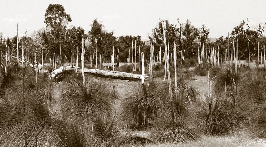
Introduction

    Whiteman Park is located 20 kilometres north-east of Perth and is bounded by
    Gnangara Road to the north, Marshall Road to the south, Hepburn Avenue to the west
    and Lord Street to the east. At almost 4,000 hectares, Whiteman Park is one of the
    largest metropolitan recreation and tourism reserves in the world.

    Whiteman Park will continue to fill a vitally important role as the population of Perth
    and Peel grows to a projected 3.5 million people by 2050. The Park will be surrounded
    by a direct projected population of over 105,000 people and will continue to protect
    the precious Gnangara Water Mound. The Park also needs to continuously evolve to
    meet the conservation, recreation and education needs of the region.

    The Whiteman Park Strategic Plan documents the site planning options following two
    meetings in July and August 2013, to explore long-term opportunities for Whiteman
    Park that align to its strategic position in the Swan Valley.

    Invited representatives at the meetings included:
        •   Noongar families and indigenous metropolitan stakeholder groups culturally
            associated with Whiteman Park
        •   City of Swan
        •   Western Australian Planning Commission
        •   Department of Planning
        •   Department of Finance – Building Management and Works
        •   Department of Parks and Wildlife
        •   Tourism Commission

    This plan identifies the need for the development of a structure plan that recognises
    the importance of Whiteman Park as:
        •   providing interconnected meeting places for communities to meet,
            recreate in and enjoy
        •   providing improved access for the community to the Park’s activities
        •   a destination of significance for local and international visitors
        •   conserving the environment and its heritage for future generations.
3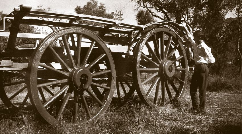
Our history
Image courtesy of the Gratte family
During the 1970s, the Western Australian Planning Commission (formerly known as
the Metropolitan Region Planning Authority) purchased most of the lands that now
constitute the Park. The Department of Planning is responsible for the operational
management of the Park on behalf of the Western Australian Planning Commission.
The Park takes its name from Mr Lew Whiteman (1903-1994) who bought land in the
area in 1939 for the purpose of grazing cattle, before developing the popular picnic
spot of Mussel Pool in the 1960s. The Park was officially opened in 1986 and named
in recognition of Mr Whiteman.
Today the Park offers the public a variety of attractions, special events and facilities
that include:
• Caversham Wildlife Park
• Woodland Reserve
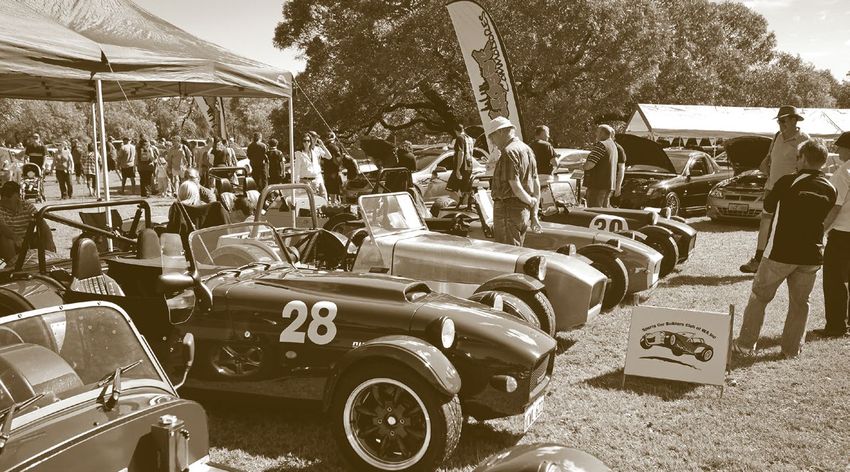
• Revolutions Transport Museum
• Vintage bus, train and tram rides
• the Motor and Tractor Museums of WA
• 14 kilometres of cycle paths and walking trails
• Barbeque facilities and picnic grounds
• Mussel Pool.
The Park is located within the boundaries of the City
of Swan which has a blend of residential, commercial,
industrial and rural land. The Park is one of the largest
metropolitan conservation, recreation and tourism
reserves in the world. It contains almost 4,000 hectares
reserved for parks and recreation in the Metropolitan
Region Scheme, creating a space for the community
while also protecting a major underground drinking water
source, the Gnangara Water Mound, which supplies a large
proportion of Perth’s drinking water.
4
Whiteman Park is one of Perth’s most visited attractions, with more than one million
    visitors each year. It is also the most visited attraction in the Swan Valley. Recently
    the Park earned a place among the very best attractions in the world for consistently
    achieving top ratings from industry and travellers. Whiteman Park has been a finalist
    in both the WA Environment Awards and the WA Tourism Awards for the past four
    years culminating in being awarded the Gold Medal for Major Tourist Attraction at
    the 2016 Perth Airport WA Tourism Awards in November 2016. The online travel site
    tripadvisor.com.au has also awarded it a Certificate of Excellence based on the 4.5
    out of five rating it received from visitors who chose to share their experience on the
    website.

5
The vision
                                                                               Image courtesy of Russell Chambers

The strategic plan is framed by the vision:

“Internationally and locally recognised
as the ‘place to meet’”

Whiteman Park is an ideal place to meet and relax, comprising numerous meeting
places for visitors of all ages to enjoy.

Whiteman Park’s meeting places are connected by a unique and rich history. The
lands from the southern reaches of the Bennett Brook are centrally connected to
Wadjuk Noongar ‘Country’, while the agricultural and transport heritage established at
Whiteman Village provide a window into the period of European settlement.

The natural environment is home to a wide range of flora and fauna, lending itself
to providing outdoor meeting places for camping, trekking, sport, and relaxation.
Trails and pathways lead visitors to meeting places throughout the Park – linking
places to meet, recreate and stay within a natural
bushland setting.

The Park’s location as a nexus to the Swan Valley offers
further opportunities to developing an awareness of the
Park’s heritage.

                                                                                               6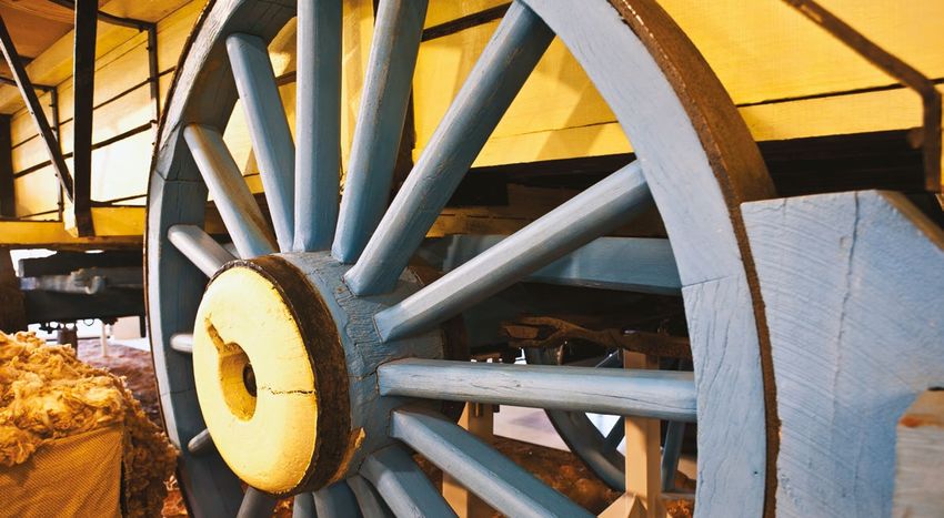
Key drivers informing
     the strategic plan

    The foundation of the strategic plan requires the identification of key areas within the
    Park that are to be reserved and/or developed and which will become the enablers for
    Whiteman Park to achieve its vision.

    The key drivers that will assist in defining the land requirements necessary to achieve
    the Park’s vision include:
        •   Noongar connection to country - preserving and promoting Noongar culture
            and the opportunity to provide a positive future by maintaining continuous
            Indigenous connection to the land and environment, providing a connecting
            theme throughout the Park;
        •   conservation of agricultural and transport heritage collections with nationally
            recognised agricultural and transport and motor sport related events;
        •   environmental heritage and conservation of endangered fauna by returning
            identified areas of the site to an environment that provides a linkage from the
            past into the future;
        •   protecting the underground Gnangara Water Mound that makes a significant
            contribution to metropolitan Perth’s public drinking water supply;
        •   encouraging tourism and eco tourist-based enterprises throughout the Park
            with strong linkages to the Swan Valley;
        •   promoting opportunities for health and wellbeing such as sporting, camping
            and relaxation; and
        •   improving accessibility for local and international visitors of all ages
            to the Park.

    While some of the existing functions in Whiteman Park have already been defined and
    developed, such as Whiteman Village as the centre for the conservation of agriculture
    and transport heritage, further work is required to review the linkages within the Park
    in order to meet the agreed vision, cultural and historical connections.

7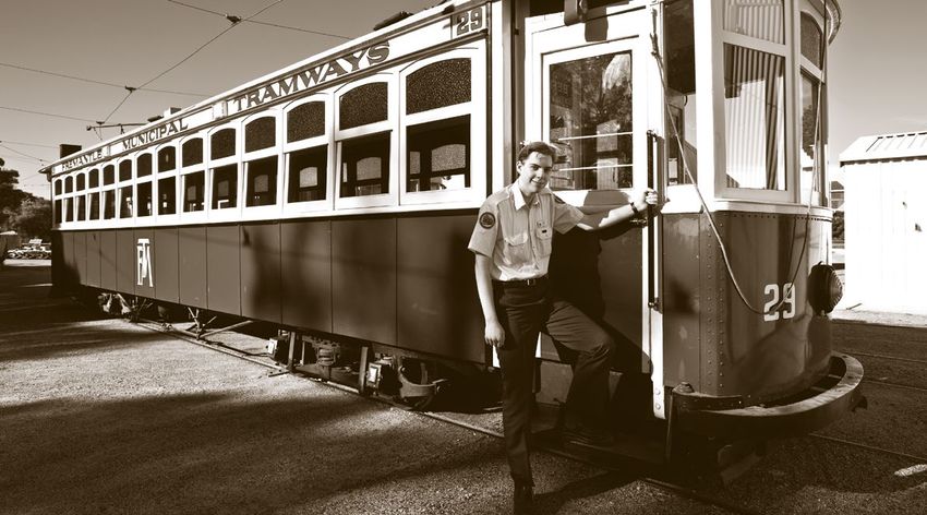
Land use areas

Whiteman Park is composed of a number of distinct land use areas, which collectively
define the Park. To achieve a successful structure plan for the Park, it is necessary to
identify the primary functions of these areas, and consider how they can be more
effectively utilised and integrated.

Six distinct land use areas have been identified:
    1.* Whiteman Bushland - an area of diverse habitat and includes long-term
        revegetation, habitat creation and environmental enhancement.
    2.* Whiteman Village - consists of the current village with a mix of retail and
        commercial areas, together with the agriculture and transport heritage
        collections.
    3. Bennett Brook Reserve Linear Park - an area that has significant Noongar
       cultural and heritage significance and part of a larger conservation corridor.
    4. Marshall Road lands - land sections on the southern section of the Park that
       provide both a buffer and integration with suburban developments to the
       south of the Park.
    5. Lord Street lands - land sections on the eastern boundaries of the Park that
       provide both a buffer and integration with suburban developments to the
       east of the Park and an entry point to the
       Swan Valley.
    6. Old Caversham Airfield - Bush Forever area
       which includes the extant former Australian
       Grand Prix racing circuit.

* Areas one and two form the ‘core’ of Whiteman Park.

                                                                                           8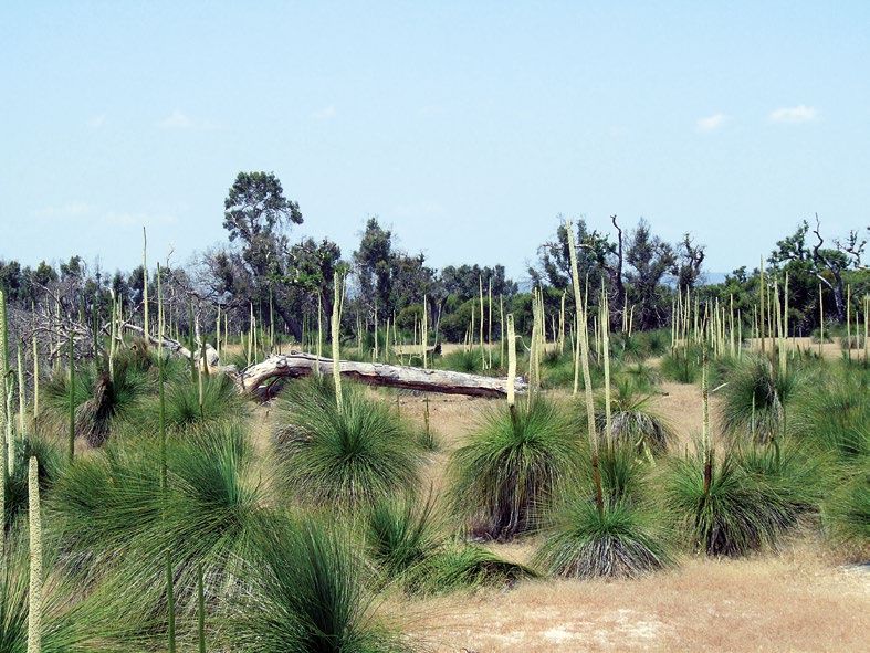
Whiteman Park Strategic Plan 2014-2019
Australian Maritime
Safety Authority
Perth Appaloosa Society
Equestrian Centre
International
Cullacubardee Shooting City of Swan
Complex
Lord Street Lands
1
North Link
5
Woodland
Reserve
Brabham Reserve
Village 2
Lord Street
6
Dayton
N Marshall
Ben n e
0 0.5 1 1.5 2 Horse Swamp
Road Lands
kilometres
Produced by GeoSpatial Planning Support,
4
tt
Department of Planning WA, on behalf of the
Western Australian Planning Commission
Brook
Copyright © August 2016
\\dopgisfilesvr02\iProducts\
Perth\WhitemanParkStrategicPlan20142019\
WhitemanParkStrategicPlan.mxd
Res
Base information supplied by
Western Australian Land Information Authority
LI 782-2015-1 3 Caversham
Vegetated areas includes:
Current Whiteman Park boundary inset
erv
Native vegetation supplied by
Department of Agriculture and Food WA
and Plantations supplied by
e
WA Forest Products Commission
Li
Legend City of Bayswater
ar
ne
Existing Park boundary
Marshall Road Lands
Pa
Bennett Brook Reserve Linear Park
rk
Lord Street lands
Caversham
City of Swan
Whiteman Park boundary External
management
areas Aboriginal
Priority 1 public drinking water
source area (PDWSA) meeting place
Vegetated areas
Waterways and lakes City of
Bayswater
Local government boundary Town of
Bassendean
Proposed Perth to Darwin Highway
Whiteman Park boundaries and land use areas
Land Use 9Areas Figure X
Key outcomes
  The following outcomes have been agreed in relation to Whiteman
  Park. In formulating the outcomes it is recognised that the structure
  plan (which will flow out of this Strategic Plan), will identify areas
  within Whiteman Park that would be appropriate for these activities
  to be based.

Outcome 1 – Provide interconnected
meeting places for communities to meet,
recreate in and enjoy
This outcome recognises the need to develop new meeting places within the Park.
It supports opportunities to encourage tourism and promotes opportunities for health
and wellbeing. A key component of this outcome is the upgrading and changes to road
and service infrastructure.

A structure plan will assist with identifying potential areas within the Park that could
meet these spatial requirements and the connectivity flows.

Key land uses that have been identified (and provisional land use areas) under this
outcome include:
    •   development of sporting fields in partnership with the City of Swan
        – Marshall Road lands
    •   land for outdoor events and concerts – Whiteman bushlands
    •   short-term tourist accommodation including camping – Whiteman bushlands
    •   designated areas for weekend markets and/or ’pop-up’ stores
        – Lord Street lands
    •   cemetery – Marshall Road lands
    •   areas designated for youth attractions – Marshall Road lands.

                                                                                           10
Outcome 2 – Provide improved community
access to the Park’s activities
This outcome recognises that for the Park to achieve a sustainable position, it
is necessary to encourage complementary and linked activities within the Park,
supported by improved access to the facilities, with the appropriate communication
and signage to assist visitors. It is also designed to achieve enhanced educational
experiences for students and the public.
Key considerations include:
• increasing the number of Park facilities with universal access
• enhancing visitor information and signage
• increasing physical and interpretive connections to the Park’s Noongar
heritage
• enhancing access to Whiteman Park’s environmental assets
• increasing the hours the Park is accessible to visitors
• enhancing educational experiences for students and other visitors to the Park.
The following actions have been considered to help facilitate this outcome:
• Continue to improve disability access within the Park
• Develop customer information bays within Whiteman Park that also cater
for other nationalities
• Develop customer information cards in multiple languages for major
attractions within the Revolutions Transport Museum
• In consultation with the Wadjuk People, the City of Swan and other
Government agencies, plan for trails and linkages between the Southern
region of the Bennett Brook (and Swan River) to Mussel Pool, the Park’s
Village and across to the Lord Street lands
• Develop trail connections to Gnangara Road
• Investigate opportunities for 24 hour, seven days a week access to the Park
• In collaboration with the local Wadjuk communities, develop an educational
program for students and the public on their heritage and its linkage to the
land and the environment
• Develop and offer educational programs to students and the public on
transport, environmental conservation and
Whiteman Park’s ’window to the water table’.
11Outcome 3 – A destination of significance
for local and international visitors
This outcome is designed to promote Whiteman Park as a great place to meet,
and is underpinned by the recognition that Whiteman Park offers visitors unique
opportunities to experience a wide range of experiences including the local Noongar
culture and heritage, transport and agriculture heritage and access to environmental
assets.
Key considerations that have been identified include:
• increasing the number of visitors to the Park
• improving visitor satisfaction
• increasing visitor awareness of the Park’s heritage aspects, such as:
– Noongar culture
– agriculture and transport
– environmental assets and conservation programs
– value of protecting its underlying ground water.
The following actions have been identified to help facilitate this outcome:
• In partnership with the private sector, promote Whiteman Park as a unique
destination and a ‘gateway’ for tourism in the Swan Valley
• Continue to enhance the services provided by the Visitor Information Centre
• Assess the Park’s existing Wadjuk heritage interpretive experiences and
identify specific areas for improvement
• Develop plans for the delivery and promotion of exhibitions in the
Revolutions Transport Museum
• Upgrade and extend the Park’s facilities to expand visitor opportunities and
experiences including active and passive recreation and nature play
• Promote the Park for other not-for-profit groups to display and run events
that showcase their transport and/or rural heritage collections
• Provide opportunities for the private sector to develop commercial
enterprises consistent with the key land use areas
• Promote the environmental and conservation activities undertaken
by the Park.
12Outcome 4 – Conserving the environment
and Whiteman Park’s heritage for future
generations
This outcome recognises the importance of Whiteman Park as a venue to promote the
environment and conservation. It recognises that in order for this to occur, it will be
necessary to improve the ecological health of the Park’s natural assets and engage the
broader community in the Park’s planning and operations.
In conserving the environment and its heritage for future generations, it is believed
that this will in turn improve the financial sustainability of the Park by increasing
visitor numbers and create non-government revenue opportunities.
Key considerations for this outcome include:
• improved ecological health of the Park’s natural assets
• improved knowledge of conservation requirements
• increased resources dedicated to conservation of the environmental assets
• increased community participation in planning for the future of
Whiteman Park
• improved financial management.
The following actions will assist in meeting this outcome:
• Develop a five-year environmental management plan for the Park
• Design and implement a revegetation program for the Park
• Continue to implement the Tammar Wallaby and Woylie Breeding Program
in Woodland Reserve while expanding the protected area of the banksia
woodland
• Investigate opportunities to establish environmental research and
conservation programs in partnership with other organisations such as
universities and conservation groups
• Seek public comment on Whiteman Park’s structure plan
• Develop a community engagement strategy for the spatial plan
• Develop a five-year financial plan for the Park that secures its financial
future including increasing the Park’s non-government financial future and
participation of the private sector, including
sponsorship opportunities.
13Structure plan
A high-level preliminary structure plan is presented on page 18 and incorporates the
key discussions and agreed outcomes. This plan is subject to further refining as more
detailed planning is undertaken.
In the first instance, the structure plan is designed to identify areas within the Park
that can be ’reserved’ to meet specific identified requirements. Further work is
required to consider interconnectivity and transition of usage between these areas
in order to finalise the structure plan. This will also include policy development to
consider such issues as a tenancy framework to incorporate public, not-for-profit and
private enterprises and how they will impact on the Park.
Identified components of the structure plan are further explained below.
Lands to be retained within
the core Park envelope
These are areas currently within the Whiteman Park envelope and are zoned parks
and recreation under the Metropolitan Region Scheme. These areas are to be retained
within the Park envelope and are considered integral to the ongoing functioning and
development of the Park.
The areas identified are highly interconnected and
provide a strong nexus linking places to meet, recreate
and stay within the natural bushland setting.
14Whiteman Village
Whiteman Park is reserved ‘Parks and Recreation’ under the Metropolitan Region
Scheme. This restricts the range of uses that the Village can accommodate.
However, it does allow for the Village to support a range of activities which include
the conservation of agricultural and transport heritage collections, wildlife park
(Caversham), tram line and various retail and commercial outlets.
The Village is intended to remain within the overall Whiteman Park boundary and will
be used to support the growth and development of the Park as a key tourism location
and recreation precinct that serves both the local community and the broader market.
The masterplan recognises the importance of the expansive bush and the visitor’s
experience of leaving an urban environment to visit a village destination.
The Village is seen as the hub that will introduce visitors to the many attractions within
the greater area and encourage interest and interaction with all aspects of the Park.
Key to this is the design of the Village and the character developed, to be conducive to
social gatherings and encouraging public interaction.
Coupled with the Mussel Pool picnic area and the opportunity to develop additional
sites for music and open air events, the Village is considered a prime location to
promote the interconnected meeting places for communities to meet, recreate in and
enjoy, while also conserving the Park’s heritage for future generations.
The viability of the Village depends primarily on enhanced access and is anchored on
the internal road, tram, train, bus and pedestrian routes that already exist.
Woodland Reserve and conservation area
The Woodland Reserve and conservation area are key areas of the Park and are to
remain within the Park envelope. The expansive area of old pasture and bushland can
be considered a large haven within an expanding suburban Perth.
Encompassing more than 200 hectares of natural and rehabilitated woodlands,
Woodland Reserve is Whiteman Park’s premier conservation program and a world-
class breeding facility for rare and endangered Western Australian fauna.
The area comprises a diverse cross-section of native
bush, semi-agricultural lands, wetlands and damp
lands constrained by ground water management. With
a relatively flat topography and the presence of the
occasional knoll, views over the surrounding bushland
are permitted.
The diversity and expanse of the Park allows the user to
have a true bushland experience and when coupled with
glimpses into the local Noongar culture and heritage,
provides the visitor with the opportunity to obtain a
unique experience while remaining in close proximity to
the Perth metropolitan area.
15Due to surrounding development, the bushlands are under increasing pressure to
provide the same type of active and passive recreation opportunities as a traditional
‘suburban’ park.
The continuing investment in the conservation program for critical and endangered
species builds upon the significant successes achieved by the Park by providing a
world class breeding facility for rare and endangered fauna of the State, including the
critically endangered Woylie.
Lands to be utilised for complementary
uses to the core Park envelope
Areas outside the core Park envelope are identified as non-essential to the operation
of the Park and can be developed to provide a natural buffer between the core Park
and the surrounding land uses.
These areas are also designed to enhance the Park’s attraction by providing
complementary usage, creating multiple attractions to enhance the visitor experience
of Whiteman Park and the Swan Valley.
Marshall Road lands
The Marshall Road lands are considered non-essential to the operation and integrity
of Whiteman Park. It is proposed that this area be used to provide both a buffer and
integration with suburban developments to the south of the Park. Any development
on the Marshall Road lands must complement and support the core Whiteman Park
land, incorporating developments that will act as an integrator as well as a buffer
between the Park and the suburban development to the south. The land will not be
utilised for residential purposes.
As already identified in this strategic plan, land uses include:
• development of regional sporting fields in partnership with the City of Swan
• development of a cemetery sympathetic with the environment and integrated
with Whiteman Park and its facilities, designed to meet the future needs of
residents in the northern suburbs to help supplement Pinnaroo Memorial
Park
• development of areas for youth attractions to supplement the visitor
experience to the Park by increasing the range of attractions bordering
the Park.
Appropriate reservation changes will be required for the proposed cemetery to occur
and it is recognised that further work will be required in respect to the planning and
environmental review necessary to allow for this to be incorporated in the relevant
City of Swan Town Planning Scheme (TPS) and the Metropolitan Region Scheme (MRS)
as a ‘Public Purposes – Special Use’ reservation similar to all other cemeteries.
16Lord Street lands
The Lord Street lands, similar to the Marshall Road lands, are considered non-essential
to the operation and integrity of the Park. However, as with the Marshall Road lands,
they are an important buffer between the Park and the suburban developments to the
east of the Park.
Importantly, the Lord Street lands provide an important nexus between the Park and
the Swan Valley. Appropriately developed, with consideration that approximately
50 per cent of the land is the subject of the Priority 1 resource protection area, they
provide an exciting opportunity to enhance the appeal of the Park and become a focal
point as a gateway connection between the Park and the Swan Valley region.
Given the critical nature of the Lord Street lands, it is expected that these lands would
be best developed under a leased format, providing a revenue stream for the WAPC
that can be used to support the master-planning of Whiteman Park.
The allocation of this area to lettable land is proposed in the context of dramatically
increasing the accessibility to the Park as a consequence of the increased population
growth in the immediate area and the continuing enhanced demand for tourism
facilities in the Swan Valley area.
The proposed leased areas are expected to be taken up with diverse uses including:
• eco-tourism and short-stay accommodation;
• retail and craft operations
• farmers markets
• food and festival retail
• youth recreation facilities (skate parks, BMX, Scouts and Guides etc).
The expansion of uses will require an upgrading of existing services and transport to
facilitate the successful take-up of the leases by tourism organisations.
Old Caversham Airfield
The old Caversham Airfield was purchased as part of the Bush Forever policy and
forms a lateral link at the south east corner of Whiteman Park. Located within the
land is the remains of the Australian Grand Prix
(AGP) circuit that was used in 1957 and 1962. In
keeping with the transport theme of Whiteman
Park, the former AGP circuit is proposed to be made
available for sanctioned “vintage” motor sports. The
motor sport use will be around the perimeter of the
environmentally sensitive Bush Forever area which is
being progressively rehabilitated.
17Whiteman Park Structure Plan
18You can also read