8th January 2021
L.O: To describe the geographical features of
Spain
←
→
Page content transcription
If your browser does not render page correctly, please read the page content below
8th January 2021 L.O: To describe the geographical features of Spain
Has anyone been to Spain
        before?

   Where did you go?

   What was it like?

The weather- The land –
     The culture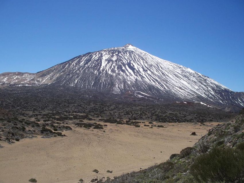
So, where is Spain?
Name of Country:

Spain

Capital City:

Population:

Official Language(s):

Average Rainfall:
So, where is Spain?
Name of Country:

Spain

Capital City:

Madrid

Population:

48 million

Official Language(s):

Castilian - Spanish

Average Rainfall:
1,240 mm (49 in) per year
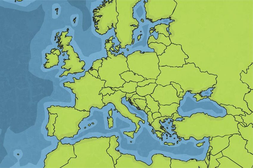
Spain is a large country in Europe and shares borders with France and
Portugal. It has the Mediterranean Sea on its east coast and the Atlantic
Ocean on its north, west and south coast.

Spain
Spain Facts
Spain is officially called the Kingdom
of Spain.

The capital city of Spain is Madrid.

The official language is Spanish.

The population of Spain is
approximately 48,000,000.

Spain has very hot weather in the
spring and summer, making it a
popular holiday destination,
especially with people from the UK. In     Madrid
winter, temperatures in some parts of
Spain can get cold, sometimes below
0°C, and it can snow.

Geography
       What do you think of when you hear the word geography?
       Geography is the study of the earth’s surface, its atmosphere and its features.
       These are some of the topics we learn about in geography.

          weather               rainforests                rivers              towns and cities

                    farming                      population                 volcanoes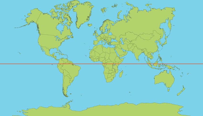
Human and Physical Geography
      Geography is usually divided into two main branches:

                                    physical geography

                                    human geography

                                          Talk About It
                  What do you think is meant by human and physical geography?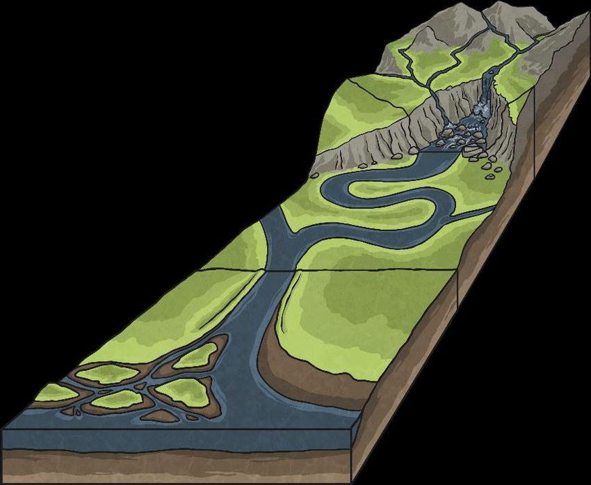
Geography
       Are these examples of human or physical geography?

       Can you explain why?

          weather             rainforests              rivers    towns and cities

                    farming                   population        volcanoes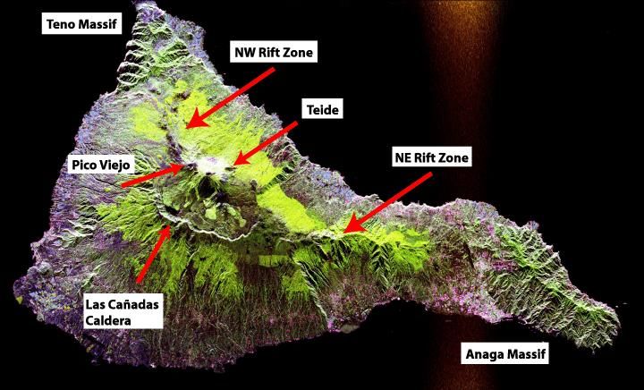
Human and Physical Geography
                Human Geography                          Physical Geography

      Human geography relates to human         Physical geography relates to geography
      activity or something that is humanly-   that is naturally occurring.
      constructed.
      It studies the interaction between       It studies the natural environment and
      human activity and the planet.           landscapes of our planet.

      Human geography might answer              Physical geography might answer
      questions like:                           questions like:
      •   What is the largest city              •   What happens when a
          in Africa?                                volcano erupts?
      •   Why is the UK                         •   Why does a river flood?
          population growing?                   •   How are mountains
      •   Why do we experience                      formed?
          global warming?
Physical Geography
Physical geography relates to geography that is naturally occurring.Physical Geography
Weather
Weather refers to the state of the atmosphere in a particular place.
When we study weather, we are thinking about elements, such as the temperature, how
wet or dry it is, the wind levels or whether there are any storms.
An area’s average weather, over approximately 30 years, is described as its climate.Physical Geography
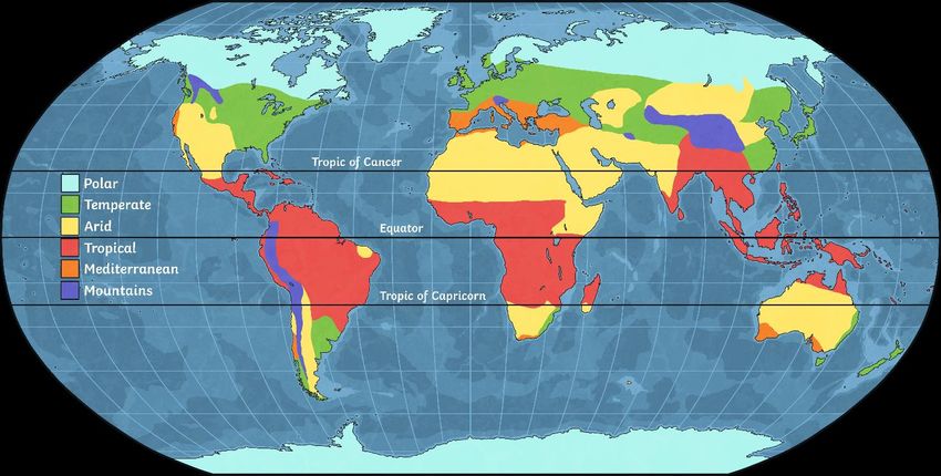
Climate Zones
Climate zones are parts of the world where there are similar weather patterns.
Studying climate zones involves learning about the patterns of weather experienced in
different parts of our planet and exploring the reasons behind them.Physical Geography
Biomes
Biomes are parts of our planet with similar climates, landscapes, animals and plants.
When we study biomes, we explore elements, such as temperature, rainfall and soil, to help
us understand which plants and animals might live there.
Some different types of biomes include rainforests, deserts, woodland and grasslands.Physical Geography
Mountains
Mountains are areas of land that are usually over 600 metres high. They are often higher
and steeper than hills.
When we learn about mountains, we explore how they are formed and where they are
located on our planet.
Studying mountains can link to learning about tectonic plates, volcanoes and the layers of
the earth.Physical Geography
Rivers
Rivers are large, natural streams of water. They flow downhill, along a channel, from their
source to a sea, lake or another river.
Studying rivers involves learning about how they are formed and the different ways they
might flow through changing landscapes.
You might also explore how rivers can erode land over time.Physical Geography
Volcanoes
A volcano is a mountain or hill with an opening where lava, gases and rock fragments can
escape from.
Studying volcanoes involves exploring how they are formed, where they are located and the
different types of volcanic eruptions.
Learning about volcanoes is often linked to other areas of geography, including the layers of
the earth, tectonic plates, mountains and earthquakes.Physical Geography
The Water Cycle
The water cycle describes the constant recycling of all water on Earth.
Water moves in a continuous cycle between the land, oceans and atmosphere.
When we study the water cycle, we learn about the sequence of evaporation,
condensation, transpiration, precipitation (rain or snow) and collection.Physical Geography
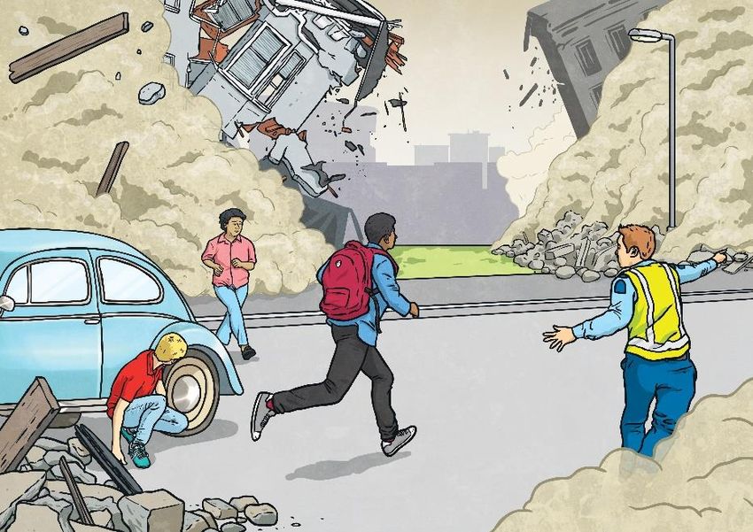
Earthquakes
Earthquakes occur when the plates of the
earth’s upper layer (the crust) move and
release stored energy. The sudden and
intense shaking often results in much
damage.
We learn about what causes earthquakes,
where they occur, how they are measured
and the destruction they can cause.
Earthquakes are linked to our learning
about the earth’s layers, tectonic plates and
volcanoes.So, what are the physical features of
the land in Spain?
Name of Country:
Spain
Capital City:
Madrid
Population:
48 million
Official Language(s):
Castilian - Spanish
Average Rainfall:
1,240 mm (49 in) per yearMountains
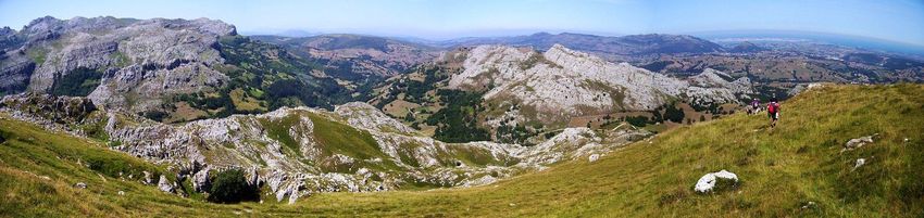
The Cantabrian Mountains
Cantabria is known for a rainy and cool climate. The region is also greener than southern Spain and is very
mountainous.
Cantabrian Mountains, Spanish Cordillera Cantábrica, mountain chain generally extending along the northern coast of
Spain for approximately 180 miles (300 km).
Popular tourist location for hikers and there is also a ski resort there too. On the tops of the mountains, there is snow and a
huge variety of wildlife like; chamois and red deer, wolves, brown bears and wildcats.
In forests, on meadows and cliffs life plays out its dramas far away from civilisation in the Cantabrian Mountains.
You can now complete your own research of the Cantabrian
Mountains or you can use the information I have shared with
     you to complete the sentences on the next page.
Mountains: The Cantabrian Mountains
The Cantabrian Mountains are located in…
The mountain stretch …miles
Tourists visit the mountain for…
The mountain is home to…
I would describe the Cantabrian Mountains as…Rivers
Rivers

  Spain has five main rivers, including
the Tajo, Duero, Guadiana, Guadalquivir
               and Ebro

Longest river: Rio Ebro with 910km/566
miles. Please note that the Tagus which
   is the longest river on the Iberian
peninsula only passes through Spain over
            716 km/ 446 miles.
Source
The river, The Ebro, is a river of the north and
northeast of the Iberian Peninsula, in Spain. It
rises in Cantabria and flows 930 kilometres (580
mi), almost entirely in east- southeast direction.
Mouth
Can you describe the
River’s journey?Look at the mouth- how is it different to the
mouth of the Tyne?The mouth of the River Ebro has a delta. How would you describe the land?
River waters are always flowing
 toward a larger body of water,
     like an ocean or a sea.
Sometimes an area is created
   called a delta. A delta is a
wetland area that forms as river
waters empty into a larger body
  of water. Often, deltas look
    triangular in shape and
    sometimes they're even
described as looking like a fan.
The Delta del Ebro is
the largest wetland in
Catalonia, Spain, with
an area of 320 km2,
and one of the most
important aquatic
habitats in the western
Mediterranean.The Ebro Delta wetland is internationally important for eight species of plants and hundreds of species of fauna, especially birds. Here 95 species nest, and many other species winter, rest and feed during migrations. In total, the Ebro delta shelters 316 species of common birds.
The economic activities taking place in the Ebro delta include
agriculture (crops, fruit trees, rice), fishing, aquaculture and tourism
  with a total annual economic value of around 100 million Euros.

        Here you can see two men cultivating the rice crops.
                      https://www.youtube.com/watch?v=GvzCxrDkclw
You can now complete your
own research or use the
information I have give you to
complete the sentences about
the Ebro River.Rivers: The Ebro River
The Ebro river is located in…
The mouth of the river is located…
The river flows in a …. direction towards
Tarragona.
The mouth of the river is special
because…Volcanoes
Teide is an active volcano on the island of Tenerife (Canary Islands, Spain).

The volcano is 3,718 meters above sea level. It is the highest mountain in Spain and any island in
the Atlantic Ocean. It is 7,500 meters above the ocean floor, it is the third largest volcano in the
world from its base.
This last eruption happened
unexpectedly and scientists
consider that it may happen again.

Its last summit eruption happened
in 850 A.D when it produced the
black lava covering the volcano
today.

Las Canadas Caldera was created
during this eruption. This caldera is
about 2000 metres above sea level.
Mount Teide receives snowfalls at the
same time every year. This is because its
altitude is above sea level. Very few
places in the world get to experience this.

The mountain has a height of 2371
metres making its temperatures go below
zero for ten months a year.

This gets the mountain covered in the
snow more often especially on its highest
parts. Its low precipitation makes its snow
cover much thinner than the Alps.
You can now complete your
  own research on Mount
     Teide or use the
 information I have given
   you to complete the
  sentences on the next
           page.
Volcanoes: Mount Teide
The Mount Teide is located in…
The Mount Teide is an …
Mount Teide is ….high
The temperature at the top of the mountain…You can also read