A coordinated catchment - Mary Regional Resilience Strategy January 2020 - Queensland ...
←
→
Page content transcription
If your browser does not render page correctly, please read the page content below
A coordinated catchment

                       Mary Regional
                  Resilience Strategy

January 2020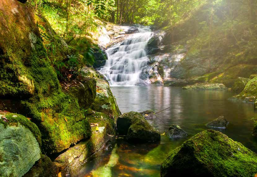
Document details                                                                                              Copyright
      Security classification                      Public                                                          This publication is protected by the Copyright Act 1968. © The State of
                                                                                                                   Queensland (Queensland Reconstruction Authority), January 2020.
      Date of review of security classification    January 2020
      Authority                                    Executive Director, Resilience        Licence
      Author                                       Queensland Reconstruction Authority   This work is licensed by State of Queensland (Queensland Reconstruction Authority) under a Creative
                                                                                         Commons Attribution (CC BY) 4.0 International licence.
      Document status                              Final
                                                                                         To view a copy of this licence, visit www.creativecommons.org/licenses/by/4.0/
      Version                                      1.0
                                                                                         In essence, you are free to copy, communicate and adapt this annual report, as long as you attribute
      QRA Reference                                QRATF/19/4277                         the work to the State of Queensland (Queensland Reconstruction Authority).

                                                                                                        Interpreter
      A coordinated catchment is an integrated, multi-hazard and multi-disciplinary                     The Queensland Government is committed to providing accessible services to
      approach to coordinating resilience action across the Mary region, and is a                       Queenslanders from all culturally and linguistically diverse backgrounds. If you have
      partnership between the organisations listed below.                                               difficulty in understanding this report, you can access the Translating and Interpreting
                                                                                                        Services via www.qld.gov.au/languages or by phoning 13 14 50.
      Wide Bay Burnett Regional Organisation        www.wbbroc.org.au
      of Councils                                                                        Disclaimer
      Fraser Coast Regional Council                 www.frasercoast.qld.gov.au           While every care has been taken in preparing this publication, the State of Queensland accepts no
                                                                                         responsibility for decisions or actions taken as a result of any data, information, statement or advice,
      Gympie Regional Councilil                     www.gympie.qld.gov.au                expressed or implied, contained within.
      Noosa Shire Council                           www.noosa.qld.gov.au                 To the best of our knowledge, the content was correct at the time of publishing.

      Sunshine Coast Council                        www.sunshinecoast.qld.gov.au         Copies
      Queensland Government                         www.qld.gov.au                       Copies of this publication are available on our website at: https://www.qra.qld.gov.au/our-work-
                                                                                         resilience-regional-resilience-plans/central-west-queensland-regional-resilience-strategy

                                                                                         Further copies are available upon request to:
                                                                                         Queensland Reconstruction Authority
                                                                                         PO Box 15428
                                                                                         City East QLD 4002
                                                                                         Phone (07) 3008 7200
                                                                                         info@qra.qld.gov.au
                                                                                         www.qra.qld.gov.au

             Acknowledgement of Country
             We acknowledge the Aboriginal peoples
             and Torres Strait Islander peoples as the
             Traditional Owners and Custodians of this
             Country. We recognise and honour their
             ancient cultures, and their connection
             to land, sea and community. We pay our
             respect to them, their cultures, and to their
             Elders, past, present and emerging.

2   Mary Regional Resilience Strategy                                                                                                                                                               2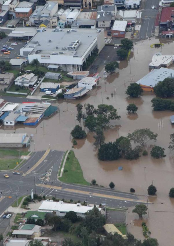
Foreword
A region that works together
is a resilient region.
The Mary region is home to some of Queensland's most iconic A Coordinated Catchment - the Mary Regional Resilience Strategy
landscapes, environmental attributes and a sense of community recognises the extensive range of valuable disaster resilience
and identity that sets us apart. These attributes go the very heart studies, programs, projects and strategies already underway across
of who we are in the Mary region, and form a significant part of our the region and being implemented by a host of organisations,
individual and collective community values. community groups and individuals. It is a partnership between the
Wide Bay Burnett Regional Organisation of Councils (WBBROC), the
To protect these values, we must work together across government, Queensland Government and the four councils of the Mary region:
communities, organisations and as individuals, to collaborate
and share our knowledge and efforts on our pathway towards our • Sunshine Coast Council
resilient future. • Noosa Shire Council
• Gympie Regional Council
The Mary region, and its diversity of communities, is well-versed in
dealing with the often sudden onset of a range of natural hazards • Fraser Coast Regional Council.
from catchment-wide flooding to fast-moving bushfires, as well as A Coordinated Catchment - the Mary Regional Resilience Strategy
severe storms and the occasional tropical cyclone. We rise to the is a locally-led blueprint which provides us with the basis upon
occasion, always. However, we must also remain dedicated to a which to come together across local government boundaries
cycle of continuous improvement in how we prevent and prepare for and in partnership with the Queensland Government, our valued
natural hazard events. communities and other local stakeholders. It charts a pathway for
us to coordinate, collaborate, connect and champion multi-hazard
Coordinating to build resilience in the Mary region means proactively
Cr Mick Curran
resilience efforts into the future.
drawing upon the skills, knowledge and experiences of all members Chairman of the Wide Bay Burnett Regional Organisation of Councils
of our community, to contribute and collaborate - working together
in new ways with mutual respect, to collectively drive our region from
strength to strength. It is about building our longer-term capacity
to adapt to changing circumstances and inevitable natural hazard
impacts, in a healthy, productive and constructive way.
Cr Mick Curran
Chairman of the Wide Bay Burnett Regional Organisation of Councils
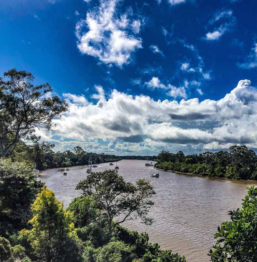
Image: (left ) Mary River aerial. Courtesy of QRA, (above)
Images: (Top)
Kondalilla FallsKondalilla Falls at Montville.
at Montville
(Left) Mary River aerial. Courtesy of QRA.
3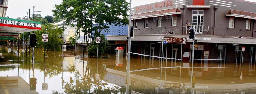
Contents
        Foreword3
        Our vision                                  5
        Our shared values                          6
        Our community                              8
        About this strategy                        11
        What is resilience?                        16
        Resilient settlements and infrastructure   18
        Social resilience                          28
        Resilient economy                          32
        Resilient environment                      34
        Resilient settlements                      36
        Strategic pathways                         43
        Strategy implementation                    46

     Image: Flood monitoring station,
     Fraser Coast Regional Council.

4   Mary Regional Resilience Strategy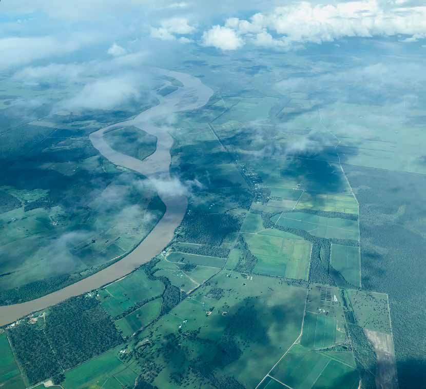
Our vision
Across the Mary region, we know serious weather and we take it in our stride.
Our historical roots were forged by flood and fire.
We are resourceful and self-reliant, and we take great pride in looking after
our family, neighbours and friends.
We maintain strong community bonds. Community connection is at the core of our resilience in
the Mary region. Our sporting groups, community groups, special interest groups, charity and
volunteer groups are all examples of our diverse forms of community.
We go to great lengths to be prepared for the unexpected, each and every day.
We know that to be resilient, each one of us has a role to play. We take this role seriously.
We look out for the vulnerable in our community – our elderly, our children, the ill
and those with disability.
We are conversant with the types of natural hazards we face every year, and we are constantly
improving how we endure. We do this by forward planning for serious weather
and climate impacts.
We take proactive steps to coordinate our resilience behaviours and actions as individuals,
families and communities for a safer, more resilient Mary region.

Image: Mary River at Kenilworth. Courtesy of QRA.

                                                                                                5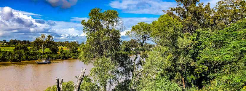
Our shared values
     As a community, we have a story to tell...
     Our sense of community spirit is our greatest and most valued asset. We are genuine,
     authentic and friendly. We warmly welcome newcomers and visitors to our great region.
     We are proud of our rich heritage. From gold mining, to agricultural production, from fishing
     villages to the home of Mary Poppins. Our identity as a region is formed by our historical roots
     - with beautiful period architecture to match.
     Our weather and climate is enviable, most of the time. We enjoy the best of Queensland’s
     sub-tropical climate, from sunshine to rain which keeps our landscape looking lush. We
     acknowledge that Mother Nature can sometimes pack a punch.
     Our natural landscape is diverse and dramatic. We are the adventure capital of Queensland,
     with boundless opportunity to take in the best of all the great outdoors has to offer, coupled
     with rich ecological and biodiversity values which we seek to protect.
     Our lifestyle is bound by the bush and the beach. From national parks to some of Australia’s
     most notable and secluded beaches, our region is the gateway to unparalleled
     lifestyle options.

                                                  Our region offers a variety of experiences.
                                          The Mary region has something to offer everyone.
                                                         Our potential is unlimited.

     Image: Food’n’ Groove concert.
     Courtesy of Fraser Coast Regional Council.

6   Mary Regional Resilience Strategy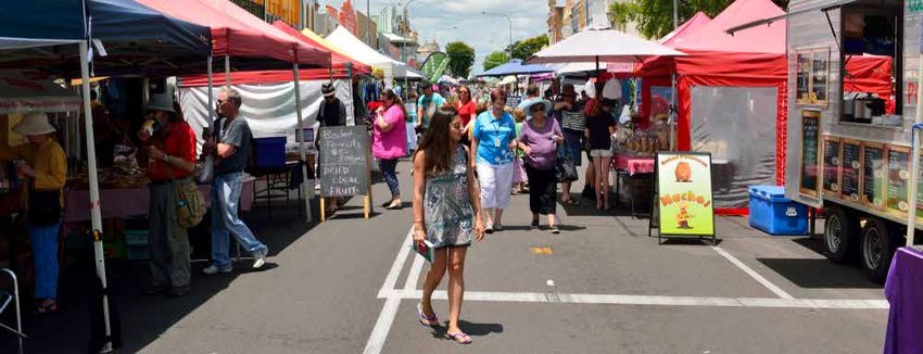
Mary River catchment

                       7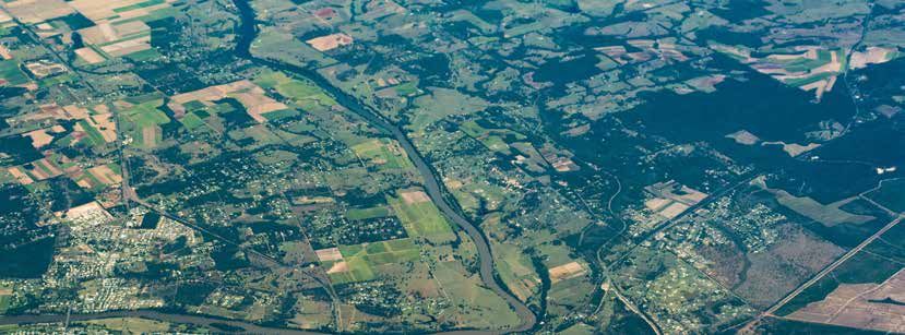
Our community
     The Mary region and                                                      Local governments
     natural hazards                                                          The Mary region primarily includes areas of the Fraser Coast, and
                                                                              Gympie (both of which are part of the Wide Bay Burnett Regional
     The Mary region takes in the area of the Mary River catchment.           Organisation of Councils), along with the Noosa and Sunshine Coast
     The Mary River emanates from the southern Conondale Ranges,              local government areas.
     Maleny and Jimna and flows north through Kenilworth toward               These four Councils are working together with a key focus on
     Gympie, and on to Maryborough.                                           delivering shared solutions to common resilience challenges across
     The Mary River is joined by tributaries that flow through local towns    the Mary region.
     and communities, flowing east from around Goomeri, and flowing           Information about local hazards and resilience is available via the
     west from around Cooroy. Major tributaries include the Obi Obi, Little   following council websites and Disaster Dashboards:
     Yabba, Six Mile, Amamoor, Kandanga, Tinana, Deep, Munna and
     Wide Bay Creeks.                                                         Fraser Coast Regional Council
     The Mary River catchment collects rainfall and flood water,              https://www.frasercoast.qld.gov.au/
     discharging into the Ramsar-listed Great Sandy Strait at River Heads     http://disaster.frasercoast.qld.gov.au/
     – north-east of Maryborough and south-east of Hervey Bay.
                                                                              Gympie Regional Council
     From flooding to bushfire, cyclones and severe storms to
     heatwaves – the Mary region is familiar with the onset of                https://www.gympie.qld.gov.au/
     emergency and disaster events.                                           http://disaster.gympie.qld.gov.au/
     Coupling both topography and rainfall patterns, the streamflow of
                                                                              Noosa Shire Council
     the Mary River is highly variable with large areas of the catchment
     exposed to flash flooding.                                               https://www.noosa.qld.gov.au/

     Severe storm is no stranger to the Mary region, with clear               http://disaster.noosa.qld.gov.au/
     topographical characteristics in the western area of the catchment       Sunshine Coast Council
     and beyond which support increased storm activity in specific
     locations across the region. As a fertile region, the Mary also          https://www.sunshinecoast.qld.gov.au/
     supports a thriving agricultural industry, with grazing land and crops   https://disasterhub.sunshinecoast.qld.gov.au
     often impacted by various weather and hazard events.
     Much of the upper reaches, or headwaters, of the catchment
     comprise National Parks, bushland reserves and forestry plantations
     and these locations can be susceptible to bushfire and landslip.

     Image: Mary Valley, Conondale.

8   Mary Regional Resilience Strategy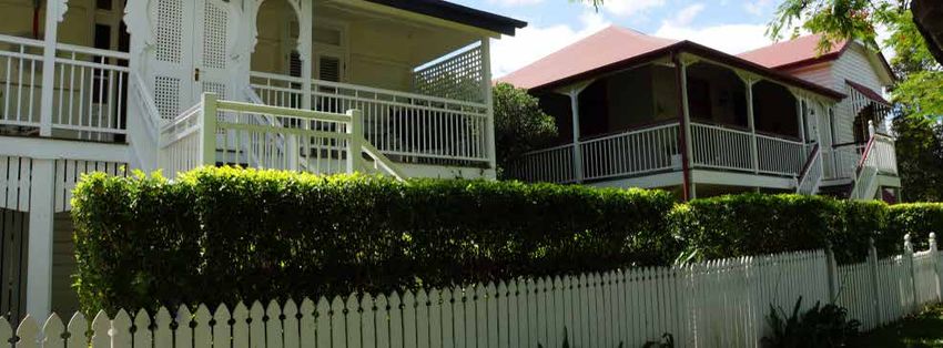
Our community
The Mary region takes in almost 979,950 hectares, comprising
more than 53,660 individual properties. It is home to a population
of approximately 128,600 within the catchment. The population
is growing rapidly with new residents attracted to the region for a
range of lifestyle, employment and financial reasons.
                                                                           Our community snapshot
The original inhabitants of the Mary area were the Kabi Kabi               Local government areas 4
(Gubbi Gubbi) and Butchulla Aboriginal Peoples.
Today, the Mary region includes a broad cross-section of                   Catchment population 128,600
communities including small settlements and villages, service towns
and hinterland towns, rural production areas, national parks and
plantations, through to major urban settlements such as Gympie
                                                                           Agricultural land use   51%
and Maryborough.
Townships in the upper Mary region include Montville, Maleny and
                                                                           Low income              55%
                                                                                                  vs 44.8% across
                                                                                                  Queensland

Mapleton at the top of the catchment. Kenilworth and Kandanga are
located in the centre valley area.
                                                                           Ageing population       22.3%
                                                                                                 65 years+ vs 15%
                                                                                                 across Queensland

The lower Mary region is approximately double the size of the upper        Children                17.8%
                                                                                                 aged 14 years and
                                                                                                 younger vs 19.6%
                                                                                                 across Queensland
reaches of the catchment, stretching from Gympie to Tiaro and
through to Maryborough, before being joined by Bunya Creek and             Indigenous population 3.3%
                                                                                                 vs 4% across
                                                                                                 Queensland
the Susan River towards the river mouth at River Heads.
                                                                           Persons with disability 7.7%
                                                                                                 vs 5.2% across
Outside the Mary region, communities such as Hervey Bay, the                                     Queensland

Cooloola Coast and the coastal villages of the Great Sandy Strait
are directly and indirectly impacted or influenced by natural hazard
events in the Mary region.
Whilst the population of the Mary region is diverse, it shares many
unifying factors which extend beyond just geographic or catchment-
based location such as shared key economic activities and
industries, shared value sets and shared historical linkages.

                                                                                        3.3%
From an economic perspective, the primary sectors producing                                       Indigenou
the largest industry output in the Mary region over recent years                                  s
are construction, real estate services and manufacturing. Growth                                  vs 4%
industries across the region include mining, financial and insurance                              across

                                                                                                             55%
services, and health care and social assistance sectors. Noting the                               Qld
region’s increased proportion of the population aged +65 years,
relative to the state average, it is unsurprising that health and social
industries continue to experience growth.

Image: Maleny Lane. Courtesy of Tourism Australia.

                                                                                                                     9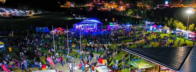
How catchments work                                                      Walking the landscape
      Almost every season, somewhere in Queensland will experience             The Mary Regional Resilience Strategy is supplemented by a
      heavy rainfall which can lead to flash flooding and riverine flooding.   separate body of work led by the Department of Environment and
      This is due to our sub-tropical climate and can be driven by             Science, called Walking the Landscape. The primary aim of the
      monsoon troughs, east coast low events and cyclones.                     framework is to help develop a whole-of-landscape understanding
                                                                               to improve evidence-based decision making for the sustainable
      Where rainfall goes, depends upon topography. Queensland                 management and restoration of ecological systems.
      incorporates a number of drainage basins, within which we have 64
      river catchments, including the Mary River catchment.                    Walking the Landscape incorporates available knowledge on
                                                                               landscape components e.g. groundwater dependent ecosystems,
      River catchments are defined by elevated areas, known as the             lacustrine wetland, riparian vegetation and processes
      headwaters, at the top of the catchment. These elevated areas            e.g. hydrological, geological. The framework integrates existing
      determine where water will flow, either out to the Pacific Ocean         scientific information with local knowledge about how catchments
      or south into New South Wales or South Australia. Catchments             work. Through this process, the Department of Environment and
      generally comprise a number of tributaries which catch and convey        Science worked with local stakeholders, local and state government
      rainfall into our major river systems.                                   and communities to gain a collective understanding of many
      Catchments are not just relevant in terms of flooding and floodwater,    Queensland catchments from Cape York to South East Queensland.
      but can be important to consider in relation to other natural hazards    The process helps answer questions like how the landscape impacts
      such as bushfires and landslides. The inter-linkages between             water movement or why groundwater dependent ecosystems occur
      different hazards is highly evident at the landscape-scale. For          in certain locations.
      example, in some cases bushfire events can burn very hot, stripping
      vegetation and damaging soils across vast areas. Degraded                Catchment stories produced by the Department of Environment
      landscapes can also occur after years of persistent drought.             Science can be viewed online via the Wetland Info website.
      Especially in Queensland, the disaster season is that period of the      www.wetlands.des.qld.gov.au
      year where we can experience all types of natural hazard events, and
      this is changing as a result of climate-related considerations. This
      means we might experience a bushfire event one week, and a major
      flood the next. Where our landscape is degraded, either by fire,
      drought, or poor land management practices, flooding rains can lead
      to landslips and extensive landscape and riverine erosion.
      Catchment contamination, erosion, sedimentation and silting
      are particular challenges for the environmental quality of our rivers,
      and the fauna and flora they support. This can also impact the
      quality of our water supplies, on which our communities and
      economies depend.
      Understanding how our catchments work is vitally important, as
      they can be subject to impacts from a wide range of natural hazards
      beyond just flooding.

      Image: Mary River. Courtesy of QRA.

10   Mary Regional Resilience Strategy
About this strategy
Mary Regional Resilience Strategy Recognising regional values
The Mary region is one of Queensland’s most environmentally, Identifying, understanding and reflecting region-wide community
socially and economically diverse regions, and a region which is values is an essential aspect in driving resilience action into the
characterised by the depth of values shared by its residents. These future. This is because our values, the very reasons why we choose
values go to the core of community and individual identity, and can to live, work and play in the Mary region, are often the things we lose
often be impacted by disaster events – of which the Mary region has in a disaster event. These values also set us apart from other parts
experienced many over the years. When these values are impacted of Queensland.
by disaster events, our resilience to, and recovery from, disasters can
be challenged. These values can relate to sense of place and belonging, community
identity, places and occasions for people to come together to
From flooding to bushfire, cyclones and severe storms to heatwaves share and celebrate, or they can be values such as the ability to
– the Mary region is familiar with the onset of emergency and make a livelihood, feel safe or familiarity with local surroundings.
disaster events. Into the future, the region is not immune from larger Environmental values can be damaged or even lost. When our core
magnitude events and community-led disaster resilience will enable values are impacted by a disaster, it makes our recovery process as
us all to work better together to prevent, prepare for, respond and individuals, families and communities more challenging and we find
recover – to maintain and protect our community values. ourselves needing to adapt to our new circumstances. Some people
will find this easier than others, requiring community-led leadership
Supporting community leadership in fostering disaster resilience is a to look out for and care for those who may find dealing with severe
core focus of this strategy, recognising communities and individuals weather events, disaster impacts and transitions into recovery, a
as key players in developing pragmatic and fit-for-purpose challenging process.
approaches to disaster resilience and recovery.
Video: Find out more about the Mary Regional Resilience
This strategy takes both a bottom-up and top-down approach to Strategy at www.qld.gov.au/maryregion
the coordination of resilience actions and effort, recognising both
the valuable role of grassroots, community-led resilience as well
as government-led, multi-disciplinary coordination in coupling
sustainable communities and sustainable development with
disaster risk reduction.
Diagram: Core elements of the Mary Regional
Resilience Strategy.
Grassroots Disaster Sustainable
community-led development
resilient
action + disaster risk
communities reduction
Image: Aerial view of Fraser Coast region with Mary River.
11Our aspirations for resilience Strategic focus
This strategy is a regional blueprint for coordinated resilience action This strategy takes a multi-hazard approach to the varied aspects of
that will work to the following objectives: disaster resilience, noting that many resilience-building measures
and activities are often multi-dimensional. That is to say, many
• sharing, leveraging and coordinating resilience efforts across measures or activities identified for particular hazards, for example,
the region flooding, can equally apply to the resilience-base necessary for
• adopting a place-based approach to resilience action, communities to prepare for, and recover quickly and effectively from,
tailored to the varied characteristics of the region and other natural hazards such as cyclones or bushfires.
its communities
The reason for this is because of the strategic, systems-based
• aligning sustainable development with disaster
approach required to underpin resilient communities. Disaster
risk reduction
resilience is not just about hardening critical infrastructure. Rather,
• telling our unique resilience story, recognising that one size it requires a combination of social, environmental, economic,
does not fit all built environment and infrastructure measures. When considering
• recognising the role of disaster resilience to our local and matters of community-based disaster resilience from this strategic,
regional economy and social (or community) resilience. systems-based perspective we can start to understand, identify
Effective disaster risk reduction requires an integrated, coordinated and develop robust multi-hazard resilience measures to strengthen
and whole-of-region approach. our communities to endure Queensland's dynamic weather and
changing climate.
Coordinating resilience across A systems-based approach
the Mary region
The purpose of this strategy is to guide how we share and
This strategy seeks to guide how we work together to proactively coordinate approaches to improved resilience and disaster risk
journey toward enhanced community and climate-related disaster reduction across the Mary region. It is developed as a partnership
resilience over time. between the Queensland Government, Fraser Coast Regional
Council, Gympie Regional Council, Noosa Shire Council and Sunshine
Its purpose is to combine strategy and investment in resilience Coast Regional Council.
action in a way that encompasses the impacts of our weather and
climatic conditions across the Mary region. This strategy adopts a Collaboration and integrated engagement across this partnership
holistic view of the factors which underpin and contribute to disaster have been critical to the successful development of this
resilience, having regard to the multitude of natural hazards we are strategy. It involved a multi-disciplinary approach engaging
exposed to across the region, and the various ways in which we can with a range of professionals who specialise in mental health,
collectively address our risks. engineering, planning, community and economic development,
disaster management, transport, environmental management,
The strategy sets out a coordinated 'blueprint' for improving disaster communications and more.
resilience across the Mary region, building upon a comprehensive
suite of existing studies and strategies derived at a local and regional A coordinated approach to community resilience, sustainable
level. It aims to ‘change the game’ in how we reduce disaster risk development and disaster risk reduction enables us to work across
and strengthen the resilience of our individuals, communities, the jurisdictions, disciplines and communities to adopt innovative and
economy and the environment. fit-for-purpose approaches to:
Whilst the coordination of disaster resilience action is a key • better understand our collective risk
aspiration, we recognise that no two places or communities are • work better together to limit our exposure
the same – though we do share some common characteristics.
• seek out new, cutting edge opportunities to reduce
disaster risk
Image: Mary River downstream of Maryborough.
• continuously improve how we prepare for,
Courtesy of QRA.
respond to and recover from disasters.
12 Mary Regional Resilience StrategyWorking across the elements of resilience Integrating related programs and projects
This multi-dimensional and cross-disciplinary approach has This strategy combines and builds upon a range of local and regional
informed the adoption of four elements which contribute to strategic documents to articulate the various aspects of resilience
holistic resilience action: action identified across the Mary region. Plans, projects and studies
have been drawn upon to inform this strategy.
National Disaster Risk Reduction Framework
Human and social
Environment The National Disaster Risk Reduction Framework is a multi-sector
collaboration led by the National Resilience Taskforce within the
Australian Government Department of Home Affairs. The framework
Disaster was co-designed with representatives from all levels of government,
business and the community sector. Over 100 participants from a
resilience diverse range of over 80 organisations came together at a three-day
Built environment intensive ‘policy sprint’ to develop key components of the framework.
Economy and infrastructure
The framework outlines a coordinated approach to reducing disaster
risk. This is one critical component to enable resilience. It is designed
to leverage the great work and progress made across all sectors
Diagram: The elements of disaster resilience since the release of the National Strategy for Disaster Resilience
in 2011 to better understand and reduce disaster risks, improve
resilience, and bolster the capability and capacity of communities to
It is the intention of this strategy that coordination of effort across withstand natural hazards.
government, communities, stakeholder groups and disciplines
integrates a resilience mindset to embed a streamlined approach to More than ever, limiting the impact of disasters now and in the future
business as usual across a wide variety of policy and strategy. This requires a coordinated effort across and within many areas including
may include, but is not limited to: land use planning, infrastructure, emergency management, social
policy, agriculture, education, health, community development,
• regional plans energy and the environment.
• regional economic development strategies
• regional transport and infrastructure plans Queenslanders are disaster resilient when...
• natural resource management plans
we work together we continually
• water resource plans to better manage
disaster risk
improve how we
prepare, respond
• local and district disaster management plans and recover from
disasters
we seek new
• local asset management and capital works plans we understand opportunities to
our risk reduce disaster risk
• local corporate and community development plans
• land use planning schemes Diagram: The four objectives of the Queensland Strategy for
• local and regional health strategies. Disaster Resilience
Image: Mary Valley hinterland. Courtesy of QRA.
13National Land Use Planning Guidelines for Disaster Resilient Queensland – delivering on the Queensland
Resilient Communities Strategy for Disaster Resilience
Prepared by the Planning Institute of Australia on behalf of the Resilient Queensland will see every region across Queensland
Australian Government Attorney-General’s Department, the National have an individually-tailored regional resilience plan by 2022. The
Land Use Planning Guidelines for Disaster Resilient Communities Mary Regional Resilience Strategy is amongst the first tranche of
were released in 2016 to provide a guide on best practice pilot projects delivered for Resilient Queensland, and will be used
approaches across various hazards. Focusing largely on policy and to guide future regional resilience strategies being developed
strategic land use planning, the guidelines provide a toolbox of throughout the state. In particular, it seeks to identify and address
methodologies for various activities typically associated with land locally-derived challenges and opportunities which are particular to
use planning and the integration of natural hazard, risk, climate the Mary region, linking back to the objectives of the Queensland
change and community resilience considerations into everyday Strategy for Disaster Resilience.
planning practice.
As the most disaster-impacted state in Australia, it is critical we
It incorporates elements such as policy making and strategic harness best practice and look for new ways to work together to
(planning scheme) plan making, hazard identification and risk improve the resilience of communities across Queensland, adopting
assessment, risk mitigation and community consultation. The pathways toward a safer, stronger and resilient Queensland.
Guidelines seek to better equip planning (and other) professionals
with the knowledge and information required to effectively integrate Queensland Climate Adaptation Strategy
resilience-based practices into all manner of land use planning The Queensland Climate Adaptation Strategy 2017-2030 outlines
activities, including catchment-based approaches to flood resilience. how Queensland will collectively prepare for current and future
impacts of a changing climate that reduces risk and increases
Profiling Australia’s Vulnerability resilience. This strategy recognises that, as a state, we are already
Profiling Australia's Vulnerability explores the interconnected experiencing hotter summers, more frequent natural disasters and
causes and cascading effects of systemic disaster risk. Prepared in impacts on our natural environment, and that these changes pose a
a partnership approach between the National Resilience Taskforce, threat to our economy, our communities, our environment and our
CSIRO and a range of professional organisations across Australia, way of life.
this report examines the relationship between our values and
our vulnerabilities, and aims to understand how Australians can The strategy, along with specific sector-based adaptation plans,
collectively prioritise efforts to reduce loss and harm. outlines our commitments and the actions we will take to transition
to a low carbon, clean growth economy and adapt to the impacts of
Factors that impact on resilience – such as climate change, a changing climate.
demographic shifts and a reliance on interconnected systems and
infrastructure – are addressed throughout the report, supported by Queensland State Natural Hazard Risk
references to relevant research, experiences and disaster events. The Assessment 2017
report provides a new way of looking at disaster risk based on the Prepared by Queensland Fire and Emergency Services, the State
premise that hazards only lead to disaster if they intersect with an Natural Hazard Risk Assessment provides a statewide analysis of
exposed and vulnerable society and when the consequences relevant natural hazard risks including tropical cyclones, severe
exceed people’s capacity to cope. storms, flooding, coastal hazards, heatwaves, bushfires and
earthquakes. The assessment considers the nature of natural
hazards relevant to Queensland, as well as elements of likelihood,
consequence, exposure and vulnerability to understand both
inherent and mitigated risk profiles. The assessment links to the
Queensland Emergency Risk Management Framework (QERMF)
which provides a comprehensive and systematic approach to inform
risk-based planning across Queensland.
Image: Sea wall, Esplanade, Urangan, Hervey Bay.
14 Mary Regional Resilience StrategyQueensland State Planning Policy 2017 Queensland Floods Commission of Inquiry
The State Planning Policy (SPP) is an instrument under the Planning The Commission of Inquiry was established by the Premier of
Act 2016 (Qld) which sets out the state planning interests critical to Queensland in response to the 2010-2011 flood events. The
responsible land use planning and development across Queensland. Commission of Inquiry conducted a comprehensive review focusing
Under this instrument, the State sets out the particular state on areas such as preparation and planning, adequacy of response,
planning matters to be preserved and protected (the state interests). adequacy of forecasts and early warning systems, and land use
These state interests are arranged under five broad themes: planning in the lead up to the 2010-2011 floods.
• liveable communities and housing The final report included recommendations across a vast range
• economic growth of technical and governance disciplines which highlighted the
complexity of flood risk management in Queensland. Included in
• environment and heritage
the recommendations was the need to conduct additional flood
• safety and resilience to hazards studies and undertake further consultation with local governments
• infrastructure. to enhance the cooperative approach to flood risk management.
The SPP covers all natural hazards from floods, cyclonic and
Sunshine Coast Council Disaster Resilience Plan
storm events, earthquakes, bushfires, storm tide inundations and
landslides. The actions required by local government to integrate the
2019-2022
policy include: In 2018 the Sunshine Coast Regional Council launched its Disaster
Resilience Plan, supporting the implementation of its Local Disaster
• identifying hazards in the first instance especially Management Plan, as well as Council's Environment and Liveability
through mapping Strategy 2017, the Regional Economic Development Strategy
• undertaking a risk assessment 2013-2033 and the Social Strategy 2015. The Plan recognises the
• ensuring land in the erosion prone area is not to be used multi-dimensional nature of resilience action, reinforcing Council's
for urban purposes commitment to a strong community by identifying principles and
priority areas to guide the application of disaster resilience activities.
• ensuring development on land in other hazard areas is
avoided or mitigates risk to a tolerable level The Sunshine Coast Regional Council is the first local government in
• ensuring development does not hinder emergency service or Queensland to develop a local disaster resilience plan.
create further risk to public safety
• ensuring built coastal protection options are a last resort.
Image: The Mary River looking south east, 18 February 2013,
at its peak of 19.95m. Photo by Craig Warhurst, Gympie Times.
15What is resilience?
Individual resilience Community resilience
It is important to know what exactly is meant by the term 'resilience', Collective community resilience tends to be defined by a different
and it can often mean different things to different people. However, set of characteristics to those which define individual or personal
there do remain common characteristics which define what it means resilience. Across the Mary region, community resilience tends to be
to be a resilient person. Often, this can be confused with stoicism, associated with:
however these two qualities are quite different.
• connection
Stoicism tends to be characterised as a show of strength in the face • leadership
of adversity and hardship to continue on and persevere. Resilience,
• capability and capacity
on the other hand, is about being equipped over the longer term to
adapt to rapid change and new circumstances – both for individuals • inclusiveness
and for communities more holistically. Resilience can include the • identity
following attributes: • innovation
• a sense of resourcefulness and self-sufficiency • opportunity.
• adaptability From a practical perspective, support for community resilience
• open mindedness across the Mary region is also interpreted to include activities and
actions such as:
• self-reliance, independence and self-responsibility
• awareness • infrastructure betterment, such as raising roads above
flood levels
• ingenuity and innovation
• human/community well-being and ownership of risk
• capability
• organisational readiness, such as undertaking drills and
• strength of core values
updating procedures in readiness for storm and
• mateship and connection with others. cyclone season
These attributes stand a person in good, solid stead to overcome • property-based resilience, such as preparing your property
and adapt to life's challenges. It is necessary we understand that for hazards, like raising floor levels and event-based
sometimes we cannot return to our lives, the way they were before protection like sand-bagging
a specific event. In some cases, we need to find value in our new
• economic resilience, such as maintaining the operation
life circumstances and learn to adapt, in order to move forward in a
of agriculture and industry in preparation for, during and
healthy, mindful manner.
following an event.
When our communities are connected and collaborating, collective
efforts benefit immensely from coordination – across disciplines,
Resilience is everyone’s business. levels of governments, localities and communities. Coordination
We all have a role to play. of resilience activities and action is a core element of proactive
community resilience building.
Image: Sunshine Coast Get Ready Schools Program. Courtesy of Sunshine
Coast Regional Council.
16 Mary Regional Resilience StrategyPlace-based resilience Cumulative, cascading and
Resilience necessitates different activities or ways of thinking compounding risks
in different locations across the region because each of our
communities are unique. When thinking about resilience to disaster risk, there are sometimes
a range of secondary or indirect risks which may not necessarily be
The uniqueness of our communities bares a relationship with our front of mind.
settlement types and locations. For example, the resilience needs
and values of our rural communities is different to that of the In certain severe weather or disaster events, a series of complex
residents of our services towns, which is also different to that of our cumulative, cascading and compounding risks can emerge, further
major river cities – Gympie and Maryborough. complicating both emergency and community response, as well as
holistic community recovery. Due to the nature of these potential
On this basis, a place-based approach is adopted by this strategy indirect risks, we should consider:
to reflect the place-based values and resilience needs of the varied
communities across the Mary region. This is discussed in further • cumulative risk – the aggregate of multiple risks which
detail in the 'Place-based approach' section of this strategy. can coalesce or merge into substantial, broad and far-
reaching impact beyond that initially understood or forecast.
Cumulative risk often occurs incrementally, subject to certain
sets of circumstances, but can be characterised by either
rapid or longer-term onset
• cascading risk – this style of risk is typically associated
with higher-order risks which can result in a different set
of flow-on risks. Cascading risk can usually be identified
through risk assessment processes, where an evaluation of
certain events, action or non-action can assess follow-on
consequences and relative likelihood
• compounding risk – occurs when a multitude of different
risks give rise to a build-up of overall risk, inherently
changing or increasing the risk profile beyond that merely
associated with single or even multiple direct risks.
Community resilience is complex and far-ranging. The impact of a
severe weather or disaster event is certainly challenging in itself
however, there are multiple considerations beyond this which
dictate our collective level of resilience. The influence of human
behaviour and human activity in consideration of risk further multiply
direct risks into a complex range of indirect risks, of which we are not
always immediately aware and may take time to emerge.
Images: Kilkivan. Courtesy of Gympie Regional Council.
17Resilient settlements and infrastructure
Case study: Generation Z’s criteria for community resilience
Get Ready Generation Z Collaborating for change, the Mary region's Generation Z have
started to come together to workshop their criteria for community
resilience. To date, the elements of community resilience identified
School leaders collaborate on resilience
by the Mary region's Generation Z are outlined below.
As part of 'Get Ready Queensland' week, Fraser Coast Regional
Council facilitated a collaborative workshop with high school Social resilience
leaders from across the region to discuss disaster management and
community resilience, and what it means to 'Generation Z'. The Generation Z workshop participants identified the following:
Generation Z are our emerging leaders, and will inherit this • catering for the elderly and ease of transition through life's
landscape over the coming decades as its stewards. Their voice stages
and their views make an important contribution to the broader • community awareness of hazard and risk, and the landscape
conversation on community-led disaster resilience. we live in
• a focus on social media as a source of critical information,
A statewide first, this workshop unpacked the various foundations of
and managing poor or incorrect information
resilience and how disasters have impacted the Mary region in the
past. Students shared stories of personal experiences, observations • connecting with all demographics and altering resilience
and their own thoughts on what it takes to be a resilient member of messages to suit
a resilient community. • strengthening community values.
A key component of this process was the immersion of students Built Environment Resilience
within the Mary River catchment landscape, using a 'big map'
process where students walked on and explored the map to gain a The Generation Z workshop participants identified the following:
strategic appreciation of the broader landscape within which they • resilient settlements and infrastructure
live, work and play. This process was largely focused on building
• retrofitting existing buildings to better withstand flooding,
a greater awareness and understanding of how catchments work,
bushfire, cyclone and storm surge
the nature of natural hazard exposure across the region, and an
improved understanding of local and regional natural hazard risks. • hardening essential or critical infrastructure services,
including network redundancy
One of the four objectives of the Queensland Strategy for Disaster • consideration of placement of buildings and how we
Resilience focuses on improved understanding of the risks we face. mitigate potential impact of natural hazards
This immersive, hands-on workshop helped equip our emerging
leaders to better comprehend natural hazard risk, be prepared, and • consideration of the materials used in certain areas
have the conversation with their peers, families and friends to for buildings
share learnings. • upgrading sewer systems to protect clean water during
and after an event
It is intended these workshops continue to be rolled out across the
• consider road immunity from hazards as well as
region, and potentially more broadly across Queensland, further
community evacuation
building on Generation Z's criteria for community resilience.
• consideration of connectivity between towns
and communities
• public transport availability in times of emergency
and disaster
• reinstatement of landline telephone boxes in public
locations as redundancy in telecommunications if mobile
networks fail.
Image: Fraser Coast Get Ready High School Workshop.
18 Mary Regional Resilience StrategyResilient economy Case study:
The Generation Z workshop participants identified the following: Community resilience coordination
• focus on opportunities and pathways to keep businesses Fraser Coast's Community Coordination Committee (CCC) was
operating after an event established following the 2013 ex-Tropical Cyclone Oswald event
• ensuring local residents maintain employment which led to significant flood inundation, loss and damage across the
• encouraging local businesses to maintain appropriate levels Mary region.
of insurance At that time, Council noted the need for increased dialogue and
• encouraging local businesses to prepare business continuity improved relationships across Fraser Coast communities, particularly
plans, identifying risks before they happen given the extent of isolation inherent across the region.
• exploring opportunities for businesses to include emergency The CCC represents a best-practice approach to community resilience
and disaster recovery into annual operating budgets coordination that is open, transparent and mutually beneficial. Council
• encouraging employers to engage with employees (and vice approached individual community groups across the region, and
versa) about emergency and disaster arrangements for what started with delivery of community training and provision of
the business. radios, transformed into a large-scale group of committed community
champions representing 17 individual communities, including two on
Resilient environment Fraser Island, across the Fraser Coast region.
The CCC now meets every three to four months and has informal
The Generation Z workshop participants identified the following:
weekly communication through which Council can share information,
• consideration of wildlife in decision-making, including for example risk reporting and weather intelligence. This helps to build
marine life and farm animals community capacity and capability in understanding risk and taking
• management of river sediment and its discharge to mitigation action. Through this network Council also receives on-the-
the ocean ground reporting and real time information and updates
during events. During an event, the CCC is a critical connection
• focus on natural mitigation processes fostered by valuable between the local disaster coordination centre and the region's
ecological communities such as mangroves numerous communities.
• retention and management of forests and bushland Council's 2019-20 budget includes allocation for community resilience-
• protection of environmental systems from both natural building activities which have funded a range of local actions, led by
hazards and future development local community groups.
• consideration of increased infrastructure on A 'big map' resilience workshop was facilitated with the CCC group
environmental values which included approximately 50 community members from across
• consideration of increased population in terms of risk the region.
exposure and impact on environmental systems. Critical infrastructure was one of the core focus elements of the CCC
The connection between responsible, sustainable development and group, largely related to the isolation of individual communities during
disaster risk reduction is inherent throughout the group's insights. major flood events. The cumulative, cascading and compounding
This not only reinforces the relationship between complex natural, risks associated with isolation of individual communities has been
built environment and human systems, but is testament to the identified including the ability for self-sufficiency during periods of
critical thinking and understanding of our emerging leaders across isolation where infrastructure services are lacking.
the Mary region, in contemplating matters of disaster resilience. There are logistical challenges in managing and servicing the needs of
a large number of isolated communities, particularly considering the
From a disaster resilience perspective, the strategic insights made
vulnerabilities and needs of the elderly, persons with disability, and
by this group could be symptomatic of the generational change
the ill, noting Fraser Coast's higher than average population aged +65
or shift already occurring, back to increased self-sufficiency, risk
years, and the region has the highest proportion of persons outside
understanding and risk awareness.
Brisbane utilising the National Disability Insurance Scheme (NDIS),
Image: Fraser Coast Community Coordination Committee The CCC represents a best practice, grassroots, community-led
workshop. Courtesy of QRA. approach to resilience activity.
19I love a sunburnt country,
a land of sweeping plains,
of ragged mountain ranges,
of droughts and flooding rains.
I love her far horizons,
I love her jewel-sea,
Her beauty and her terror -
the wide brown land for me.
An excerpt of the poem 'My Country' by Dorothea Mackellar OBE
20 Mary Regional Resilience StrategyOur exposures
Flooding
The headwaters of the Mary River emanate in high rainfall areas Maryborough has endured many great floods. In February 1863,
around Maleny and Mapleton, with annual rainfalls around 2000 two weeks of bad weather resulted in the Mary River breaking its
millimetres. In the lower areas of the catchment, north of Gympie, banks to submerge the wharf. In March of the same year a heavy
average annual rainfall is around 1200 millimetres. storm raised water levels even higher. Evacuation procedures began
as houses became inundated, with some floating away. Floods
Coupling both topography and rainfall patterns, the streamflow continued to occur in 1870, 1875, 1890 and throughout the 1900s.
of the Mary is highly variable with large areas of the catchment
exposed to flash flooding, where overland flood makes its way The Mary River catchment was affected by the 2010-2011 major
towards creeks and tributaries and the river itself, rising quickly floods, which followed nearly four months of wet weather at the
during high rainfall events. end of 2010, with six major rain events taking place between late
November 2010 to mid-January 2011. Heavy rain in the Mary River
The meandering path of the Mary River follows a path of least catchment led to flooding in Gympie and Maryborough.
resistance – carved over millennia through the landscape of
mountains, valleys, paddocks and plains. Many of the towns and In January 2013, the Mary region experienced extreme rainfall and
localities that follow its path become isolated after heavy rainfall, major flooding as ex-Tropical Cyclone Oswald made its way south,
and some can be regularly inundated. with the worst flooding occurring in the sub-catchments located
downstream of Gympie. In these areas, many long-term flood
Gympie and Maryborough, the two main centres in the Mary records were broken.
catchment, have a long history of flooding with detailed records
available from 1910. Reports of major flooding prior to 1910 are Flooding and severe weather in Australia, and particularly along the
available as far back as 1870. At Gympie, nearly 80 per cent of flood east coast, is typically associated with key climate drivers, such as
events have occurred between December and April. the Indian Ocean Dipole (IOD) and the El Nino Southern Oscillation
(ENSO). The ENSO is a natural cycle in Pacific Ocean temperatures,
Gympie’s flood history has been well documented since the first winds and cloud, which influences global climate. It includes three
major flood recorded in March 1870. A ‘major flood’ in Gympie is key phases including La Nina, Neutral and El Nino.
determined when water levels reach 17 metres in height at Kidd
Bridge. A flood marker pole is located at Lake Alford in Gympie The Bureau of Meteorology River Brochure for the Mary River
which showcases the history and heights of Gympie’s major floods provides detailed information in relation to the history of
throughout recorded history. flooding across the Mary, as well as key flood forecast and flood
classifications for river height stations across the catchment.
Images: (Top) Gympie 2011 flood. Courtesy of Gympie Regional Council.
(Left) Mary Valley storm.
Photo by Tanya Easterby. Courtesy of Gympie Times.
21Cyclone and storm surge
Tropical cyclones are low pressure systems that form over warm In 1990 Tropical Cyclone Nancy tracked as far south as Brisbane and in
tropical waters with gale force winds (sustained winds of 63km/h 2019 Tropical Cyclone Oma impacted the Sunshine Coast. Whilst some
or greater, and gusts in excess of 90km/h) near the centre. cyclones, such as Tropical Cyclone Oma, do not make landfall, they
may impact the southern Queensland coast for several days with high
Tropical cyclones are dangerous because they can produce extreme
tides, dangerous surf and damaging winds.
winds, heavy rainfall with flooding and damaging storm surges that
can cause inundation of low-lying coastal areas. Cyclonic winds can In 1990 when Tropical cyclone Nancy grazed the coast of South East
cause extensive property damage and turn airborne debris into Queensland before moving offshore, the main impacts were coastal
potentially lethal missiles. It is important to remember when the eye erosion and flooding for Gold Coast beaches and the adjacent
of a cyclone passes over a location, there will be a temporary lull in hinterland. On 1-2 February 1990, Nancy’s progress just off the
the wind, but that this will soon be replaced by destructive winds Queensland coast near Brisbane was slow and irregular. Heavy rain
from another direction. - of up to 530mm in 24 hours and 132mm in three hours, occurred
Heavy rainfall associated with the passage of a tropical cyclone can between the coast and coastal ranges south of Brisbane causing flash
produce extensive flooding. Heavy rain can persist as the cyclone flooding, and tragically four people drowned.
moves inland and weakens into a low-pressure system, hence Storm surge is an abnormal rise in sea level over and above the
flooding due to an ex-tropical cyclone can occur a long way from normal (astronomical) tide levels. It can be thought of as the change in
where the cyclone made landfall. the water level due to the presence of a storm. These powerful ocean
As well as extreme winds, a tropical cyclone can cause the sea to rise movements are caused by strong winds piling water up against the
well above the highest tide levels of the year when it comes ashore. coast as a tropical cyclone approaches.
These storm surges are caused mainly by strong, onshore winds and
Storm tide is the water level that results from the combination of
also reduced atmospheric pressure. Storm surge is potentially the
the storm surge and the normal (astronomical) tide. A three metre
most dangerous hazard associated with a tropical cyclone.
storm surge on top of a high tide that is two metres above the mean
While it can be perceived that it is unusual for a cyclone to track sea level will produce a storm tide that is five metres above mean
this far south, it is in fact quite common. Each tropical cyclone is sea level. Storm tides can swamp low-lying areas, sometimes for
unique, and it is difficult to make historical comparisons. In the early kilometres inland. Strong winds at the coast can also create large
1970, Tropical Cyclone Althea crossed the Queensland coast north waves, worsening the impact and giving rise to coastal erosion.
of Townsville and tracked south as a low along the coastline before
steering east between Maryborough and Double Island Point. It was, Storm surges are at their most dangerous when they arrive at high tide
at the time, considered to be one of the strongest cyclones to affect - when the sea is already at its high point. The resulting storm tide can
the Queensland coast. flood inland areas.
In 2013, ex Tropical Cyclone Oswald brought with it a flood event which For more information, refer to the Bureau of Meteorology or the
is recorded as one of the largest and most significant since European Queensland Fire and Emergency Services Queensland State Natural
settlement in the region. A total of approximately 6500 properties Hazard Risk Assessment.
across 90 towns were damaged, at a cost of an estimated $2.4 billion.
The Mary catchment was in flood during this period, with some parts
of the system reaching Major flood height.
In March of 2017, Cyclone Debbie made landfall near Airlie Beach
as a powerful Category 4 system. The system tracked south along
the coast, over Brisbane and into New South Wales. The Bureau of
Meteorology’s Tropical Cyclone Debbie Technical Report notes the
rainfall over the March catchment reached between 100 and 150
millimetres, with some locations exceeding 200 millimetres. The
highest total was 285 millimetres recorded at Maleny. The recorded
rainfall totals resulted in river rises along the Mary River, with
higher flood levels generally observed in the lower Mary River,
north from Gympie.
Image: Sea wall at Urangan following Cyclone Oswald, 2013. Courtesy of Diagram: 1990 TC Nancy track and intensity map
Fraser Coast Chronicle. Source: Bureau of Meteorology.
22 Mary Regional Resilience StrategyYou can also read


