Arctic Biodiversity Data Service - Progress Report 2017-2019
←
→
Page content transcription
If your browser does not render page correctly, please read the page content below
Arctic
Biodiversity
           Data Service
May 2019     Progress Report 2017-2019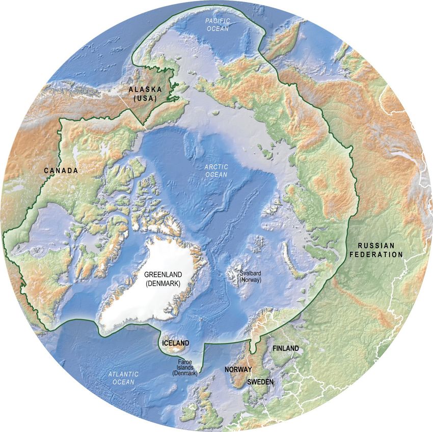
Acknowledgements
CAFF Designated Agencies:

   •   Norwegian Environment Agency, Trondheim, Norway
   •   Environment and Climate Change Canada, Ottawa, Canada
   •   Faroese Museum of Natural History, Tórshavn, Faroe Islands (Kingdom of Denmark)
   •   Finnish Ministry of the Environment, Helsinki, Finland
   •   Icelandic Institute of Natural History, Reykjavik, Iceland
   •   Ministry of Foreign Affairs, Government of Greenland
   •   Russian Federation Ministry of Natural Resources, Moscow, Russia
   •   Swedish Environmental Protection Agency, Stockholm, Sweden
   •   United States Department of the Interior, Fish and Wildlife Service, Anchorage, Alaska

CAFF Permanent Participant Organisations:

   •   Aleut International Association (AIA)
   •   Arctic Athabaskan Council (AAC)
   •   Gwich’in Council International (GCI)
   •   Inuit Circumpolar Council (ICC)
   •   Russian Indigenous Peoples of the North (RAIPON)
   •   Saami Council

Cover photo: Photo: Shutterstock, Francesco Dazzi
For more information please contact:
CAFF International Secretariat
Borgir, Nordurslod
600 Akureyri, Iceland
Phone: +354 462-3350
Fax: +354 462-3390
Email: caff@caff.is
Internet: www.caff.is

                                                                                                ___ CAFF Designated Area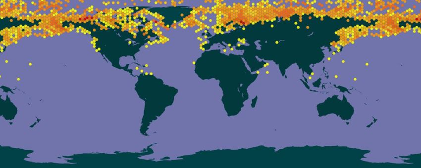
Arctic Biodiversity Data Service
Progress report: 2017-2019

Table of Contents
     1.    What is the Arctic Biodiversity Data Service (ABDS)? ............................................................. 1
     2.    Architecture ............................................................................................................................ 1
     3.    Data management .................................................................................................................. 2
     4.    Partners ................................................................................................................................... 2
     5.    Data ......................................................................................................................................... 3
     6.    Progress 2017-19 .................................................................................................................... 3
     7.    Next steps 2017-18 ................................................................................................................. 3

1. What is the Arctic Biodiversity Data Service (ABDS)?
The ABDS is the online, interoperable data management system for biodiversity data generated via
the Conservation of Arctic Flora and Fauna (CAFF), the Arctic Council’s biodiversity working group. Its
goal is to facilitate access, integration, analysis and display of biodiversity information for scientists,
practitioners, managers, policy makers and others working to understand, conserve and manage the
Arctic's wildlife and ecosystems.
The ABDS ensures that biodiversity data provided to CAFF are organized to guarantee a lasting
legacy in a manner that facilitates data discovery; increased understanding; more informed and
rapid decision-making; and ongoing research. Each time a new report or product is released by CAFF
the datasets involved are archived and made accessible via the ABDS. This document provides an
overview of ABDS and progress during the 2017-19 Arctic Council Ministerial period.

2. Architecture
The ABDS is built using open source solutions designed to facilitate sharing of information i.e.
GeoServer1; GeoNetwork2, an Integrated Publishing Toolkit (IPT)3 and PHP maker4 to facilitate online
data updates. Sitting atop a Postgre SQL PostGIS database5 this framework (Figure 2) provides an
web interface to search geospatial data across multiple catalogues, combine distributed map
services, publish geospatial data and schedule metadata harvesting from other catalogues.

1 GeoServer is a Java-based software server that allows users to view and edit geospatial data. Using open standards
set forth by the Open Geospatial Consortium (OGC), GeoServer allows for great flexibility in map creation and data
sharing.
2 GeoNetwork is a catalog application to manage spatially referenced resources. It provides powerful metadata editing

and search functions as well as an embedded interactive web map viewer. It is currently used in numerous Spatial
Data Infrastructure initiatives across the world.
3 The Integrated Publishing Toolkit (IPT) is a free open source software tool written in Java that is used to publish and

share biodiversity datasets through the GBIF
4 PHPMaker is a tool to generate a full set of PHP from databases such as PostgreSQL
5 Postgre SQL PostGIS is an object-relational database supporting geographic objects and allowing location queries to

be run in SQL.
Figure 1: ABDS Architecture

3. Data management
Key data management services include supporting network data management; assigning metadata;
establishing interoperable links via the ABDS with relevant data portals; hosting relevant datasets
that are not accessible elsewhere; rescuing datasets and working to ensure that appropriate
standards are applied.

4. Partners
CAFF works with a range of partners to further develop cooperation, access to and management of
biodiversity data. Partners include the Arctic Spatial Data Infrastructure6 (Arctic SDI); Global
Biodiversity Information Facility (GBIF); Ocean Biogeographic Information System (OBIS); Group on
Earth Observations Biodiversity Observation Network (GEOBON), Michigan Tech Research Institute
(MTRI), Michigan Technological University, International Network for Terrestrial Research and
Monitoring in the Arctic (INTERACT), Protection of the Arctic Marine Environment (PAME) Arctic
Council working group and NatureServe. See Fig 2 for a representation of how data from the ABDS is
represented in GBIF.

Figure 2: Distribution of ABDS data records in GBIF

6
 The Arctic SDI is led by the National Mapping Agencies of Arctic Council member states to share spatial data across
organizations, working groups and countries. CAFF facilitates the initiative within the Arctic Council.

2
5. Data
The ABDS contains datasets from CAFF’s monitoring and assessment activities with new data being
regularly added. Key data sources include data generated by CAFF’s Circumpolar Biodiversity
Monitoring Programme (CBMP). Examples of recently added datasets include data generated by the
State of the Arctic Freshwater Biodiversity Report (CAFF 2019), the Global audit of the status and
trends of Arctic and Northern Hemisphere goose population (CAFF 2019) and the Land Cover Change
Index Phase 2.
The SAFBR uniquely in Arctic Council assessments provides not just science and policy reports but
also an integrated database upon which the SAFBR is based. This database is a key outcome from
the SAFBR process as it provides a means to keep our knowledge on the status of Arctic freshwater
biodiversity easily updated, used, accessed, applied to answer questions and conduct further
assessments. External parties are also welcome, to make their data available via the ABDS.
As of January 2019, 326.878 data records are accessible on the ABDS (Fig 3). The jump in records
accessible in 2015 reflects when ABDS became Arctic Nodes within GBIF and OBIS.

Figure 3: Data records available on the ABDS (January 2019)

6. Progress 2017-19
During 2015-2017 key achievements include:
    •   Allowing data to be harvested from ABDS to partners i.e. GBIF, OBIS and Arctic SDI
    •   Development of an online data update system for information from CBMP expert networks,
        e.g. for the SAFBR database and Focal Ecosystem Components from the Marine Mammals
        and Seabird expert groups.
    •   Cooperation with Arctic SDI, to improve access to data and continued streaming of data into
        the Arctic SDI GeoPortal.
    •   Co-author of white paper Global Observational Needs for Biodiversity for the OceanObs’19
        conference, which is to be published in a special issue of Frontiers in Marine Science in 2019.
    •   Helping PAME develop the database: Meaningful Engagement of Indigenous and Local
        peoples in Arctic marine activities (MEMA).
    •   Development of a data management plan for Arctic monitoring station(s) to manage and
        deliver data into the ABDS, in cooperation with INTERACT including the Canadian High Arctic
        Research Station, Zackenberg Research Station and the Icelandic RIF research station.
    •   ABDS continues to evolve with increased visibility of ABDS and requests for data.

7. Next steps 2017-18
Activities during the Arctic Council 2018-2020 ministerial period will include:

3
• Continuing to facilitate data transfer and publishing from the CBMP monitoring groups and
headline indicators;
• Continuing developing ABDS to ensure system integrity, security and interoperability;
• Increase the understanding and profile of the ABDS amongst target audiences and partners;
• Expanding partnerships to ensure integration and interoperability with ABDS;
• Expanding the funding base to ensure sustainability; and
• Increased decision maker support for the ABDS including engagement in identifying partners
with complimentary mandates for cost and benefit sharing.
4You can also read