Improved (digital) data and proccesses in Cadastral System - State Geodetic Administration (SGA) Croatia - EuroGeographics
←
→
Page content transcription
If your browser does not render page correctly, please read the page content below
State Geodetic Administration (SGA)
Croatia

             Improved (digital) data and proccesses in Cadastral
                                   System

                     Authors: Benasić, Pupačić, Šantek, Šustić

                             Presenter: Maja Pupačić

                                www.dgu.gov.hr

11/22/2018                                                         1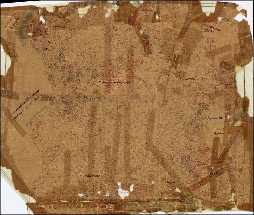
• THE REPUBLIC OF CROATIA

             • Republic with multi-party parliament
             •   [Constitution adopted on 22 December 1990]
             • 56 594 sq km (land surface)
             • Counties (21), including the City of Zagreb ;
                 Towns (127); Municipalities (429); Settlements (6755)
             • 4.290.612 persons /75,81 persons /sq km,

             •   Croatia is became the 28th member state of the
                 European Union on 1. July 2013.

11/22/2018                                                               2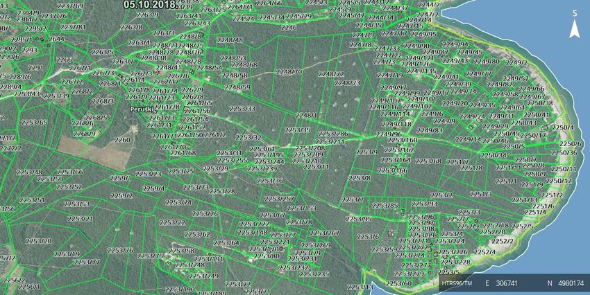
STATE GEODETIC ADMINISTRATION

 State Administrative Organization

 SGA head office + Regional Cadastral Offices (20) and Branch Offices (92)

 City Office for Cadastre and Geodetic Activities (Zagreb)

 Cadastral parcels apx. 15 ml

 3389 C.M.

11/22/2018                                                                   3
POLITICAL & STRATEGIC FRAMEWORK

EUROPEAN CONTEXT - STRATEGY
• In the development of the Land Administration System in RoC we were guided
  by the guidelines imposed by the European and national strategic context as
  well as the legal framework on both levels. The strategic context which
  determines the direction of e-government development most is the Digital
  Agenda for Europe.

• EU Action Plans for eGovernment are political instruments for promoting
  the modernization of public administrations throughout the EU.
    – eGovernment Action Plan 2016-2020
    – eGovernment Action Plan 2011-2015

11/22/2018                                                                4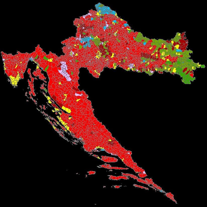
POLITICAL & STRATEGIC FRAMEWORK

EUROPEAN CONTEXT – LEGAL FRAMEWORK
•   Regulation on electronic identification and trust services for electronic
    transactions in the internal market
•   Directive on the re-use of public sector information
•   Directive 2007/2/EC of the EPand of the Council (2007) establishing an
    Infrastructure for Spatial Information in the European Community (INSPIRE).
•   General Data Protection Regulation (GDPR) – REGULATION (EU) 2016/679 OF THE
    EUROPEAN PARLIAMENT AND OF THE COUNCIL
•   Law on Freedom of Information

11/22/2018                                                                    5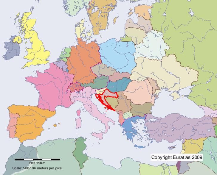
POLITICAL & STRATEGIC FRAMEWORK

NATIONAL CONTEXT – STRATEGY
•   E-Croatia 2020 Strategy
•   Action Plan for E-government development
•   Strategy of Public Administration Development in the Republic of Croatia
•   Strategic plan of the Ministry of Construction and Physical Planning (including SGA
    strategic plan)
•   National Spatial Data Infrastructure Strategy

NATIONAL CONTEXT – LEGAL FRAMEWORK
•   Law on State Survey and Real Property Cadastre
•   Law on National Spatial Data Infrastructure
•   Law on National Information Infrastructure

11/22/2018                                                                            6
CRO model for registration property and rights is divided between two institutions
Before establishing one common data base

                             KATASTAR                                                                        ZEMLJIŠNA KNJIGA
Keep and maintain all cadastral data into 112 cadastral databases                     Keep and maintain all land registry data into 100 LR databases

  We are aware that the future development of e-Cadastre will primarily depend on the satisfaction of the customers with the services provided, their
  motivation for using them and their support. In order to fulfil these expectations, the basic precondition is a unified and up-to-date database. This means that
      11/22/2018                                                                                                        7
  data must be organised and accessible in such a way that any kind of query, analysis or statistics can be made at any time and for any purpose and that the
  data can be provided on a daily basis.
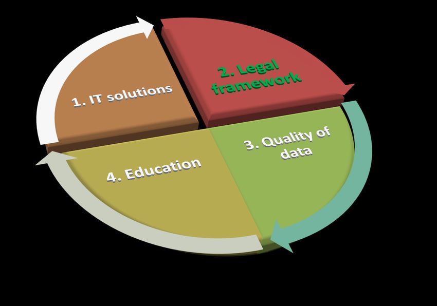
SGA ACTIVITIES

Since 1999, SGA has conducted many programs standardizing the cadastral system throughout
the RoC in organisational and technological terms.

Many projects are implemented in order to raise the data quality and many services have been
developed for the data distribution, sharing and exchange.

All preconditions have been met for fully digital business operations:
•   An unified database and application for keeping and maintaining the land registry and cadastre data has
    been established. - Real Property Registration and Cadastre Joint Information System (JIS)
•   Electronic issuing of public deeds (cadastral map copies, possessory sheet transcript/extract and Land
    Database extract) – One Stop Shop (OSS)
•   Self-service and free data searching and downloading for the purpose of producing digital geodetic
    reports - Digital Geodetic Report System (DGRS)
•   Delivery of actual (surveyed) coordinates in real time - Croatian Positioning System (CROPOS)
•   Electronic submission of digital geodetic reports (elaborates) – DGRS&OSS
•   Upcoming legislative changes also go in the direction of the coordinate cadastre, whereby a new step
    forward is made in perceiving the data quality

11/22/2018                                                                                                    8
SGA ACTIVITIES

 11/22/2018      9
Real Property Registration and Cadastre Joint Information System
                                (JIS)

  • One of the most significant and challenging projects that was financed by the WB
    loan between 2003 and 2016 was the establishment of the JIS
  • LA institutions decided not to get merged into one institution but opted for a
    unique Croatian solution of linking the institutions at the level of data and
    business processes to be maintained according to respective jurisdictions

             o A unified, centralised application for all cadastral offices and land registries (unified
               data model)
             o Standardised proceedings with data maintenance (central process-oriented solution)
             o IT linking of land registries and cadastral offices (time and financial savings)
             o Graphic and alphanumeric data integration
             o Integration with other registers and services (PIN, Spatial Units’ Register, e-Citizens,
               Geoportal, digital archives….)
             o Maintenance of harmonised (LDB) and non-harmonised data

11/22/2018                                                                                          10
State Geodetic Administration spatial data portal
RSU
JIS -an unified database
and application for
keeping and maintaining
the land registry and
cadastre data has been GEOPORTAL - central point of access to SGA spatial
established. data.
PIN
JIS
Export data
Shp, xml RSU -an unified database
and application for keeping
and maintaining the spatial
data (national, county,
city/municipality, cadastral
municipality, settlement,
street and house number).
Export data
>JIS data available to citizens through web portal
Shp, gml, xml >Online submission for public documents through private
mailbox
>Online paymant
>Digitally signed documents
OSSState Geodetic Administration spatial data portal
RSU
Allows receiving digitally
produced geodetic reports
while digital business
processes are revised
JIS
PIN ADMINISTRATION WITHOUT Export data
Web servis
PAPER Shp, xml
1,484,479 house
numbers – paired with
A2A A2B A2C cadastral parcels and
allows service issuing of
house number
certificates
Export data DGRS
Web servis
Shp, gml, xml
Enables additional electronic
business operations to be
performed by the SGA and
licensed geodetic firms. This
OSS system allows all data
required for the production of
geodetic reports to be
captured electronically,
reports themselves to be
produced in digital form, and
DAS submitted to the cadastral
office electronically.
Allows issuing digital data
Allows service viewing of to licensed surveyors
goedetic report Digital Delivering real (surveyed in the
Archives – over 12 mil. field) coordinates to geodetic
pages available experts in real timeSGA ACTIVITIES 11/22/2018 13
LAW ACTIVITIES (1)
Law on Performing Geodetic Activities - Adopted in 2018
• 2 Rule Books
Law on State Survey and Real Property Cadastre (new one)
In process – parliamentary procedure - expected by the end of this year
• Rule Book on Determining the Real Costs for using the State Survey and Real Property
Cadastre Documentation
• Geodetic Reports Rule Book
• Rule Book on Cartographic Signs
• JOŠ
Law on National Spatial Data Infrastructure - Adopted in 2018
• Spatial Data Infrastructure Act
• 2020 National Spatial Data Infrastructure Strategy
11/22/2018 14SGA ACTIVITIES 11/22/2018 15
The first land cadastre still in use today was created in the 19th century, at the time when Croatia was part of the Austro-Hungarian Empire.
CADASTRAL DATA
NI
FO NI/FO
4%
GR NI/FO/GR
GR/FO NI/FO/KO
76% GR/KO NI/GR 6%
GR/KO/FO NI/KO
GR/NU NI/KO/GR
GR/NU NI/NU
KO 10% NI/NU/GR
KO/FO NU
4%
KO/NU NU/FO
SGA conducts a number of activities for data quality improvement,
among which the most extensive and demanding are the new
cadastral survey and homogenisation.
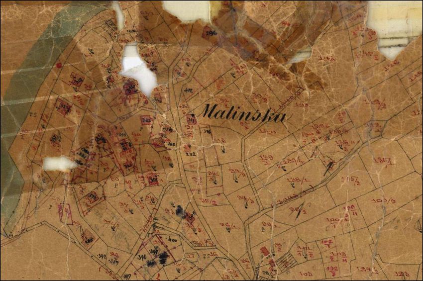
11/22/2018 16Cadastral municipality Malinska before new cadastral survey
CADASTRAL RESURVEY - method for renewal
of cadastral documentation and land register
11/22/2018• New cadastral surveys aimed at establishing the Real Property Cadastre
• Cadastral surveys are undertaken to put real property cadastral documentation in use
and establish completely new land registry and the land registry and cadastral data for
this area are harmonized 100%. (prerequisite for the EU funds, investment)
11/22/2018Cadastral municipality Malinska – new cadastral map 11/22/2018
HOMOGENISATON
HOMOGENISATON - method for improvement of digital cadastral plan
HOMOGENISATON – is not cadastral resurvey process
HOMOGENISATON – is a technical proces
• geometric and positioning accuracy improvement of the digital cadastral maps (DCM) of
the graphical survey
• correct the deformations, inhomogenities and anomalies, and at the same time keep the
parts of the cadastral maps that are already mapped by the geodetic records unaltered on
their position
• There is still a danger of incompetent use of homogenised data if the expert audience is
not educated on how to use homogenised maps. If the homogenised data, although in
digital format, does not represent the quality of the digitally surveyed point that was
previously marked in the field by the owner it cannot be the basis for transferring digital
data in the field (staking, court expert visit, measuring distances in the map for the
purpose of project designs) because damage would thus be caused.
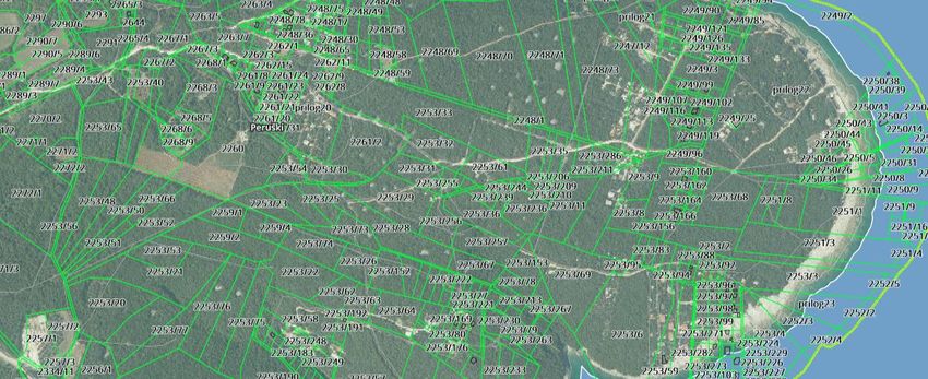
11/22/2018 20Before homogenisation: 1. The cadastral maps that the detail is already mapped by the geodetic records 2. Detail on the cadastral map – position 160 m into the sea 3. There is no cadastral parcel on the cadastral map (the result of inadequate maintenance) 11/22/2018 21
After the process of the homogenisation

11/22/2018                                22
SGA ACTIVITIES

 11/22/2018      23
EDUCATION FOR                                                                                RSU
                                           ADMINISTRATION WITHOUT
Cadastral staff on how to                           PAPER
 use the JIS application
 (1,000 employees and
    continued expert
                                                A2A A2B A2C
                            Users via web services                                                            Users via web services

       education)

                      JIS                                State Geodetic Administration spatial data portal

                                                                                                                                              Geodetic experts on
                                                                                                                                             how to use the SGDE
                                                                                                                                              functionality (1,000)

                                        After establishing the paperless
                                        mandatory to educate all the
                                                                          administration,
                                                                  Daily and
                                                                   andsystem
                                                                            continued supportit was necessary and
                                                                                users:
                                                                        education for citizens
                                                                                                                               DGRS
                                                                     and other State bodies on
                                                                     how to use cadastral data.
                                                                        Public awareness
                                                                            campaign

                                                                             OSS                                                       Geodetic experts on how to
                                                                                                                                       use the CROPOS system (500
                            DAS                                                                                                             and annual CROPOS
                                                                                                                                               conferences)

                                                                     Citizens
                                                                      Geodeticonexperts
                                                                                 how toon usehow
                                                                                              the
                                                                      OSS functionality  (public
                                                                            to use the OSS
                                                                        awareness   campaign)
                                                                          functionality (500)
State Geodetic Administration (SGA),
Croatia
Improved (digital) data and proccesses in Cadastral
System
Authors: Benasić, Pupačić, Šantek, Šustić
Presenter: Maja Pupačić
www.dgu.gov.hr
11/22/2018 27You can also read