Alternative State Highway Corridor for northwest Auckland
←
→
Page content transcription
If your browser does not render page correctly, please read the page content below
Alternative State Highway Corridor
for northwest Auckland
A new connection moving the highway
out of the Kumeū-Huapai town centre
November 2020
Te Tupu Ngātahi Supporting Growth is a Benefits of the Alternative State Highway Corridor
collaboration between Waka Kotahi NZ • Provides access for the future housing and employment
areas in the southern Kumeū-Huapai growth area.
Transport Agency and Auckland Transport.
• Removes long-distance traffic and freight vehicles from
We’re identifying and protecting the land
the Kumeū-Huapai town centre, allowing the SH16 Main
needed for transport connections in the future Road to become a key part of a revitalised town centre and
growth areas of Kumeū-Huapai, Redhills, supporting public transport along this route.
Whenuapai and Riverhead. • Reduces the severance effects on Kumeū-Huapai caused
by the current heavy use and congestion of SH16
This future transport network for the northwest will
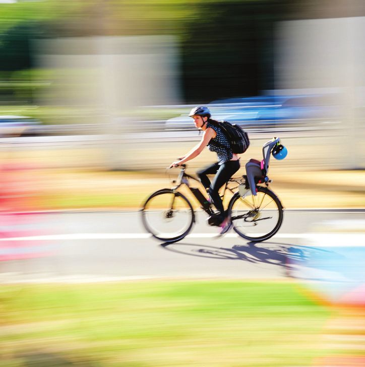
• Better network resilience and safety – there will no longer
encourage mode shift with public transport and cycling paths
be just one main route through Kumeū-Huapai. The new
close to where growth is expected over the coming decades,
highway will be one continuous route with no direct access
and upgraded and new roads.
to properties meaning less likelihood of road incidents
The Alternative State Highway Corridor is a proposed new • Improved travel time reliability given no direct access to
connection which will run between a new interchange at the properties and limited connection points to the highway
current Brigham Creek roundabout and State Highway 16
• More travel choice – continuous cycling and walking
(SH16) to the west of Huapai.
facilities provided along the route.
It will move the existing state highway traffic out of the
Kumeū-Huapai town centre and enable a wider range of
travel choices for the growing number of people who will Key features of the Alternative State
call the northwest home over the next 30 years. In Kumeū-
Highway Corridor
Huapai alone, the population is anticipated to grow from
3,400 residents to around 25,000.
Four lanes for vehicles
This is a long-term project. We’re planning now so that the
land can be set aside to build the Alternative State Highway
Corridor in line with Auckland Council’s sequencing of future
urban land for development in this area in the Speed limit likely to be 100km/h
coming decades.
We’ve identified a refined study corridor for this highway.
This corridor is the area where we think the highway would Cycling and walking facilities
be best located. It was identified after extensive technical
assessments of potential options by a range of specialists in
consultation with Manawhenua, Auckland Council Potential route for a future rapid transit
and KiwiRail. corridor through the eastern section
This information sheet describes the location of the refined Access to the corridor for vehicles will be at
study corridor, and the environmental features and land use three points: at a new interchange at SH16/
considerations taken into account to identify it. We believe Brigham Creek Road, at Tawa Road and at
the location of the refined study corridor provides the best SH16 west of Huapai.
solution to serve current and future communities.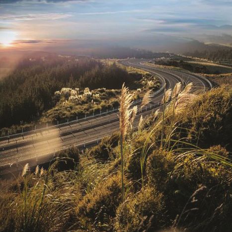
About the refined study corridor

The refined study corridor is the area         route for a future rapid transit corridor      which would require more complicated
where we think the highway would               to Kumeū-Huapai, as well as cycling and        engineering to reduce flood risk, and this
be best located. It is 10.5km long and         walking facilities.                            area was therefore assessed as not as
begins at its eastern end at a new SH16/                                                      suitable as a route location.
                                               At the North Auckland Rail Line, the
Brigham Creek interchange. It then
                                               rapid transit corridor and cycling             This area is zoned by Auckland Council
extends westwards before heading
                                               and walking facilities split from the          as Countryside Living which provides
north to rejoin the existing SH16 west
                                               Alternative State Highway and head             for rural lifestyle living. The refined
of Huapai.
                                               north following the North Auckland Rail        study corridor would have an impact
For the purposes of describing the             Line to the Kumeū-Huapai town centre.          on this zone, however this is the only
corridor in detail, it is divided into three   There is potential for a cycling and           type of land use zone in this section and
sections from east to west:                    pedestrian connection to the Alternative       therefore cannot be avoided.
                                               State Highway Corridor at Taupaki Road.
• Section 1: New Brigham Creek                                                                The form of the new Brigham Creek
  Interchange to North Auckland                Cycling and walking facilities will            Interchange may have an impact on the
  Rail Line                                    continue along the full length of the          section of the highway route between
• Section 2: North Auckland Rail Line to       Alternative State Highway Corridor to          the interchange and Taupaki Road.
  Tawa Road                                    SH16. We’re still investigating what side      This section of the highway may need
                                               of the highway they will be located.           to change from its current indicated
• Section 3: Tawa Road to SH16 west
                                                                                              location to connect to the final design of
  of Huapai                                    What we considered                             the interchange.
Please refer to the Alternative State          There is a range of environmental factors
Highway Refined Study Corridor map to          that were considered for this section                 Section 2: North Auckland
see the complete corridor.                     of the corridor. The area in general
                                                                                               2     Rail Line to Tawa Road
                                               contains a high density of floodplains,        The middle section of the corridor
       Section 1: New Brigham
 1                                             waterways, wetlands, wildlife habitats         continues in a westerly direction, before
       Creek Interchange to North
                                               and vegetation.                                curving north. A connection point at
       Auckland Rail Line
                                                                                              Tawa Road will provide access to/from
The eastern section of the new                 The refined study corridor crosses
                                                                                              the Alternative State Highway Corridor
corridor will begin at the proposed            through the shortest stretch of
                                                                                              and the Kumeū-Huapai town centre via
SH16/Brigham Creek Interchange                 floodplains and has less impact on
                                                                                              Access Road. There is also potential for
(see overpage for more details about           waterways. This reduces the risk to
                                                                                              a cycling and pedestrian connection
this interchange). This section will be        wildlife habitats and vegetation at stream
                                                                                              from the Alternative State Highway at
multi-modal, accommodating not only            crossings. There are more floodplains to
                                                                                              Tawa Road.
the new highway, but also a potential          the south of the refined study corridor

                                                                                                      Rapid Transit Corridor

                                                                                                               RAPID TRANSIT
                                                                                                                 CORRIDOR

             What the new corridor could look like between the new Brigham Creek Interchange and the North Auckland Rail Line
New Brigham Creek Interchange
   The current roundabout at SH16/Brigham Creek Road will be upgraded to
   an interchange in the future. The interchange will be complex, as it needs to
   provide for many transport modes – including a potential route for a future
   rapid transit corridor, a cycling and walking corridor and the Alternative State
   Highway. The interchange will also enable local trips, which will be supported
   by our other transport projects such as the upgrade of Fred Taylor Drive and
   Brigham Creek Road.
   We’re investigating the best way for cyclists, pedestrians, public transport
   users and drivers to travel through the interchange. The area we are
   investigating for the Brigham Creek Interchange is shown on the Alternative
   State Highway Refined Study Corridor map. We’ll share more details of what
   the new interchange may look like as plans develop.

Auckland Council has a draft Spatial          High quality soils which are good for          One of the key factors is the placement
Land Use Strategy for Kumeū-Huapai            production are found throughout the            of the corridor in relation to the Kumeū-
and Redhills North which proposes an          area, therefore impacts to this type of        Huapai Future Urban zone. The southern
expanded business zone to the west of         land unfortunately can’t be avoided.           area of this zone is steep, and less likely
the existing business zone adjacent to                                                       to be intensely developed. Land with
                                              The refined study corridor will impact
Access Road. The Tawa Road/Access                                                            significant development potential will not
                                              the Countryside Living zone. This zone
Road connection with the new highway                                                         be lost by the corridor passing through
                                              is predominantly used for rural lifestyle
will support heavy vehicle access and                                                        this area. It will also reduce the impact
                                              living rather than for rural production
is aligned with the strategy. For more                                                       on Countryside Living land on the edge
                                              activities. However further to the north
information about the Council’s draft                                                        of the future urban zone.
                                              and the route would sever a significant
strategy and to give feedback, visit
                                              part of the Kumeū-Huapai Future Urban          Similarly, we looked to avoid hilly
akhaveyoursay.aucklandcouncil.govt.nz.
                                              zone, and further to the south it would        land which would make the highway
Cycling and walking facilities will be        impact on existing (or future) rural           more prominent in the landscape and
provided along this section of the            production uses in the Mixed Rural zone.       complex to construct.
corridor. We’re still investigating which
                                                       Section 3: Tawa Road to SH16
side of the new highway these will             3       The western section of the
be located.
                                              corridor heads north, passing through               Connection points
What we considered                            the lower end of land identified for future         In addition to accessing the
The main consideration in this section        urban growth, before joining the existing           new corridor at Brigham Creek
relates to land use. As with section          SH16 to the west of Huapai. Cycling                 Interchange, there will be two
1, much of this general area passes           and walking facilities will be provided             connection points – one at Tawa
through the Countryside Living zone,          along this section of the corridor. We’re           Road and the other at SH16 to
which provides for rural lifestyle living.    still investigating which side of the new           the west of Huapai. The form of
                                              highway these will be located. These will           these connection points is still be
The zoning immediately to the south
                                              potentially link into cycle and pedestrian          decided. There is also potential for
of this area changes to Rural Mixed,
                                              connections at SH16.                                cycling and walking connections at
which provides for rural production and
non-residential activities, generally on      What we considered                                  Taupaki Road and Tawa Road.
smaller sites. Some rural lifestyle use is    There were many factors we needed
also permitted in this zone.                  to balance and consider through this
                                              section, including the location of existing
                                              key infrastructure, the hilly nature of
                                              the terrain, landscape and impacts
                                              on ecology.

    What the new highway corridor could look like between the North Auckland Rail Line and SH16
As the corridor heads towards SH16, Access to local roads
the location of an existing gas and fuel The next phase of our programme will
pipeline is an important consideration. look more closely at maintaining access
This carries fuel from Marsden Point along local roads. Maintaining access
to Wiri and gas throughout the North includes things like considering whether
Island. The refined study corridor is the corridor should go over or under
positioned clear of this line; crossing local roads.
the line would present challenges
Bridges enable uninterrupted access
for construction of the highway and
along existing local roads and provide
maintenance of the pipeline.
a continuous connection for the new
The refined study corridor through this highway.
section also minimises impacts on the
Our investigations to date have focused
many streams and waterways which are The refined study corridor could affect
on providing access along Taupaki and
prevalent through the Awa and Foster existing local access for a number of
Waitakere Roads with bridges, as these
Roads area. local roads including Joseph Dunstan
are important north-south rural roads in
Drive, Dysart Lane, Pomona Road,
The effects of a highway location close the area. In addition, initial investigations
Tawa Road, Puke Road and Foster
to the residential area of Waimauku have show it’s likely a bridge will be needed
Road. Further work will be undertaken
also been considered. The corridor joins to enable the corridor to cross over the
to explore what options may address
SH16 at a point just west of Foster Road, North Auckland Rail Line.
the severance of local access on these
reducing any impacts of the highway
The table below indicates whether the roads. This could include bridges or the
on this rural township and keeping the
refined study corridor is likely to cross provision of service lanes, which would
alignment close to the Kumeū-Huapai
over or pass underneath. enable alternative access to properties.
Future Urban zone.
The refined study corridor will...
Taupaki Road Pass underneath a new Taupaki Road bridge
North Auckland Rail Line Cross over the North Auckland railway line via a bridge.
Waitakere Road Pass underneath a new Waitakere Road bridge
Next steps
We will share feedback with landowners and the community early to mid 2021.
A Detailed Business Case will be submitted to Waka Kotahi NZ Transport
Contact us
Agency and Auckland Transport for approval in mid to late 2021.
P 0800 4769 255 (GROW AKL)
We anticipate starting route protection in late 2021 or early 2022. This will be
confirmed mid next year, when budgets are reviewed. E info@supportinggrowth.nz
W supportinggrowth.govt.nz
LATE 2020 - EARLY 2021 EARLY - MID 2021 MID - LATE 2021 LATE 2021/EARLY 2022
Detailed
business case Route
Feedback Share submitted to protection of
from landowners feedback with Waka Kotahi NZ the preferred Secure funding Construction
and t he community landowners and Transport Agency alignment (Notice begins
sought and the community & Auckland
of R equirement
reviewed Transport
for approval process)
Timeline is indicative only and subject to change. Timing of future phases are yet to be confirmedYou can also read