This presentation builds on an earlier study by Bloomsburg planning student Jesse Lewis, who was an Intern at the Lewisburg Neighborhood ...
←
→
Page content transcription
If your browser does not render page correctly, please read the page content below
This presentation builds on an earlier study by Bloomsburg planning
student Jesse Lewis, who was an Intern at the Lewisburg Neighborhood
            Corporation (LNC) during the summer of 2013.
   Revised and expanded by Andrew Ciotola and Samantha Pearson.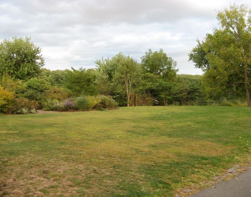
Lewisburg area currently has no adequate river access
for non-motorized watercraft (canoes, kayaks, paddle
boards, inner tubes, etc.)
There is one access ramp but with inadequate parking
availability and a launch point of unreliable solidity.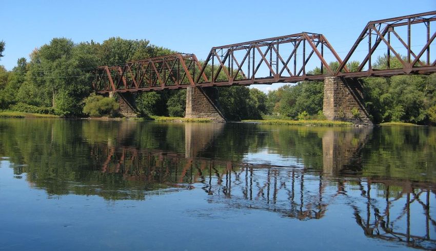
Non-motorized (NM) launches require less space
because parking and driveway are for individual
vehicles rather than vehicles with trailers.
NM launches generally require less engineering
and construction and no construction in the
waterway (i.e. boat ramps).
NM launches entail less noise, water, and air
pollution, and less traffic disruption (individual
vehicles versus vehicles with trailers)
Lewisburg area already has a state-maintained
motorized launch at Chillisquaque FBC Access on
Rt. 405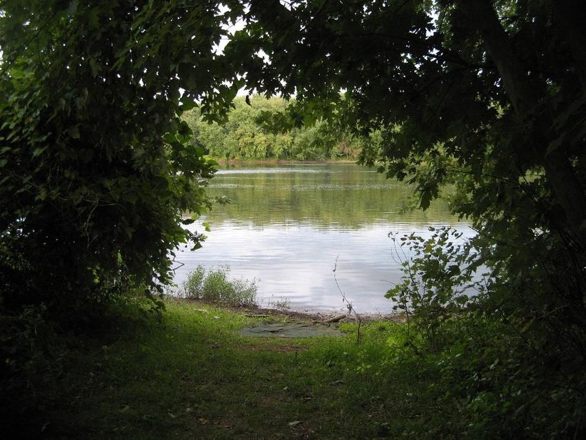
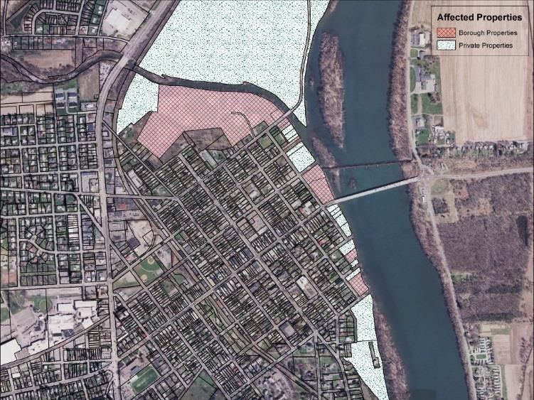
Borough of Lewisburg Union County and Northumberland County Property Owners (both adjacent and surrounding) Residents Tourists Susquehanna Valley Visitors’ Bureau Buffalo Valley Recreational Authority Local canoe/kayak liveries PA Fish and Boat Commission Buffalo Creek Watershed Alliance PA DCNR Susquehanna Greenway Partnership Bucknell University
Enhances property values.
Attracts visitors to community, with consequent
benefit to local economy (like Buffalo Valley Rail
Trail).
Improves aesthetic appeal & community identity.
Encourages healthy lifestyle / exercise /
recreation.
Increases appreciation of local waterways and
environment among residents.
Increases appreciation for Lewisburg’s historic and
cultural connection to the river and the creek.
Offers great “active” opportunity for families.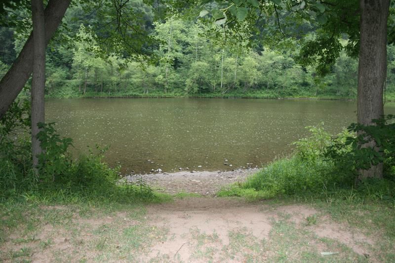
Possible injuries at launch sites.
Potential tax increases to residents.
Risk of negative environmental effects due to
litter at access site.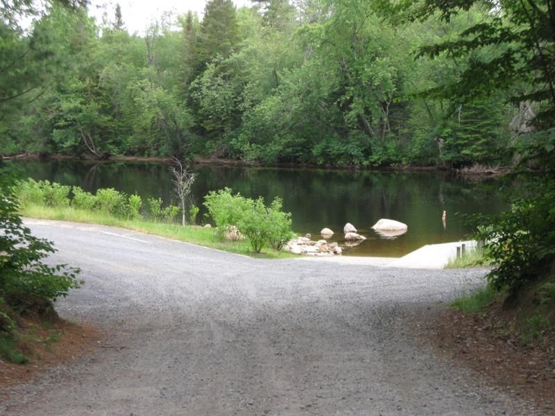
Hamilton Bottom DCNR Access, Pine Creek, Waterville, PA.
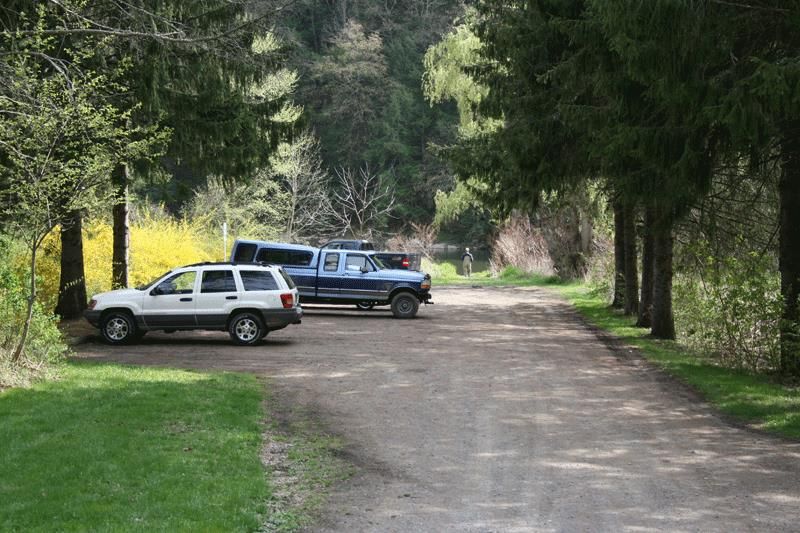
Clark Farm DCNR Access, Pine Creek, Cammal, PA.
    (Simple launch is at far end of parking area.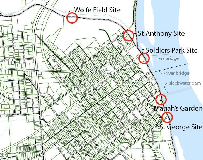
Black Pond Hand Launch, NYDEC, Franklin County, NY
Raquette River Hand Launch, NYDEC, Near Tupper Lake, NY.
Indian Carry Hand Launch, NYDEC, Franklin County, NY.
Lewisburg, PA
Lewisburg, PA
WOLFE FIELD SITE                            ST ANTHONY ST SITE

                     MARIAH’S GARDEN SITE
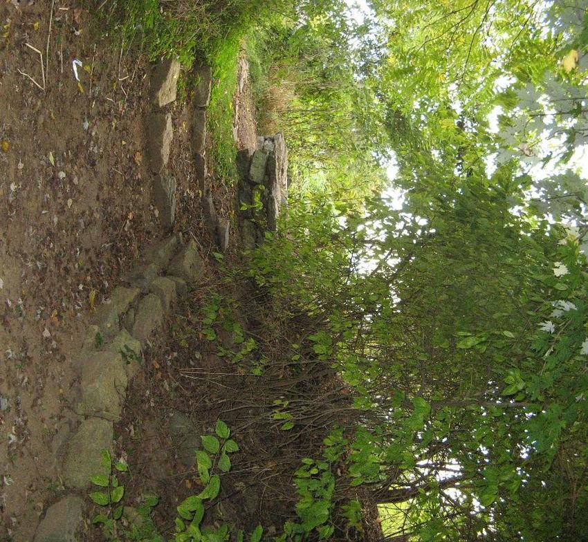
SOLDIERS PARK SITE ST GEORGE ST SITE Located in the rear (western) section of Wolfe
Field park, on Buffalo Creek, adjacent to the
brush piles. Conveniently already in a park with an existing gravel
lane for access. (No additional road construction
required).
Borough property.
Topography is conducive to the project. Would require
relatively little excavating.
Relatively quiet, in spite of Rt 15 traffic noise
Plenty of space for picnic tables, benches, etc. Buffalo Creek water levels are often very low in
the summer, limiting navigability in peak season.
At a remove from the Susquehanna River, where
water is more navigable.
Return from Susquehanna River to launch requires
upstream paddle against current.
This portion of Wolfe Field is currently
inaccessible (behind locked gate) most of the week.
Remote location might lend itself to vandalism and
other unlawful behavior.
Routine flooding could damage landscaping or
structures. This site is located on the borough side of the St
Anthony Street bridge, adjacent to the
Community Garden. Prominent location would make the launch a
community showpiece, meaningfully connecting
borough to the river.
This area has already been developed for
community and recreational facilities (Community
Garden, playing fields, recycling).
Easy access to/from Rt. 15, facilitating shuttle runs
up- or down-river.
Gently contoured topography suitable for a launch
site. Would require limited landscaping work.
Plenty of space for benches, picnic tables, etc. Land is currently in private hands.
Routine flooding could damage landscaping or
structures.
Indirect access to main channel (behind island);
especially difficult at low water.
Old coffer dam poses some risk at low water
levels. (Adequate signage could help solve this
problem).
Limited space for parking.
St. Anthony Street / River Road is a busy corridor.
Would need to deal with existing structure (flood-
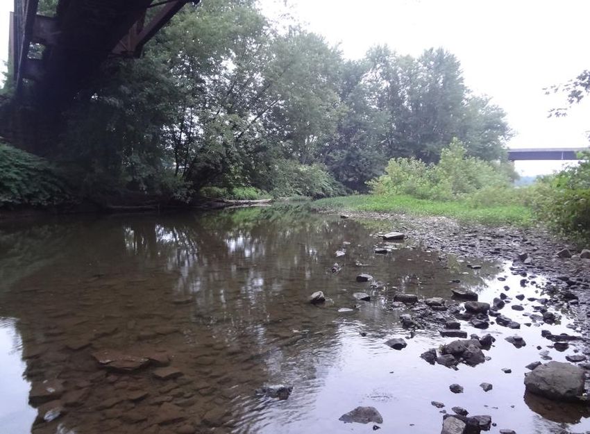
prone house). This site is located on the north side of Soldiers Memorial
Park in Lewisburg, at the confluence of Buffalo Creek and
the Susquehanna River, next to the abandoned RR bridge.
(RR bridge on left; Route 45 bridge on right in photo) A central, highly visible location that would make
the site a community showpiece, meaningfully
connecting the borough to the river.
Owned by the Borough.
Would occupy an under-utilized portion of an
under-utilized park. This area is currently an open
power-line cut.
Area would be suitable for further recreational
development (picnic table, pavilion, etc.),
especially along the undeveloped bank.
Topography is suited to the project.Potential space for parking under powerline along bridge abutment
Boat launch would enliven a currently under-utilized park.
Indirect access to the main channel (behind an
island), especially at low water.
Relatively high bank.
Need to remove metal debris in riverbed to
eliminate some safety issues (minimal).
Busy street and bridge.
Seen to possibly impinge on and even threaten
formal, historic park. This site is located at a small park off of Walnut Alley
between St Louis and St Catherine Streets. Owned by the Borough.
Would highlight the presence of an under-
utilized park.
Area would be suitable for further recreational
site furniture (picnic table to complement
existing benches) especially in the existing park
area.
Has direct access to the main channel with no
intervening island. Land is surround by private land.
Alley location is hard to find.
Difficult topography with an area with a high
bank adjacent to much lower land.
Directly below slack water dam.
Limited space for parking.
Alley is private space for adjacent residences.
Riverbottom at bank is muddy, not rocky, with
a great distance to slightly deeper water.Current informal river access where St George St Right-of-Way extends toward the river.
This site is an existing river access.
There is already space for some parking.
Adjacent to an existing nature trail and an open lot
that has further potential for recreational
development (picnic area, etc.).
There have already been talks of implementing a
“mattress” style gabion basket for a temporary
removable boat launch.
This is a feasible spot because of the existing
infrastructure and access.
From the river, this is the most visible and easiest
to access of the five sites. It has the most direct
access to the main channel. Site is partially on private land.
Adjacent open land is a brownfield with more stringent
development requirements should any improvements
be pursued.
To shift the access onto Borough-controlled property
would require significant excavation and removal of
trees.
It is below the remains of the slackwater dam, limiting
direction of travel to downstream for some users.
Limited space for parking and turnaround.
Riverbottom at this location is muddy and the bank is
quite a distance from the slightly deeper channel. Grant applications can be completed and
submitted to
PA Department of Conservation and Natural
Resources
PA Fish and Boat Commission
US Fish and Wildlife Service
Seek partnerships with local employers
Promote partnerships with wellness programs Would the Borough Council authorize the North
Ward Neighborhood group to pursue the idea of a
canoe/kayak launch site in the Borough further?
Would Council care to narrow the options now or
to move on to the next steps in a public design
process with all four sites in the running?
Assemble a committee with representatives from
various official bodies and stakeholder groups to
organize a design charrette.
Publicize the effort to get more people involved.
Conduct surveys to gauge public interest. Thanks for your time and consideration! Questions?
You can also read