ISimangaliso Wetland Park - Lake St Lucia - on the road to recovery
←
→
Page content transcription
If your browser does not render page correctly, please read the page content below
iSimangaliso Wetland Park
                             Lake St Lucia – on the road to recovery

iSimangaliso Wetland Park was listed as a world heritage site in 1999 for several outstanding universal values, a key
component being its ecosystems and ecological processes that include the unique Lake St Lucia system, also a
Ramsar site (wetland of international importance).

In recent years however, this system has been under severe strain, but the new iSimangaliso Authority management
strategy for the Lake St Lucia system sees a fundamental shift in past management practice. As part of this strategy
the uMfolozi River was encouraged to re-link to Lake St Lucia in July 2012.

This led to the opening of Lake St Lucia to the sea, with many positive results. These include a return to salinities
more typical of an estuary and the reappearance of fish and prawns, which can now enter the lake from the sea.
Consistently good rains since September 2012 have continued to maintain high water levels in the lake,
complementing the new management strategy.

The joining of the two systems marks the end of a management approach which has kept them separate for the last
62 years, in the belief that sediments carried by the uMfolozi posed a threat to the lake (see 'Lake St Lucia:
Understanding the problem and finding the solution' on www.isimangaliso.com).

Because the uMfolozi River provides about 60% of the lake’s fresh water, the separation of the two systems deprived
the lake of a significant inflow of fresh water. The loss of the uMfolozi also altered the movement of sediments in the
mouth area and affected the natural opening and closing of the St Lucia mouth. The implications of this management
approach became evident during the drought of 2001 – 2010, the worst in living memory. During this period, the
lessening of the uMfolozi’s influence on the estuarine and marine environments caused the St Lucia mouth to close
(2001 – 2012), with detrimental effects on the marine, estuarine and lake ecosystems.

The results of recent multi-disciplinary science undertaken under the auspices of iSimangaliso have given us a better
understanding of the uMfolozi’s hydrological and ecological importance. The uMfolozi influences the opening and
closing of the St Lucia mouth, the system’s overall water and salinity balance, and the movement of marine and river
sediments which are a natural component of the estuarine environment. Following the joining of the two systems,
modelling exercises suggest that the estuary will be open to the sea more often than it will be closed, and that the
uMfolozi River exerts a necessary influence on the overall health of the St Lucia system.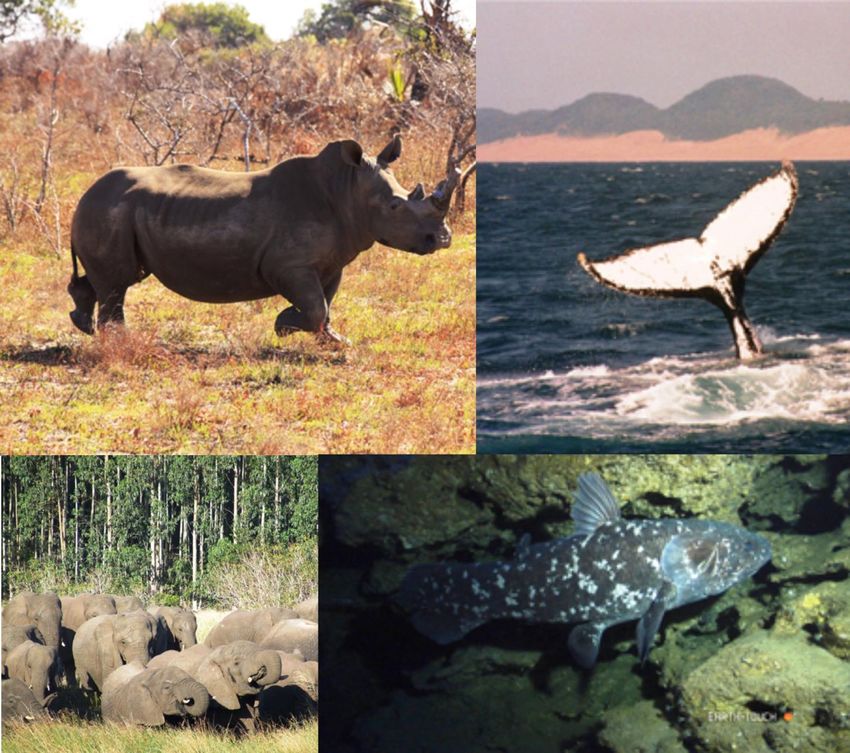
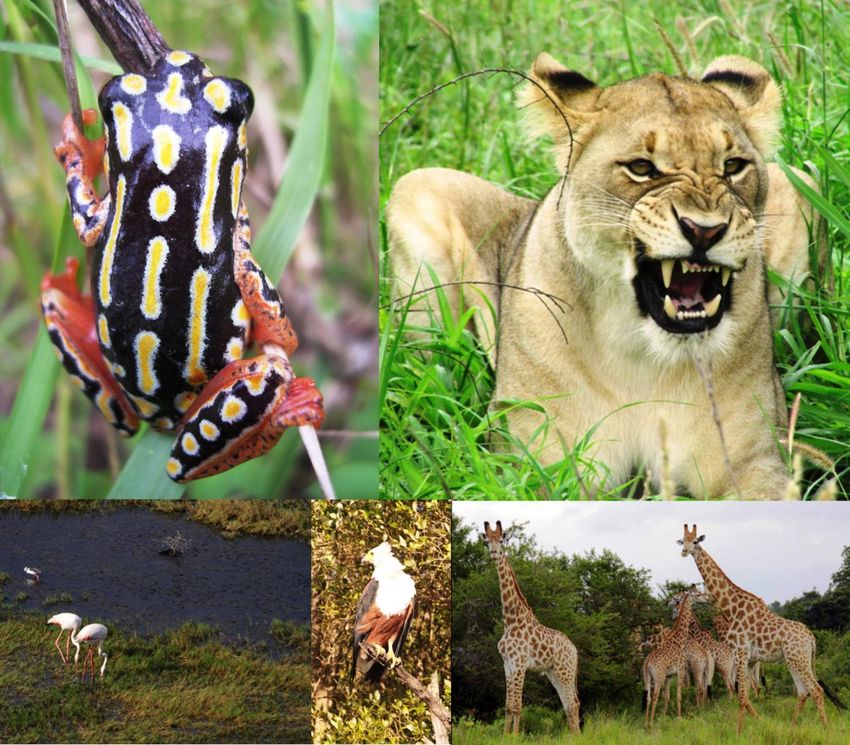
‘iSimangaliso must be the only place on the globe where the oldest land mammal (the rhinoceros) and the
     world’s biggest terrestrial mammal (the elephant) share an ecosystem with the world’s oldest fish (the
               coelacanth) and the world’s biggest marine mammal (the whale)’ – Nelson Mandela

When the uMfolozi River rejoined the Lake St Lucia system on the 6th July 2012 via a beach spillway, large volumes
of water entered the Narrows and northward into the lakes for a period of two months. The September 2012 rains
caused the uMfolozi River to flow strongly, and to breach the sandbar and create an open mouth into the joined
system. Good spring and summer rains, and the newly-configured outlet to the sea have resulted in high water levels,
and a single, inter-connected water body throughout the 70 km lake system.

The exciting changes being recorded as a result indicate that natural processes are being restored and that the
estuary is recovering.

iSimangaliso will continue to monitor the system closely. While it is likely that the mouth will continue to move
northwards during summer, the dynamic impacts of river flow and wave action mean that the mouth could be
positioned anywhere between Maphelane and St Lucia.

"Studies that refine our understanding of the lake are well underway. These will also propose management
interventions that reflect this improved understanding. Our goal is to restore the long-term hydrological and ecological
functioning of Lake St Lucia. This multi-disciplinary study is supported by iSimangaliso’s Global Environment Facility
(GEF) Project and will be completed in the next six months. The studies are being run in tandem with stakeholder
participation," says Zaloumis.

Over the past year, a number of changes have been observed in the system:
Rainfall

Since last July, when iSimangaliso implemented its strategy to allow the uMfolozi River to join Lake St Lucia, the area
has experienced good rainfall boosting the restoration of the Lake St Lucia system.

A total of 1505 mm of rain was received in St Lucia town over the past year (October 2012 - October 2013. Good rains
(540 mm) fell during the spring and summer of late 2012 and early 2013 with this trend continuing through autumn and
winter 2013 (270mm and 150 mm respectively). The first two months of spring 2013 yielded good rains with 185 mm
recorded at St Lucia, and the trend continues.

Good rains have also fallen in the five river catchments that flow into the lake. This has resulted in significant changes
to the current ecological state of the whole Lake St Lucia system which stretches for 70 km from Maphelane in the
south to the uMkhuze swamps in the north.

                                             Current state of the system

Water levels

The strongly flowing rivers have resulted in dramatic and sustained increases in the water levels throughout the lake
system. The uMfolozi has remained consistently joined to the Lake St Lucia system; its high water volume entering
Lake St Lucia for over 14 months for the first time in 60 years. As a result of the loss of uMfolozi water and the below
average rainfall during 2002-2010, the lake was divided into four distinct water bodies and disconnected from the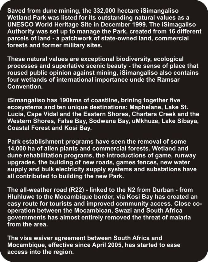
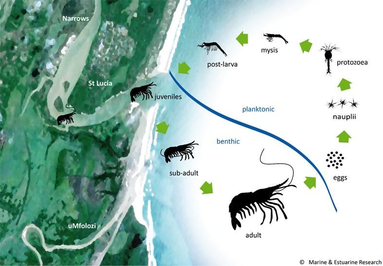
Narrows. The lake system is now one continuous water body from the mouth area near Maphelane to the uMkhuze
wetlands in the north. Water levels in the system are high and above mean sea level. This increase in water volume
has resulted in a change in living conditions for the plants and animals and has significantly increased habitat diversity
and functionality throughout the system.

Mouth state

Because of the outflows from the uMfolozi River and the tidal currents, the estuary mouth has remained open since
September 2012 creating a direct connection between the Lake St Lucia system and the sea via the beach spillway
for the past 15 months. The beach spillway has been widened by the dynamic forces at play in the mouth area, where
strong river flows and tidal currents move beach sediments easily. Tidal exchange of water occurs during the high
spring tides and even some of the higher neap tides, allowing both river and seawater to enter the estuary.

Salinity

Salinity in the northern parts of the system declined sharply over the summer (see graph below) in response to the
freshwater inputs and rising water levels with a maximum of 15 recorded in False Bay (seawater is 35). Salinities in
these northern parts had previously been well above sea water (100+) due to the lack of freshwater input to these
areas and the high evaporation levels. The lower parts of the system were fresher because of the narrower, on
average deeper channels, as well as the freshwater input from the uMphathe River, which has kept salinities low. This
is an unusual condition to have for an extended period in an estuary as salinities are usually higher near the mouth
where the sea has the greatest influence and lower at the head of an estuary. This pattern has now begun to shift with
salinity increasing in the mouth area and decreasing in the upper areas of the lake.

Plant and animal responses

This change in water levels and salinity led to some rapid changes to the animal species found in the lake. For
example, a small (2mm long) brackish water mussel, Brachidontes virgiliae, responded quickly to the fresher
conditions in False Bay and colonised the newly inundated shoreline vegetation in large numbers. These animals
were easily seen in the shallows around the lake forming clumps on the sediment and the plants covered by water. By
contrast the more brackish conditions developing in the Narrows has resulted in significant densities of river prawns,
Macrobrachium spp. being recorded by researchers working in the system.

Changes to the aquatic and shoreline vegetation in response to these new conditions will be slower. Beach walkers
would, however, have noticed towards the end of May 2013 vast numbers of the fruits of the white mangrove,
Avicennia marina, lining the intertidal areas around the mouth. This tree fruits heavily in the autumn and this is part of
the dispersal mechanism of these estuarine trees. Seeds that are washed out of the mouth into the sea are
transported along the coast so that mangrove colonisation can take place in other suitable estuaries, providing an
input of new seed stock to adjacent systems.

During the last summer (up to February 2013) the intertidal habitats at the mouth and other shoreline areas of the lake
hosted a large variety and number of migratory wading birds attracted by the rich food resources present in this area.
This group made up almost half of the 50 000 birds that were recorded in the whole lake system during the summer.
The most obvious species found in the lake throughout the year were the flamingos, pelicans and ducks that took
advantage of the increased habitat made available by higher water levels. Towards the end of spring the migratory
waders returned to the system from the Palaearctic and began feeding in the intertidal areas at the mouth.
iSimangaliso scientific studies

The iSimangaliso Authority will continue to monitor the situation and investigations are well underway to find a long
term solution to the hydrological and ecological issues facing this important estuary system. This multi-disciplinary
study is supported by the iSimangaliso Global Environment Facility (GEF) project.

                          For more information, visit their website – www.isimangaliso.com
You can also read